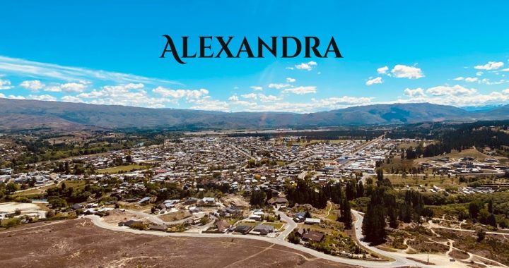
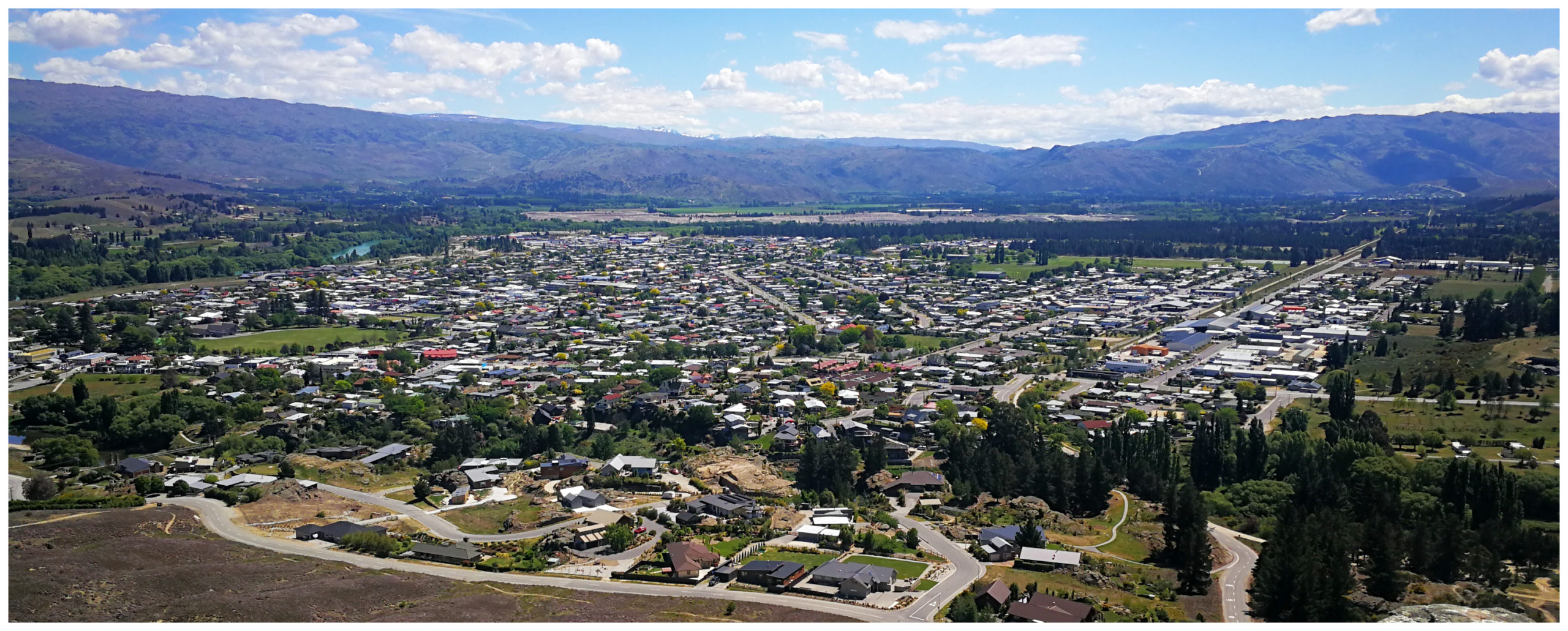
Exploring Alexandra
Alexandra was only a short drive from our camping spot at Pinders Pond near Roxburgh (46km). See our previous blog.
We had our eyes on finishing off the Roxburgh Gorge Cycle Trail by cycling Alexandra to Doctors Point and return. More on this later in the blog.
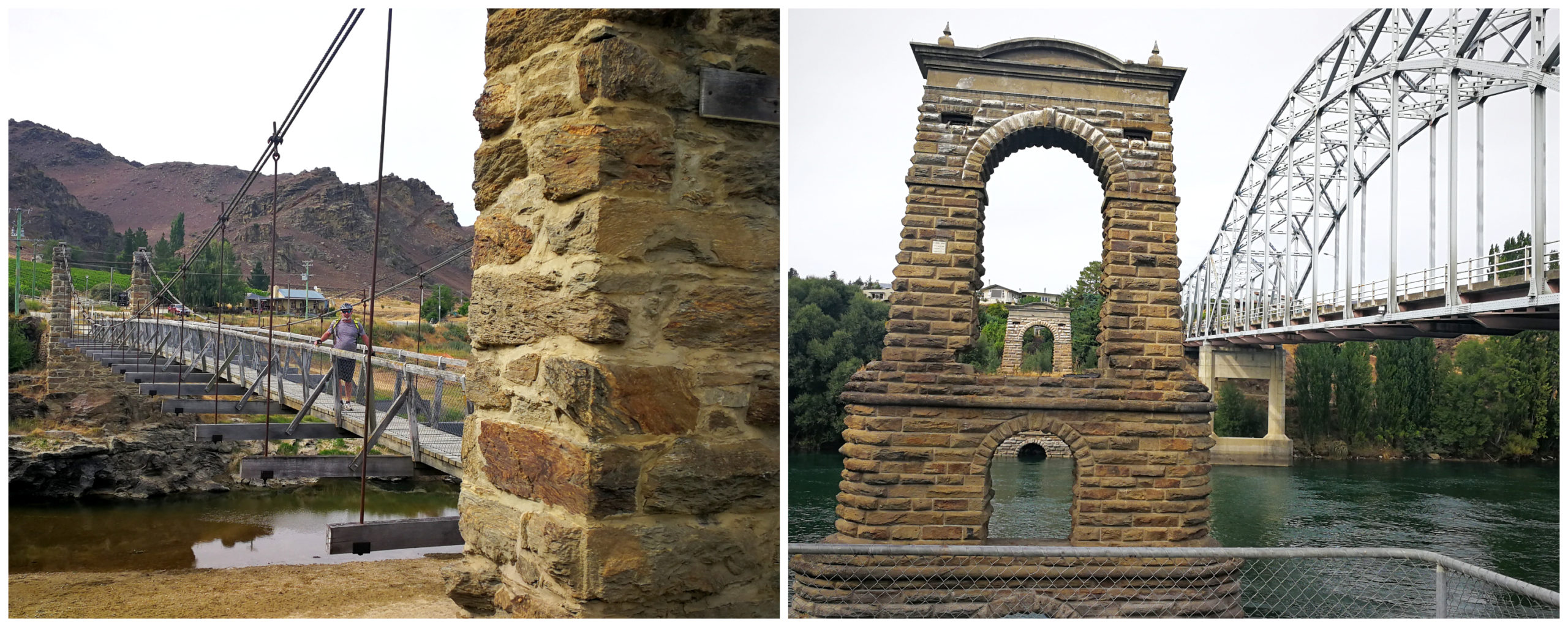
the Shaky Bridge and the iconic stone pillars of the old Alexandra Bridge
Alexandra has a bit of a reputation of being the hottest, driest and coldest town in NZ. It has four distinct seasons and is one of the reasons it is rather a unique place to visit at any time of the year.
It is spread out on the banks of the Clutha River, 188 km from Dunedin and approximately 30 km south of Cromwell.
Molyneux Park
Molyneux Park is a large gravelled parking area, close to town and is a great camping facility for NZMCA members (#8807). It is an area supplied to the NZMCA for members to park and stay overnight for a maximum of 3 nights for free.
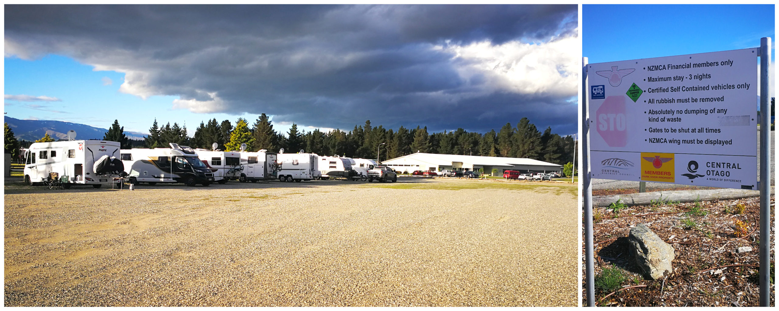
very lucky to have facilities like this so close to town – Molyneux Park
The park in its entirety is a real asset for the town with an ice rink, swimming pool, netball, rugby and cricket grounds. The camping area backs onto a BMX and skate park, children’s playground and picnic area. There are also some rather conveniently placed public toilets.
There are showers located at the indoor swimming pool complex that campers can use for $5 each (probably the most expensive showers I’ve come across).
Central Stories Museum & Art Gallery
The Central Stories Museum & Art Gallery is located in the main street and we’re always keen to visit local collections of history and memorabilia.
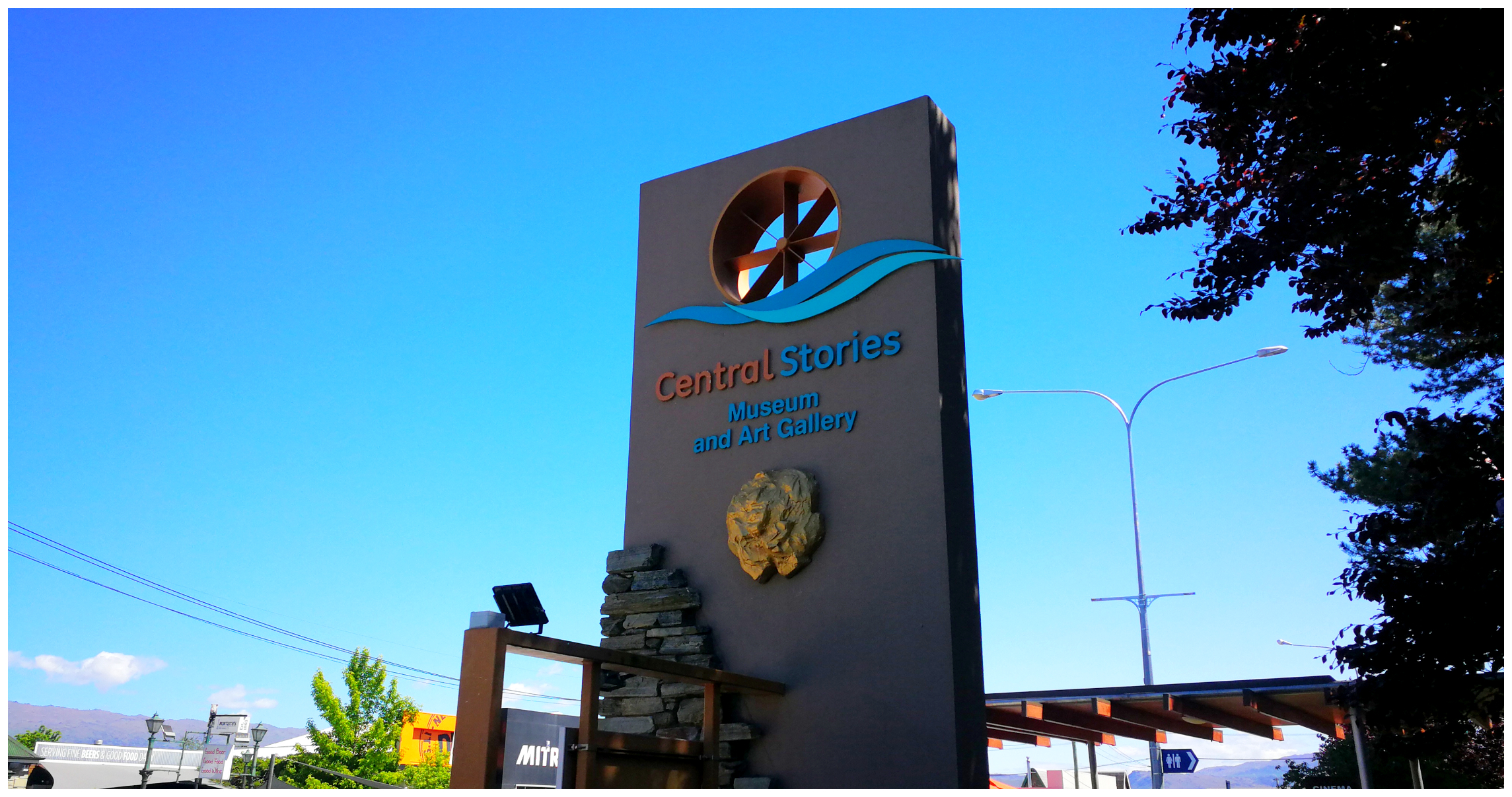
it’s easy to find located in the heart of the town
They’ve done a great job setting out exhibits which depict the rich history and heritage of the Alexandra region. We wandered around reading and learning about:
- Geology, gold mining, gold dredging – including a miniature working model dredge
- stories of the early explorers and a section devoted to the hard-working Chinese miners who set up in this area
- the history of the merino sheep
- how rabbits were introduced to the area (big mistake!!)
- the creation of the very popular annual Blossom Festival
- we spotted the critically threatened Otago Skinks in a live display depicting their natural environment
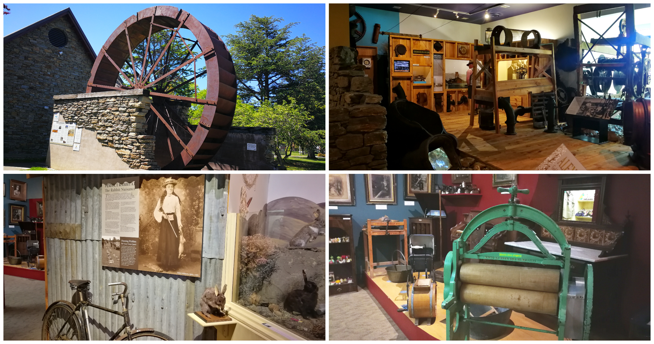
a great way to spend a very hot afternoon, always something to learn in these small-town museums
Lookout
It was a scorcher of a day, which Alexandra is renown for. Getting up to 28 degrees, we decided that it really wasn’t a day for much walking in the bright sunshine so it was with some relief when I realised we could drive up to the lookout, rather than a very hot and taxing slog uphill.
putting Alexandra into perspective at the top of the lookout
We took the drive up to the lookout which is above the iconic Alexandra clock. There is a walkway to the clock and beyond to the lookout but on a day like today, why walk when you can drive!!
Graveyard Gully
Next on the list was a drive out to Graveyard Gully where the original burial ground was located at the beginning of the peak of the Central Otago gold rushes in the mid-1860s. Back then in this area, there was a tent township known as Manuherikia Junction.
It is thought that this area was chosen for the cemetery as it was well placed away from the valuable rich gold mining claims which took up most of this area.
Some of the miners who perished in the notorious snowstorms on the Old Man Range in 1863 also rest here. The last confirmed burial here was in May 1869. Records show that there are 41 pioneer graves.
It soon became apparent that they would quickly run out of space and they weren’t willing to give up rich gold mining land for the expansion of the cemetery. A decision was made to create a new cemetery which led to the opening of the present one to the north of Alexandra in 1867.
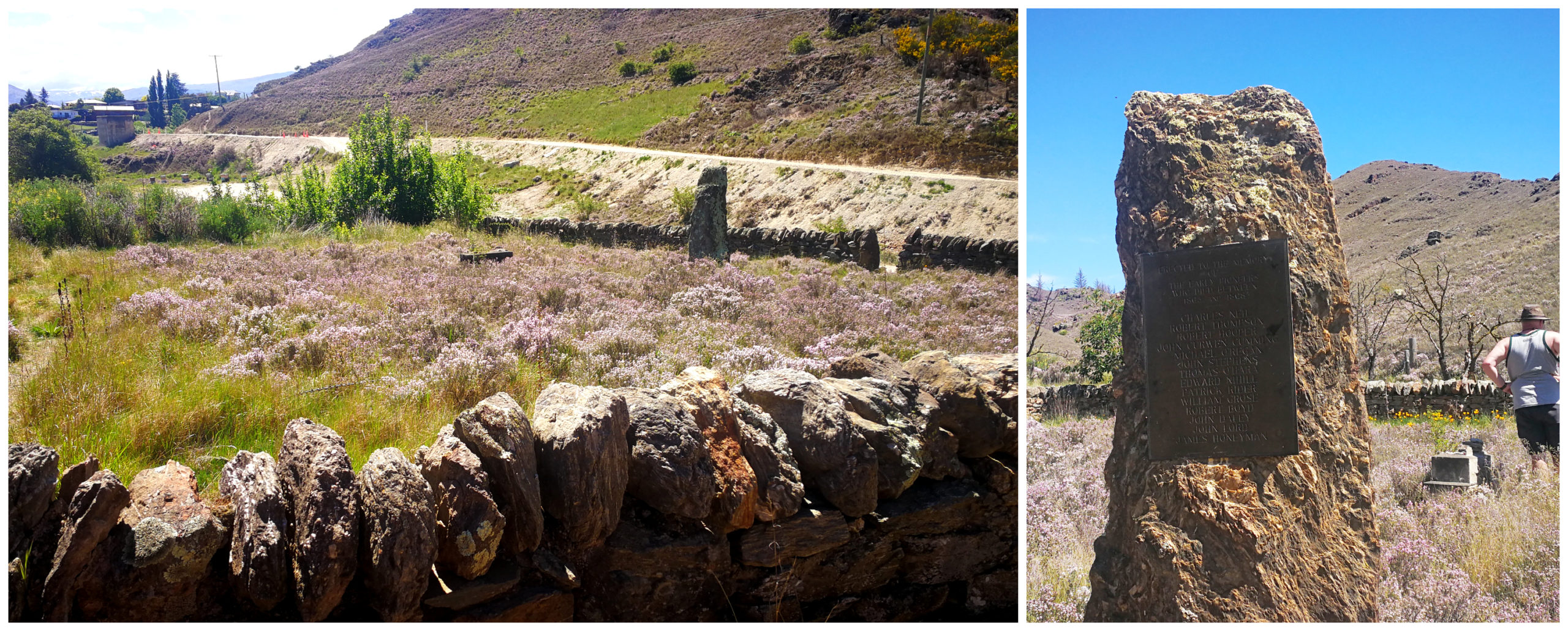
all that remains, a stone wall and a single plaque with a list of misspelt and missing names
The Forgotten Cemetery
The small cemetery was neglected over the coming years which led to its first restoration in 1892. A communal stone was engraved with as many names as locals could recall. The stone wall was also rebuilt. Sadly, nothing more was done until 1967 when another reconstruction was carried out.
Once again the wall was rebuilt, and the old damaged communal headstone was replaced by the bronze plaque seen today. Unfortunately, it has been discovered that the original communal headstone was full of errors. Many names were misspelt and many were either left off or the deceased are actually buried at the new cemetery and not at Graveyard Gully.
There are no longer any visible signs of burials at the small walled original cemetery.
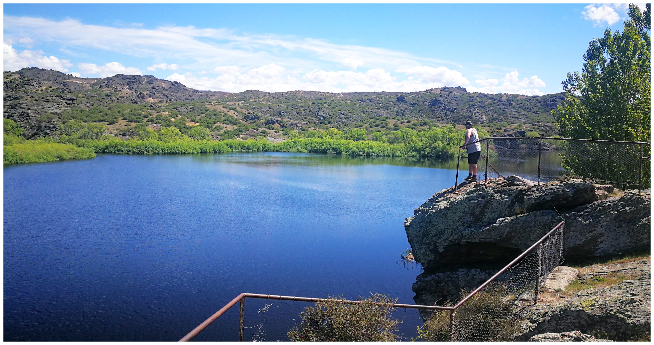
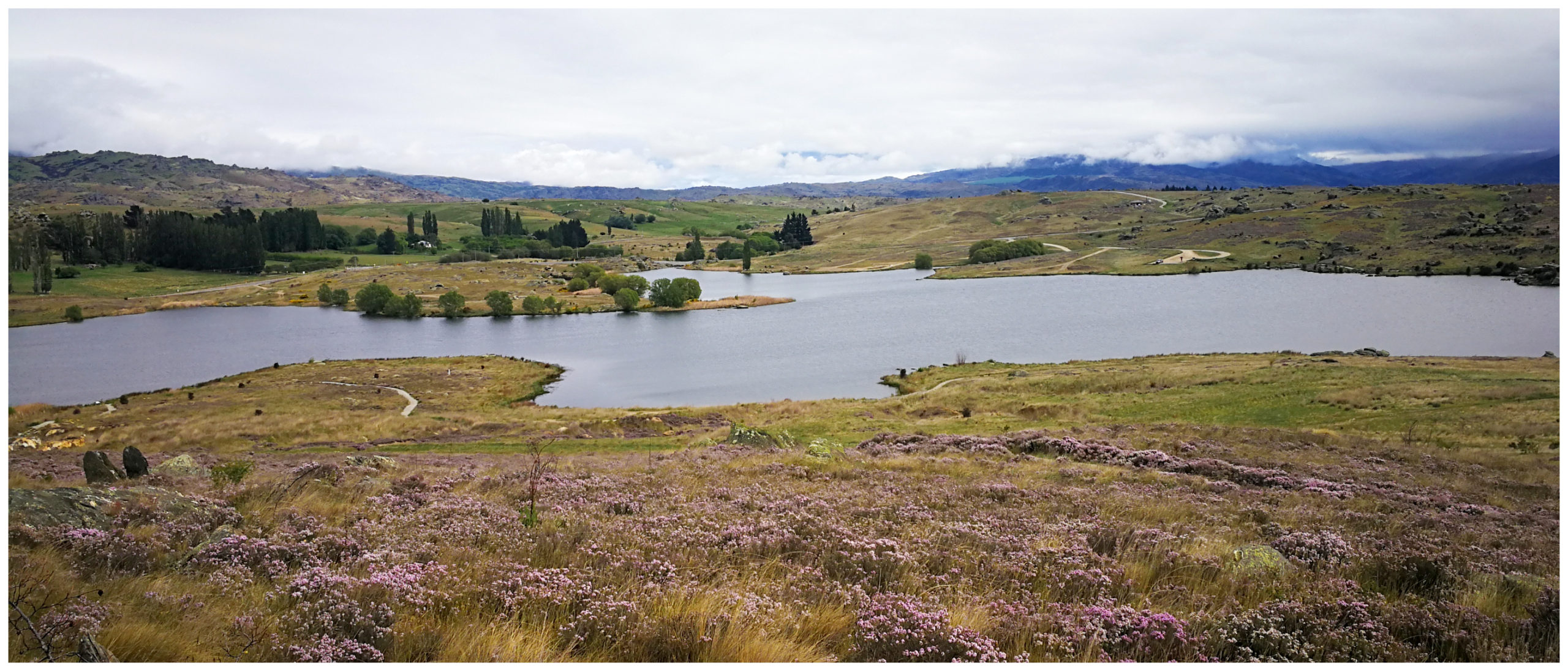
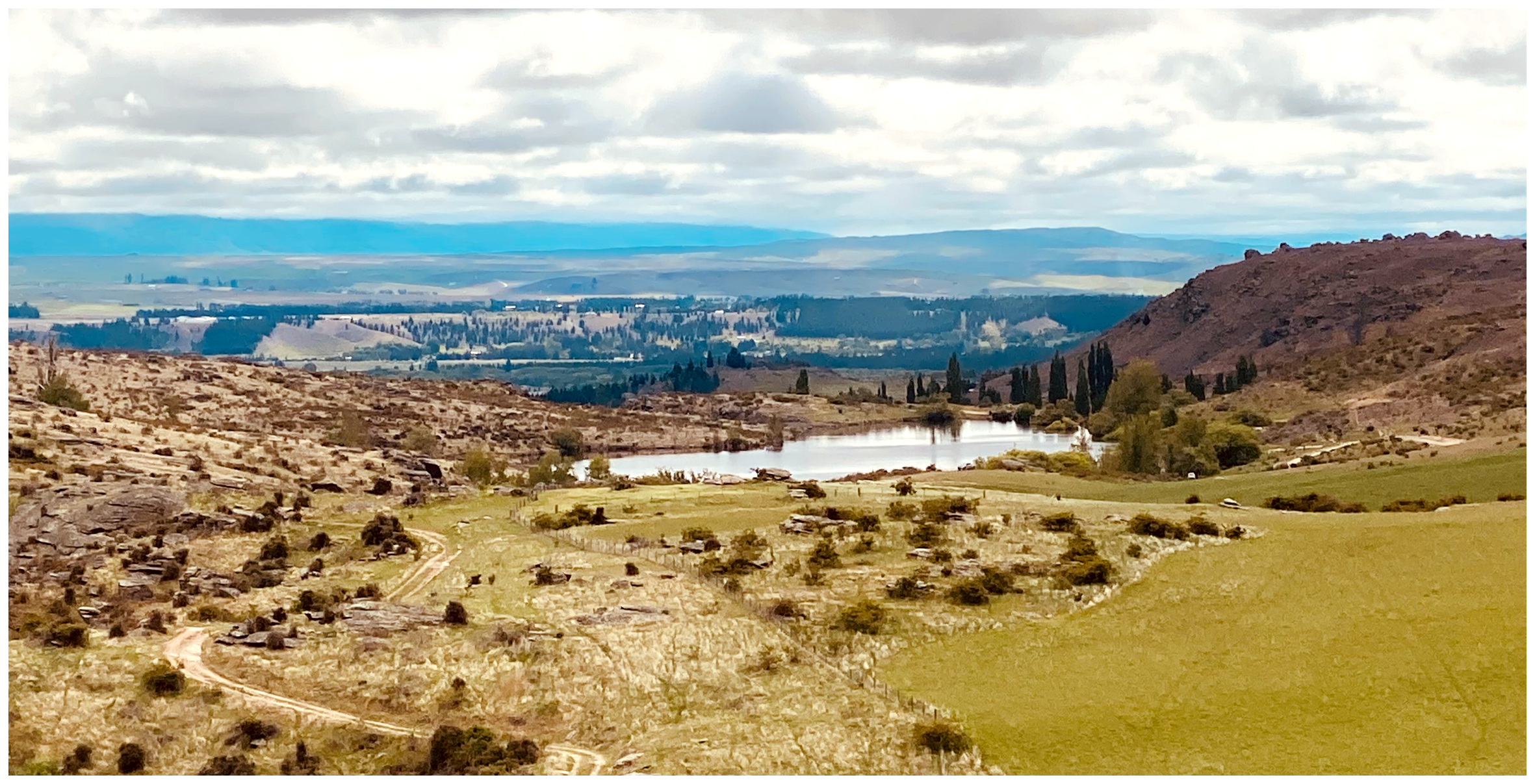
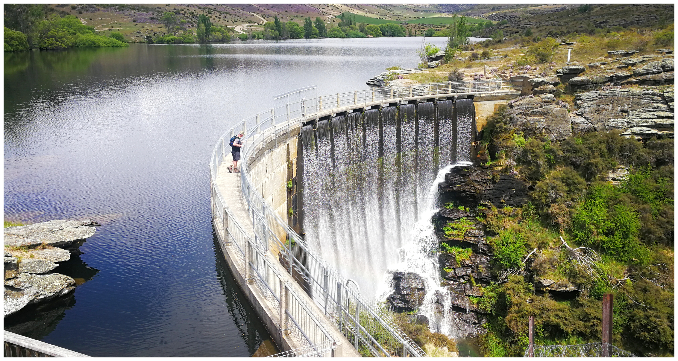
Lower Manorburn Dam
Next on our list was a visit to the Lower Manorburn Dam. This dam was constructed in the early 1900s and people have been ice skating on the dam every winter ever since.
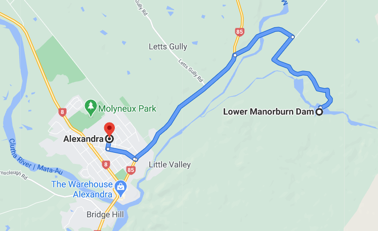
located 8km from Alexandra township
In the 50s and 60s busloads of them would turn up from Invercargill, Dunedin and Christchurch and it would be filled with skaters. There are many happy memories from locals and further afield of time spent on this dam. And no doubt, a few sore limbs and heads as they connected on the ice!
nope, not a skater to be seen
Well the day we visited, there certainly wasn’t any skating going on. In fact, it would have been nice to have a bit of ice on hand as the temperatures hovered in the high 20s.
the cool blue waters of Lower Manorburn Dam
just a little too much ripple for that perfect reflection today
Today, the dam offers good fishing, kayaking and swimming. It is still popular but more of a picnic and a chill-out area. The public ice skating rink in the township of Alexandra has taken over as the preferred location for a skate.
Manorburn Dam
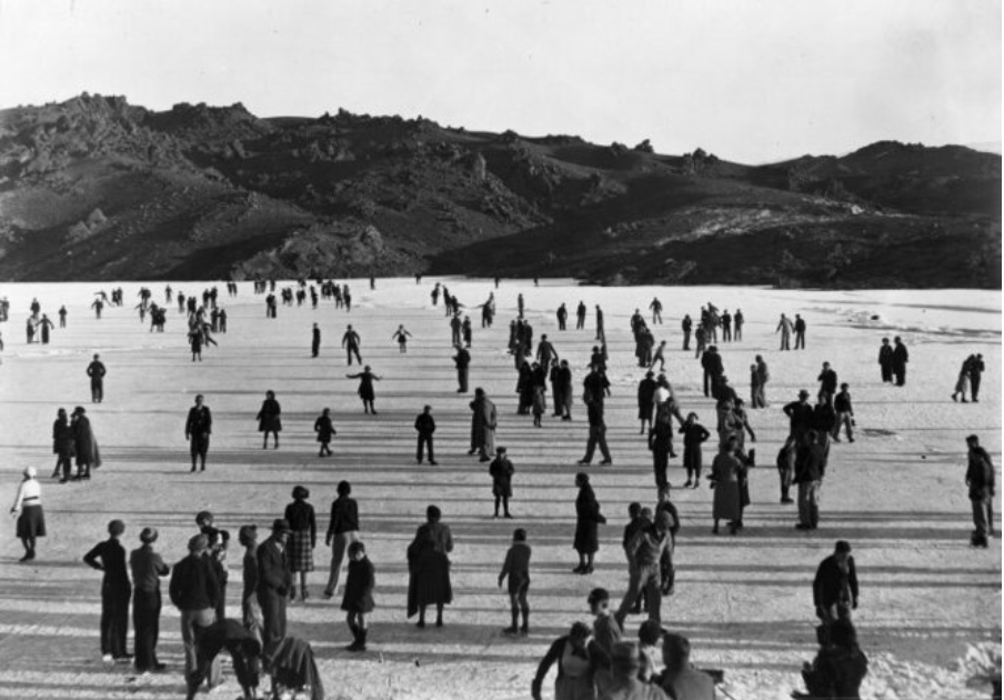
Photo courtesy of National Library, Taken circa June 1939.
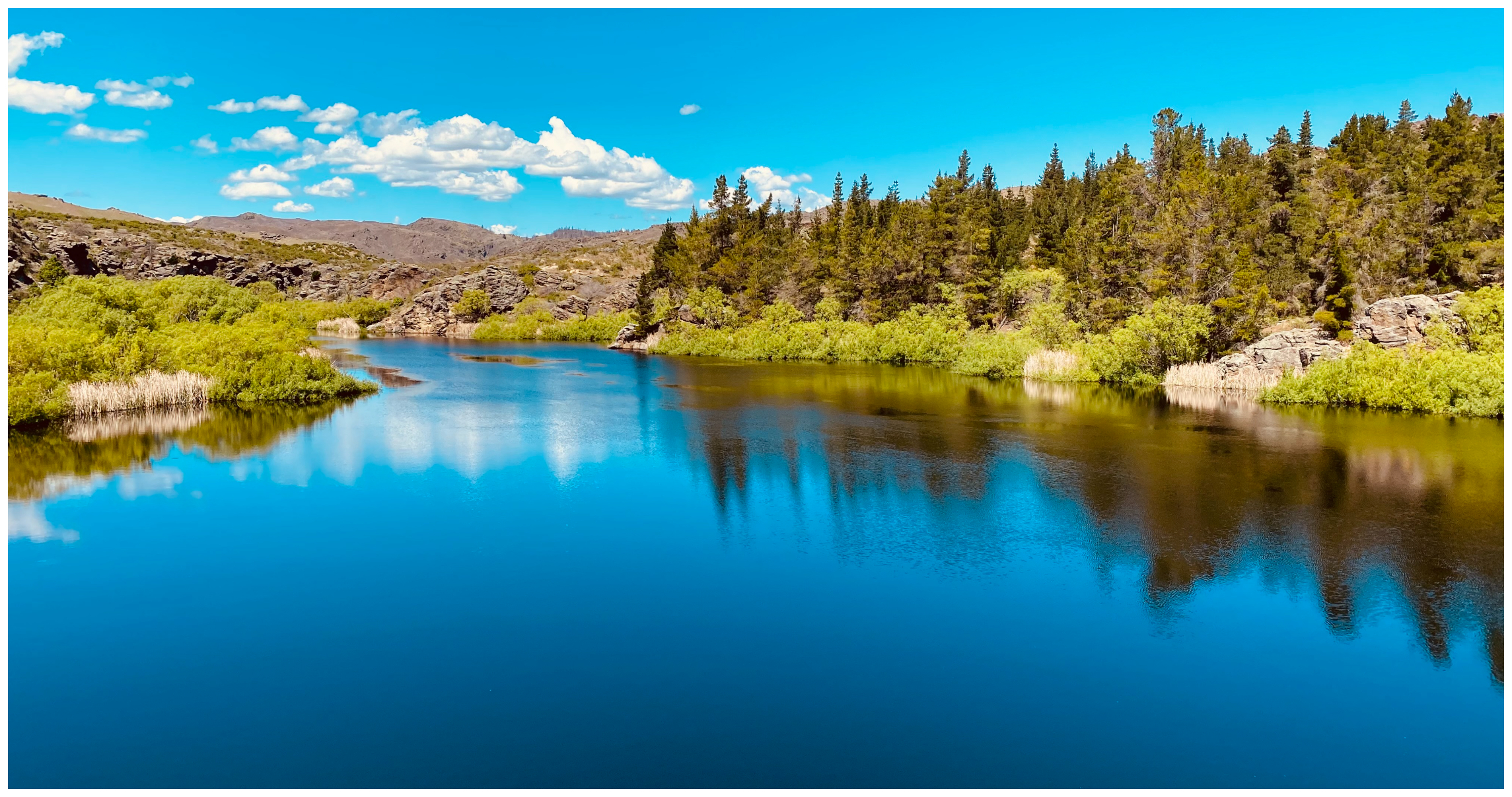
Butchers Dam
Carrying on with the ‘dam’ theme, we stopped off at Butchers Dam, also close to the Alexandra township.
view of the dam from the Flat Top Hill Conservation Area – we were soon to learn what lies under the dark waters of the dam
There used to be freedom camping on the shoreline but this is no longer the case (sadly).
There are a few options when it comes to walking trails, but we decided to walk the 1-hour loop track.
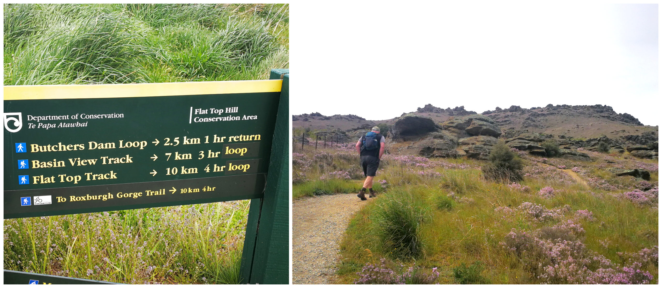
spoilt for choice when it comes to walking trails
Soaking up the History
We’ve driven past Butchers Dam numerous times but little did we know about the history surrounding this area.
we could still see evidence of the mining activity above the water level of the dam
As expected, Butchers Gully (now submerged under the dam) was teeming with gold mining activity. Although not quite as rich as the nearby Conroys Dam, it was productive for many years and was home to more than 150 miners and their families.
Submerged in the dark green waters of the dam is the old store, butchers shop and hotel, drowned when the dam was completed and flooded in 1937. Apparently, when the water level is low, the chimney stacks can still be seen under the surface.
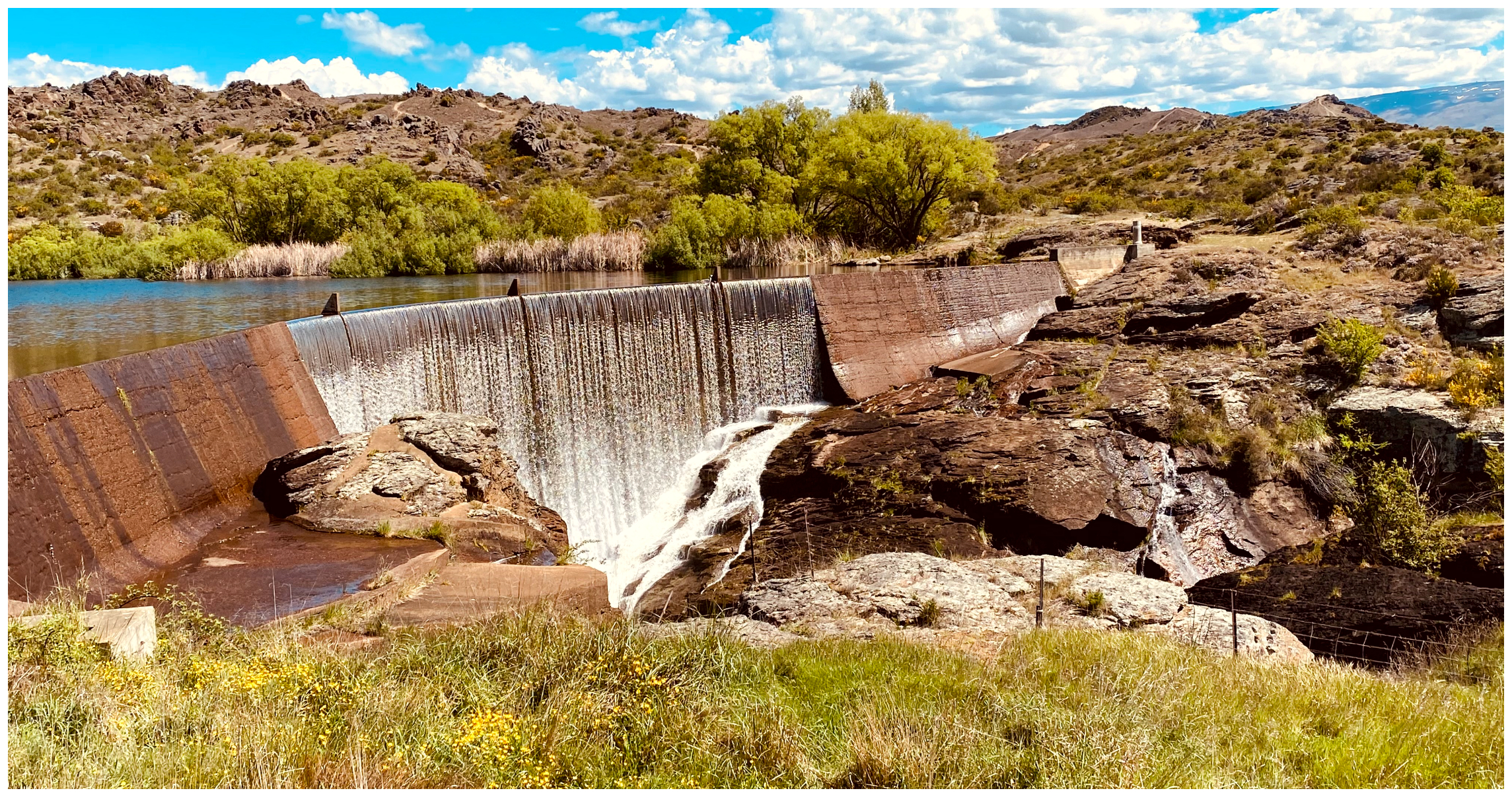
The Dam
It must have been quite the engineering feat when the dam was constructed between 1935 and 1937. It was built during the great depression to create a water reservoir for Alexandra. Today it is used for irrigation purposes and is privately owned.
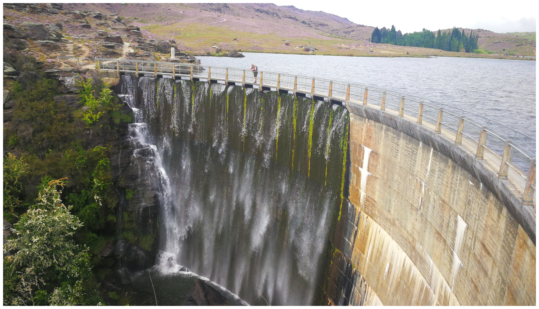
walking the plank, the path across the dam
There is an impressive 728-metre tunnel which had to be drilled through solid schist rock.
Loop Walk
As mentioned earlier, there are a number of walking or mountain biking choices around the Flat Top Hill Conservation area. This encompasses some of the historical evidence of European and Chinese gold mining settlements which didn’t get flooded when the dam was established.
These tracks loop back on themselves so provide numerous combinations for exploring.
- Butchers Dam Loop Track (1 hr return, 2.5km)
- Basin View Track (3.15hr return, 7km, bike grade 3)
- Flat Top Hill Track (4hr return, 10km, bike grade 3)
- Roxburgh Faces Tramping Track (3-4hr return from Flat Top Tramping Track junction)
We wandered across the impressive concrete structure of the dam and meandered around the loop track. We came across the interpretation boards and read about the fauna and flora and also more about the gold mining remains.
Lye Bow (Li Bo)
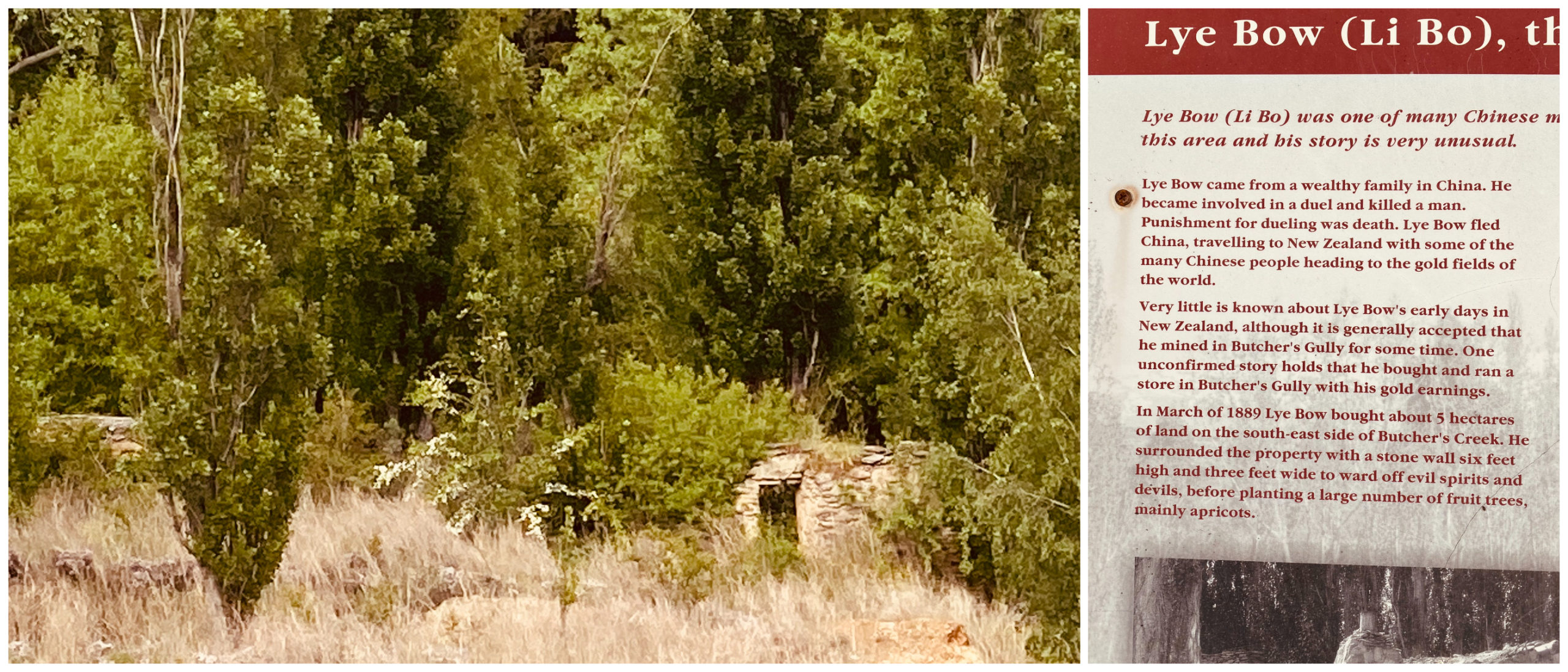
it was fascinating to learn about the colourful character Li Bo
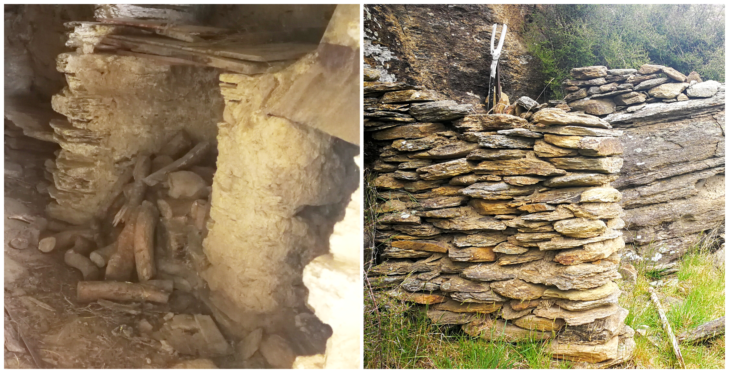
The remains of Lye Bow’s (Li Bo) market garden, orchard, shist rock storeroom and surrounding rock fence could still be seen. He sounded like a popular character in the area and there was quite a story about his daily trips into nearby Alexandra to sell his produce, milk and butter.
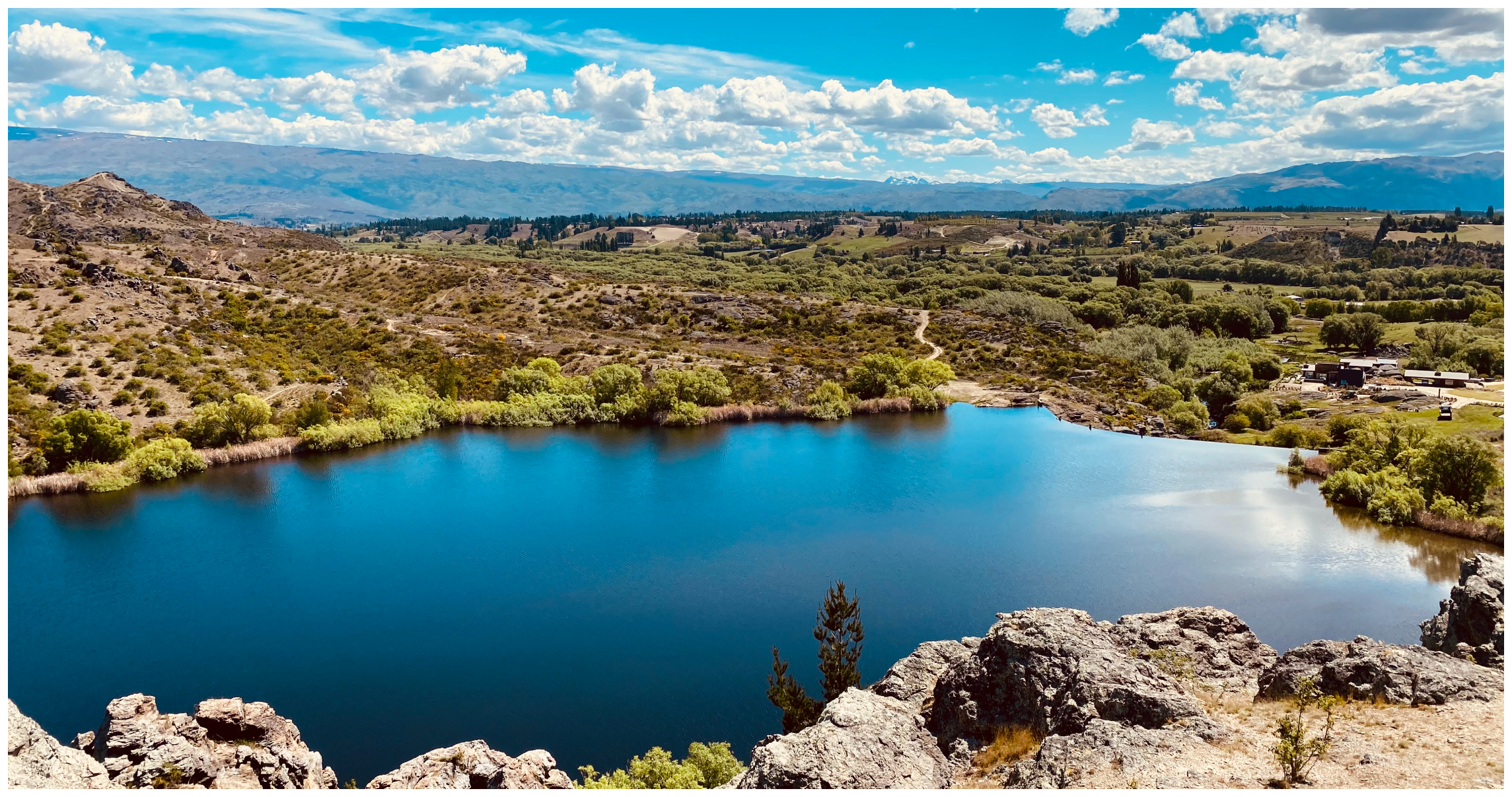
Conroys Dam
Another day, another dam. Yup, there are many dotted around this area.
Located quite close to Butchers Dam (across the other side of the main road) we decided to check out another man-made dam, constructed just before Butchers started in 1935.
preloading (coffee!) before our hike, overlooking Conroys Dam
Its creation was solely to provide irrigation for the orchards on the Conroys Flats and to some of the orchards on Earnscleugh Flats closer to Alexandra. Like Butchers Dam, flooding of the dam destroyed many of the early mining workings on Muirs Flat.
It is only above the dam that some evidence of early mining can still be seen.
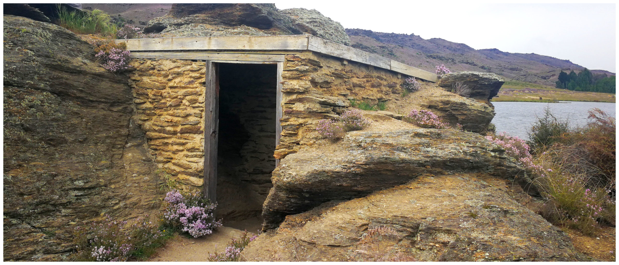
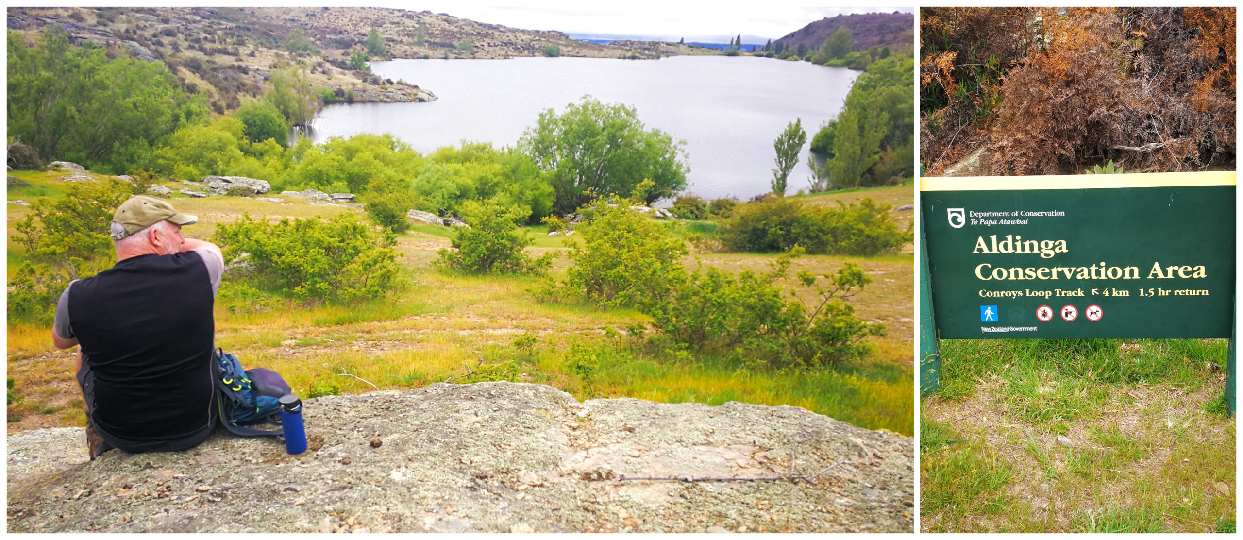
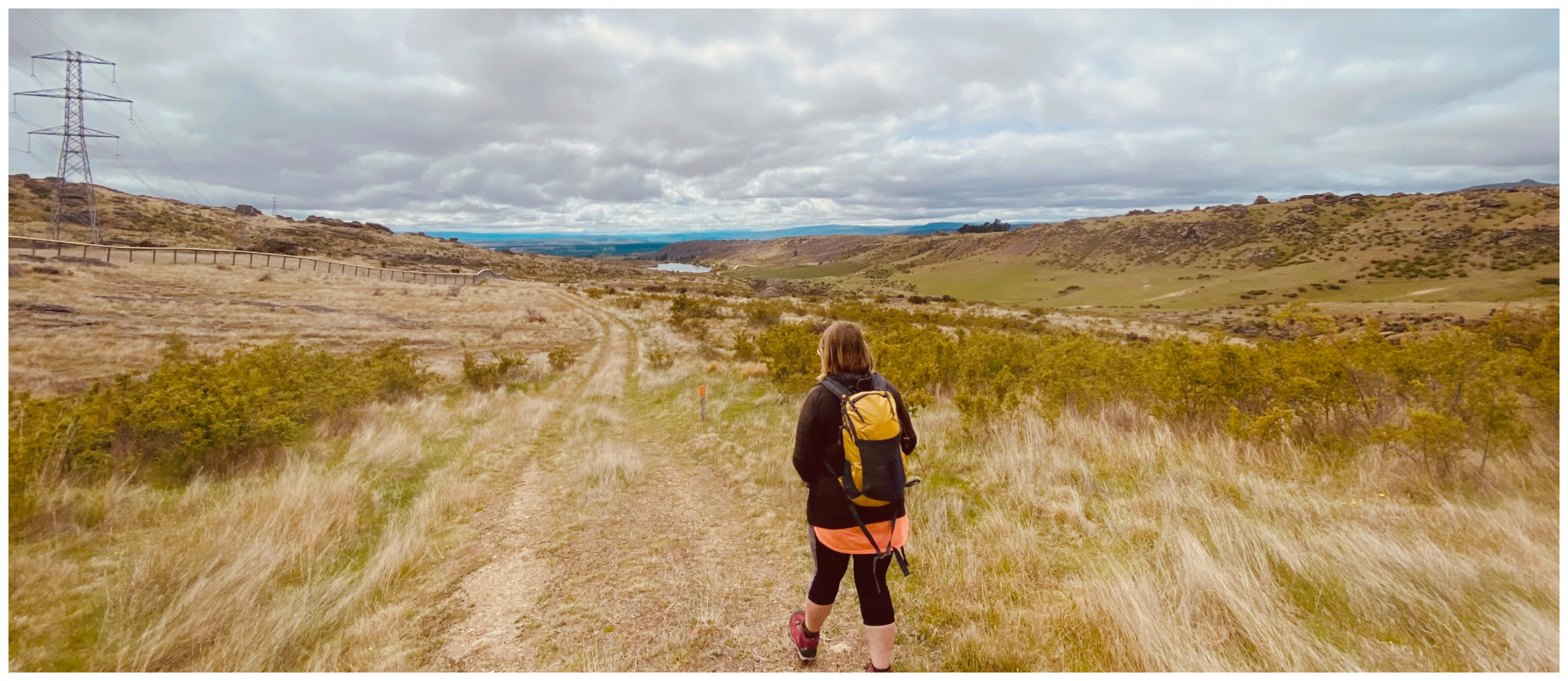
Aldinga Conservation Area
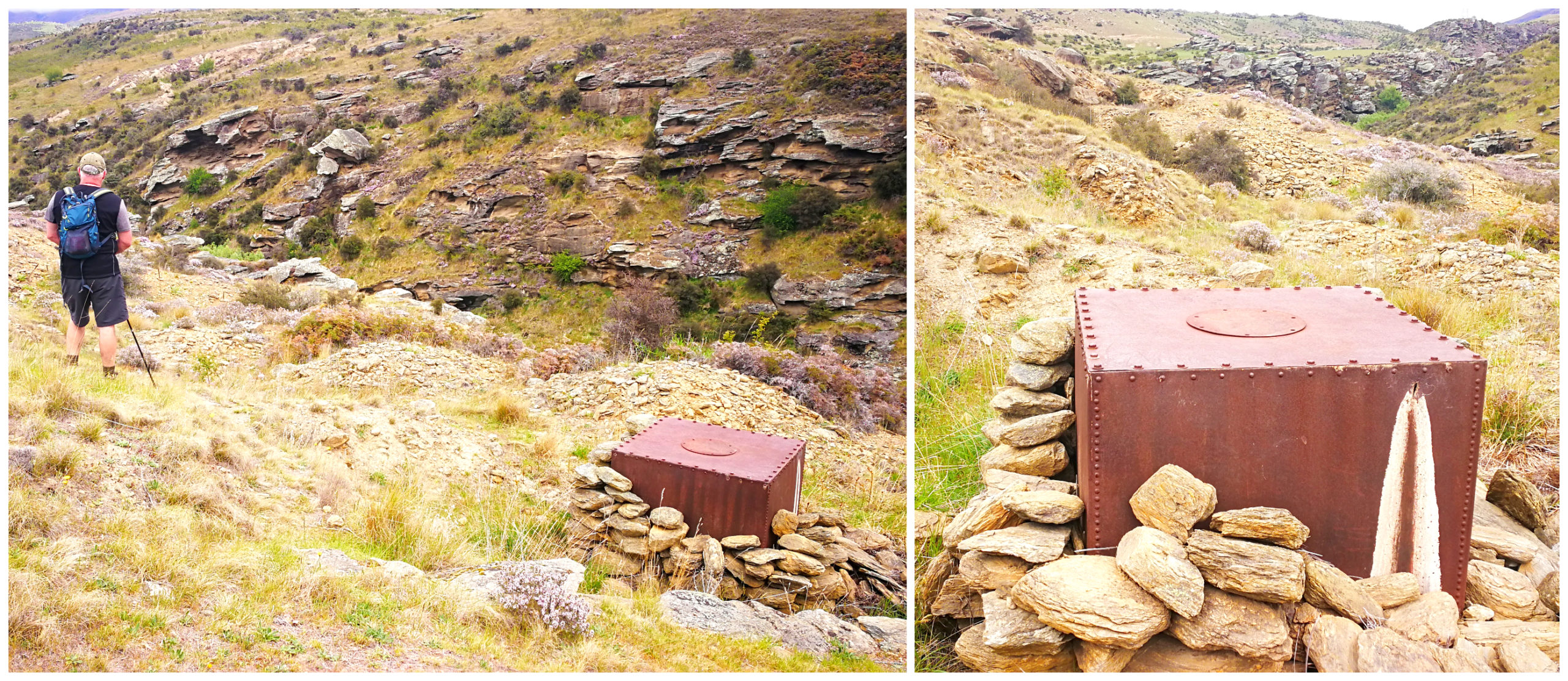
We set off on a 1.5hr walk on the DoC track that snakes its way through the craggy, grassy terrain. Halfway along the trail, we started to see some old races, tailings, small dams and sluice workings.
it took half an hour of an uphill slog to start seeing mining evidence
After the European miners finished with the area, the Chinese arrived and worked over the area again. It is likely that the stone remains of buildings are those that the Chinese built and lived in between 1870 and 1900.
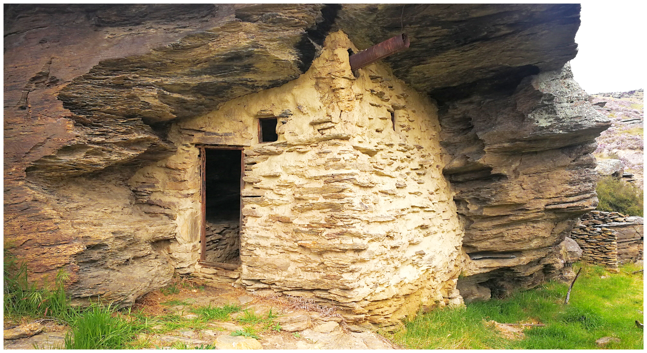
isn’t this a wee gem of a restored miners hut
depicting the hard life of a miner
Department of Conservation track that snakes its way through the craggy, grassy terrain of the Aldinga conservation area hide the remains of old miners’ huts, including one perfectly preserved dirt-floored abode built under an enormous overhang of schist rock.
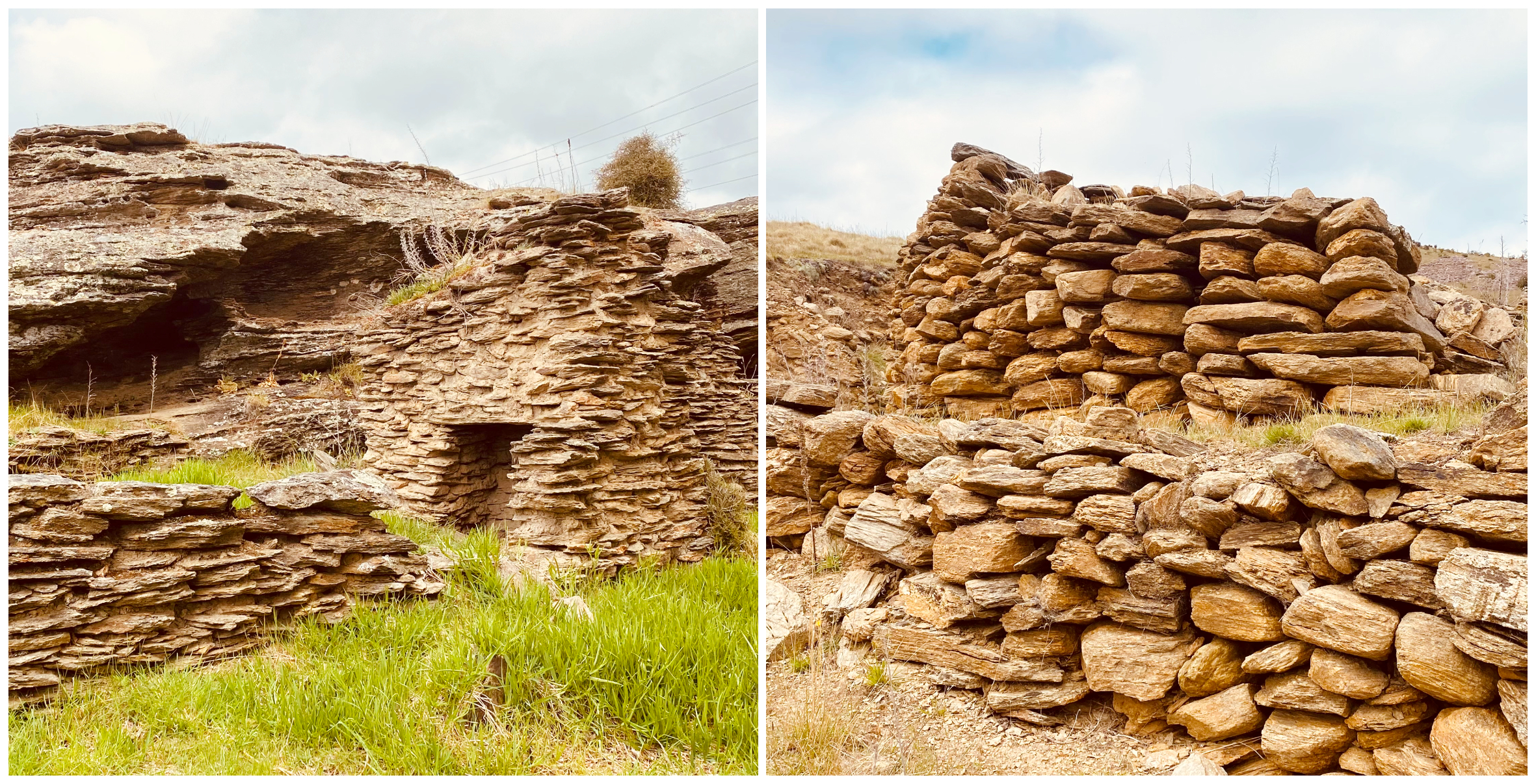
some of the rock walls standing the test of time
This was one of the wealthiest gullies in the district with a reef on each side. At its peak, this area was home to around 400 miners.
it was all downhill from here towards the dam in the distance
Our arduous and the hot climb was well rewarded with spectacular views back towards Conroys Dam, looking like an oasis in the barren rocky landscape.
it was clear to see just how far up we’d hiked – the oasis that is Conroys Dam
Grand and Otago Skinks
I recalled seeing the live exhibit in the local museum of the Otago Skinks and spotted two of them sunning themselves under the artificial light.
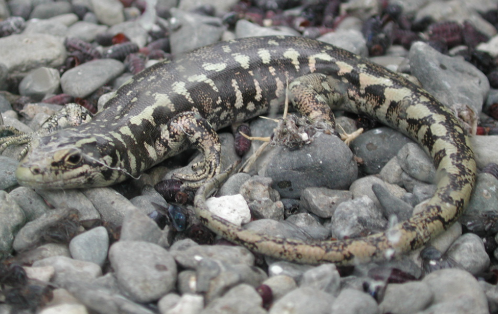
photo courtesy of Wikipedia.com
The very long and large (1.6km) predator-proof fencing built along a section of the steep and undulating hillside in the Aldinga Conservation Area is to provide a protective habitat for the Otago Skinks. The Mokomoko Drylands Sanctuary was established in 2009 as a 14-hectare sanctuary.
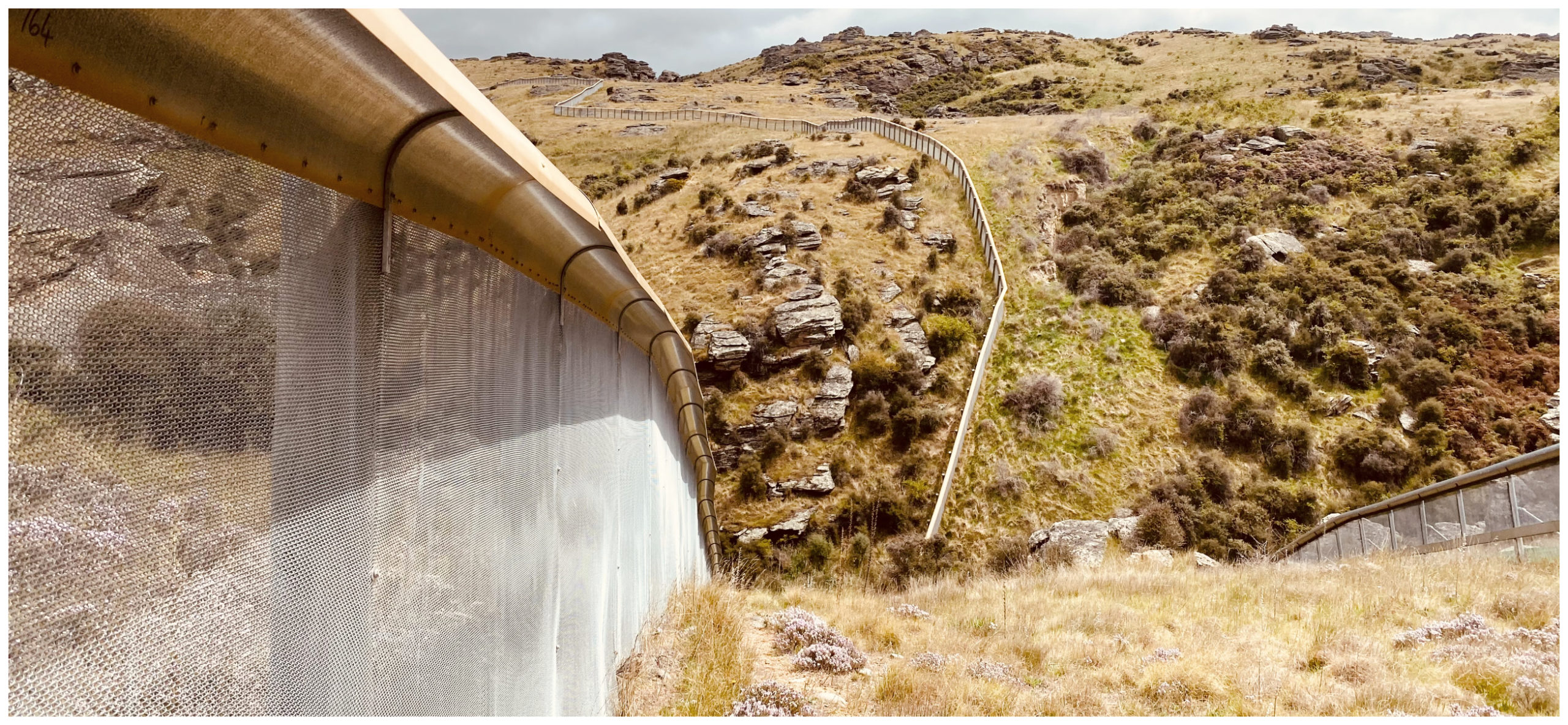
the robust predator-proof fence stretches out into the distance
Otago Skinks are one of two of NZ’s largest and rarest reptiles. They can grow as long as 300mm. Grand and Otago Skinks are unique to Otago. They are listed as “Nationally Critically Endangered” and it was feared that they would dwindle away to the point of extinction within a decade.
Picnic by the Dam
It was a well-deserved coffee and sandwich enjoyed beside the cooler waters of Conroys dam. The sound of the cascading water over the large concrete structure was soothing as we sat looking over the vast area of water.
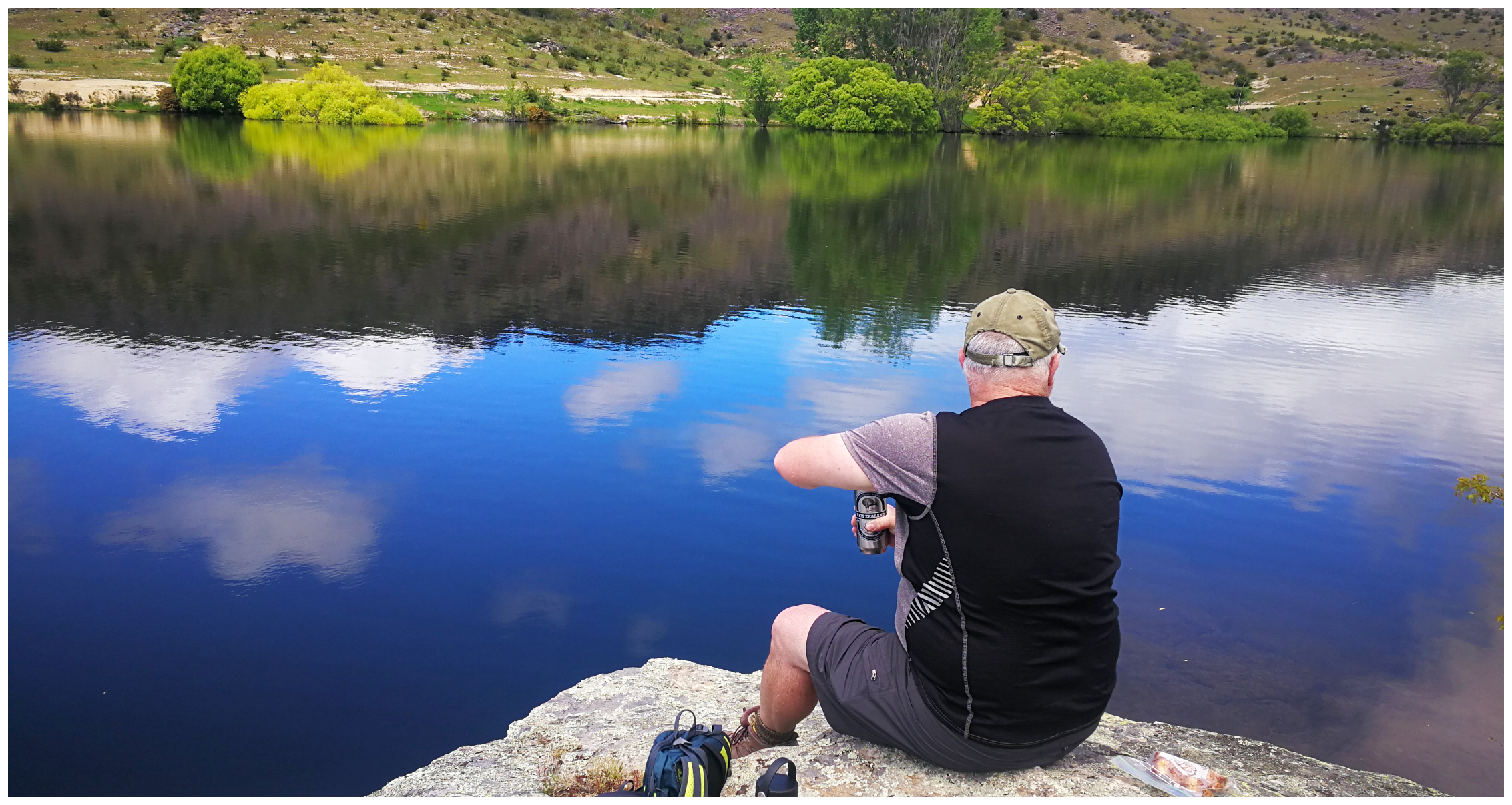
rehydrating and a sandwich by the dam
We can understand the reasoning behind the need for irrigation but also sad that much of our history has gone forever, lost to a watery grave in the name of progress.
the manmade waterfall that is Conroys Dam
Click on the link below for some highlights of our exploration around the greater Alexandra area:
Roxborogh Gorge Cycle Trail Part Two
Well after a couple of days of exploring the local area surrounding Alexandra, we set off in the early morning to finally conquer the rest of the Roxburgh Gorge Cycle Trail.
As explained in my earlier blog, the trail is in two sections, separated by a 12km jet boat ride. As we didn’t want to take this option we completed the trail in two parts.
We cycled from basecamp at Molyneux Park and within 3.5km we reached the official start of the trail which would take us to Doctors Point, the furthest we could go.
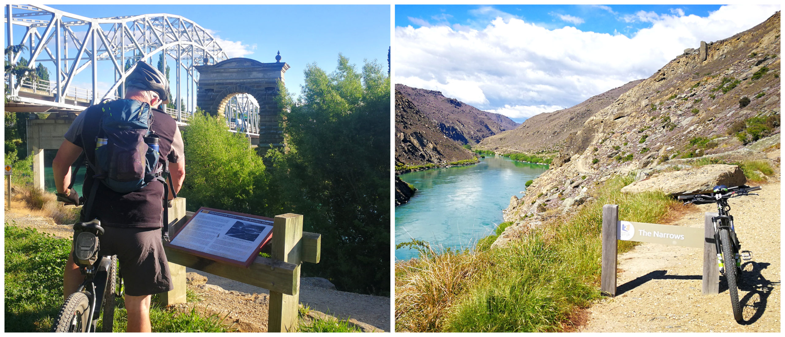
the start of the track at Alexandra Bridge
It is a 20km return trip from the start near the Alexandra Bridge.
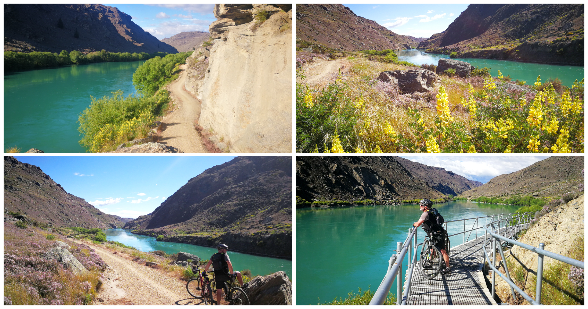
leaving the willows behind, the track opened up revealing the Roxburgh Gorge
We followed the Clutha River, shaded by the many willow trees along the way. The trail soon opened out into the heart of the Roxburgh Gorge and resembled the views we enjoyed when cycling the Roxburgh Dam to Shingle Creek.
there were plenty of photo ops along the way there and back
The colour palette is just amazing. There are the rocky bluffs and hillsides covered in purple with flowering wild thyme, contrasting with the aqua blue-green of the fast-flowing Clutha river. This is in sharp contrast to the grey schist rock and the bright green of the willow trees which populate the water’s edge.
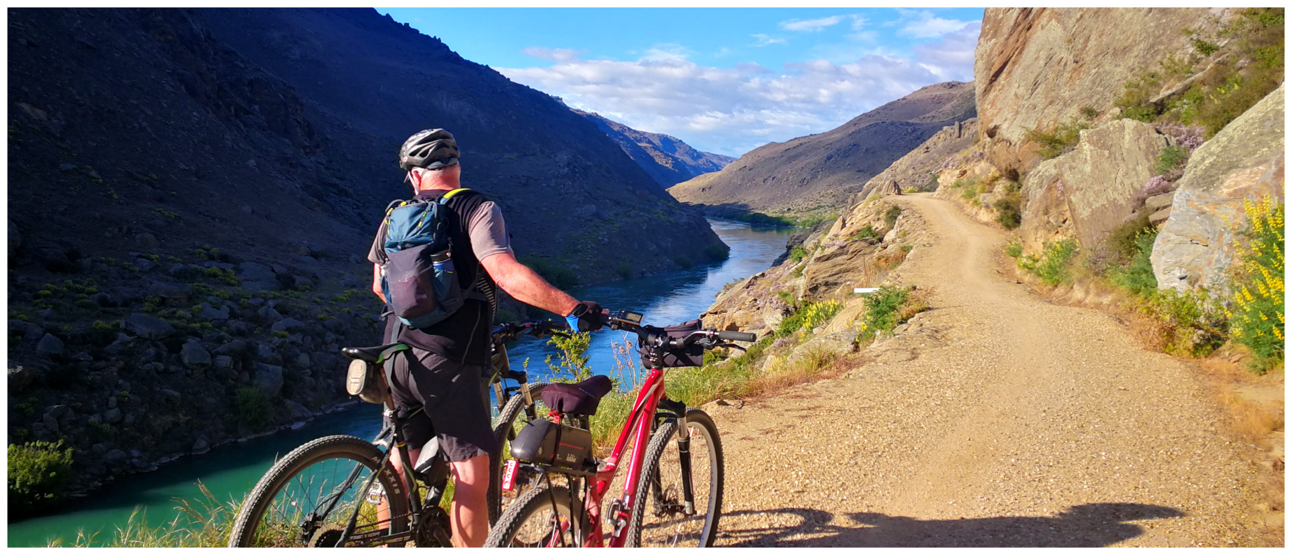
Track Condition
It is a wide slightly undulating trail.
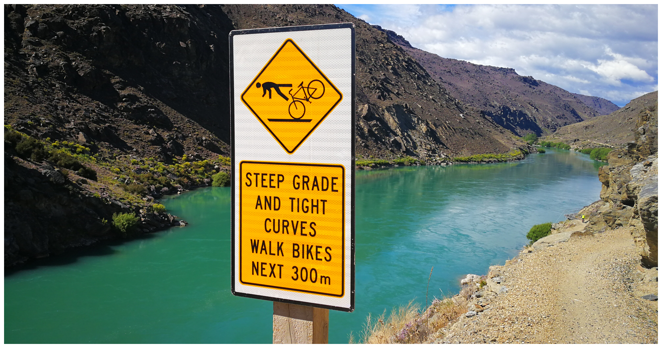
heed the warning signs
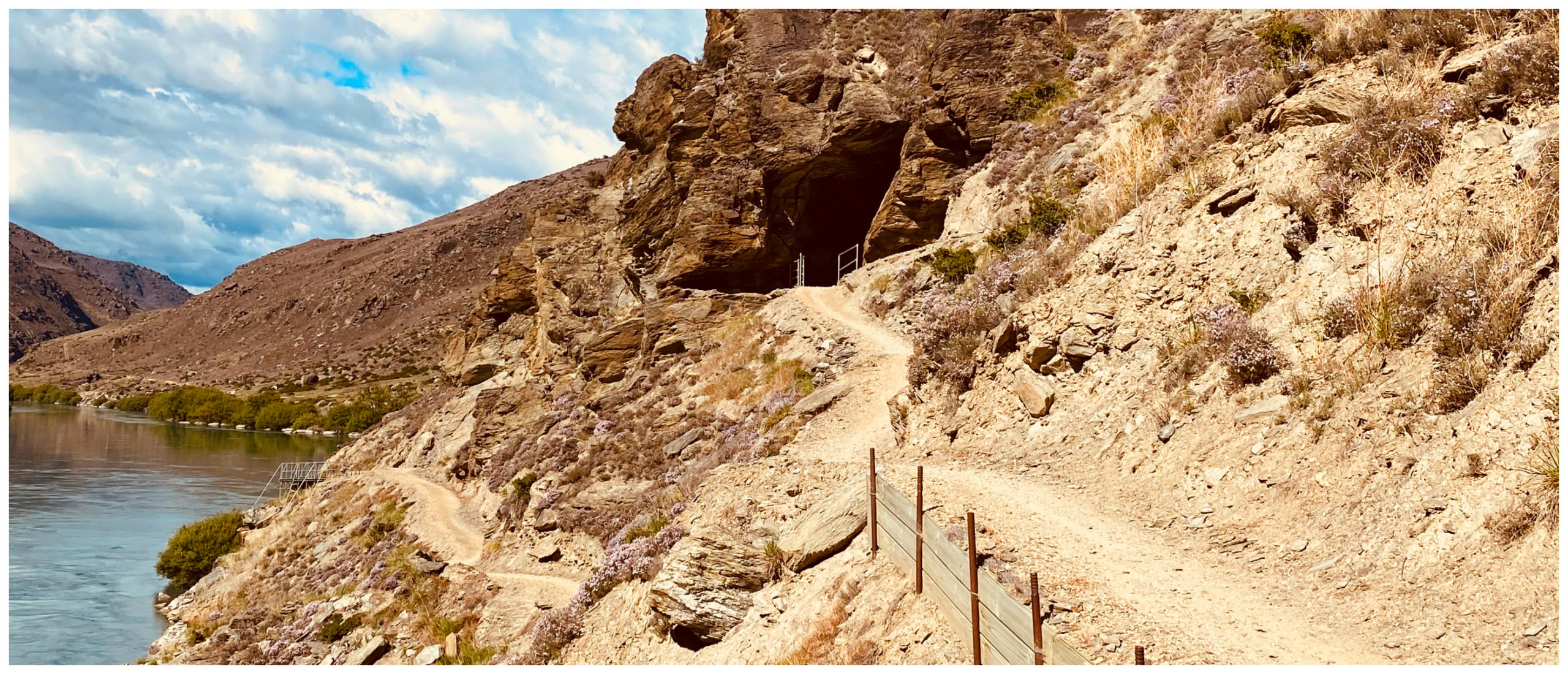
heading into the sharp switchback
The trail is well-formed with only one tricky section to navigate. I heeded the warning to dismount from my bike and walk the narrow 300m of track. I’m no hero when it comes to steep drop-offs and tight switchbacks to navigate.
As mentioned earlier, we set off early in the morning to miss not only the heat of the Alexandra summer temperatures but also to complete the trail before it gets busy with other cyclists. It is a very popular trail and I think best enjoyed when you have the majority of the track to yourselves.
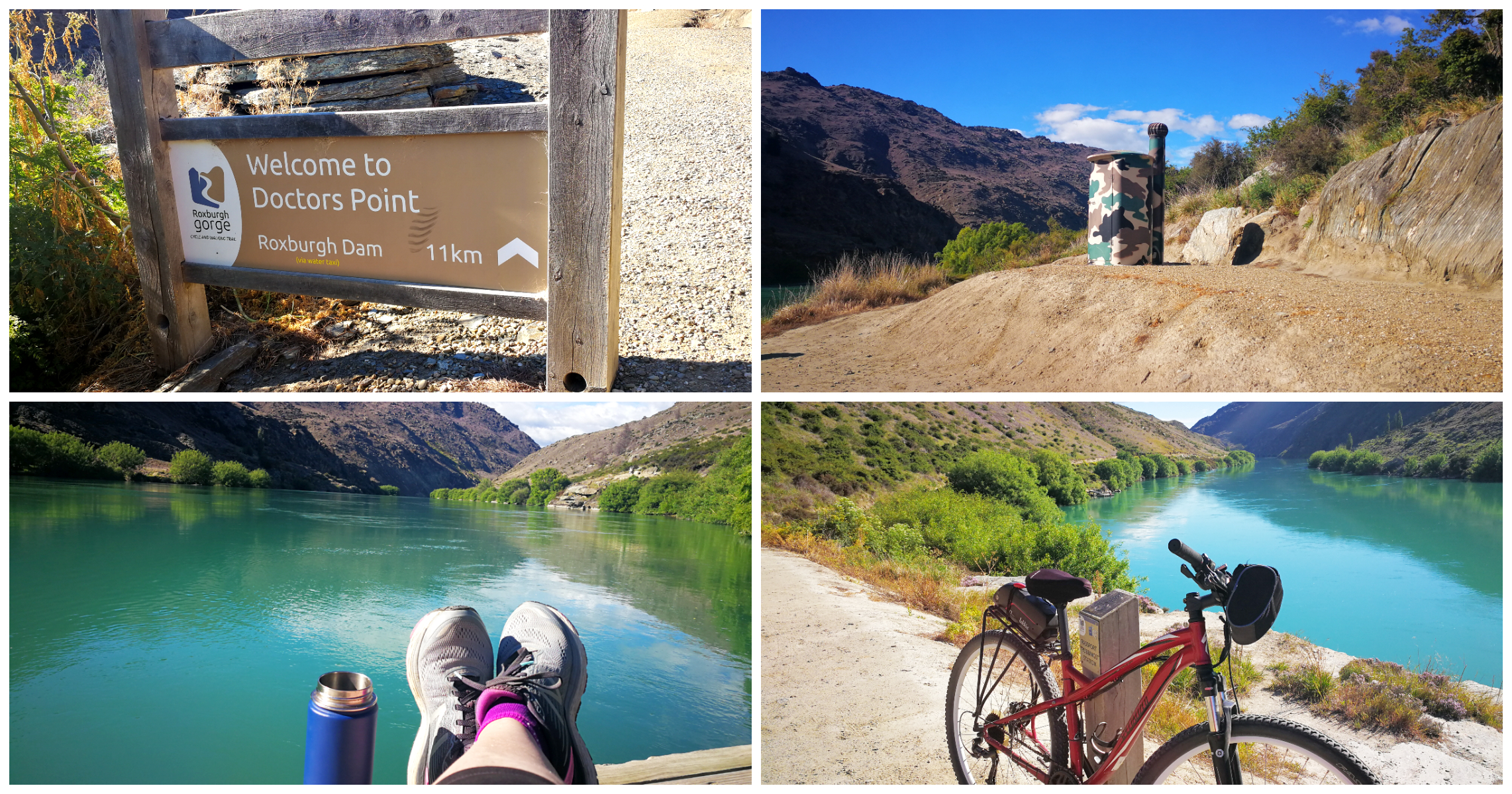
Doctors Point is the meeting point for the jetboat and a loo with a view!
Once again, the thermos of coffee and sandwiches went down well while sitting on the jetty at the far end of the trail. There’s no better view for a picnic than sitting in the noisy silence of mother nature.
Click on the link below for a video of our highlights of Roxburgh Gorge Take Two.
Your blog is great. We meet up at Pinders Pond,
Oh hi Marlene, yes I remember meeting up! Thanks for your feedback and hopefully our paths might cross again some time. Linda
Does the drive to the obelisk appeal?
We found that the best thing to do in Alex !
Thanks Sharon, we drove to the Obelisk when we were staying in Roxburgh, covered off in my previous blog. It was one of our more memorable roadie! Loved, loved, loved it!!!