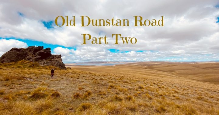
Following on from my Old Dunstan Road – Part One blog, we set off from basecamp at Ranfurly, to continue along on the old wagon and bullock trails of our pioneering forefathers.
This time we were covering a greater distance, but by all accounts, it should take us less time. We had already covered the more challenging section of the Old Dunstan Road.
Our Route
We departed Ranfurly and headed to Clarks Junction, some 90km away.
Clarks Junction
Clarks Junction is deemed to be the ‘modern’ start of the Old Dunstan Road as it turns north-east into the Lammermoors. But in the 1860s there was a steady stream travelling from Dunedin via Outram.
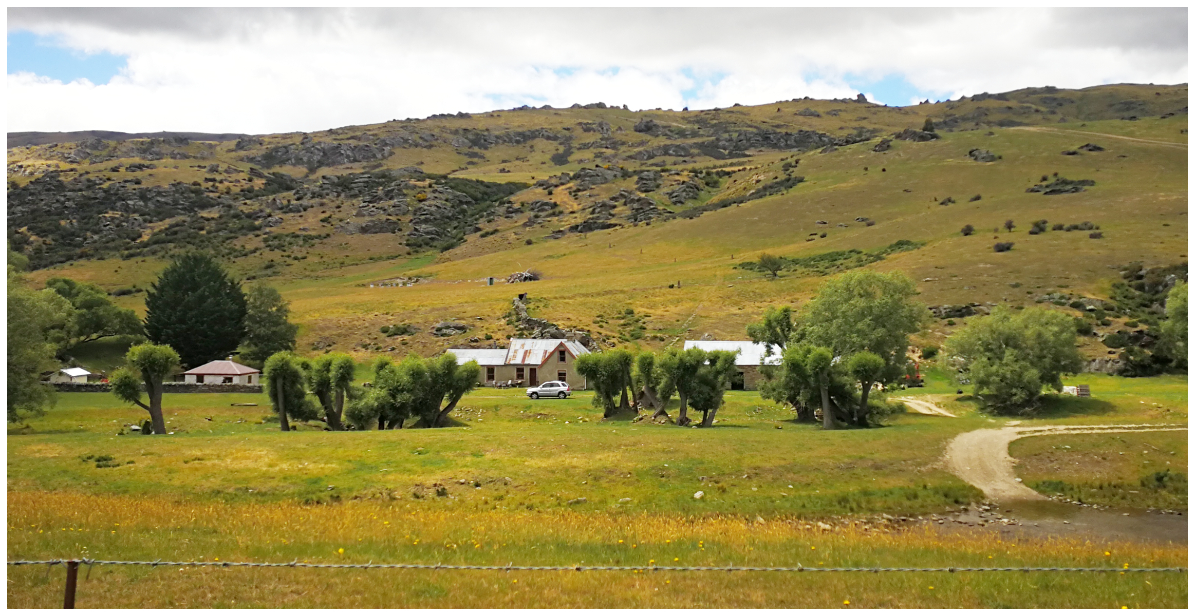
Travellers would stop at one of the Accommodation Houses or Grog Shanty’s which had sprung up at Clarks Junction to rest and refresh for the night. Some miners preferred to carry on straight to Rocklands Station homestead, Deep Creek. Here, food and shelter were available, before facing the first big climb. The mountain range is known as the Lammermoors.
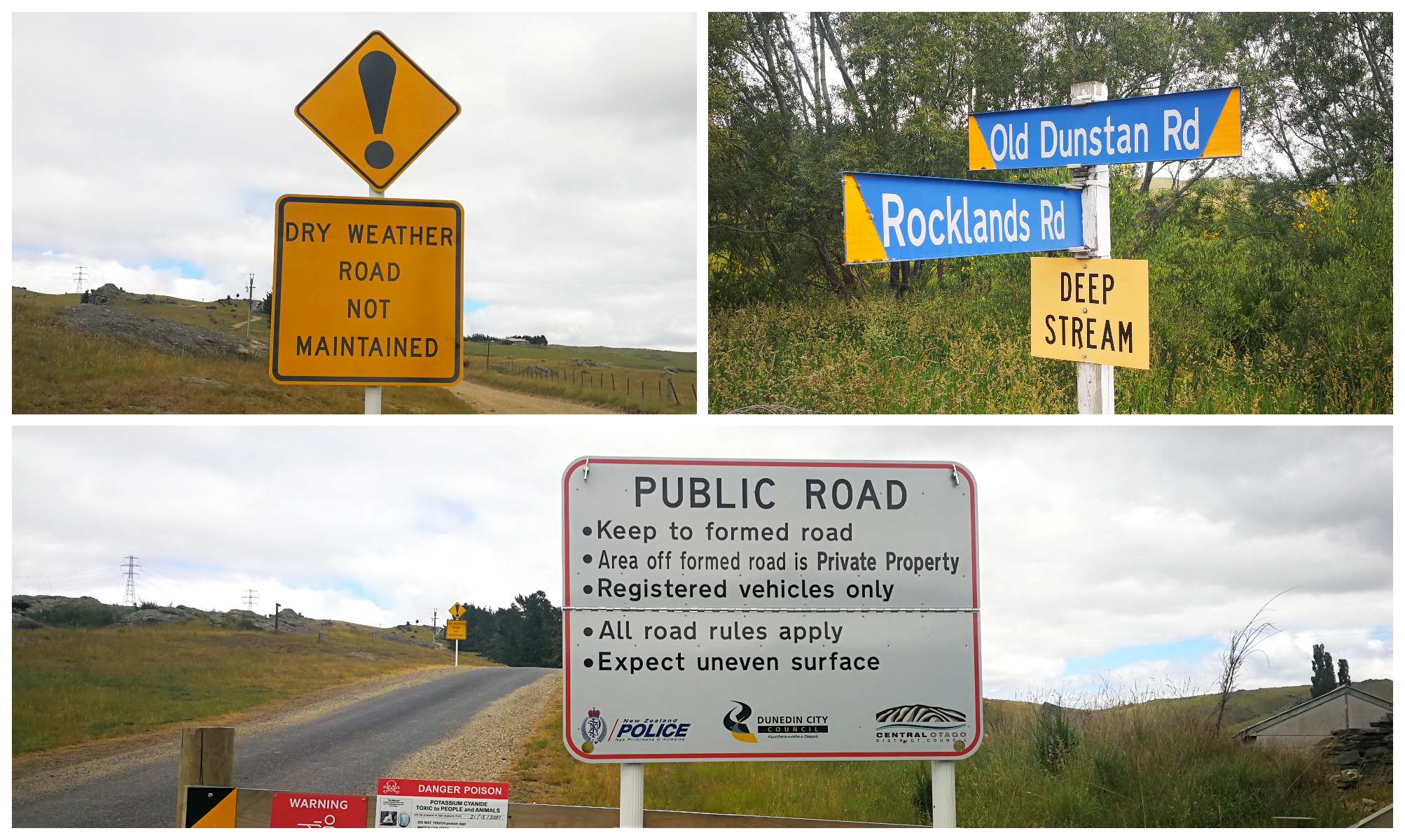
early travellers would stop at Deep Creek, but they didn’t have any warning signs of what was to come
Today, the road from Clarks Junction to Deep Creek is sealed but narrow. Keep a lookout for stock trucks who regularly make the trek from the Rocklands Station.
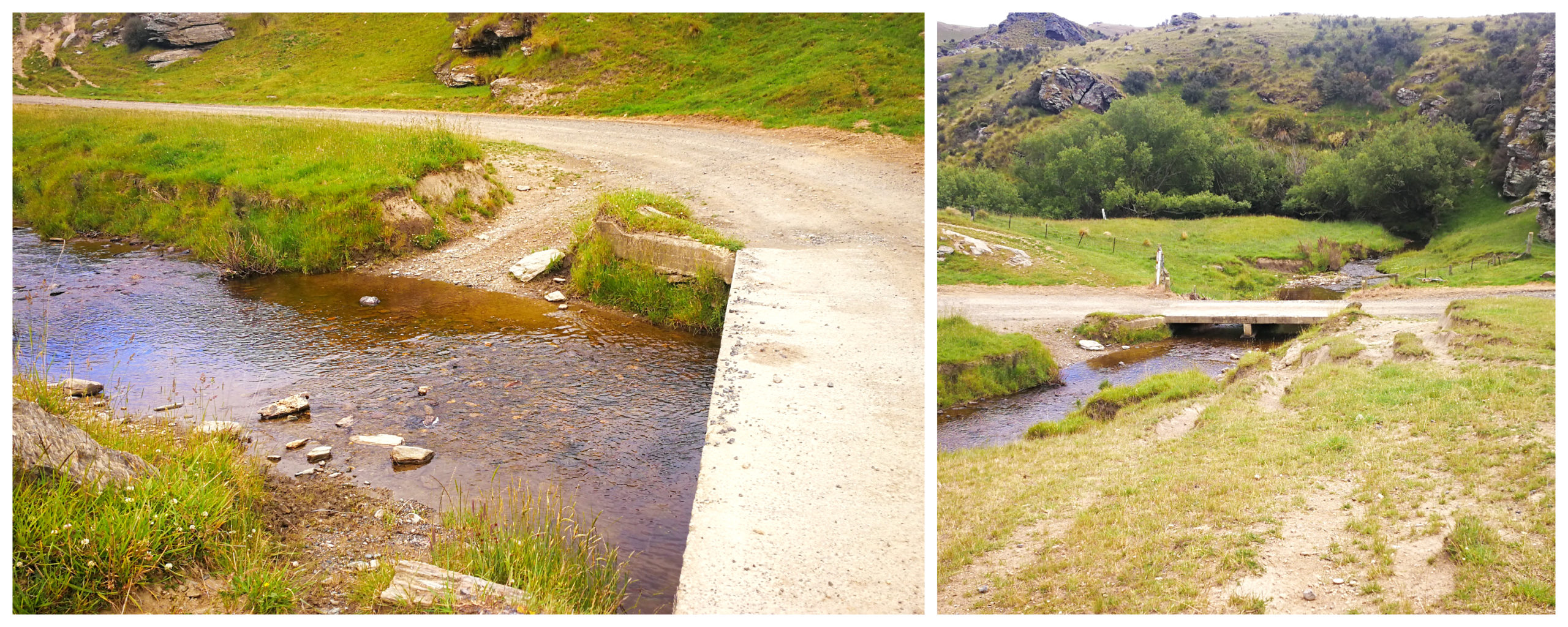
wagons and coaches did not have the luxury of a concrete bridge to cross the many creeks and rivers
A bridge now spans Deep Creek, right beside the ford that served the wagons for many years.
it was quite surreal to think that this is the very ford used by horse-drawn wagons and Cobb & Co coaches
Onto the Gravel
As we passed by Deep Creek, we could see some ruins of an old stone house. This was the Oasis Accommodation House and stands just inside the entrance to a private residence close to the ford. Records show that there were, in fact, a number of accommodation houses at Deep Creek, and strangely enough, a Police Station.
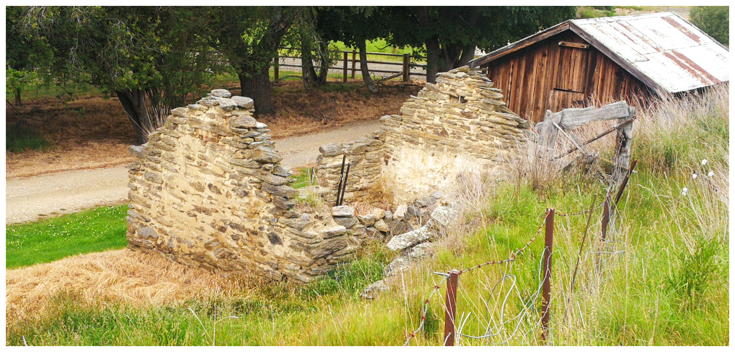
the ruins of the Oasis Accommodation House
We crossed over the first of many cattle stops and onto the gravel. Instantly, we understood why the early travellers would require to be rested before tackling the first of 4 mountain crosses.
We were driven by a different sort of horsepower and traversed the steep and long climb within a few minutes. For those drays and bullock teams, it must have seemed like that first hill would never end.
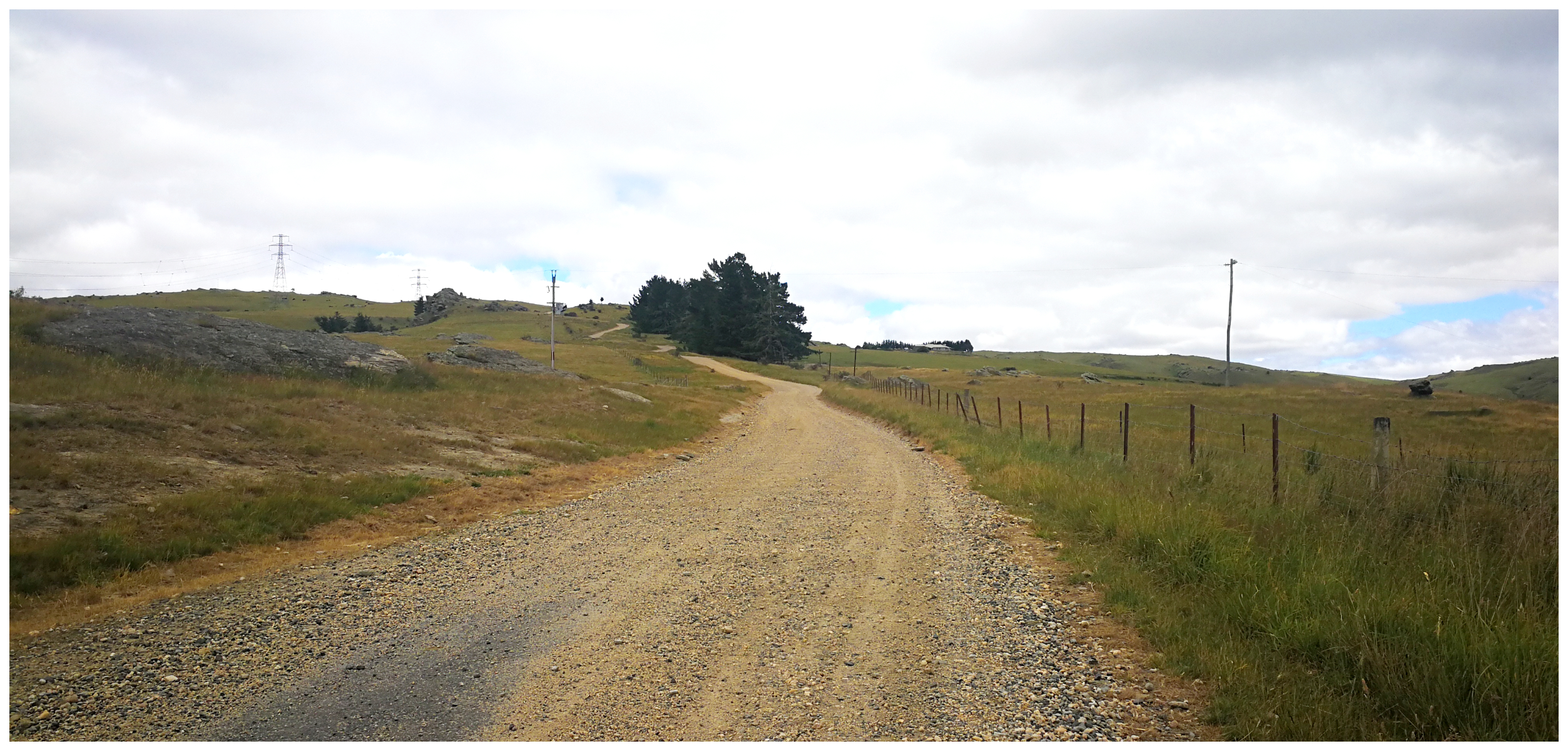
we said goodbye to the sealed road as we started the first climb skirting the Lammermoor Range
It was always a steep and demanding climb and a long, hard haul for coaches and heavily laden wagons, often made worse by early snow.
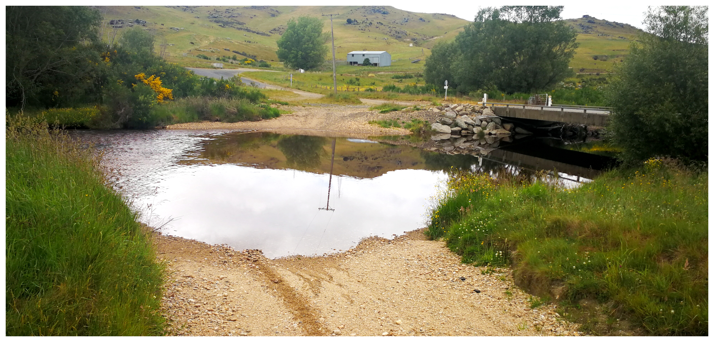
Sutton Stream
We carried along the narrow metalled track which in places was barely wide enough for two cars to pass. We reached the zigzag crossing of Sutton Stream which again was a slow and difficult section for the wagons to negotiate.
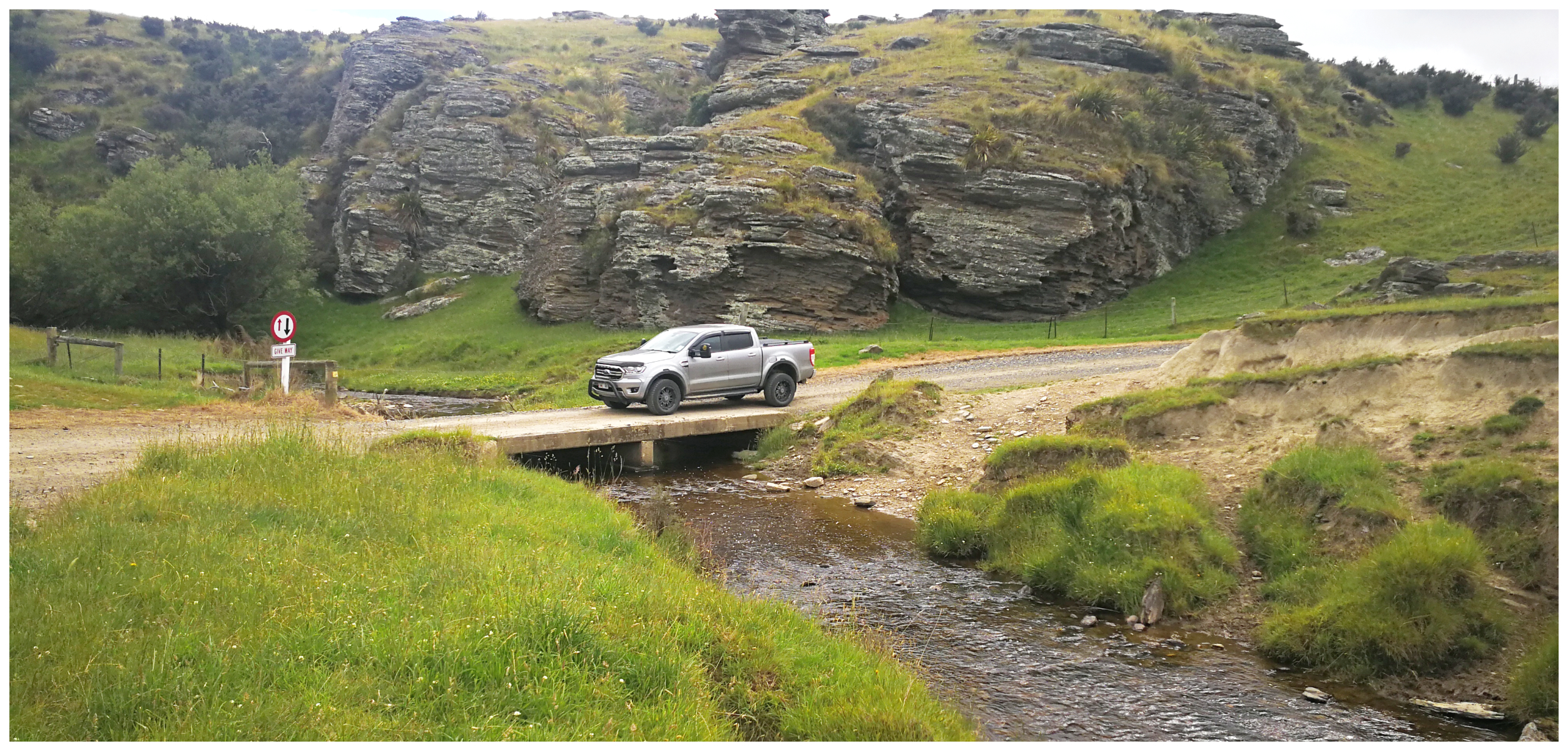
It’s a lot easier to cross Sutton Stream nowadays compared to those earlier harrowing days when they had to watch out for ambushes and robbers! The original ford is still visible alongside the more modern concrete bridge.
Old folklore talks about the gold coach hold-ups that used to happen along this narrow pass. We could understand what easy targets the laden and heavy coaches must have been. The track was flanked by high hills and cliffs. They would have already been going slow to negotiate the tight switchbacks and creek crossing at the bottom.
Today, the crossing is on a concrete ford above the normal flow level and poses no problem to cross. And we didn’t encounter any ambushes or armed hold-ups!
old structures were still visible nestled in the treeline. Possibly an old grog shanty or accommodation
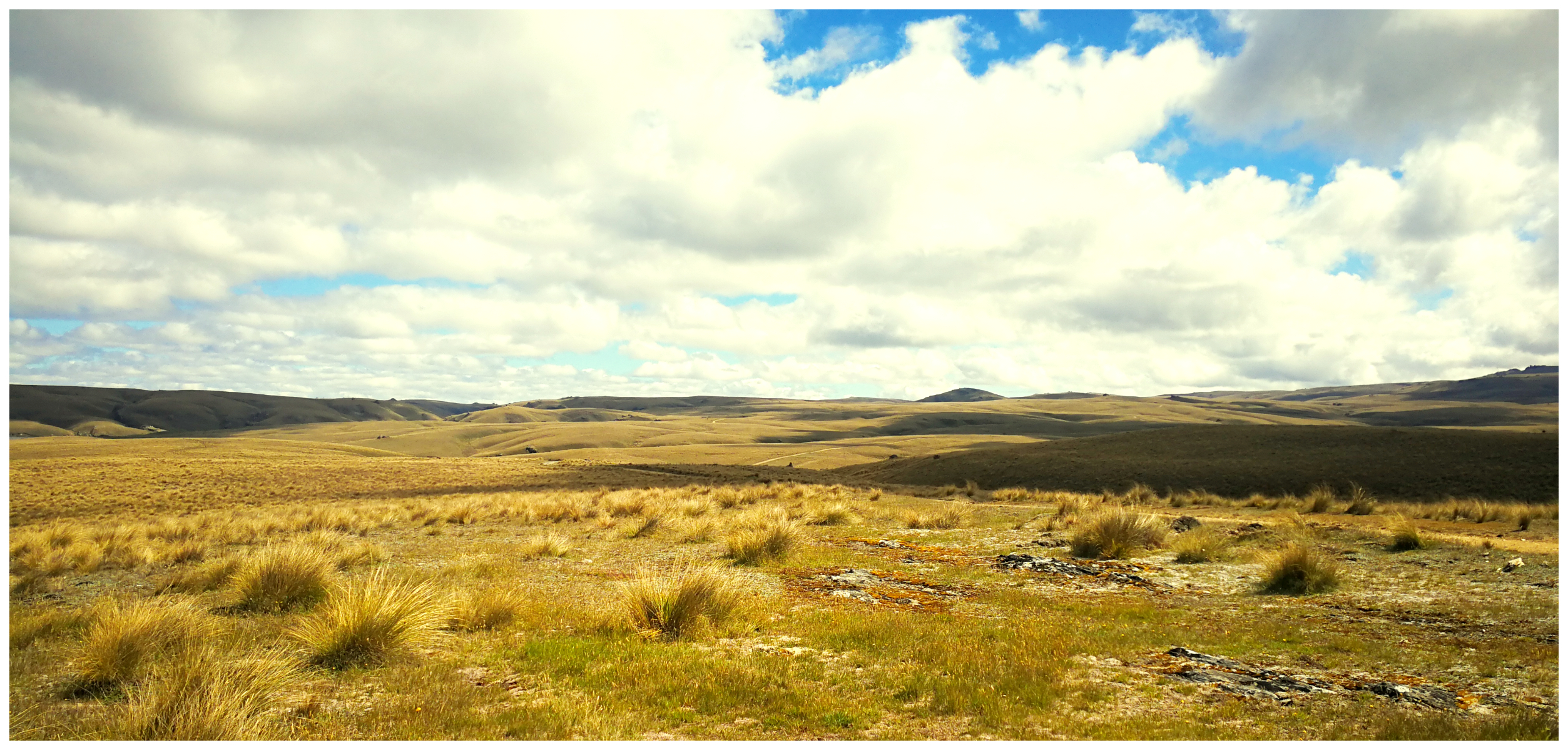
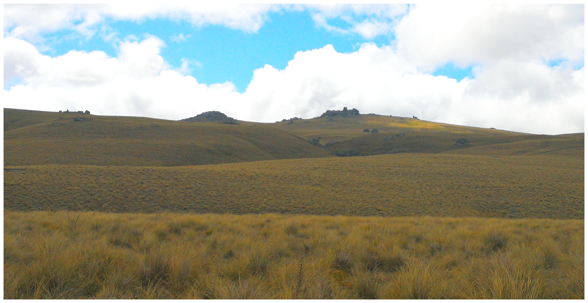
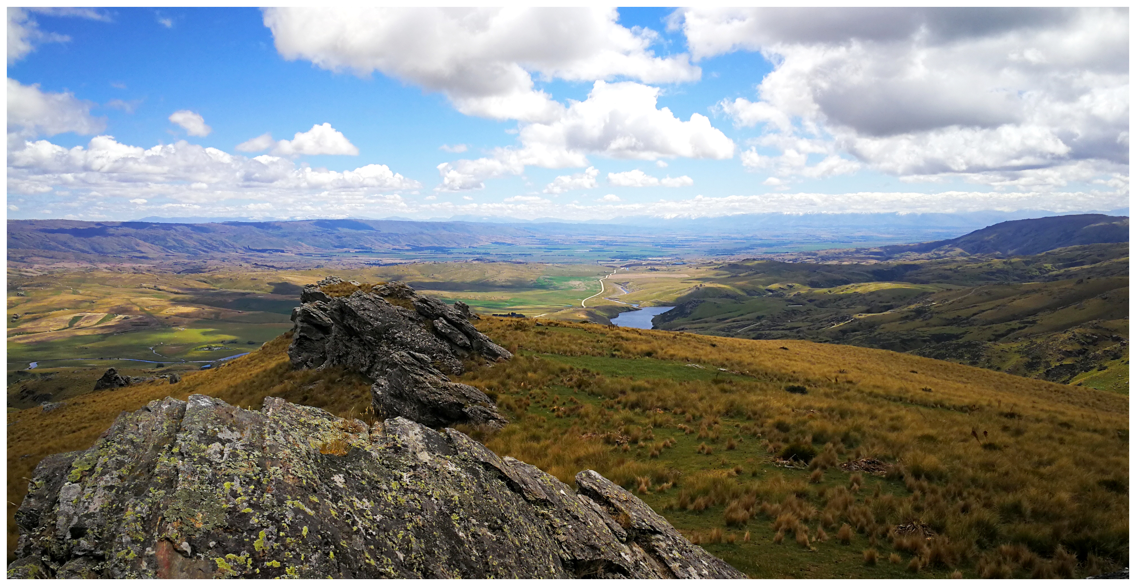
Continuing on we could clearly see the next mountain range that the early travellers needed to climb – the Rock and Pillar Range.
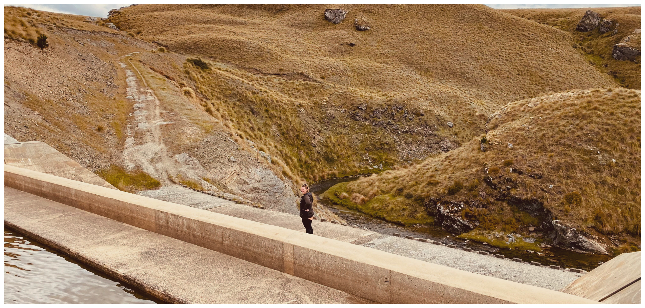
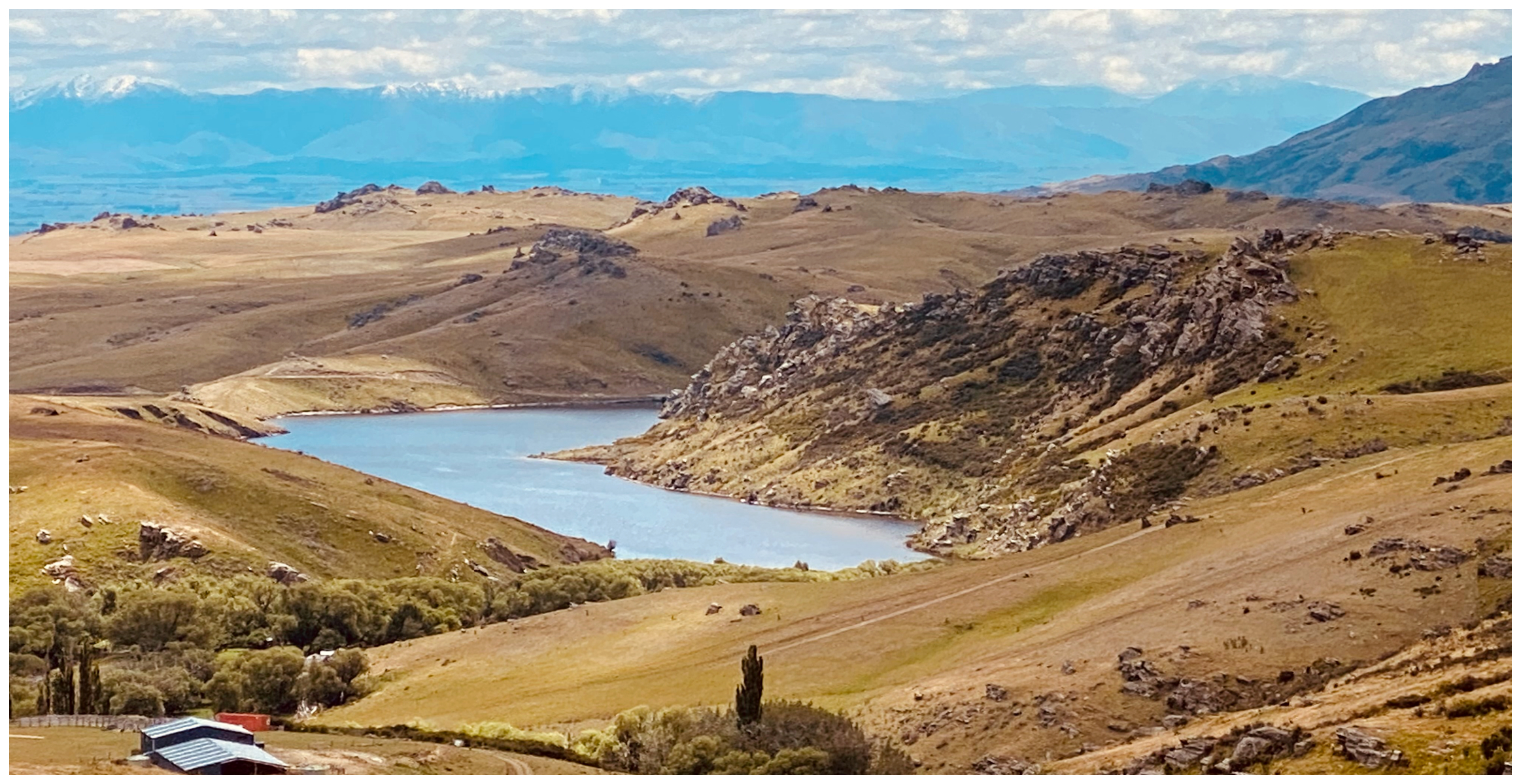
Great Moss Swamp (Loganburn Reservoir)
Before traversing the Rock and Pillar Range, the early drivers needed to negotiate the Great Moss Swamp. The first miners who travelled the Old Dunstan Road soon nicknamed the area The Dismal Swamp. This was a good indication of what it must have been like for them.
no longer a swamp but precious wetlands
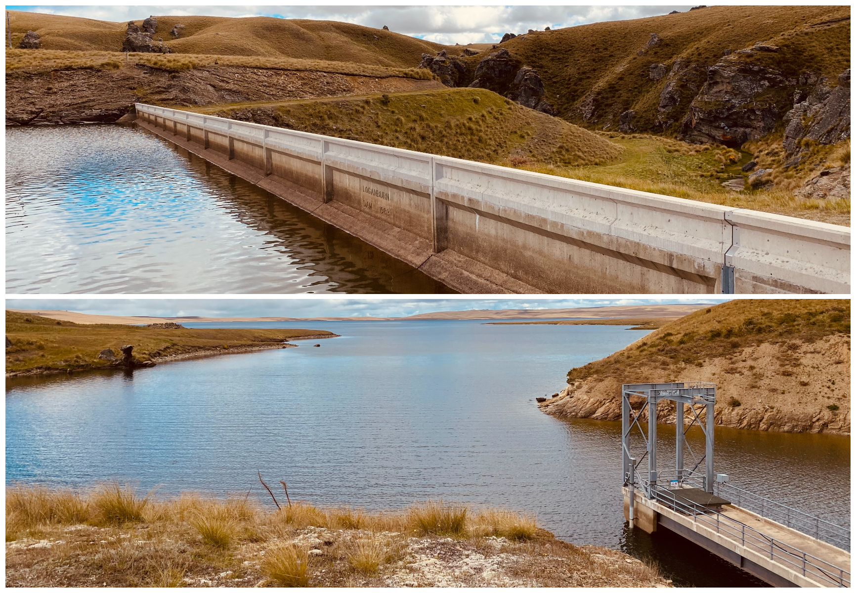
Now dammed and no longer a swamp but a stunning lake. It is now known as Loganburn Reservoir and is still classified as a significant wetland. The dam feeds into the Taieri River further along the Old Dunstan Road at Paerau (Styx).
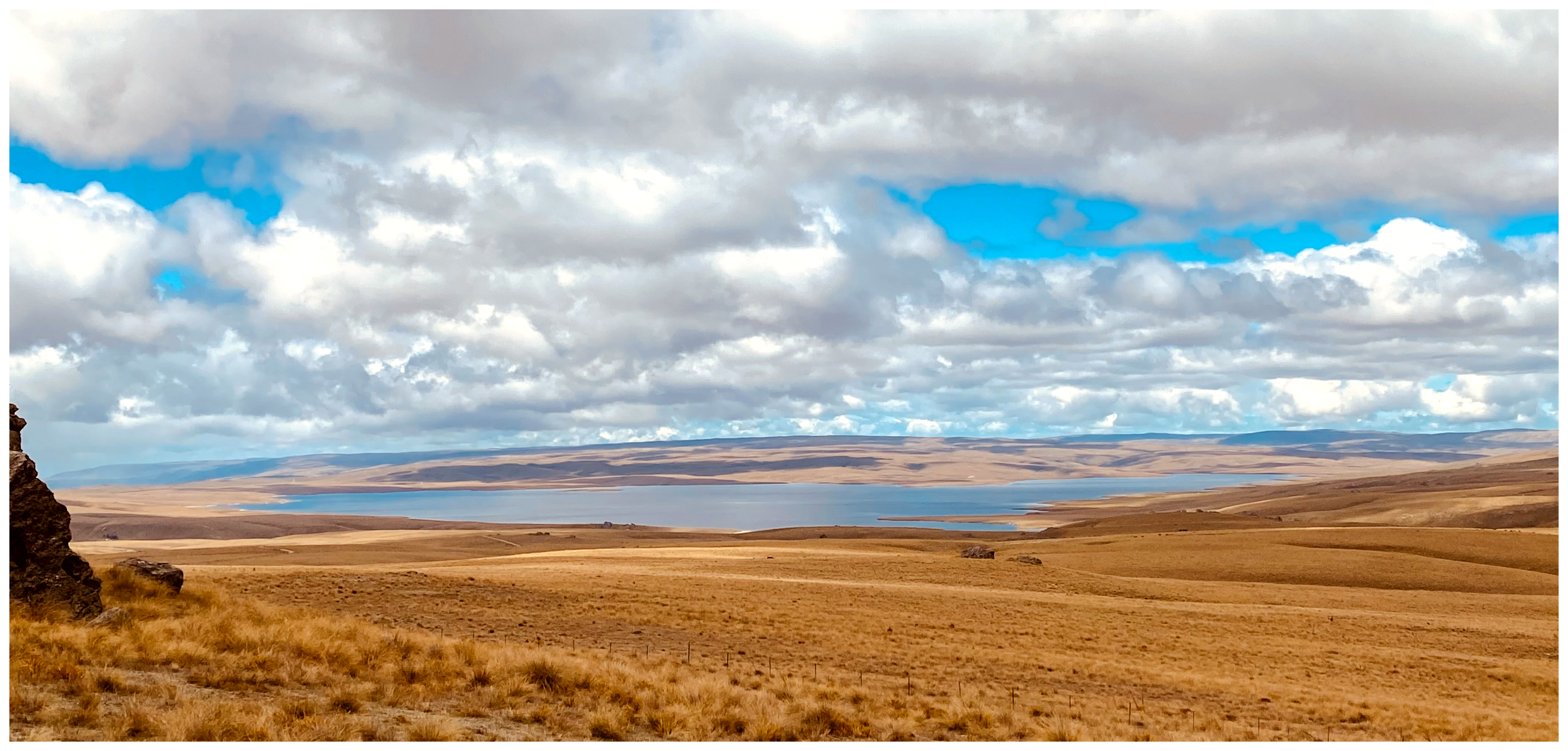
like an oasis in the desert…the Loganburn Reservoir makes for a serene vista
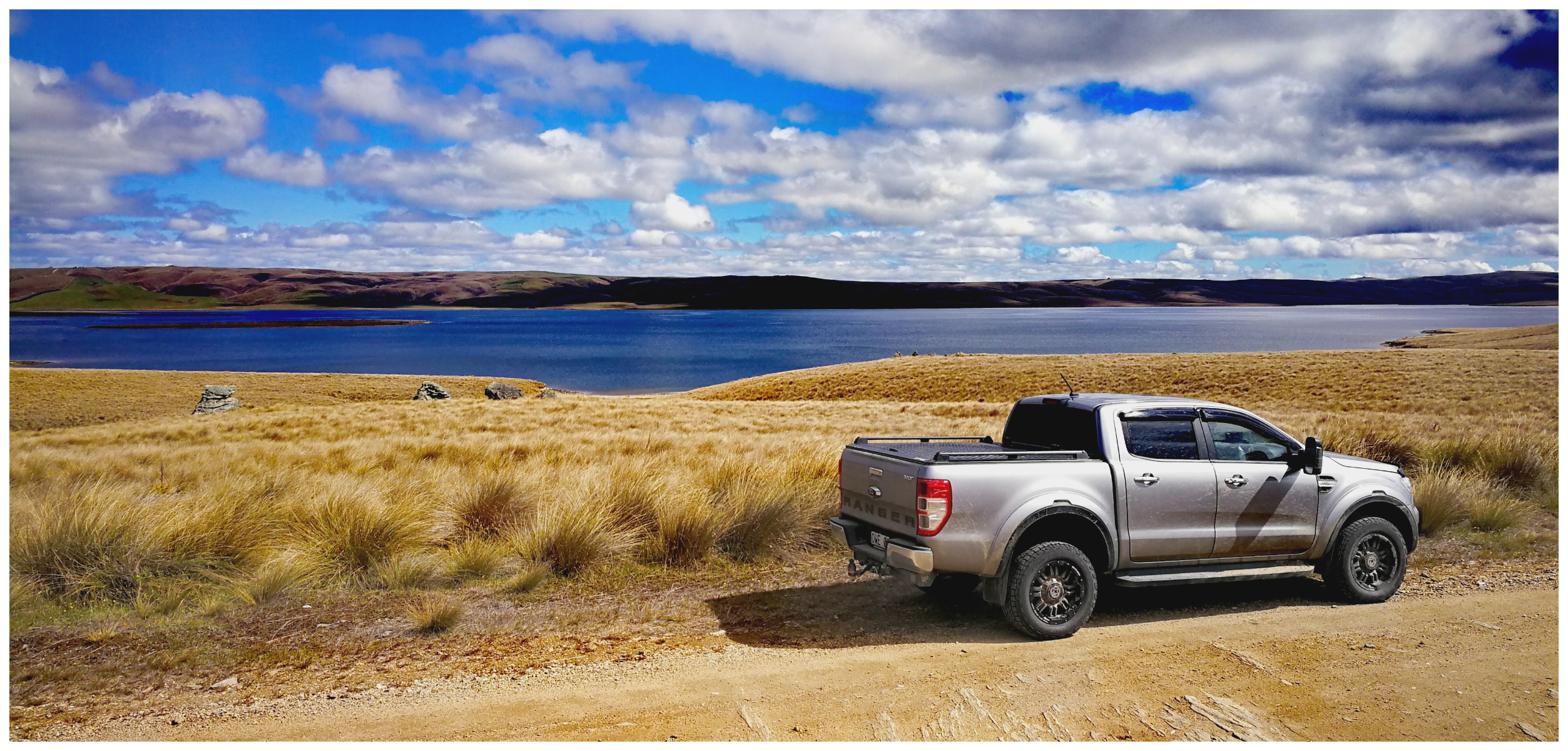
still just as stunning up close
The Loganburn Reservoir is a relatively recent development and was finished in 1983.
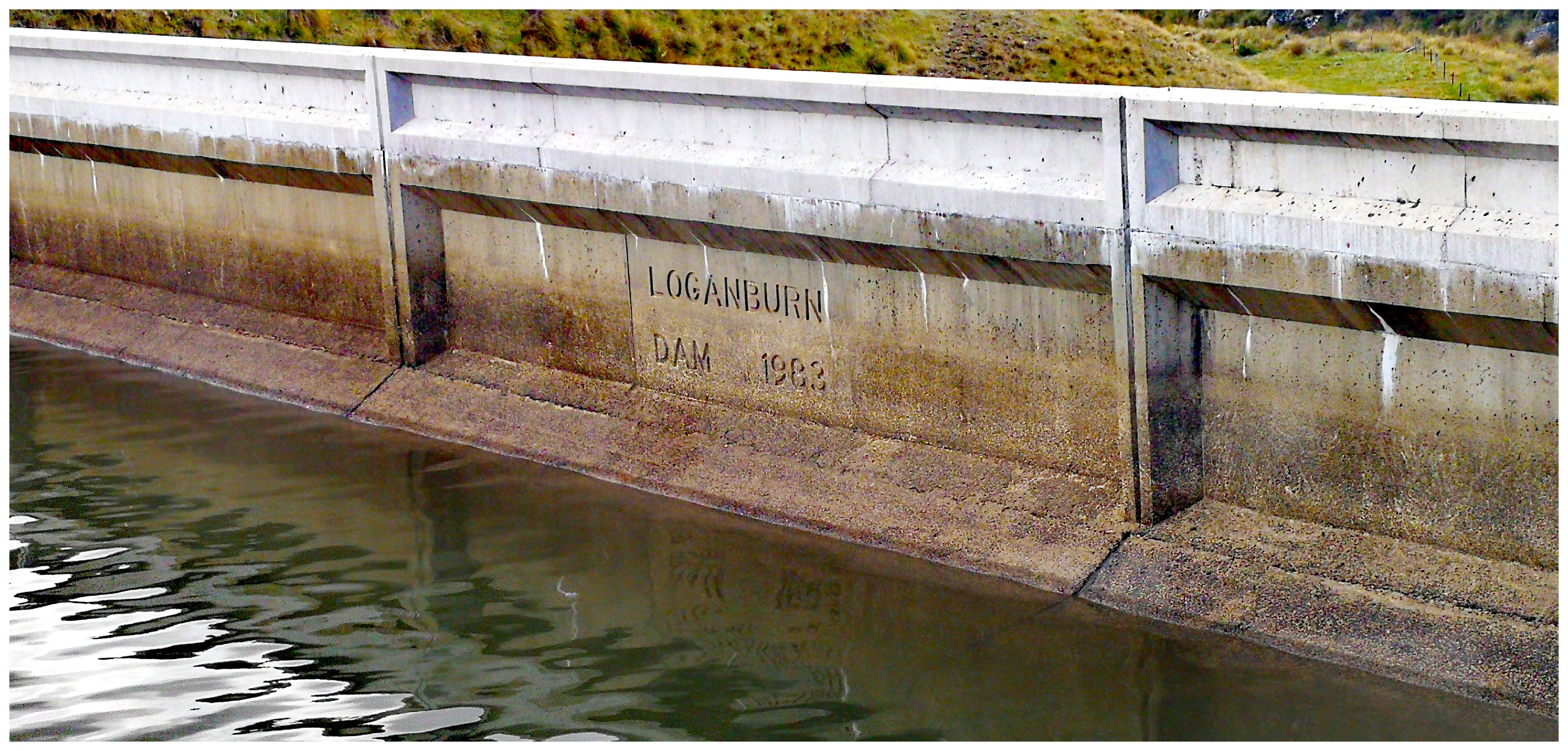
the construction date etched into the concrete wall of the dam
It was raised by a further 80cm in 2014 by an additional spillway along the top of the dam. Although 80cm doesn’t sound much, it actually increased the storage of water by a massive 11.5 million cubic metres!
walking along the dam it was easy to spot the extended 80cm added to the top of the spillway
The reservoir provides irrigation for approximately 60 farmers and generates power when the water is released for irrigation.
it was great to be able to walk along the top of the dam
After walking the dam, we decided it was a good idea to find a sheltered spot for a ‘tailgate’ lunch. It was certainly an isolated and serene location to break open the thermoses and sandwiches.
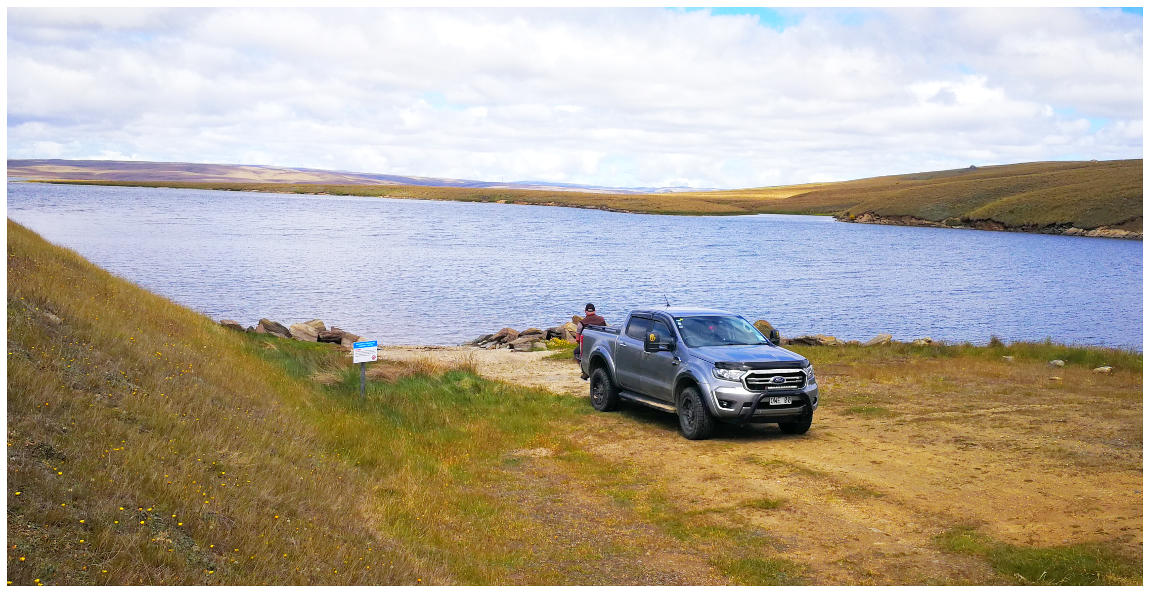
time for lunch!
The Rock and Pillars
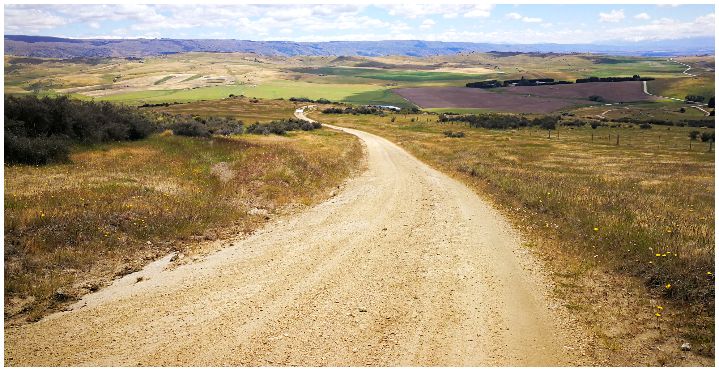
Leaving the Loganburn Reservoir, the Old Dunstan Road continues to climb to the summit of the Rock and Pillars Range.
following the road to the summit of the Rock and Pillars
When the early travellers finally reached the summit, they would rest up at the infamous McPhee’s Accommodation house. Nothing remains of the buildings today so it is a bit ‘hit and miss’ to work out exactly where it was. We could identify McPhees Rock (1310m) and McPhees Creek (ford) so had a fair idea of the general location.
McPhee’s Rock towers above the summit of the Old Dunstan Road
The tired travellers must have been relieved to have reached this summit as it was considered to be the halfway mark between The Oasis at Deep Creek and the Styx Hotel. Hence McPhee’s would be referred to as Halfway House or Mother McPhee’s.
Crossing the ford, the Old Dunstan Road crests the summit at 1041m above sea level.
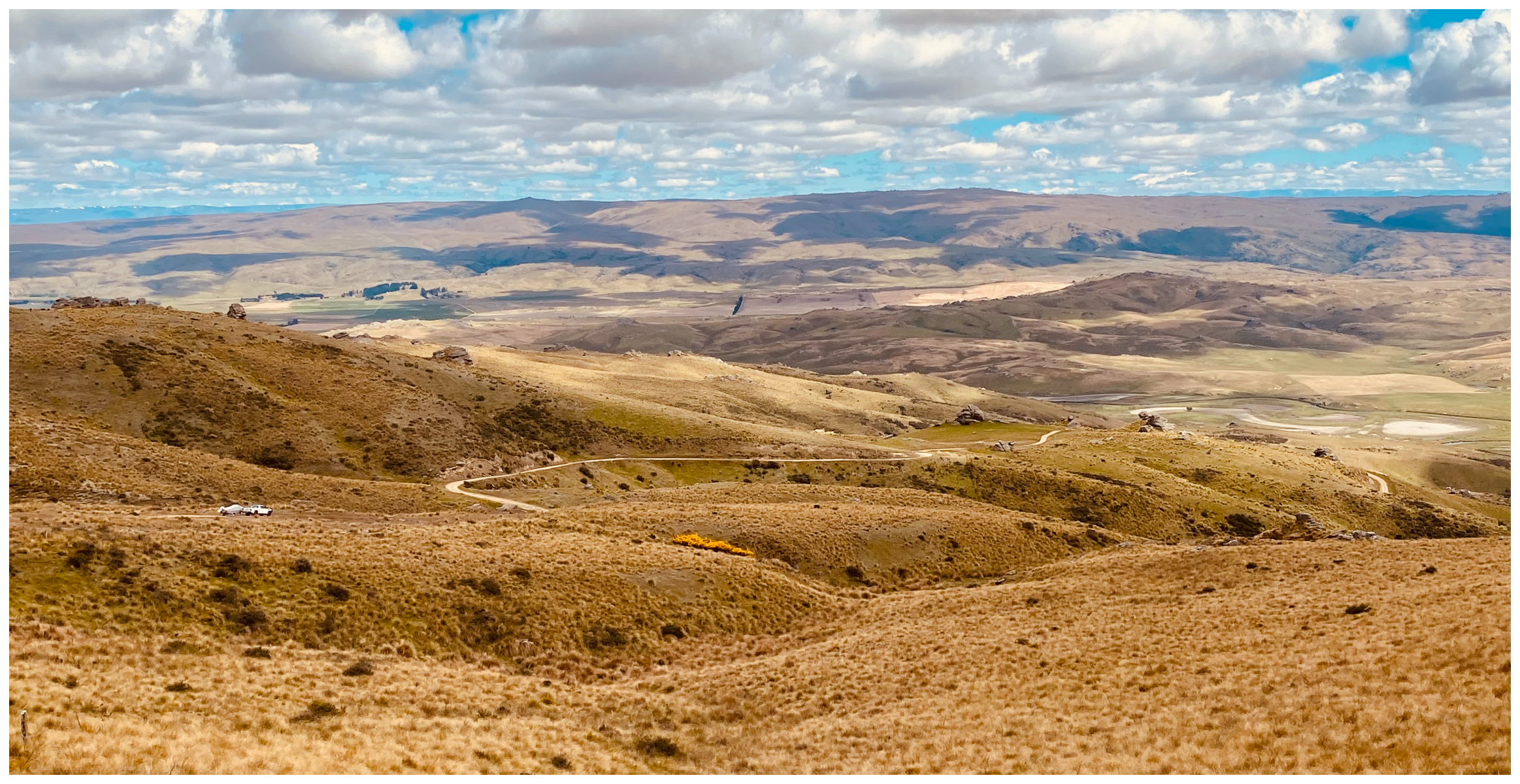
All Downhill
It’s a steep descent as we travelled down the other side of the mountain range. No problem for us in the Ranger, however, it must have been a different story for those wagon and coach drivers.
I don’t think the early drivers cared much for admiring the view as they carefully negotiated the downhill run
The drivers would have to chain the brake of the wagons to steady the rate of descent. Not to mention the harsh weather conditions during the winter months. It was not uncommon for icicles to hang from the horses’ bellies, while they steamed like a furnace from their sweating bodies.
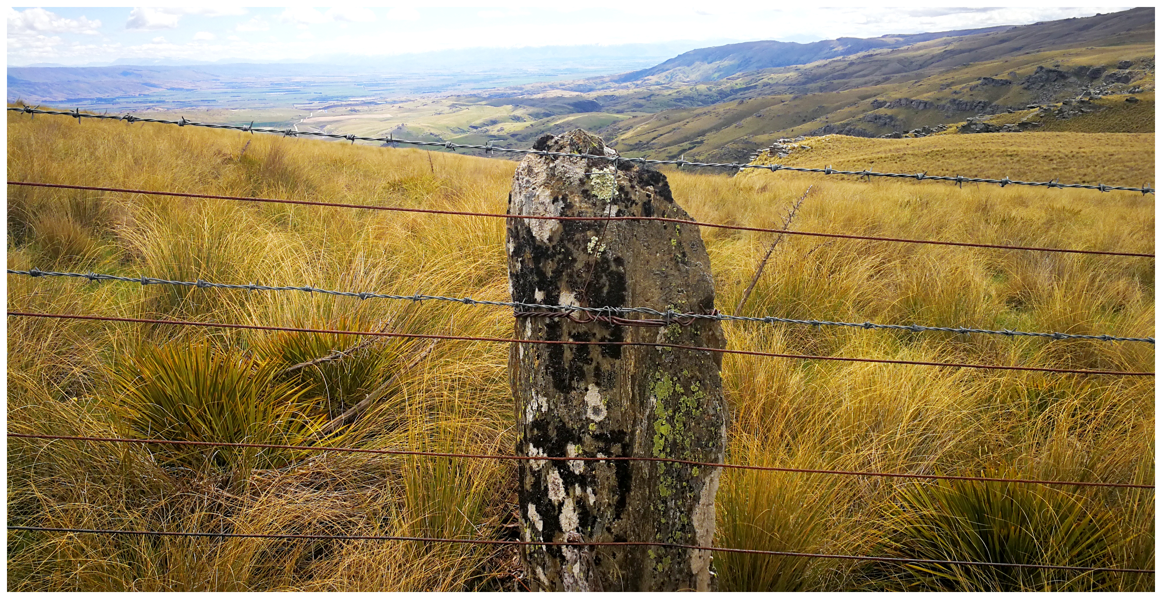
with a serious lack of timber, schist rock was used as fence posts
I’m sure they didn’t pause to take in the expansive views over the valley. The serpentine-like Taieri River twisting and turning through the flatlands, ending up at the Paerau Reservoir – built in the 1950s.
we had to make plenty of stops on our descent to admire the panoramic views over the valley
Paerau (Styx)
Styx was once a hub for the first runholders, and later a busy stopover for wagons, coaches and armed gold escorts, this small settlement holds many memories.
With the endless stream of miners trudging through the area, Accommodation Houses quickly sprung up, followed by a hotel, police station and jail. It is thought that the jail was more for securely housing the gold strongboxes during the mounted escort overnight stops, rather than prisoners.
There was also a ferry operating to transport passengers and goods across the Taieri River. A second hotel was located across the other side of the river.
this is the closest we could get to what is left of Styx
All the buildings are located on private property and the signs saying so certainly deters anyone who thinks it is okay to wander the fascinating historic buildings. We had to be satisfied with viewing from afar. There is, however, a track located close to the bridge which you can take to get to the jail. It is tricky to find, but something that we will suss out on our next visit.
the Paerau Reservoir holds secrets below the waterline
From the old ford, both the hotel and remaining Old Dunstan Road lie buried beneath the waters of the Paerau Reservoir.
End of The Road
A Little more than a kilometre from the road bridge over the Taieri, a closed gate on the right marks the point at which the Old Dunstan Road crossed from the two hotels to continue on to Blackball through what is now private property.
That is where we picked up the Old Dunstan Road on our Part One journey the day before.
the end of the road for us, as the original Old Dunstan Road disappears across private farmland
What To Expect
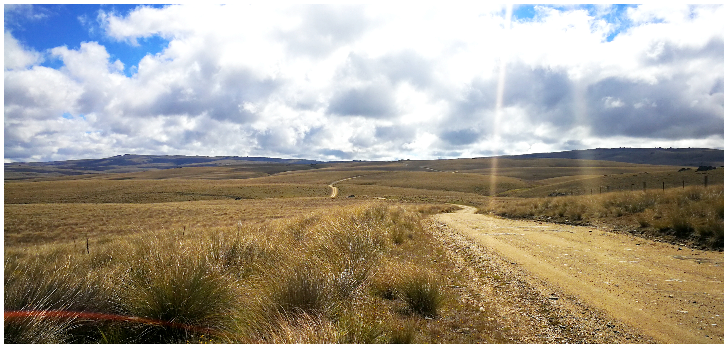
It was certainly the easier section of the Old Dunstan Road to traverse compared to our travels the day before. The road is usually a reasonable metalled surface although the long, high section on the summit below McPhee’s Rock can be wet and muddy even in summer.
There are several fords which were easy to navigate, however, they should never be taken for granted. As usual, always be prepared as the weather can change dramatically very quickly.
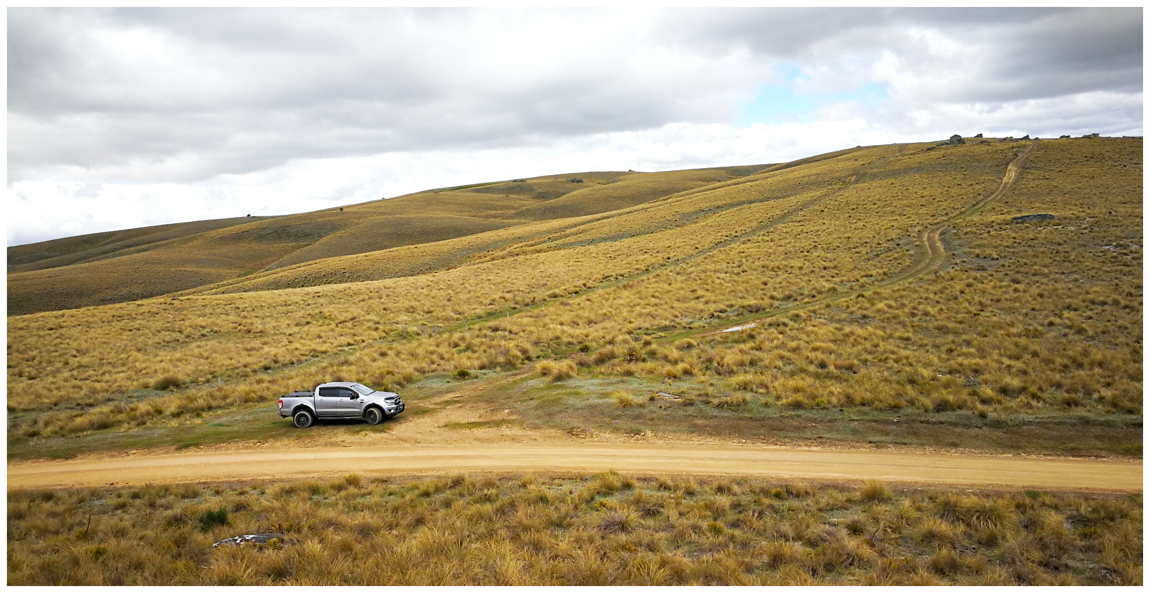
it is a remote backcountry road, always be prepared
Because the road crosses two mountain ranges with hills higher than 1,000m, it is frequently shrouded in fog so pick your day to travel. The stark beauty of its treeless paddocks and tussock country, dotted with dramatic rock formations is something you won’t want to miss out on.
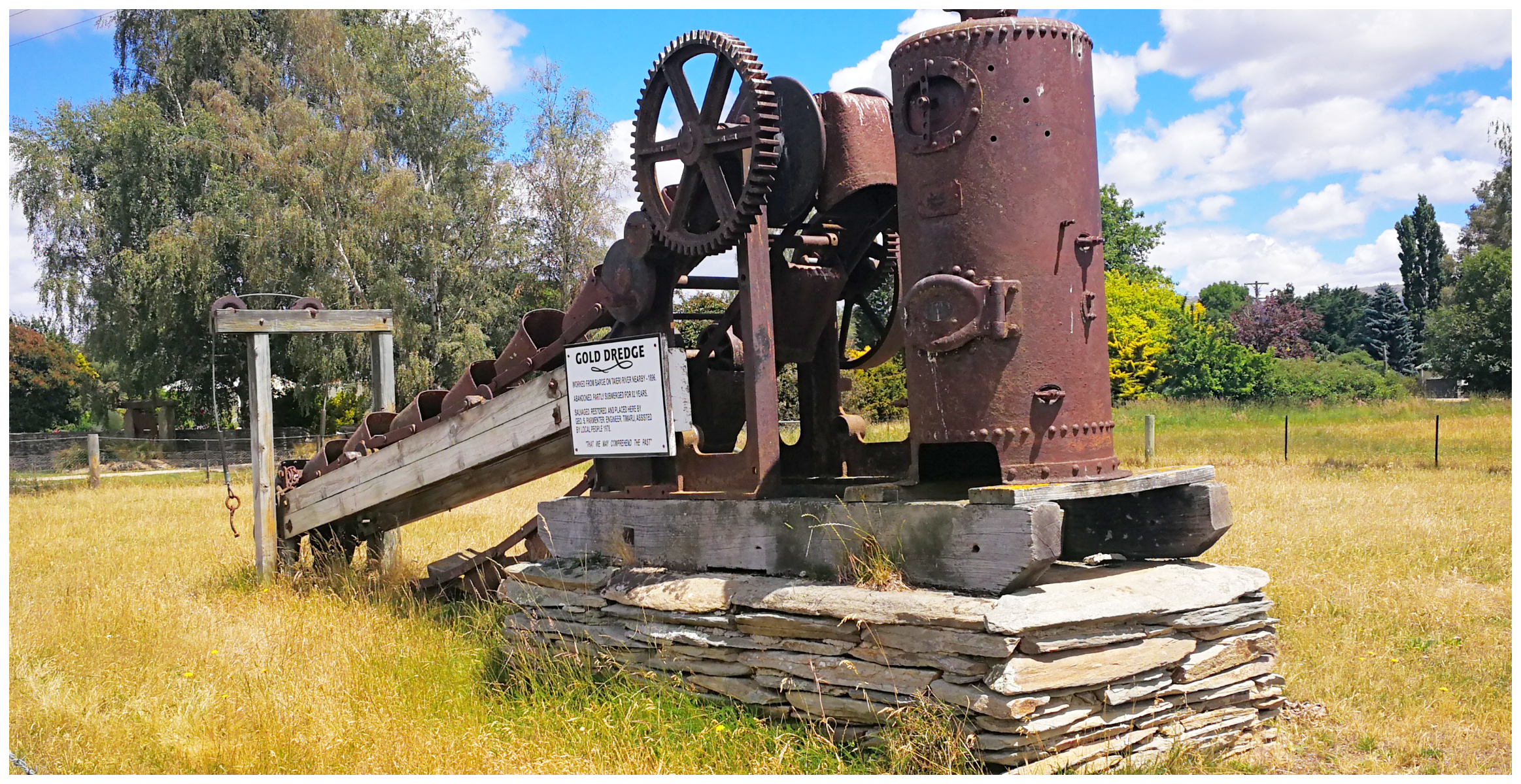
old relics from the past are located alongside the road
If you haven’t done so already, click on the link HERE to read Part One of our journey of the Old Dunstan Road.
As I said after Part 1 you have done a great job & keep it up. It is really interesting for the likes of myself who used to travel those roads 60yrs ago & have been living in Aus. for the last 40. The research you have done has exposed history which I did not know about or had forgotten. I have dug out my AA District maps ( which are well out of date ) but they have most of the places you have mentioned .
Thank you so much Geoff for your feedback again. Hours of research goes into our trips before and after, let alone writing it and documenting it. No wonder I don’t have time to work….lol. Glad it is bringing up memories of life in NZ for you all those years ago. Linda
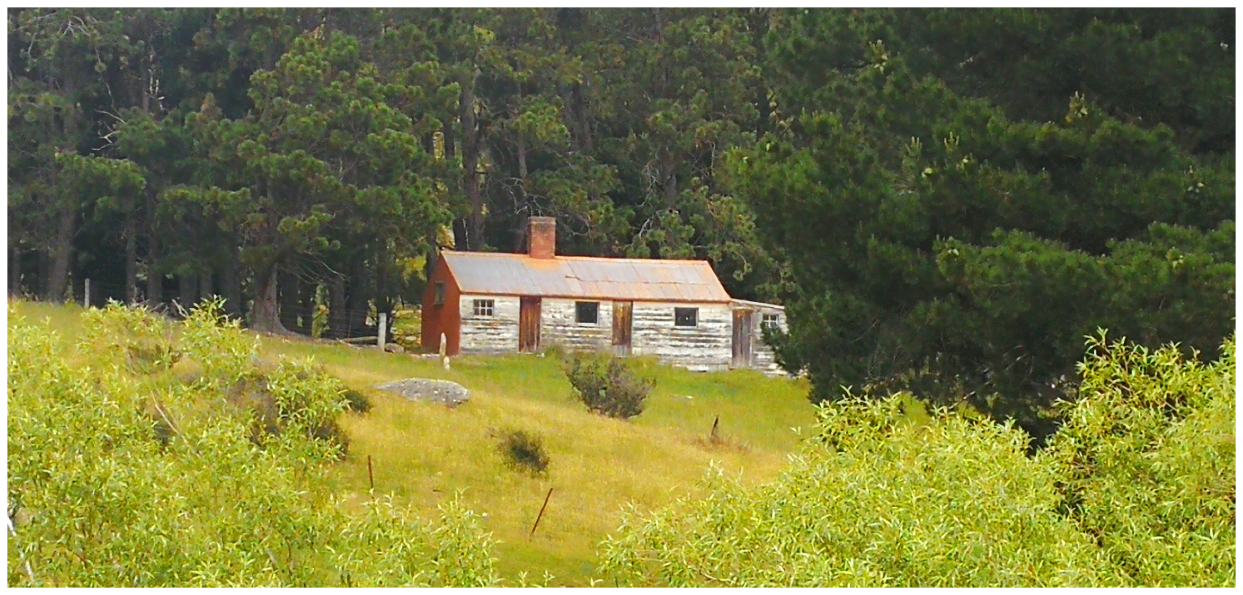
Hi, The photograph of the wooden building was never a Grog house it is the Dip Hut ,accommodation for Rocklands workers. I lived there with my parents in the 1950s when my parents were the married couple on Rocklands.
Oh thanks for that information. Nothing like first hand stories, you must have some great memories! L