Kiwis Fly the Coop have had our wings clipped for the past few months. We’ve been undertaking a building project in Te Anau so we’ve been confined to the Southland area while the project has been progressing. We had our eyes set on taking a roadie to the Canterbury region.
Canterbury Bound
JB Caravans was having another Southern Muster in the Hakataramea Valley, Canterbury. This is the 2nd Southern Muster and we were looking forward to catching up with old friends and making new ones. It was the perfect opportunity for us to ‘spread our wings’ again. It would be the furthest we’d travelled for quite some time.
This blog covers quite a few kilometres, a summary of where we stayed and what we did on the way between Te Anau to Hakataramea and back.
Lindis Pass Historic Hotel
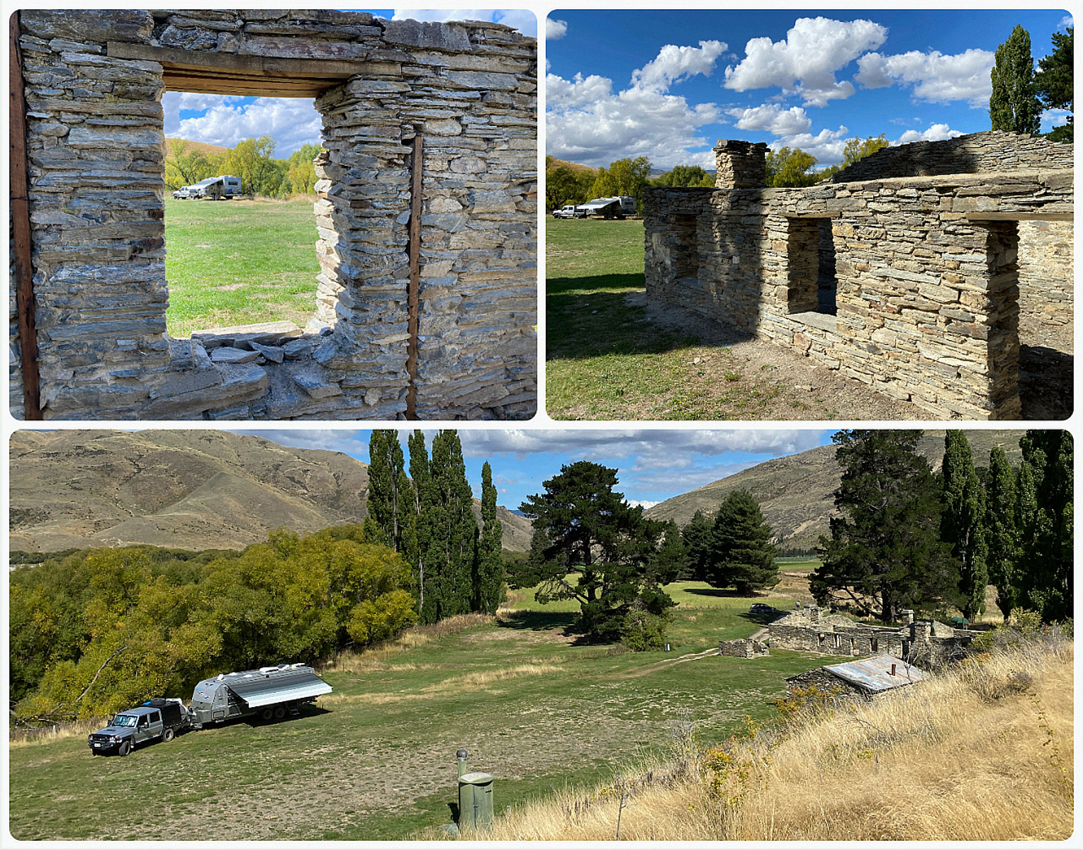
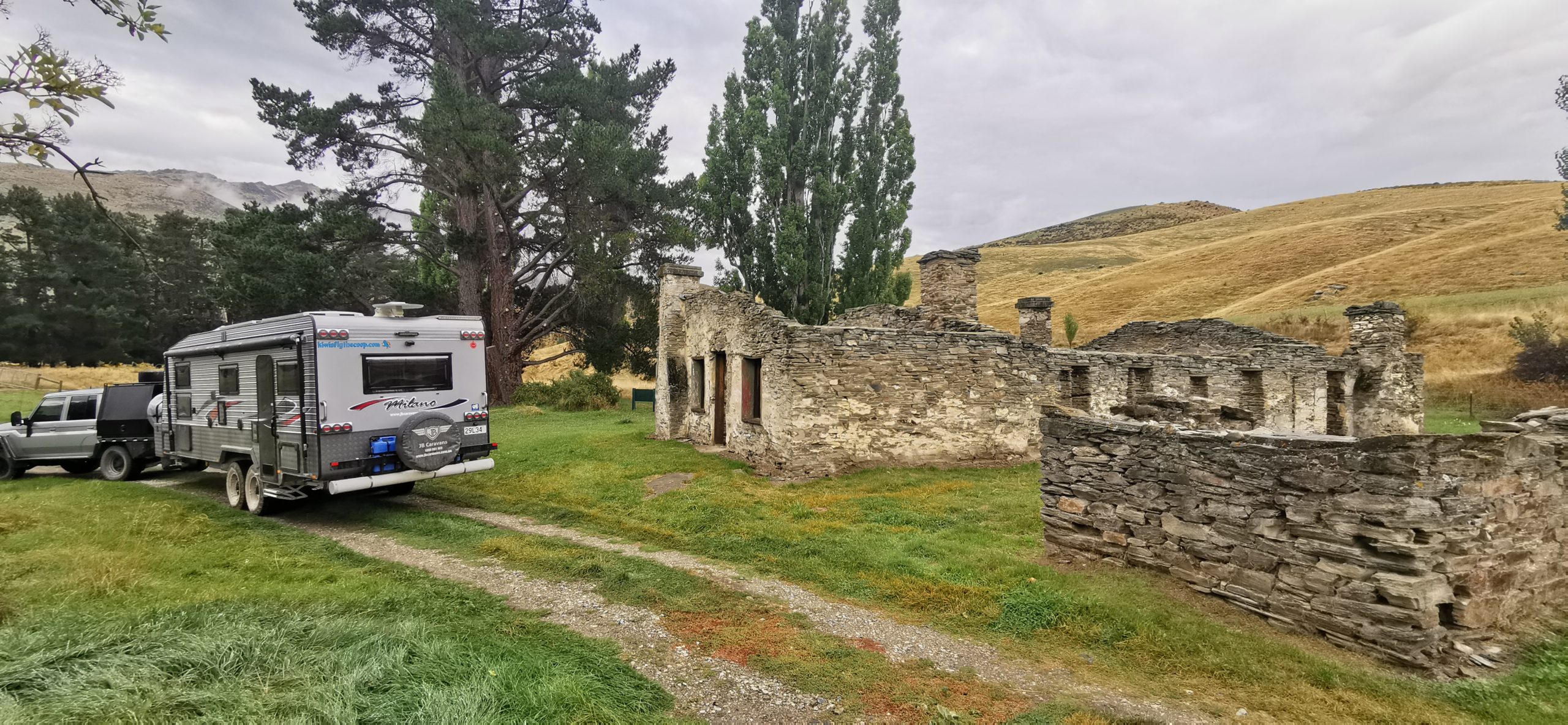
This wasn’t our first time staying at the Lindis Pass Historic Hotel Campsite. Located 272km from Te Anau is a basic DOC campsite, alongside the Lindis River.
What we love about staying here is that the area is steeped in history and we get to camp right beside the ruins of the historic Lindis Pass Hotel (keeping in mind the 20m rule of no camping within the zone of the buildings).
Make sure you keep an eye out for the turnoff into Old Faithful Road (SH8) as it can be easy to miss. This narrow metal road will take you to the Nine Mile Reserve where you will find the hotel ruins, picnic and camping area. Generally, the road isn’t too onerous providing you don’t meet anyone coming the other way. Keep a lookout for a couple of tightish corners and overgrown trees.
Take a wide swing to get into the main gateway of the camping area. It can be tricky in wet weather as it is on a slope and it would be easy to slide into the fence post if muddy.
it’s a pretty special spot, oozing history, serenity and beauty
Steeped in History
Although Nine Mile Reserve is now an idyllic riverside camping and picnic spot, it was once an area bustling with activity during and after the great Central Otago gold rush.
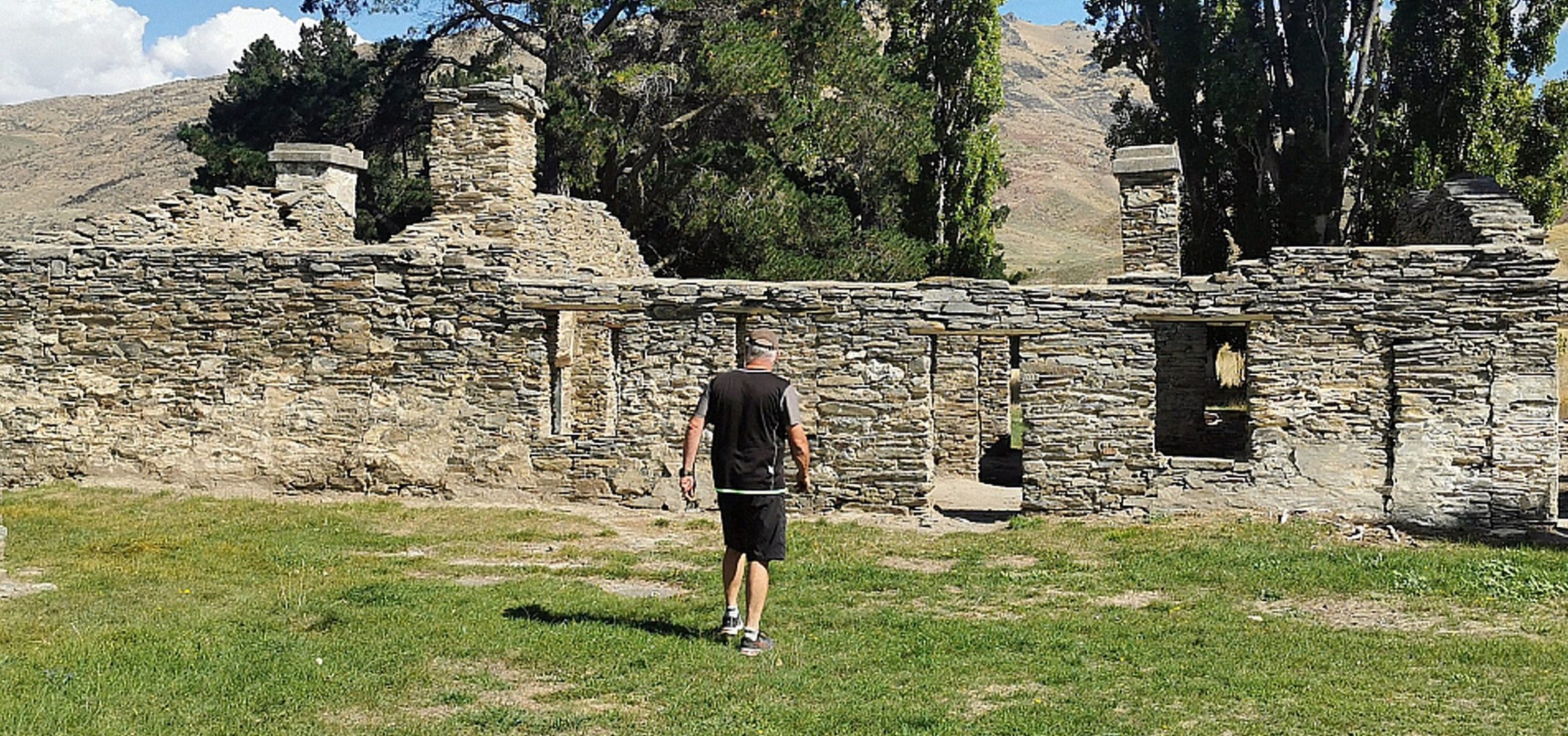
there’s plenty of time to wander the ruins and learn the history of the hotel and the surrounding area
DoC information boards tell the story of the hotel, which actually began as a store during the first gold rush in 1861. It then morphed into a Hotel and had been of service to locals and travellers for more than 70 years. It was enlarged over the years but eventually abandoned in 1951.
there has been some great restoration work that’s been done to try and maintain the ruins so history is not lost
Wattie Thompson
A short walk up the hill behind the hotel ruins will take you to the remains of what was Wattie Thompson’s hut. Wattie was the last miner to work the area and evidence of his hard work, and others before him can still be seen in the piles of tailings left behind. You can also clearly see the remains of the derelict Lindis River bridge.
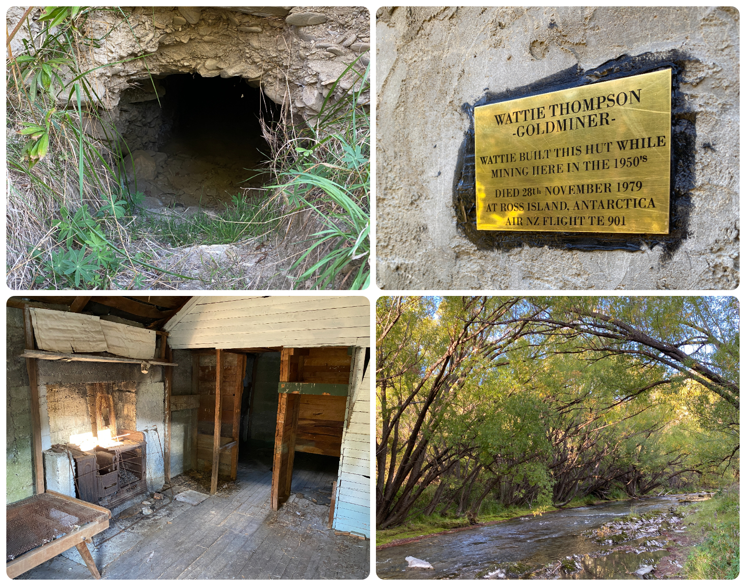
Watties Hut has been restored and still sits where he left it located beside the river
Dissolution after the big floods of 1971 washed away most of his hard toil, Wattie walked off his claim, only to lose his life in the Mt Erebus disaster a few years later in 1979.
make sure you take in the landscape while you’re there
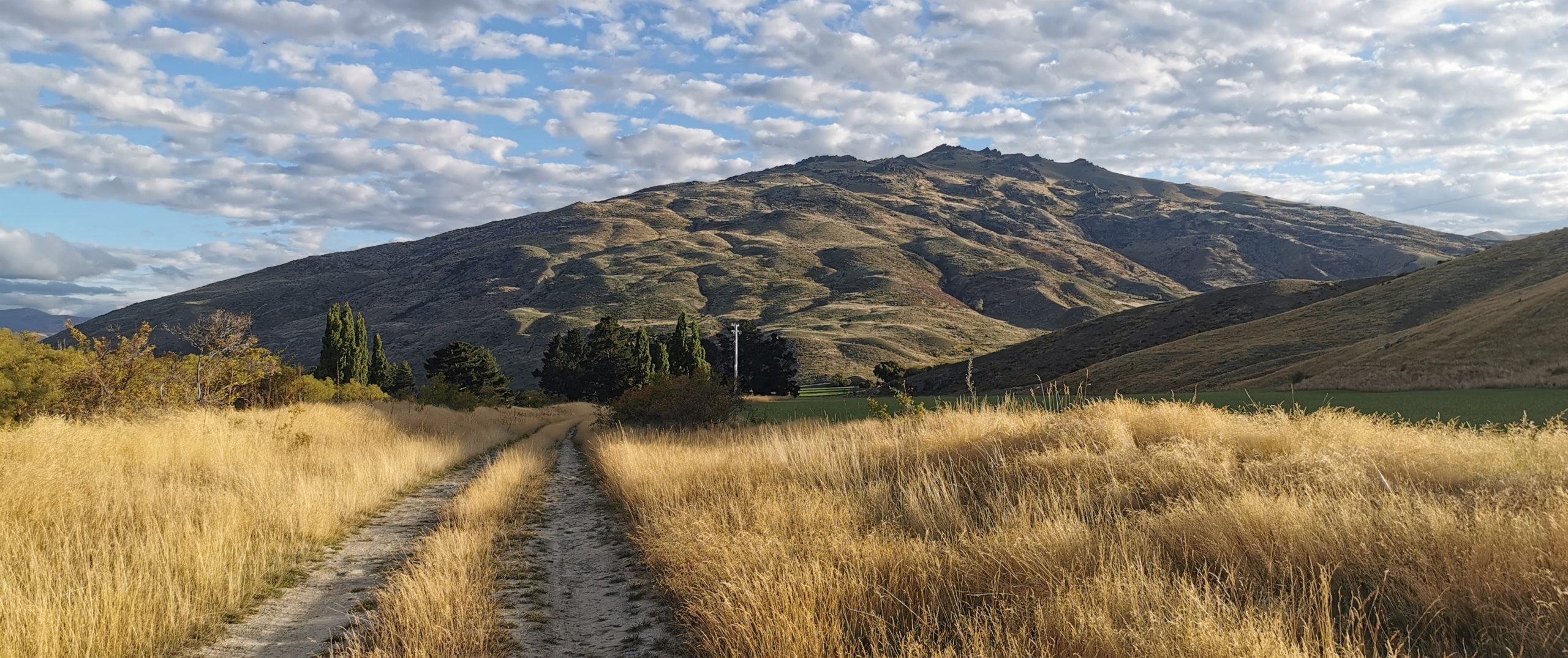
Quailburn
We were on a time schedule to get to the JB Southern Muster so we only stopped at the Lindis Pass Hotel Campsite for one night. It was back on the road for us the next morning.
A much shorter travel day for us today – only 90km up the road to be exact.
Not far past the Clay Cliffs, is the no-exit road to Quailburn Woolshed. It is part of the Ahuriri Conservation Park and access to the site is good, but be careful if you don’t have much clearance. There are a couple of dips in the road which could cause problems.
Quailburn Station
Quailburn Station is a small slice of a larger station known as Benmore Run. This was one of the largest properties in Otago during the 1870s and was owned by Robert Campbell.
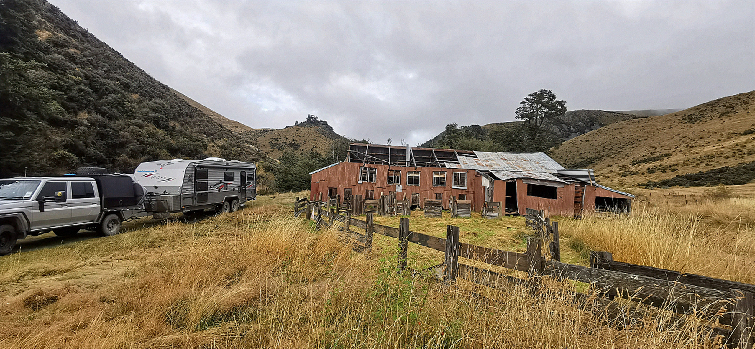
Right at the end of Quailburn Rd, we came across the historic woolshed, and this was where we found our park for the night.
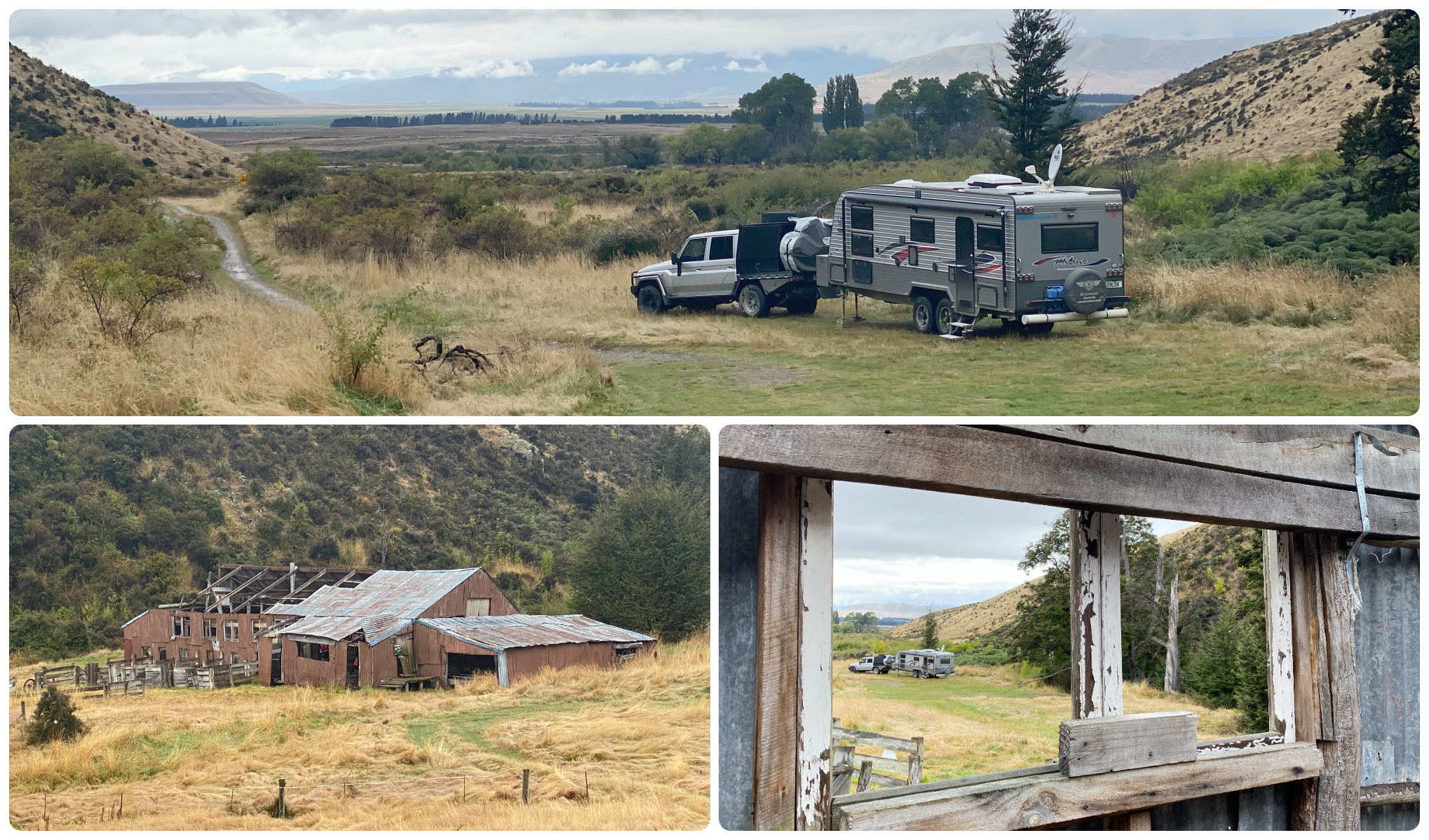
it wasn’t hard to find a spot as we had the place to ourselves
The Woolshed
Although it looks a lot older, the beech pole constructed woolshed was built in the 1920s. Nearby lies the sheep-dip, yards and race (more intact than the shed itself).
Damaging winds whipped up from the valley below and all but demolished the structure in 2020. There is a ‘Warning’ tape across the doorways to deter visitors from entering.
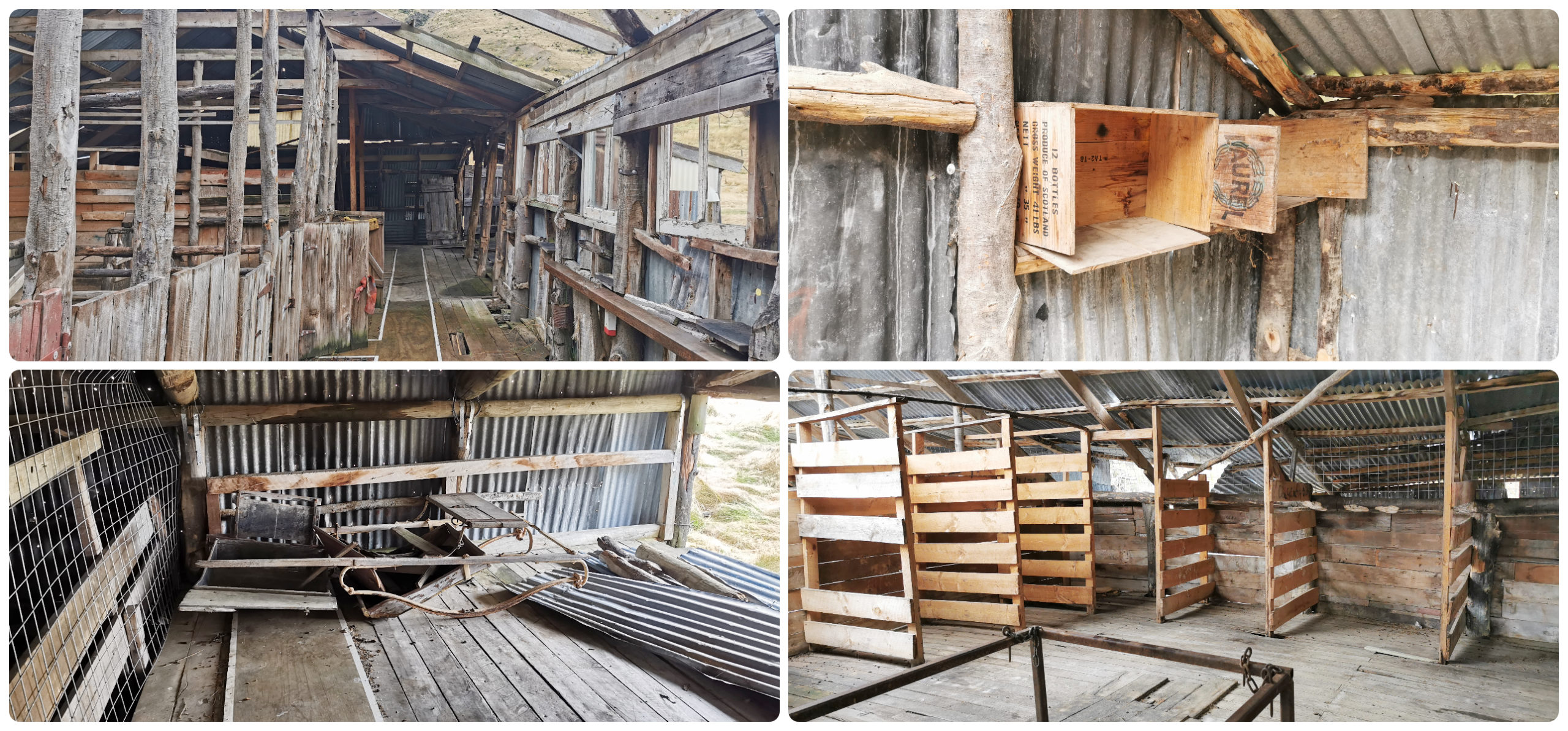
we carefully tiptoed our way around the old ruins, sticking to the reinforced walkway for safety
I don’t think the tape is very effective though as many cyclists on the Alps2Ocean cycle trail use it as a handy stopping off point for a bite to eat. They seek shelter from any adverse weather in the sheep and wool stalls inside the shed.
I counted over 20 cyclists who made the short detour off the trail to come and visit the historic building.
They looked very bedraggled and mud-splattered. Many mentioned that the trail was in quite a state of disrepair between Lake Ohau and Quailburn. Many had also taken a ‘spill’ due to the muddy rutted conditions.
One gentleman told me that he thought we were the Coffee Cart. Now there’s a business opportunity just waiting.
the old woolshed makes a great photo backdrop
Quailburn Homestead
Further up the hill from the woolshed stands the old Quailburn Homestead nestled amongst impressive beech trees. It’s clearly home to many birds and certainly had the smell to go with it. It would have made someone a lovely home back in the day but now just has wire netting on the windows and left to mother nature to take hold.
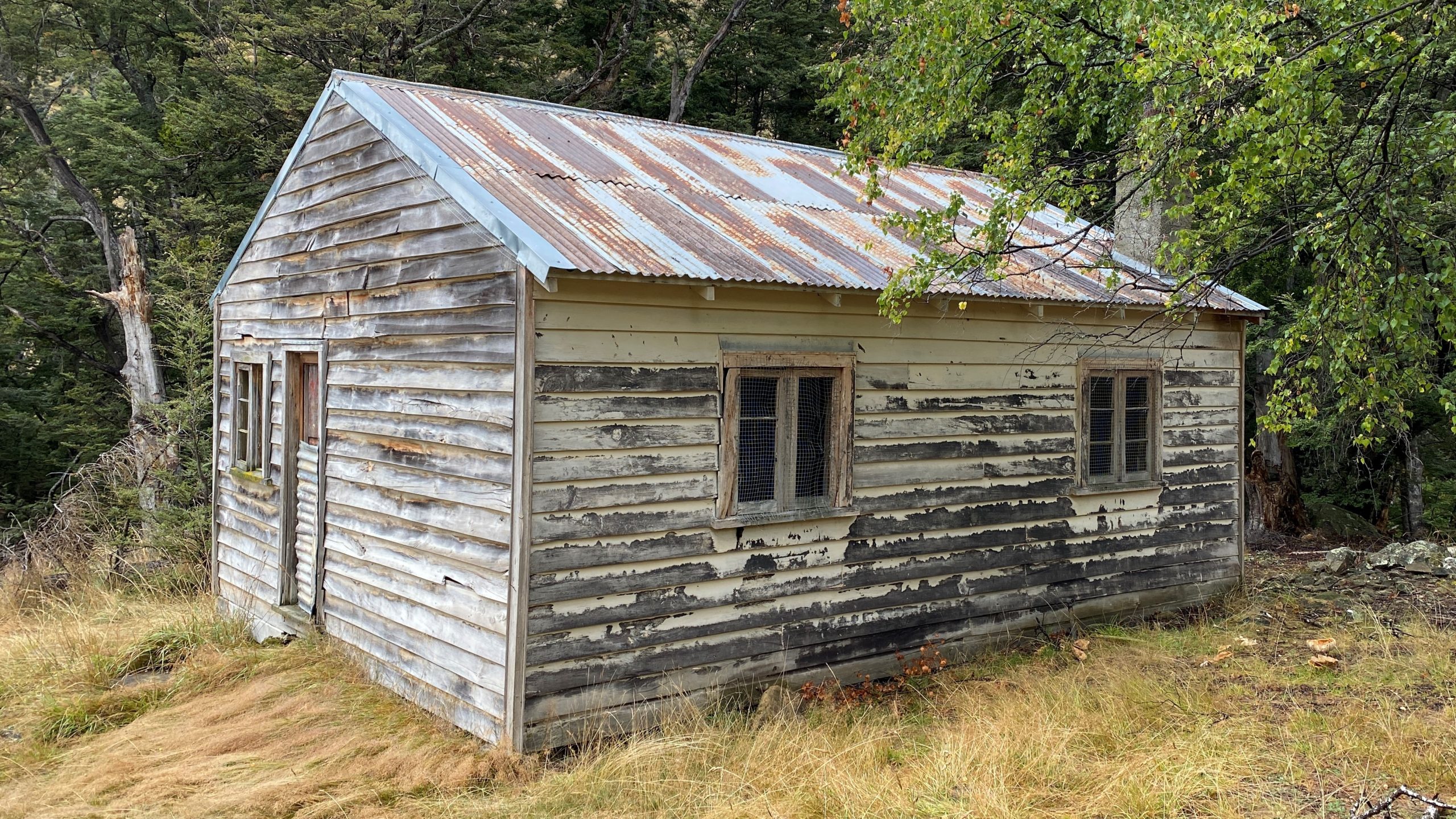
the old homestead has seen better days but the birds think it’s pretty good digs
Remains of possibly the original ‘out station’ hut for Benmore Station are located close to the start of the Quailburn Bush Track. It is thought to have been occupied by a married couple in 1878-79. The foundation blocks are scattered amongst long grass and hard to spot. The huge Benmore Run had nine mustering huts during its heyday in the 1890s.
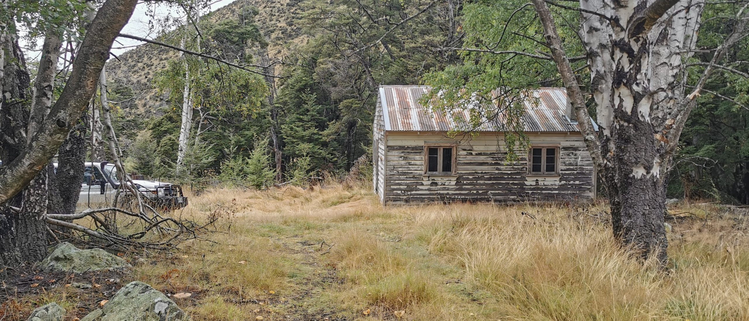
the homestead can still be found nestled amongst the original trees, just up the hill from the woolshed
at the start of the Quailburn Track, you need to look carefully to spot the remnants of the old musterers hut……but you can easily be distracted by the views
Quailburn Bush Track
At the top of the hill, by the treeline is the start of the Quailburn Tree Line Bush Track. This is a 30-minute climb that takes you to where the trees stop growing and the barren hills begin. If you carry on, the track takes you further uphill along a rougher track to Quailburn saddle, towards Ahuriri River East.
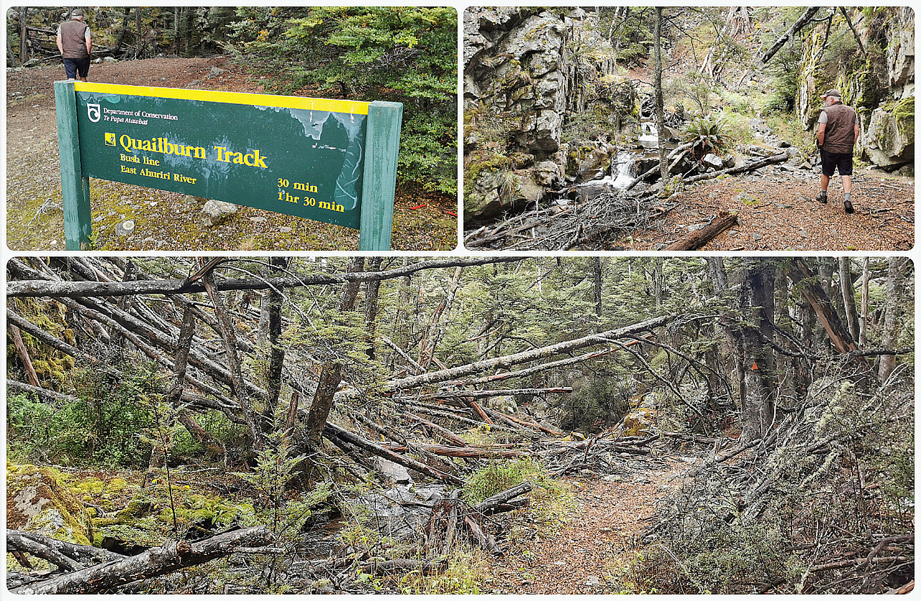
we soon started to see where mother nature had unleashed her wrath on the landscape
Well, we could certainly see where the wind and rain had done significant damage to the areas surrounding the track. It turned into an army assault course as we scrambled up and over numerous fallen trees. There was also 8 creek crossing and yup, I got seepage up and over the top of my hiking boots!
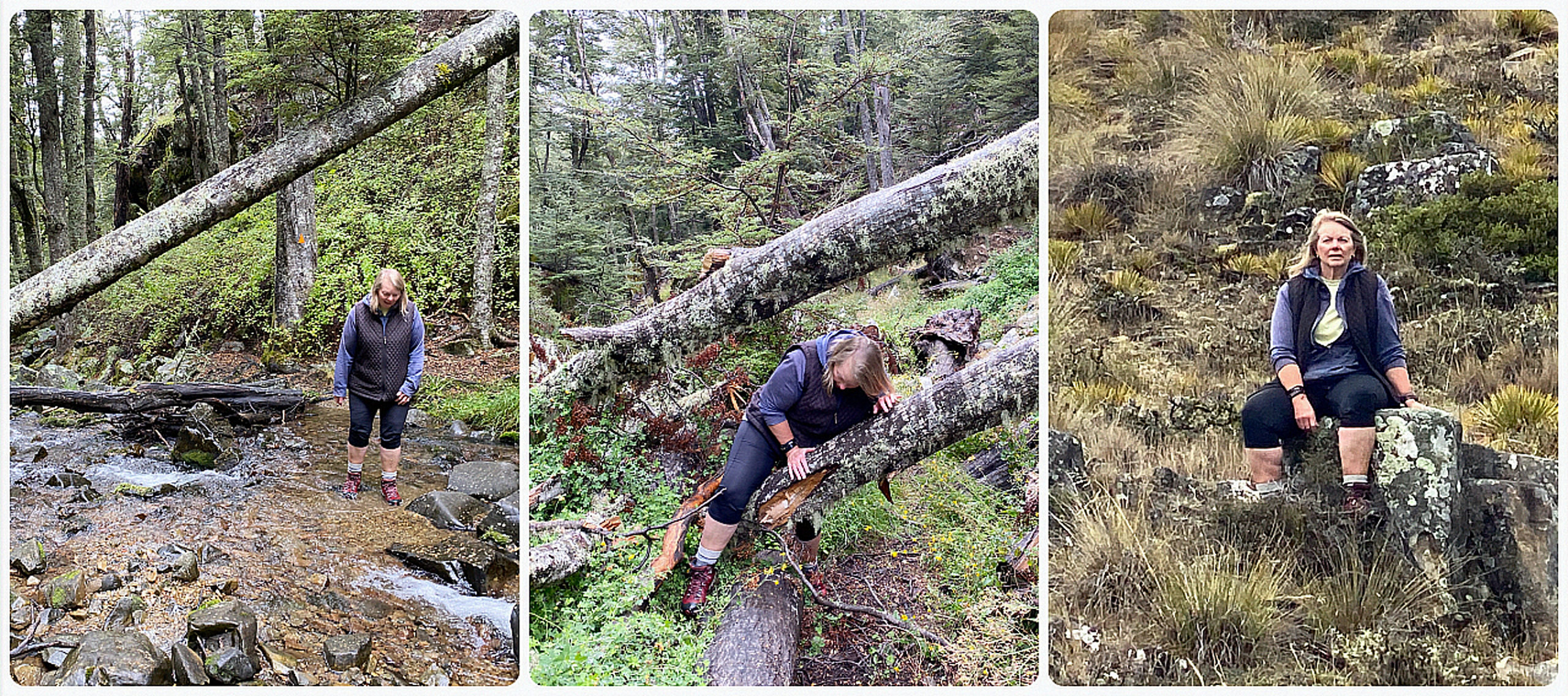
yup, the photos say it all!
We reached the top of the treeline and took in the wonderful views. As it was getting later in the afternoon, we decided not to push on to East Ahuriri – something for next time.
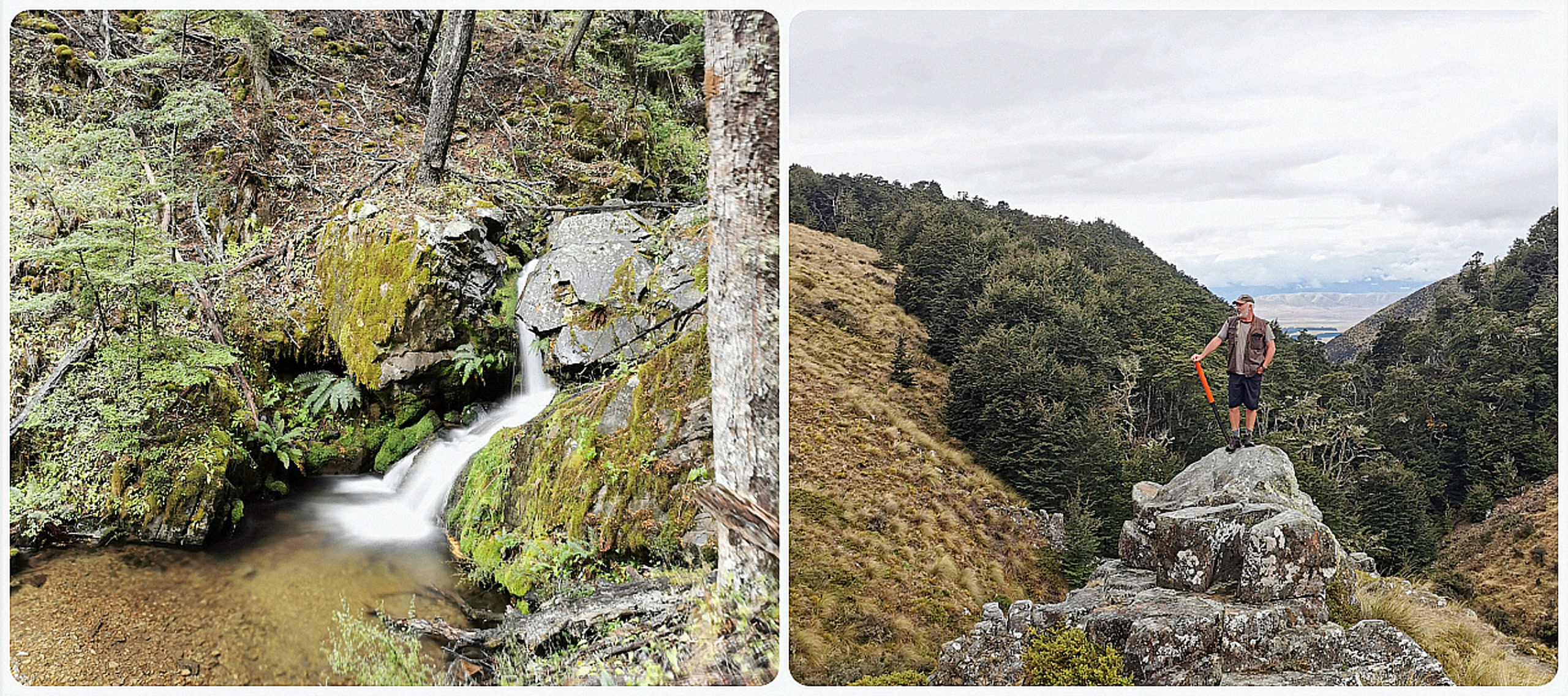
we made it to the top of the treeline – oh my…..the views!
As expected, we were the only ones at the Quailburn Woolshed for the night. The silence was deafening, except for the babbling Quailburn Creek that was flowing past us……bliss.
Canterbury Calling
As the saying goes, ‘no rest for the wicked. It was ‘up sticks’ and hit the road. During our Committee Meeting, we both discovered that neither of us had visited the Clay Cliffs. Bizarre I know, considering we have both worked in the tourism industry! So as it was just down the road, we thought that we’d get there early to make sure there was adequate parking for the ute and caravan.
make sure you read all about the history, it’s fascinating stuff
Clay Cliffs
Located just 10km west of Omarama, take the Quailburn Rd turnoff, then look out for the unsealed Henburn Rd. You’ll come across a gate and a donation box. Pop in your $5 and continue driving to the carpark.
We had picked a good time of the day to arrive (earlier in the morning). There was space for us to turn around and park up. It might be a different story if towing a caravan and the carpark is more than half full.
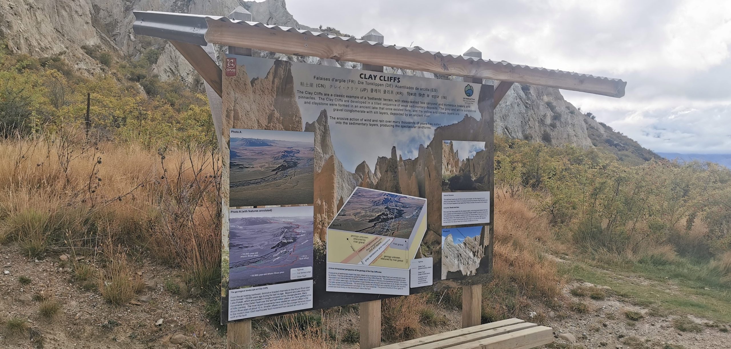
It’s easy to spot the Clay Cliffs from a distance. They are a stark sight – tall barren pinnacles separated by narrow ravines.
Be Prepared
From the carpark, it is approximately a 10-15 minute walk uphill. The closer you get to the sharp pinnacles, the rougher the track can get.
As you get to the foot of the soaring peaks, the ground can be quite unstable so make sure you only go as far as you feel comfortable. Remember, it is harder going back down than up. Good footwear is imperative. Jandals just isn’t going to cut it.
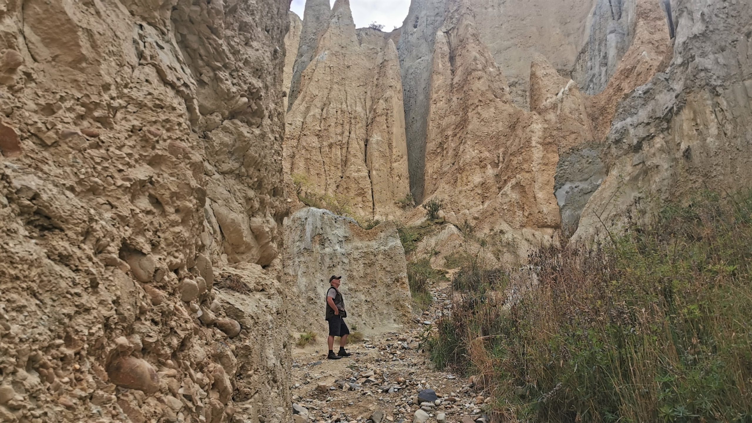
although there is so much to see, make sure you watch your footing
Bad Lands
I can see how the area has earnt the nickname “The Bad Lands”. These otherworldly formations are made up of layers of gravel and silt, and like much of the South Island, were originally formed by the flow from ancient glaciers around 20 million years ago. For the pinnacles to form, the area was uplifted and tilted by the nearby active Ostler Fault – then mother nature did her thing, wind and rain eroded them into sharp peaks.
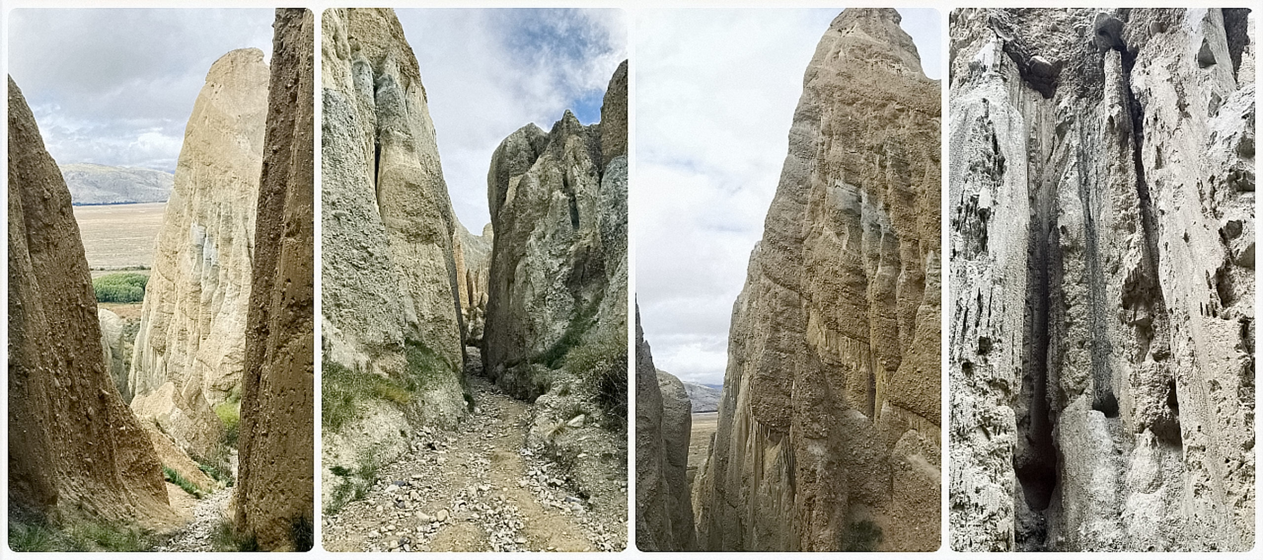
the landscape is of apocalyptic proportions
As you can imagine, Mother Nature is still at work here. Some of the overhanging slanting towers looked like they could give way at any moment. I wouldn’t want to be there in the next heavy downpour!
Kurow
I love visiting this area and it had seemed like a long time since we were last here. We spent quite a while exploring the different dams and staying at some of the Waitaki campsites. Click here to read my previous blog on the Waitaki region.
This time, we decided to stay at Kurow. A place that we skipped through last time.
Kurow Holiday Park
We’re always keen to stay at camping grounds that support the NZMCA. Kurow Holiday Park (#8172) is one of the businesses that are part of the NZMCA Camp Saver Scheme so offers a discount to its members.
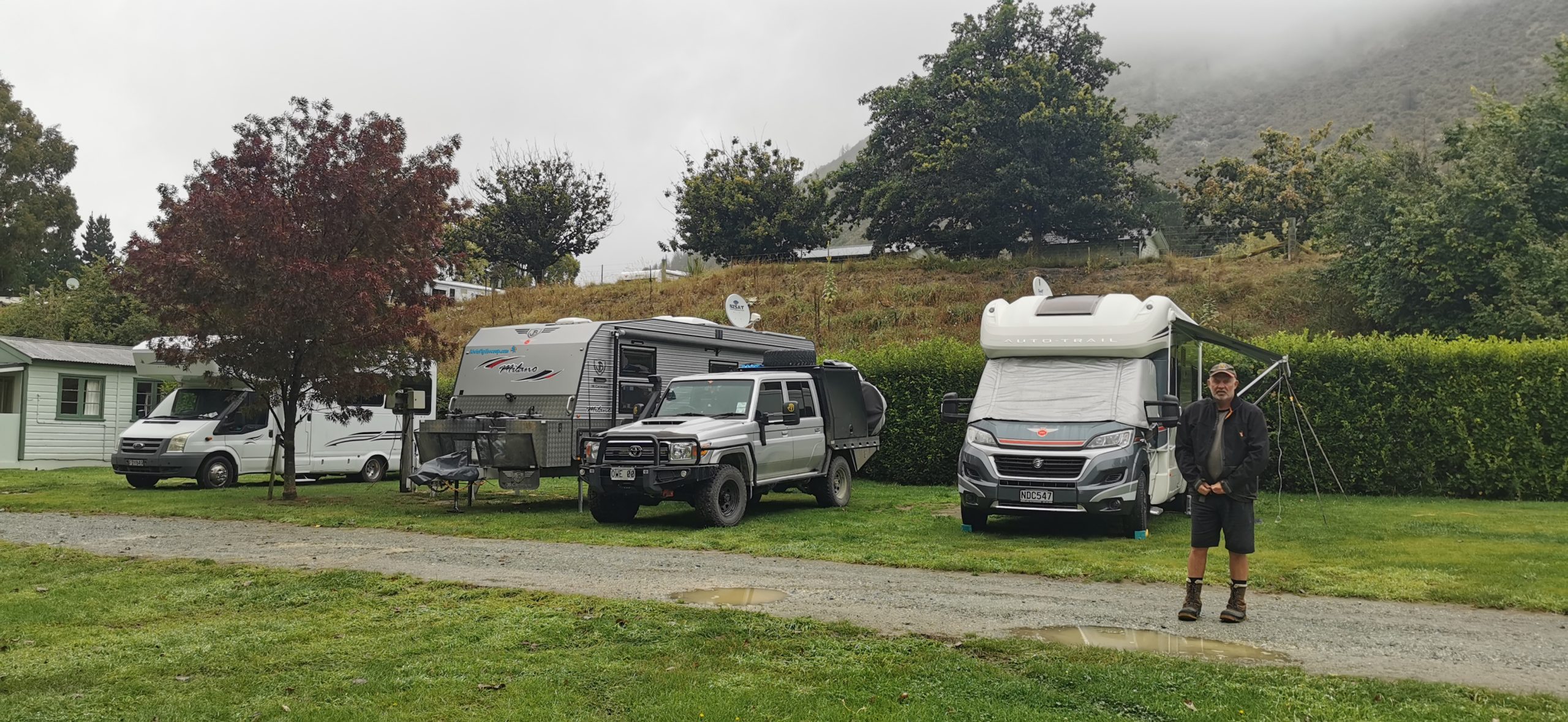
we found a spot to park up for a couple of nights
After checking in at the office we were directed to an area that was more ‘larger rig’ friendly which is on the lower level of the camping ground.
Although the grounds were rather devoid of people, there were still a lot of caravans parked up. With the Waitaki River just a short distance away, boating and fishing are high on the list of attractions so these avid water sports fans obviously have their spots set up for the season (or longer).
we took some time to wander around the grounds, across a couple of bridges over some of the ‘braids’ of the Waitaki River and back to camp
Although the Waitaki River is a wide, fast-flowing body of water, the camping ground borders a Trout Sanctuary which offers a safe and pretty spot for swimming and kayaking. There is a water slide and boathouse which must be super busy during the summer holidays.
Kurow’s Claim to Fame
The town of Kurow sprung up in the 1920s as the base for the building of the nearby Waitaki Dam and forming Lake Waitaki. This was the first of a series of hydroelectric projects on the mighty Waitaki River.
What I didn’t know, was that the first social security scheme for NZ workers was designed in the town by the Presbyterian Minister, Arnold Nordmeyer.
In more recent times, Kurow is known as the boyhood home of rugby legend Richie McCaw.
Eat, Drink & Cycle
The A2O trail (the Alps to Ocean) passes right through Kurow, which makes it a great stop along the journey, and many do. What a great asset it has been for the town of Kurow as there were groups of cyclists staying and eating at the local businesses in town.
We jumped on our bikes and cycled a small section of the trail from the holiday park to the Waitaki Dam and back. A nice 16km ride, good for when you’re short on time.
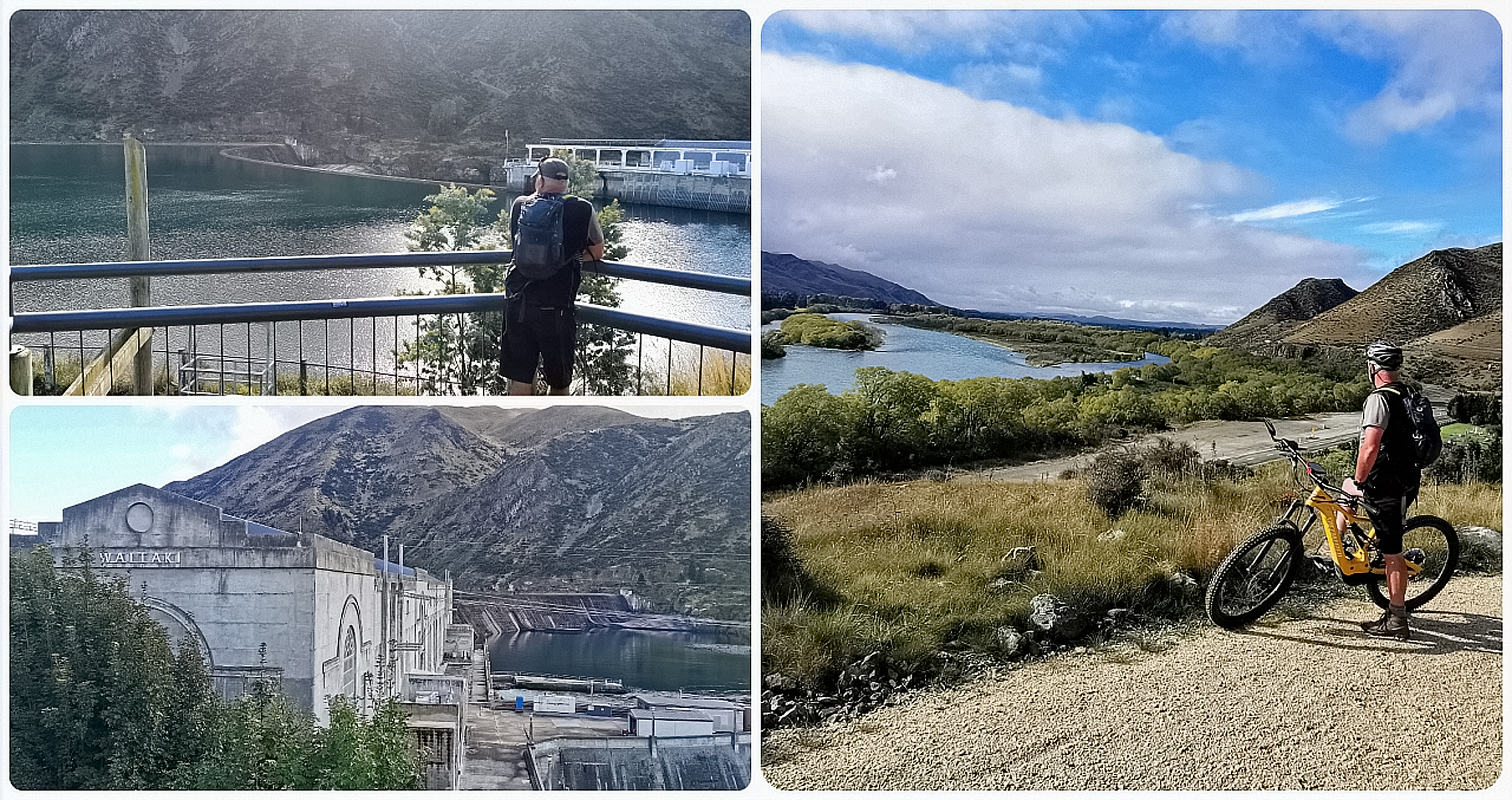
it’s a great ride from Kurow to Waitaki Dam, the last major dam to be built using picks, shovels and wheelbarrows (finished in 1934)
We’re always keen to support locals, so thought that it was only fair to call into The Vintners Drop (Ostler Wines) located on the main street. We had tastings of a few different varieties of Ostler Wines, Pinot Noir, Pinot Gris, Riesling, Rosé and Gewürztraminer.
There are increasing amounts of Pinot Noir that are being grown in the limestone soils around the Waitaki region. There were 13 wineries and vineyards in operation in the Waitaki Valley alone. Scotty did a great job getting our bottle of purchased Pinot Noir back in one piece whilst cycling back to the caravan!
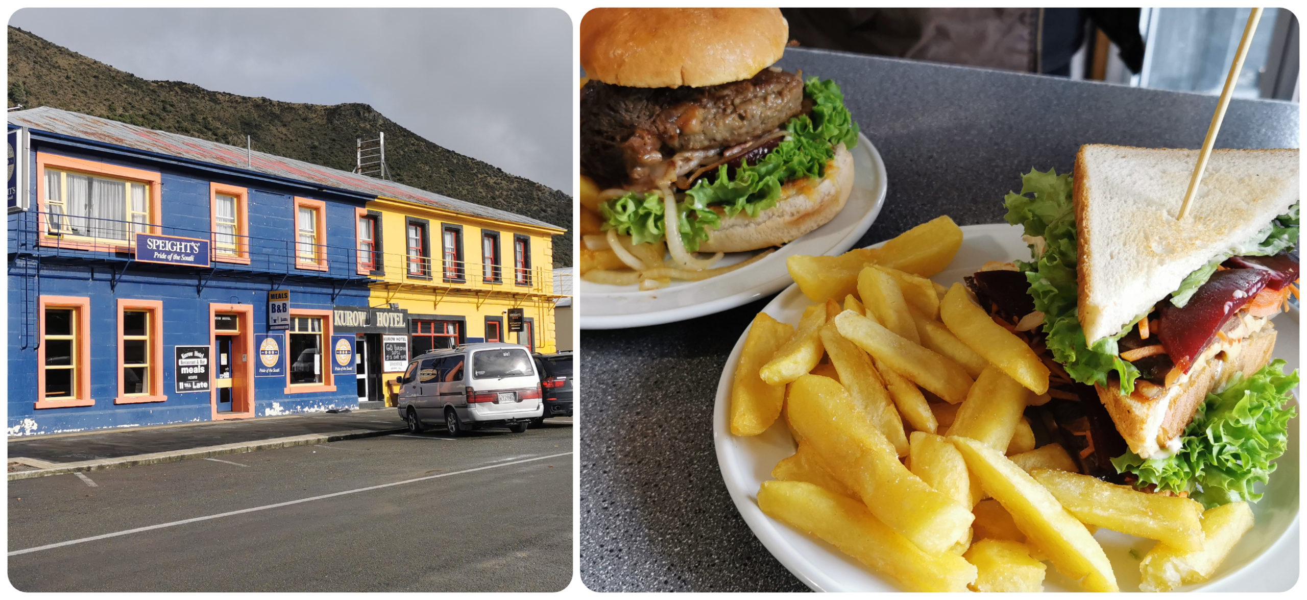
Easy to spot this pub and the meals were fresh and filling
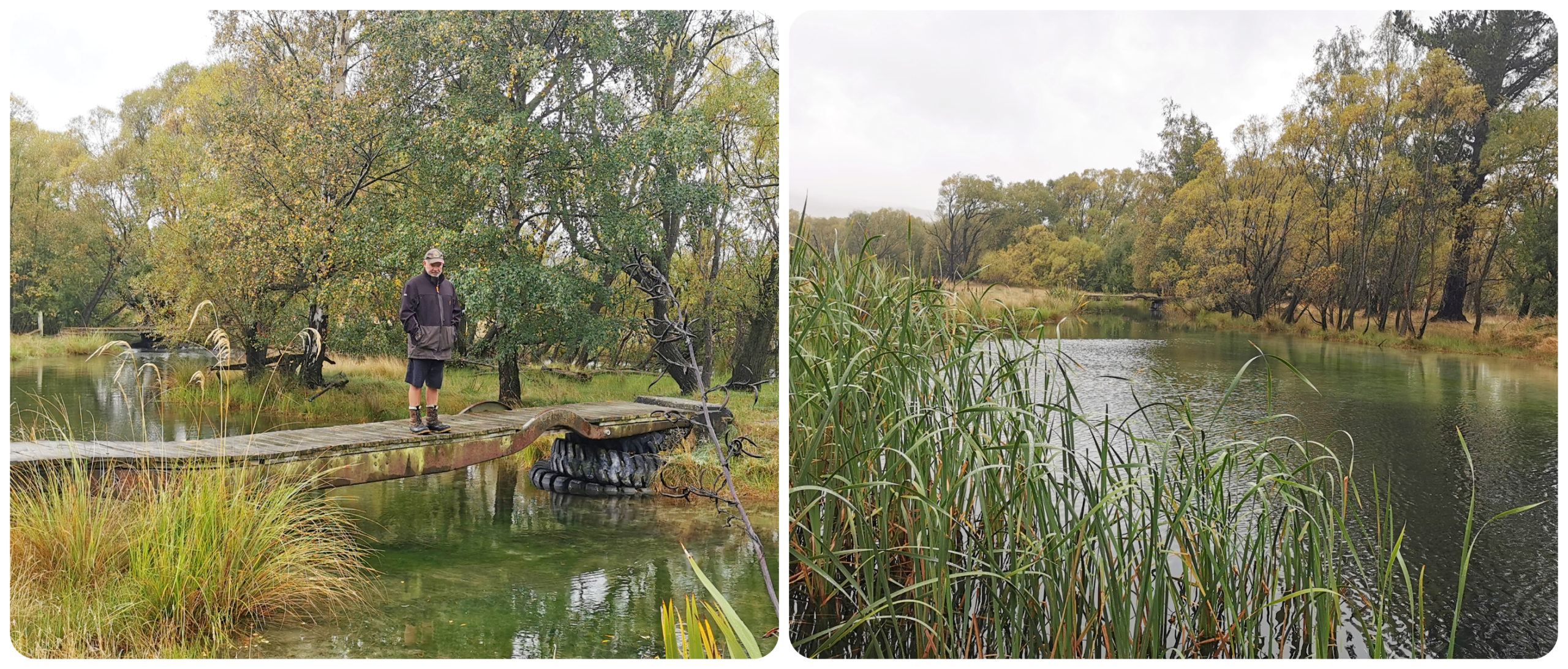
Kurow Island
I had no idea that there was such a thing as Kurow Island. We cycled across one of the bridges over the Waitaki River to the carpark between the two crossings.
The island is a 10-hectare area of what was a wasteland, nestled between braids of the Waitaki River. It was used to dump rubbish for most of the 20th century. The dump was relocated in 1996 but it remained as a landfill for years after as people just continued to dump their rubbish there.
An Island is Reborn
The Island Restoration Project was formed consisting of 7 locals. The committee drew on community support, installing an entrance gate to prevent further illegal dumping. The gorse, broom and blackberry bushes were eradicated by setting up community working bees.
By the time the grass was ready to sow in 2008, it was far from its days as a landfill. The former wasteland has been reborn and is now enjoyed by locals and visitors. There is an easy track to cycle or walk around and is a real tribute to all those who worked so hard to get it to where it is today.
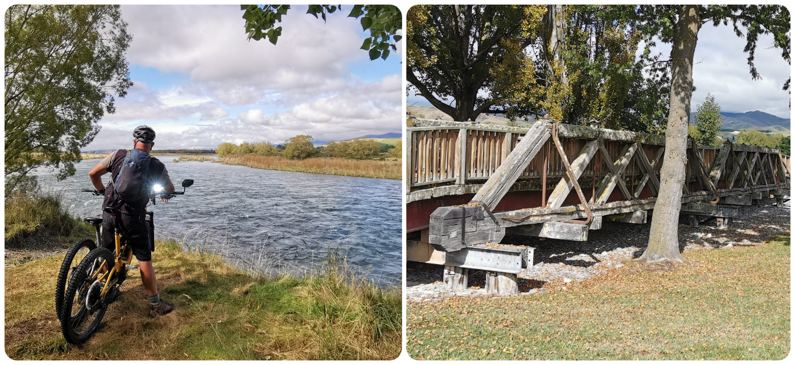
we cycled around the island which is surrounded by the Waitaki River and the old bridge beams adorn the entryway to the island
The entranceway is marked by recycled beams from Kurow’s historic bridges.
JB Caravan Southern Muster
Our first JB Southern Muster held in Omakau in November had 8 vans in attendance. This time, we had 18 vans arrive at a pretty special location.
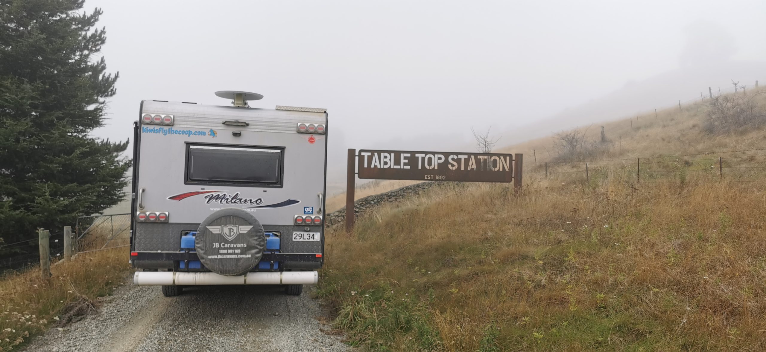
Nestled close to the Hakataramea Valley, Table Top Mountain has been in the same family since the late 1800s
It is certainly a case of ‘who you know’ and we were given permission to hold our Southern Muster high on top of a mountain on the privately-owned Table Top Station, in the Hakataramea Valley. It was only a short 20-minute drive from Kurow to the station. Then it was another 20-minute drive, traversing paddocks and hills to get to our camping spot.
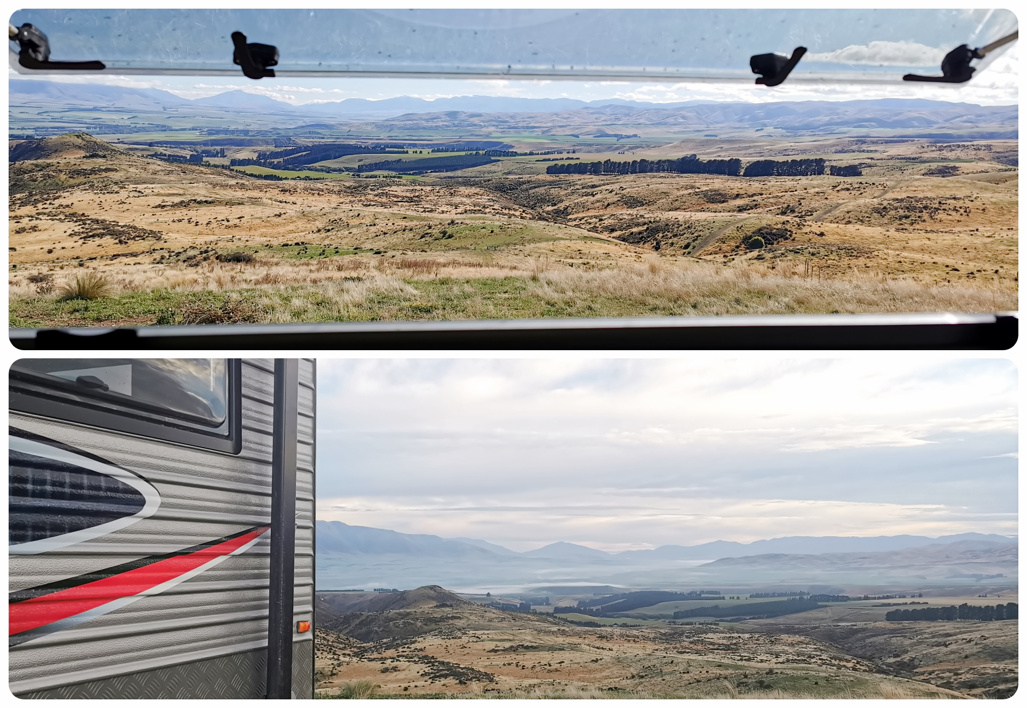
sometimes money just can’t buy a view like this out your back window, nailed it!!!
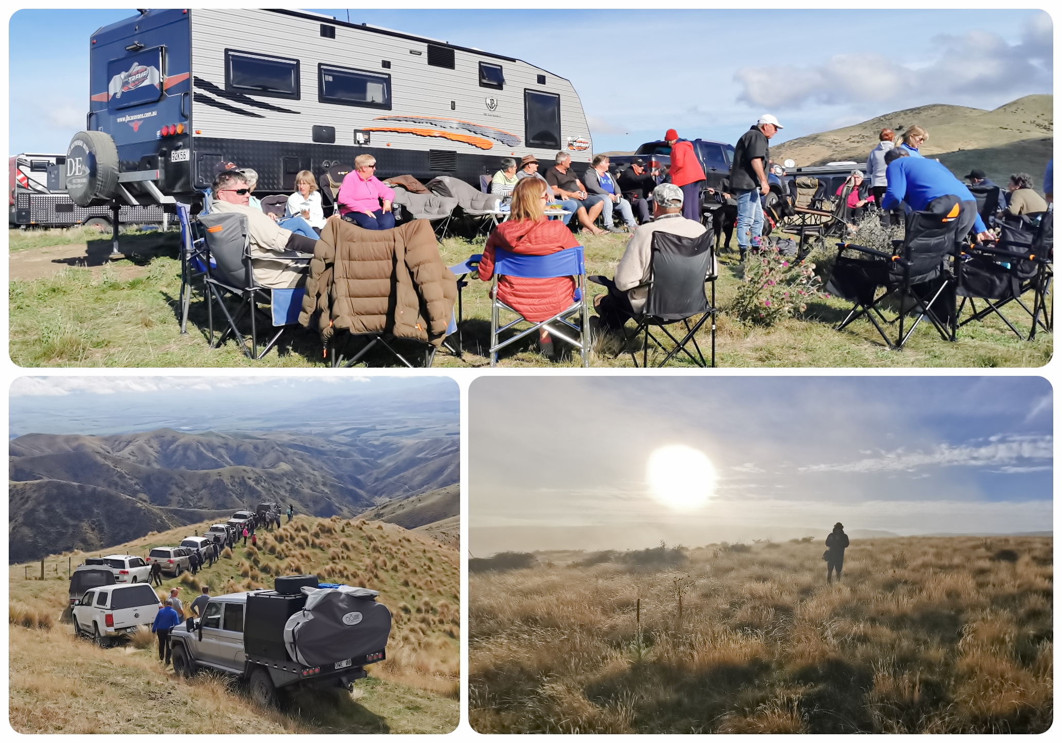
fun, friendship and 4wd safari, it was quite some weekend for sure
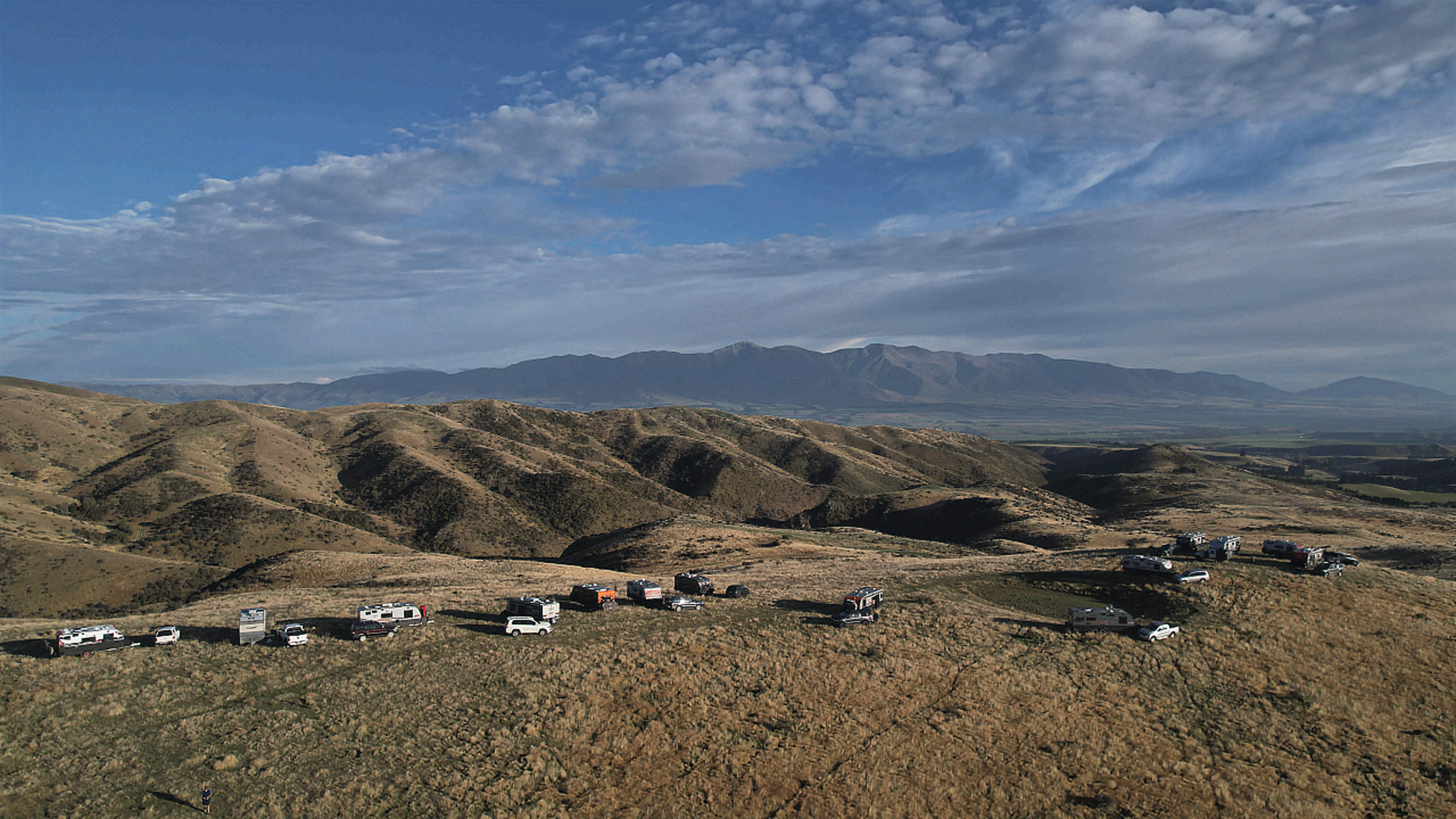
the 18 JB caravans were spread out along the mountainous ridge to make the most of the 360-degree views
The photos say it all really. It was great meeting up with a bunch of like-minded people in such an amazing location. Click on the link below to view a short video on the highlights of our weekend.
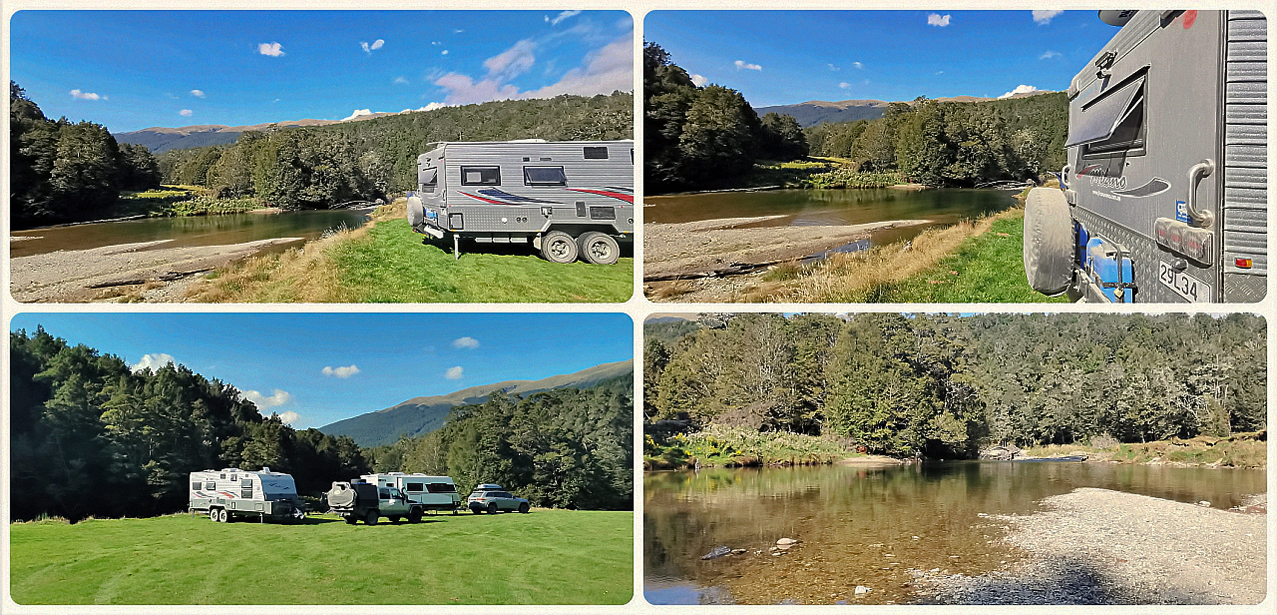
Piano Flat
After the muster disbanded on Sunday, we headed for Fishermans Bend, a Waitaki Lakes District Council camping ground at the base of the Aviemore Dam. We were here for just one night as we had a LONG list to get done back at Te Anau.
A message came in from our friends Darryl and Cathy. “We are heading to Piano Flat to do the 4wd track up to Old Man Range. Want to come too?”. Well, I guess the List of Things To Do can wait just a bit longer!
The Piano Flat DoC Camp is a spacious area located within the Waikaia Forest Reserve. It’s a popular spot for fishermen, hunters, hikers and 4wd fanatics.
It’s a spacious, spread out camping area along the banks of the Waikaia River
Although it is classed as a ‘basic’ camping ground, there are toilets, fire pits and even a playground.
there certainly aren’t very many DoC camping grounds that have playgrounds
It is always good to get to these spots mid-week when most people are back at work. It can be a busy spot during the weekends. Although there weren’t very many campers, the sandflies made sure we didn’t feel alone. They can be vicious here most of the time.
Piano Flat History
Piano Flat is actually named after a member of an orchestra, which was formed to entertain the early settlers and miners. Harry Selig, the piano player, was reputed to have been the first person to find gold on the flat. It was originally known as “Piano Harry’s Flat” but shortened to Piano Flat.
It is believed the first people to have camped here was in 1928, and has become more and more popular over the years. The first of the cribs that we see today was built around 1948. The playground was built in 1958, restored and maintained by crib and station owners.
Piano Flat to Old Man Range
This track officially starts 12km from camp. The road to get to the start takes you through the beech forests of the Waikaia Forest Reserve. It’s pretty easygoing with just a few twists and turns but a good firm and smooth surface.
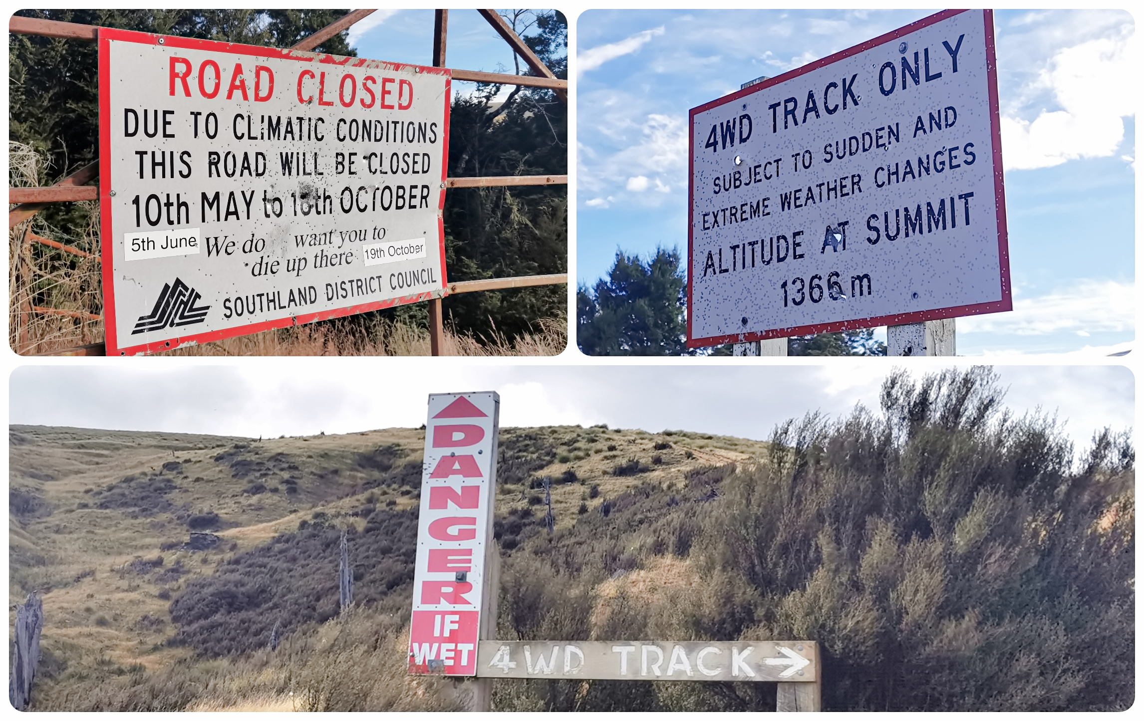
you certainly can’t say that you weren’t warned
Once you get to the gate, the warning signs are a stark reminder that these tracks need to be treated with respect. For safety reasons, it is closed off during the harshest of the winter months. It’s not a track to be taken lightly as the weather can change extremely quickly and rain can make the mud holes deep and an easy trap for the unsuspecting driver.
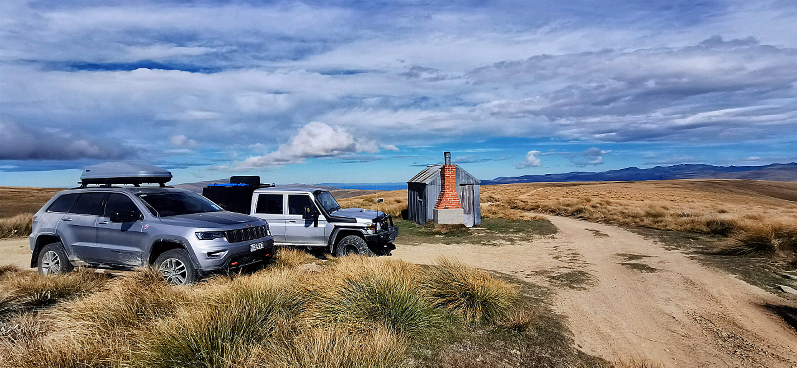
This isn’t our first trip to Old Man Range, but this is the first time traversing it from this direction, and we’ve wanted to tick it off the list for quite some time. It was a bonus to be able to join our friends Darryl and Cathy in their Jeep Grand Cherokee.
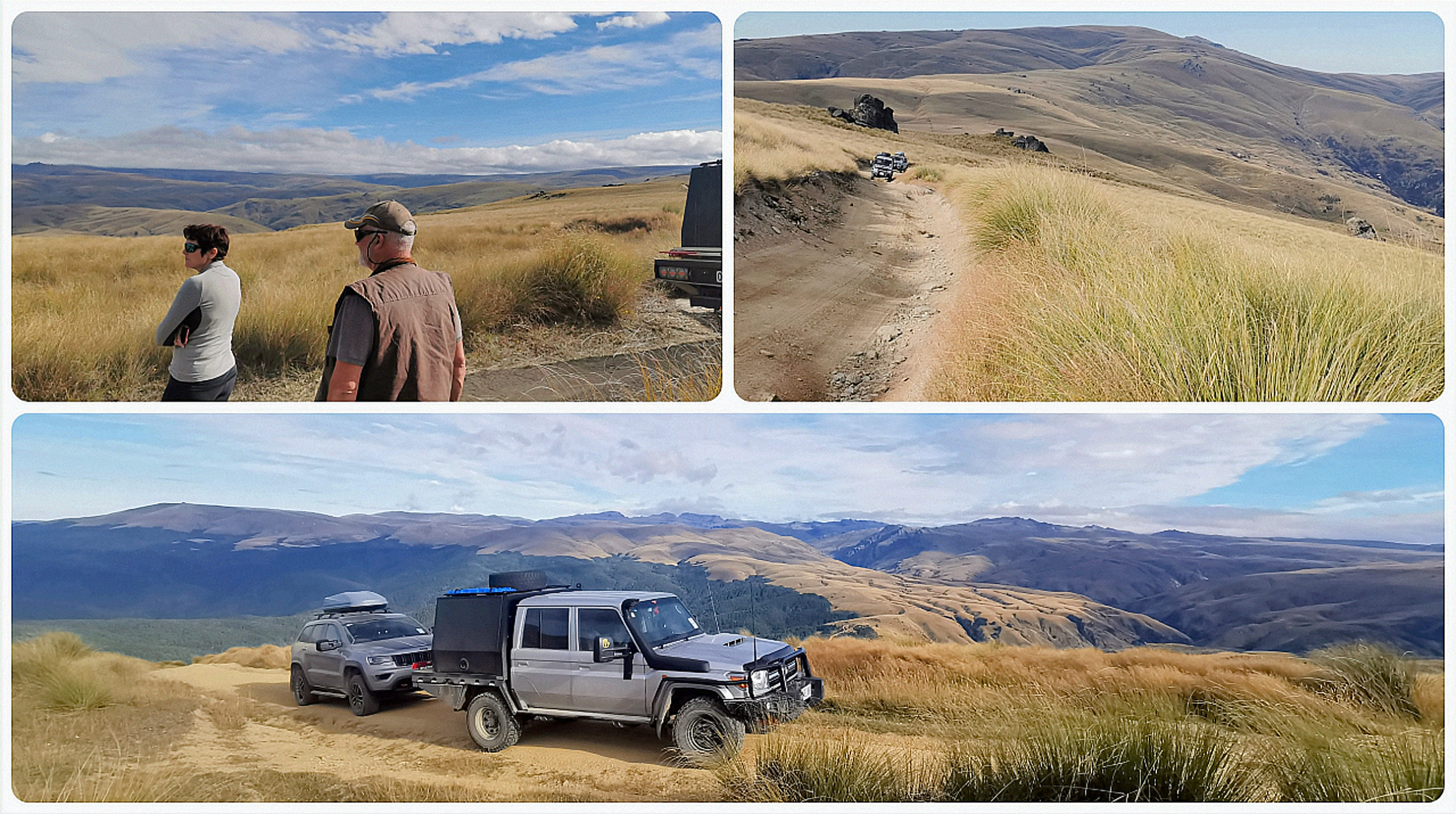
as we got closer to the top, the views spanned out around us
Climbing and Climbing
We were headed for the AA Hut (Waikaia Bush Rd) as this is where we had been twice before from the opposite direction (Roxburgh end).
I knew that the AA Hut sits at around 1,300m above sea level so knew that we were in for some serious climbing.
The higher we got, the rockier the track got. We saw the evidence of the muddy holes and bogs that have either caught out vehicles in the past or gave them something to aim for, giving that extra bit of challenge. Apart from a few token muddy patches, it was an extremely dry and barren landscape and track.
The Notorious Staircase
In doing my research (I like to know what I’m in for), I’d read and seen video’s on the ‘staircase’. This is located fairly close to the AA Hut and is the last challenge before reaching our ‘turn around’ destination.
The schist rock has formed a natural steep staircase. It turns into a waterfall during heavy rainfall, which would make it a whole different story than the conditions we experienced.
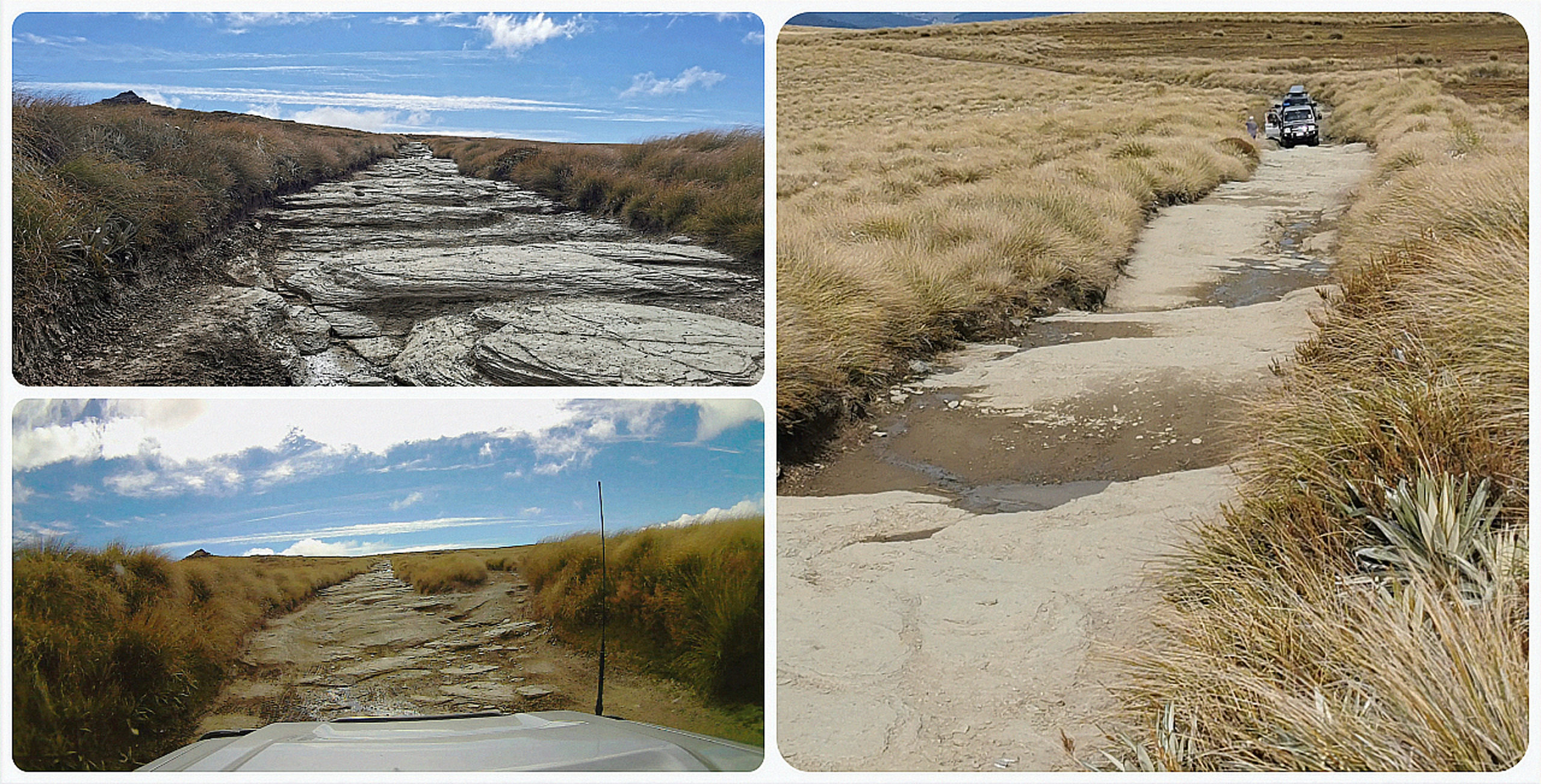
it’s difficult to show the steepness and height of the steps in a photo
Our two vehicles tiptoed and crawled their way up each rocky incline, the drivers negotiating the right approach each time.
All in all, not as bad as I expected it to be. Mind you, I thought that it was worse going back down than coming up (but then that’s just me, not my driver’s opinion….lol).
AA Hut
I love stopping off at this little hut. The photo backdrop is always amazing and looks like a ‘calendar moment’ every time. It’s provided shelter for hunters, trampers, skiers, cyclists and day-trippers for many years. Don’t expect any luxuries though. It is just a tin shed nowadays but at least it would still provide protection from the wind, rain and snow if ever required.
the AA Hut never fails to provide a perfect photo opportunity
It sits at 1396m so you can imagine how harsh the environment can be in the colder months.
Potters Hut
We did an about-turn and headed back the way we came until we spotted the sign for the short detour to Potters Hut.
It’s only 3km off the main track (a bit bumpy and rutted) and there are two huts situated in the barren landscape. One historic stone hut and a corrugated iron DoC Hut.
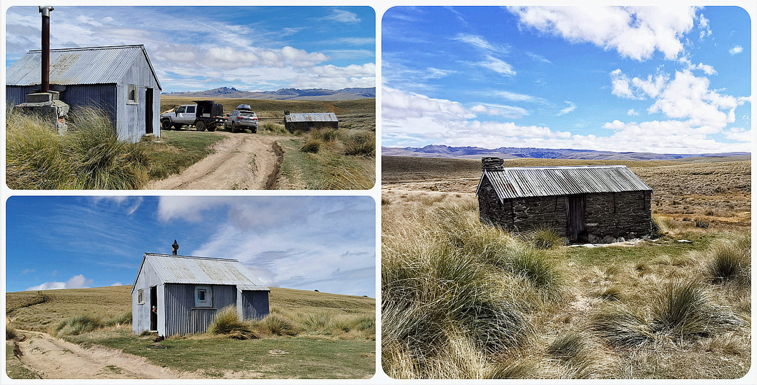
the old and the new(ish), what a harsh environment those poor miners had to endure!
The two huts are located near historic gold workings in the Campbell Creek catchment. The old stone hut was owned by Andrew Ree who mined at Potters from 1883 to 1923.
The conditions were harsh and the miners who came to this area were ill-prepared to cope with the conditions. Up to 17 miners perished in the first winter alone. We could still clearly see the tidy piles of rock tailings left behind by these hard-working miners.
The newer musterers hut was built by Roxburgh farmers to provide them with some shelter and safety in inclement weather. It provided us with some shelter to have our lunch.
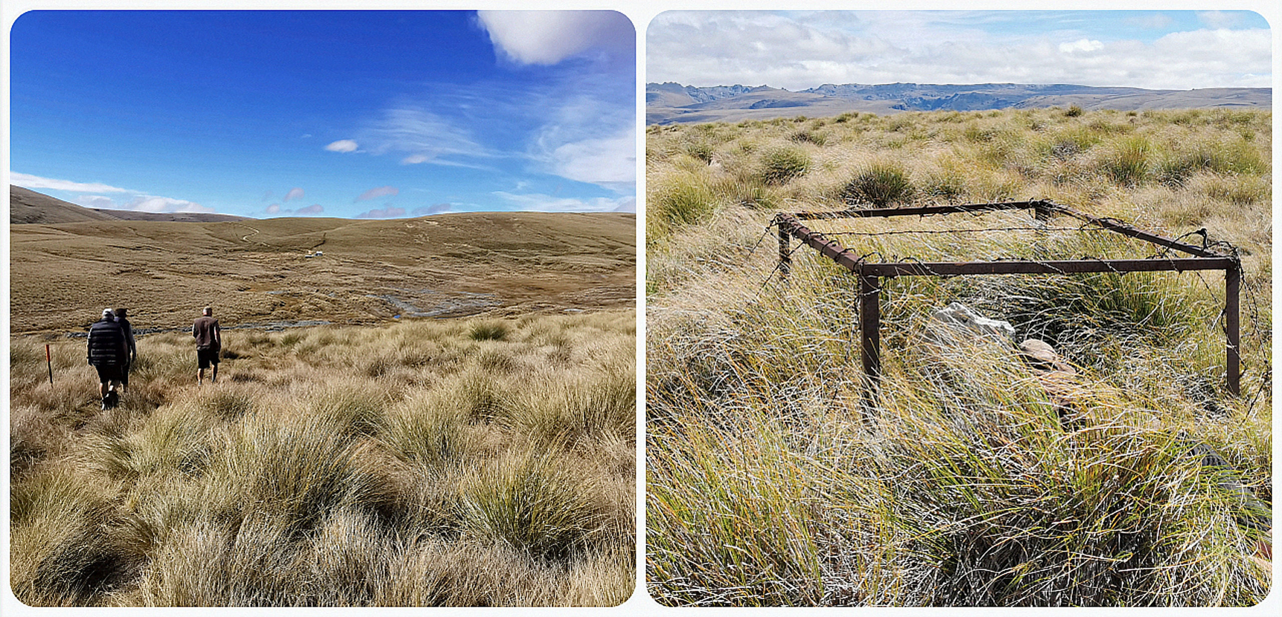
it was quite a hike but we made it to the gravesite
We wandered over a couple of hills to get to a gravesite with the best views in the world. William Pitt is buried (probably where he fell) 20th June 1864 while trying to clear snow so the pack horses could get through with supplies.
Canton Bridge
Our final detour of the day before arriving back at basecamp. We wound our way down towards Canton Bridge (funnily enough on a road called Canton Road).
The road surface is relatively good, you just have to watch out for a ford with steep entry and exit. A vehicle with poor clearance would struggle crossing it even when the water level was low.
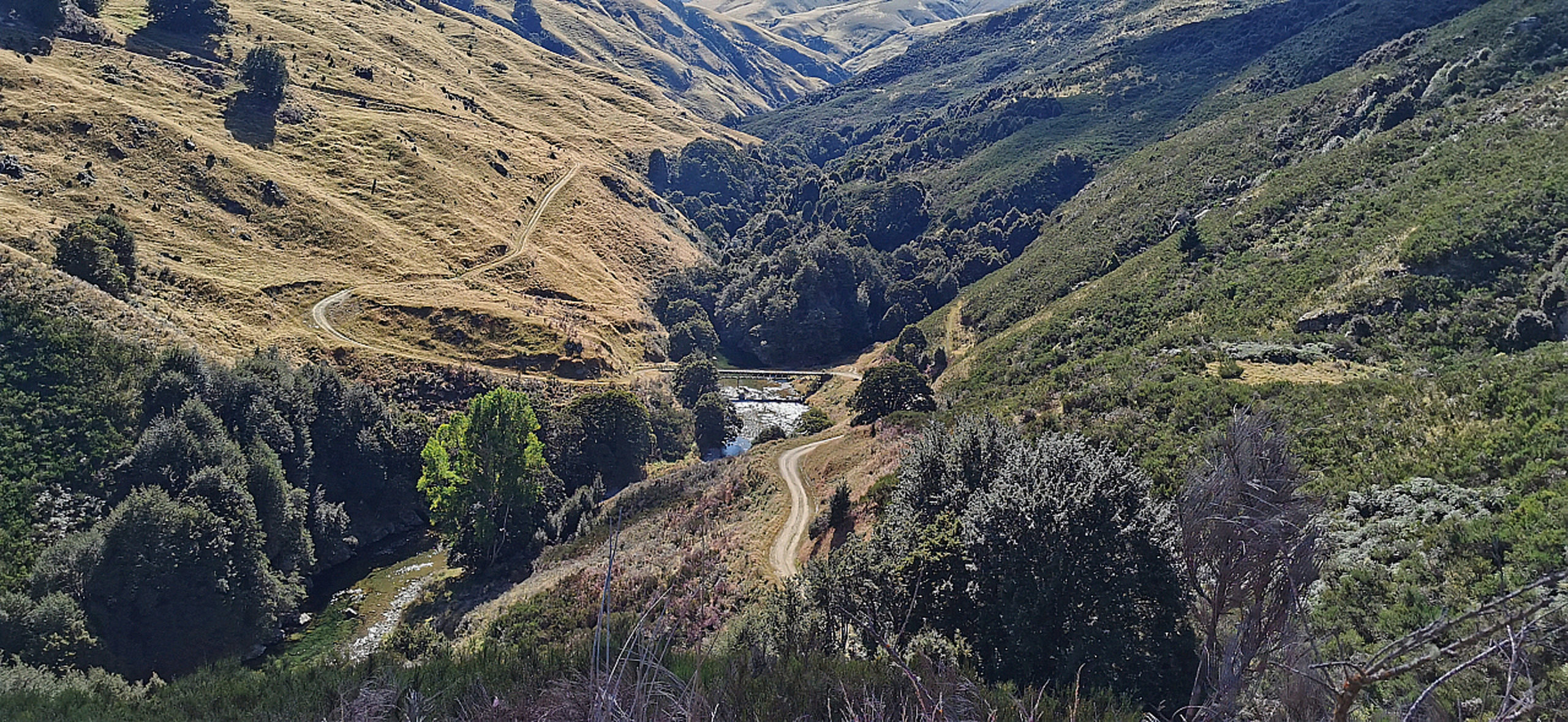
spot Canton Bridge way down in the valley, that’s where we’re heading
Canton Bridge soon came into view way below us as we bumped our way closer. It served an important role in enabling miners to get to the goldfields at Potters, across the Waikaia River.
The bridge is as far as you can now go as there are a pair of very sturdy iron gates at the far end. If you were to continue along this road, it would take you through the privately leased Glenaray Station. (presently it is under review for more public access)
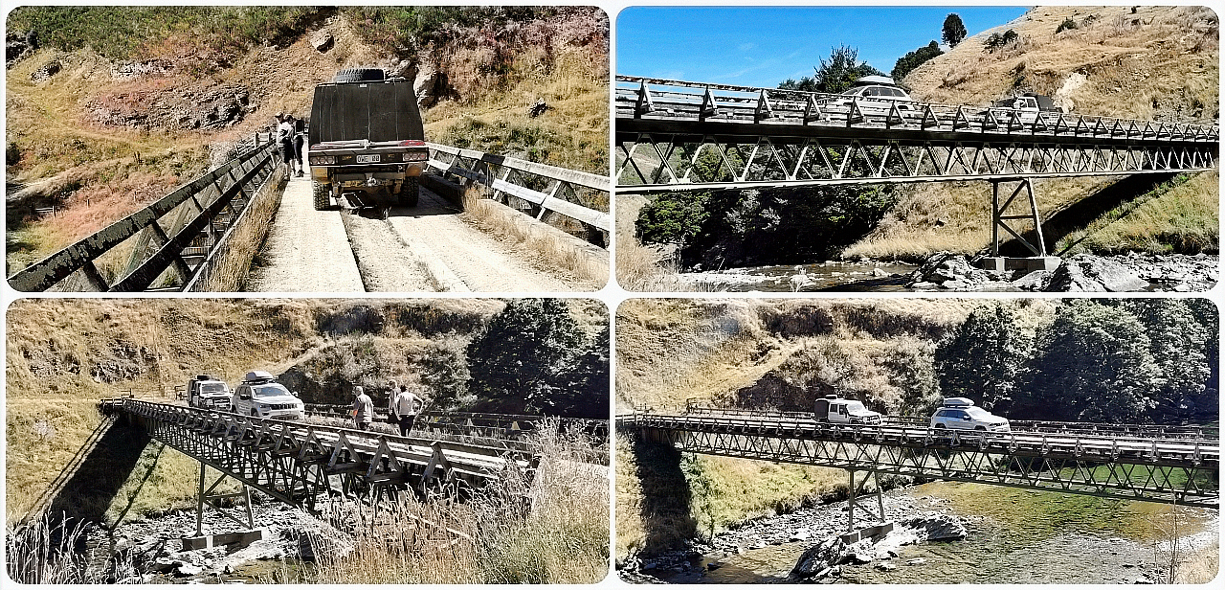
built to last, this bridge was a Godsend to those early miners and prospectors
Back to Reality
Facebook: https://www.facebook.com/kiwisflythecoop/
Instagram: https://www.instagram.com/kiwisflythecoop/
Another very thorough and interesting blog post of great written accounts, fantastic photos and a couple of real nice video clips too. Thanks Linda & Scotty.
Thanks for your feedback Kevin, always appreciated. L