Like the miners in the 1800s, we were lured to St Bathans to discover gold. Well actually, the history surrounding the discovery of gold to be exact.
The Creation of St Bathans
St Bathans began as a boomtown known as Dunstan Creek way back in 1863. In less than a year, there were 1,000 miners living in the then known Dunstan Creek and a further 1,000 in the surrounding district.
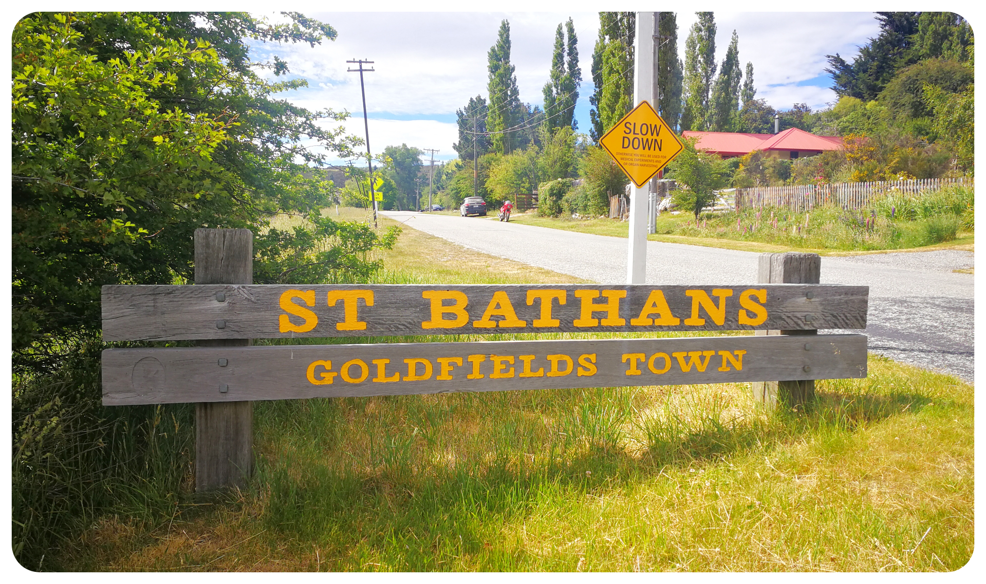
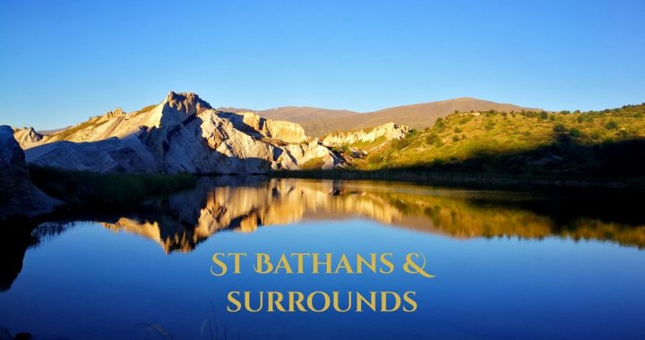
Welcome to St Bathans
Three years after Dunstan Creek was formed, the name was changed to St Bathans, after the first surveyor of the district.
In case you haven’t noticed yet, we love exploring these towns and settlements. To learn, discover and explore a little of what these areas were like in the early days. We are always learning new things and that’s what travel is all about.
St Bathans Domain
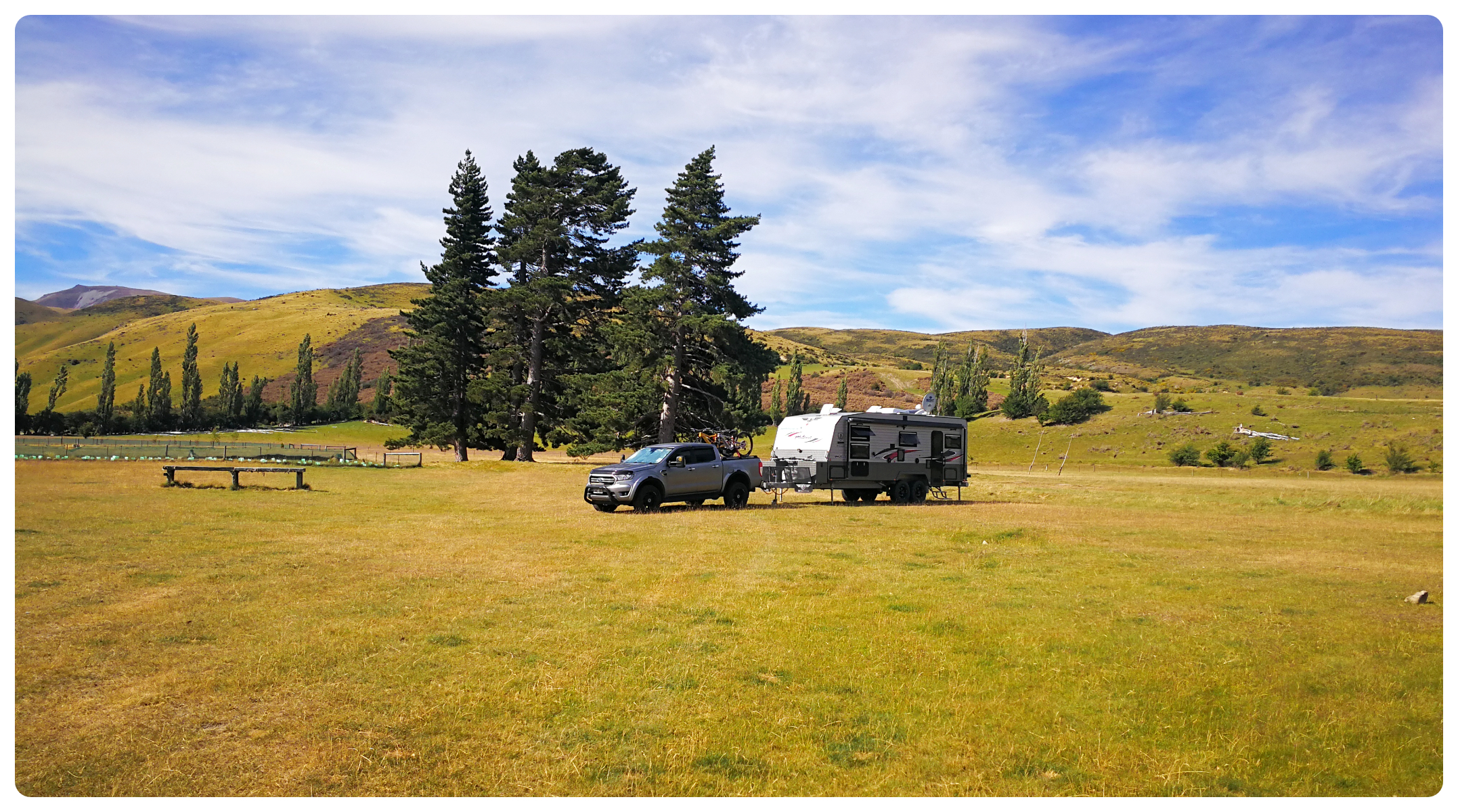
We chose to stay at St Bathans Domain (NZMCA #8716). This is a large flat area where you can camp for free and is administered by DoC. It is dog friendly but usual rules apply as there is stock in neighbouring paddocks.
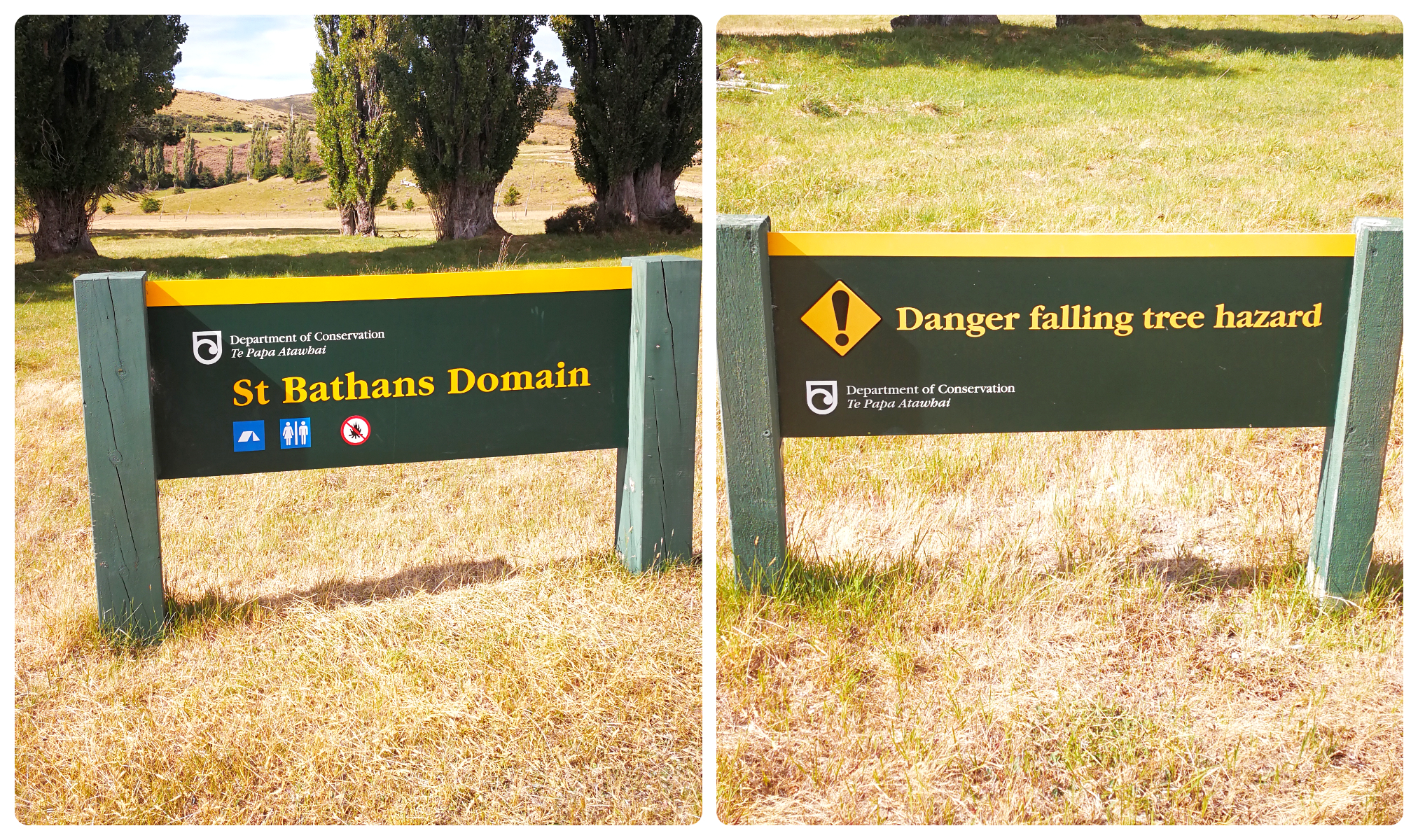
Keep a lookout for the entry to the Domain and DON’T park by the trees!
There is non-potable water and a long-drop toilet available.
It is conveniently located next to a walkway which will take you to the Blue Lake (approx 500m) or into the township (approx 1.2km).
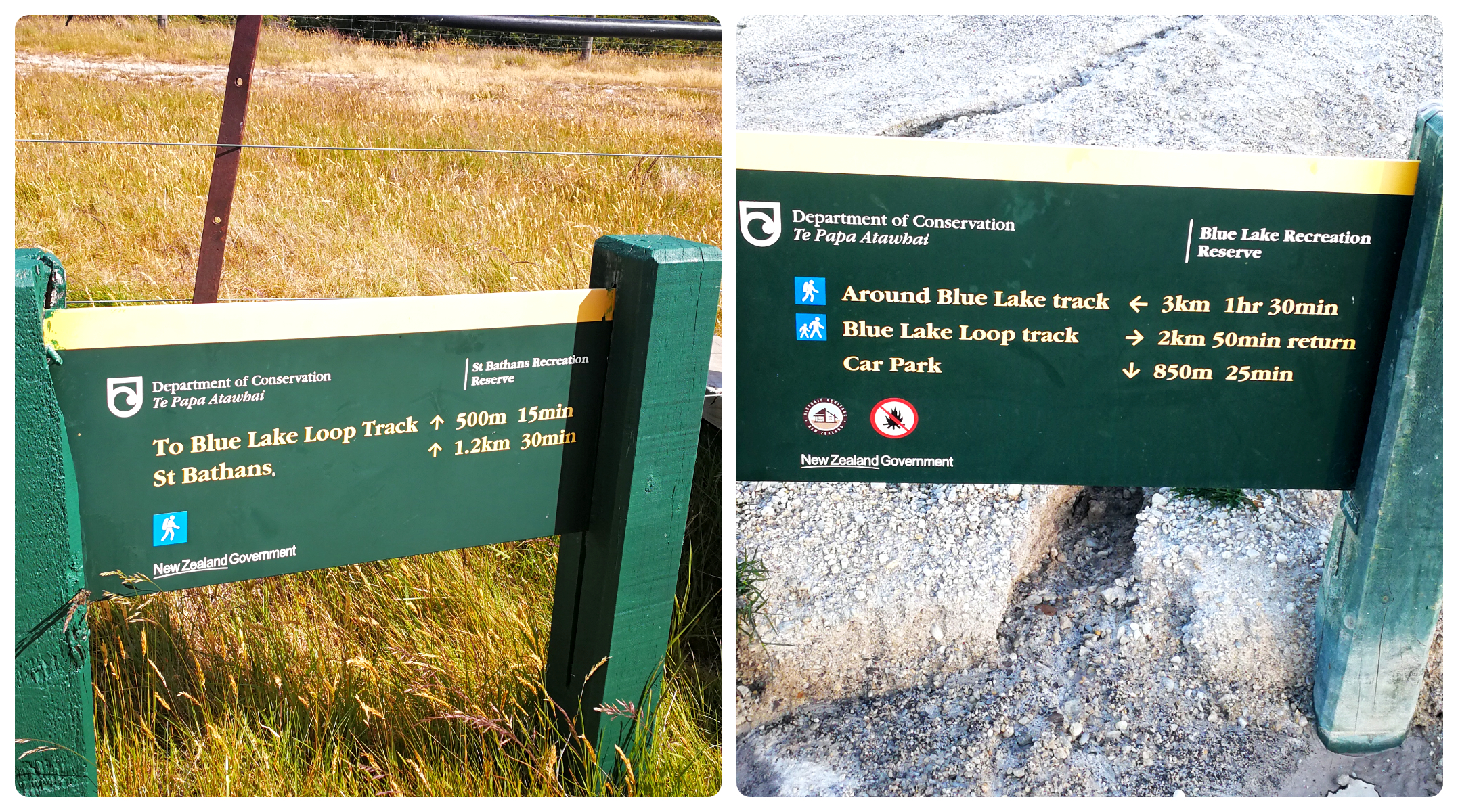
it’s easy to find the signage for the path to the Blue Lake
We were completely alone on our first night but we were joined by a small number of tenters, many on cycles.
yup, on our lonesome the first night
The St Bathans Domain in itself can boast quite a history. Many of the miners in the area came from Ireland so the highlight of the year was the St Patrick’s day picnic that was held at this very domain. It was also the venue for the annual Boxing Day Races, Gymkhanas and annual games between St Bathans and nearby Cambrian.
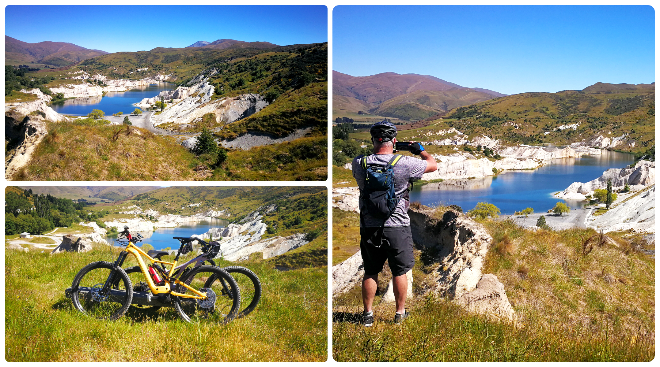
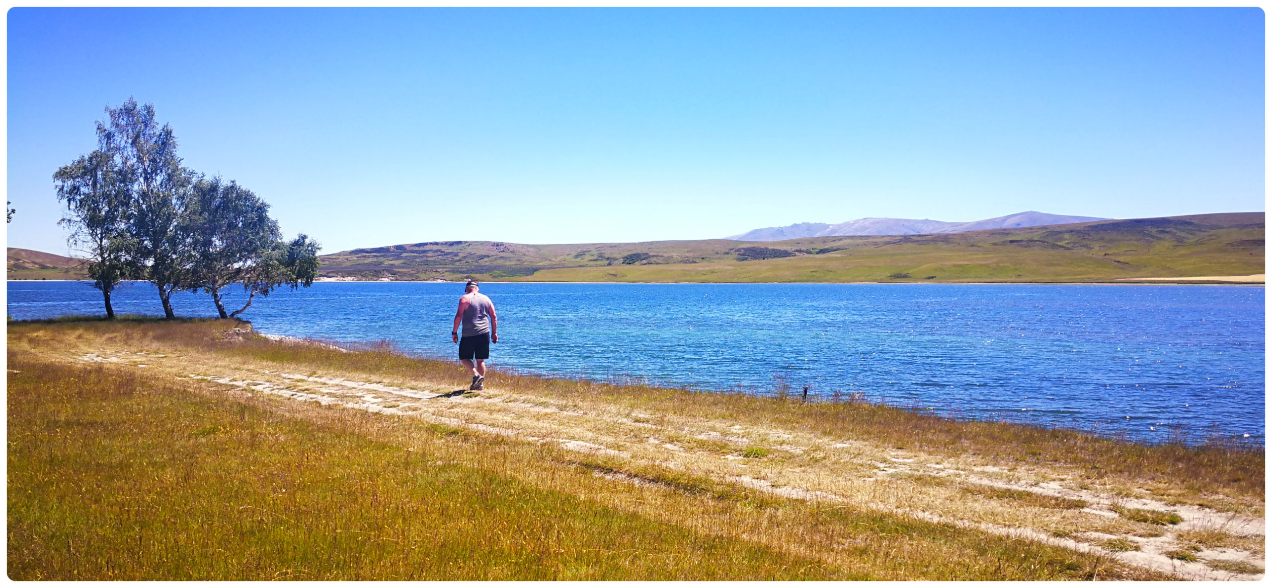
The Blue Lake
As mentioned earlier, the path from the Domain will take you to the start of the Blue Lake Loop Walkway. This is a short 2km walk but there is also a longer more strenuous loop around the entire lake which is 3.5km.
the shorter 2km loop walk is well-formed and easy to follow
Kildare Hill
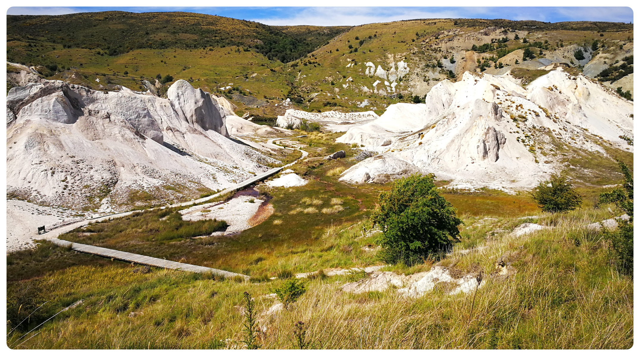
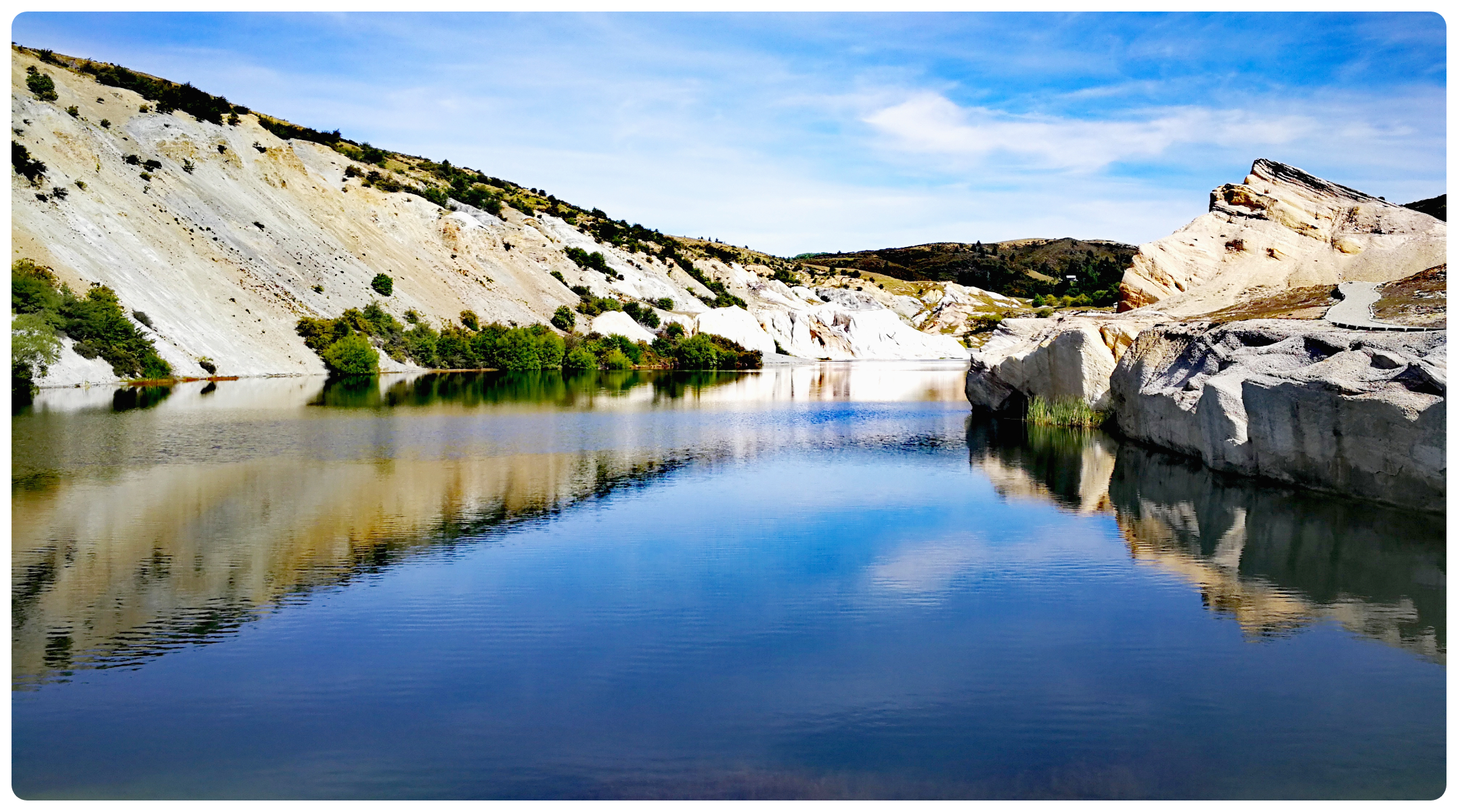
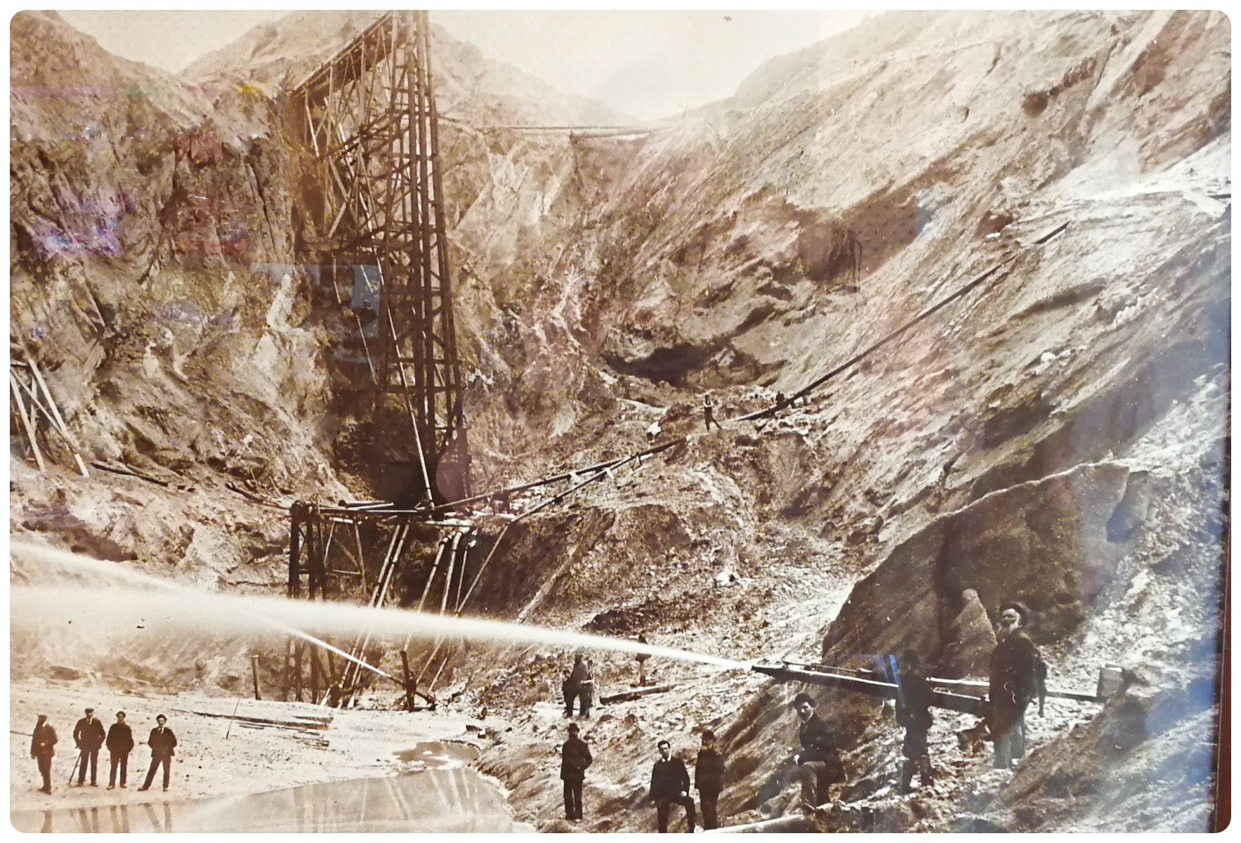
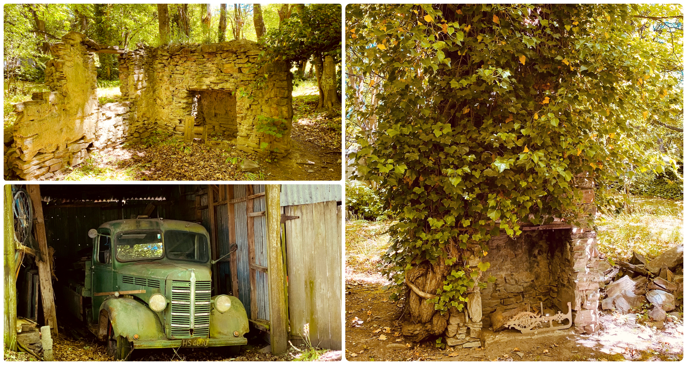
It is hard to imagine that this beautiful serene lake was actually the location of a large 130m high mountain called Kildare Hill. In 1864, deep shafts were sunk into the hill to bring the gold-laden rocky slush to the surface. A major sluicing operation took over, pretty much obliterating the hill to below ground level.
hard to imagine this being a 130m high hill
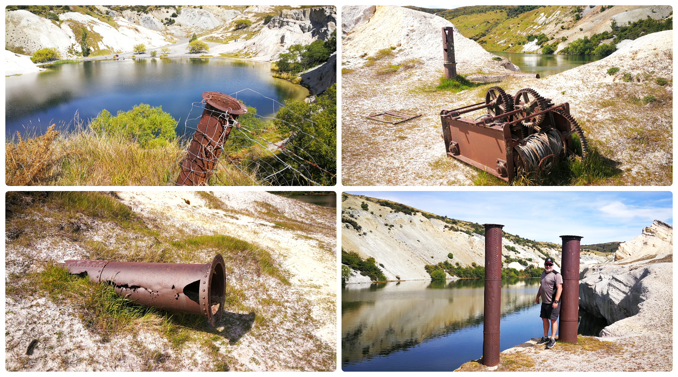
Hydraulic Elevation
John Ewing (responsible for the creation of Pinders Pond through sluicing) had arrived in St Bathans. He brought with him the knowledge and equipment to introduce hydraulic elevator sluicing to raise the gravel and burrow even deeper below ground.
By the time mining was abandoned in 1933, it was the deepest hydraulic mining lift in the world at the time. It consisted of two vertical lifts, one of 165ft and another at 60ft.
there are plenty of reminders of the mining days left behind
The locals called it ‘The Glory Hole’. More than 2,834 kilos of gold was extracted from the three largest mining operations. These were Vinegar Hill, the Kildare Mine (Blue Lake) and the Scandinavian mine at Surface Hill.
When the operation was dismantled the massive hole was flooded, giving us the Blue Lake we see today.
Lunar Landscape
The scars of the past were evident as we wandered the well-formed track. White clay cliffs loomed overhead which indicated where the original ground level was prior to the extensive sluicing. Some of the landscape took on quite a lunar-like structure and appearance.
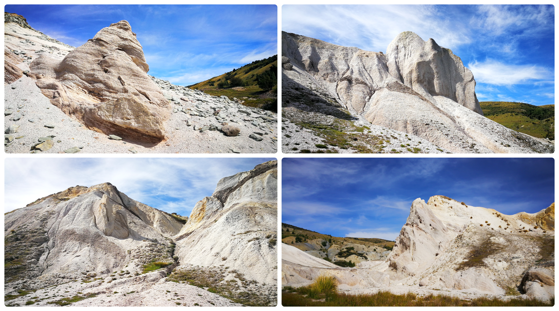
the ‘moon-like’ landscape was quite barren and parched in places
The white soil made quite a startling contrast to the deep blue of the nearby lake.
desert-like landscape
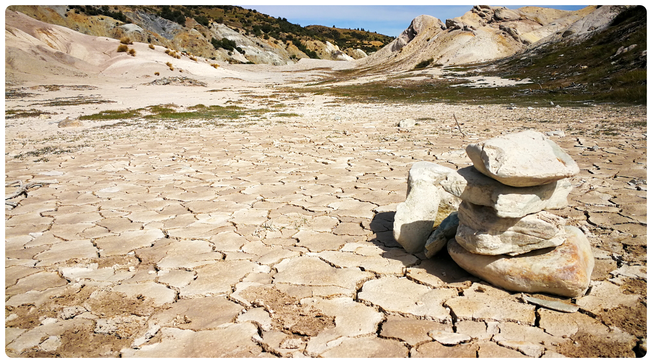
Mining Relics
Littered along the track were relics of the mining era. Water was vital to the sluicing and hydraulic elevation operations and we could clearly see evidence of the old rusty pipes that carried water from many kilometres away.
Walkabout
We managed to score a great pamphlet called ‘Walk Around Historic St Bathans’. This is a great way to conduct a self-guided walking tour of the inner township of St Bathans. It had points of interest and told a story of each of the historic sites. It gave some fascinating insights into the town and how it must have looked way back in the 1800s.
By the late 1860s, St Bathans was well established with 15 hotels, a number of gambling and dance halls and many businesses.
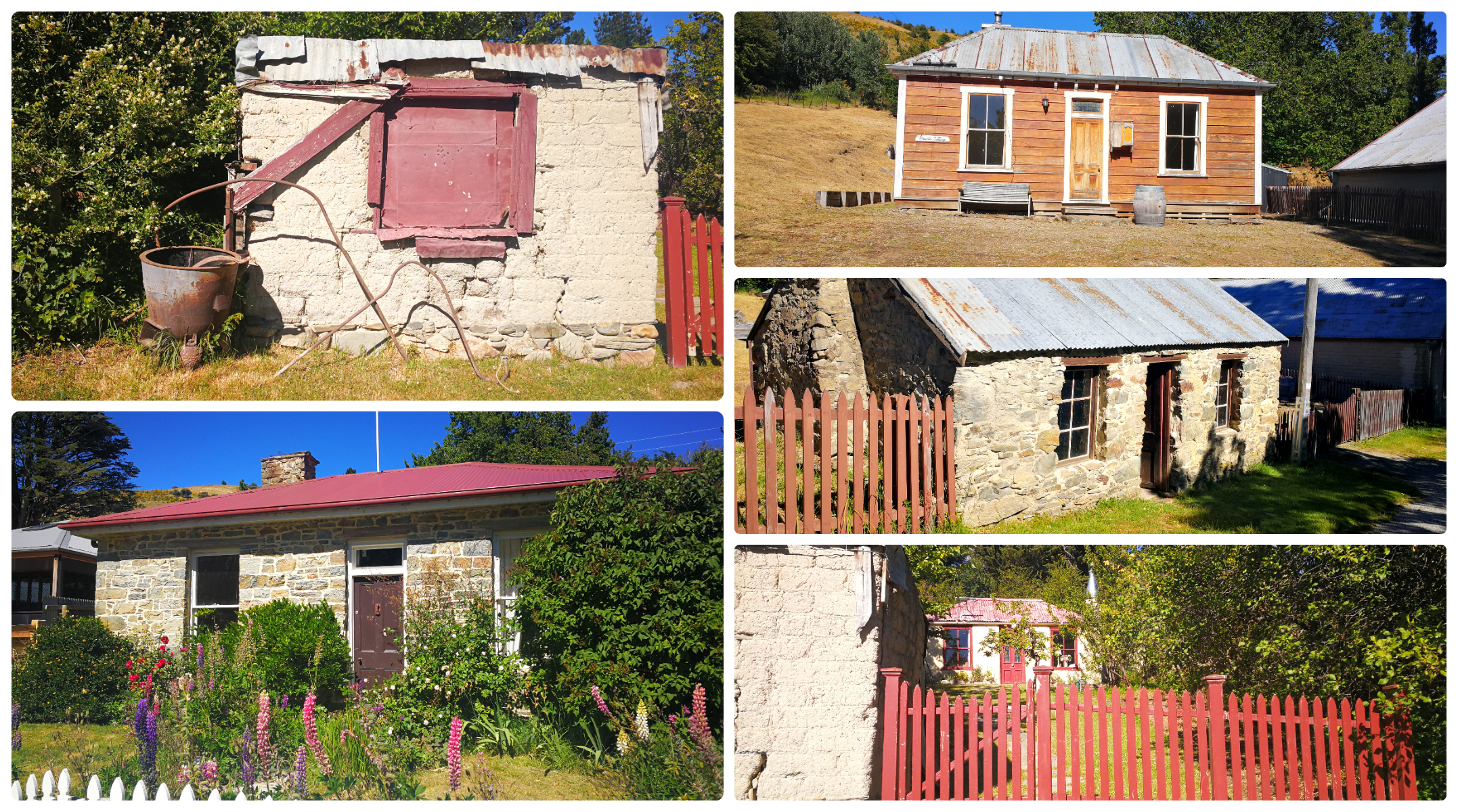
so many cottages dotted around the town, all with their own stories to tell
Many of the original cottages are still being used as private residences and have been lovingly restored. Other evidence of structures that made up the town was now non-existent or just ruins being overtaken by mother nature.
Some of the more ‘intact’ structures included the following buildings:
St Bathans Post Office
This elegant two-storied timber building standing on a prominent site in the historic town is actually the third version of the post office. Initially, it was not much bigger than a dog box (as described by locals) and was inconveniently located up on a hill. In winter the locals had to wade through a sea of mud in order to gain entry.
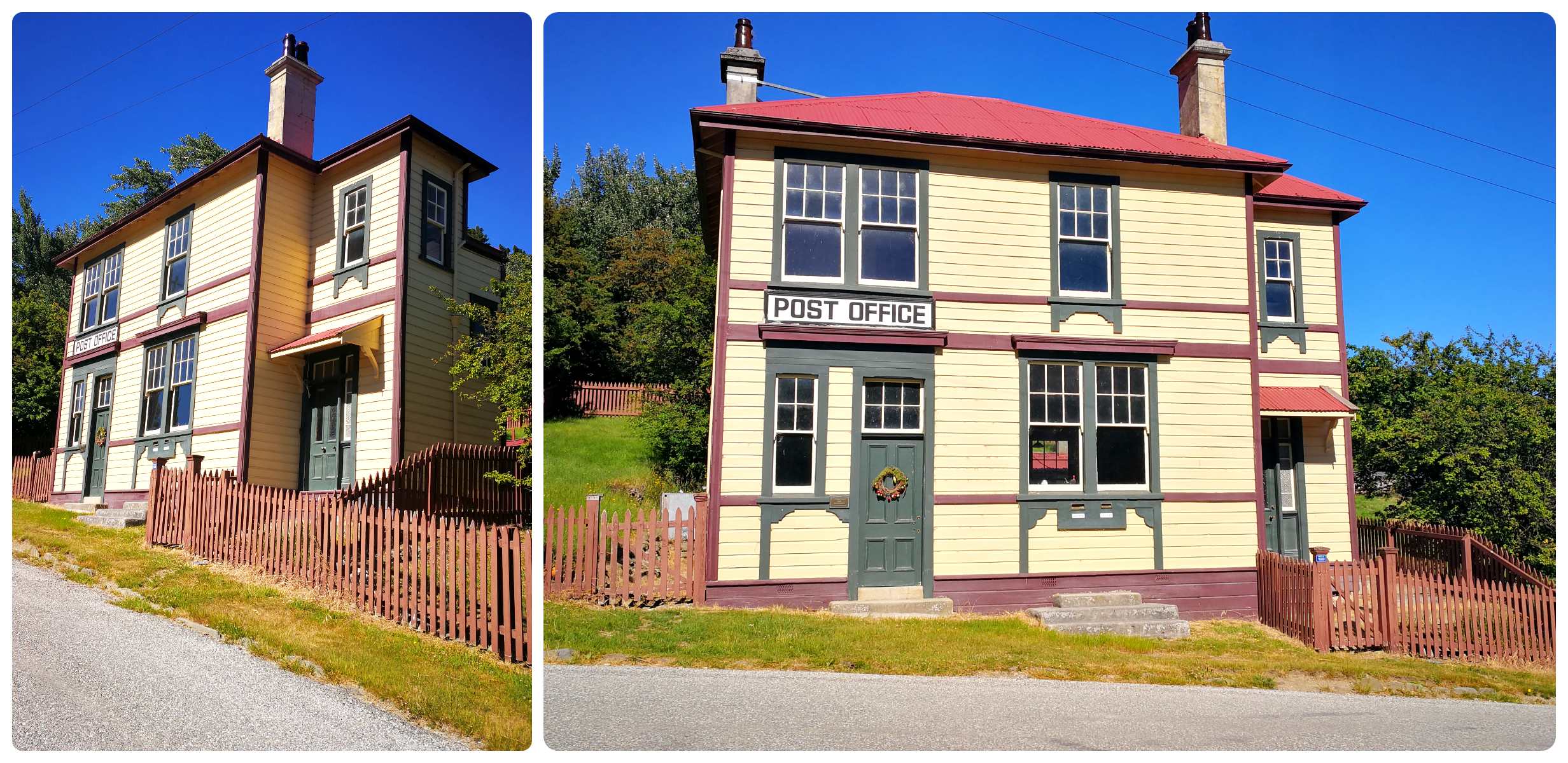
the Post Office standing tall in the centre of town
This grand old lady was opened in 1909 and continued to operate as a post office until 1937. It was then turned into a private residence until 1981 when it was taken over by Dept of Lands and Survey. It is now owned by DoC.
Bank and Gold Office
This building was one of three banks in the township. The Bank of New South Wales opened in 1864 and was combined with the Gold Office. I could just imagine the miners lining up with their gold takings for the day.
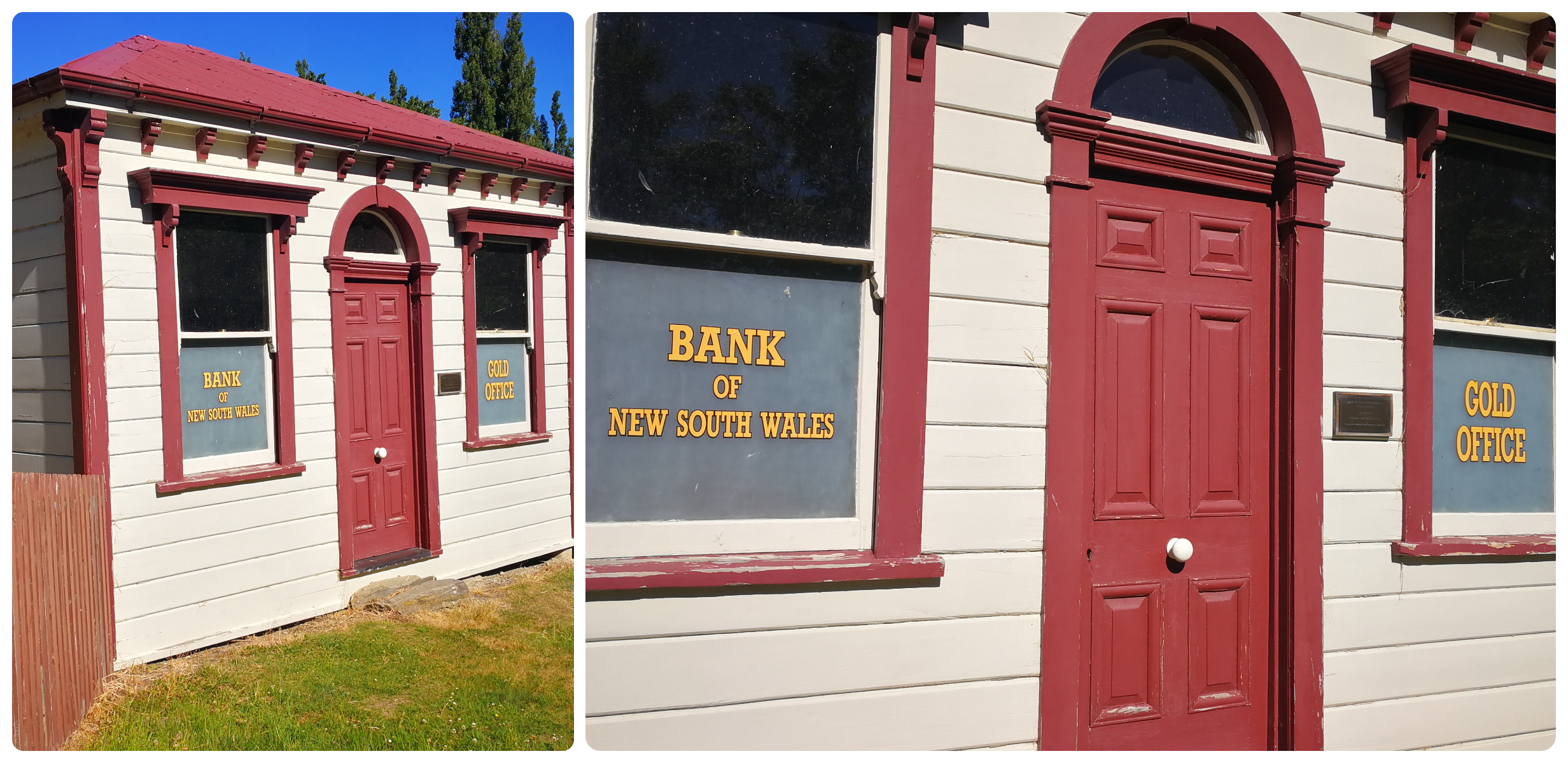
can you imagine the miners lining up to deposit their gold at the end of the week?
It has been quite a transient building. The original location was across the road by the old tennis courts. It was then moved to Oturehua in the 1970s, only to be brought back to St Bathans by DoC in the 1980s. Maybe they could have saved themselves a whole lot of work and left it where it was!
The Public Hall
Located beside the Vulcan Hotel, The Public Hall was built in 1880, formerly known as Ballarat Hall. While the two front rooms were initially used as gold offices, the main hall was the centre of the town for meetings. The Masonic Lodge held its first ceremony here in 1902.
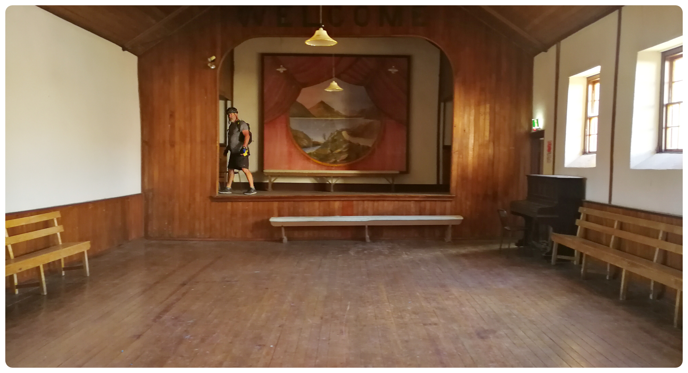
the inside of the Public Hall with its ‘sprung loaded’ wooded flooring
It has been the venue of countless performances and entertainment. It is unusual in that it has a sprung floor, quite advanced for the times. I stood there visualising the dances that must have had that place pumping.
Being located next to the hotel must have been very convenient as the men escaped for a cold bevvy between dances.
The Vulcan Hotel
Probably the most prominent landmark of St Bathans, the Vulcan Hotel. The well-preserved hotel was originally the Ballarat Hotel, constructed in 1882. Its name was changed after a fire destroyed the original Vulcan Hotel further down the street.
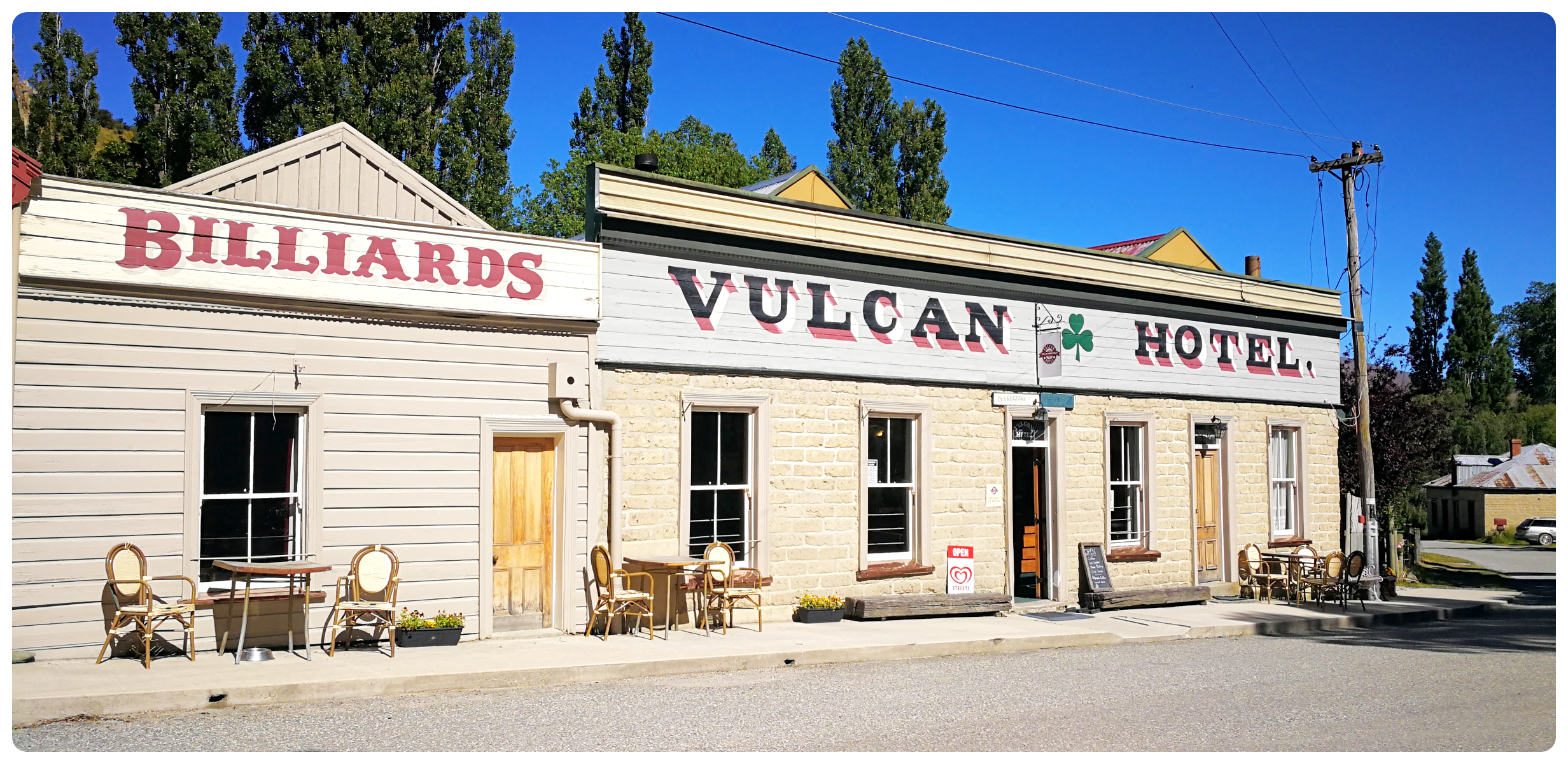
the iconic Vulcan Hotel
It was originally built from iron but was reclad with the sun-baked bricks that we see today. The adjoining small pool room was erected in the 1960s.
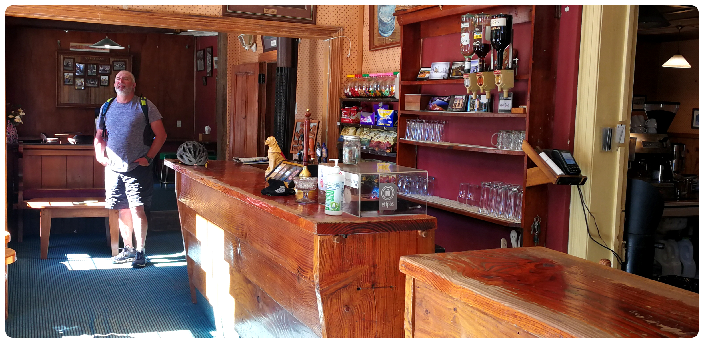
‘The Rose’ stayed quite elusive while we were there
There have been many reports of overnight guests experiencing a ‘presence’ of the resident ghost who seems to hang around Room One. Nicknamed ‘The Rose’, it is thought that it is the ghost of a prostitute who was strangled in the room more than a century ago.
loved this photo on the wall of the Vulcan Hotel showing the depth of Blue Lake, before it became a lake!
We did call in for a lovely coffee and later for a cold bevvy. Although we did not feel any ghostly presence, we did sit there and soak up the ambience that can only be gleaned from most of these historic pubs. There are plenty of photos on the walls of days gone by which helps paint the picture of what the town was like in its hey-day.
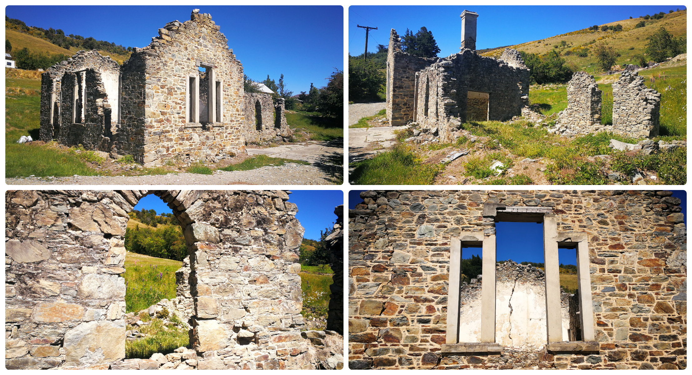
Old School Ruins
Always a sucker for old stone ruins, we walked up to where the old school stood. Constructed in 1875, it had to be extended in 1885 to cope with an increasing role.
the beautiful ruins of what was once the school
Unfortunately, huge cracks appeared in the building after a severe earthquake in 1943, forcing the school to close. Classes resumed in the Post Office building until 1949.
Sadly it is past its prime and I doubt that no amount of restoration will ever be enough to bring this piece of history to life again.
Our Walking Tour Continued
There were many more fabulous buildings to discover as we continued our self-guided tour through the township. These included a couple of churches and cemeteries.
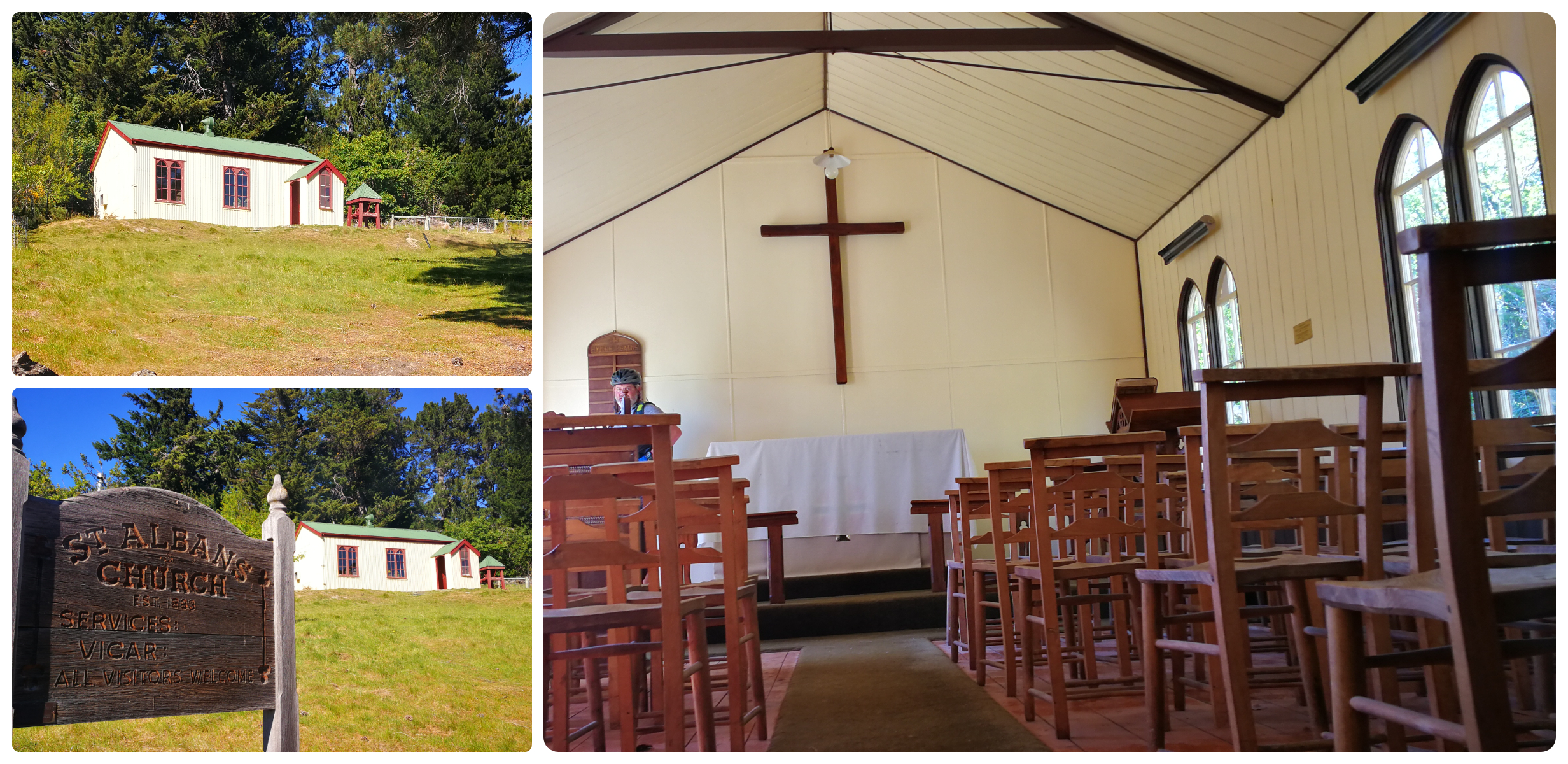
St Albans was the first prefabricated building in NZ, erected in 1883
Our walking map and stories depicted life for the occupants of these dwellings and buildings.
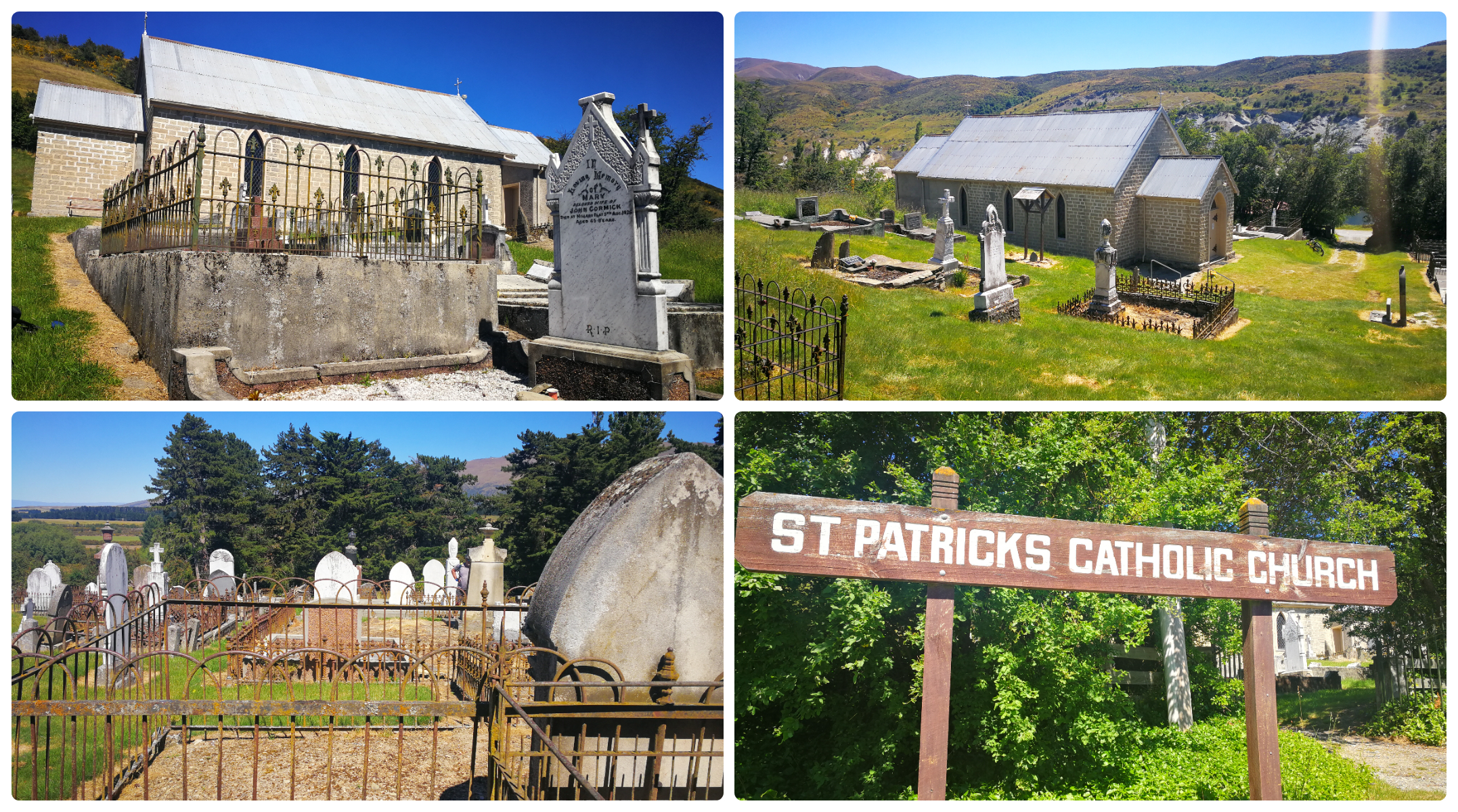
St Patricks Church and its own ‘Catholics Only’ Cemetery
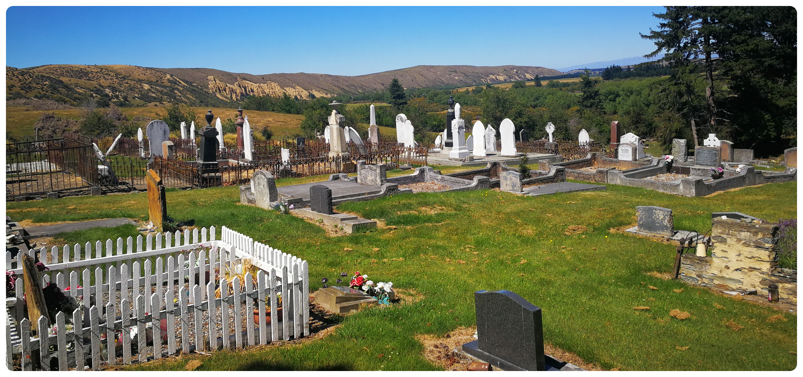
the Public Cemetery for the ‘Non-Catholics’ is placed a wee way out of town
Time seems to have stood still in this small town and it took little imagination to picture the numerous stores, banks, blacksmiths and hotels with their dancing girls, and hundreds of diggers here in its hey-day.
we finished off our tour around the town with a ride up to the lookout over the Blue Lake
Cambrian(s)
Just 6km from St Bathans is the little settlement of Crambian(s). I don’t think I’ve visited somewhere which is known by so many different names.
It is debatable as to whether it has the (s) on the end so I have bracketed it to cover both bases. Google maps and some literature have the (s) on the end but all the road signs (and locals) don’t. It was also known as Welshman’s Gully (a lot of Welsh miners worked the area), and Four Mile (the distance from St Bathans). Cambrian(s) has also earnt the name of ‘The Village of Trees’, which becomes obvious closer to the old settlement.
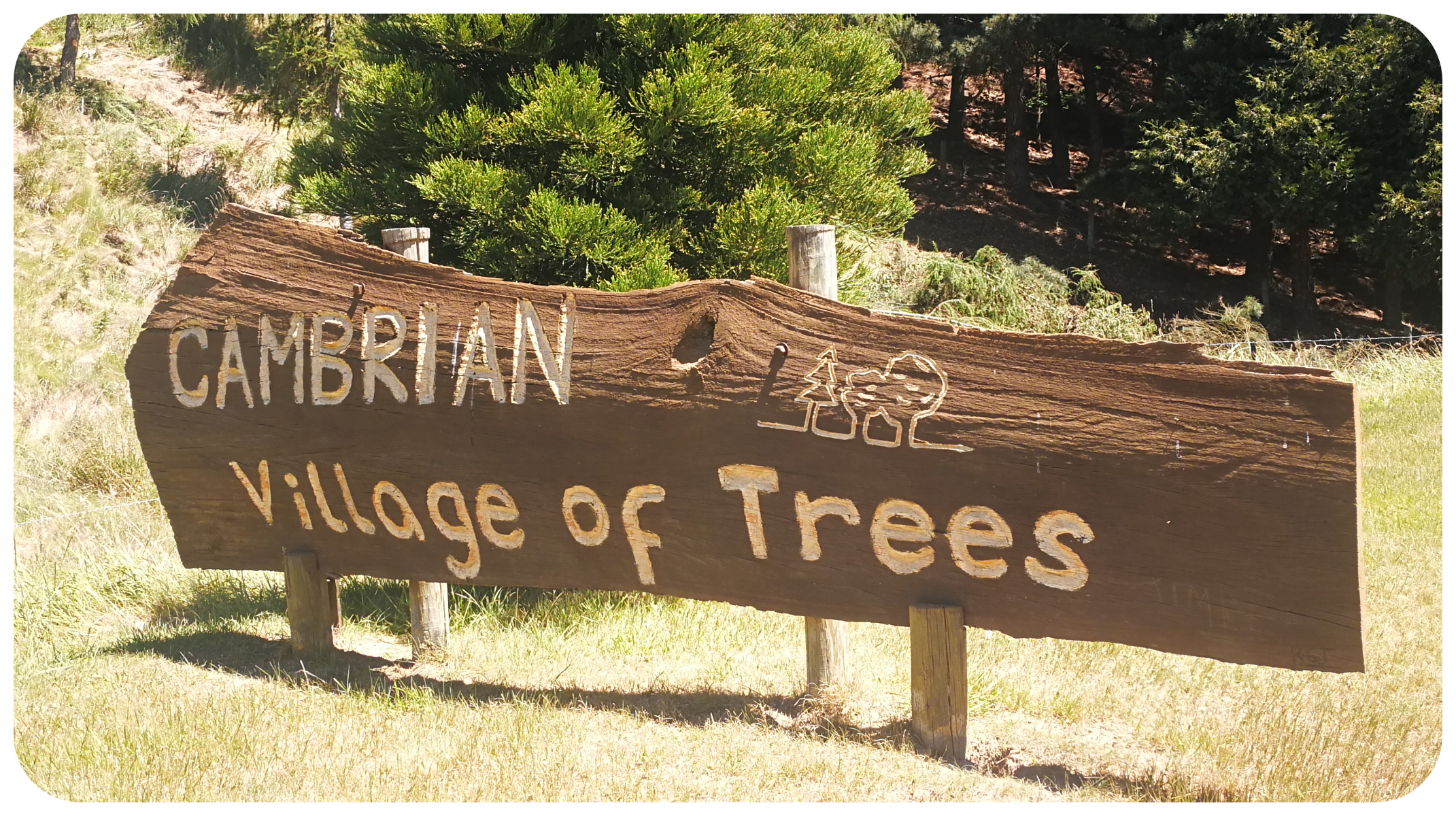
Welcome to the Village of Trees
History
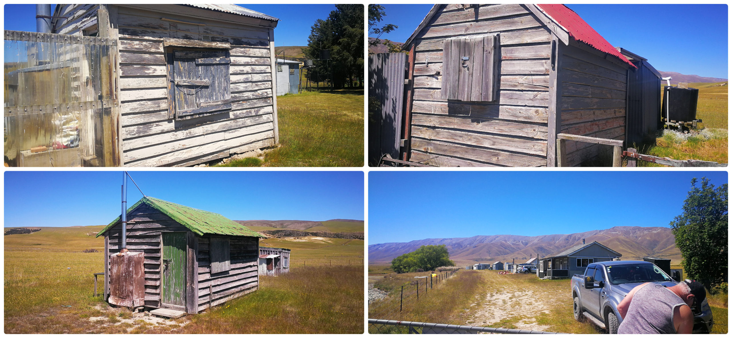
The town was originally settled by Welsh gold and coal miners in 1863, around the same time as St Bathans. Very little evidence of the once-bustling town remains. There is a collection of original mud-brick cottages dotted along the road, now privately owned.
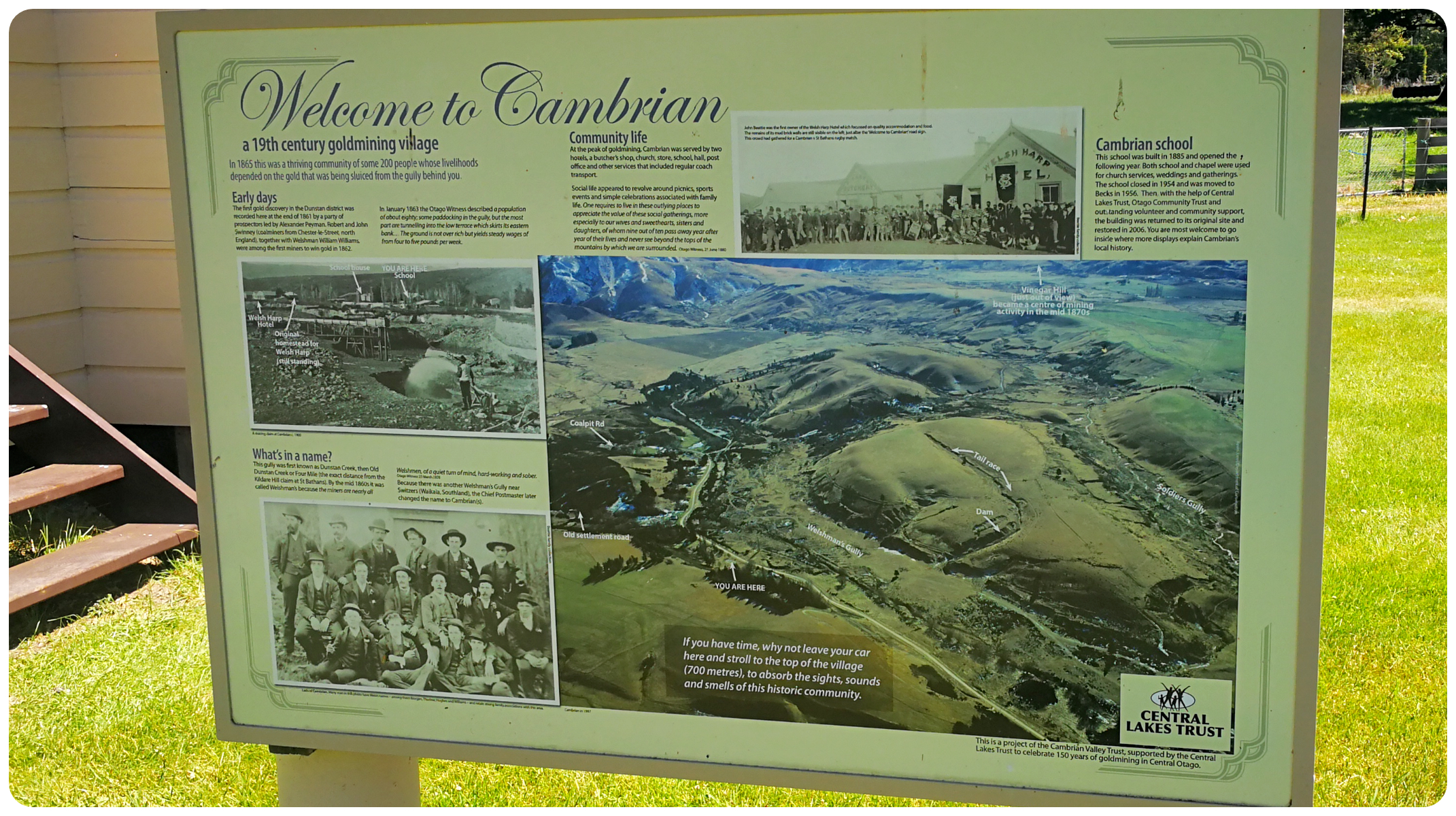
A great history board depicts the layout of the land way back in Cambrian’s heyday
Records show that there were around 200 miners who made Cambrian(s) their home. The town then consisted of a hotel, two stores, a church and a school.
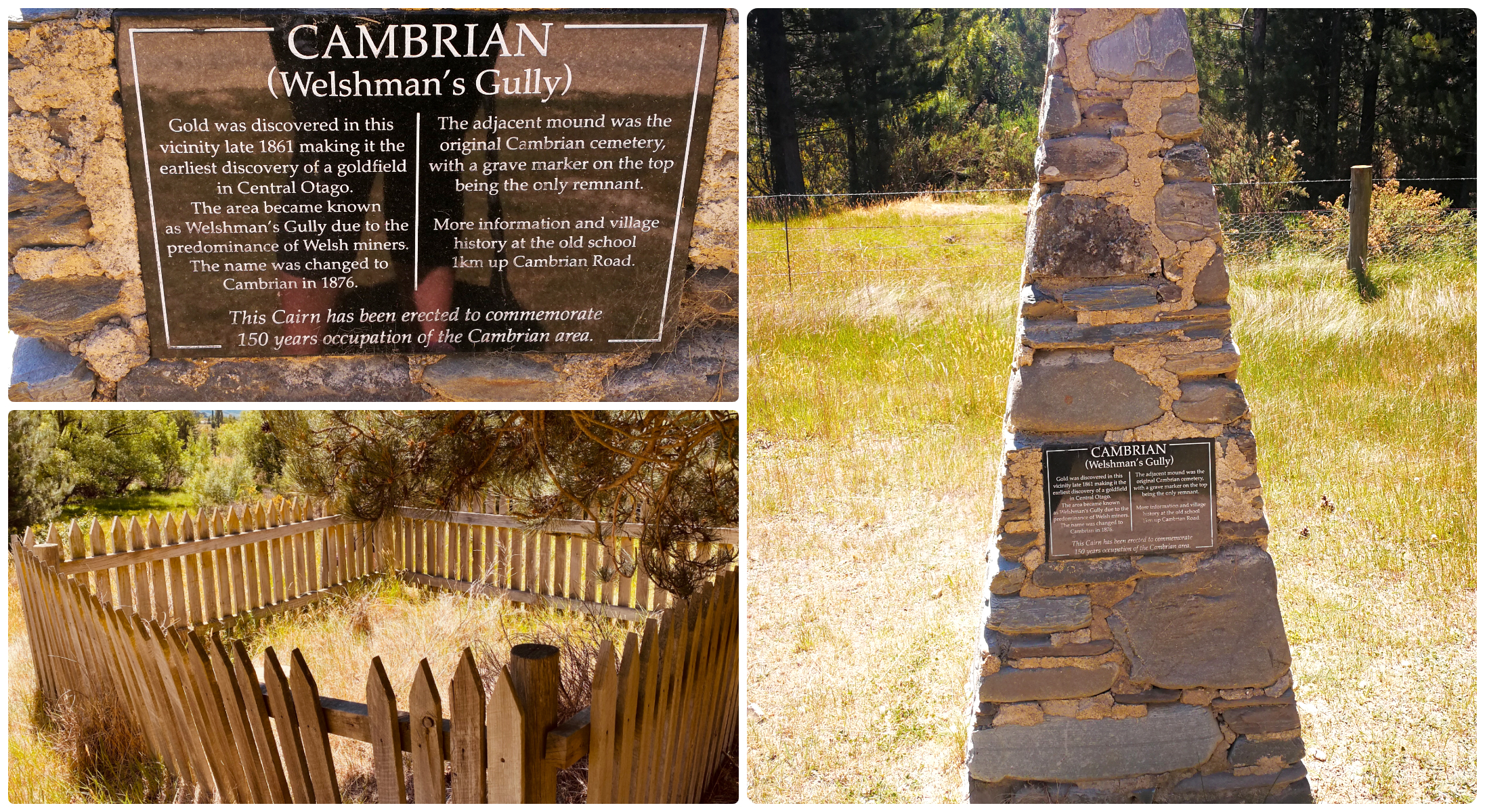
a small monument and a single fenced gravesite are all that is left of the cemetery. Bodies were exhumed and moved to St Bathans Public Cemetery to make room for mining.
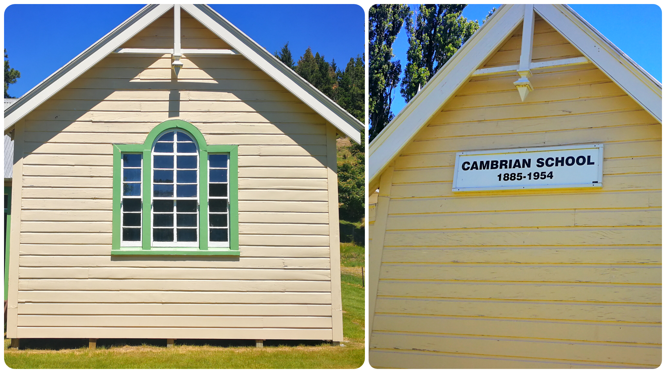
Cambrian School
We stopped off at the Cambrian School. The restored school building first opened in 1885 and contains a large number of pictures and copies of historical documents relating to this 1880s gold mining town.
Certainly worth a stop to look through the old schoolhouse
You can easily spend quite some time fossicking through all the information on display. I loved the line up of the old school desks, books, school bags and pianos. It just felt like the children could be coming through the door any minute to start their day’s lessons.
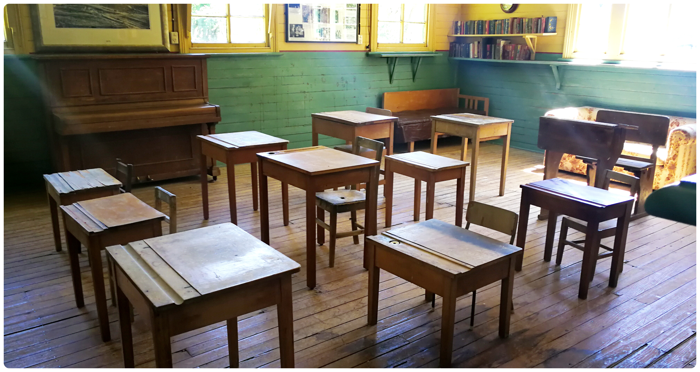
desks lined up ready for the day’s lessons
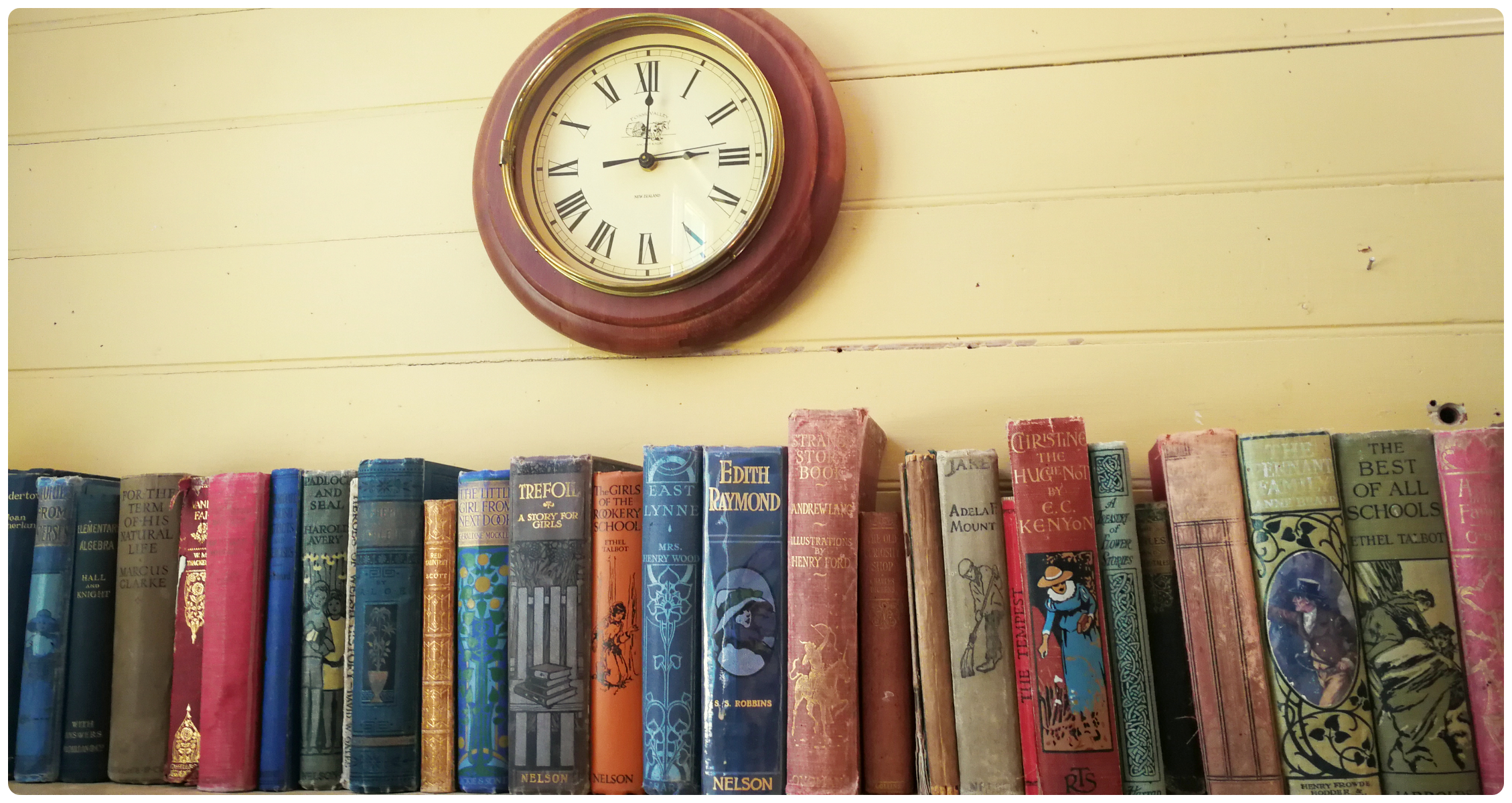
According to the clock, it’s hometime!
this bag must be able to tell some stories
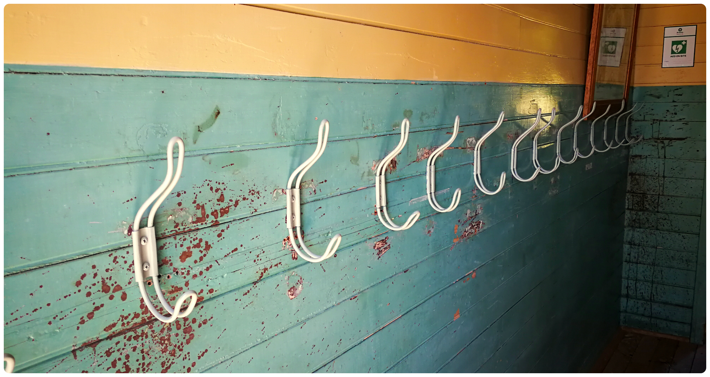
do you remember the school cloakrooms?
We’re so lucky that locals have the passion to keep these memories alive and maintain special places like this.
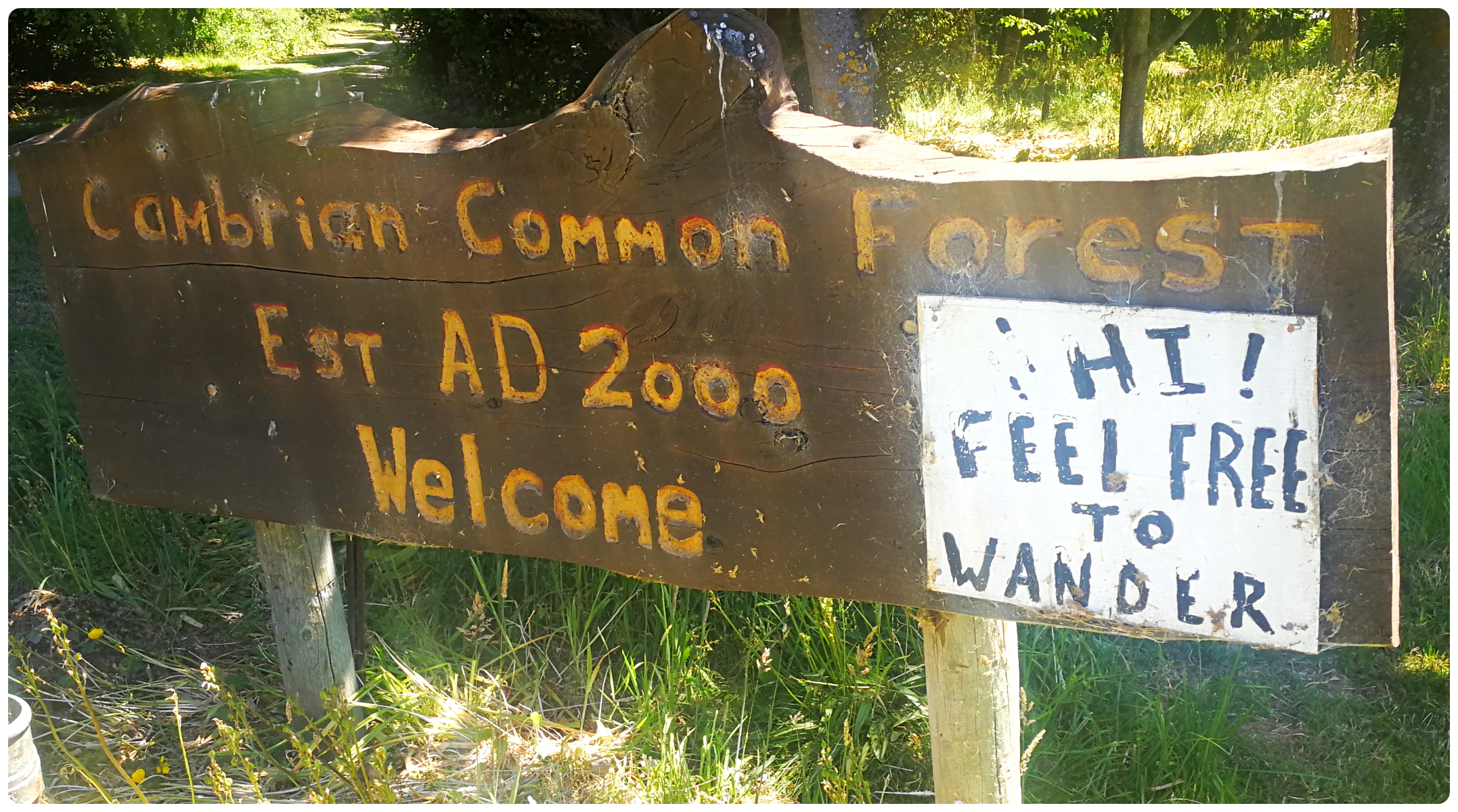
Cambrian Common Forest
This small unassuming settlement can boast some pretty famous names. We drove past the gatepost of artist Grahame Sydney (love his paintings!), the residence of former All Black captain Anton Oliver until we reached the Common Forest and the home of Bob Berry.
a labour of love for Bob
Bob, one of the region’s longest-term resident, was responsible for the planting and his cottage sits opposite, behind the sign “beware of the hug”.
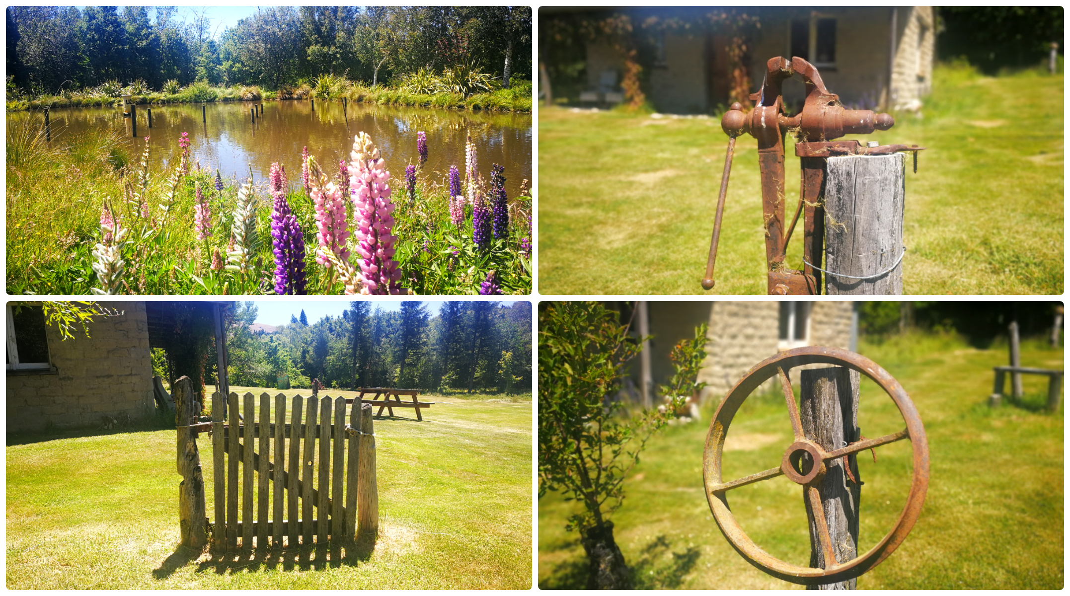
such beautiful and peaceful grounds
It was very peaceful and serene as we wandered the freshly mown lawn which surrounds yet another historic cottage, overlooking a tranquil pond.
The former teacher started planting here in 1980. His goal, to help Cambrian become the “Village of Trees”. I think that he is well on his way to achieving this.
relics hidden in the trees as we wandered further up the road
Homestead Camp
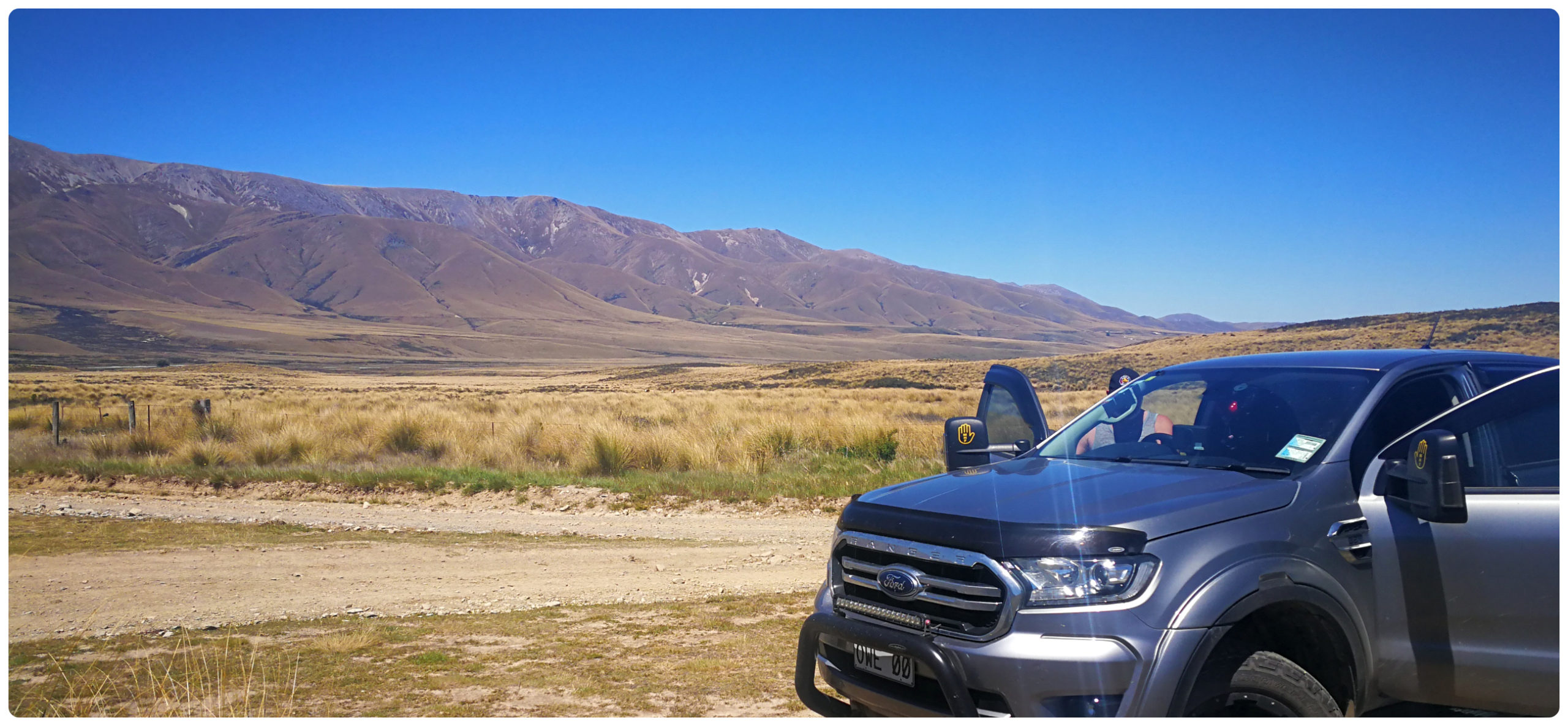
We had been researching the access road into Homestead Campsite to decide if it was viable to tow the caravan in there for a couple of nights.
As usual, there were quite a few different opinions on whether it was doable so if in doubt, take the ute in there first.
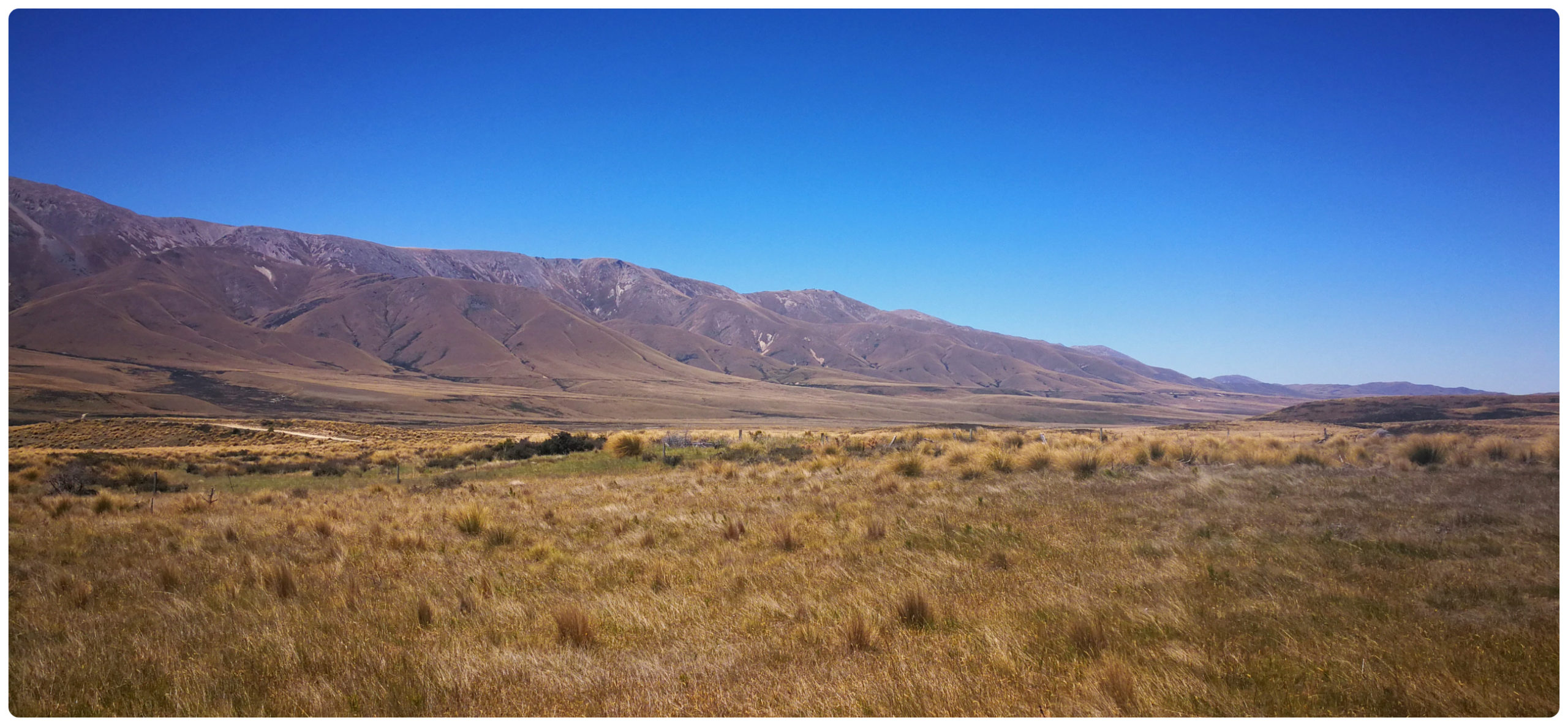
the views along the straight dusty roads were breathtaking
It is approximately a 30-minute drive (28 mins) from St Bathans, pretty much on dusty gravel roads.
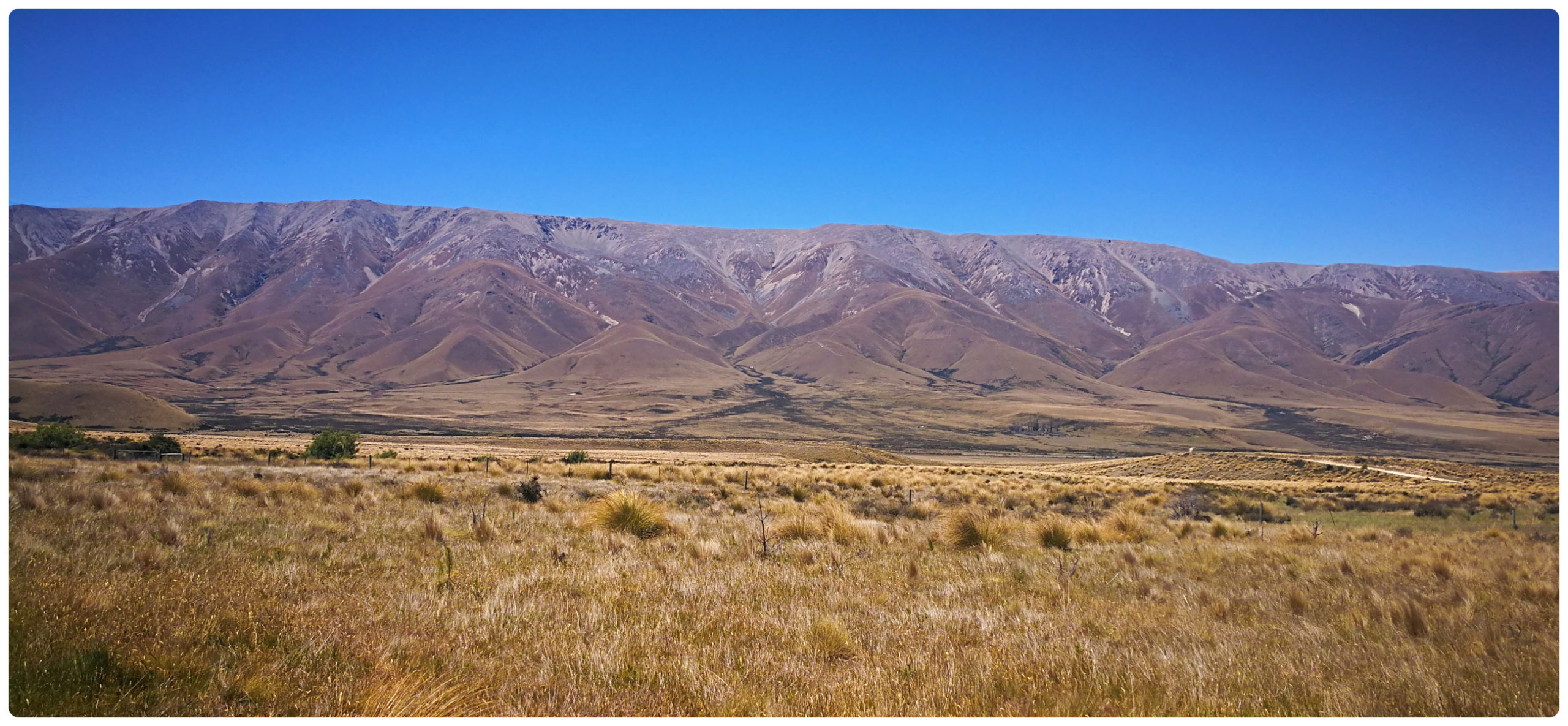
This is a basic campsite and is located in the Oteake Conservation Area. The isolated campsite is the ideal base for mountain biking, hunting, fishing and tramping in the nearby St Bathans and Hawkdun Ranges.
although exposed, the campsite offers spectacular mountain range views.
The road in stretches in a long straight line, as far as the eye can see.
The rolling mountains, soared skywards and I can imagine it would be absolutely breathtaking in the winter months when they would be layered in snow.
The camp area is exposed during windy conditions as the large plains offer little protection from the winds that funnel down.
Access
Access would certainly be doable towing our caravan. Yes, there is a ford to cross which would be weather dependent and something to take into account with a low vehicle.
We decided to carry on to do the loop around, travelling along Home Hills Runs Road, encompassing Falls Dam.
Scroll in and out on the map below to follow our route back to St Bathans Domain.
Falls Dam
Home Hills Runs Road
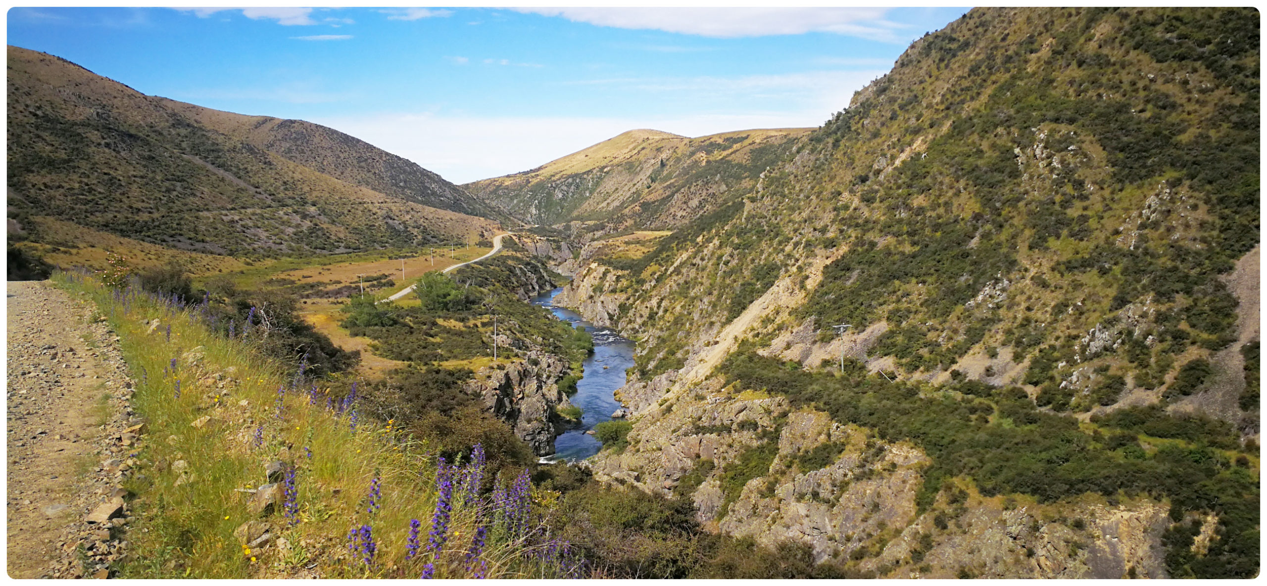
There are two parts to our trip into Falls Dam. Firstly we traversed Home Hills Runs Road from the Homestead Campsite. There were 3 fords to cross so it’s not a road I would recommend for low vehicles. They were manageable due to lower rainfall so I can understand why the road is often closed during the winter months. We passed a bridge that had been partly washed away so there’s certainly some serious water that passes through the Manuherikia River, which feeds the Falls Dam.
the tussocks, the mountain range and the blue sky…..an artists heaven I’m sure!
Manuherikia River
This river also provided much-needed water for the gold mining operations throughout the greater area. A massive water race was constructed early on in the gold rush days. One of the longest water races in NZ still provides precious water for irrigation in and around the Maniototo area.
The scenery and structures along the way, features in many paintings, including Grahame Sydney. I can certainly see the attraction for artists to replicate the beautiful backdrop for some of these cribs and barn buildings. The Hawkdun Range making a jaw-dropping backdrop for some pretty amazing scenery.
so many ‘wow’ moments as we traversed the valley floor
There were a few gates to open and close as Home Hills Runs Road traverses the farm station it is named after.
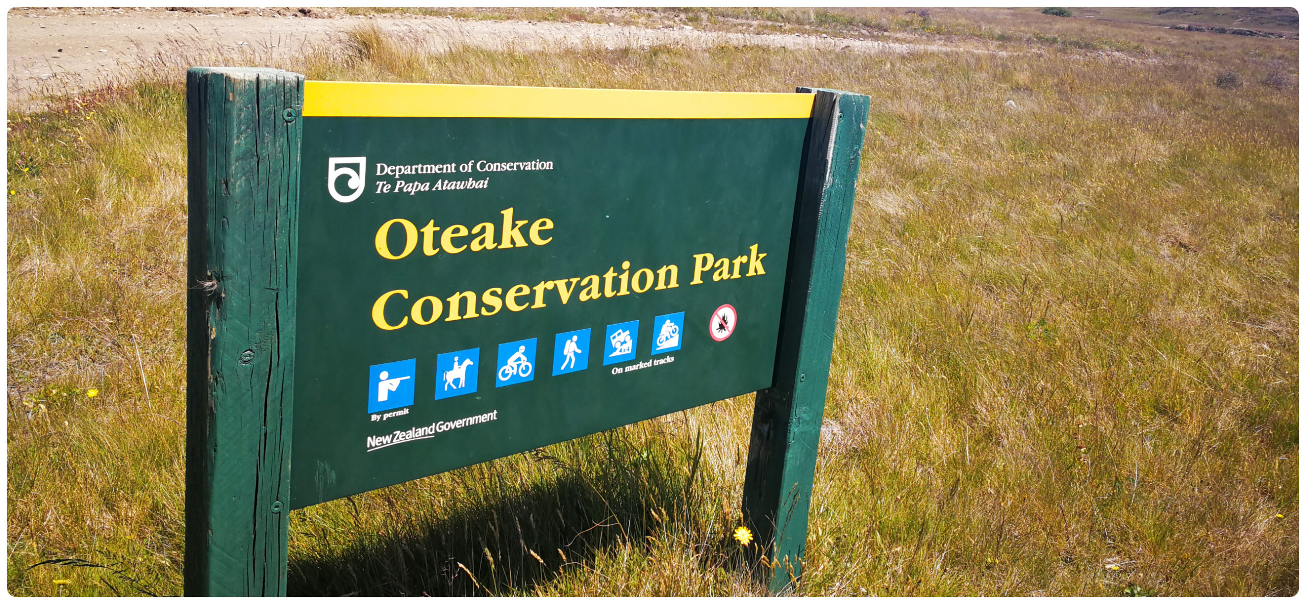
Oteake Conservation Park
We then entered the Oteake Conservation Park which is a massive 65,000-hectare playground with tracks galore for trampers, 4WD enthusiasts and mountain bikers to enjoy during the summer months.
the massive playground of the Oteake Conservation Park
A side road took us to the shores of the lake which has been formed due to the building of the dam. There are a handful of fisherman’s cribs dotted along the shoreline which has obviously been here for many years.
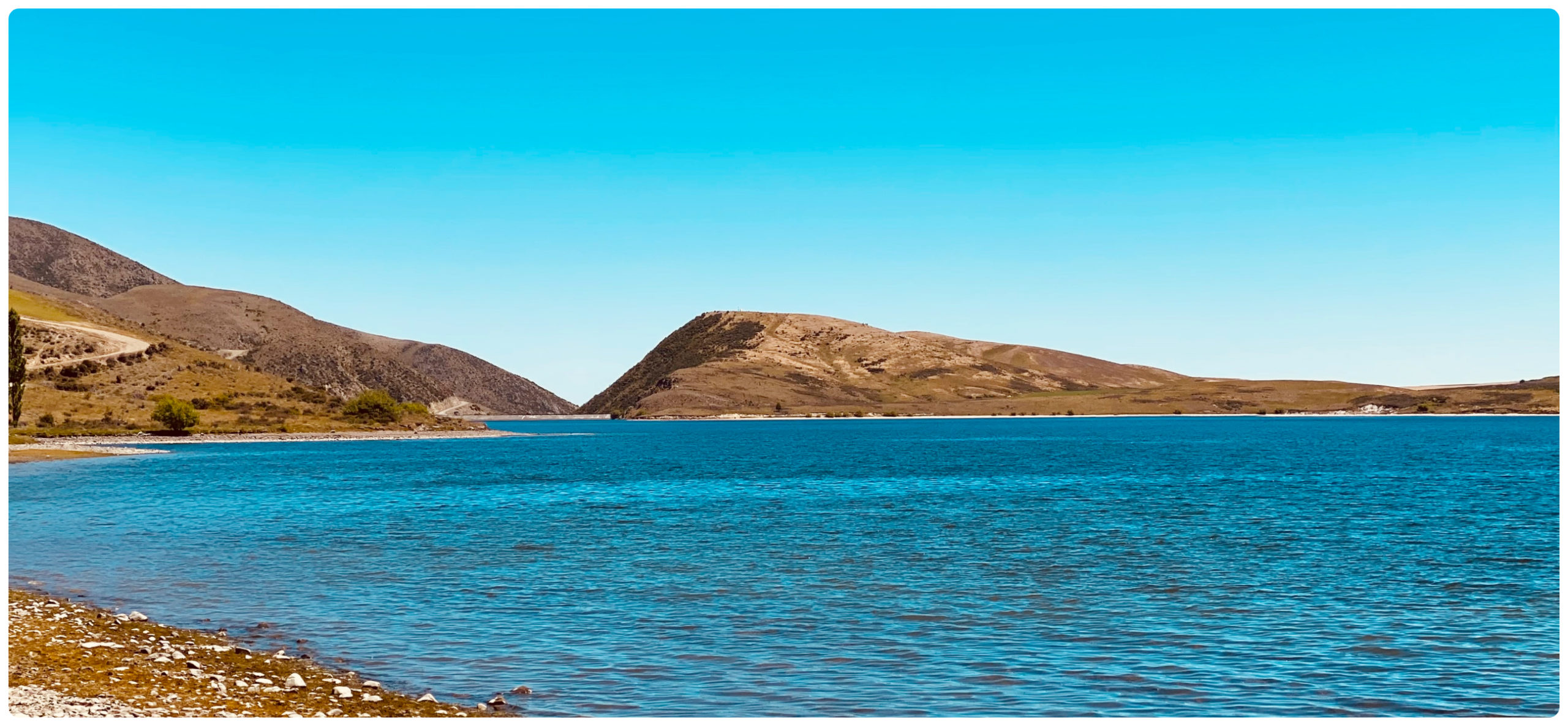
the lake formed by Falls Dam is like an oasis in the barren tussock land – the dam face off in the distance in the valley of the hills
I have to say, “what a spot”! The expansive water stretching out amongst the parched, tussock dotted landscape looked very much like an oasis in the desert.
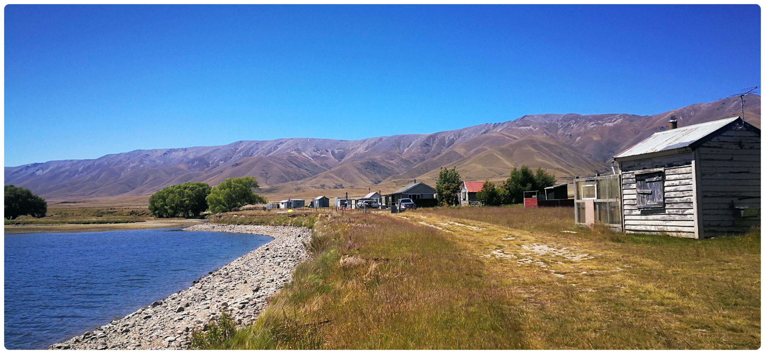
there are a few lucky fishing crib owners dotted along the lakeshore
the basic but adequate cribs provide the fishermen with shelter and a few home comforts
a chance to stretch our legs
The Dam
The actual Falls Dam is situated on Loop Road, 10km east of St Bathans. Keep a lookout for the sign Fiddlers Flat Road, which takes you to the dam wall. If you don’t want to do the entire loop, then this is an excellent trip from St Bathans. The road is just as scenic with the Hawkdun Ranges as a backdrop.
the road into the dam follows the river along the valley floor
The power-house was opened in 1935 during the depression years, to provide irrigation and power.
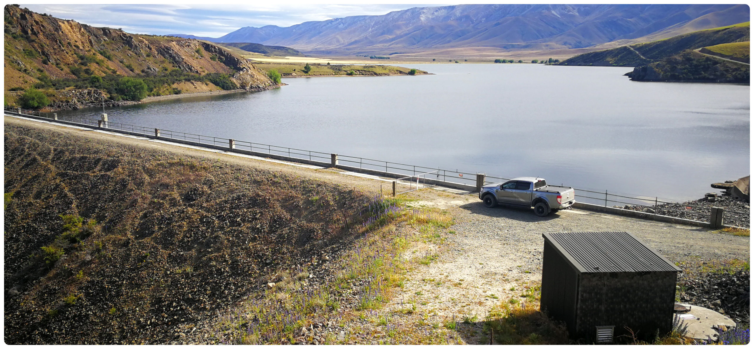
the rockfill dam
The decision was made to construct a gravity dam using rockfill. There were two reasons for this. Firstly it would require more manpower than a concrete dam, something the government were keen on doing seem the country was in the heart of the Depression Years. Secondly, there was a possible future raising of the dam to provide more storage. A rockfill dam could still be raised if required. A concrete face was built on the upstream wall.
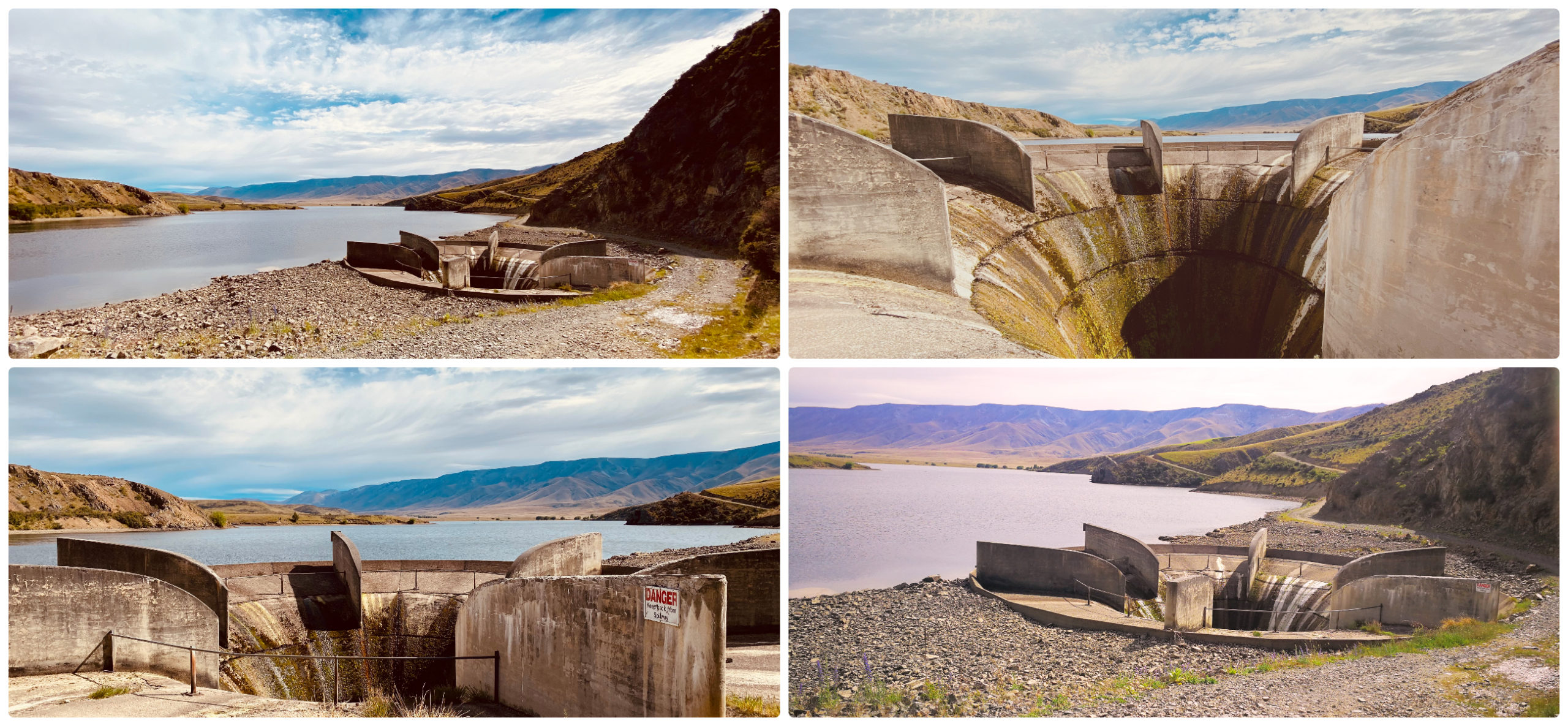
the ‘glory hole’ is like a large plughole in a sink
The circular concrete spillway was constructed and a vertical shaft. This was to be nicknamed ‘Glory Hole’ and acts a lot like the drain in a sink. When water gets too high it spills into the drain to prevent overflow.
The construction of the dam started after the completion of Poolburn and Idaburn Dams.
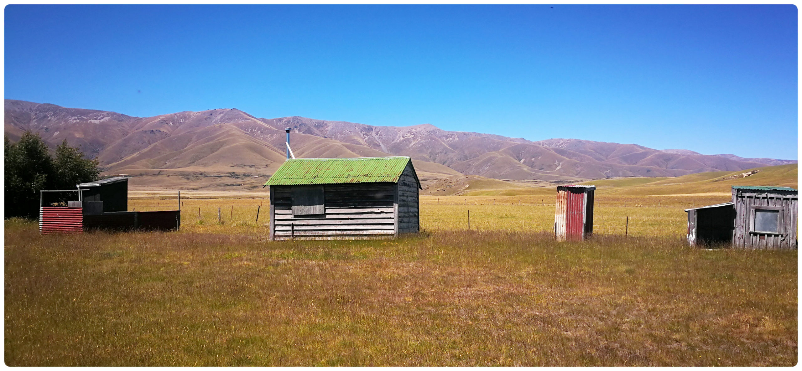
Workmen’s Camp
The working gangs of men were housed in a tent city on the flats close to the dam. These tents were an ‘upscaled’ version of previous working camps as they had wooden floors. There was also accommodation for married workers (lucky wives – NOT).
There was also a cookhouse and post office established for the workers.
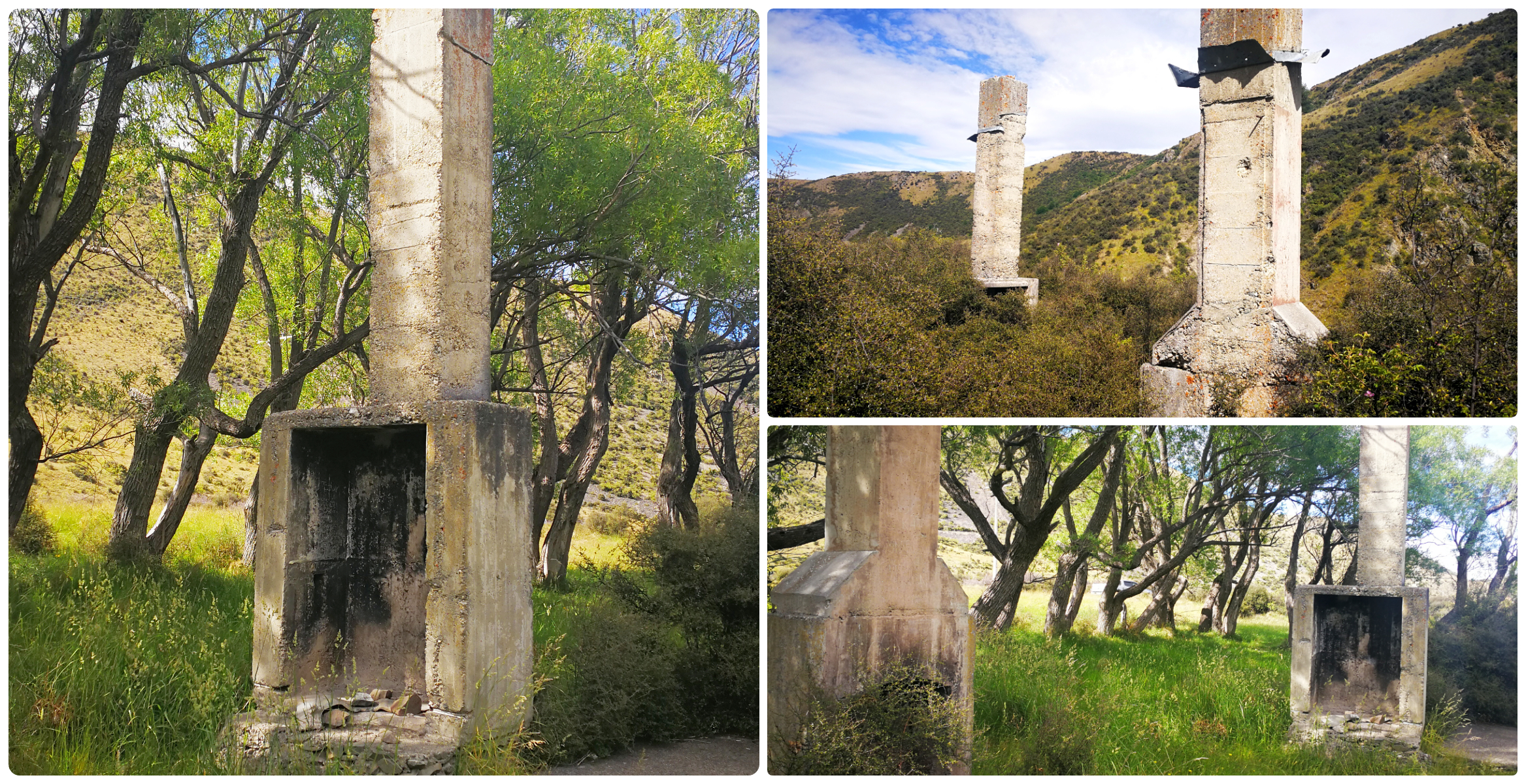
the chimneys are all that remains of the work camp
All that remains are some of the foundations and chimneys of a couple of houses built close to the edge of the cliff overlooking the river below.
Pioneer Generation
In 2003, Pioneer Generation completed the installation of a small hydroelectric station at the dam. The generator uses the water which is surplus to irrigation and also the discharge from the dam for irrigation schemes on the Manuherikia River.
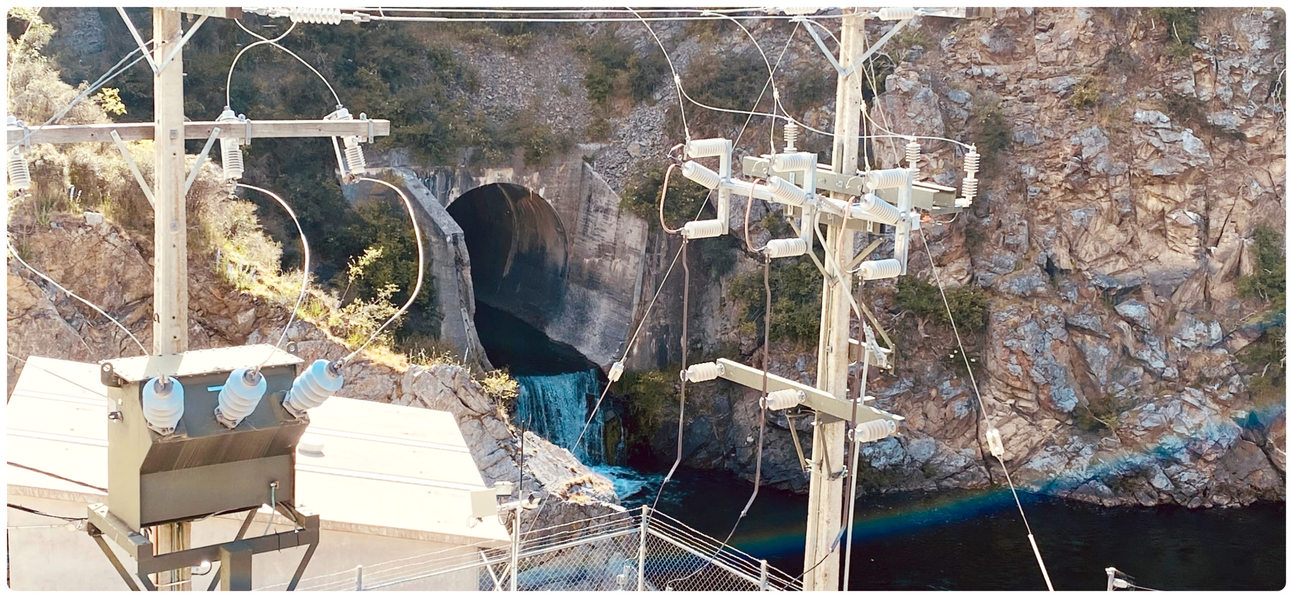
the modern-day power station now sits on the lower side of the dam
Summary
Our three-night stay at St Bathans Domain did the area justice. It gave us time to fully explore the town and it’s surrounding areas.
It is a place that epitomises the gold rush days that is such a big part of Central Otago’s history.
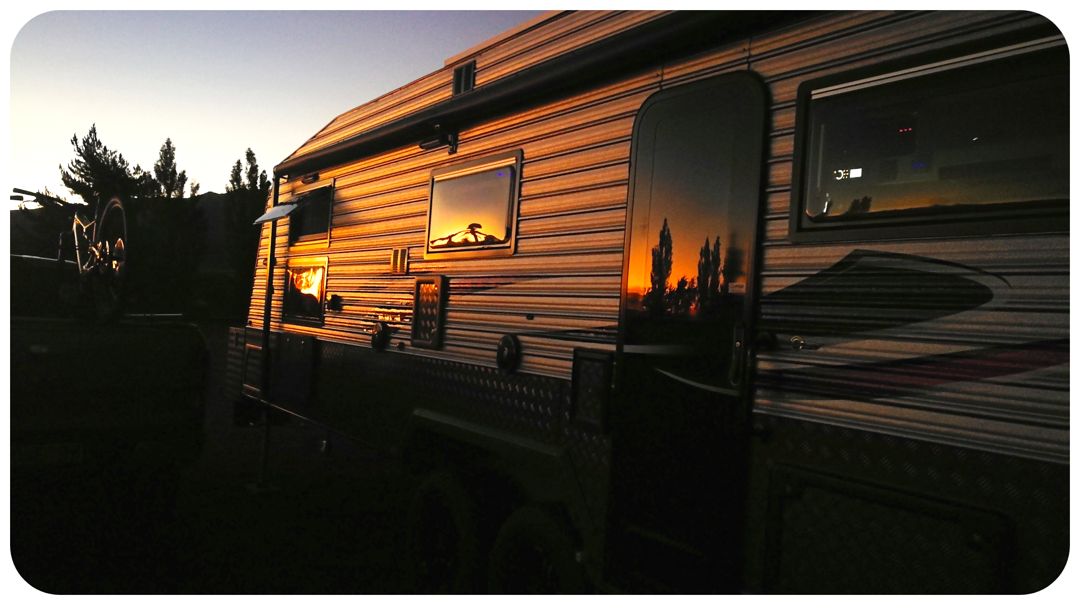
we were treated to some pretty amazing sunsets
Click on the link below to see a video of our highlights while staying in St Bathans.
Thanks Linda. Another really interesting blog post read and photos.
Plus the video was great too!
Thank you!
Great following your journey, we are about to purchase a true 4wd to be able to explore further. Just a heads up Home Hills Run Road to Homestead Campsite is currently undriveable, it got washed out mid Jan with the big storm that flooded central. Many massive drops, water cut wash outs through the road even made cycling a challenge, requiring bike portage. You can drive with a proper 4wd about as far as the first entrance to the Mt Ida water race walking and cycling track, after that best if you drive in convoy in case a vehicle gets stuck.
Oh thought I’d heard about the washout but wasn’t sure where exactly. We drove that road just before xmas….good timing on our part I’m thinking!
Pingback: Remnant – Exploring Colour