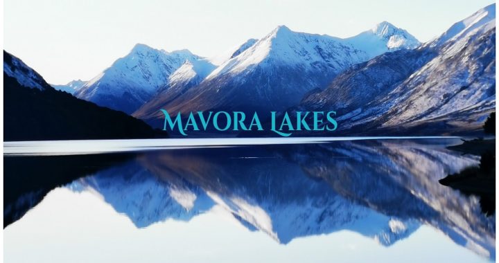
After exploring Milford Road (see the previous blog), we stopped off a Te Anau to decide our next destination. We have been wanting to get to Mavora Lakes for a long time. Located in Southland, Mavora Lakes epitomizes solitude, remoteness yet still easily accessible. It has an impressive landscape of serene lakes, wide-open tussock grasslands and beech forests.
So What is the Road to Mavora Lakes Like?
This is usually the first thing most people ask when Mavora Lakes is mentioned.
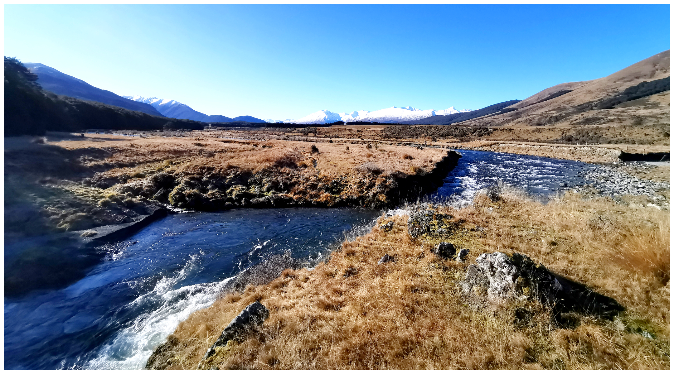
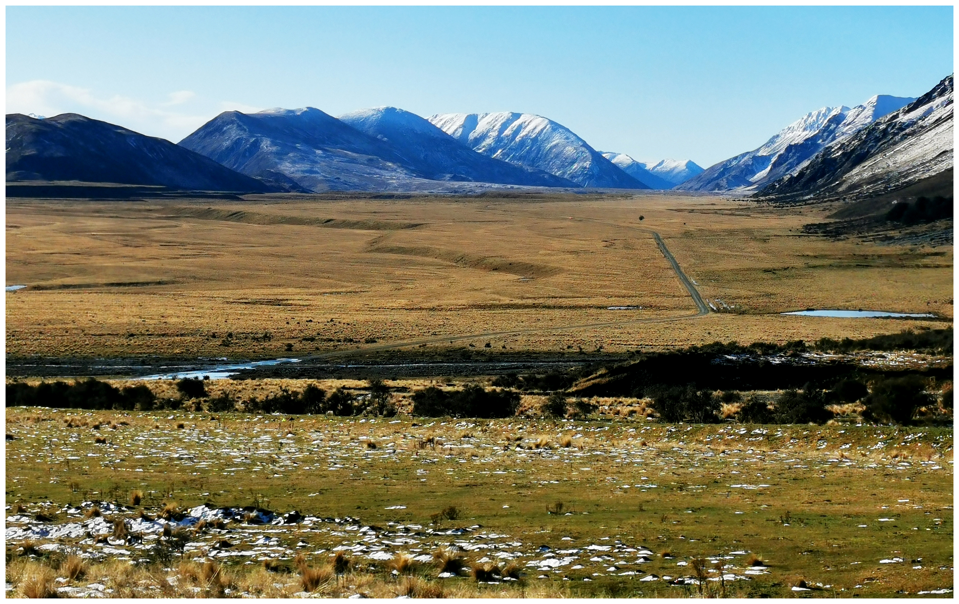
The road in for some reason has some negative comments but we have certainly been on a lot worse. There is approximately 35km of gravel road to get to the start of the DoC Camp (NZMCA#9196). Then there is another 8 km to get to the top of the north lake which is as far as the camping ground goes. From there the only option is by foot, cycle, quad/motorbike or 4×4 along a rough track.
There are two lakes, North and South and a huge DoC Camp hugging the shoreline, including the river that connects the two of them.
There are two turn-off points from SH94 between Mossburn and Te Anau, at Centre Hill or Burwood Station. Although the road is unsealed, it is in good condition and there are not any tight turns or steep hills to negotiate. As with any back-country road, pay attention to your speed and preempt any oncoming traffic (particularly during the summer months). We paid a visit to Mavora Lakes over 20 years ago in a campervan. The road is in a much better condition than it was then. It has also been widened.
be prepared to get either dirty or dusty, depending on the season
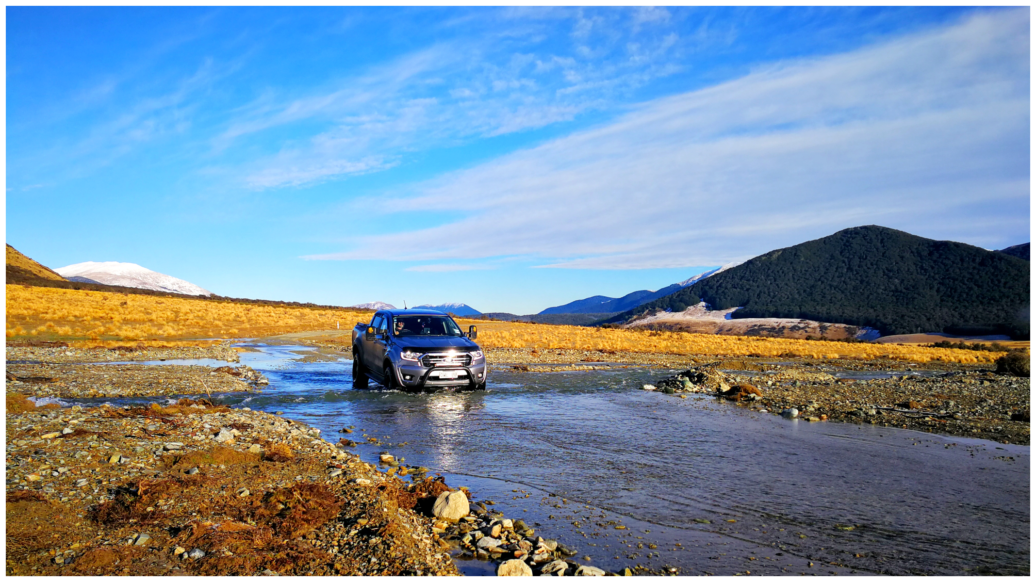
we certainly got ‘down and dirty’
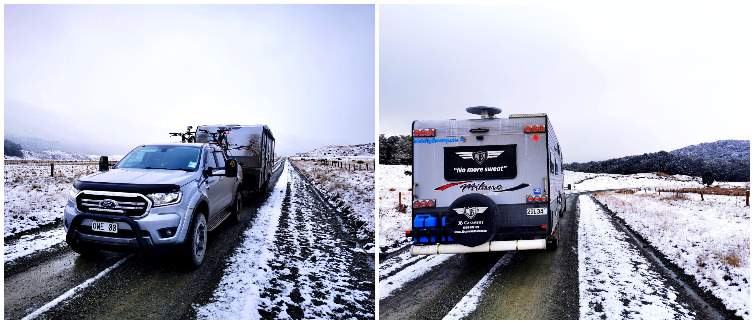
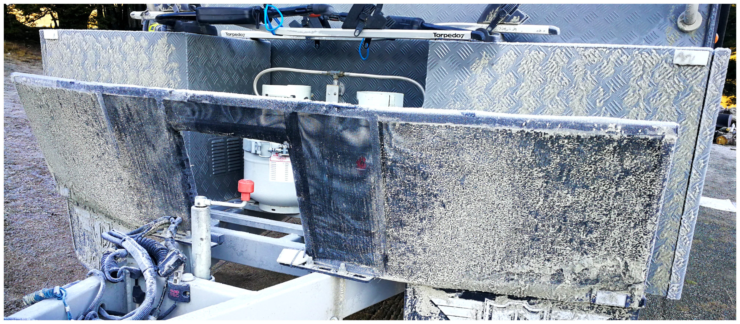
NB: be prepared to get dirty (the vehicle that is). In the winter you will most probably end up having mud and dirt splattered along the sides. In summer, you will have dust sucked into every vent and opening. It’s all part of the adventure.
There Was a Slight Hesitation!
There was quite a bit of discussion with the committee in the car while we were parked on the main road by Mossburn. It was snowing and getting rather heavy. Now I admit that I’m not that experienced when it comes to driving conditions in snow and am rather a nervous passenger in this situation (must be my North Island upbringing!). I stared dismally out the window, wondering if it was going to be a wise decision to travel 40km on a gravel road in heavy snow.
I had to put my trust in my Southern Man. After all, he’s got experience of driving in the Antarctic so surely it can’t be worse than that!
it was like a scene out of a Christmas Card
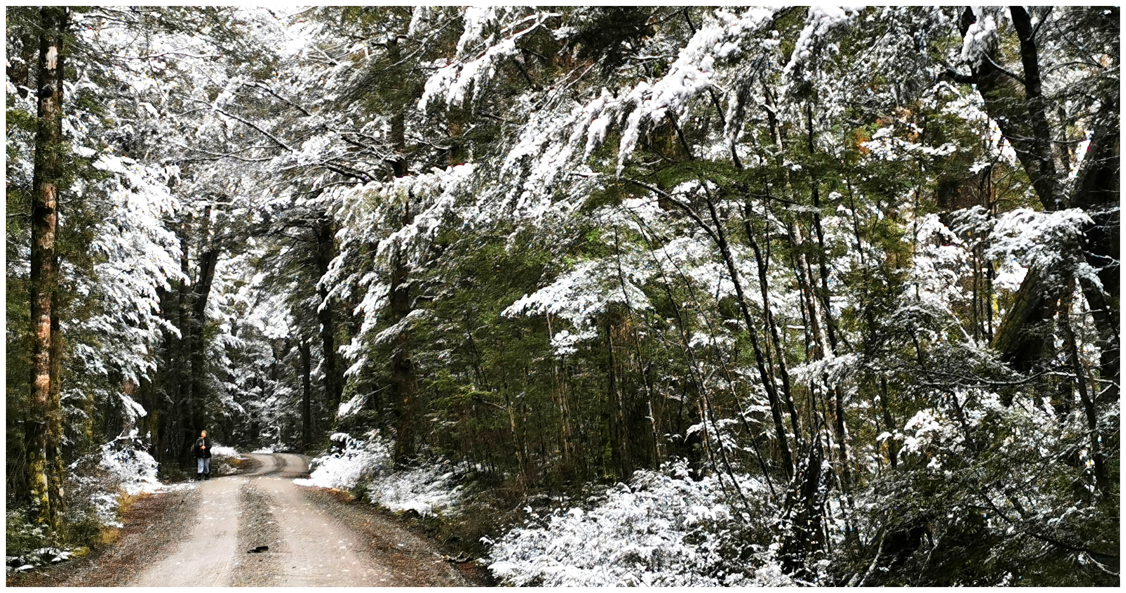
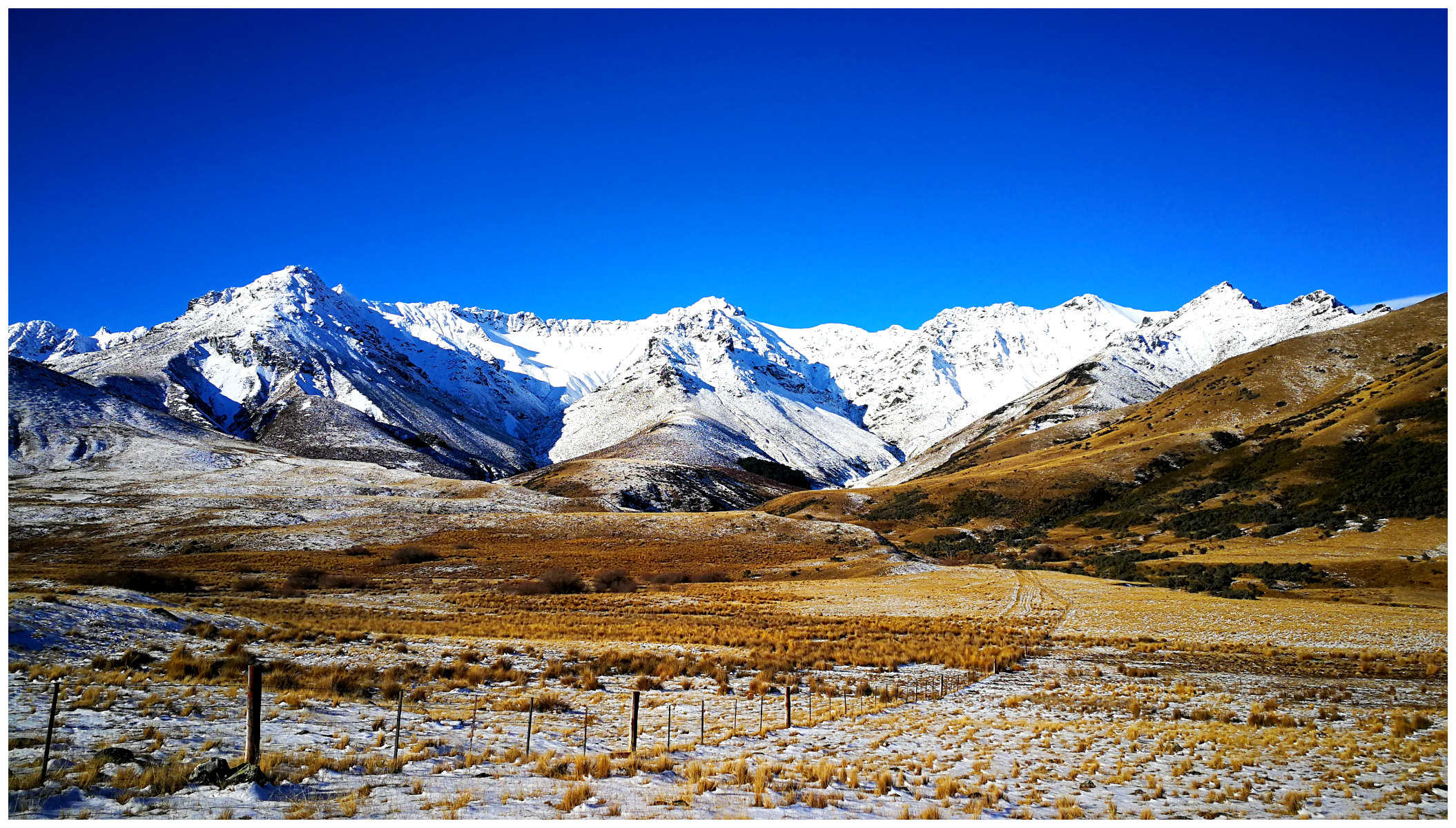
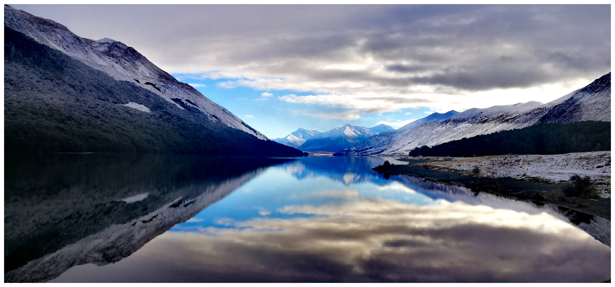
We surveyed the road and saw that there were already track marks on the road and my trusty driver assured me that we would only go as far as the existing tracks go. I’m happy to report that the conditions slowly got better, the further in we travelled. The snow had stopped falling which left us with the most stunning views.
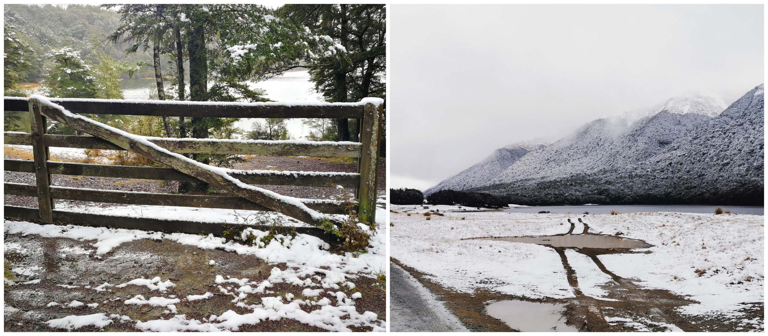
the snow was right down to lake level
The drive into the DoC Camp was decorated in the ‘white stuff’ which gave it such a magical look.
Mavora Lake Campsite
- officially there are 60 sites available but I would suggest there are way more (providing you stick to the formed tracks)
- dogs allowed, on a lead at all times
- Fires should be lit only in the barbecues and fire drums provided. Use dead wood only. Chainsaws are not permitted. The use of portable stoves is encouraged.
- Motorised craft is allowed on the North Mavora Lake only.
- Jet skis are not allowed.
- There are no rubbish bins so it’s pack in, pack out.
- No water available in winter.
- long drop toilets.
- NZMCA DoC Pass can be used or $8pp per night.
Spoilt for Choice
Many campers stop at South Mavora Lake as this is the first one you get to on the drive-in. There are much more open spaces to choose from if you keep going to the end of North Mavora Lake.
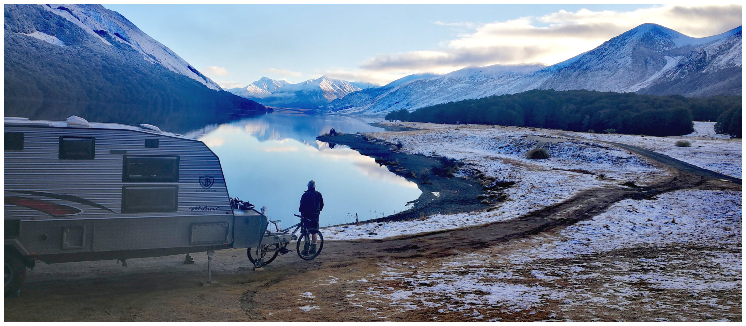
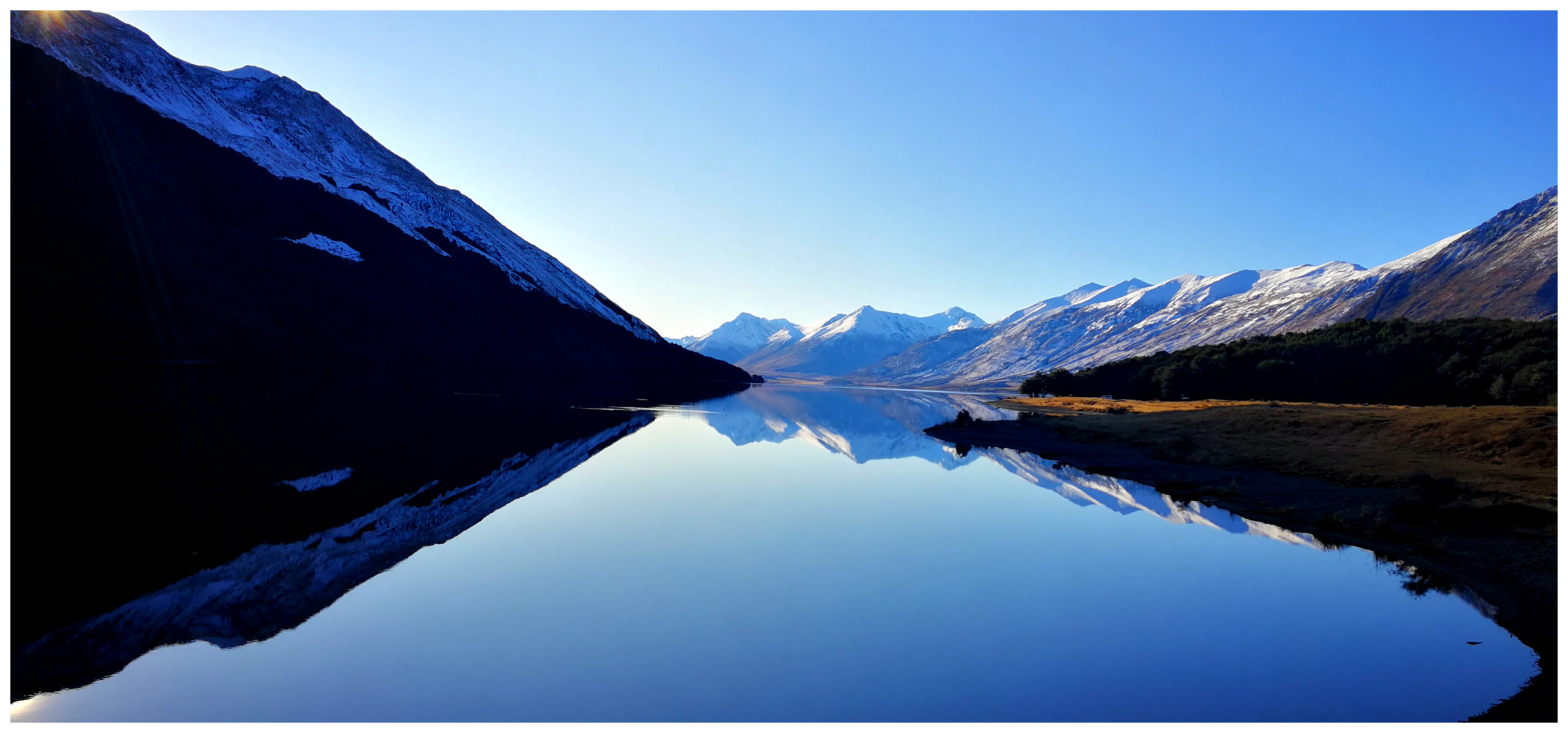
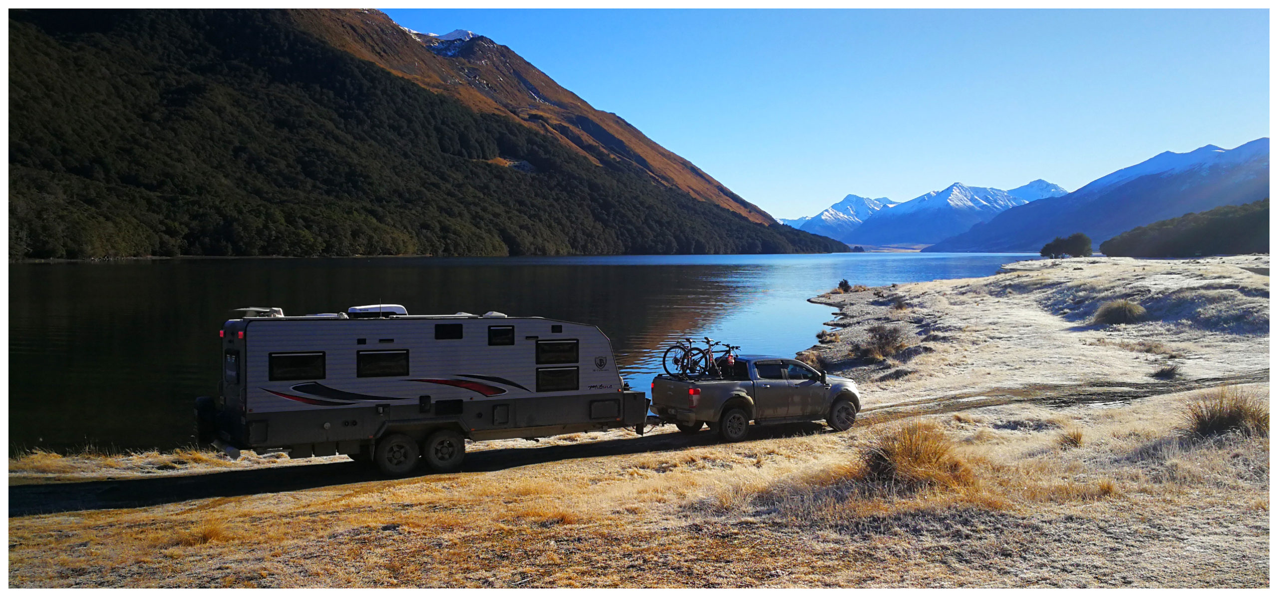
we had grandstand views up the North Mavora Lake
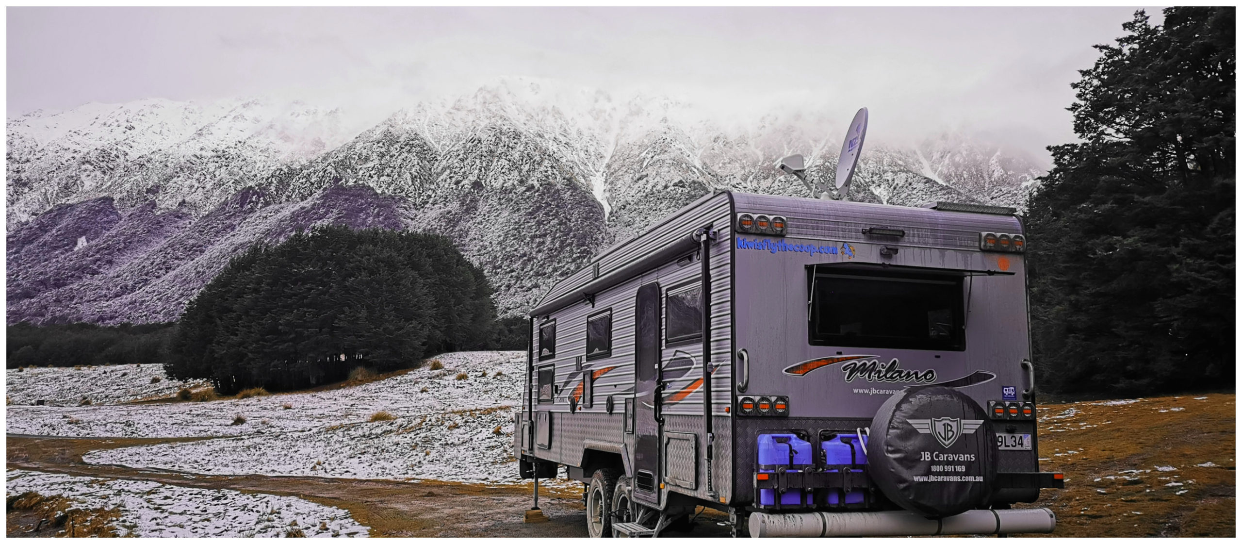
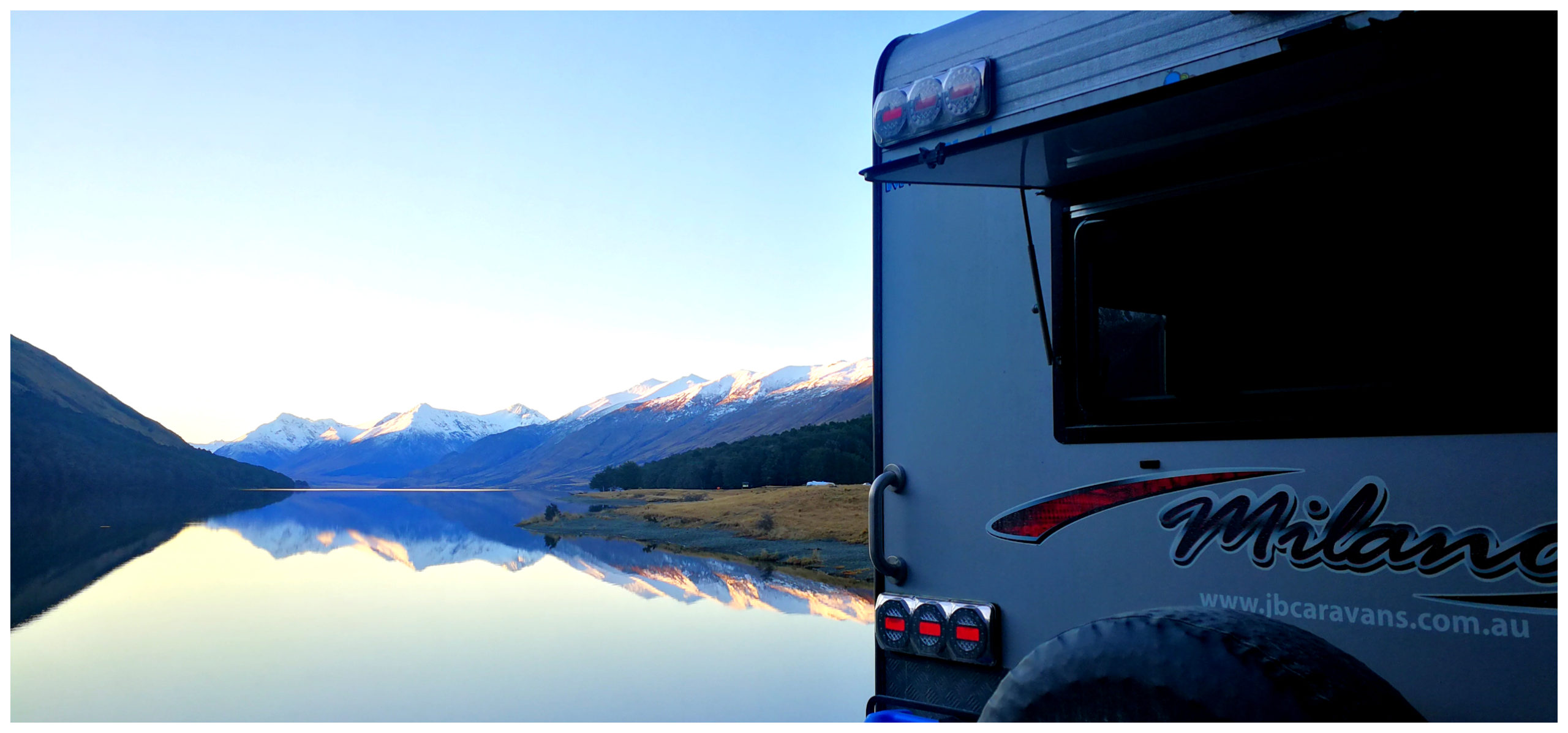
As you can imagine, we were spoilt for choice when it came to camping spots. We had been given a heads up on some good choices so headed to the top of the North Lake and found a lovely spot. We had some southerly winds so decided on getting some shelter from that direction. No matter where you park if you want a view, you are going to be exposed to winds from one or more directions. Yup, you can tuck yourself amongst trees but you forego the most jaw-dropping views.
lake on one side, mountains on the other
A lot of people have mentioned that they have been plagued by sandflies. This is another good reason to visit Mavora Lakes in winter. I think that they were all hibernating and busy reproducing for the summer months. If you visit in the warmer months, you may want to consider camping further away from the lakeside to avoid the worst of them.
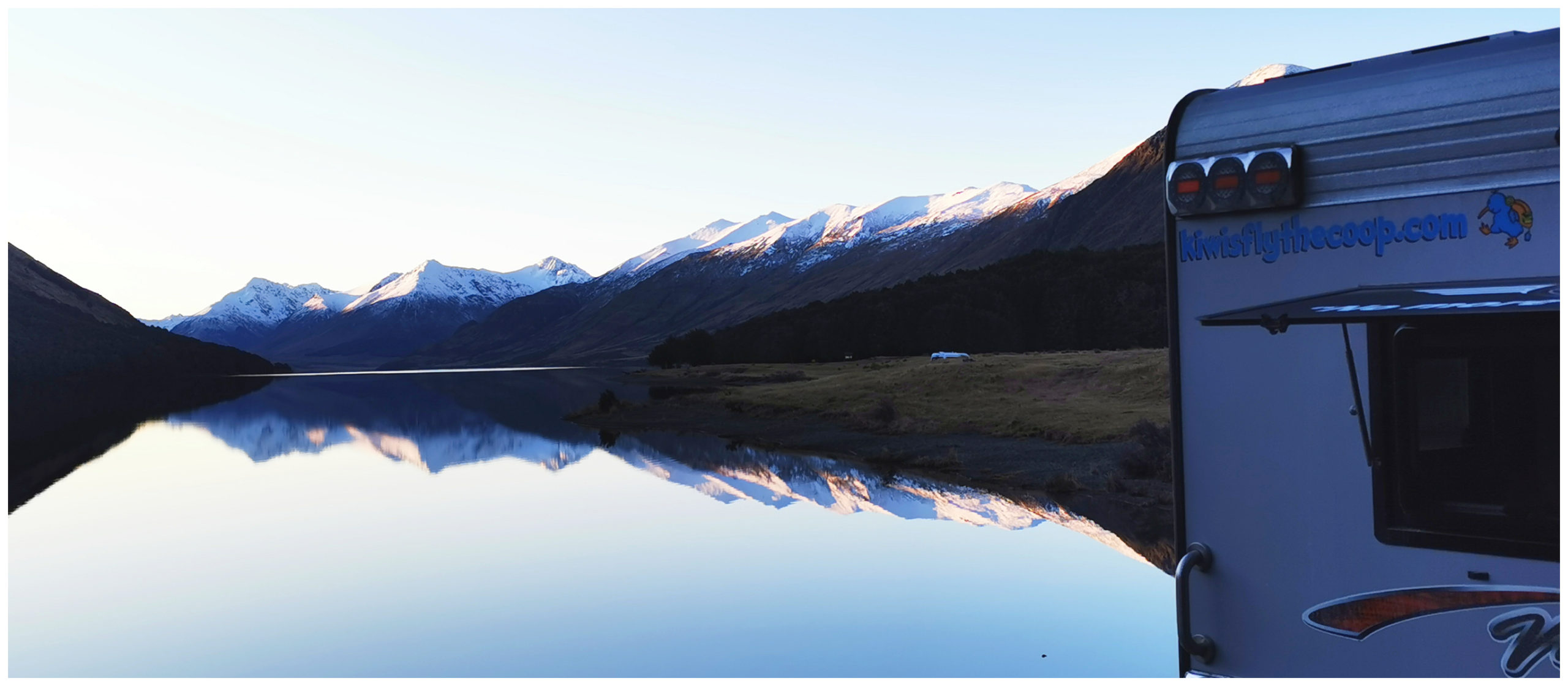
we never got tired of the view
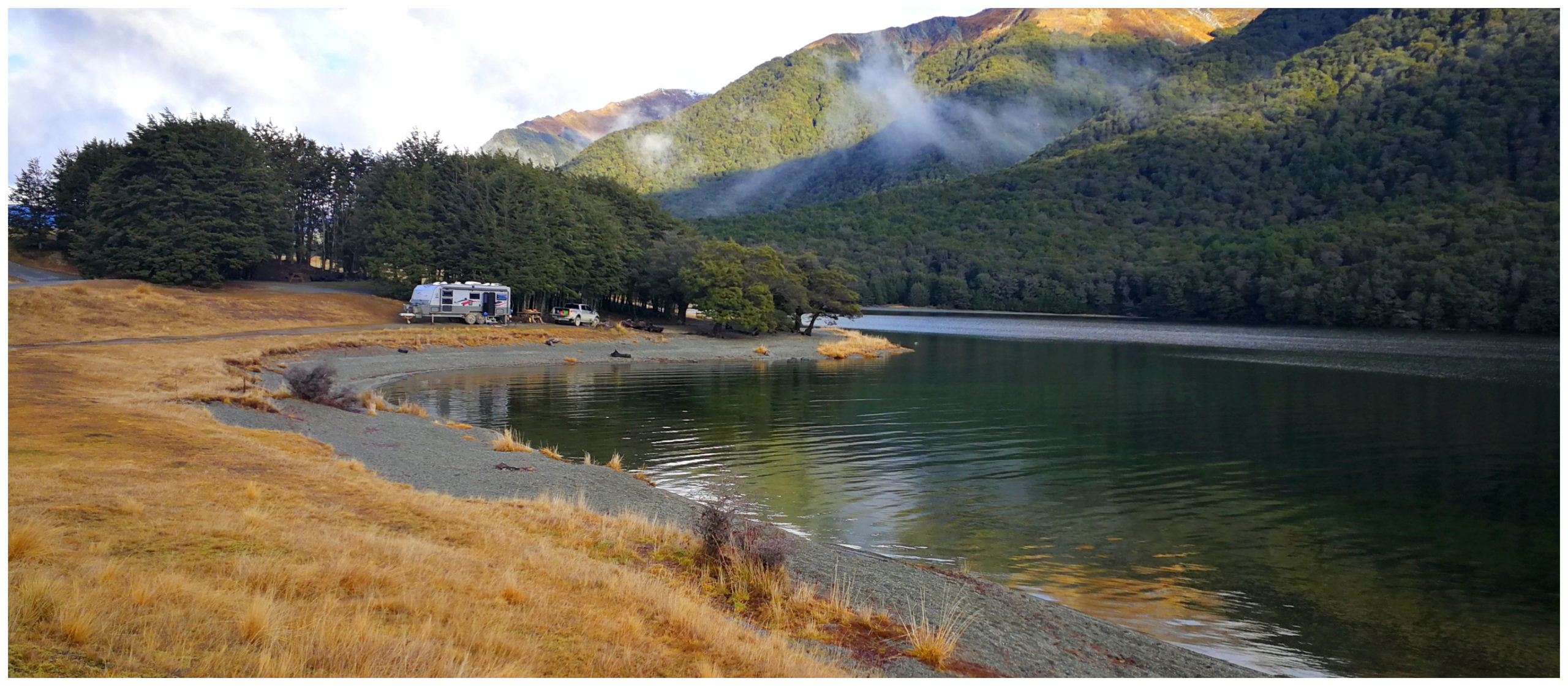
nicely sheltered from the southerlies
Track to Careys Hut (Mavora Walkway)
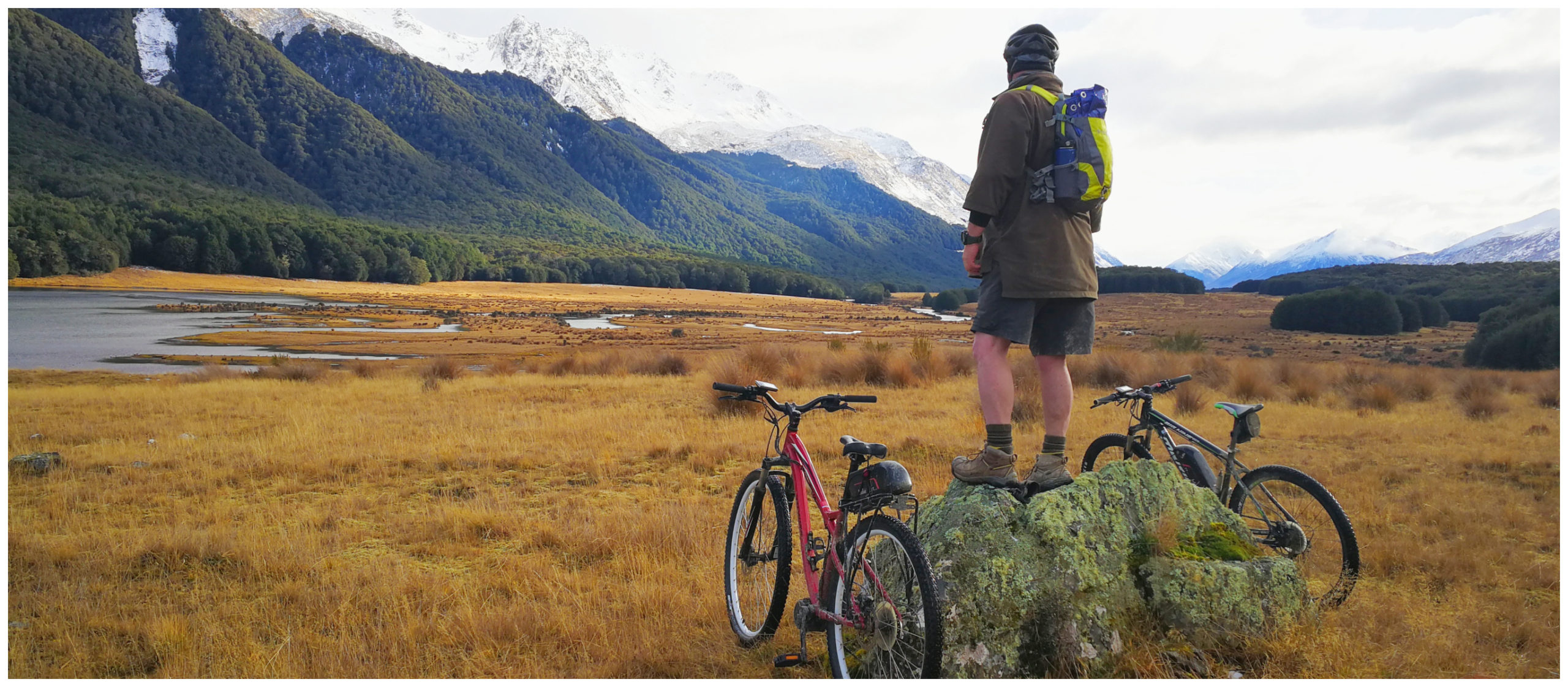
The weather became more settled the next day so we set off on our bikes – yikes, I did have to make sure that the layers were on as we explored the 4×4 trail towards Careys Hut through the snow. There are 3-4 huts located along this trail, the closest, Careys Hut is 10km, the next, Boundary Hut is another 6 km.
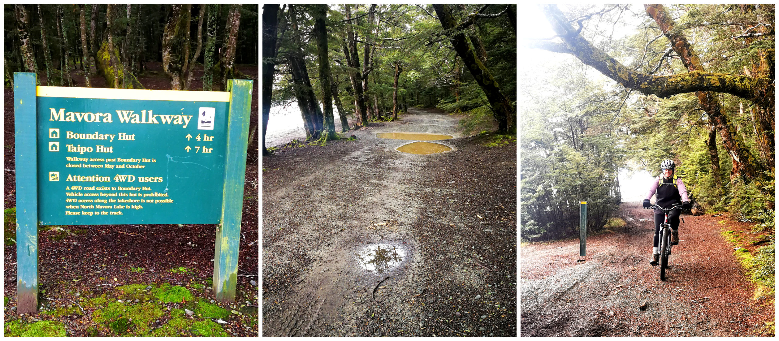
the start of the Mavora Walkway, a very watery 4×4 track
Because of rain and snow in the previous days, there were some rather deep water features that we needed to negotiate along the way which made the going quite slow and a bit technical.
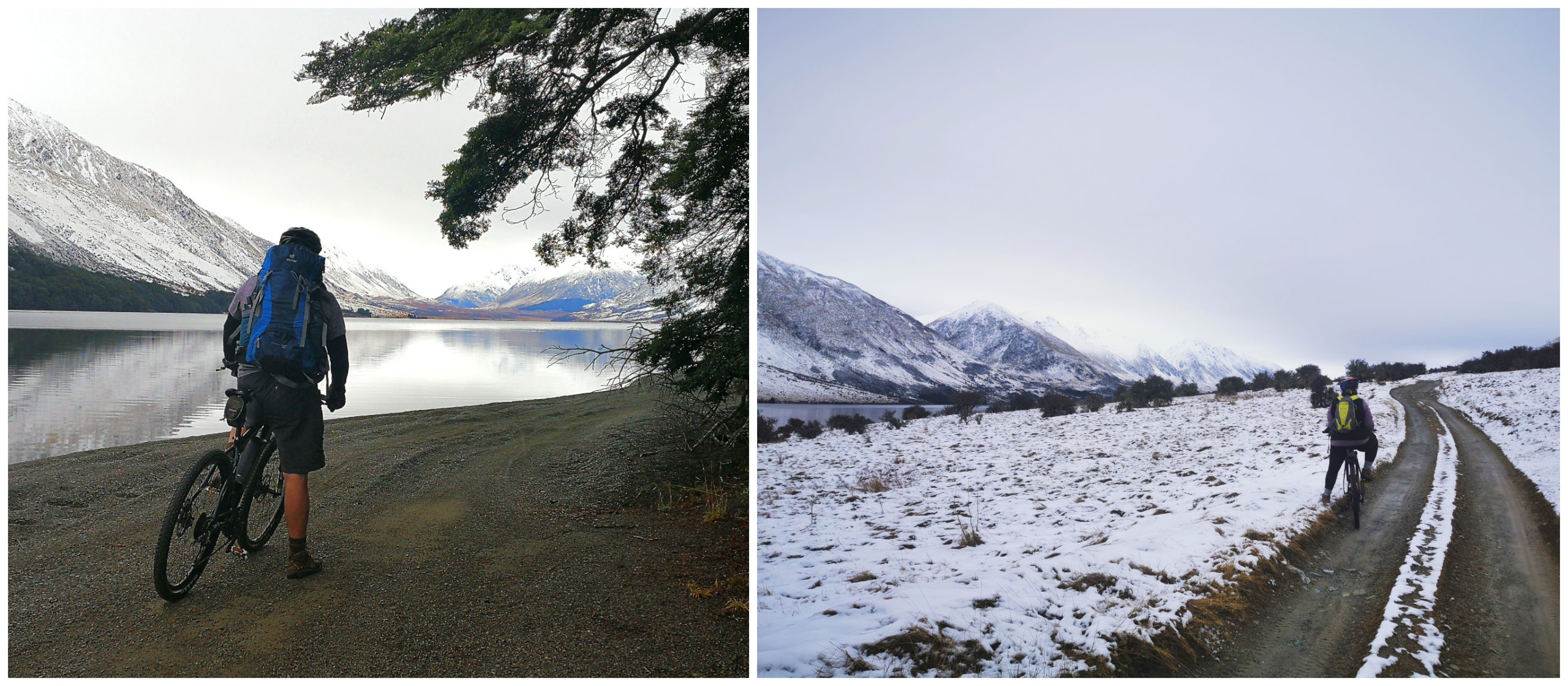
views towards the northerly most part of the lake and a good covering of snow
Our mountain bikes soon became covered in mud and we had artistic patterns emblazoned on our jackets and backsides. We negotiated the trail, getting stuck on the gravel beach and then the roller-coaster mud path that took us further into the valley.
lakeside picnic spot
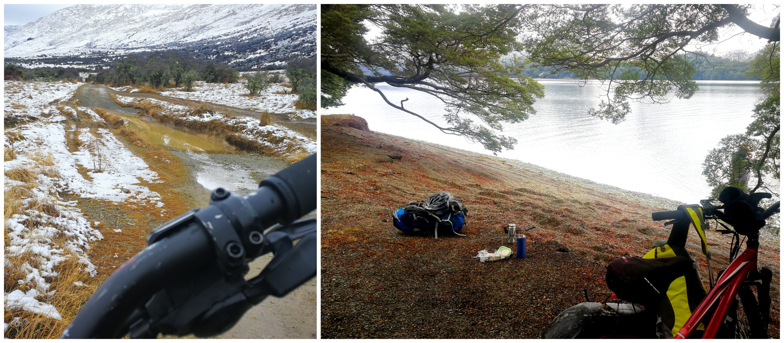
We were keeping an eye on some rather heavy-looking clouds to the south and knew that the weather can deteriorate quite quickly. Scotty was also having a few mechanical issues with his bike so we decided to turn around and make our way back.
We picked a lovely spot beside the lake for a picnic lunch on the way back. It took us nearly 2 hours to travel 7km. We didn’t quite make it to Careys Hut, so look forward to making it further next time.
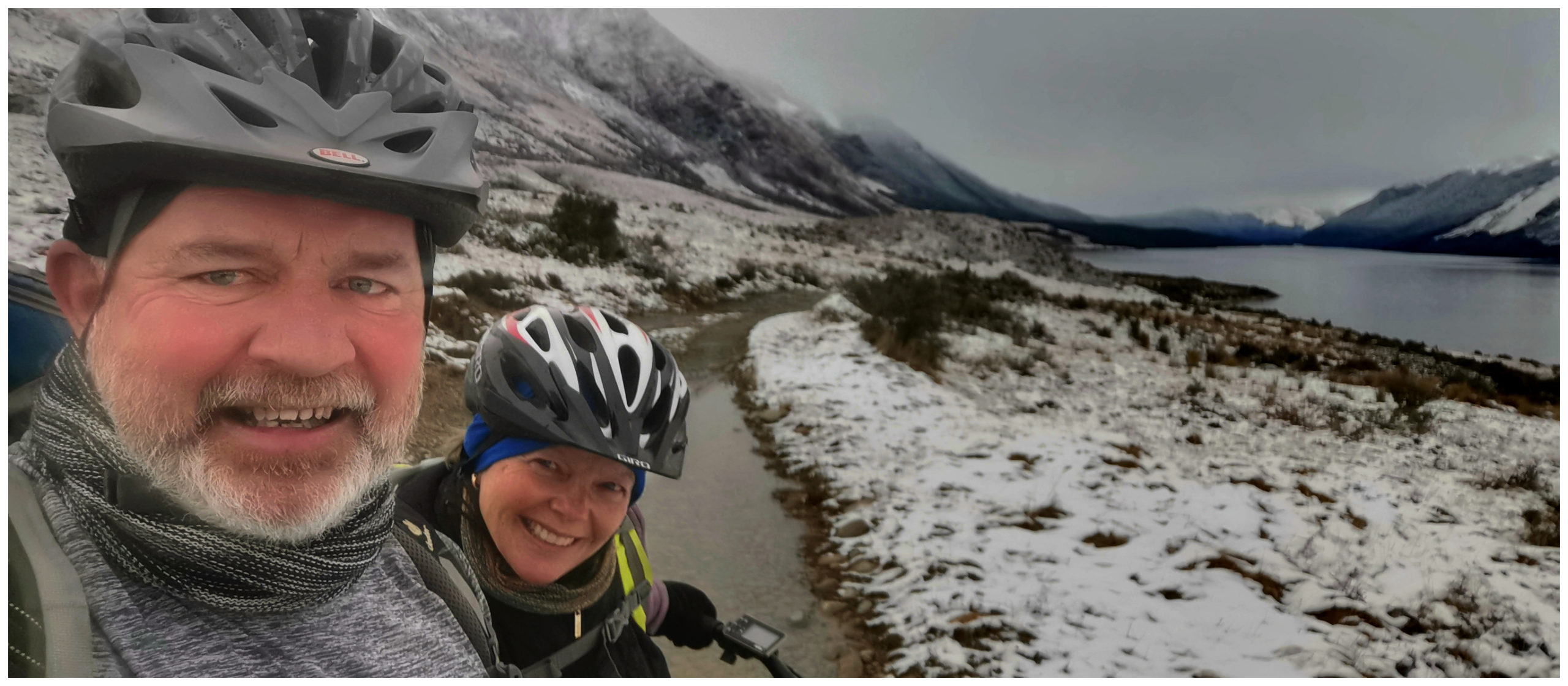
always time for a snowy ‘selfie’ with the weather looming in the background
Walking Tracks
There are several walks to choose from as well as 3 different swing bridges.
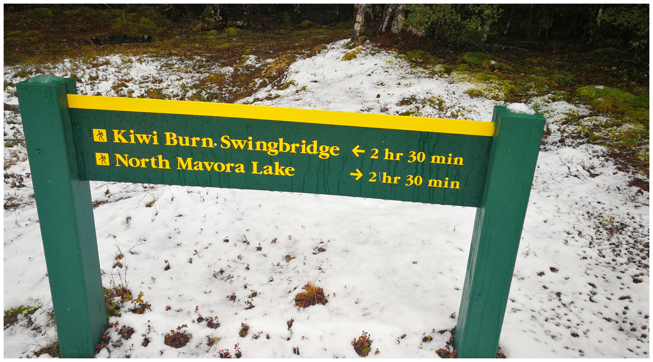
Kiwi Burn Loop Track
The access point is easy to spot as it is signposted as you enter the Mavora Lakes, Conservation Park.
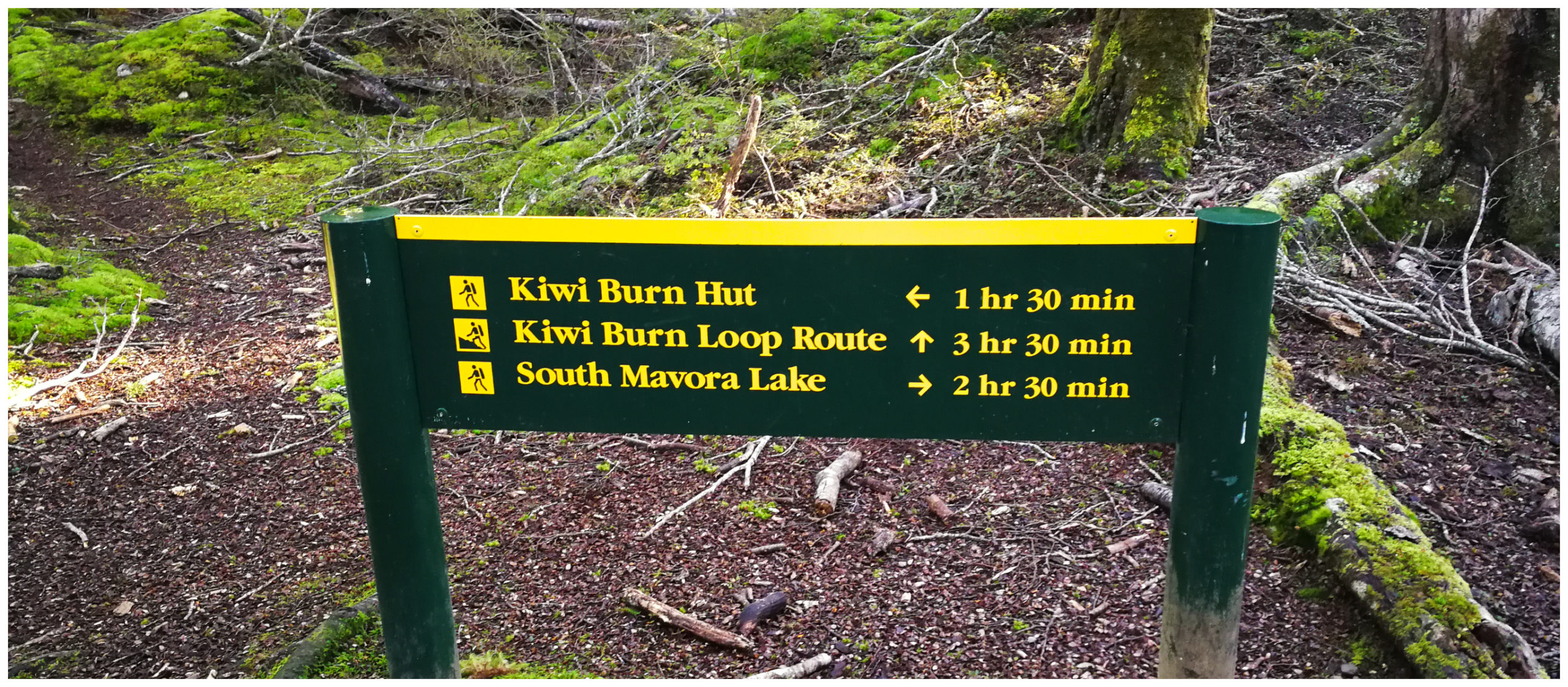
the track is well signposted
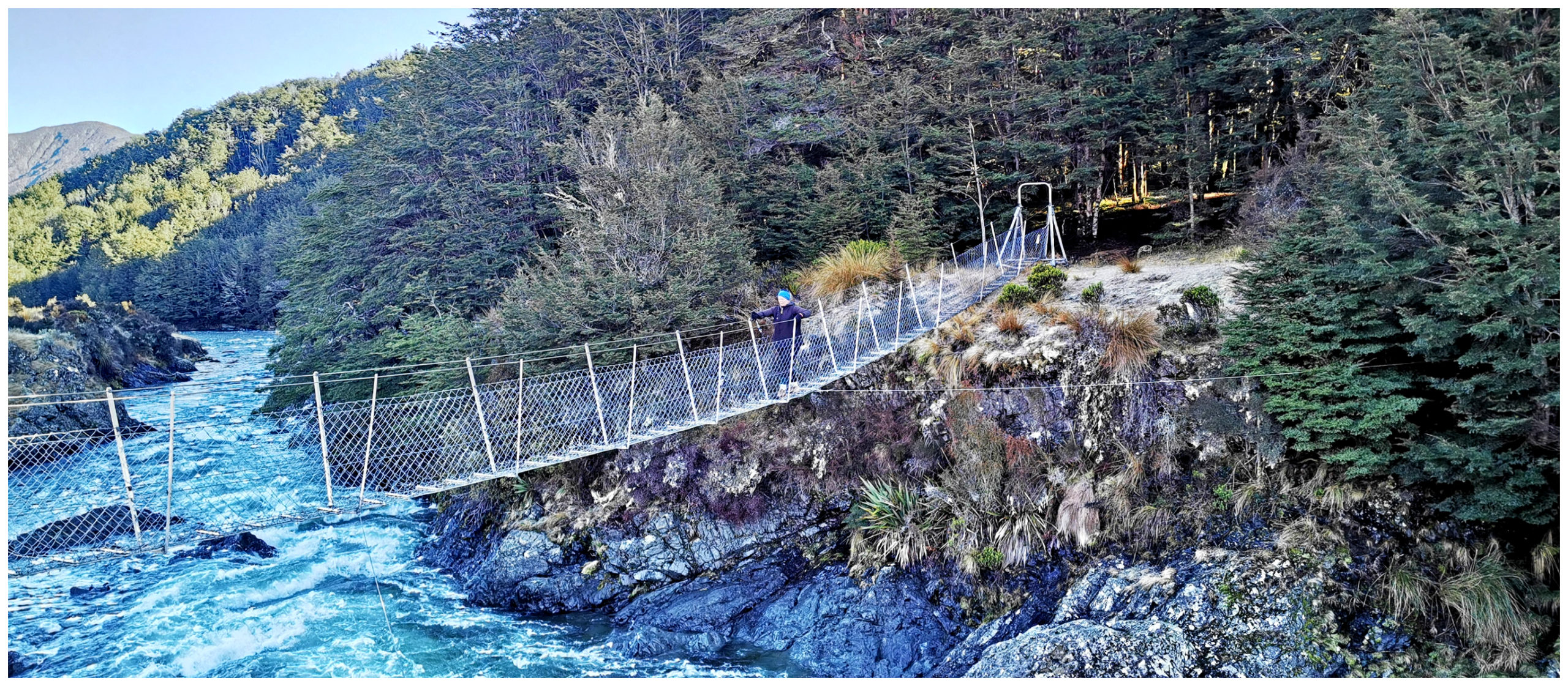
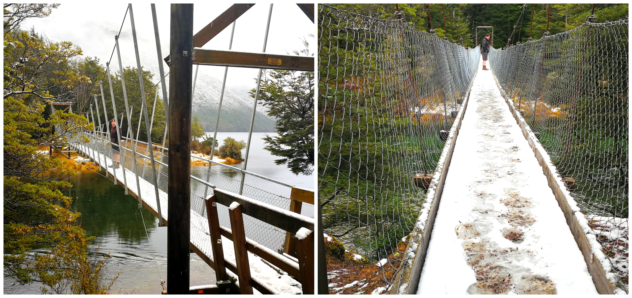
the bridge of the single hair
At the start of the track, you need to negotiate a rather narrow, precarious metal swing bridge. This swing bridge reminded me of Molly Woppy and Bridge of the Single Hair (it’s a generation thing!).
this is not a happy face as I negotiate the narrow shakey bridge
The track was quite boggy with a few stream crossings. It follows along the right side of the Mararoa River with fabulous views of the Livingstone and Thompson mountains between the moss-covered forests.
we stopped to admire the panoramic views
Within an hour, the track winds away from the river before it opens up and rambles along to the Kiwi Burn Hut. Although it is a loop track and would eventually take us back to the swing bridge, we were happy to about-turn after an hour and make our way back the way we’d come.
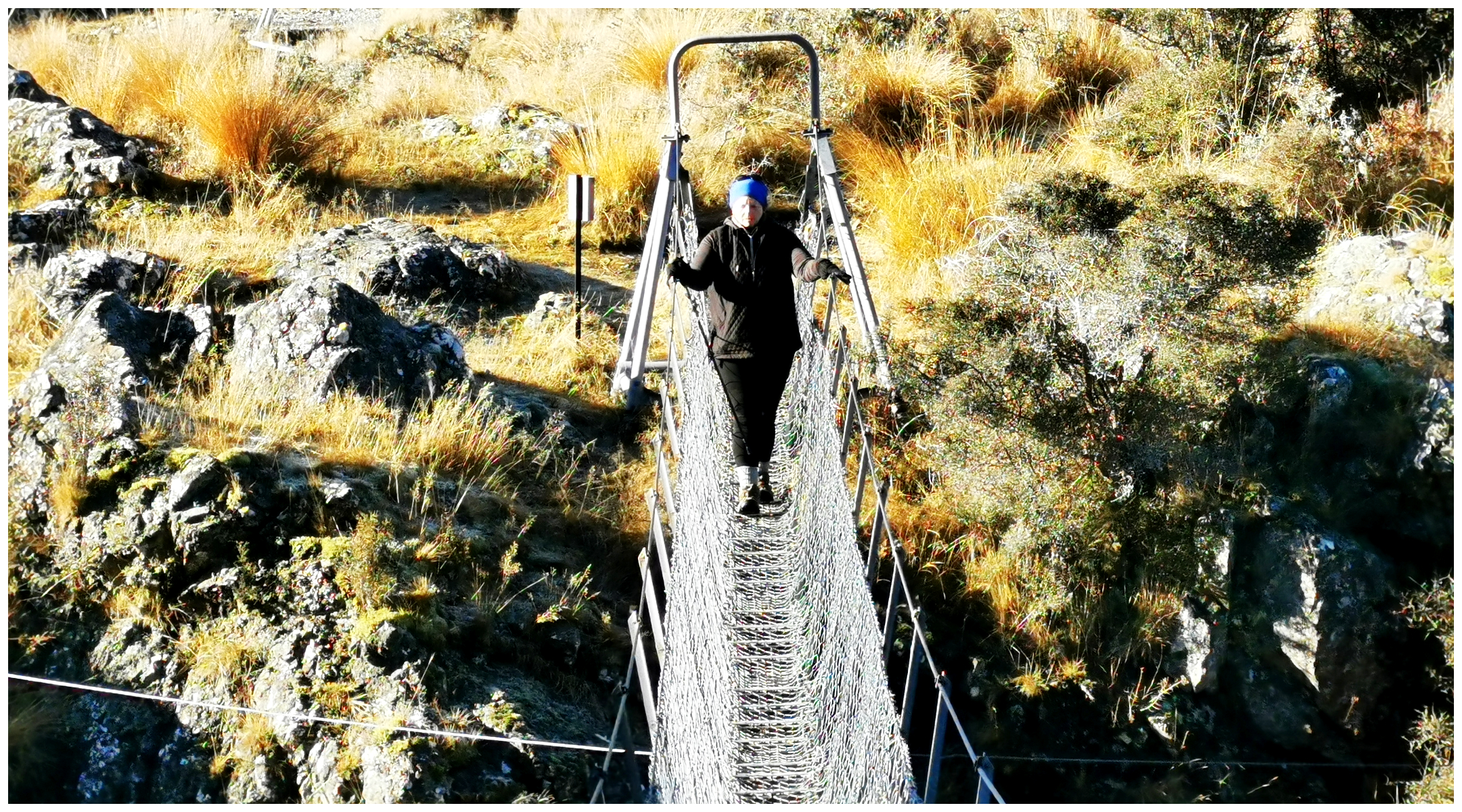
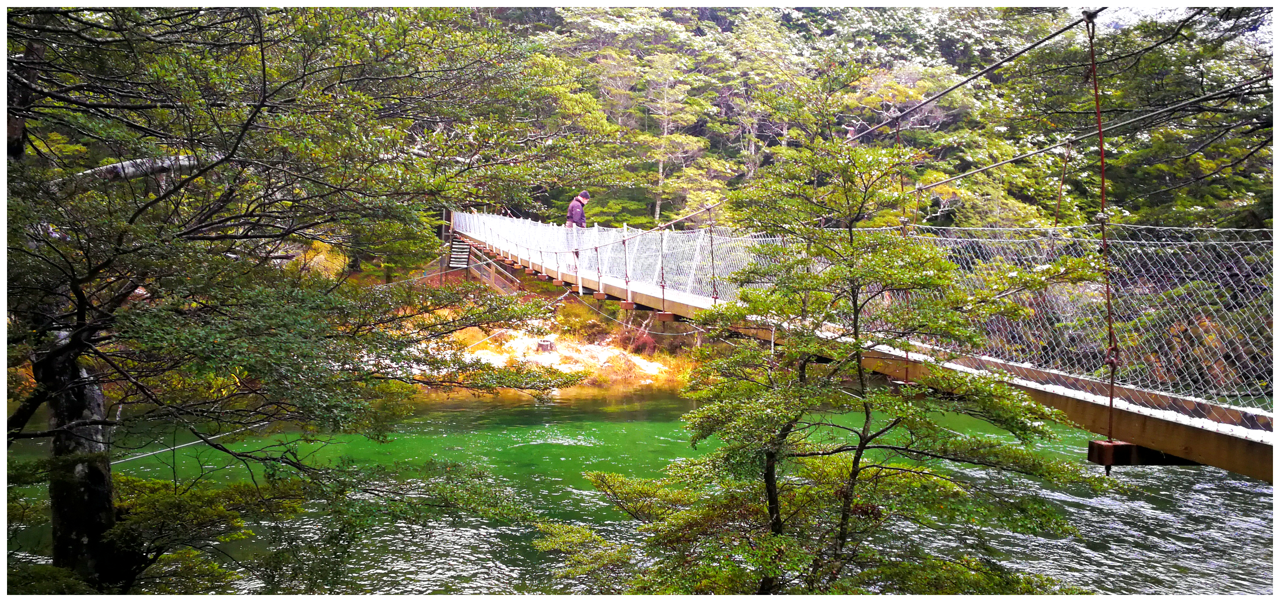
North & South Lake Swing Bridges
These swing bridges are a little more substantial than Kiwi Burn when it comes to swing bridges (thank goodness). There are tracks that you can walk which takes you from one swing bridge to the other which is 2.5 hours.
spoilt for choice for walkers
You can also walk to Kiwi Burn from here. All the trails join up as some stage and all seem to take around 2.5hours.
snowy South Lake swing bridge
It would be great if you had some walking buddies who could start at the opposite end and you could swap car keys halfway. This would save you the walk back.
North Mavora Lake swing bridge
exploring the DoC camping area by bike
We jumped back on our bikes and travelled another 14km but this time we stayed in the confines of the Doc Camp. That gives you an indication of the size of this massive park.
The Road to Walter Peak Station
Walter Peak Station is one of New Zealand’s most iconic high country stations on the shores of Lake Wakatipu.
Yes, we’ve been to Walter Peak Station via the Earnslaw across Lake Wakatipu from Queenstown many times during our tour driving days. I had never driven in before and OMG what a beautiful drive it is.
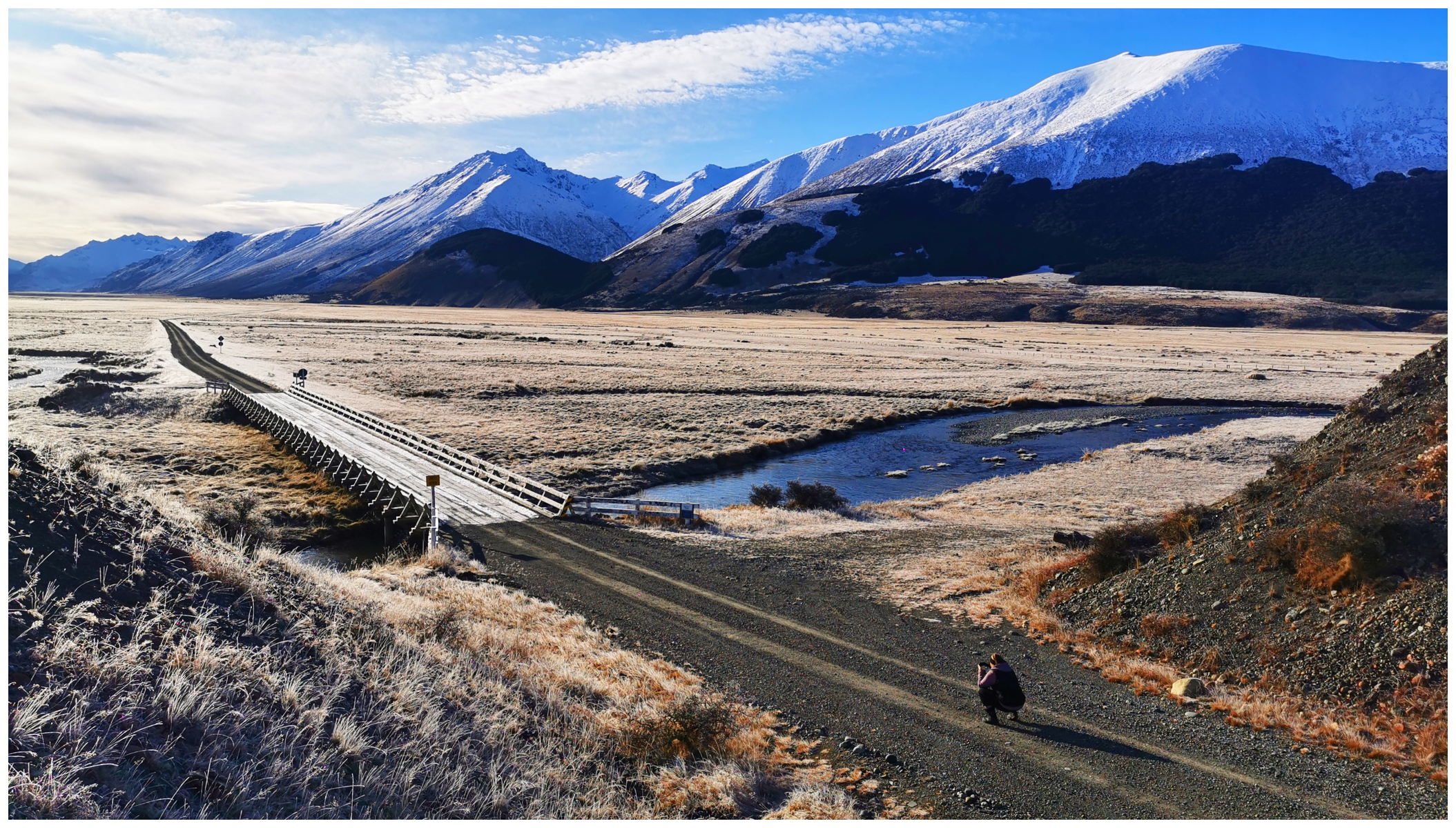
The section of road from Walter Peak Station to Mavora is part of the Alps to Ocean Cycle Trail and covers 50km. Because it is part of the trail, there are shelter sheds with information boards dotted along the roadside.
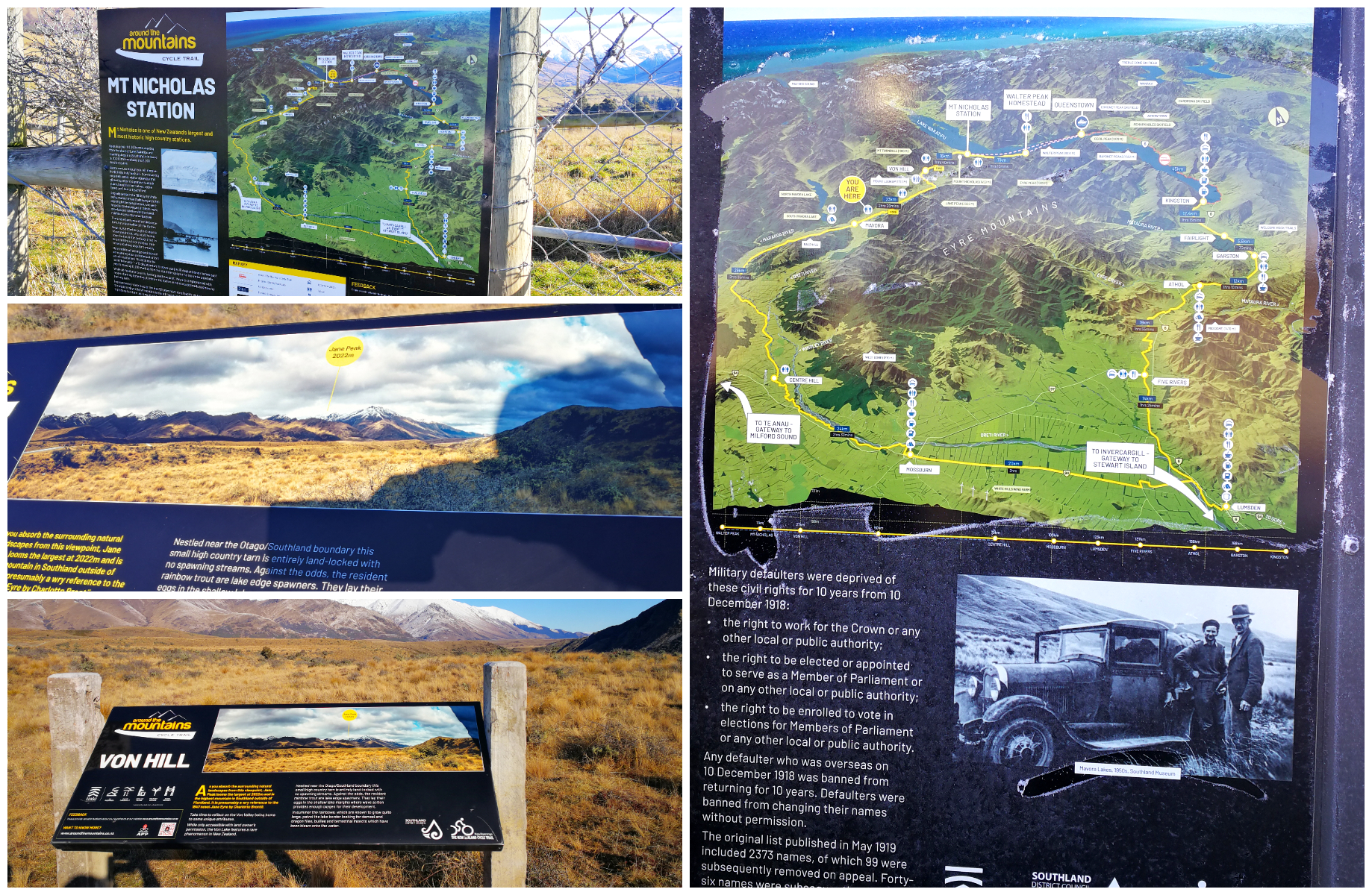
make time to stop at the shelter sheds to read the information boards
It is worth allowing time to stop at these shelters and read the history of each section. It explains the history and layout of the landscape.
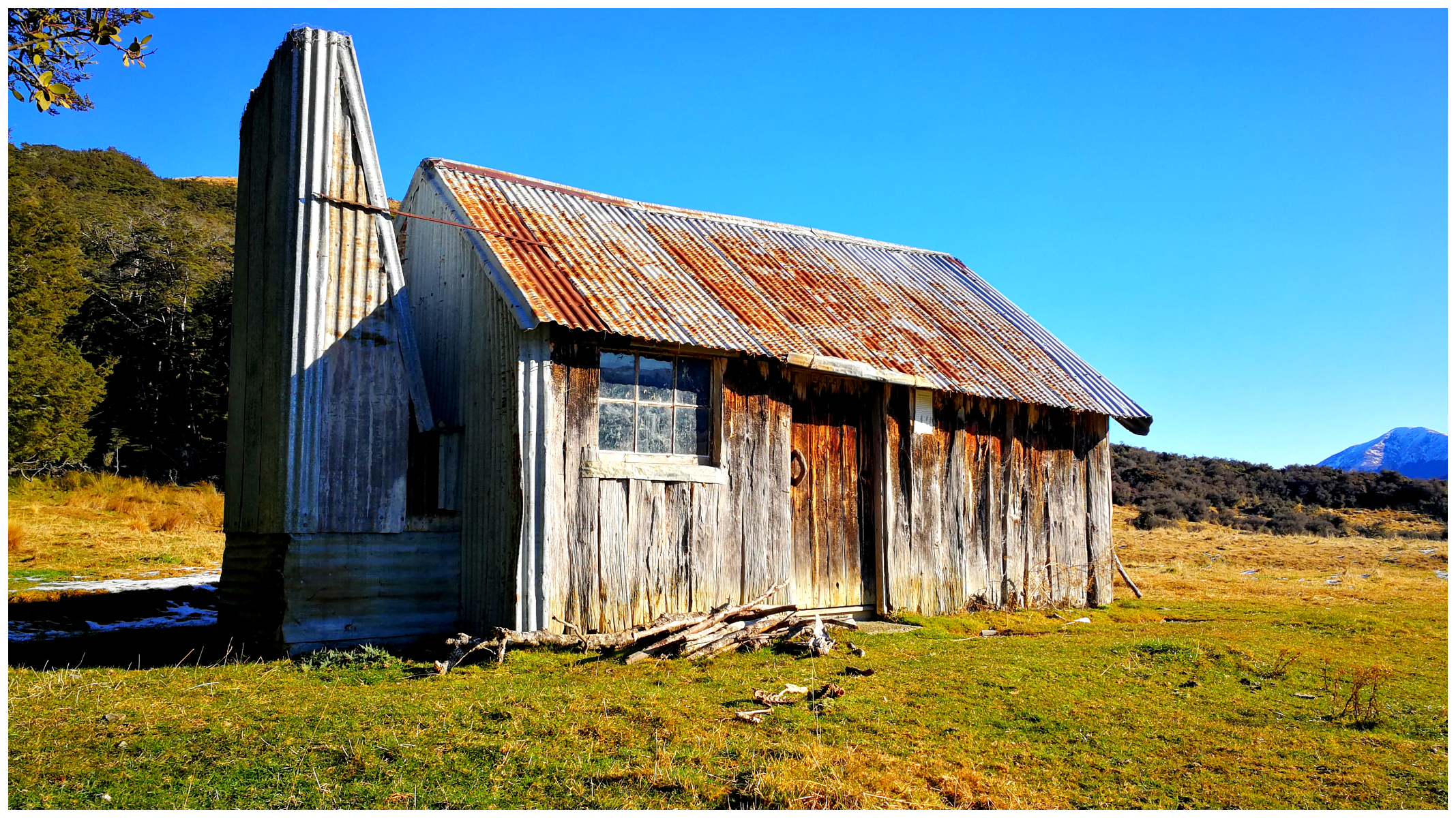
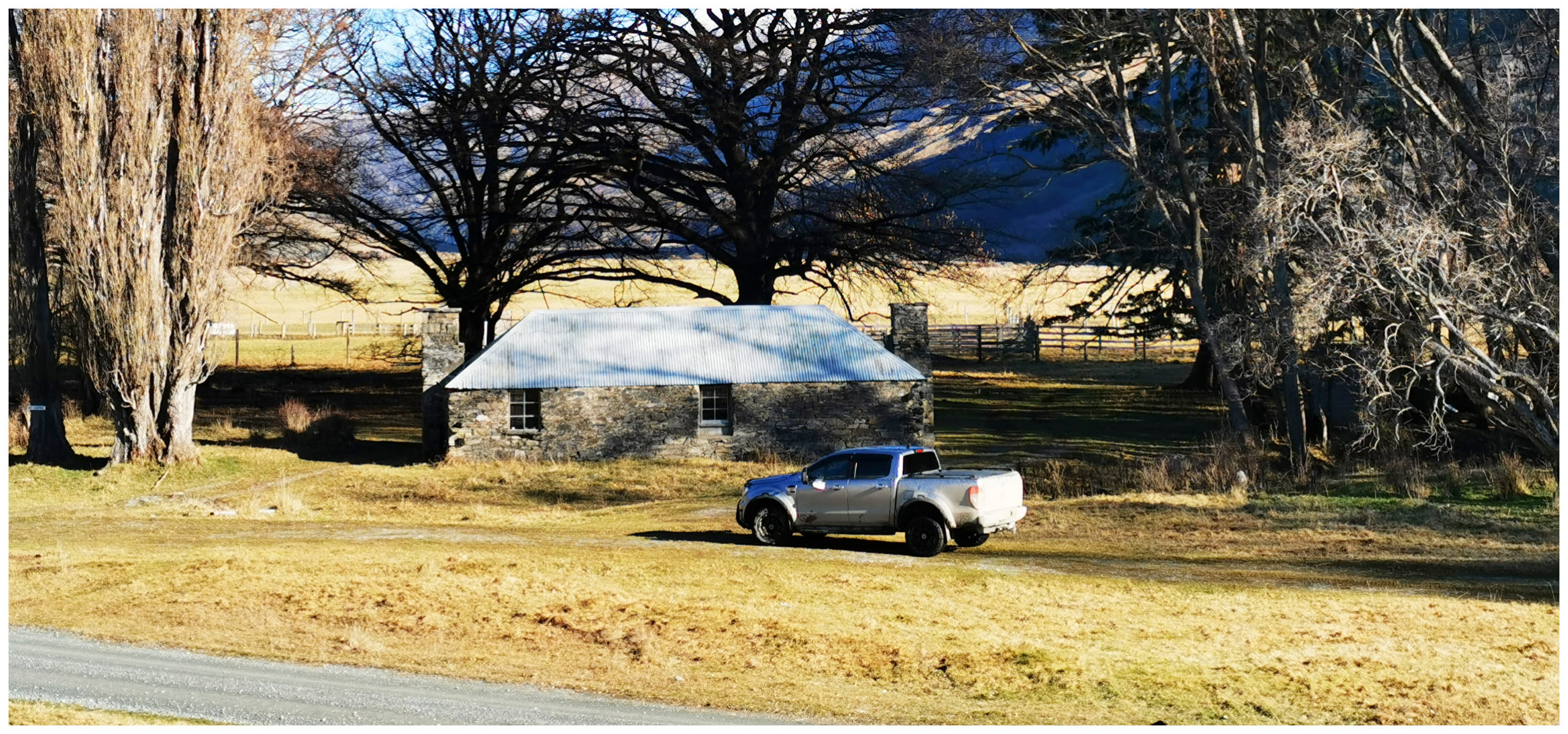
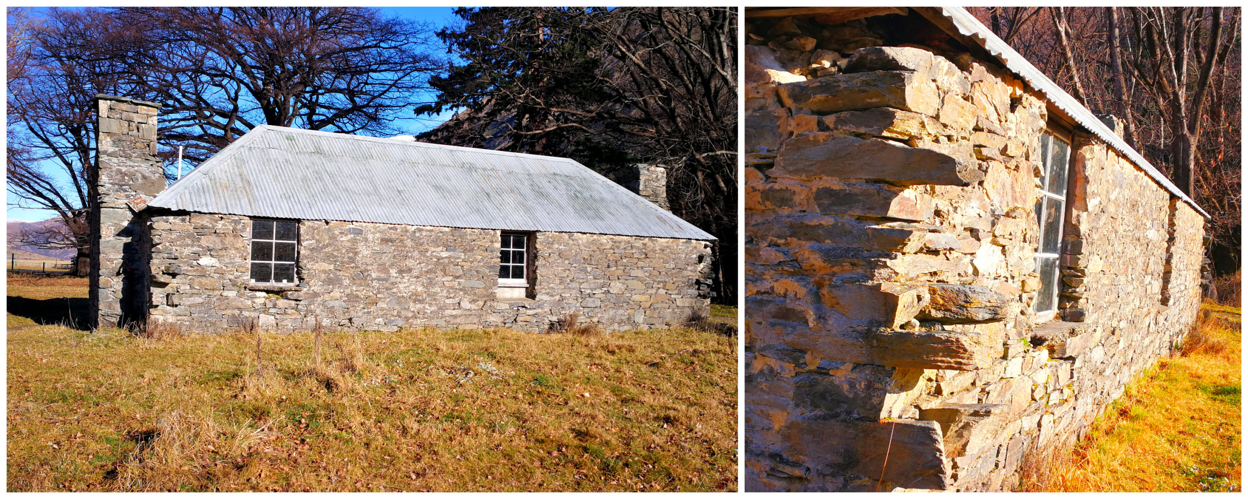
Bullock Creek Hut is a glimpse into the past
We also spotted a few Musters and Deer Cullers huts including Bullock Creek Hut. We detoured off the road to drive up to fossick around the hut which is open for public viewing.
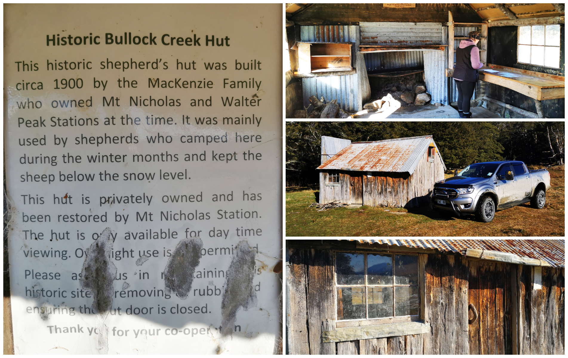
open to the public for inspection – I made sure I signed the Visitors Book
It was a stunning view from the hut, across the valley towards the Oreti River and the Thompson Mountains. This is also looking towards where the boundary of Mt Nicholas Station starts.
it may be an old hut but a million-dollar view
Walter Peak Station is located on the far side of Mt Nicolas Station and they are 12km apart.
this old original cookhouse has over 150 years of country farming history
originally part of a 13 room homestead with a tennis court – this is all that remains
What’s the Road Like?
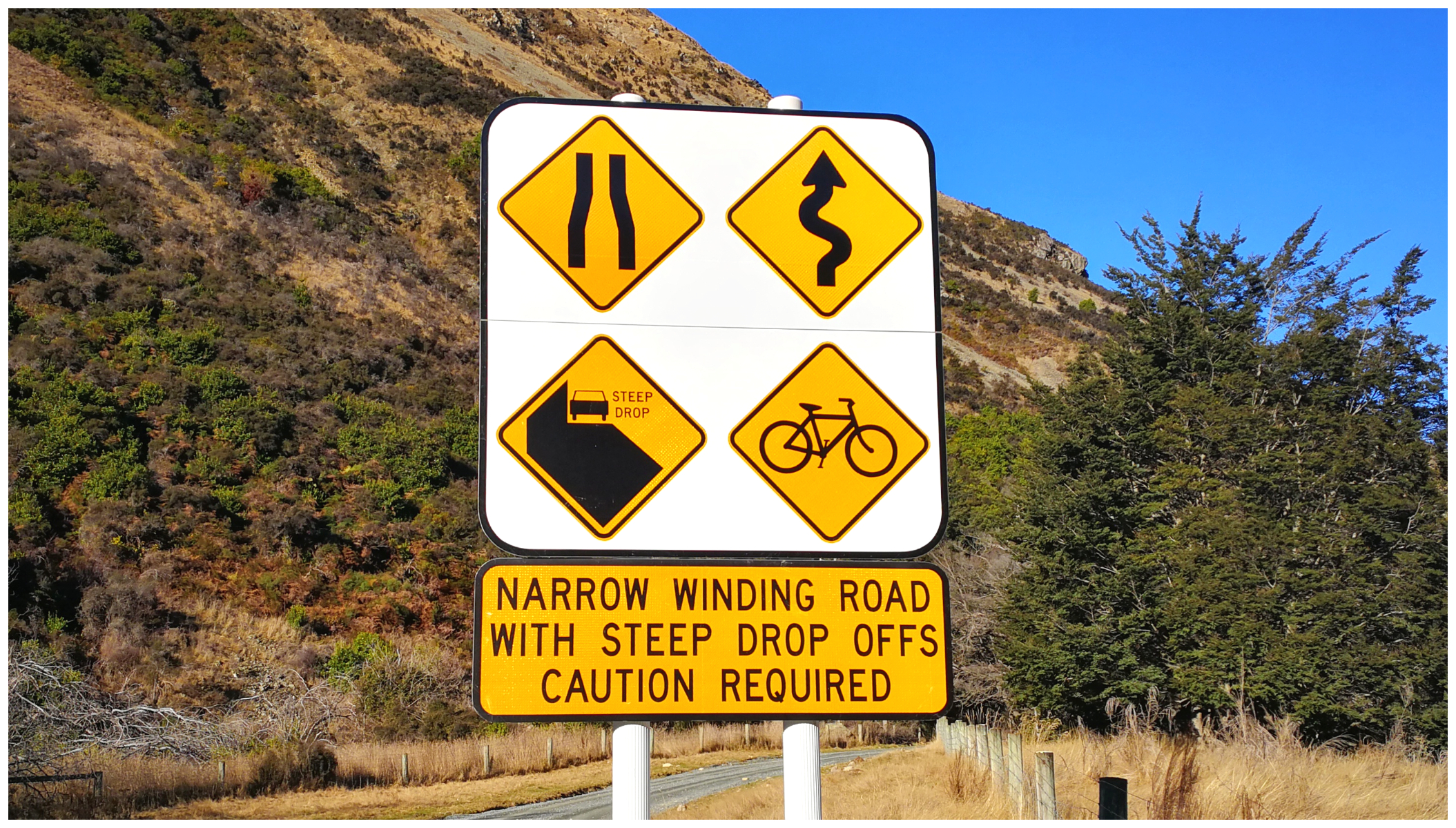
make sure to heed the warning signs
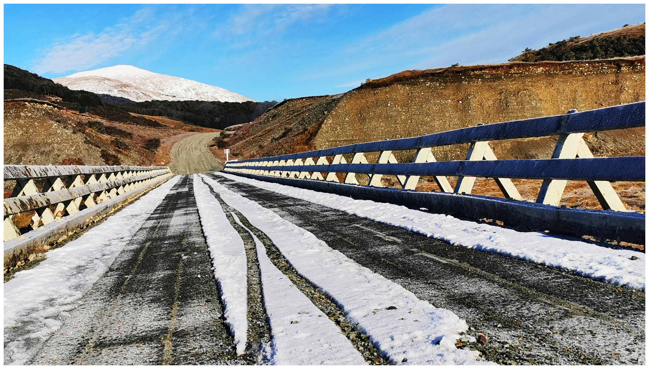
Firstly, I would recommend that you tackle the road in a vehicle with good clearance. It doesn’t necessarily need to be a 4×4 (unless there has been a high rainfall). This is because there are a number of fords to cross and they are rocky. Apart from the ford crossings, the road surface is unsealed but in relatively good condition.
one of the many ford crossings
Big Views, Big Landscape
brace yourself for stunning vistas
Be prepared to be ‘wowed’ by the views that pan out in front of you as you traverse this road to Walter Peak Station.
the beginnings of the Oreti River and getting that perfect shot!
We crossed the bridge over the Oreti River. I did not realise just how long this river is. Covering a massive 170km, it starts high up the in mountains close to the Mavora Lakes, running through the towns of Lumsden, Winton and Invercargill. Its outflow in the Foveaux Strait is at the southeastern end of Oreti Beach.
……and that perfect shot
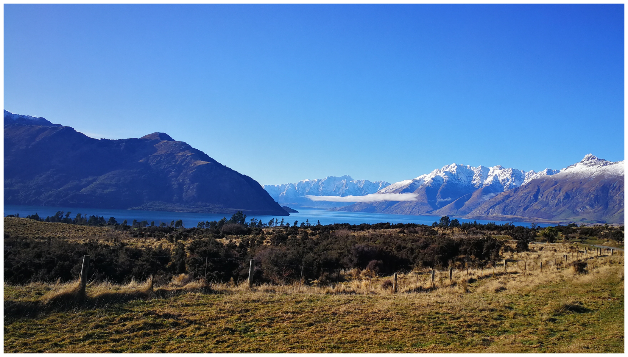
our first peek of Lake Wakatipu as we near Mt Nicholas Station
Walter Peak Station
Walter Peak was founded way back in 1860. Today it is a working high country sheep station with 18,000 Merino and Perendale sheep and 800 beef cows. It covers a whopping 25,758 hectares.
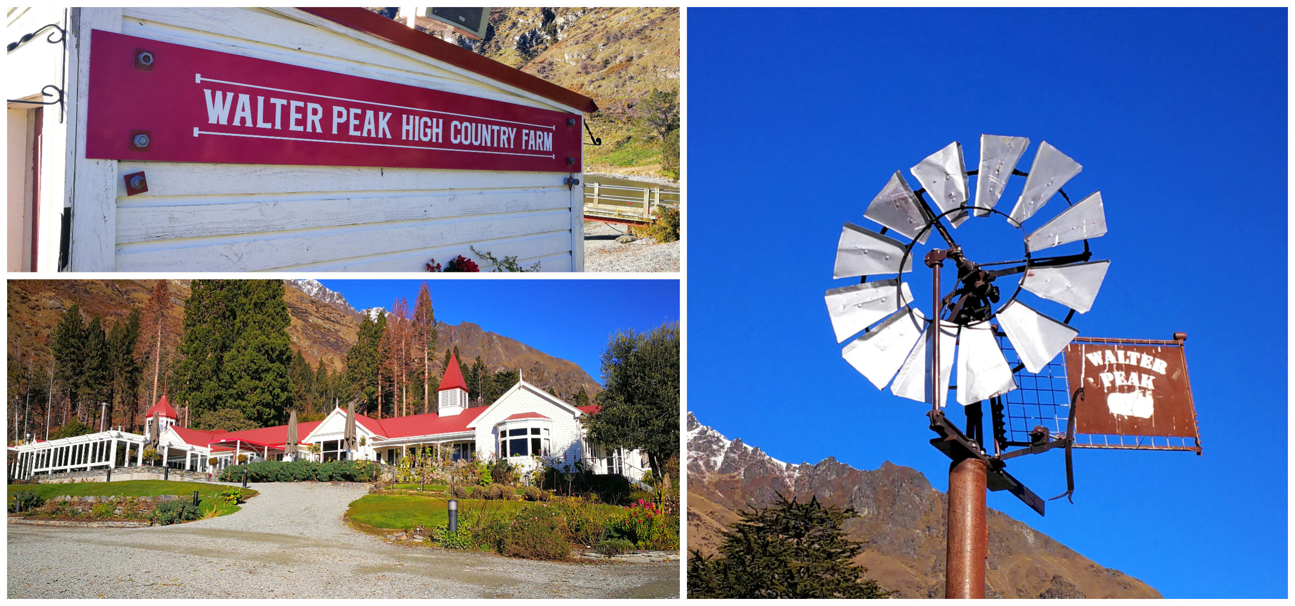
the iconic Walter peak Station
It is still a very popular destination for tourists who make the 45 minute trip across Lake Wakatipu to visit Walter Peak Station on the TSS Earnslaw. This 107-year-old vintage steamship is the only hand-fired passenger-carrying steamship still operating in the southern hemisphere.
We were sitting enjoying our ‘tailgate’ lunch, looking out over the lake and spotted the TSS Earnslaw, chuffing her way across the lake towards us.
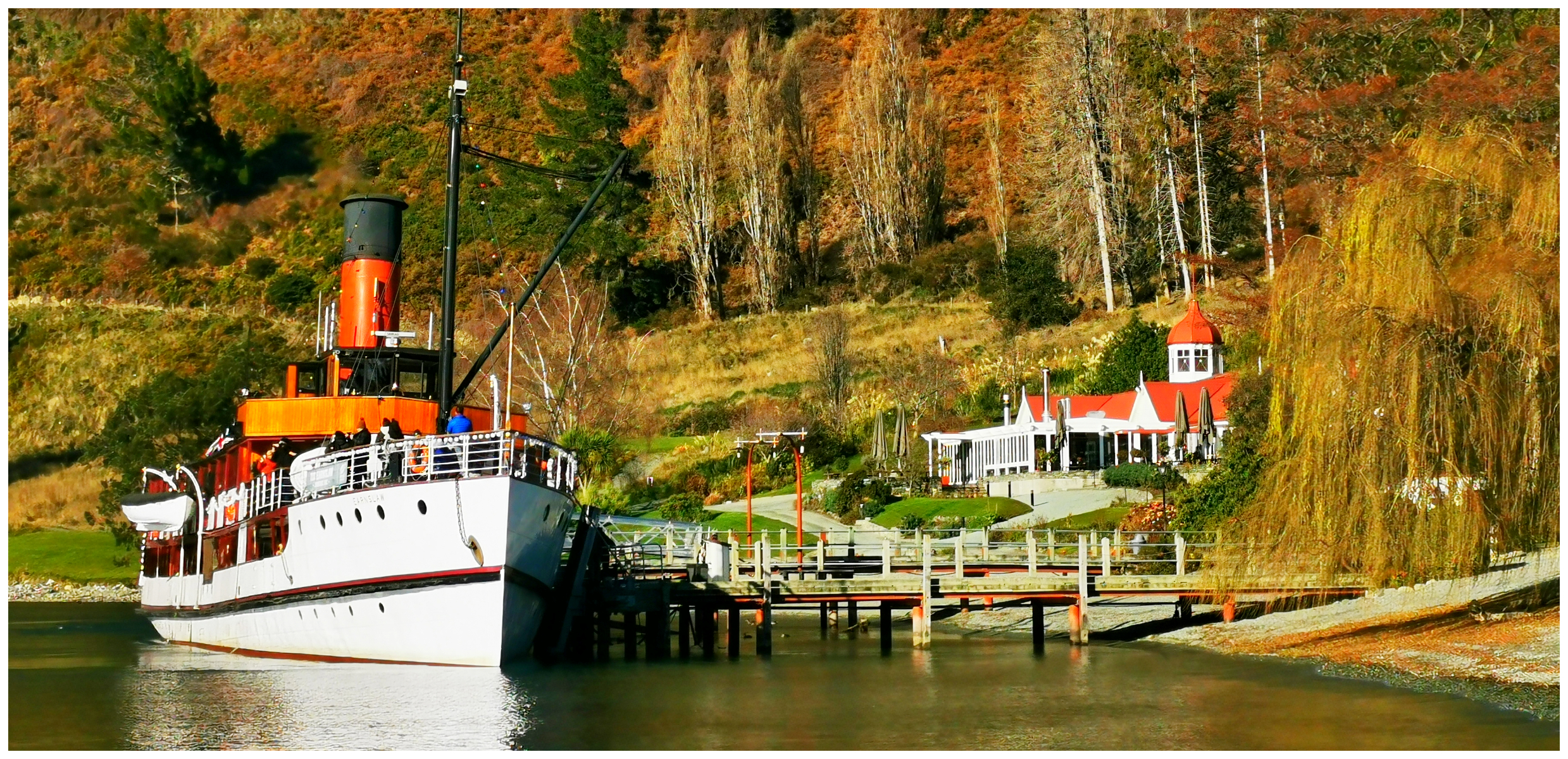
she’s a grand old lady for sure and looks good for her age!
She is looking very grand and made for a wonderful sight as she sidled up to the side of the historic wharf. It was still the July school holidays so the boat was full. It was good to see how popular the cruise still is considering NZ’s lack of overseas tourists.
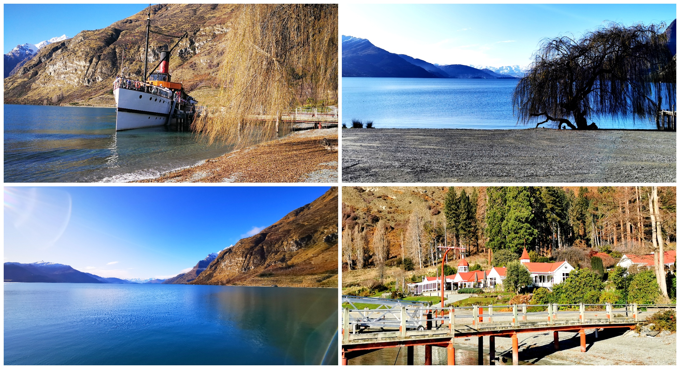
such a serene spot with stunning views
Summary & the Grand Finale
We stayed a total of 6 nights at Mavora Lakes and it was well worth the wait to get there. As there is no cellphone/data coverage, it was a complete ‘unplug’ and a bit of a ‘reset’ for us.
Be Prepared to Get Photo Bombed
There are way too many photos to choose from – all of them seem the perfect calendar shot. Here is just a few.
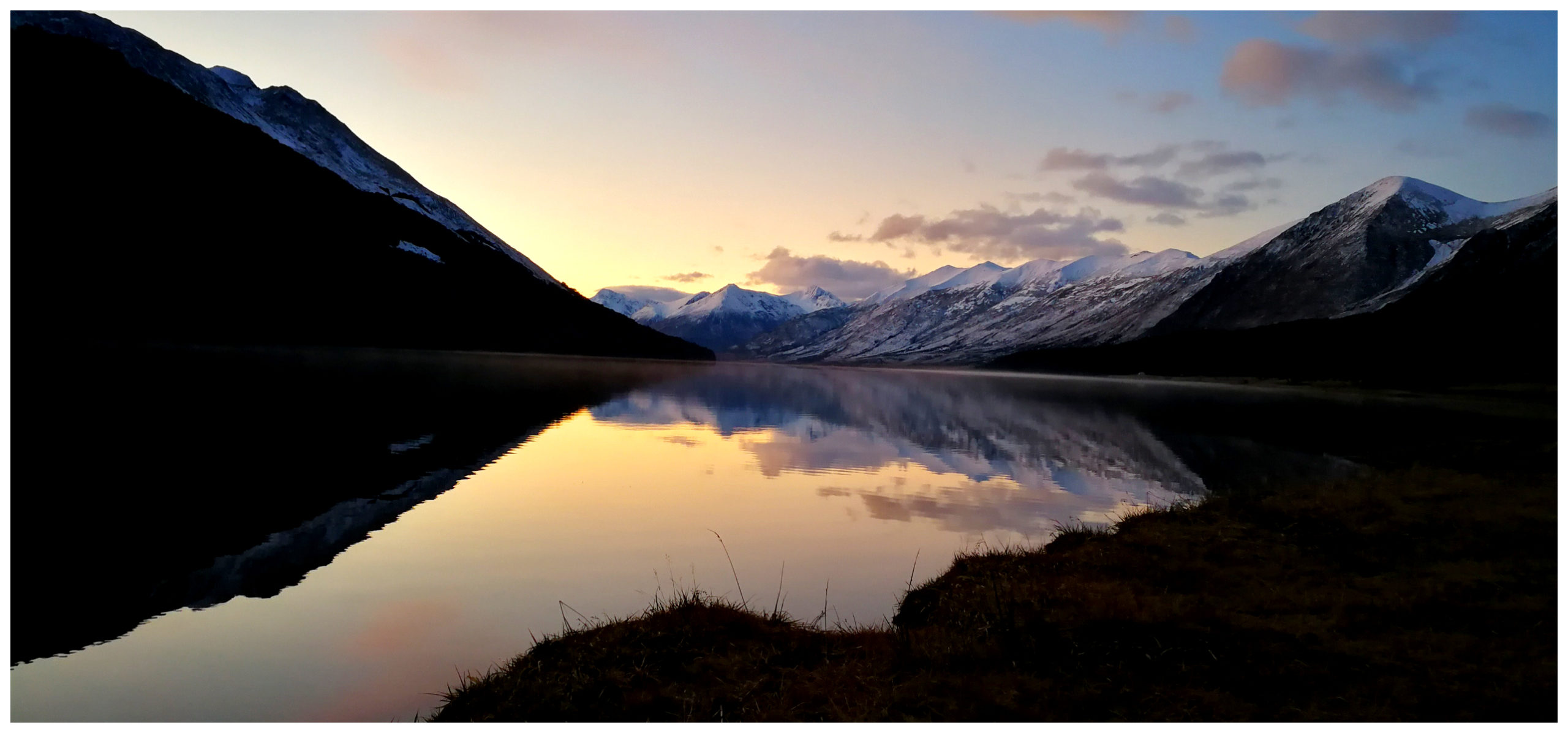
most of our evenings were just so still and the colours and reflections just kept changing
and then there was the morning glow, peeking up over the top of the mountains
and then we’d end up with a day like this!
even beautiful on a cloudy day
We cooked over an open fire most nights and watched the changing light reflecting on the lake.
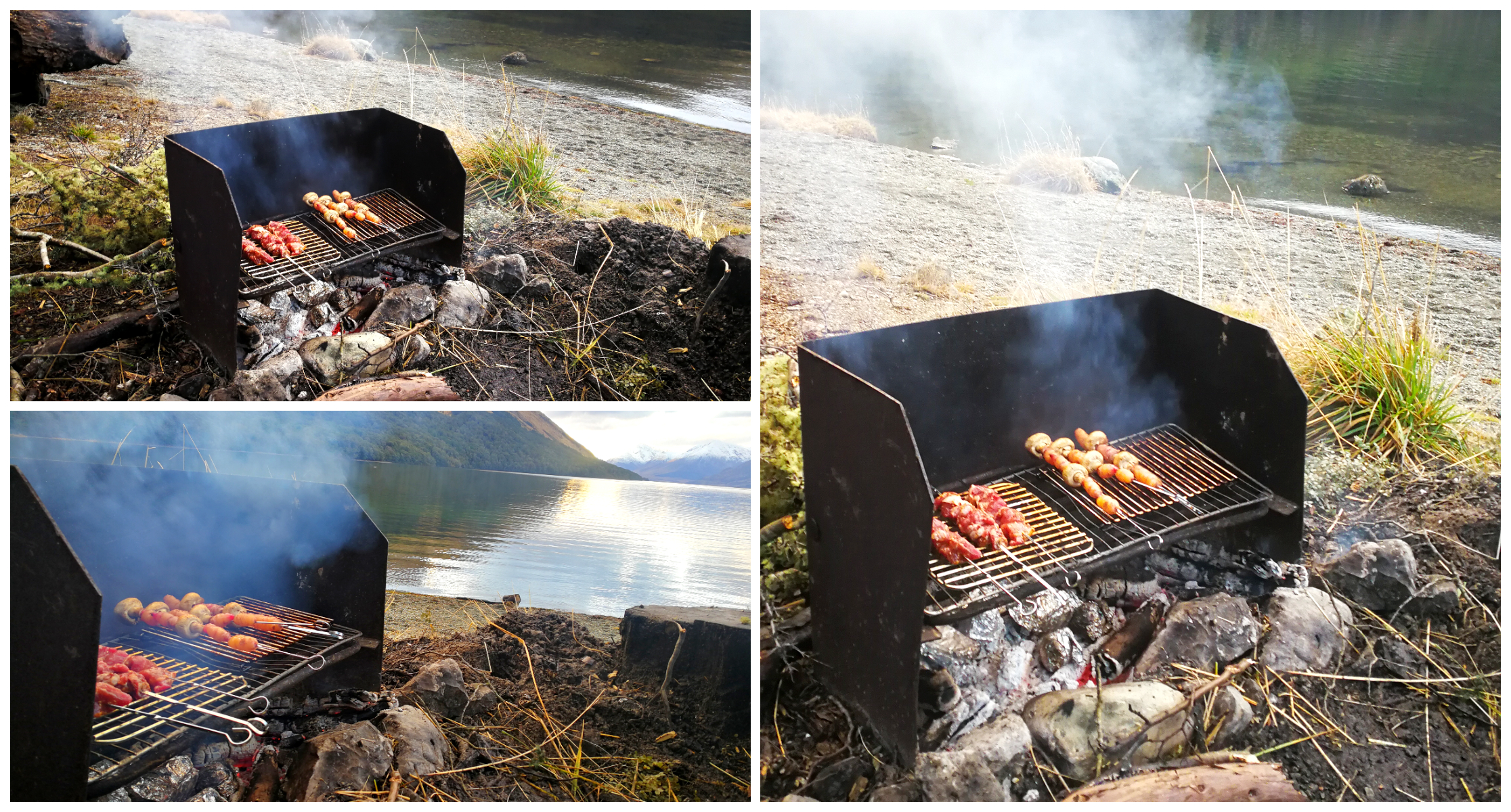
there is nothing better than fireside cooking
The feeling of remoteness had a calming effect and the quietness was almost deafening. We saw very few people coming and going due to the weather and time of the year. I think that it is a very different story in summer or the holiday season.
and just like that, it was time to go – we so want to go back, just to sit, unplug and reset again
Click on the link below for a video of our highlights.
This is the only blog that has helped me to understand exactly where all 3 swing bridges are located near Mavora. Thank you for the detailed descriptions!
Thanks Kayla, so pleased it’s helped get your bearings. Hopefully you’ll get to enjoy Mavora as much as we do.