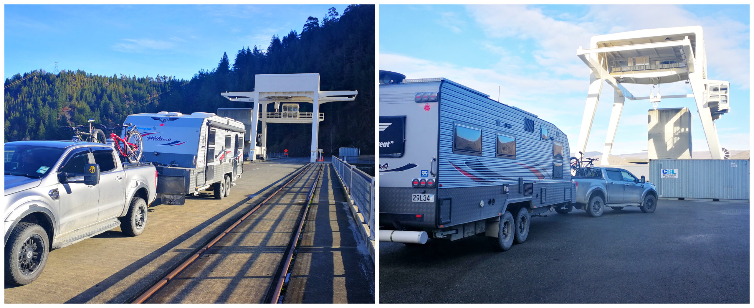
Leaving Ohau B Canal
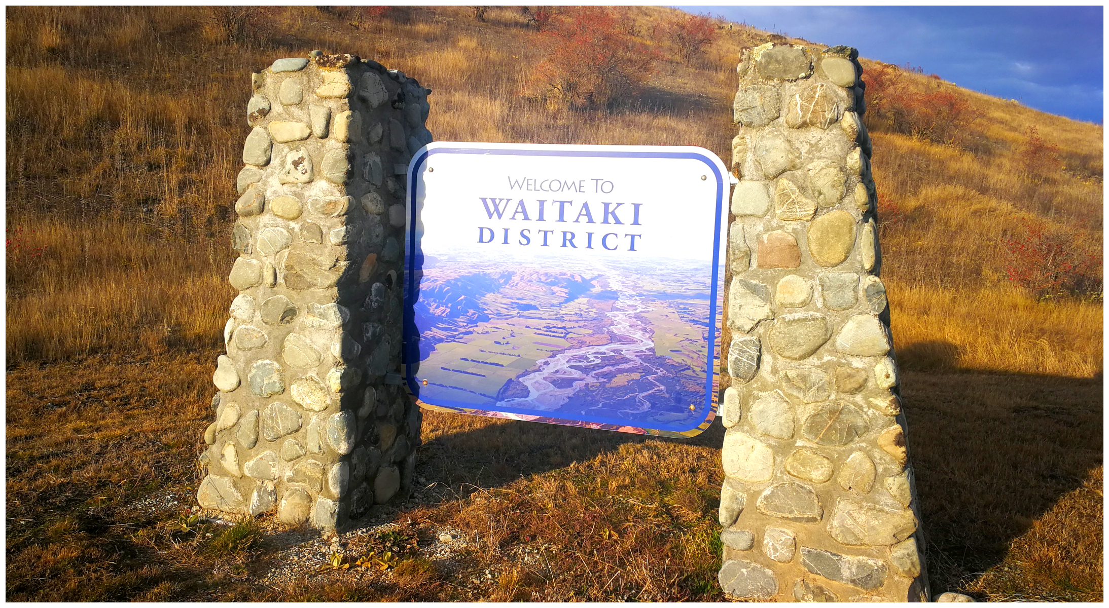
According to the ‘Welcome to Waitaki’ sign, the Ohau B Canal is on the far side of the sign. If you check it out on Google Maps, it is still in Mackenzie District, not the Waitaki District. Either way, I included our stay at the Ohau B Canal in my Mackenzie District blog.
crossing the border – no passport required
It was time to leave Ohau B, empty-handed, apart from a couple of donated fillets of salmon thanks to our generous neighbours (I like to call the donations ‘Pity Packages’).
We wanted to head towards Benmore and Aviemore. It has been over 20 years since we have both explored this area and I have vivid memories of just how beautiful it is in the Waitaki District.
During the winter months, some freedom camps are closed. Although all the facilities are shut ie toilets and water, you are still able to camp at some for free. Well, that scenario suited us just fine.
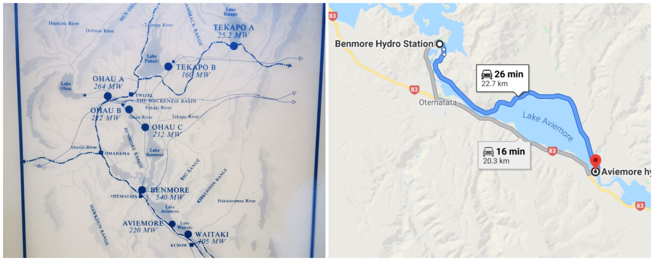
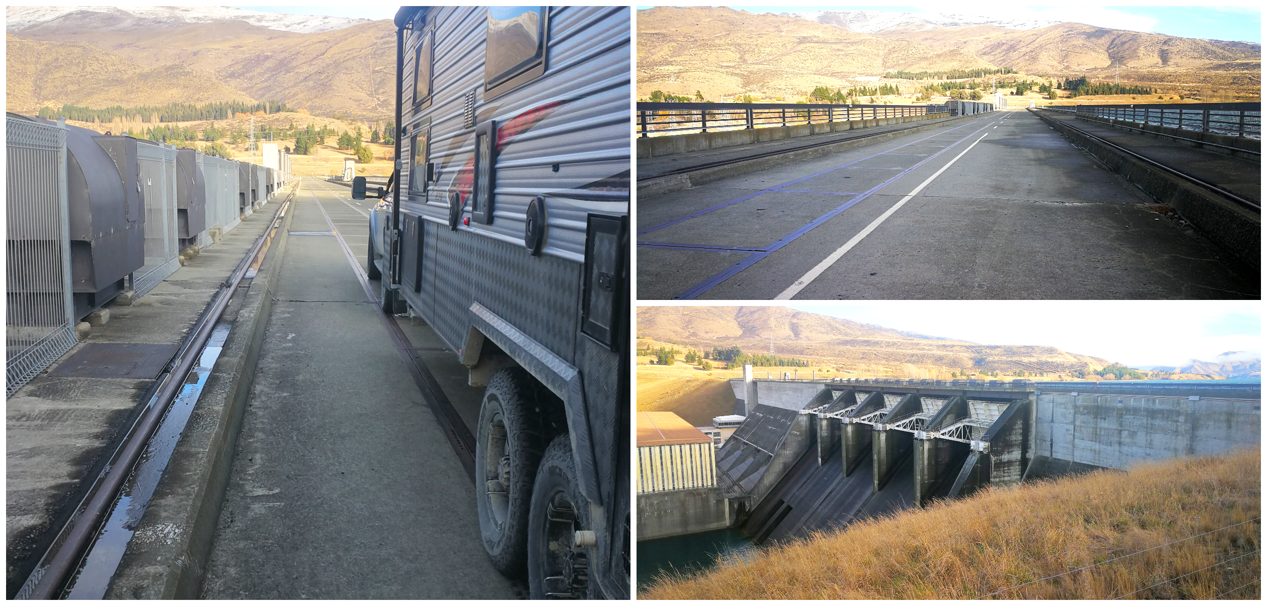
Entering ‘Dam City’, and our route from Benmore to Aviemore off the main SH
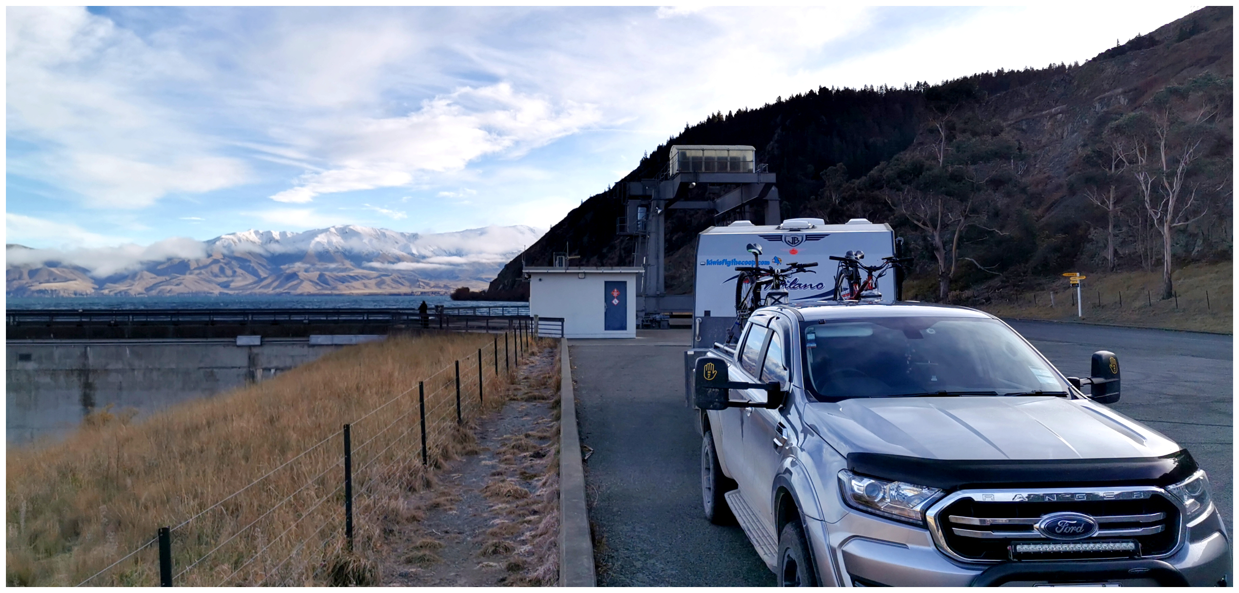
Benmore Dam
Located approximately 70km from Ohau B Canal, is the Benmore Dam.
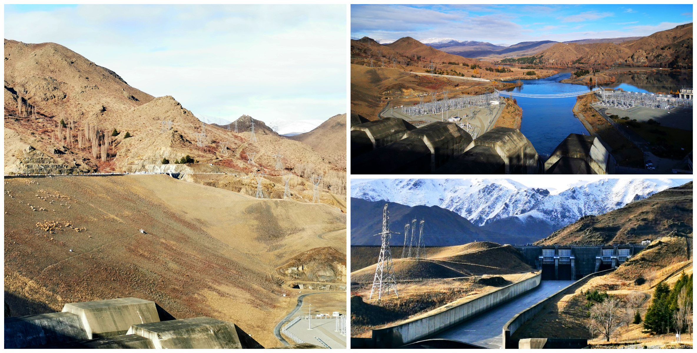
the massive earth dam and a view of the spillways from the top and bottom
it’s great that you can drive right over the top of the dam
Let me get some of the nerdy facts out of the way:
- construction on the Benmore Dam started in 1958
- Lake Benmore was filled in December 1964 and is the largest manmade lake in NZ and covers 75 square km
- it has 1.5 times more water volume than Wellington Harbour
- the Benmore Dam is NZ’s largest earth dam
- at the time of construction, the dam was the largest in the Southern Hemisphere
- the first power was produced in January 1965
- the power station generates enough electricity each year for about 298,000 homes
- Otematata, 8km from the dam was created to support workers who constructed the dam, and their families
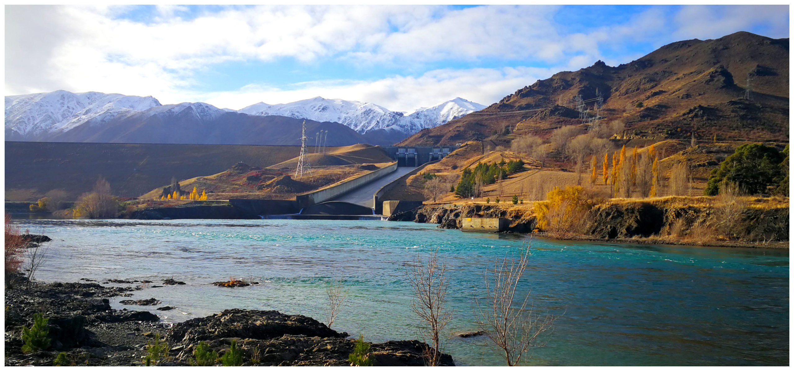
it would be quite a show when the spillways are opened but today, they were as dry as a bone
Loch Lairn Reserve
There are a variety of options when it comes to camping on the shores of the lakes in the Waitaki District. Most of these are owned and managed by the Waitaki District Council. Click here to read about their camping guidelines and costs.
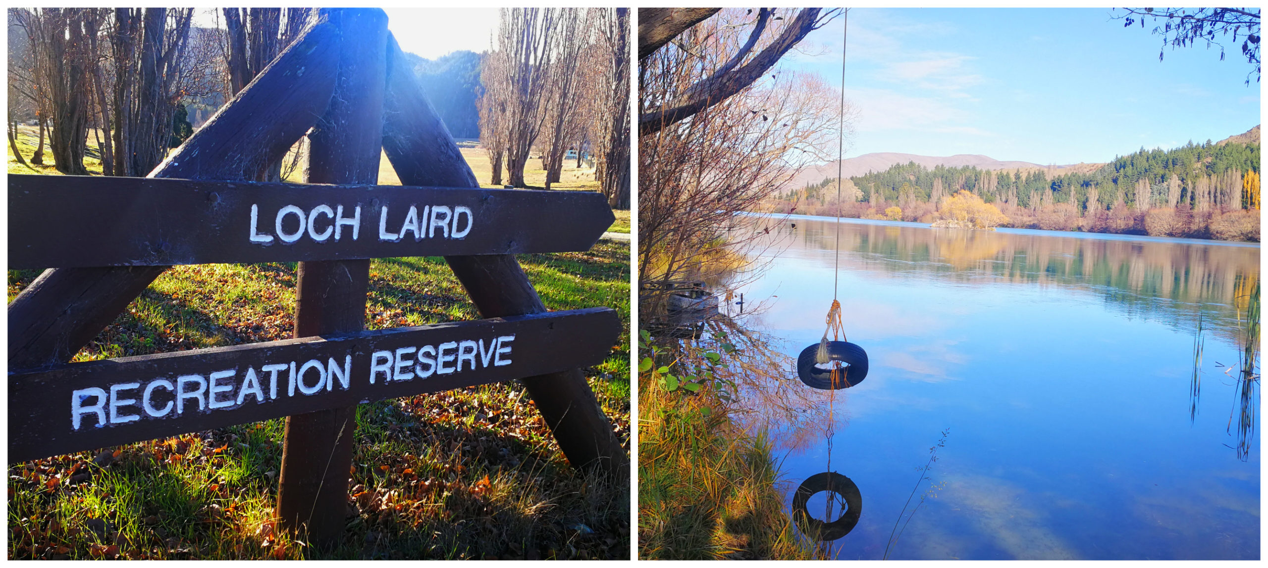
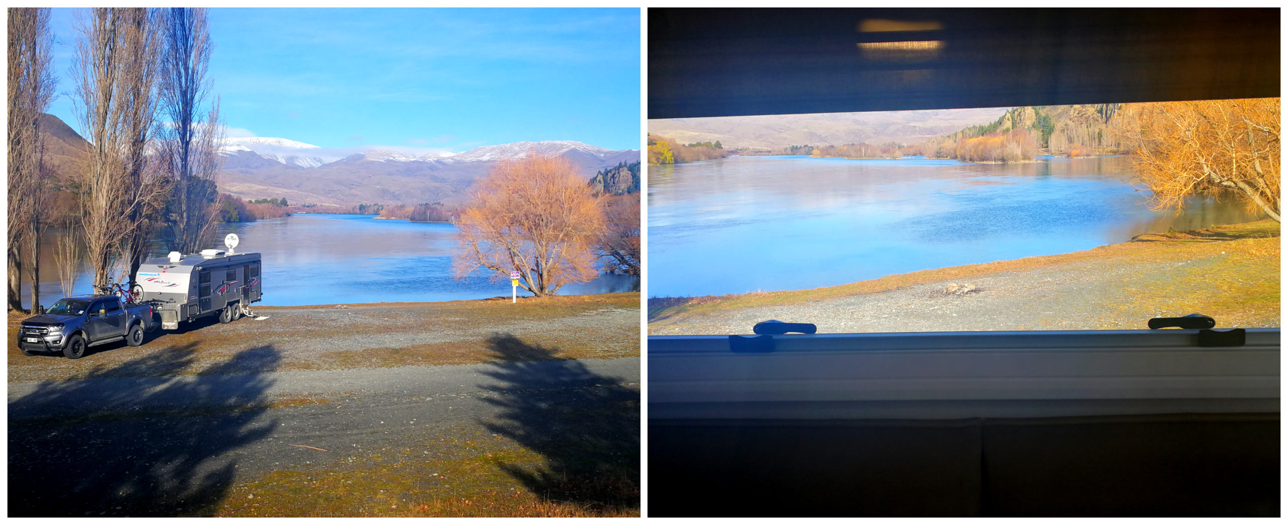
Loch Laird was our home for the night
After driving up and over the dam and back, we decided to overnight at Lock Lairn Reserve. As all the facilities (toilets and water) at the camp were closed, it was free to stay. Normal casual camping fee is $8pp per night.
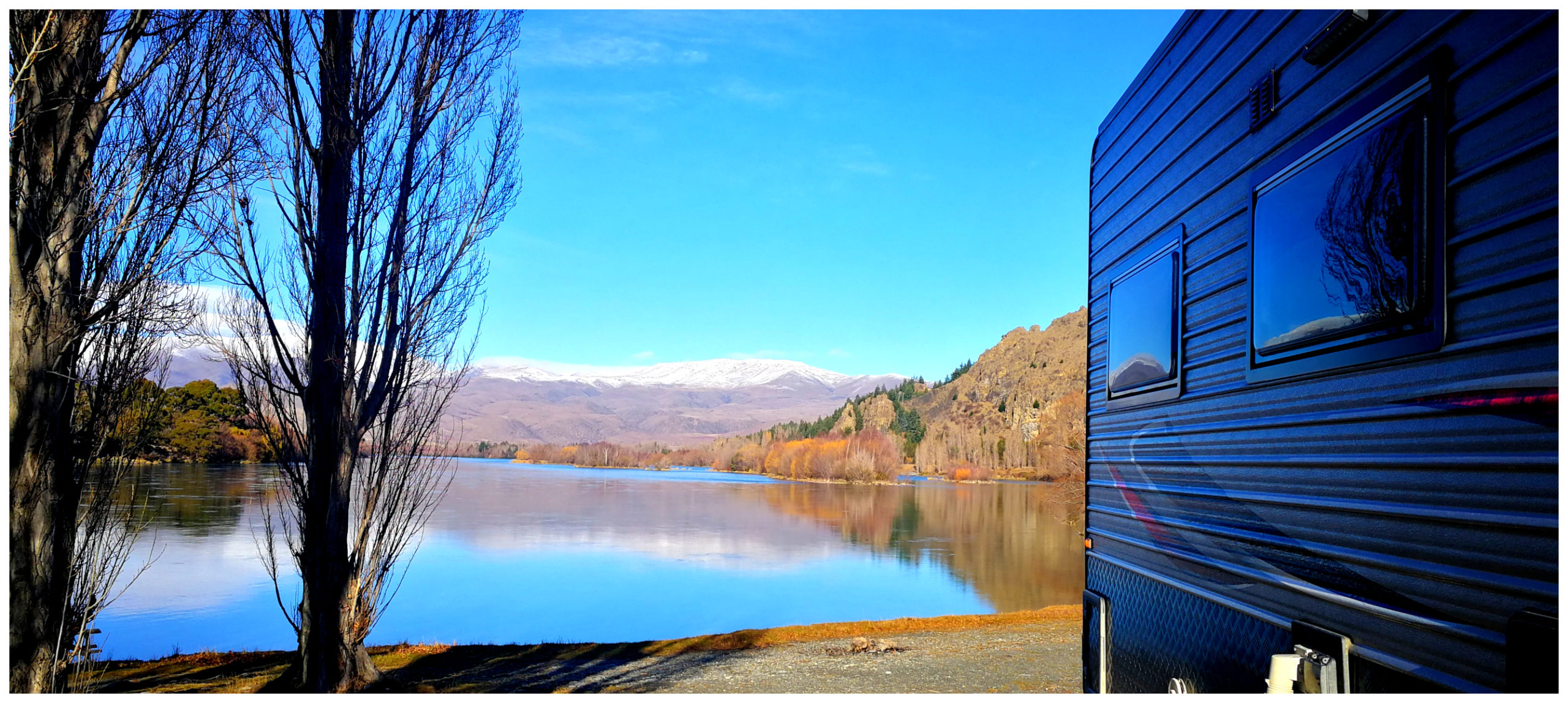
oh my…..whatta view!
Located right on the Waitaki River which flows from the Benmore Spillways, we had an amazing view right down the valley. It was peaceful and quiet and we had the place to ourselves.
and I was very happy with this view from our lounge window
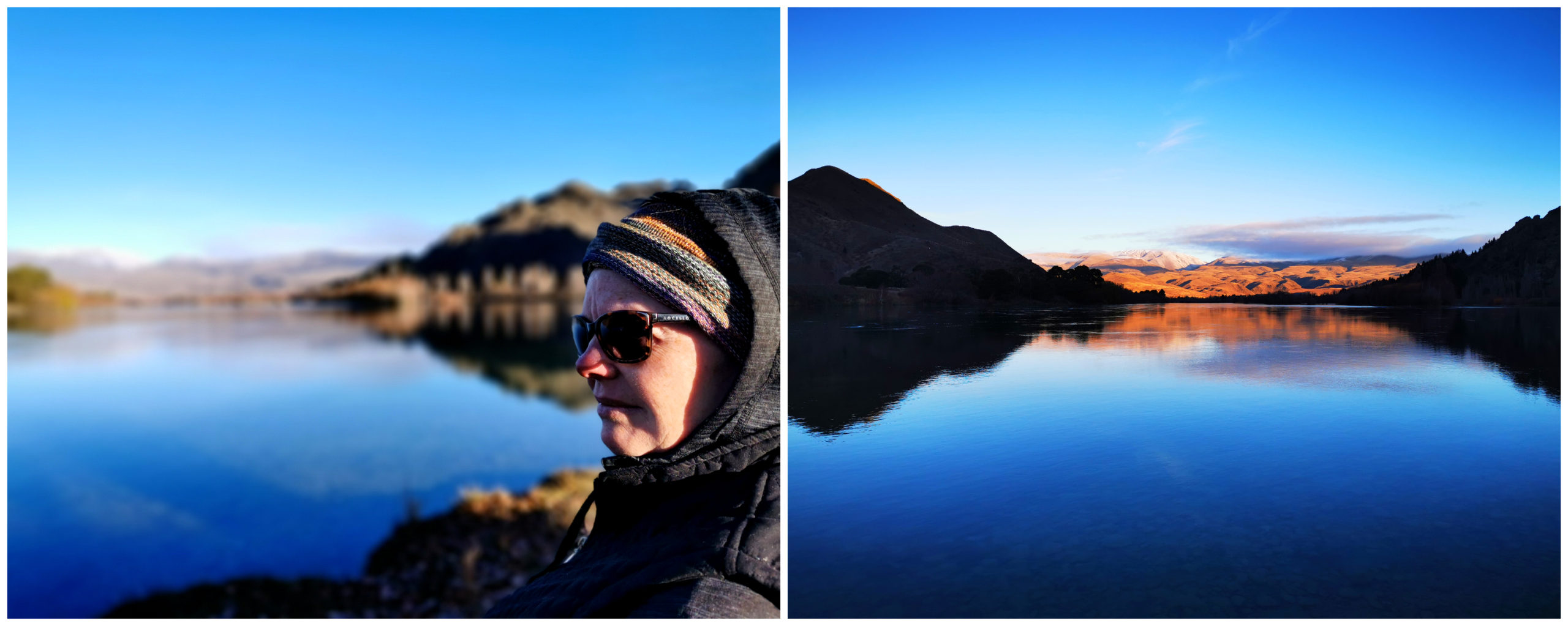
morning has broken…..I feel a song coming on!
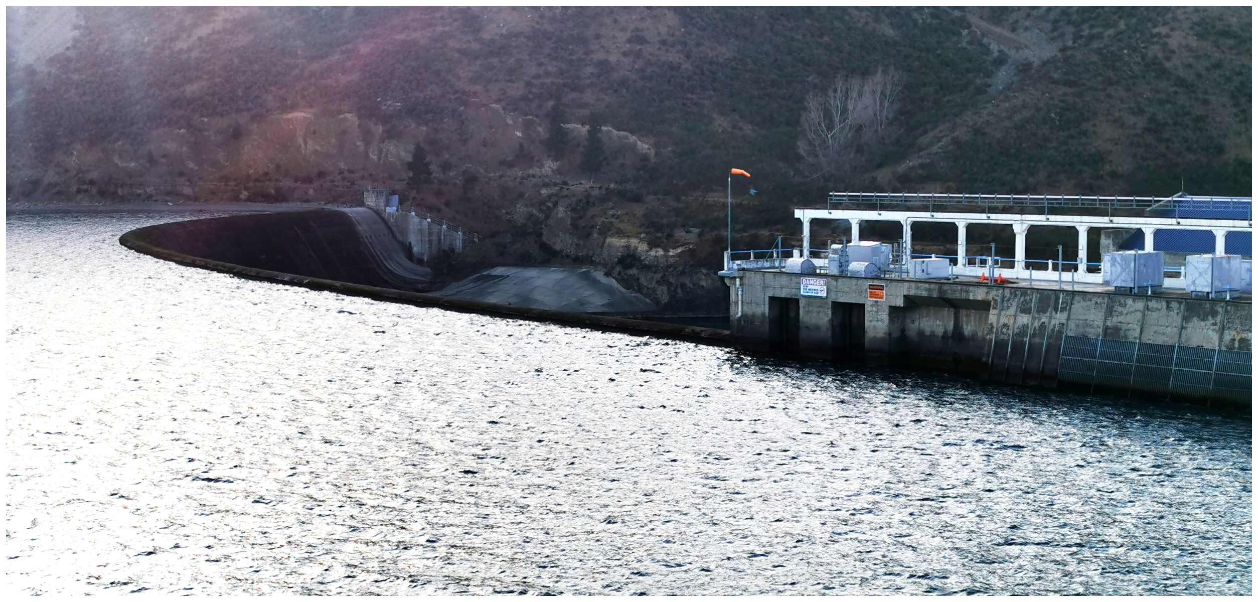
Aviemore Dam
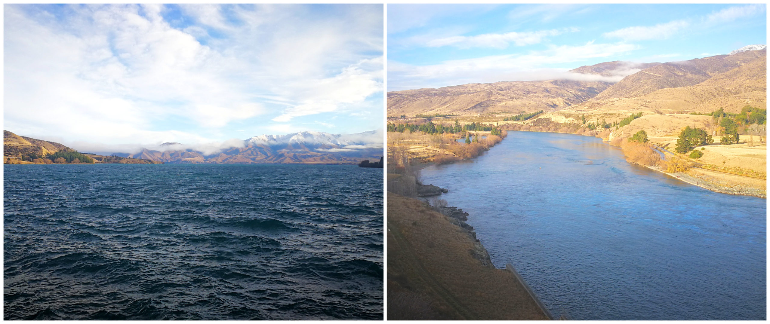
Back on the road the next day, we were up and over Benmore Dam again, this time heading towards Aviemore Dam. Travelling down the eastern side of the lake for approximately 22km, it was so picturesque.
Mind you, extra attention to the road ahead of us was needed. There seemed to be a lot of roadkill to avoid. On closer inspection, the roadkill turned out to be wild wallabies. There were also random rocks that had dropped off the close cliff faces that hug the roadside.
what a difference a dam makes…..the two sides of the Aviemore Dam
Unlike the Benmore Dam, Aviemore Dam is constructed of both earth and concrete. This is because it actually crosses a faultline. I wouldn’t have thought that building a dam on top of a faultline would have been a good idea!
crossing the Aviemore and the faultline!!!
Just to make me feel better about it being on a faultline, considerable work was done during the 2000s to strengthen the dam against earthquake forces.
When the dam was first constructed during the 1960s the faultline was deemed inactive, but they have since upgraded it to dormant. Very reassuring.
top of the dam and spillways
Like the other lakes and rivers in the area, there are a variety of camping options available. There are some pretty magical spots along the shoreline that we’ll have to revisit to try them out next time we’re in the area.
Waitaki Dam
Further downriver from Benmore and Aviemore, you’ll come across the Waitaki Dam. It is the smallest, oldest and furthest downstream of the three man-made lakes of the Waitaki hydroelectric project and located only 7km from Kurow.
no spillways on the Waitaki Dam
Work began on the 48m high dam in 1928 and was officially opened in 1934. It is unusual in design by the fact that it does not have a spillway. The water flows over the top, which would look quite spectacular in times of floods.
It has a rather interesting history, as it was the last major dam to be built by pick, shovel and wheelbarrow. At its peak, 1200 men worked in freezing and often dangerous conditions. It must have been a hive of activity during the extremes of Waitaki winters, making for bleak working conditions and high accident rates.
Little remains of the 350 houses and 700 huts that housed these men and their families.
Awamoko NZMCA Park
From our camping spot at Loch Lairn, we kept on heading towards the coast.
We were heading towards Duntroon. We called into the Domain Camping Area in the township but for the price ($25 with power or $20 without) we decided to carry on to Awamoko Domain, an NZMCA Park (#8237), 17 km further on.
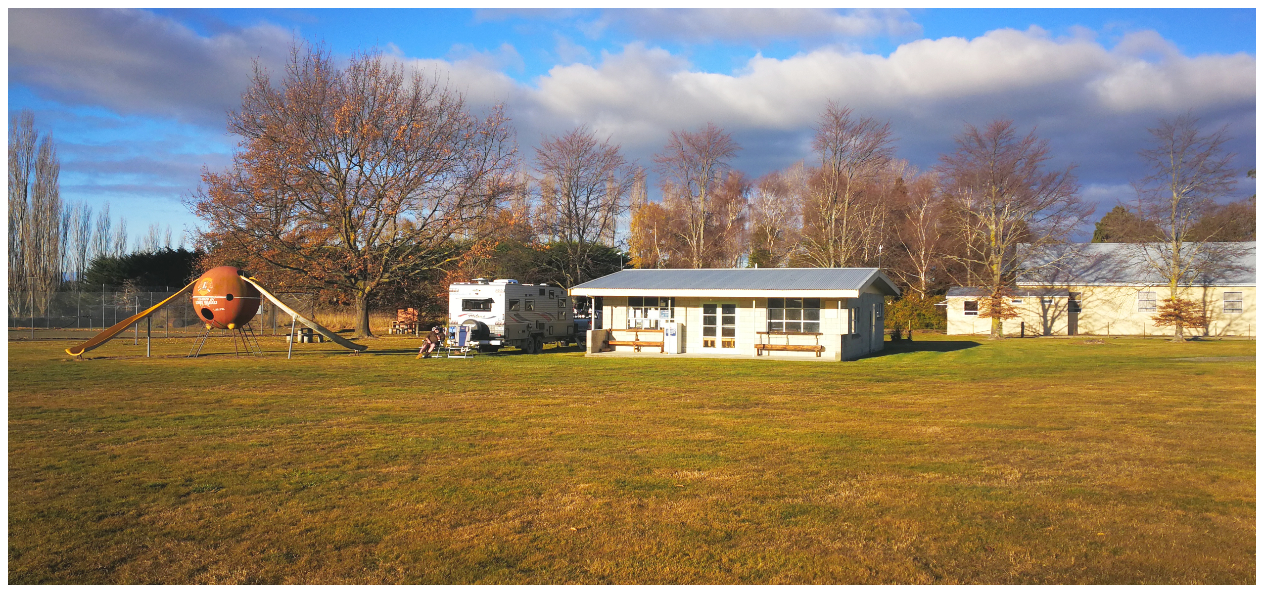
Our parking spot at Awamoko NZMCA Park, spoilt for choice as there was so much room!
Being an actual Domain, meant that it was a large, spacious and flat area with plenty of options when it came to parking up. We tucked ourselves behind the old clubrooms to give us a little shelter from a stiff breeze coming in.
It is pretty much in the middle of nowhere with the district of Awamoko being a predominantly a pastoral and agricultural district.
It made an ideal base for us to explore Duntroon and its surrounding area.
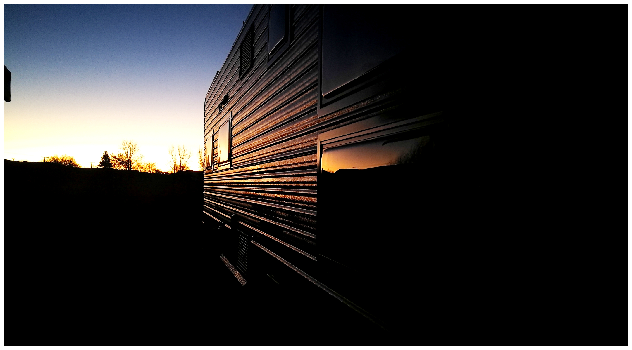
we were treated to a stunning sunset
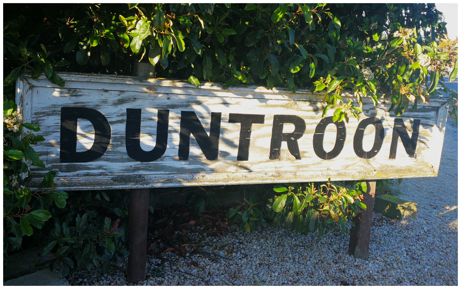
Duntroon
Located only 25 minutes inland from Oamaru, the town straddles SH 83 and offers weary travellers a place to stop for a break in their journey.
The Alps2Ocean cycle trail also traverses the Duntroon Wetlands and emerges at the centre of the township. Many cyclists choose to stop in Duntroon whilst making the trip from Mt Cook to Oamaru.
we made our way back to explore a little of what Duntroon had to offer
After we had set up camp at Awamoko, we made our way back to Duntroon. The small farming town lies in the Waitaki District although traditionally considered a North Otago town. Over the years, borders have been moved between regions. It now lies within the farthest southern reaches of Canterbury.
Duntroon was once a very busy railway terminus of the Kurow Branch line. It actually served the town for well over a century, only closing in 1983. The old railway station has been turned into boutique accommodation for fly fishermen and cyclists on the A2O cycle trail.
The Vanished World Heritage Centre is located within the township. It showcases the geology of the Waitaki region and provides information on the fossils of extinct species that have been found in the region. We didn’t go in this time around but click here if you want to find out more information.
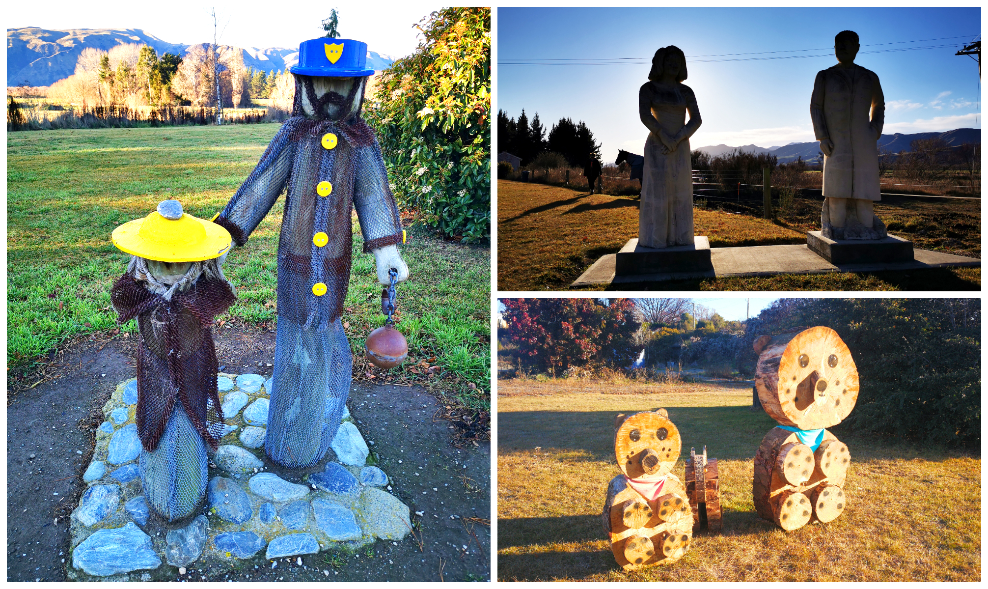
some quirky statues in the small town of Duntroon
Nicol’s Blacksmith Shop
Sitting right in the middle of town, you’ll find the Nicol’s Blacksmith Shop. It has been part of Duntroon’s history for over 100 years.
It is rather unique as it is a very rare example of a building of its age, still presented in its original form. Typically constructed of weatherboard over an earthen floor. Often these buildings were modernised in keeping with the times. This would include the installation of luxuries such as flooring. It was built for a purpose back in the day, and that is how it stayed.
Thankfully, four local farmers purchased the Blacksmith Shop in 1975 so that its original condition and purpose was maintained. The Blacksmith Shop is now owned by the Nicol’s Blacksmith Historic Trust.
Open with working Blacksmiths weekends 10 am-3 pm from Labour weekend to Queens Birthday weekend.
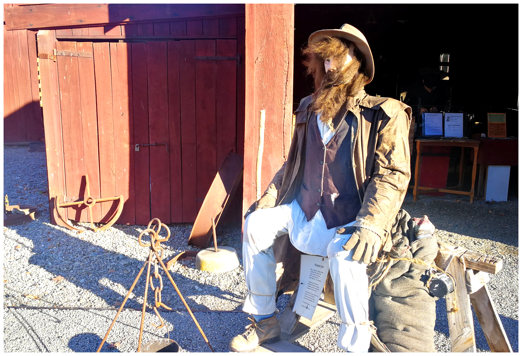
this dude sits ‘pride of place’ outside the Nicol’s Blacksmith Shop
St Martin’s Anglican Church
Quite possibly, one of the most photographed churches in the Waitaki District.
Built and consecrated in 1901, and constructed of solid limestone (Oamaru Stone). It stands as a very grand testament to some amazing craftsmanship of the time. It has got quite a Gothic style and is named after St Martin’s in the town of Duntroon in Scotland.
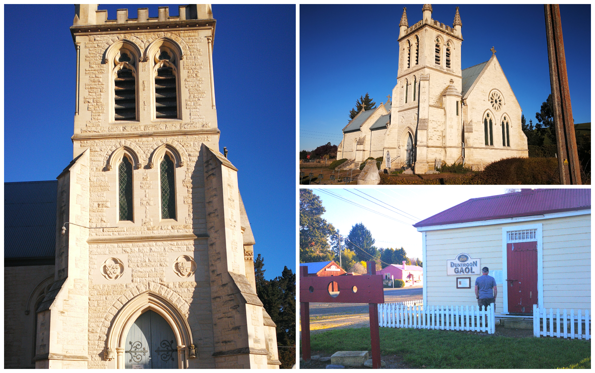
every town needed a church and a gaol, both boxes ticked there
Earthquakes
Now that name got my attention. How on earth does a place get a name like “Earthquakes”?
Well, it’s not what I thought. It was given its name when it was thought that the house-size rocks that lay there were dislodged by earthquakes. Millions of years ago they split away from the cliff faces due to the land slumping not earthquakes.
There is an underground river which runs right under the Duntroon area. Millions of years ago the region was deep under the ocean. This is why it attracts many fascinated geologists every year. Very well-preserved fossils of shark-toothed dolphins, whales, penguins and many more marine life can be found all over the region’s farmlands. All over some 400 metres above the sea level.
A short 10 minute walk uphill, on Earthquakes Rd, we could clearly see some remains fossilized in the limestone rock.
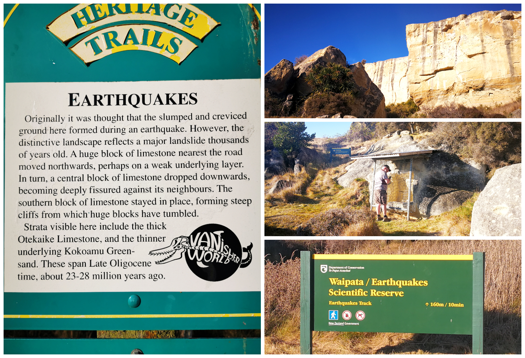
Fossil finding on Earthquakes Road
Elephant Rocks
Here, lying in grassy fields is a paddock full of rocky limestone outcrops in all different shapes and sizes. To some, they look like elephants (with a lot of imagination). It has been 60 million years in the making!
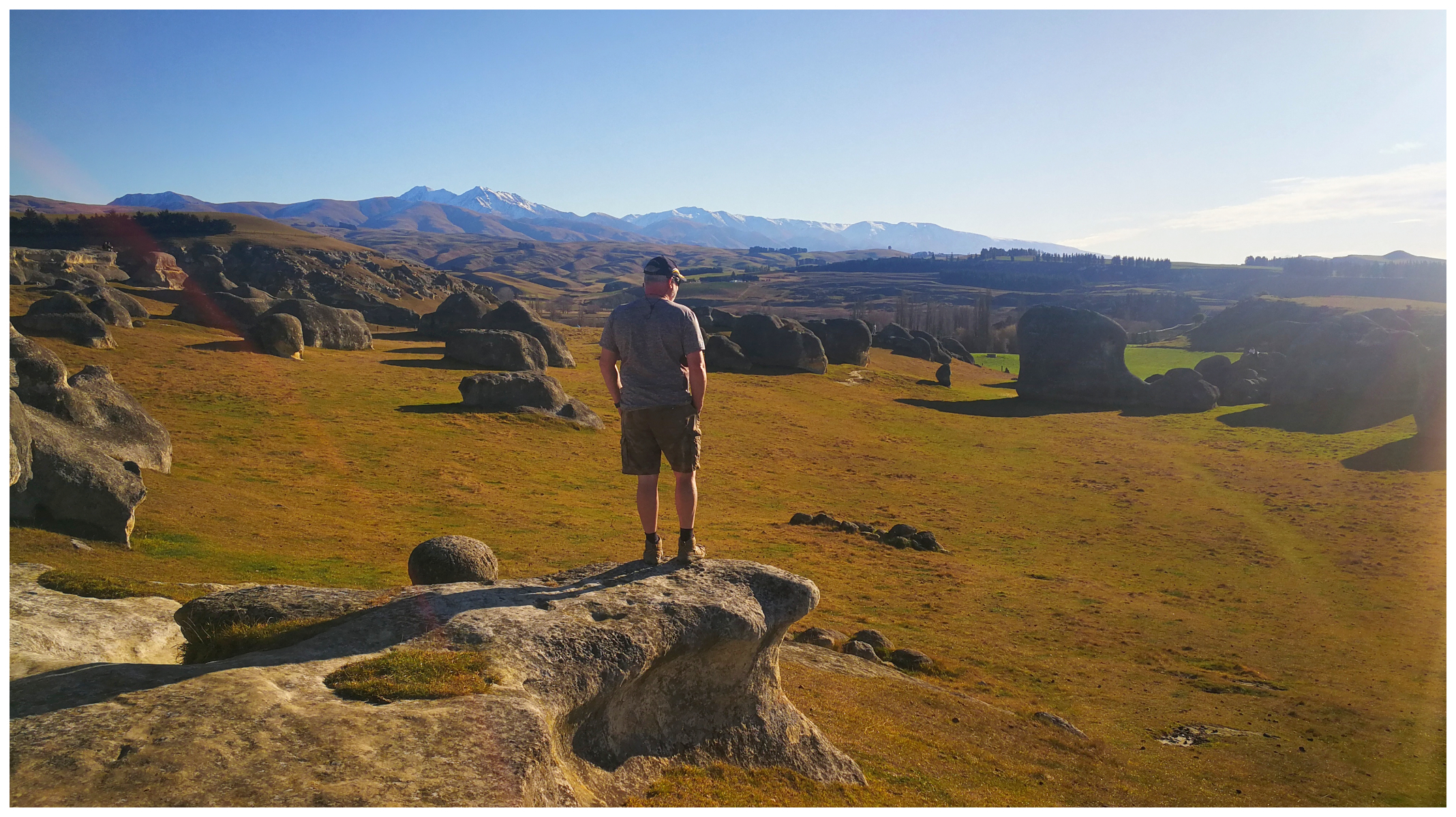
a birds-eye view of the Elephant Rocks
Some scenes in the movie The Chronicles of Narnia was filmed amongst this incredible boulder-filled field.
The rocks show signs of weathering and erosion. They have been rounded smooth or pockmarked. We did struggle to find any that resembled an elephant – except one!
The paddock is part of a private farm and accessed via a 5-minute walk from a parking bay on Island Cliff-Duntroon Road.
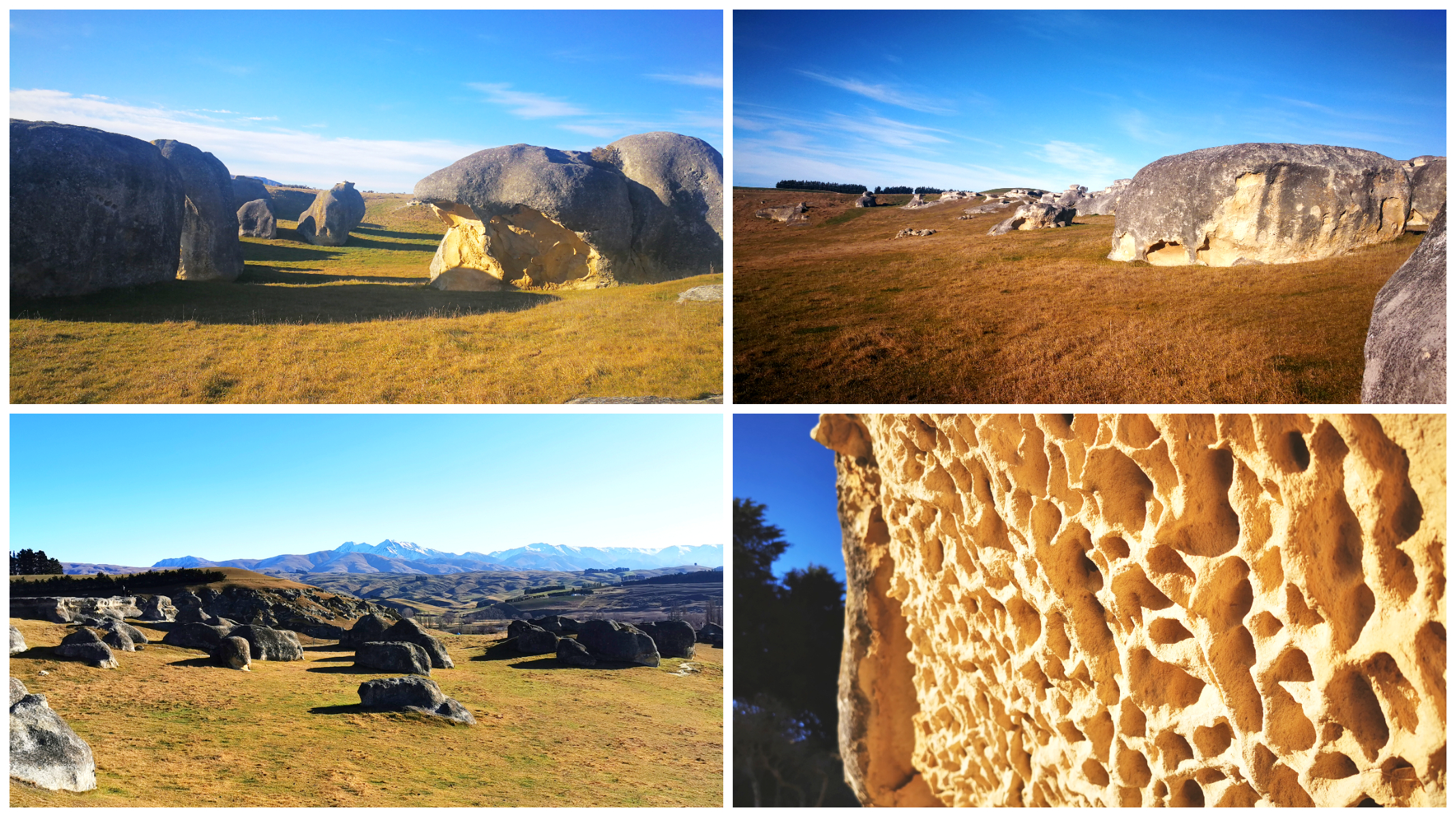
up close and personal with some of the fascinating rock formations
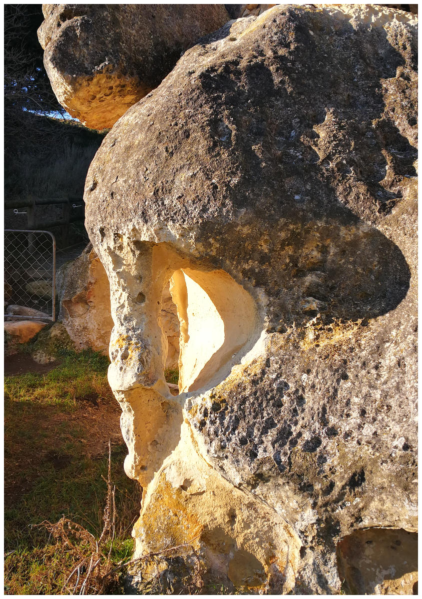
I found the elephant!!
Anatini Fossil Place
Just a short drive further down Island Cliff-Duntroon Road, you will arrive at the sheltered and narrow valley of Anatini. They also used this site for filming scenes in Narnia.
A short 5-minute track from the parking bay winds its way into the valley. Here we came across the fossil of a baleen whale, partially exposed in a limestone outcrop. It did take a bit of imagination to work out how the skeleton was lying.
The fossils are all encased in under a protective cover to ensure it remains safe from weathering or vandalism.
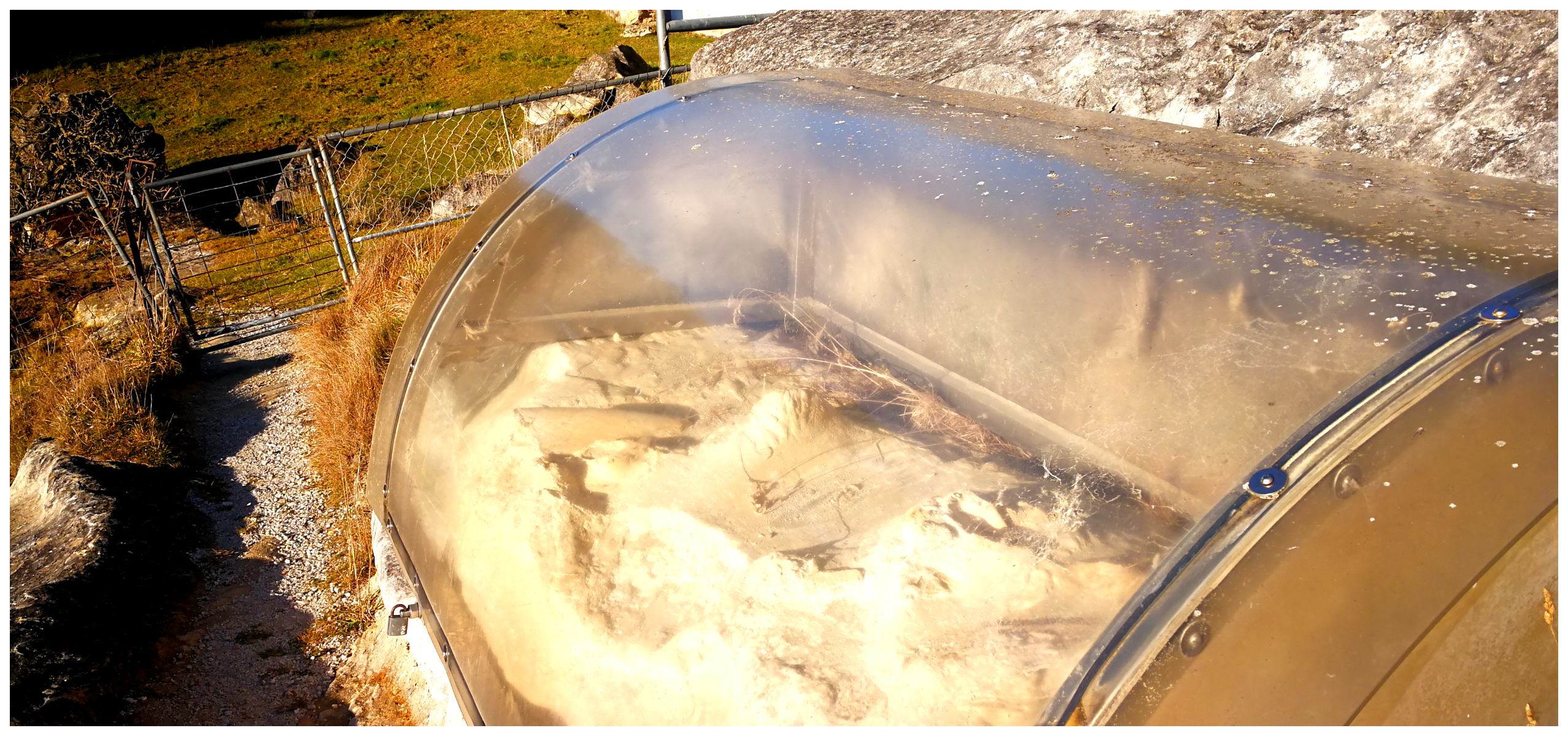
more fossil finding, this time a baleen whale (I’d never heard of these before!)
Maerewhenua – Rock Art Site
There is actually a couple of sites to view Maori Rock Art in Duntroon. You will easily spot Takiroa Rock Art, located not far from the township of Duntroon.
There is evidence that this is where early Maori took shelter under the limestone cliffs. They left their mark by way of artwork. We could see their drawings through the protective fencing.
The second site to witness some of the ancient artwork is at Maerewhenua, a short distance out of town (Cnr of Livingstone-Duntroon Rd & Settlement Rd)
Once again, located under an impressive limestone overhang, it contains charcoal and ochre paintings which date back to before the arrival of Europeans. Multiple Moa bones have been discovered here. This indicates that Maori occupied the site for hundreds of years.
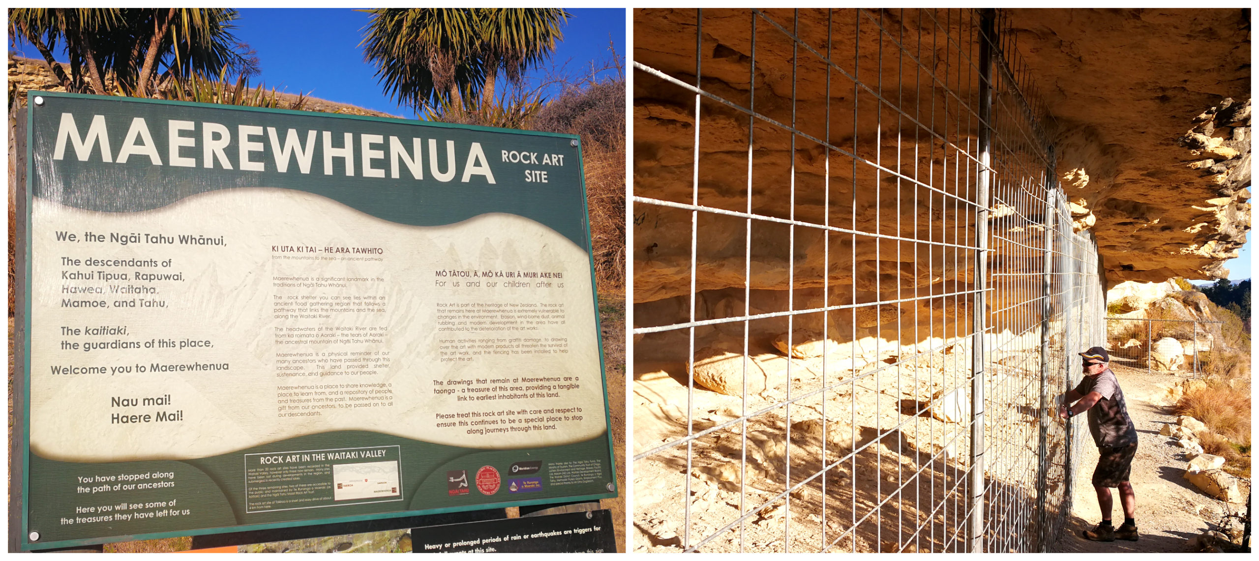
I wouldn’t make a special trip to see the rock art but it was still interesting to learn the history
Exposure to the weather has not been kind to these carvings or artwork. A lot of fading and deterioration has taken place over the years. The vandalism of the site prior to the security fencing being erected hasn’t helped either. Some of the graffiti dated back to the 1960s and beyond. That is if the dates inscribed is to be believed. It was a shame that this has ruined history forever.
Danseys Pass
Danseys Pass is a gravel road located on the boundary of the Waitaki and Central Otago districts. It is also sitting right on the boundary between the Canterbury and Otago regions.
The road is predominantly gravel and cut directly from the Haast Schist solid bedrock. It is a well-used link between the towns of Naseby and Ranfurly in the south, through to Duntroon.
The pass is named after William Heywood Dansey. In 1855 with three companions, they were the first Europeans to cross the pass in search for land in the Maniototo district.
We were aware of the “not suitable for towing” rating, so we took the opportunity to explore the Pass without the caravan on the back.
Not a Winter Road
Danseys Pass is a mountain pass, therefore subject to adverse weather conditions. It can always be a bit hit and miss with regard to road closures.
The “Road Closed” sign was located near the beginning of the pass at Livingston. We agreed that we’d like to get as far as possible. After all, we still had 22km to go before we got to the gate.
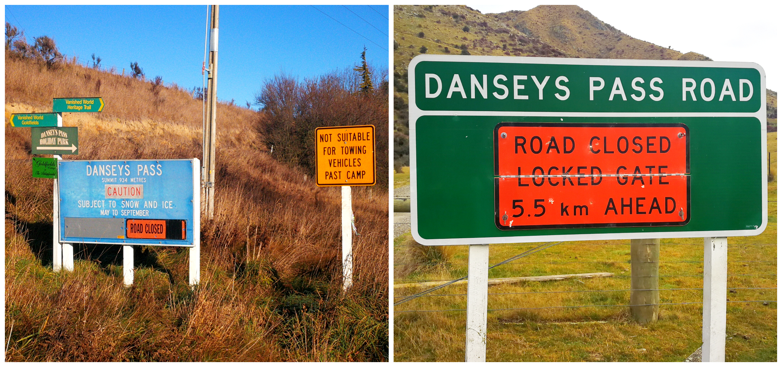
there was ample warning of the road closures
The 2nd warning sign stated that there was only 5km to go before the closure point. It seemed that this would be a great spot for a hot coffee while taking in some of the fantastic landscape around us.
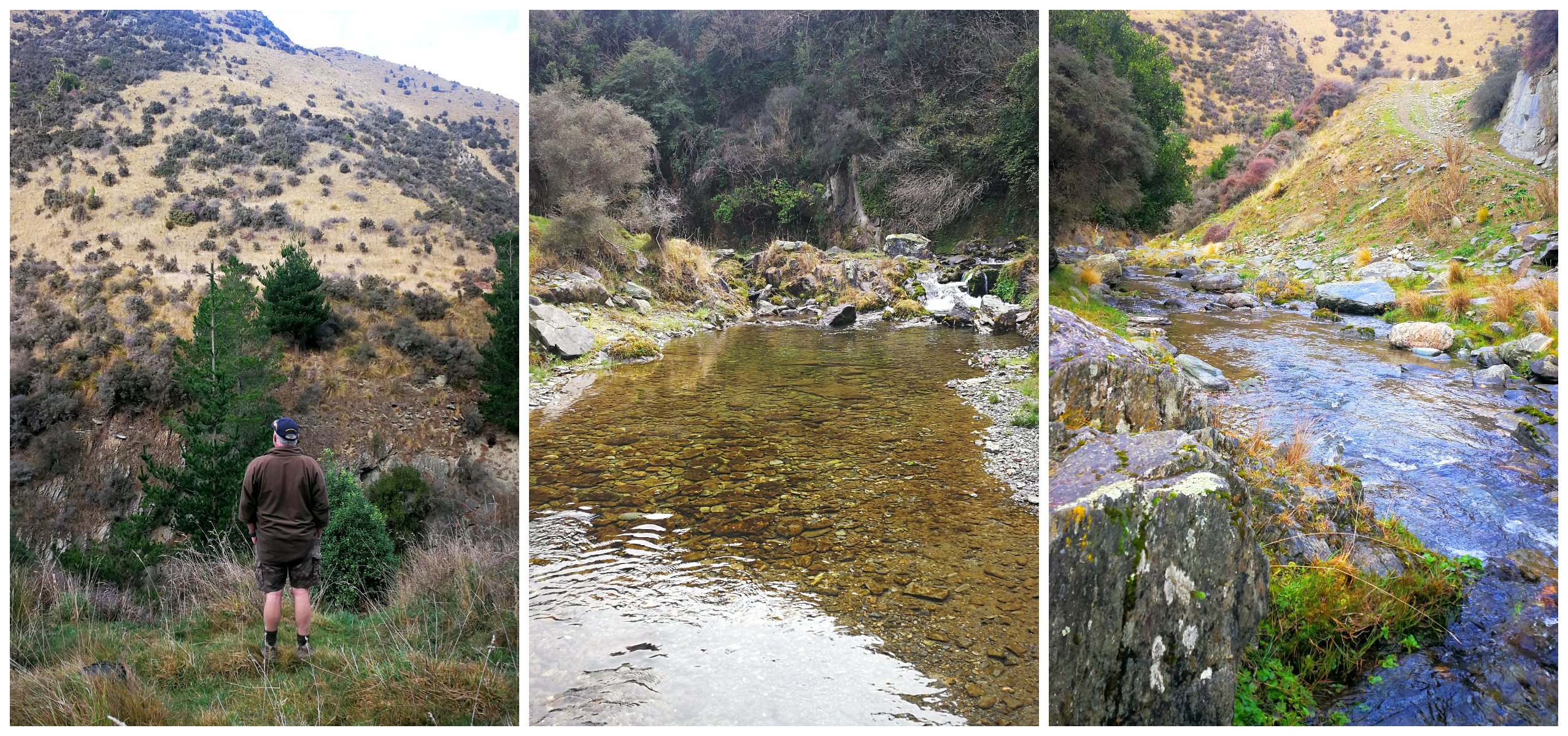
just some of the stunning scenery along Danseys Pass
Although it was disappointing not to be able to tick Danseys Pass completely off the list, we’ll look forward to exploring the other end of the pass when we eventually get to visit Naesby in the future.
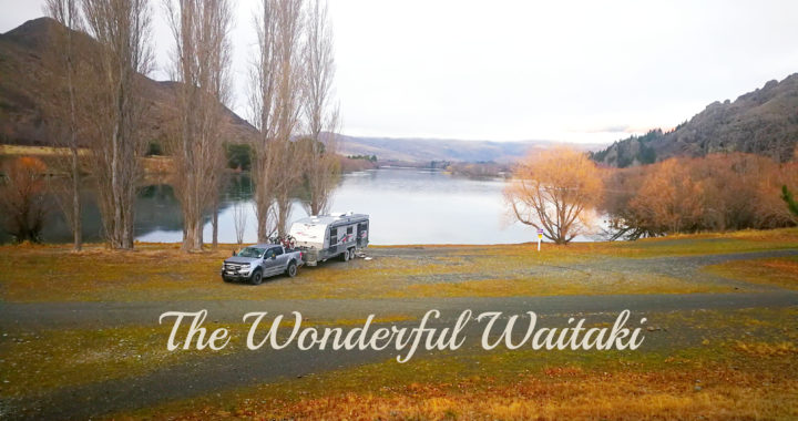
Farewell Waitaki
It’s fair to say we love the Waitaki District and it covers such a big area.
Our next stop was Moeraki. But to read all about our stay there, you will need to stay tuned.
Click on the link below to view a video of some of our highlights of the Waitaki.
There are so many wonderful places to visit in this area. We were down this way several years ago, so it was nice to revisit through your blog
Robin and Jenny romanyrambler.blogspot.com
Thanks guys, glad it brought back some happy memories. L