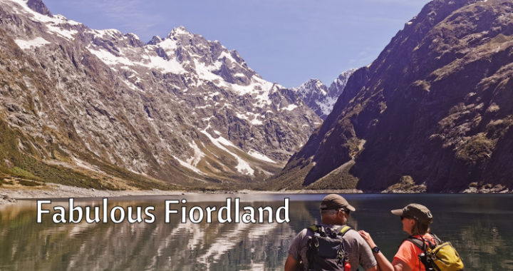
It isn’t our first time exploring the fabulous Fiordland National Park….and it won’t be the last.
It was Time to Revisit Fiordland
Although we’ve been in and out of the Fiordland National Park on day trips, it was way back in July 2020 that we last stayed at Cascade Creek DoC Camp. Needless to say, it was in quite different weather conditions than what we experienced this time. Click here to read what we saw and did during that stay.
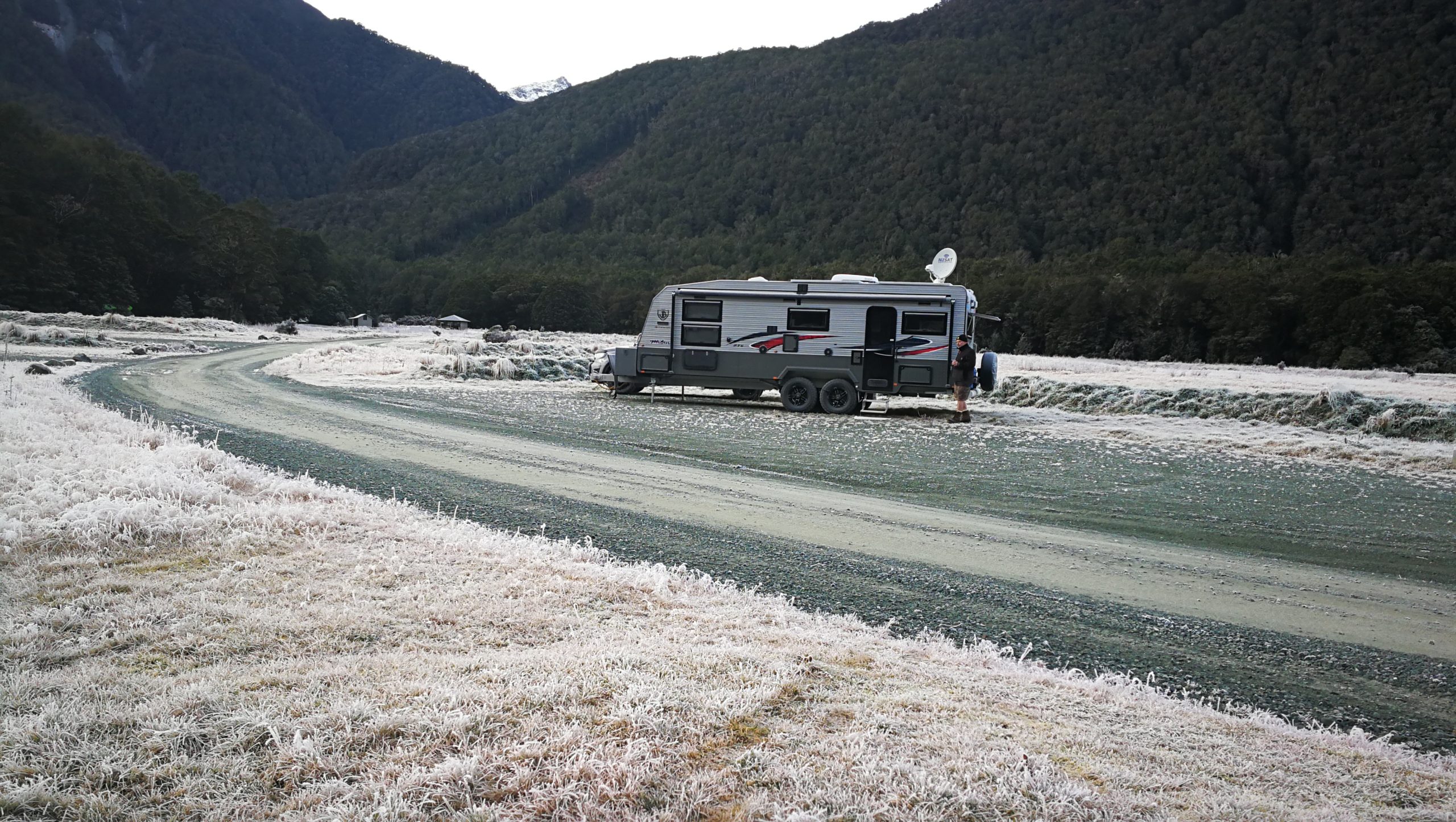
it was a different story temperature-wise when we were last camped at Cascade Creek in July 2020
Cascade Creek DoC Camp
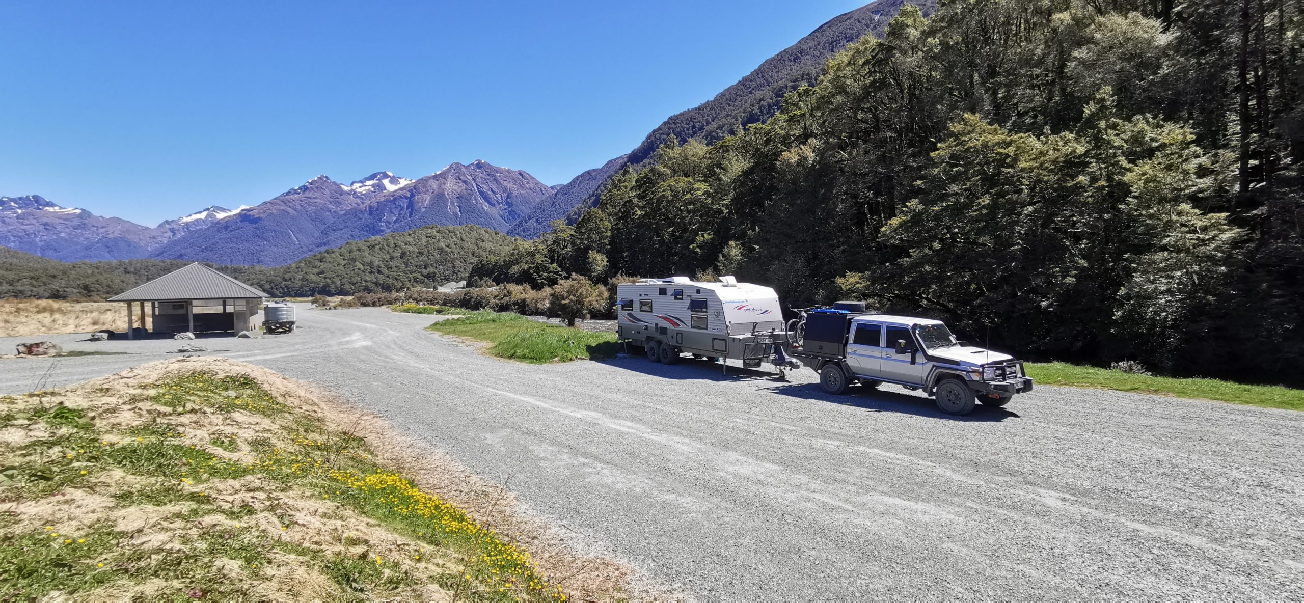
We have explored all the DoC Camps along the Milford Rd within the Fiordland National Park, and for us, Cascade Creek (NZMCA TD#9041) is our pick to stay for a while. It is the largest Doc Camp and the last one before Milford Sound.
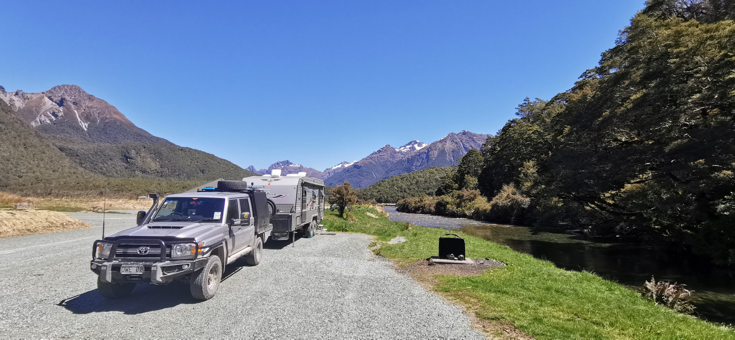
We had a perfect window of opportunity weather-wise to enjoy Fiordland at its best
Like all the DoC Camps in Fiordland National Park, it is $15pp per night, but we stayed using our annual DoC Pass. It is a large, flat area, sited between Cascade Creek and the stream flowing out of the eastern end of Lake Gunn.
lack of tourists and fellow travellers meant that we had the pick of the spots
There are multiple long-drop toilets dotted around the entire camp, non-drinkable water and a couple of shelters. Some of the sites are located close to purpose-built firepits. It was on one of these sites, close to the stream that became our home for the next three nights.
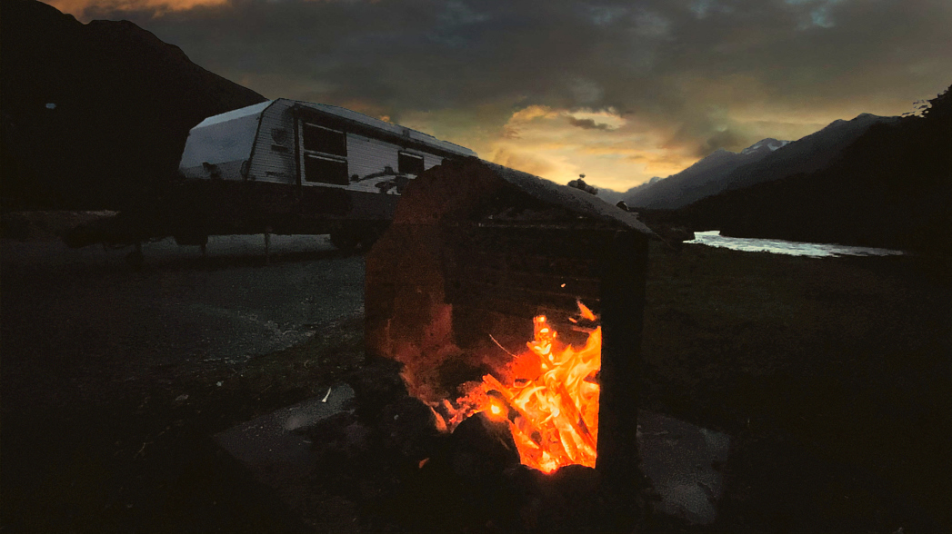
We made sure that we brought a supply of firewood in with us and Scotty soon had a warm glow for us to sit beside for the evening
Cascade Lodge
Some may recall Cascade Lodge which was opened in 1964. This was located across Cascade Creek (opposite side to the current camp). Unfortunately, the 56-bed lodge was built right in the middle of the flood zone and succumbed to floodwater on more than one occasion. It was dismantled and the lodge buildings were transported to Te Anau where they became the basis of what was then the Te Anau Kiwi Holiday Park.
looking across to the site of the old Cascade Creek Lodge, you would never know that such a large building was ever there
We cycled over to what was the site of the lodge and tearooms. Apart from a bit of broken tarseal, there was no evidence that there was ever such a large structure that sat there.
the entryway into what was the Cascade Creek Lodge
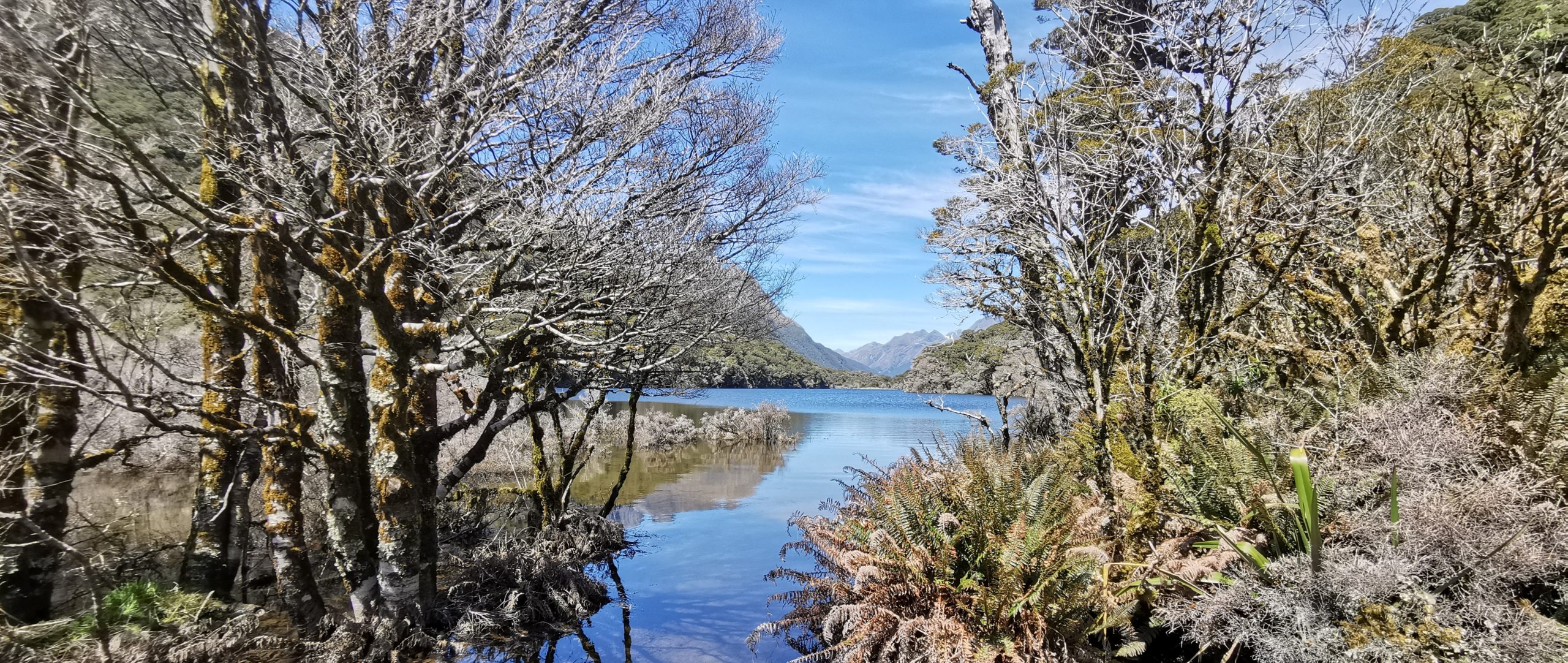
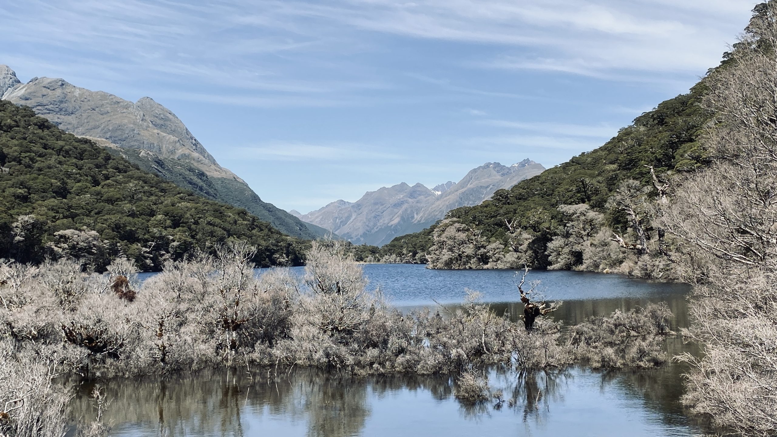
Lake Gunn Nature Walk
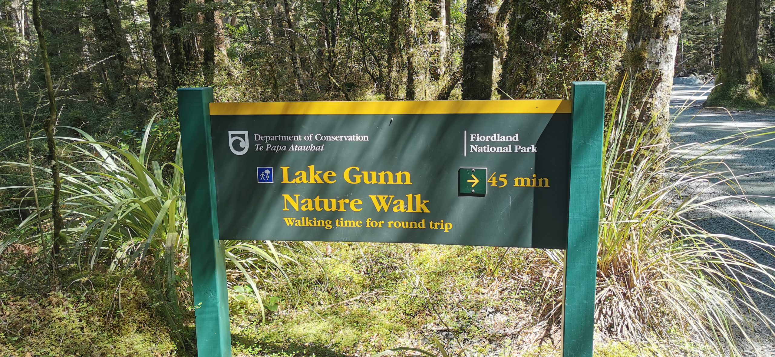
you can’t miss the sign as you drive into the campsite, pointing you in the direction of the Lake Gunn Nature Walk
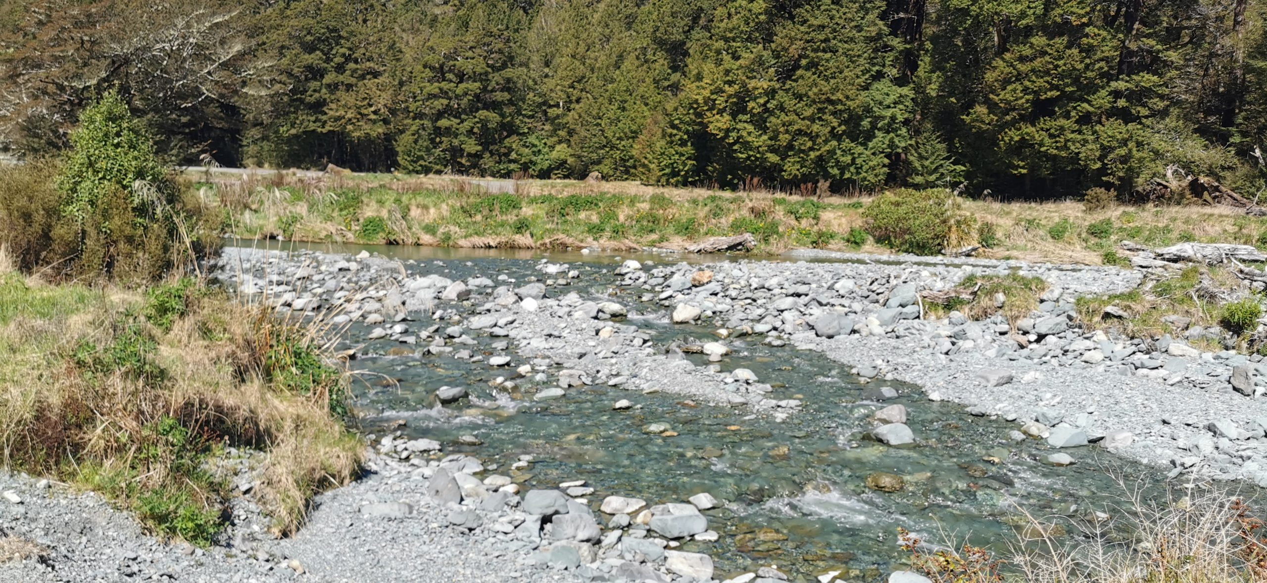
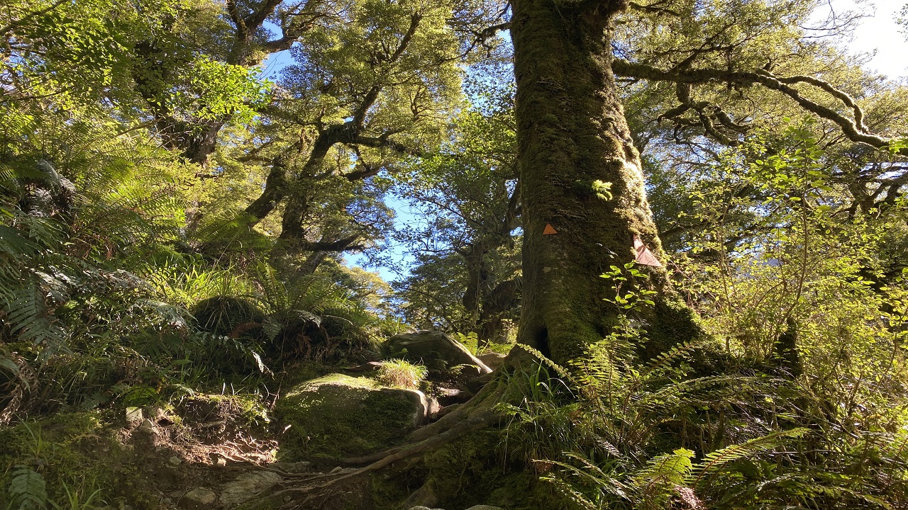
As in our last stay, we enjoy the beautiful nature walk which takes you to the shores of Lake Gunn. Instead of doing the loop, you can divert off and follow the outlet stream that will bring you back to basecamp.
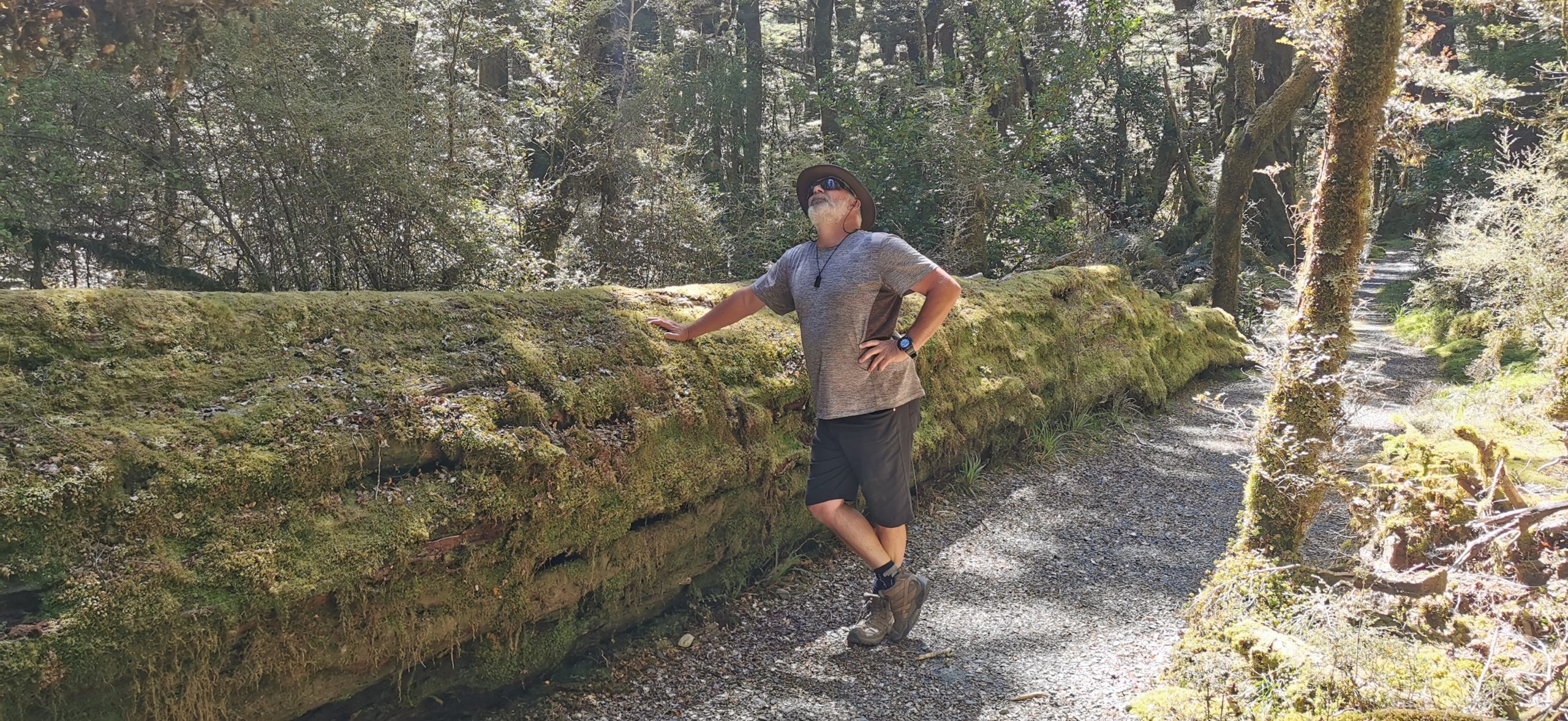
the moss-laden beech trees that have fallen along the trail
It is a very enjoyable 45-minute stroll through moss-laden trees and a crystal clear babbling stream.
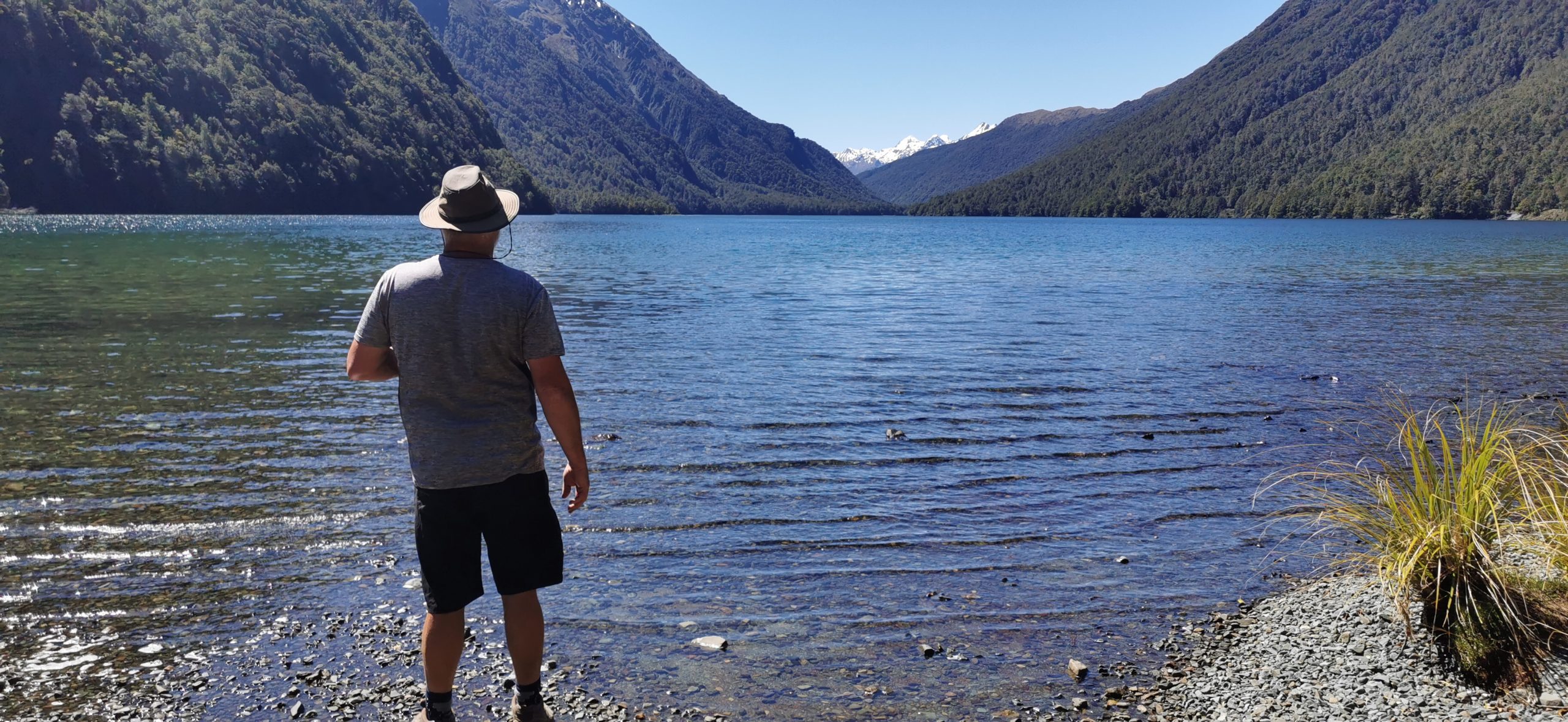
Lake Gunn, always such a pleasure to behold
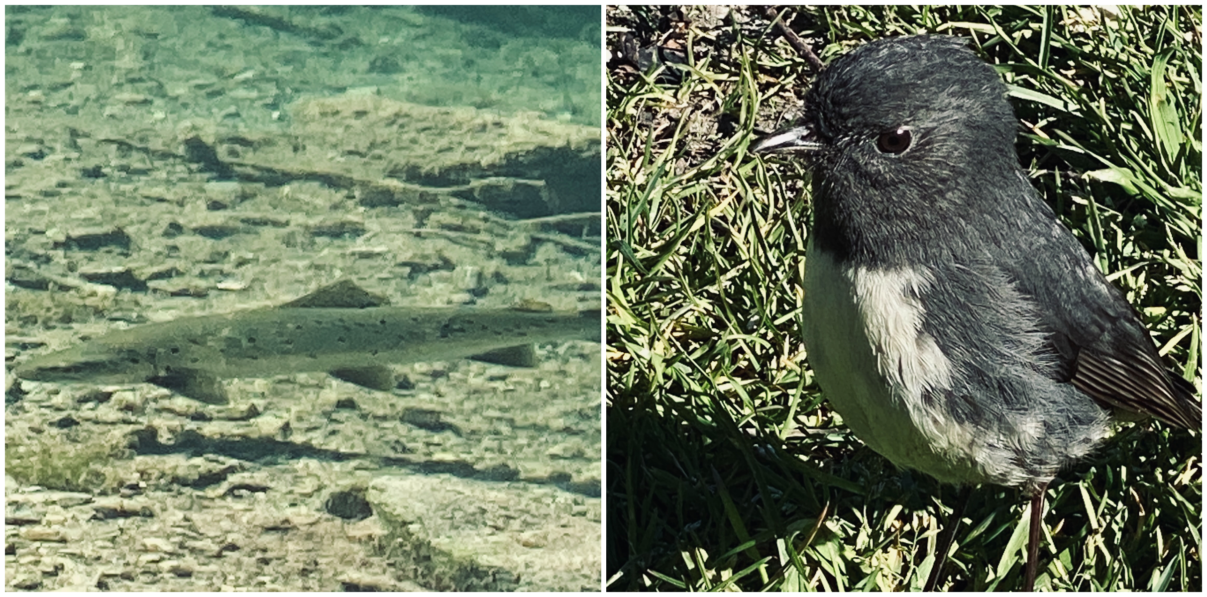
One of the advantages that has come out of these crazy times, is the increase in the presence of birds. This friendly NZ Robin kept us company for most of our walk and we watched this trout slowly swimming by.
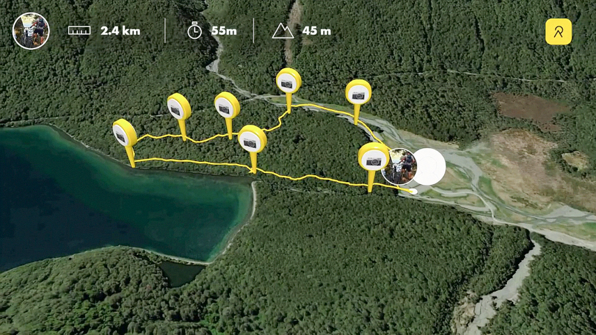
an aerial view of our Lake Gunn Nature Walk
Our Unfinished Business in Fiordland National Park
Having stayed during winter last time, we were a bit limited on the tracks and trails we could walk. Many were still closed after the massive floods swept away some tracks during the devastating floods in February 2020.
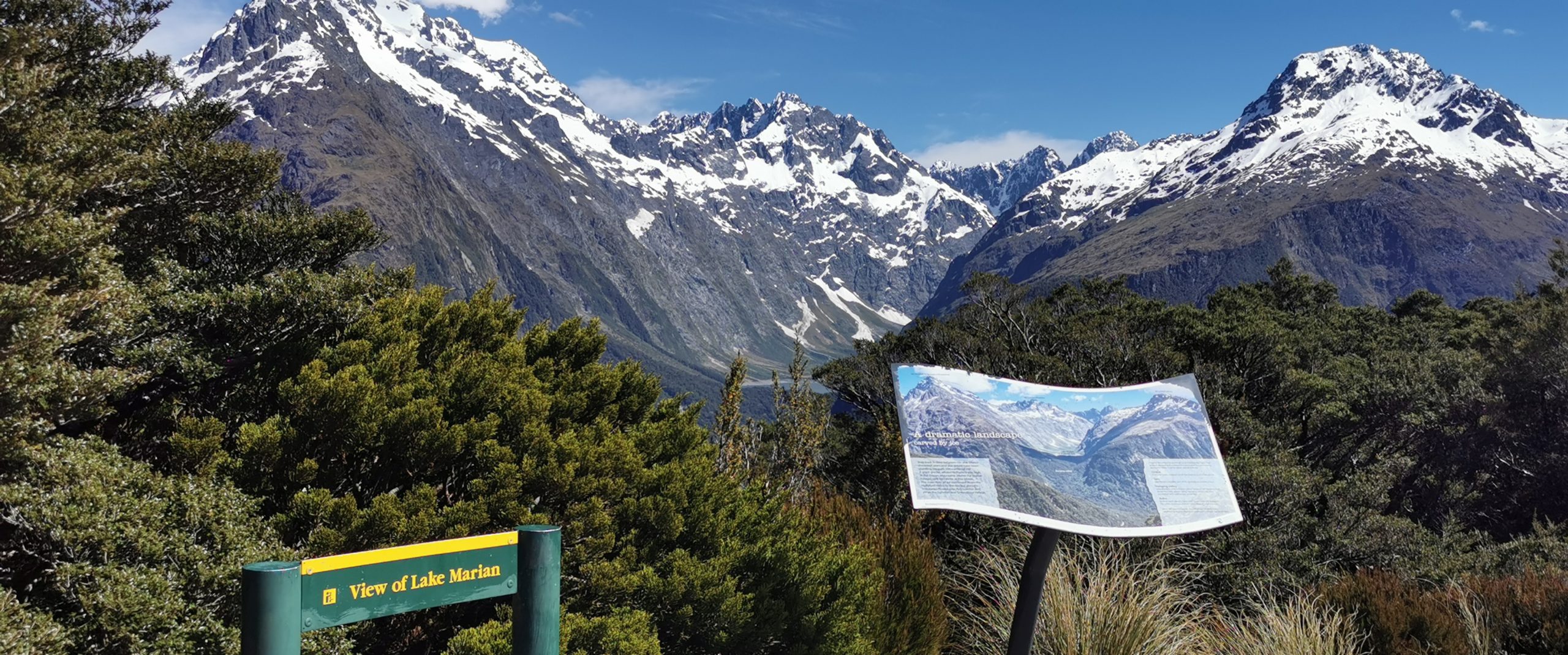
Lake Marian Track
One of the tracks that were closed was the track to Lake Marian. We’d seen photos from fellow travellers who had hiked there and it was somewhere that we really wanted to tick off the list.
On doing some research, I discovered that it was going to be a challenging hike, but one I wanted to conquer, regardless of how long it was going to take me.
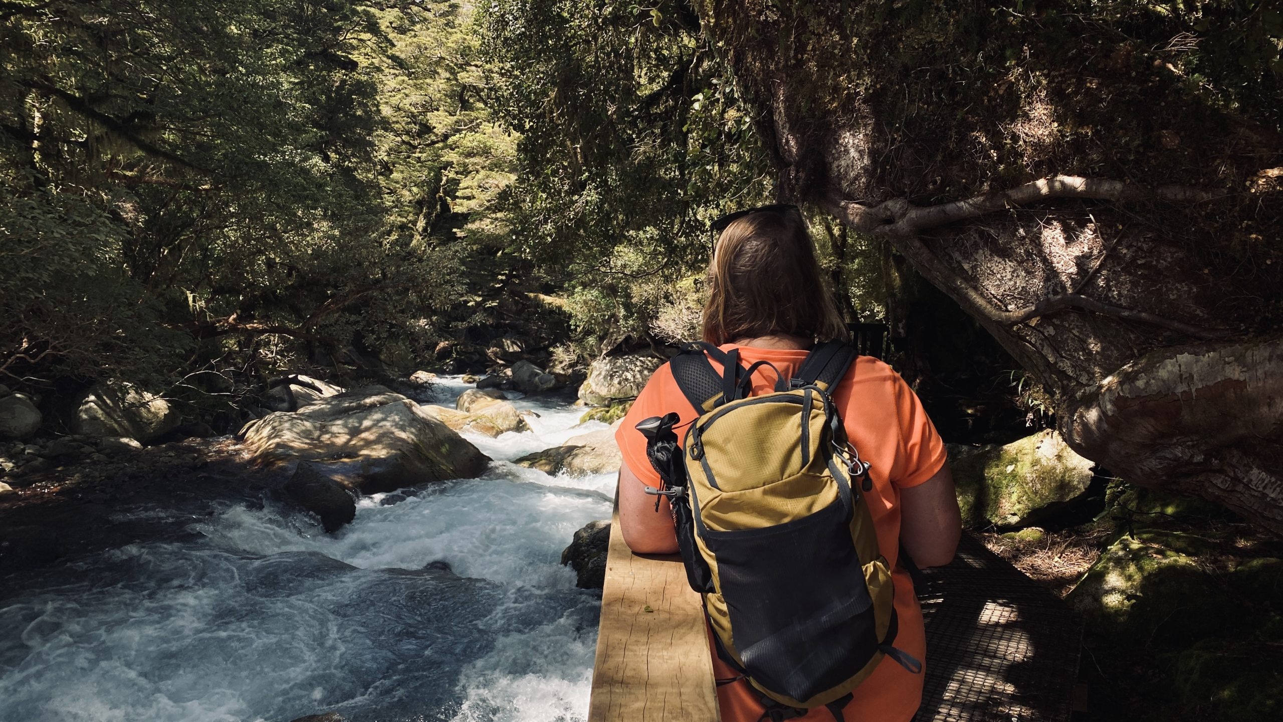
I’m still nursing a sore knee which has been troubling me for most of the year. With my knee strapped, pain killers, coursing through my blood and two hiking poles, we set off in the truck to Hollyford Road, just a short drive away.
the signs point you in the right direction
About 1km down the road, you will easily spot the parking area and signs to point you in the direction of the track.
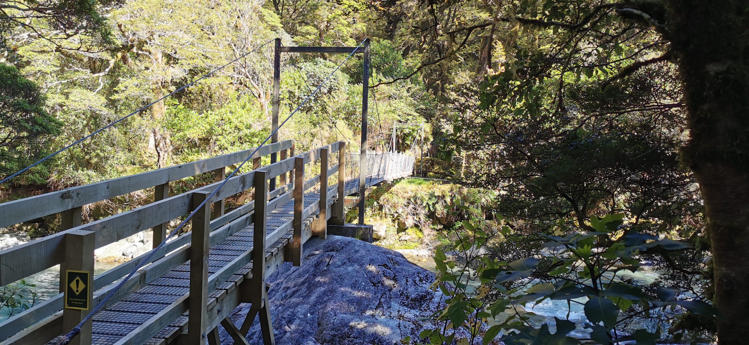
the first obstacle you need to tackle is the swing bridge across the raging river below
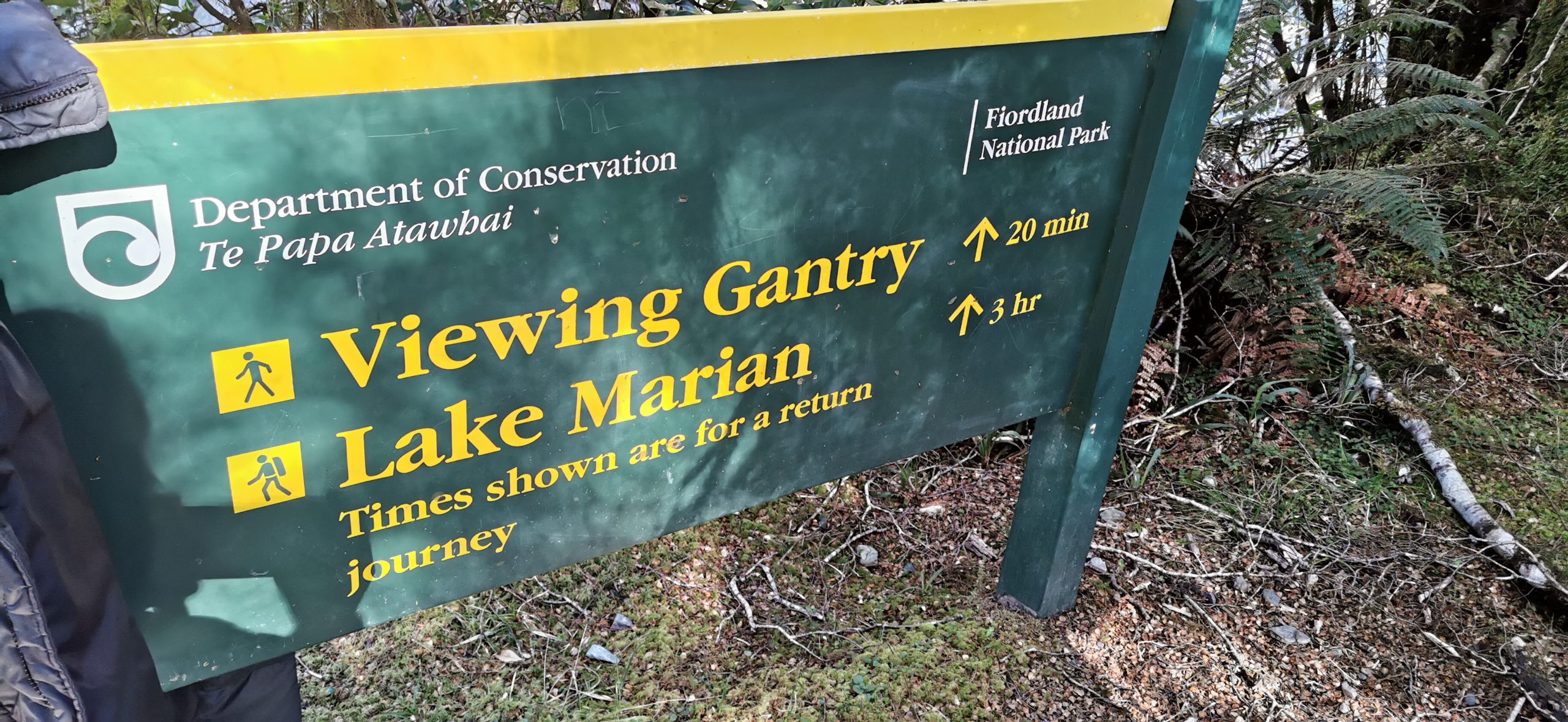
Viewing Gantry
If you aren’t keen on a 3-hour arduous hike to the lake and back, then I urge you to take the shorter 20-minute easy stroll across the suspension bridge to the Viewing Gantry.
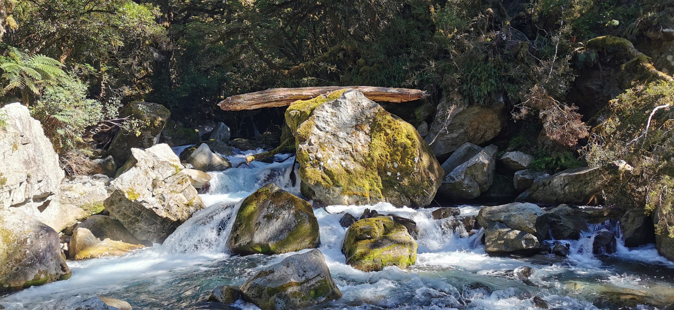
Mother nature balanced this log perfectly…..there must have been some raging waters to put this on top of the boulder!
The Marian Falls are just stunning. The sheer amount of water coming down the rocks and boulders are mesmerising. The wooden walkways take you close to the action and literally overhang the roaring waterways.
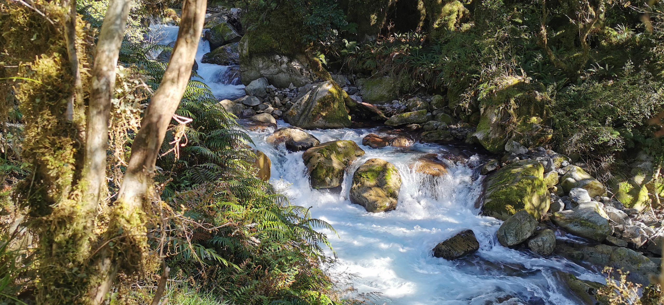
the wooden boardwalk/gantry allows plenty of opportunities to take photos up close to the cascading water
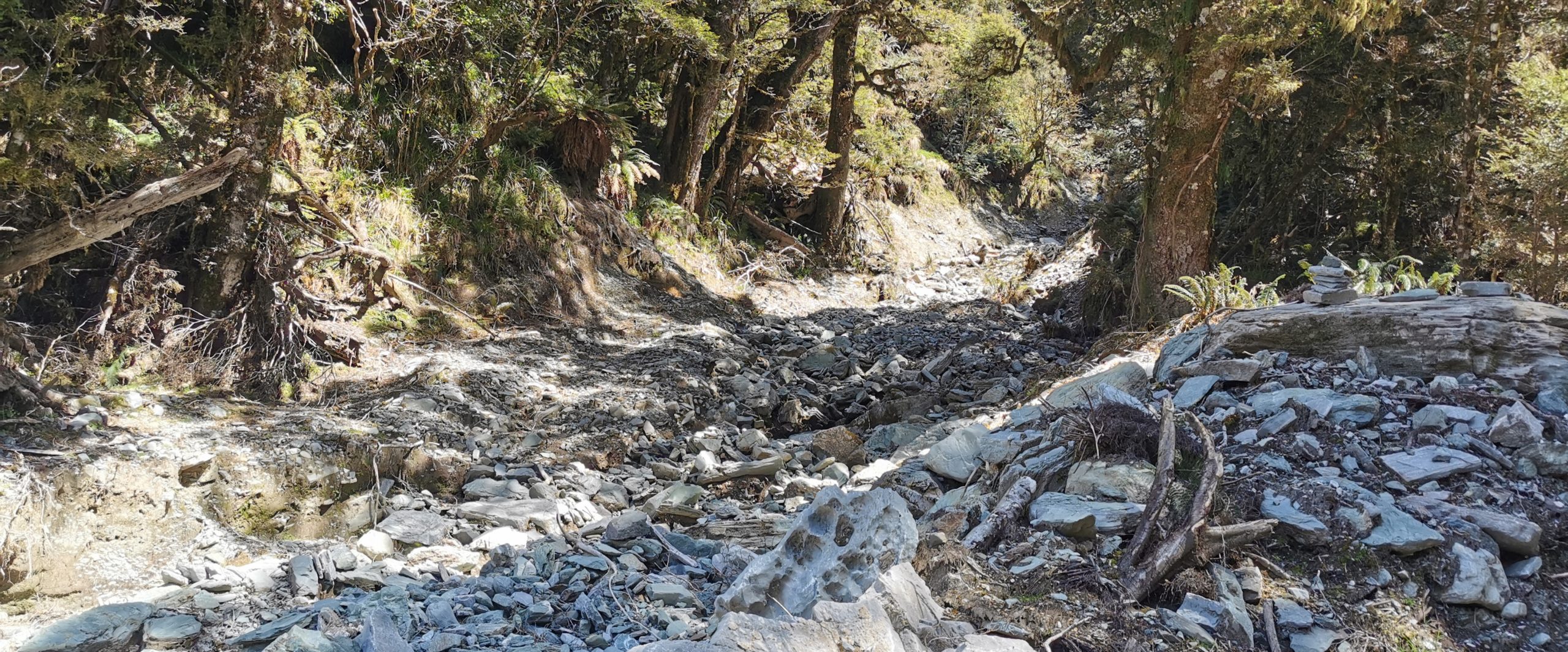
This was as far as we could get back in July ’20, so DoC did an amazing job reopening the track to the lake. We could see where the state of the track revealed just how much damage must have been done during those torrential downpours.
I love how they have maximised the experience by building these wooden boardwalks so close to the raging waters
It Was all Uphill From Here
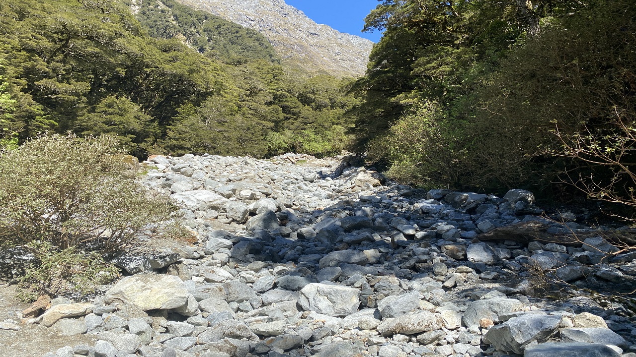
Leaving the roaring sounds of the falls behind us, it was all hiking uphill from there. We climbed and climbed, sometimes hopping and skipping from one boulder and rock to the next.
take note of the sign!!
There weren’t many chances to admire the scenery as we walked as there was much concentration needed to work out where you were going to place your foot next (let alone maneuvering the hiking poles as well).
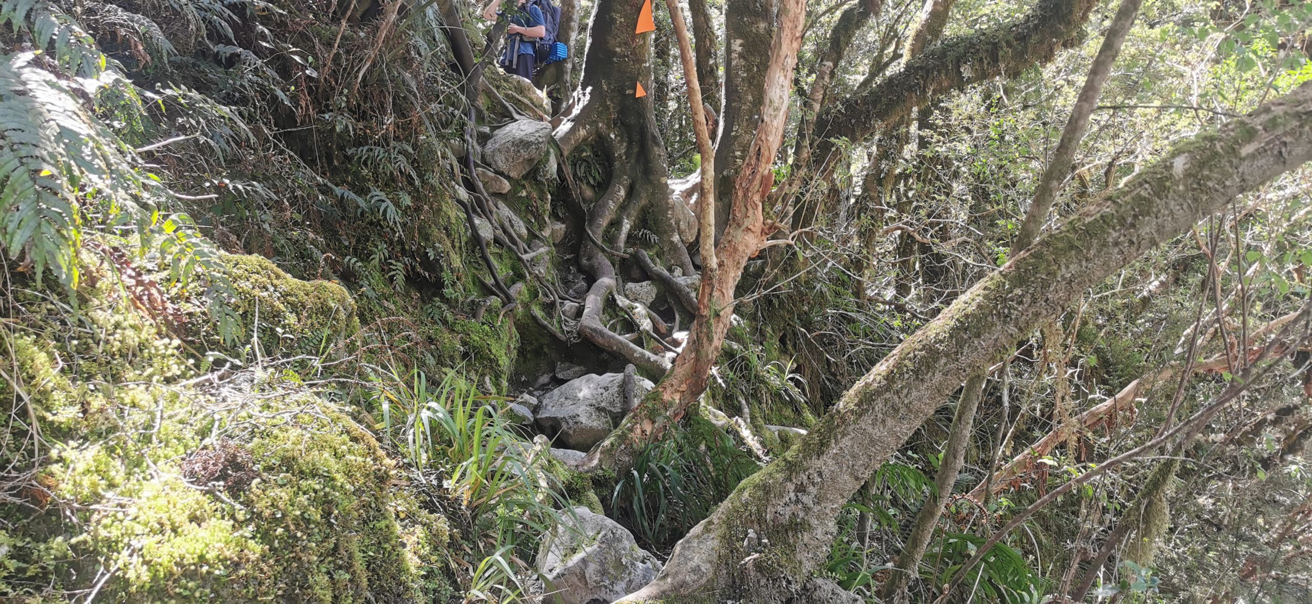
be prepared for a ‘climb’, there were some pretty steep sections to negotiate
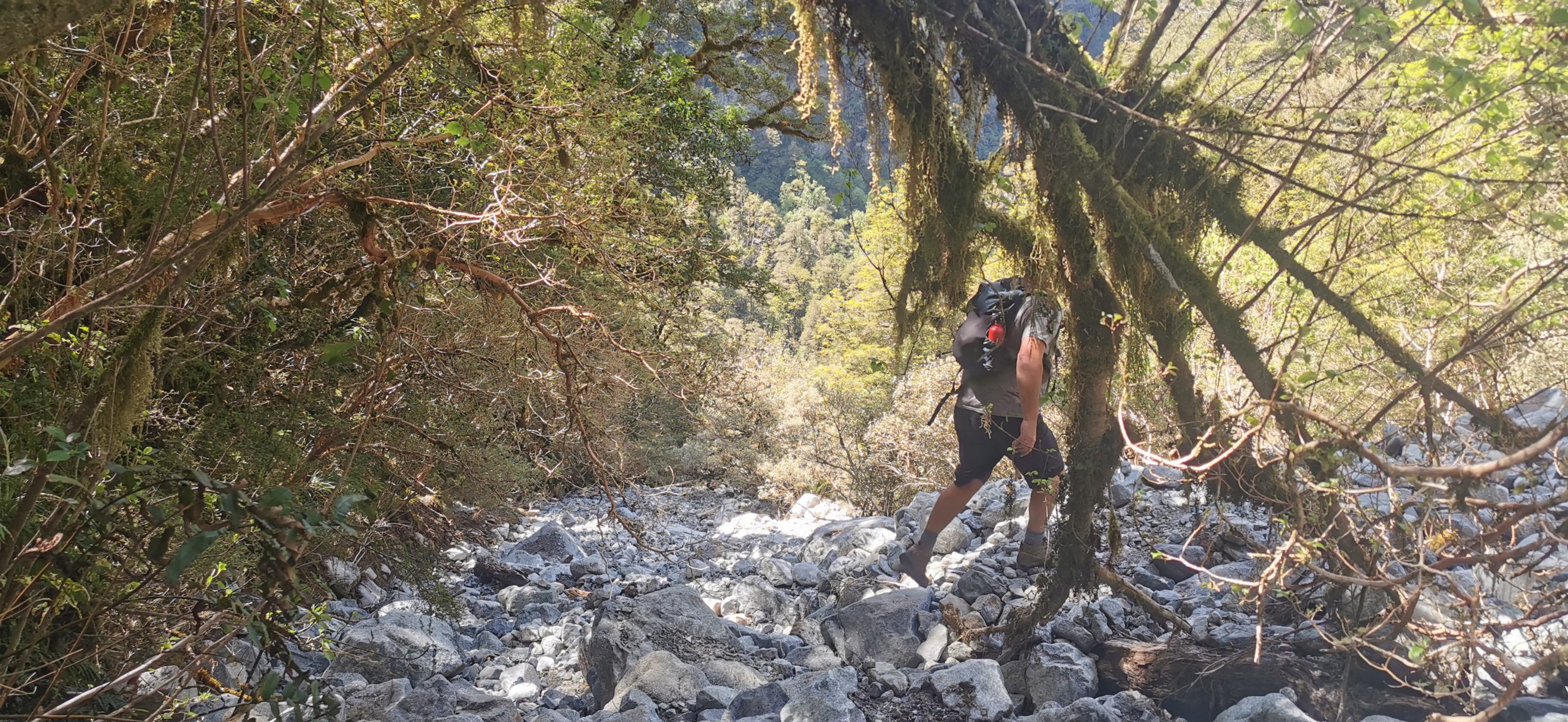
we could clearly see where the track had been washed away by rock and mud slips during the floods of 2020
Eventually, the treeline started to thin out a bit and after about 1.5hrs of huffing and puffing and rest stops, Lake Marian open out in front of us.
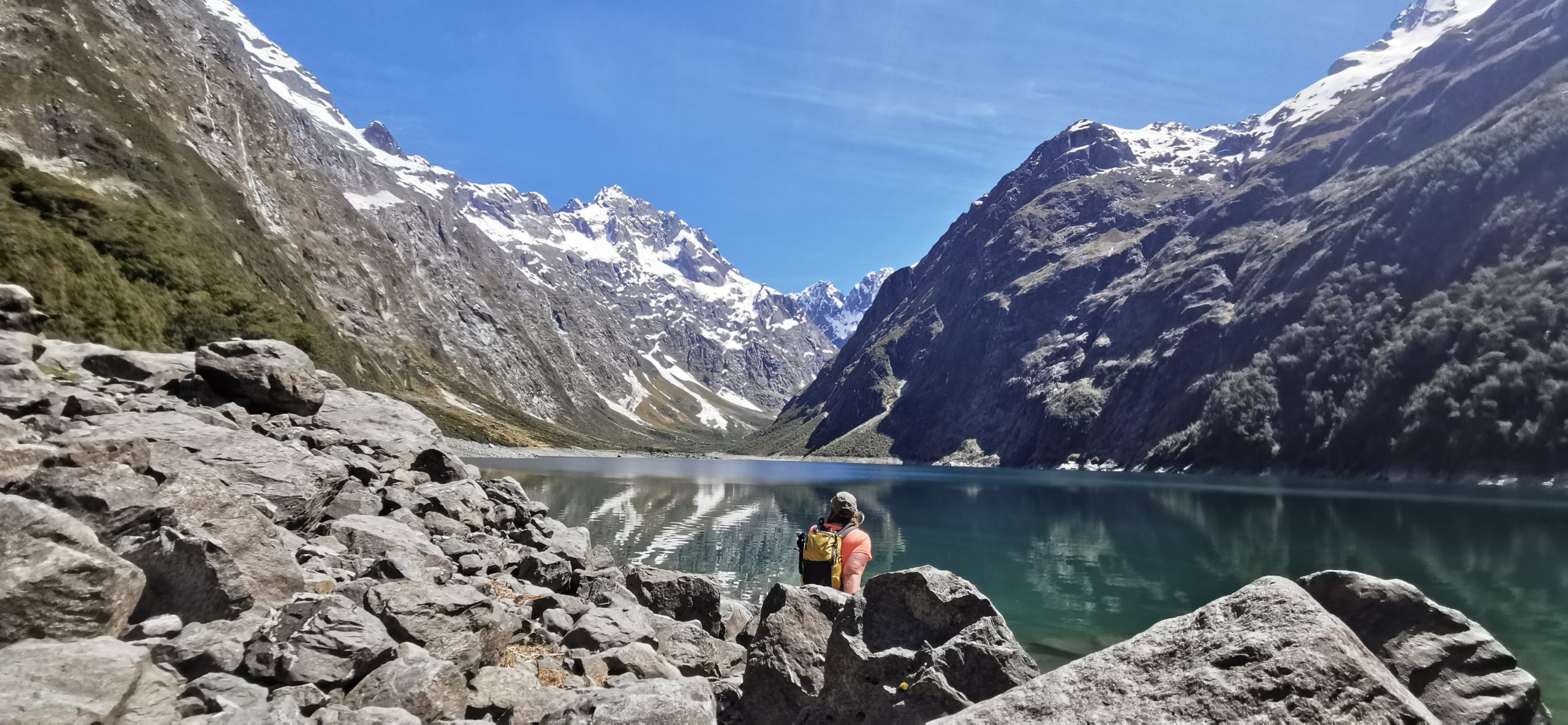
Look at what greeted us when we made it to the end of the trail
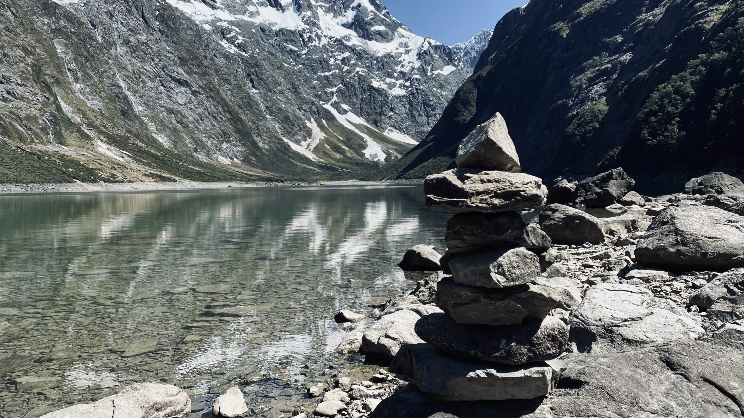
This gorgeous turquoise lake is surrounded by mountain peaks (soaring up a massive 2,000 metres) and waterfalls. It is truly jaw-dropping. Lake Marian sits in a hanging valley (carved by glaciers) between the peaks of Mt Christina, Mount Crosscut and Mt Gunn.
…..just to pause and say WOW!!
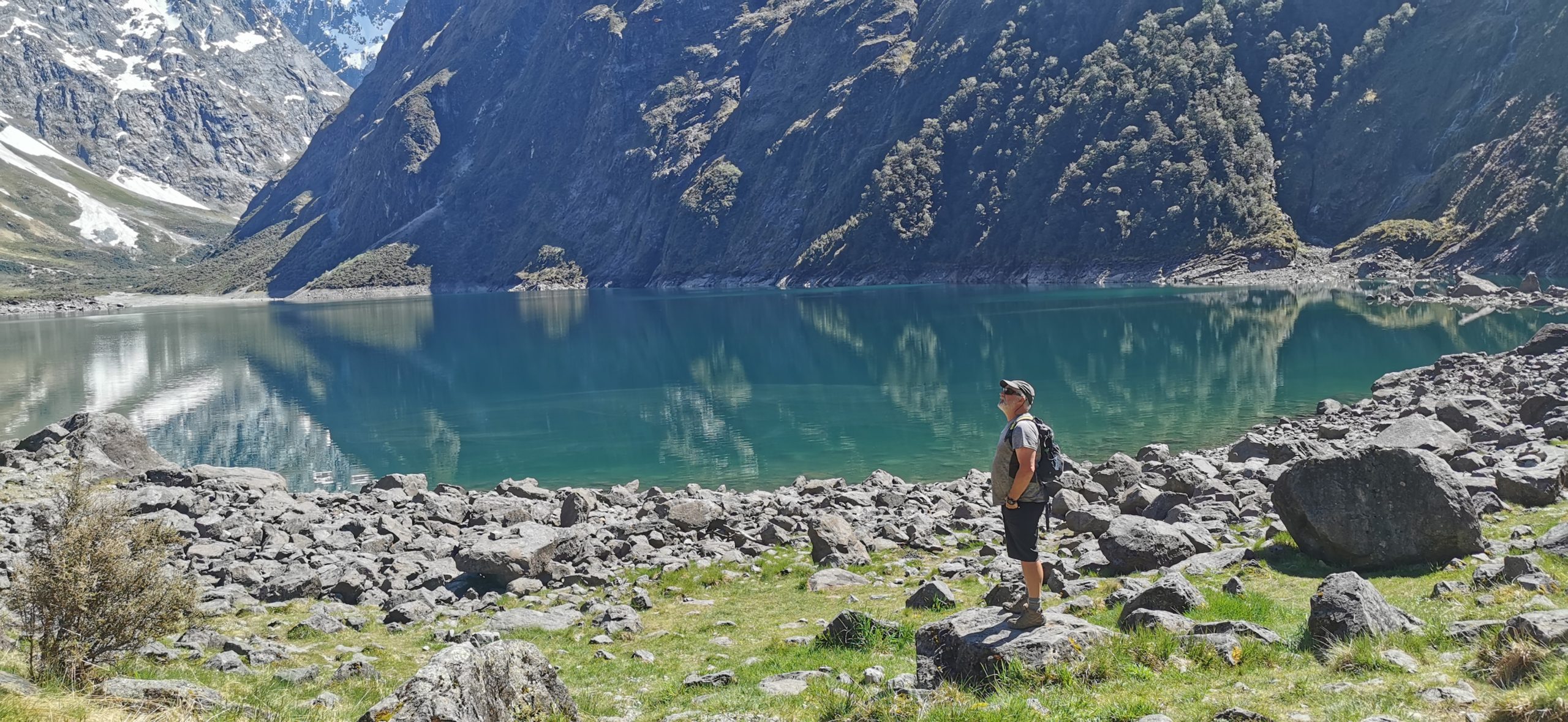
At this point, most who arrive at the lake are very hot and sweaty (especially in summer), so it is quite common for them to strip down to their undies and take a dip in the ice-fed waters of Lake Marian. We gave this a miss on this occasion!
There is something calming and refreshing being by a glacier-formed lake, surrounded by mountains
After a suitable rest, and also consuming most of our water supply, it was time to tackle the downhill track back to the carpark. It took us about as long as the ascent, downhill isn’t always necessarily easier than uphill – especially on the knees!
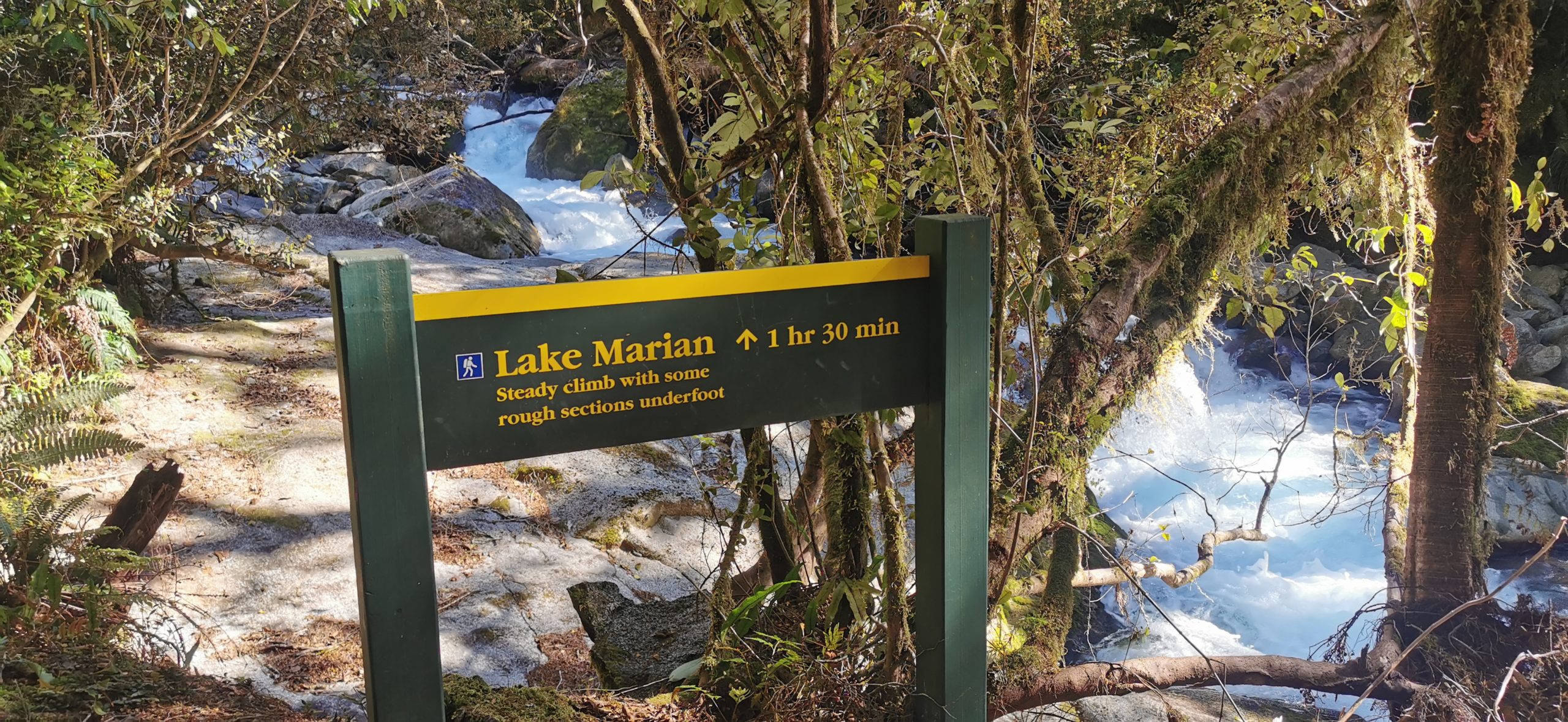
How Hard is Lake Marian Track?
The track is approximately 4km one way. The sign says to allow 3 hours return. I would suggest you allow more than this for your hiking time, especially if you like to take lots of photos along the way. This also allows you to catch your breath. You also want to make sure to spend time at the lake for a dip and just soak up those views.
As mentioned earlier, the track to the Viewing Gantry is flat, well maintained and suitable for all fitness levels. However, after the waterfalls, take heed of the warning sign stating that there is a steep incline and a rocky, uneven track – this sign is right!
It’s fair to say, there is a bit of manoeuvring to do to climb some sections of the track
Ensure that you have good, sturdy footwear (leave the jandals behind). When it has been wet, the rocks can be slippery and there is some muddy sections. Expect to have to climb using your hands for leverage.
one of the many slips that you need to negotiate, rock-hopping your way over the drifts
It isn’t the easiest of day walks in the Fiordland National Park, but if you love a challenge, then it is so worth it.
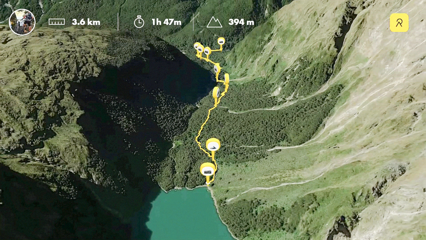
An aerial view of our walk to Lake Marian
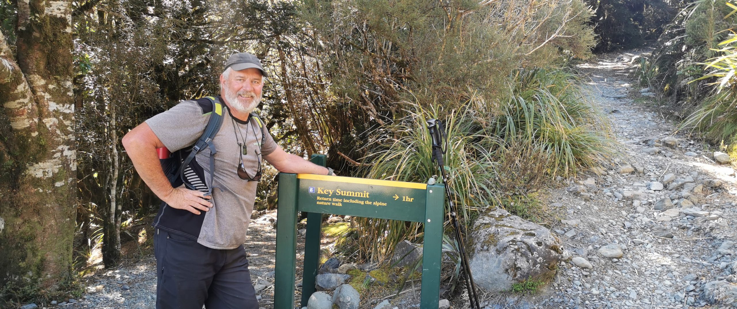
Key Summit Day Hike
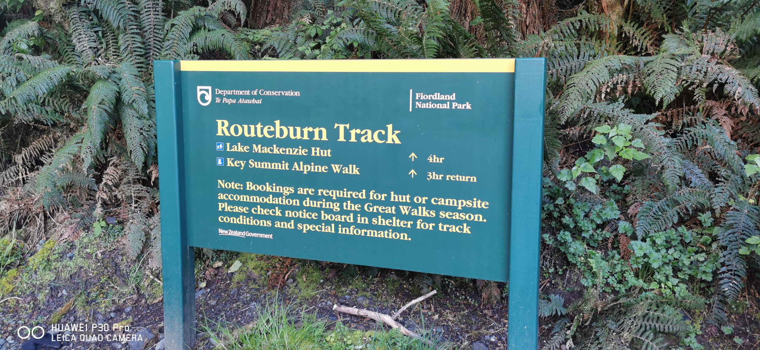
If you aren’t into multi-day hikes or short on time, then the day hike to the Key Summit is the one for you. This is a section of the multi-day hike, The Routeburn Track and starts at The Divide carpark.
there is a large car park at The Divide, on the way to Milford Sound
Because The Routeburn is such a popular track, the condition of the trail was like walking a motorway compared to the Lake Marian track that we had conquered the day before.
It’s fair to say that my knees were still screaming at me from the thrashing I’d given them yesterday. Once again, I donned knee supports, anti-inflammatories, pain killers and hiking poles.
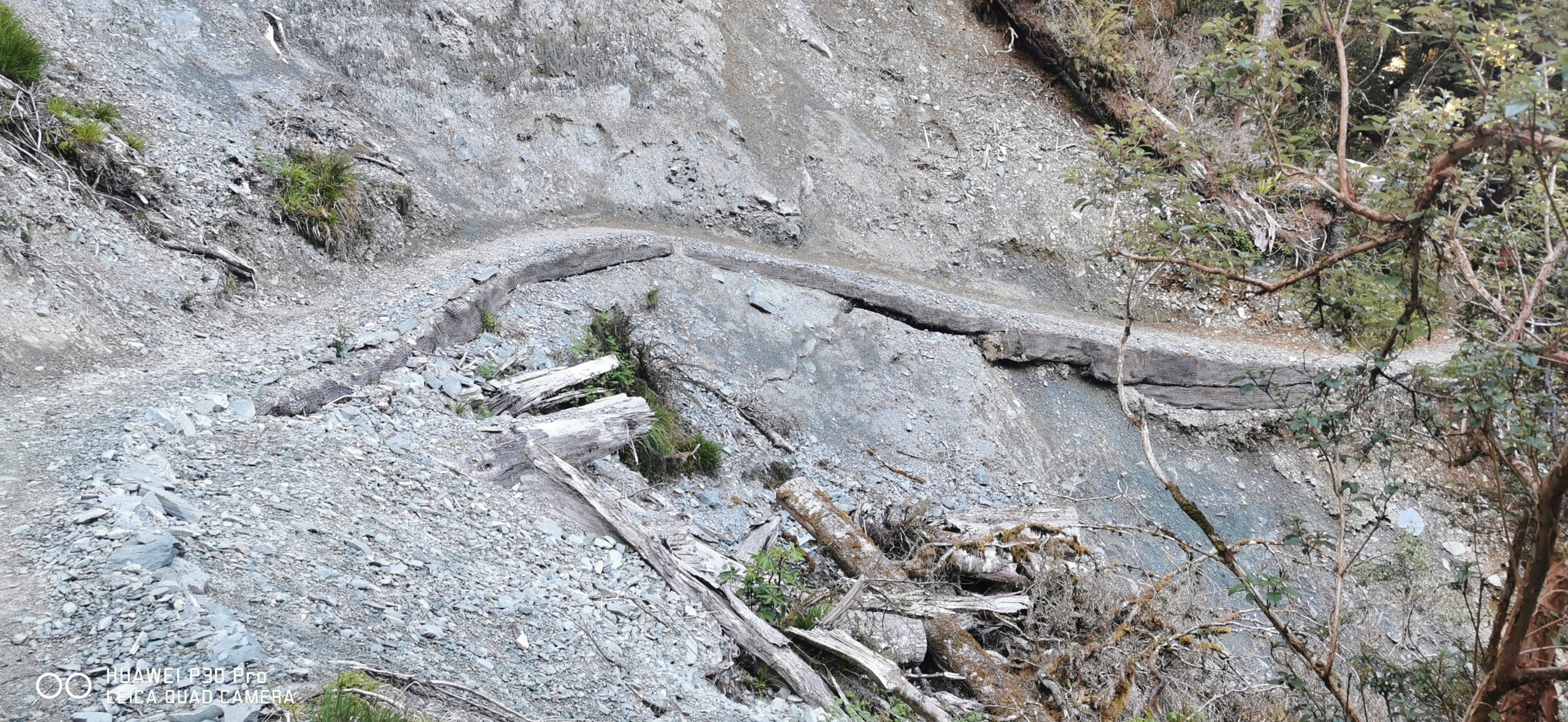
Although the track surface is smooth going, it was quite evident of the work required by DoC to keep this popular track open to the public, there’s been some serious damage done by mother nature
How Far to the Summit?
From The Divide carpark allow an hour to get to where the Routeburn Track branches into two. Take the right-hand trail that continues uphill. It is another 20 minutes of climbing to get to the top. There are lots of zigzagging to get to the top but as with all things, worth the extra effort.
after 1 hour of uphill trudging, we came to the fork in the track to Key Summit
We made a few stops along this section to take in the view that was unfolding as we trudged our way towards the summit (actually it was more to catch our breaths as at this stage, I felt like I was about to puff up a lung!).
the view was the perfect excuse for a break in the constant climb up to the summit
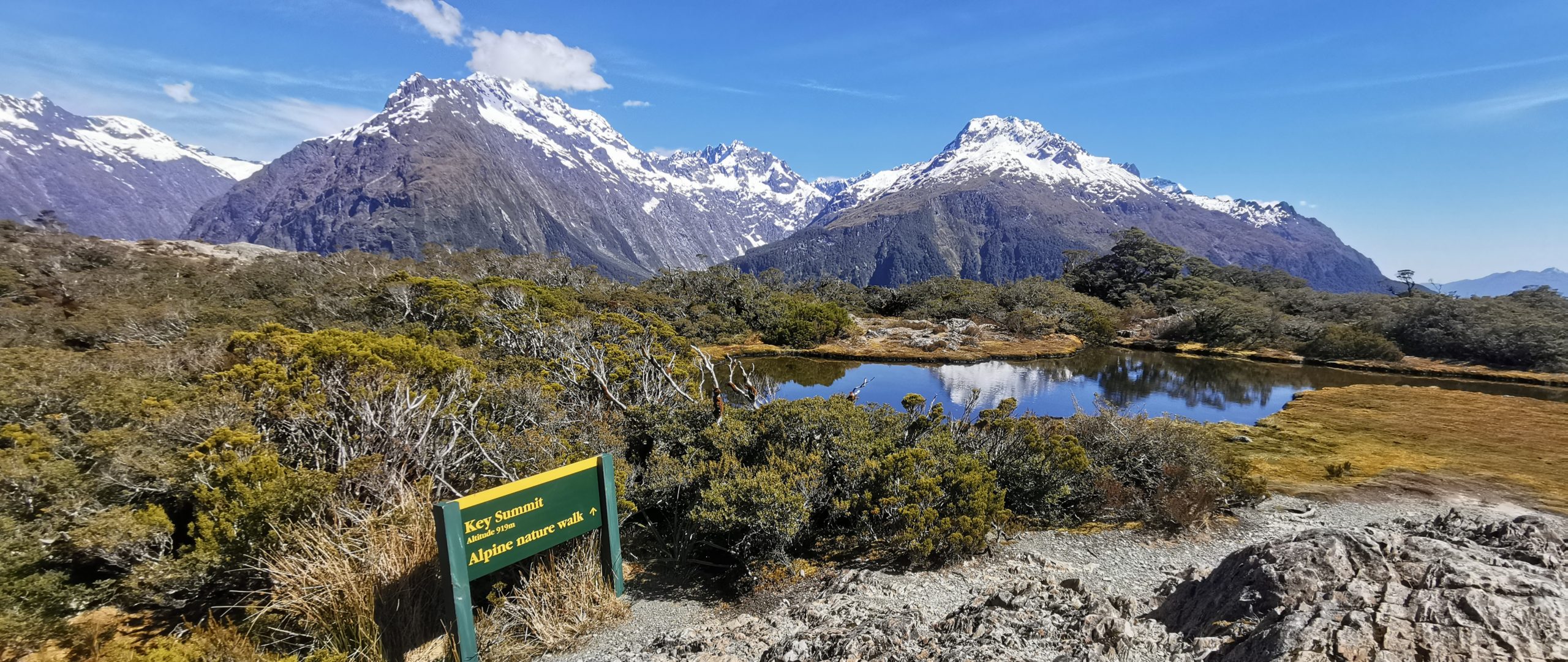
Near the top of the climb the trail forks as part of a worthwhile nature loop. We carried on to the high summit ridge, passing beautiful natural tarns and large areas of green lush sphagnum moss.
But Wait – There’s More!
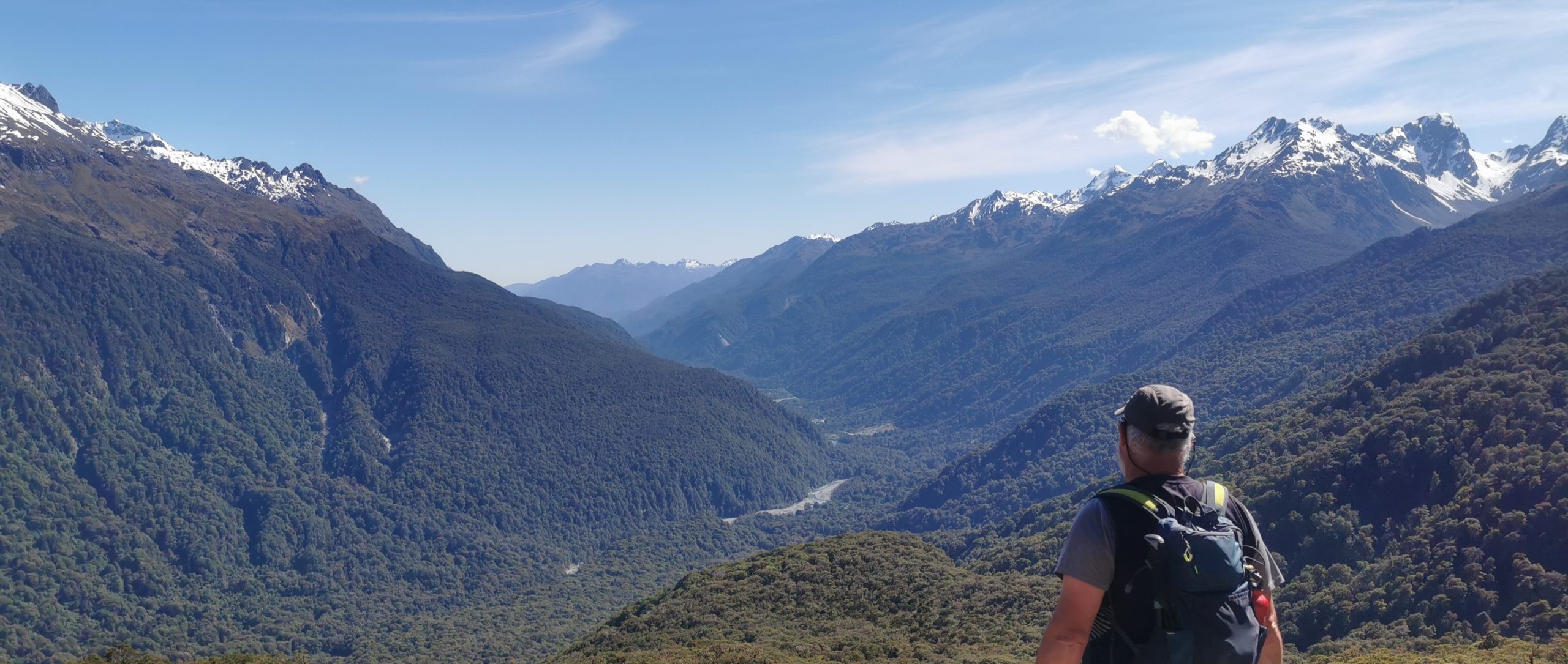
We paused at the ‘official’ Key Summit and marvelled at the panoramic views splayed out before us. A metal circular map explains just what you are looking at as you scan the horizon full of glacier-formed valleys and rugged mountainous ranges. It is about now that you realise just how massive the Fiordland National Park is.
we were greeted with these spectacular panoramic views!
Looking north we could follow the Hollyford Valley, with the Alisa and Darren mountains on either side. Soaring above Lake Marian (where we walked yesterday) is Mt Christina and Mount Crosscut. As we glanced to the east, we were looking down through the Greenstone Valley.
There was yet another sign, pointing to the Lake Marian viewpoint. I hadn’t come this far, not to walk a further 10 minutes to overlook the hanging valley and Lake Marian.
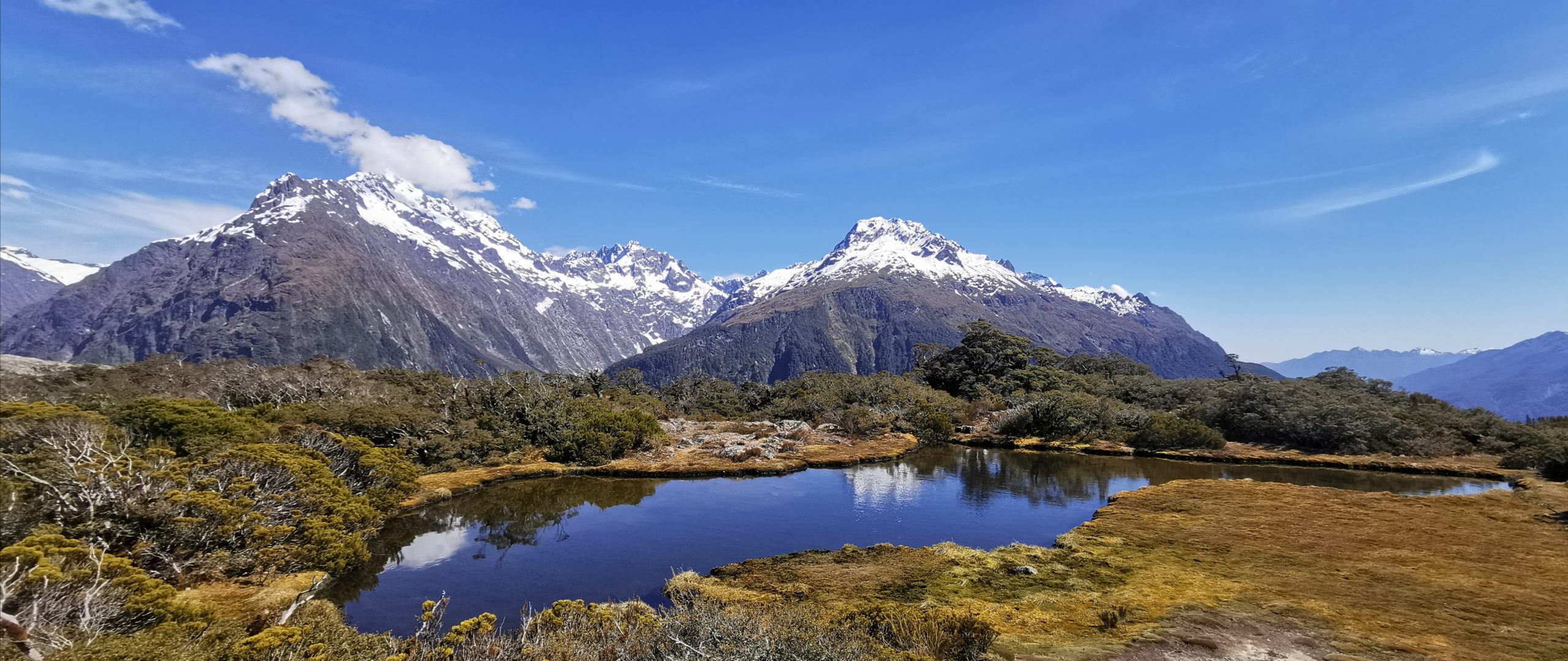
there are small tarns that provide the perfect reflective features in the foreground of the soaring mountains
We could just see Lake Marian perched in the high hanging valley. It really put into perspective, just how high we had climbed the day before – yet we were even standing at a higher elevation than that.
Lake Marian is just visible, hanging out in her hanging valley
There are some very conveniently placed bench seats to sit and ponder life, the views and breathe in the pure air. After consuming our protein bars and our water, it was back on the track to meet back up with the Routeburn Trail.
Lake Howden
Back on the main trail, there was a sign saying Lake Howden (10 minutes one way). Although my knees were complaining, I didn’t want to miss seeing Lake Howden. So onwards we went. I’m pretty sure that it was longer than 10 minutes (or did it just seem that it was!).
I’m glad we pushed on and walked the extra distance to view Lake Howden
The lake is a little underwhelming compared to Lake Gunn and Lake Marian but still has quite a natural beauty.
Lake Howden
Lake Howden Hut
Howden Hut was a well-known hut located close to the side of the lake. It was surrounded by green foliage. A landslide consisting of trees, mud and rocks came slamming into it during the big storm in February 2020.
There were 30 trampers inside and miraculously, no one was injured. They were all choppered out the next day.
believe it or not, this is where the large DoC hut once stood
The hut was damaged beyond repair and was dismantled and removed. Most hikers opt to stay at the Lake MacKenzie Hut, a further 8km along the Routeburn Track, therefore Howden Hut was never replaced.
There is no evidence to show where the hut was located. There was only the trail of destruction left by the massive slip. The scars in the landscape are still obvious.
Trampers can either continue along the Routeburn or divert to the Greenstone Track, Caples Track or Pass Creek Track.
About Turn
This is where we did an ‘about turn’. We headed back uphill before starting the long descent back to The Divide. In total, we’d walked approximately 11 km.
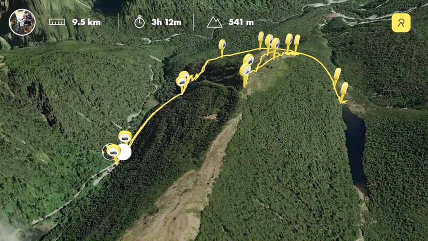
An aerial view of our walk to Key Summit and Lake Howden
We Will Return to Cascade Creek
We still have some more tracks and trails on our list to do within the Fiordland National Park. Our time here is not done and dusted.
More adventures saved for next time.
Click on the link below for a video of our highlights and interactive maps of our hikes/walks.