We were still parked up at Ranfurly and it was time for another roadie. We had completed the Danseys Pass a couple of days prior (see my previous blog). This time we had done our research on the best way for us to travel the Old Dunstan Road. We decided we would tackle it in two parts.
History of the Old Dunstan Road
To fully appreciate the Old Dunstan Road, you really need to understand the history behind it. How did it come to be traversing not 1, but 4 mountain ranges? Surely there must have been an easier route to travel from Dunedin to the then called Dunstan (Clyde) area? Well, apparently not back in the gold rush days of the 1800s.
When gold was discovered in the Clutha River and the mass migration of miners began from the dwindling gold sites around Gabriels Gully near Lawrence, there arose a need for a road to the interior of Central Otago from Dunedin. It was imperative that supplies reached the miners. Also, the miners needed to get their gold back to Dunedin.
Other routes inland from Port Chalmers in Dunedin proved unsuitable due to the number of river crossings which had already claimed many lives.
Old Dunstan Road Was Formed
Starting from Dunedin, the Old Dunstan Road is 176km. It crosses 4 mountain ranges – the Lammermoors, the Rock and Pillars, Rough Ridge and the Raggedy Ranges.
The thousands of miners who flocked to the interior needed supplies of food, timber and other provisions which all had to be brought from Dunedin.
It took horse-drawn drays two or three weeks to complete the round trip. Bullock wagons could take even longer. It was still preferred by the gold miners or those in a hurry as it was 48km shorter than the Pigroot but was also more desolate and dangerous. Hence, wagoners often travelled in groups so they could assist one another to get through a muddy section or up a steep hill.
Soon stores, pubs and accommodation houses sprang up at strategic sites along the trail.
Our Route
With all this background historical information, we set our course for what seemed the shortest loop of the two from Ranfurly. It turned out that this planned route was to be the longest to traverse, being the most challenging part of the Old Dunstan Road. It didn’t help that it had been raining in the area a day or two prior.
We headed south, through Patearoa and took the Linnburn Runs Rd turnoff (40km). This is where you can join the Old Dunstan Road. This is what they call the ‘modern’ access. The original road now traverses private farmland towards an area called Blackball.
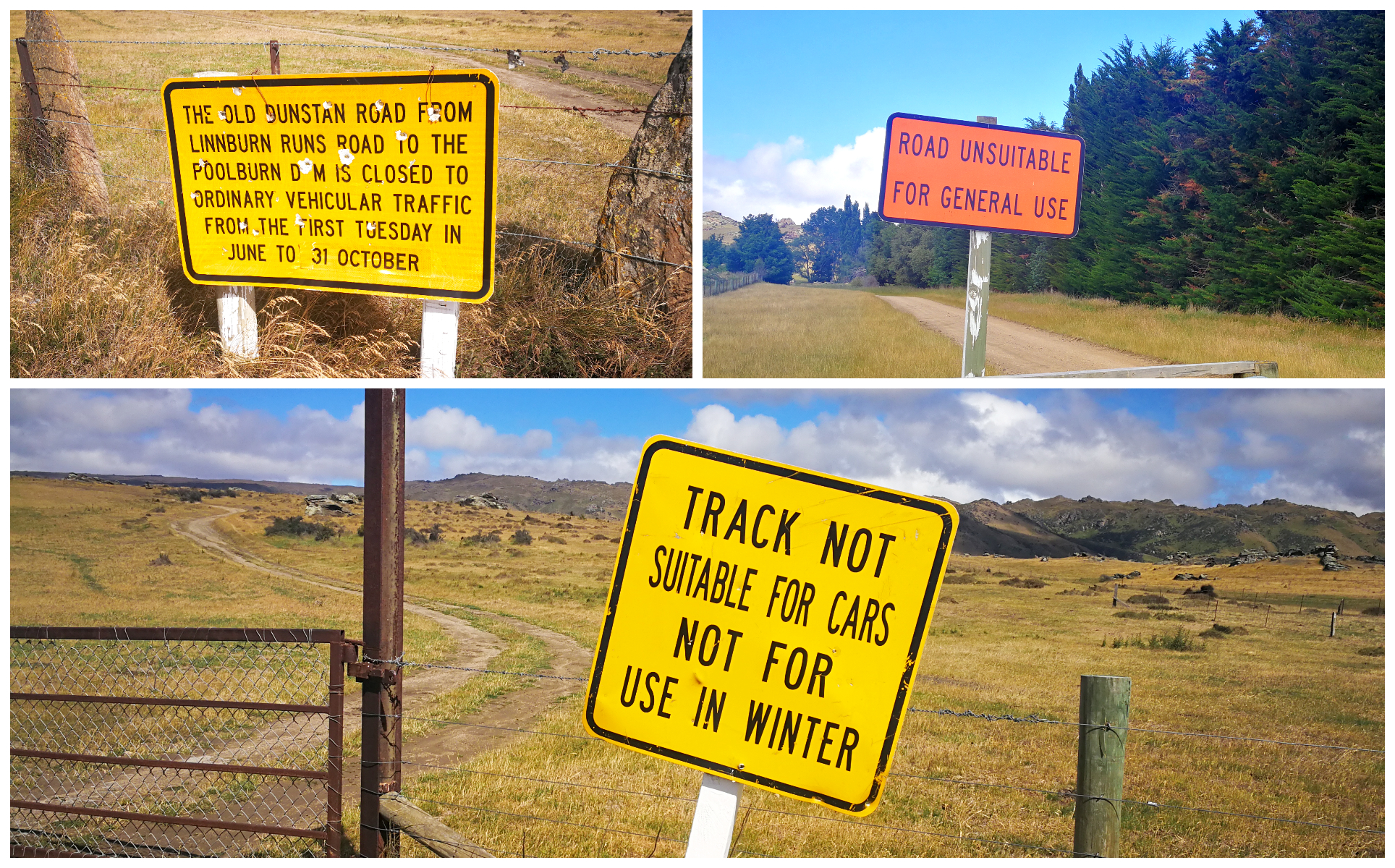
the warning signs placed at the gate to the start of the Old Dunstan Road
Blackball Detour
Approximately 4km in from the closed gate off Linburn Runs Rd, today’s Old Dunstan Road climbs over one of the 4 Mountain Ranges – Rough Ridge. It’s approximately 4km where we found the detour to Blackball.
This was an essential stopover on the original route. There isn’t much left of any structures. We tried finding the old rabbiters’ hut and ruins of the accommodation house and pub where the Cobb & Co coach used to have to stop for supplies.
The road was quite rugged and we came across a farm gate. Maybe we didn’t bump our way along the road far enough but we couldn’t find any trace of the old settlement.
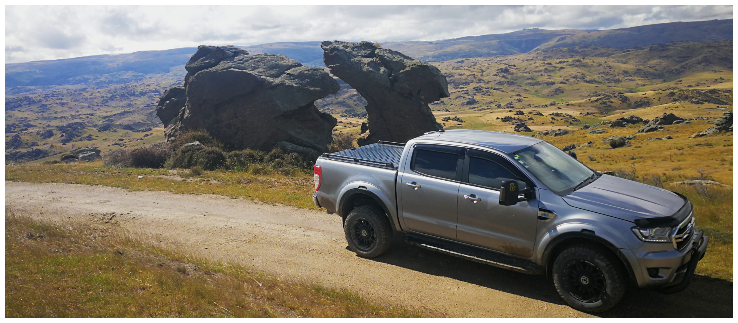
I’m sure the wagon trains didn’t have time to stop to admire the view…..or amazing rock formations
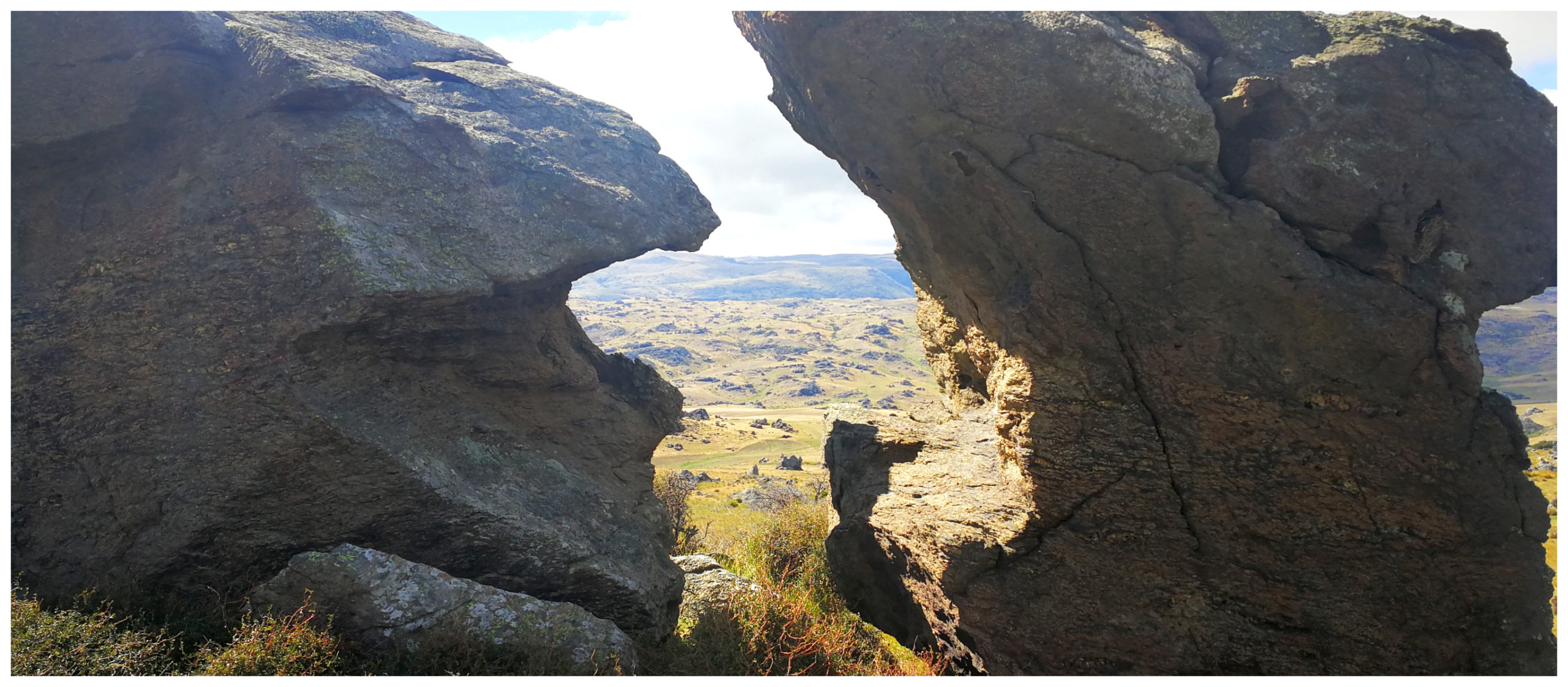
the twisted and jagged rocks, a perfect frame for the vast tussock vistas beyond
Our Climb up Rough Ridge
After doing an ‘about turn’, we continued our climb over Rough Ridge and another 4km along is where we joined onto the original Old Dunstan Road.
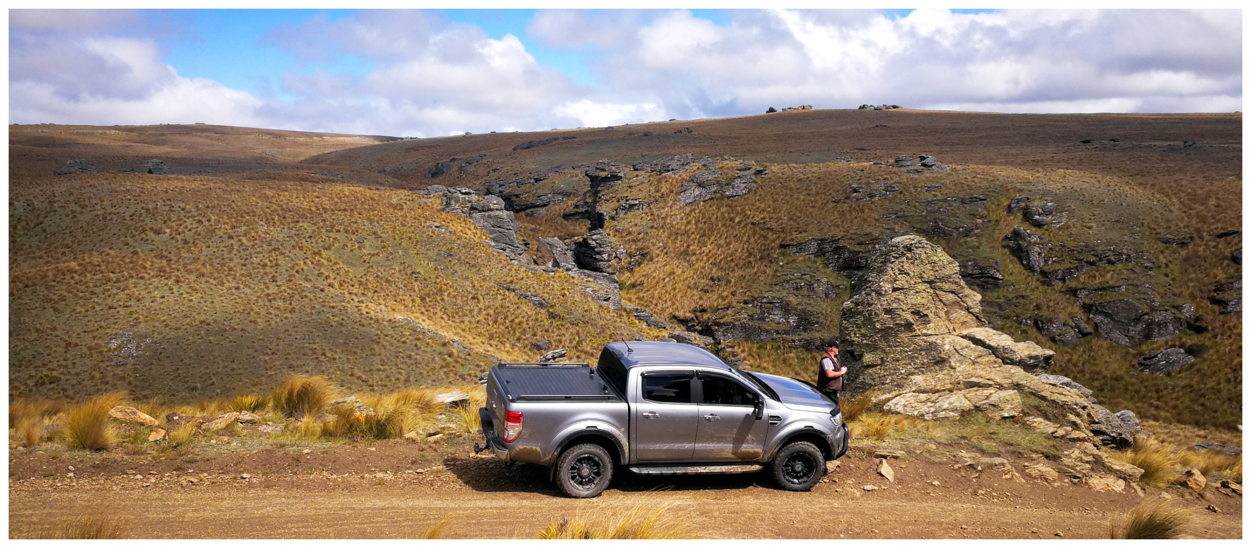
we soon got the feeling of the isolation the early travellers must have felt as they traversed Rough Range
This is a section of the road which was one of the most challenging for the waggoners. It’s known as Totara Pinch as the road twists its way over Totara Creek.
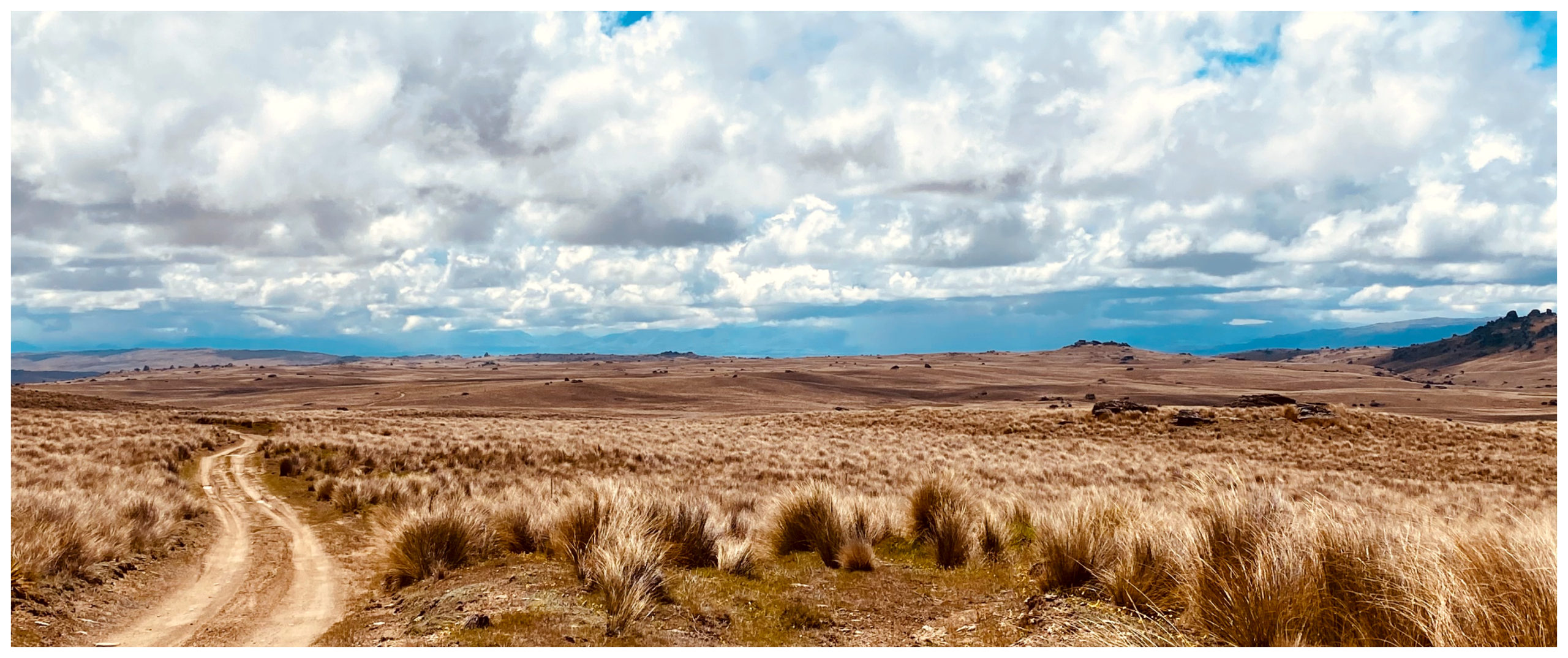
we were rewarded with expansive views as we continued along the ridgeline
Long Valley Ridge Road
We seemed to be climbing forever before reaching over 1,000m above sea level. High up on Rough Ridge we found the Long Valley Ridge Road turnoff. This would lead us to the most isolated church in NZ – the Serpentine Union Church.
I couldn’t mark this road on Google Maps above as it’s not recognised as an actually formed road, which gives you an idea of the state of it. This made me a bit more nervous as we turned in to make the 14km journey towards Serpentine.
We crawled our way through swampy depressions, dotted with tussock-covered knolls. It is arguably the most isolated open space in all of Otago. It should never be taken for granted at any time of the year and it requires an experienced driver to tackle it.
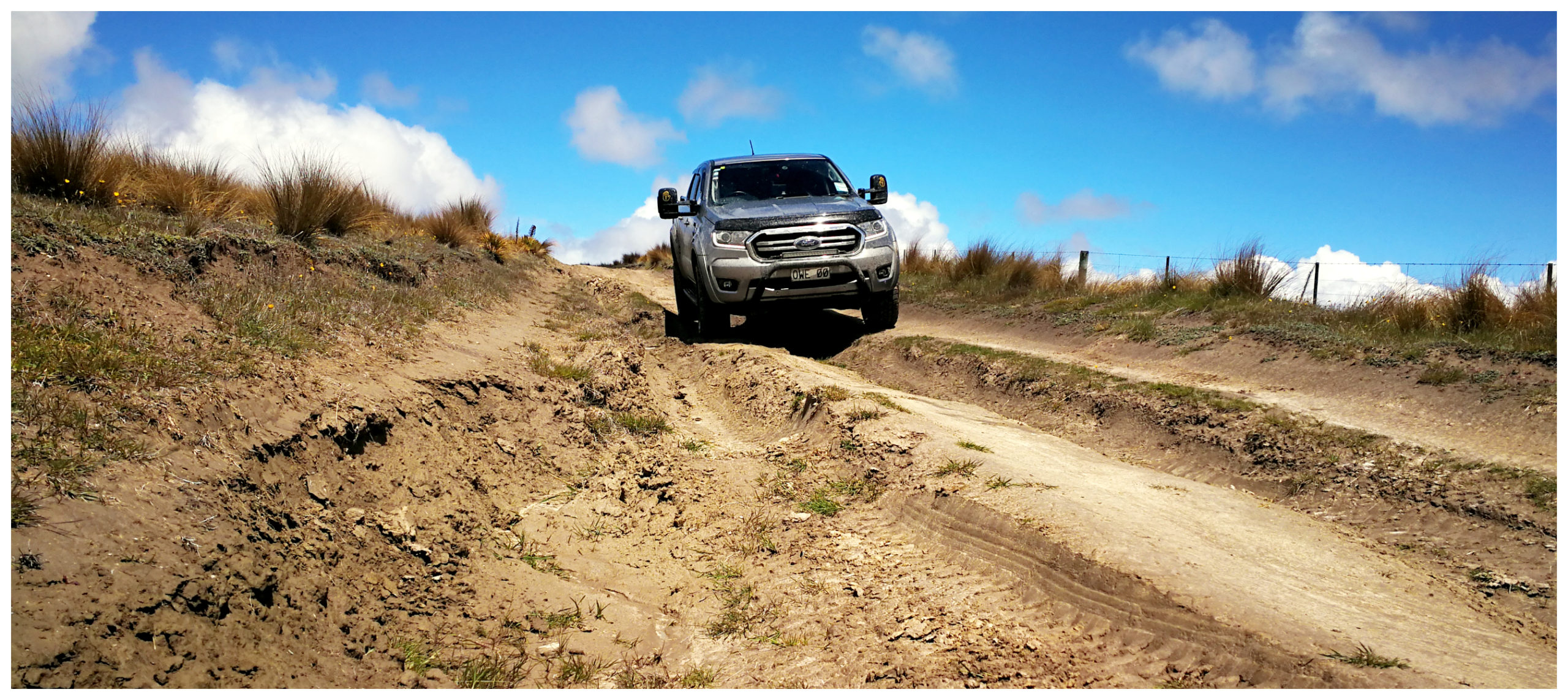
careful wheel placement is required when lining up some of the deeper ruts
The track is very rutted and starts to get wetter and softer with large puddles as the altitude increases. The deep ruts certainly require good wheel placement.
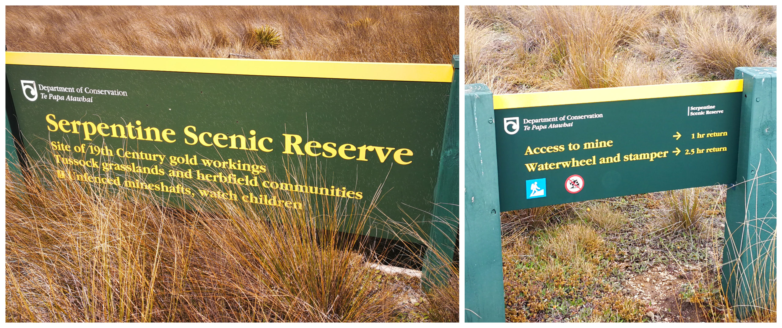
The Long Valley Stamper
About 2.5km before the church, a DoC sign marks the 2.5hour walk to the Long Valley Stamper and water wheel.
We stopped to admire the views of the surrounding vast tussock land, with both the Poolburn and Upper Manorburn reservoirs visible.
we’ll save the walk for another day
There is a short drivable track which will take you to a group of stone hut remains. We didn’t opt to take the track or the 2.5hr walk to the stamper and water wheel. We’ll save this for when we have more time up our sleeve.
Instead, we continued our undulating and bumpy drive to get to the church.
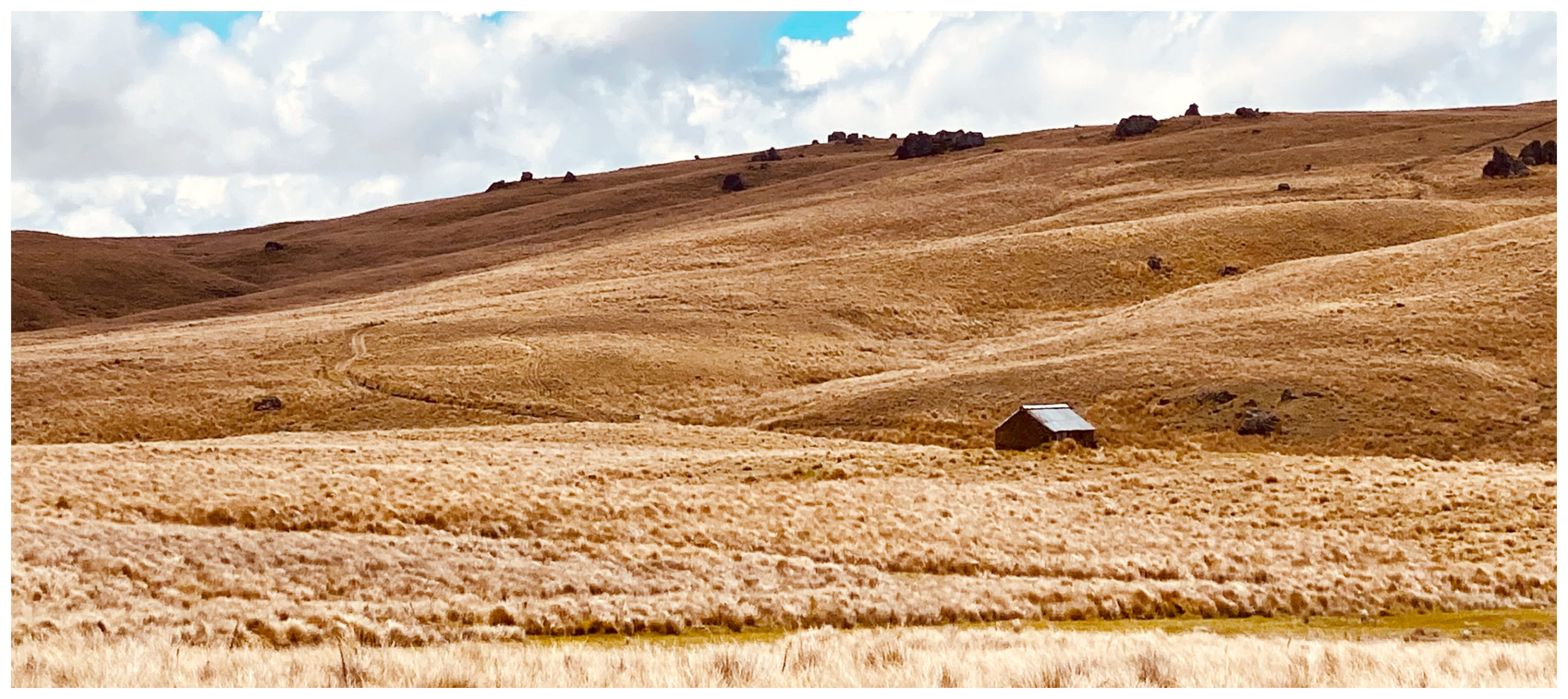
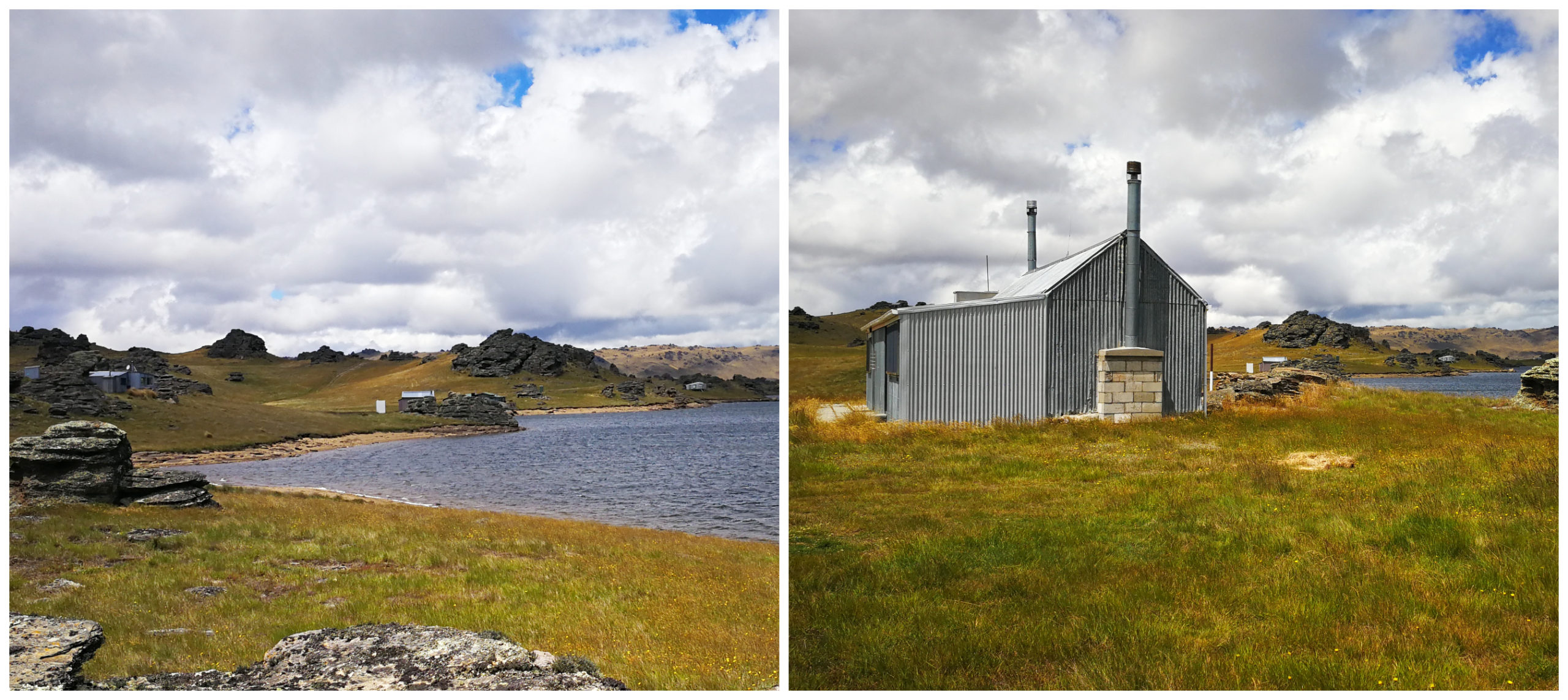
Serpentine Church
The small, unassuming stone church, came into view. It stands on a low rise. It sits at an altitude of 950m and was the highest church in NZ when it was built in 1873.
We had to negotiate our way over the Waimonga Creek, which joins forces and forms the Serpentine Creek. Earning its name as it resembles a Serpentine as it twists and turns to the Taieri River.
Epitome of Remoteness
Standing at the church you get this overwhelming feeling of remoteness and loneliness. The clarity of the air and utter silence was almost deafening.
how is this for utter remoteness for a church?
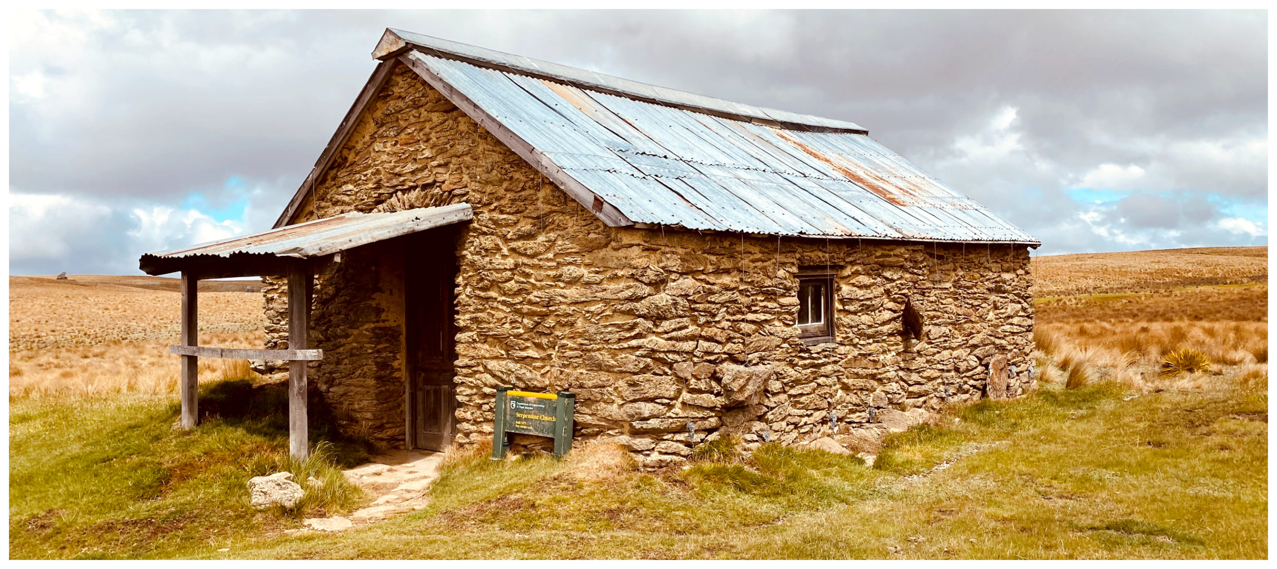
it blends seamlessly into the landscape
Once again, it is astounding how many of the early gold miners could exist in such harsh, isolated conditions. When gold was discovered here, a Tent City popped up, as did two hotels and a couple of stores.
Several Chinese miners would work the basin each summer but retreated back towards Moa Creek when winter descended. Understandable, when it was recorded that the ice could be 50 centimetres thick!
History Abounds
Presbyterian Serpentine Union Church was built in 1873 by public subscription from the miners resident on the surrounding diggings.
Thankfully, there has been ongoing restoration over the years and it is a unique example of our pioneering history. There is also an information board about the life and times back in the 1800s.
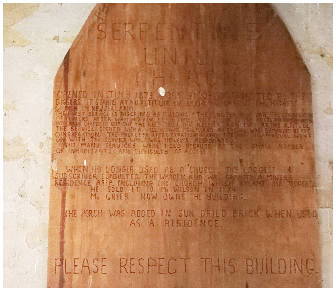
the carved information board at the front of the church
I loved the story about how the minister was late arriving for the first service. No doubt a very important event for the struggling gold miners. Tired of waiting for him to arrive (not surprising given the condition of the access!), the congregation of miners went down to the hotel for refreshments and apparently ‘drank deeply’.
Once the overdue preacher did arrive, he gathered together his congregation and needless to say, the first hymn was sung rather joyously. Unfortunately, the boisterous behaviour continued and that prompted an end to the service. It is said that the minister left, announcing that he would never again preach to such an ungodly lot!!
A Short Churchly Life
It seems that the church was sold to a couple of miners, who put in a stove to help make it more habitable. It was later used as a musterers’ hut and later still, it provided a shelter for hunters.
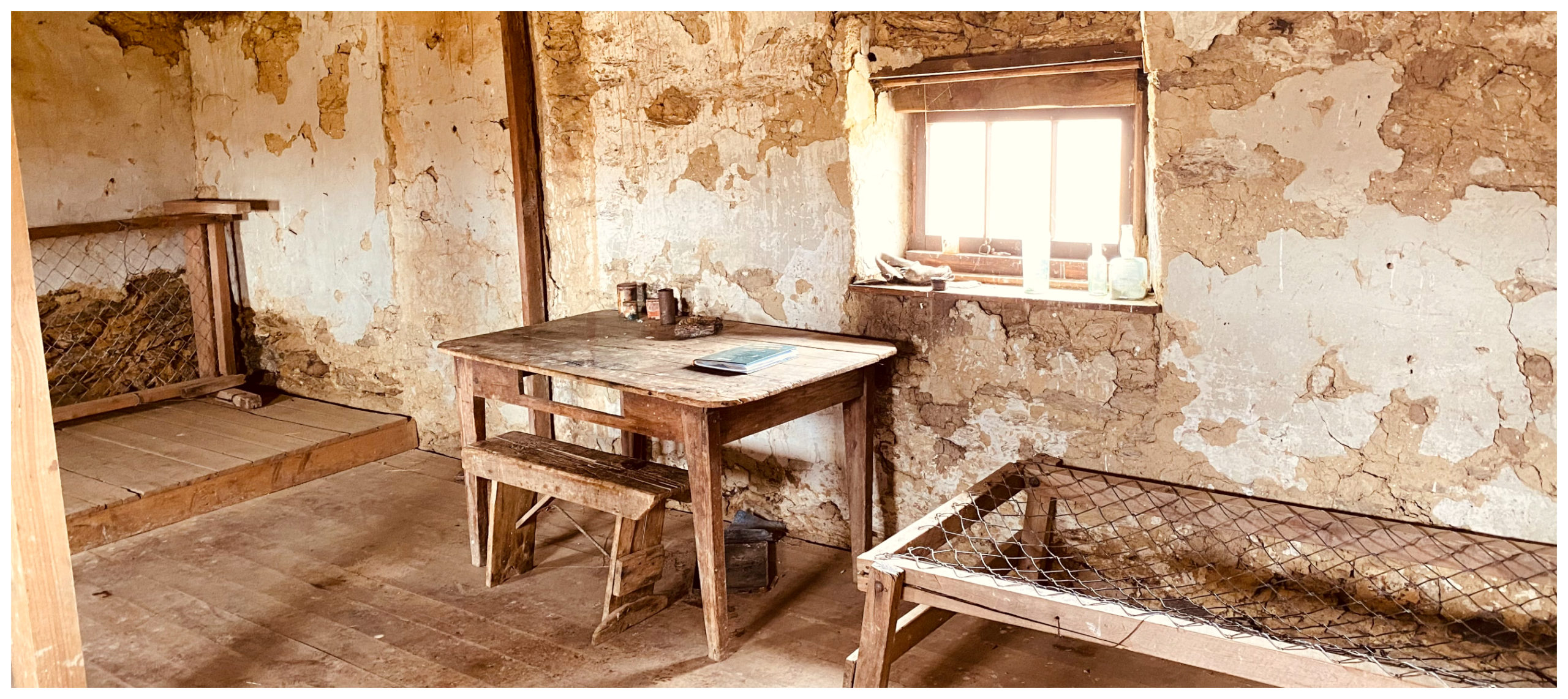
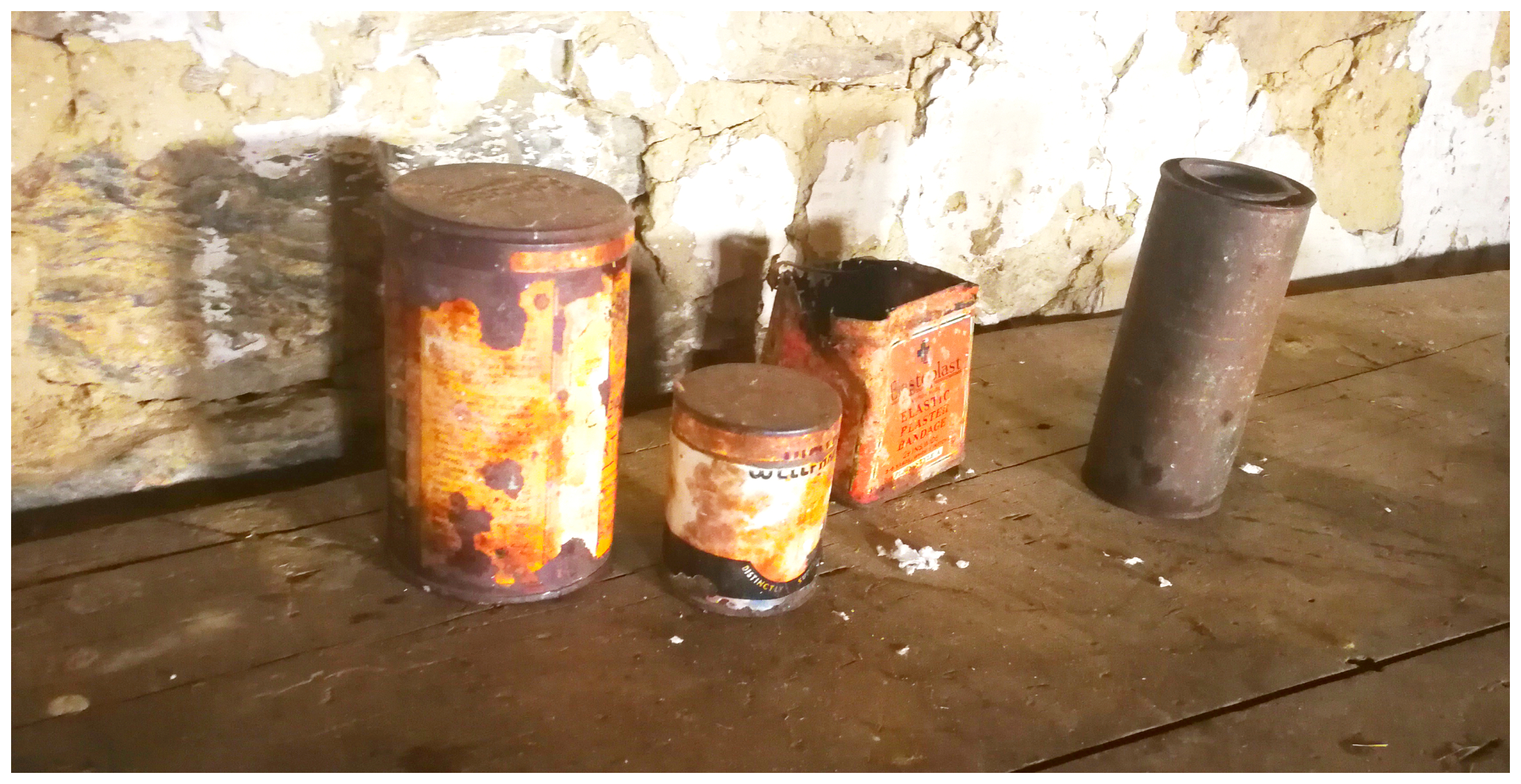
the inside was like a time capsule with relics from the past inhabitants
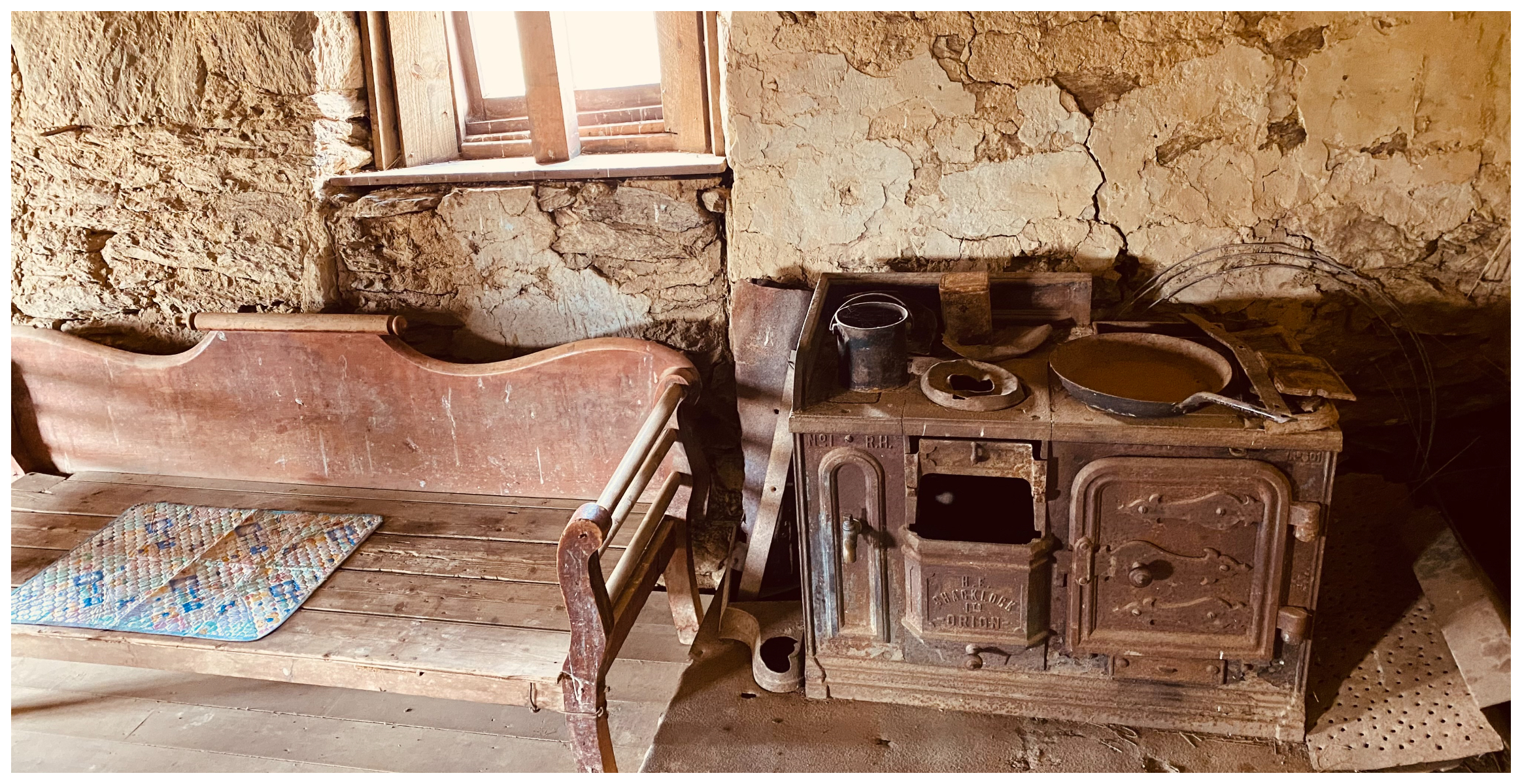
the fireplace fitted later to provide comfort to those who sort shelter
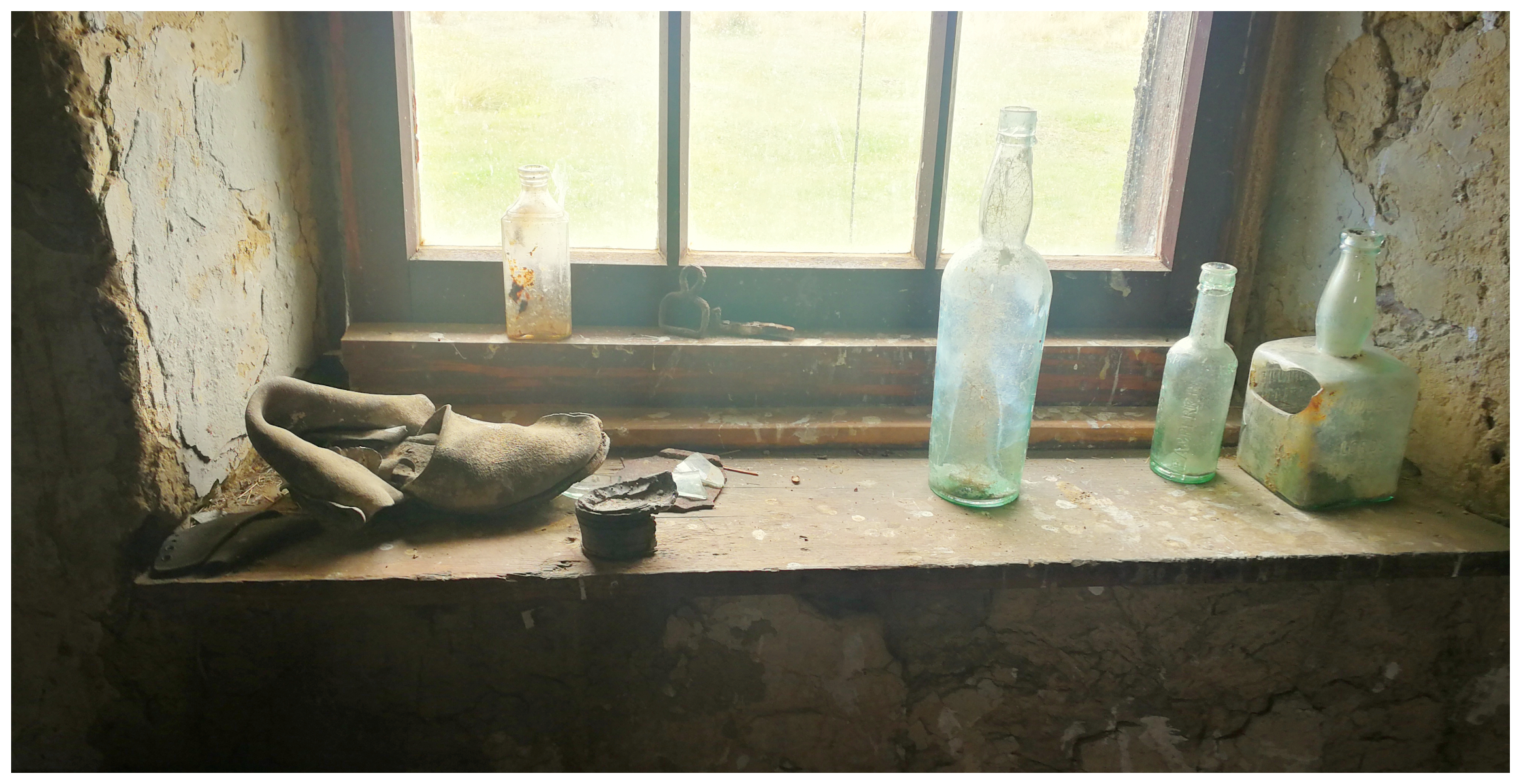
someone left their shoe behind!
I’m sure it used to be a tasty snack!
Back on the Old Dunstan Road
We were on the original road again, heading towards the Poolburn Reservoir. We were struck by the beauty of this man-made lake. Outcrops of jagged rocks scattered across the lake and shoreline. On a still day, the reflections must be outstanding. Unfortunately, not so much on the day we visited.
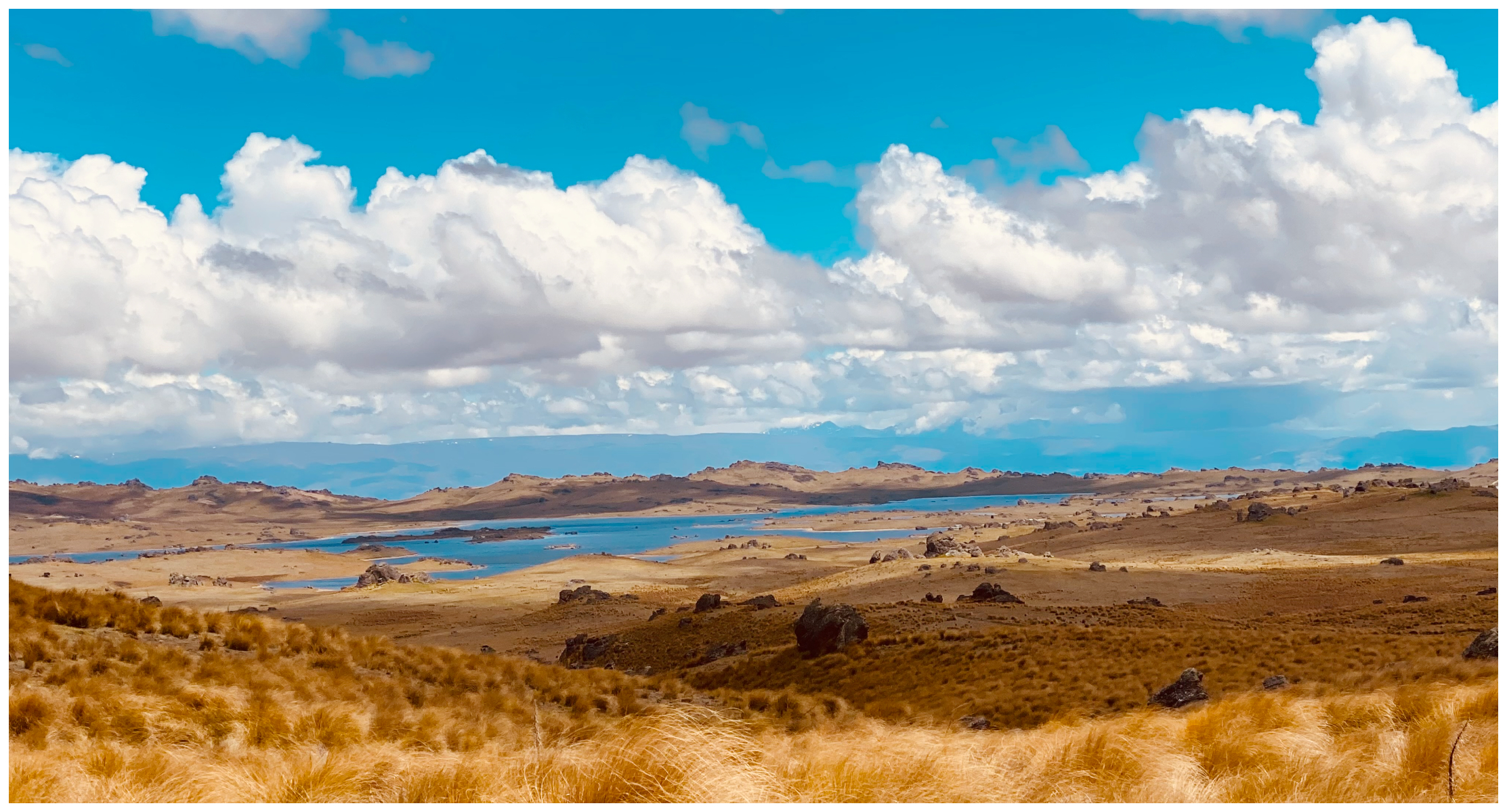
the view towards Poolburn splayed out before us like some sort of painted landscape
It is an exposed part of the landscape so there was a stiff breeze across the water, putting paid to any ‘reflective photography’.
Poolburn Reservoir
Completed in 1931, the flooding of the reservoir resulted in parts of the Old Dunstan Road to be submerged, lost forever. Just above where the dam is located, stood the grog shanty known as Drunken Woman’s Inn. This was run by a woman who it seems, enjoyed her own illicit merchandise rather too well.
The area had 5 hotels in total, all flooded.
various standards of accommodation dotted along the shoreline
Today, as in most cases with dams, the shoreline is dotted with cribs. Holidaymakers and keen fishermen have erected their makeshift shelters. These can vary in size and grandness. Ranging from basic tin sheds to more elaborate structures with all the comforts of home.
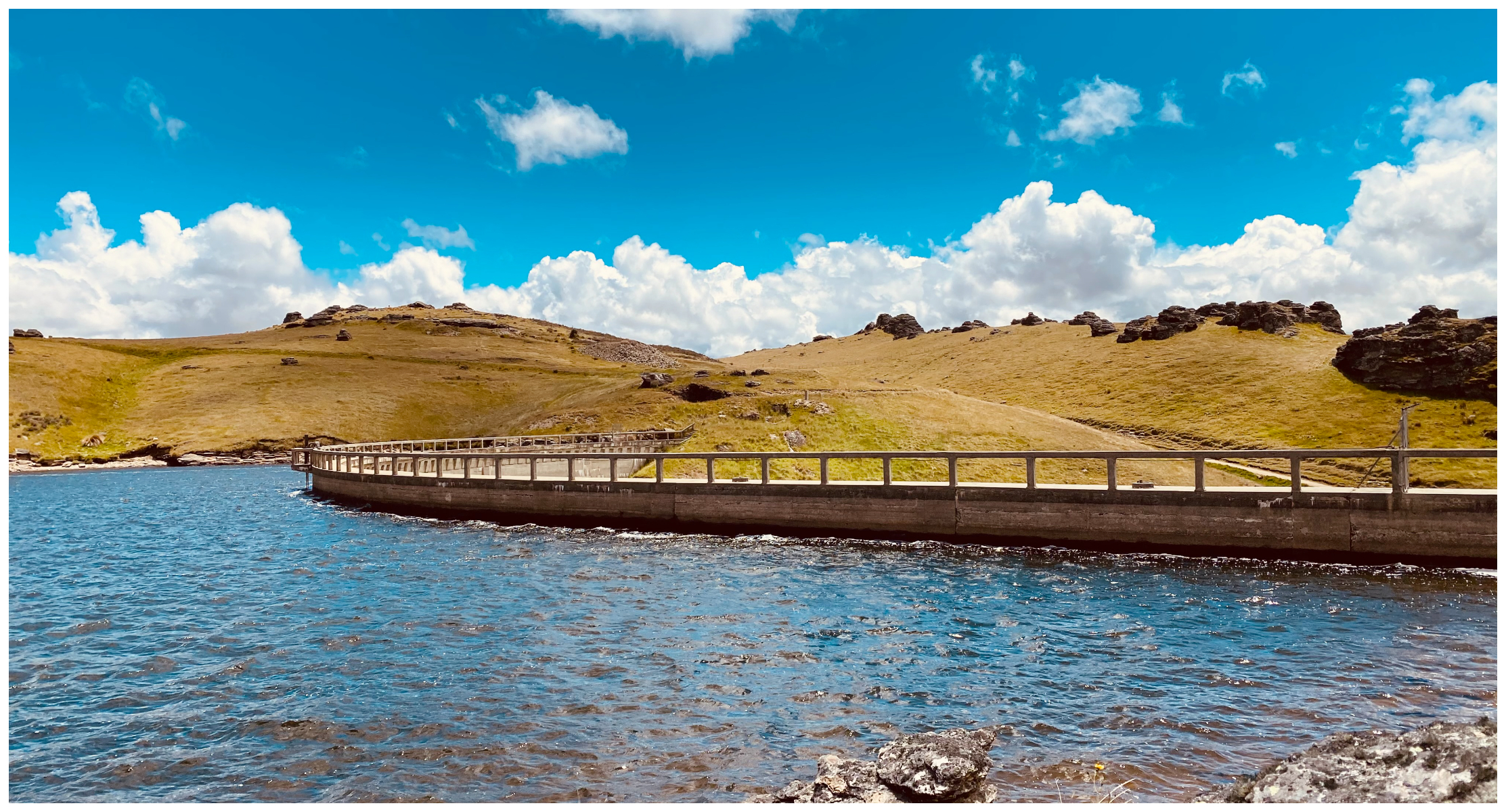
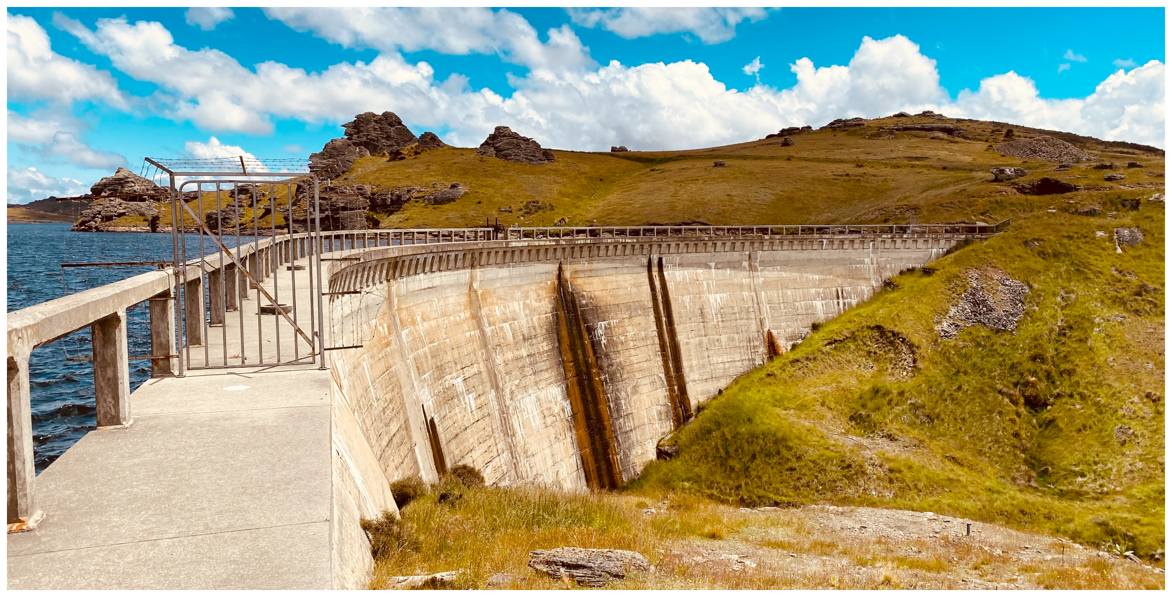
the massive concrete structure of the dam wall
it took two years to build the dam
The dam was built for the irrigation of the farms way down in the Ida Valley. The large concrete arch dam is 30m high and 150m long. There was a staggering 11,000 square metres of concrete used in its construction. The expansive reservoir covers over 300 hectares. It is a mecca for fishermen who hunt the brown trout.
For any ‘The Lord of the Rings’ fans, Poolburn Reservoir was used to depict ‘Rohan’. This means absolutely nothing to us as we must be nearly the only people in the world not to have watched the film trilogy!
Onward We Go
Dropping down from the Poolburn Reservoir, the road was much more ‘normal’ due to the traffic that travels to and from the dam. Although still rutted and boggy in parts, it is a rather civilised track to negotiate in a less specialised mode of transport.
The scenery is quite remarkable, overlooking the southern sections of the North Rough ridge. The road follows the original boundary line of the Bonspiel Station to enter the Ida Valley below.
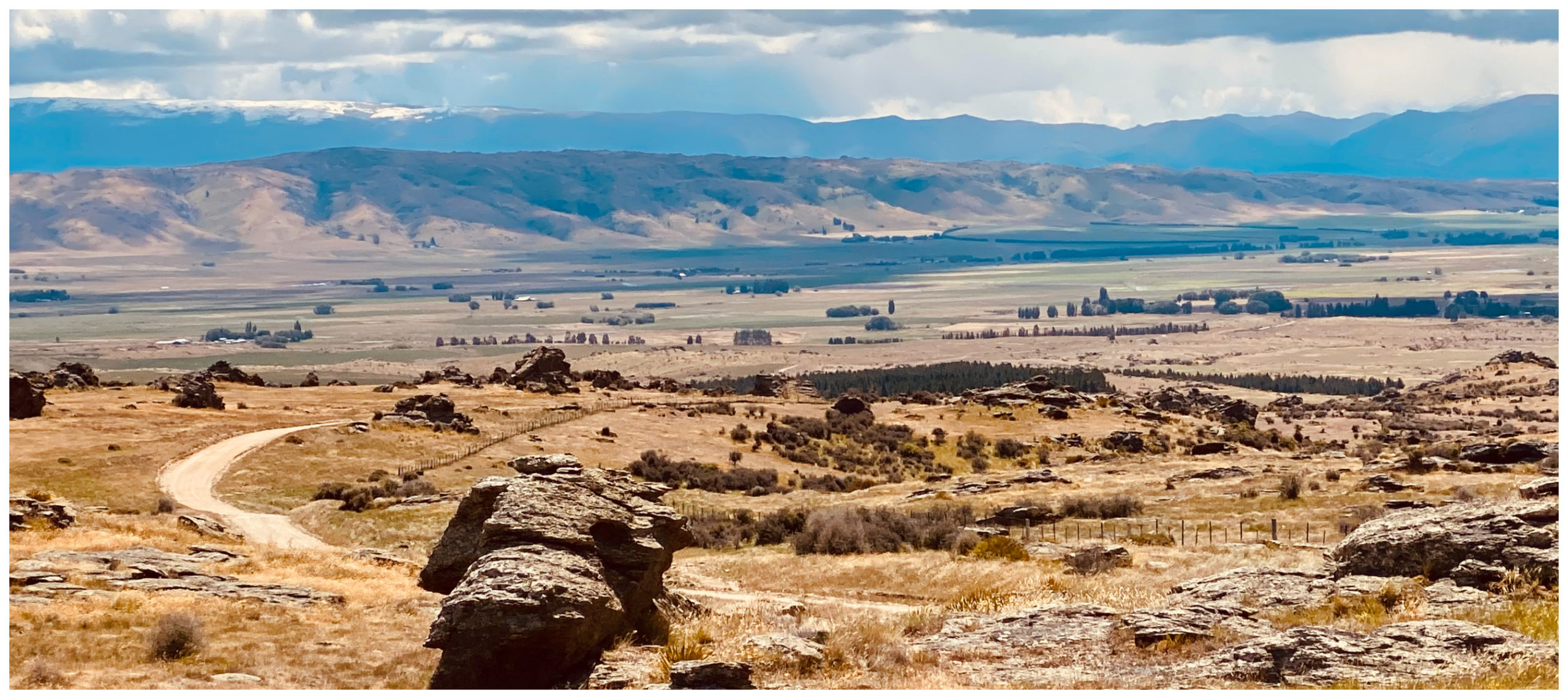
winding our way down from Poolburn Dam, looking out along Ida Valley
Moa Creek
We popped out at the historic Moa Creek. Gold was discovered at Moa Creek in 1863, but it was the later Chinese miners who continued to work here that put Moa Creek on the map.
The original Moa Creek Hotel still stands on the corner of Poolburn-Moa Creek Road. Sadly, beer no longer flows at this hotel and looks more like a house than a pub.
There is also a historic cemetery located in the middle of paddocks with no easy access to get to it. We could spot the fenced-off area in the distance but decided to continue on with our journey. We’ll save that for another time.
It’s at this junction that officially marks the end of the Old Dunstan Road today. We finished our loop roadie by heading back towards our basecamp at Ranfurly.
Including our detours towards Blackball and Serpentine, we covered just over 150km and took us the best part of a whole day.
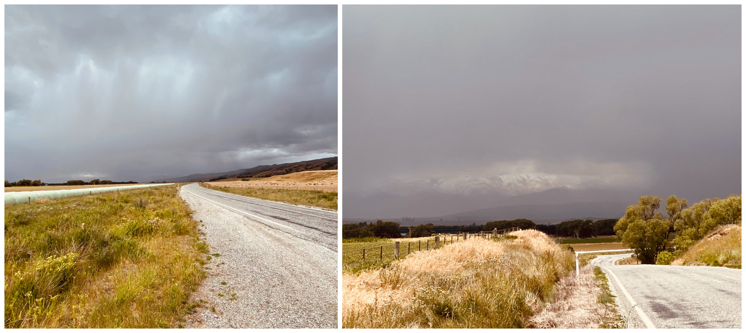
an example on just how quickly the weather can change as we head towards the eye of the storm – thankfully once we had come down off the tracks
Always be Prepared
We travel with basic recovery gear and a personal locator beacon for emergencies. If you want to drive the same route, a 4WD and sound experience in driving in an off-road environment is certainly preferable. A travel buddy in another vehicle would also be an advantage. Watch the weather and be prepared as it can turn very quickly.
Some sections of the Old Dunstan Road is easier than others. Do your research before you decide which parts are right for you to drive.
Have a read of my next blog – The Old Dunstan Road – Part Two, where we traverse the other mountain ranges that make up this historical pass over the four mountain ranges.
So it would be better to get to the Serpentine church from the Poolburn end?
Shellie has said it’s pretty rugged from the Omakau end.
Love following you around via your blog and it’s thanks to you we’ve found out about some ‘interesting ‘ places (:
Thanks Ann, to Serpentine Church, it would be easier to drive from Poolburn but you still have 14km of rough track to get to the church either way.
That was an exciting and interesting adventure through some wild country that most New Zealanders wouldn’t know existed. What those early travellers would have given for a 4WD truck!
We said pretty much the same thing as we powered up some of those steep tracks within minutes – they would have taken most of the day!!!
Very interesting. Briniging back memories having traversed a lot of it 60yrs ago. Doing a great job keep it up.
Thanks Geoff, glad it brought back memories for you. Probably hasn’t changed all that much. L
Hi my name is Helen, my son who has a Toyota landcrusier is thinking of going thru here next weekend, I’ve heard you have to get permission to go thru, as the gates are locked, I’m also wondering what the track would be like, as he not that experienced yet
Hi Helen, we didn’t need permission. They may lock the gates during lambing or adverse weather as the track can certainly change due to rainfall. We drove it during a dry summer so could get boggy if it has been raining a lot. It’s a fantastic track to drive though. I’m sure he’s got all his recovery gear sorted so just get him to check what the weather has been like there over the past few days.