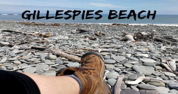
The committee (ie Scotty and I) held a meeting and we both agreed that we’d like to visit Gillespies Beach on the West Coast.
Off the Beaten Track
Gillespies Beach is a little off the beaten track so the road in does come with some warnings.
We did our research, read some blogs and comments on FB and figured that it was safe to make our way out there after leaving our camping spot in Franz Josef (click HERE to read the previous blog).
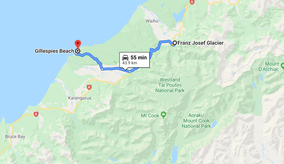
It is only 44km from the Franz Josef Glacier but we expected it to take a bit longer for us to get there, taking into account road conditions. We always like to plan to get to our next destination within a decent timeframe. This is usually between 11 am and 2 pm. This is the lull between the overnighters leaving the next wave of campers coming in.
We thought that timing was imperative as the camp at Gillespies Beach is a DOC Camp and didn’t appear to be all that big for the larger size rigs. Hopefully, we would get that window of opportunity to park up relatively easily.
The Road Into Gillespies Beach
On the NZMCA App, it mentions that the road is not suitable for larger campervans and caravans. However, we had been in touch with fellow campers who reassured us that the road was no worse than some of the others we’d driven.
This turned out to be spot on. Yes, the road is gravel, narrow and winding (for about 10 km). We met 3 vehicles on the worst stretches of road. Thankfully they were in spots where there was enough of a ‘pullover’ area. It was a squeeze but no reversing was required on the trip in. The road surface, although gravel, was smooth with no corrugations or undulations.
Sure, there were some tight corners with low visibility, but overall it was much easier than anticipated.
Make sure you stop at the Fox Glacier lookout on the way. This is one of the best views you can get of the glacier as the old road in never reopened and remains closed.
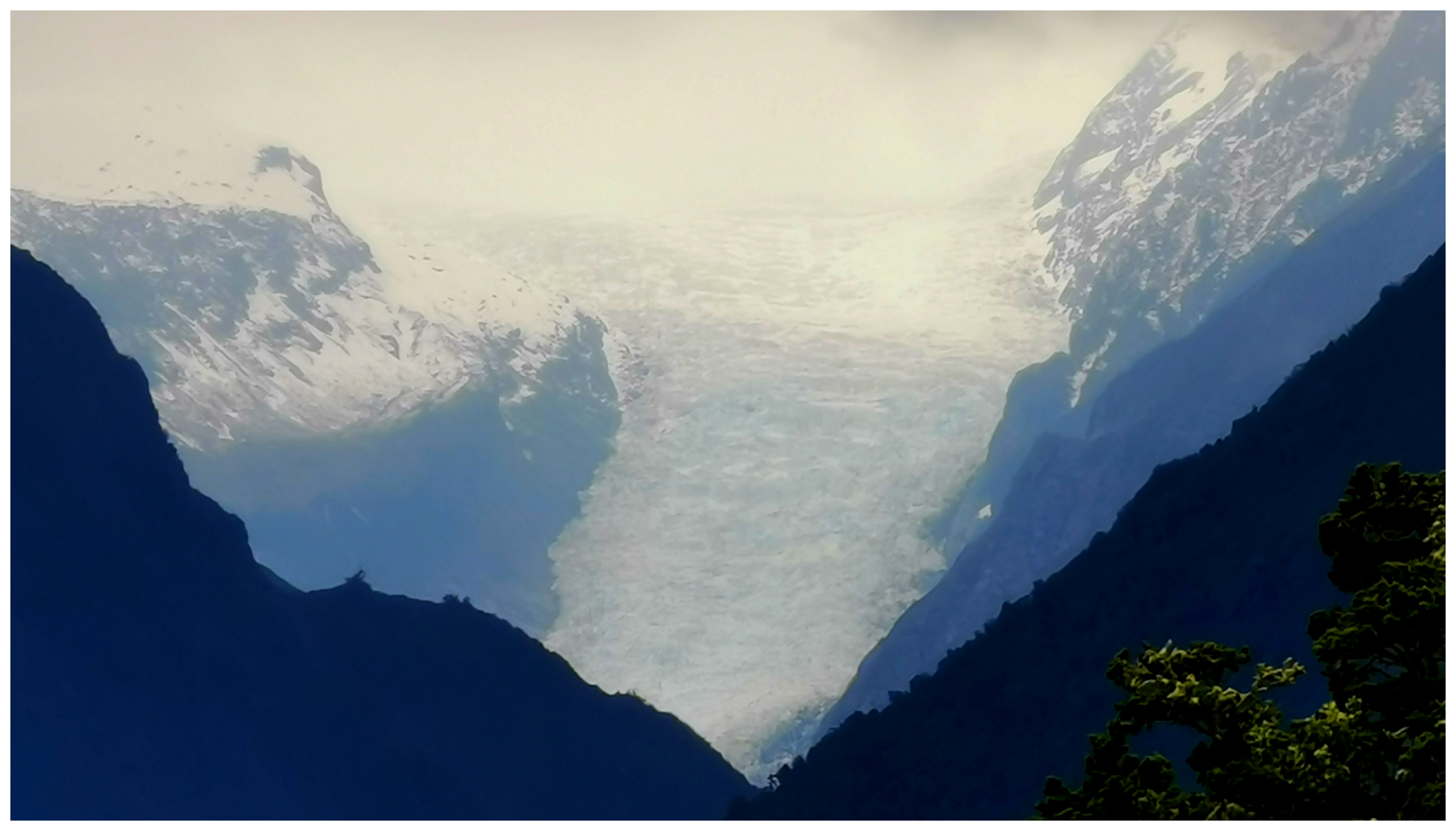
Taken with a zoom lens, Fox Glacier can be seen from the road to Gillespies Beach
Gillespies Beach DOC Camp
Gillespies Beach DOC Camp is a ‘first come first served’ bases. Officially there are only 8 unpowered sites but you know how it goes. There are always a lot more that squeeze in than what is stated.
Our timing couldn’t have been more perfect. There was not one camper there when we arrived. We were very limited on where we could park the beast up. We secured a lovely spot with an area behind us to enjoy and no one could park beside us (always a bonus!).
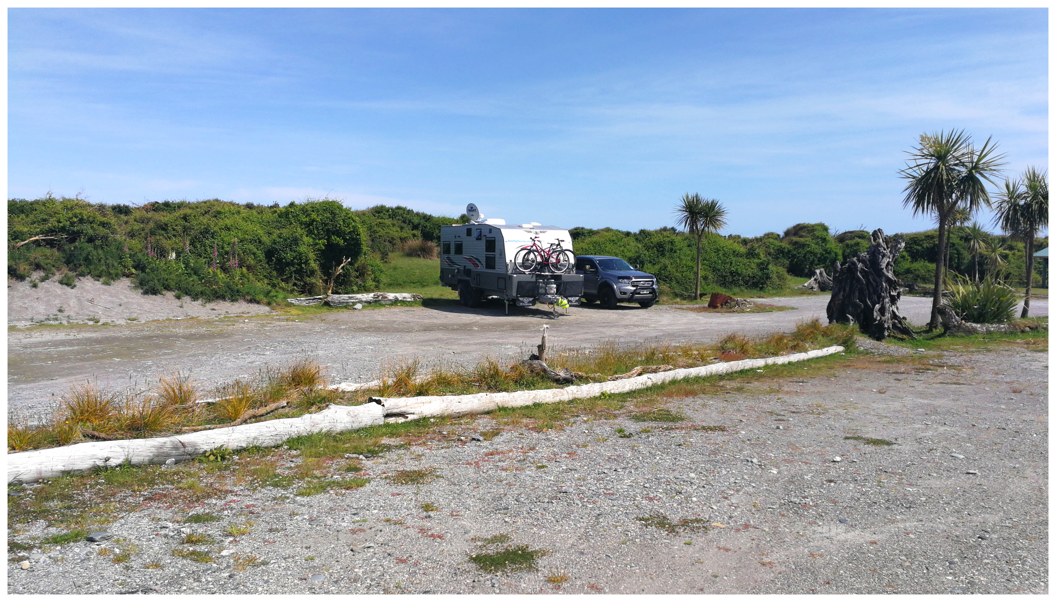
It was all about timing to get the best spot
As with most DOC Camps, it cost us $8pp per night. NB: if you have the DOC/NZMCA campsite passes, they cannot be used at this campsite. The campsite pass for rental campervans also cannot be used here.
There are clean toilets and basins for people to use to wash dishes (or teeth!). There are also the odd fireplace, picnic tables and shelter from the prevailing winds.
It is just a short walk over a small sand dune (about 50m) and you’re right on the beautiful West Coast Beach.
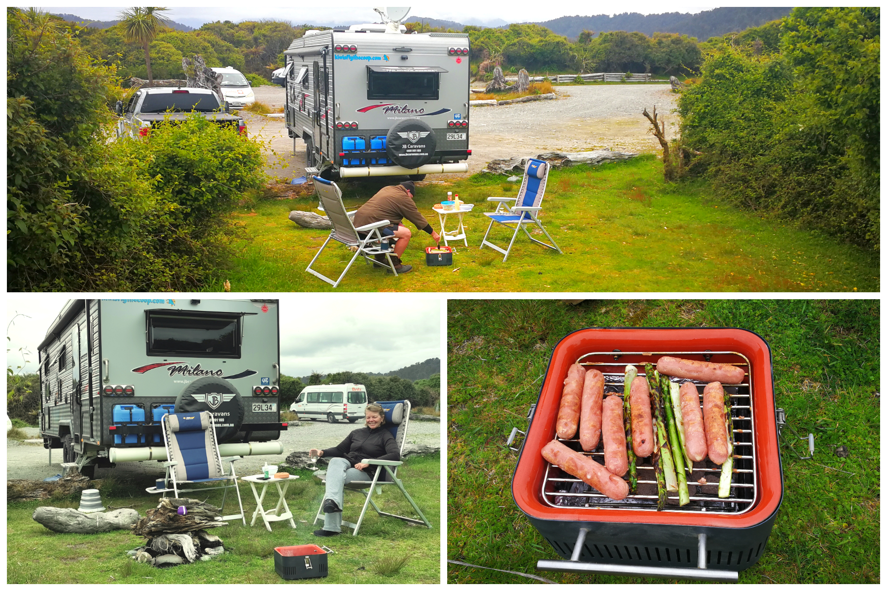
So important to allow room for the outdoor kitchen and dining areas!
We were parked only 50 meters away from this view
Gillespies Beach History
Gillespies Beach is more than a spectacular unblemished West Coast Beach. It has quite a history attached to the sleepy little settlement which today, is home to only a small cluster of baches (cribs). There are a few relics left behind to remind us of the people who must have lived, worked and died here.
In 1865, gold was discovered in the area by a miner called Gillespie, after failing dismally further down the coast at Bruce Bay. His discovery of gold led to a swarm of prospectors arriving and soon the area became a bustling township, home to several hundred people.
But alas, the township didn’t last long. Most had pulled the pin by 1920 as they weren’t able to access the gold they believed was still in the ground. Even the arrival of a bucket dredge failed to deliver the prized gold. All it did was suck up the beach’s stones and driftwood rendering it useless.
Gillespies Beach Walks
From basecamp, there are various walks you can take all of varying distances.
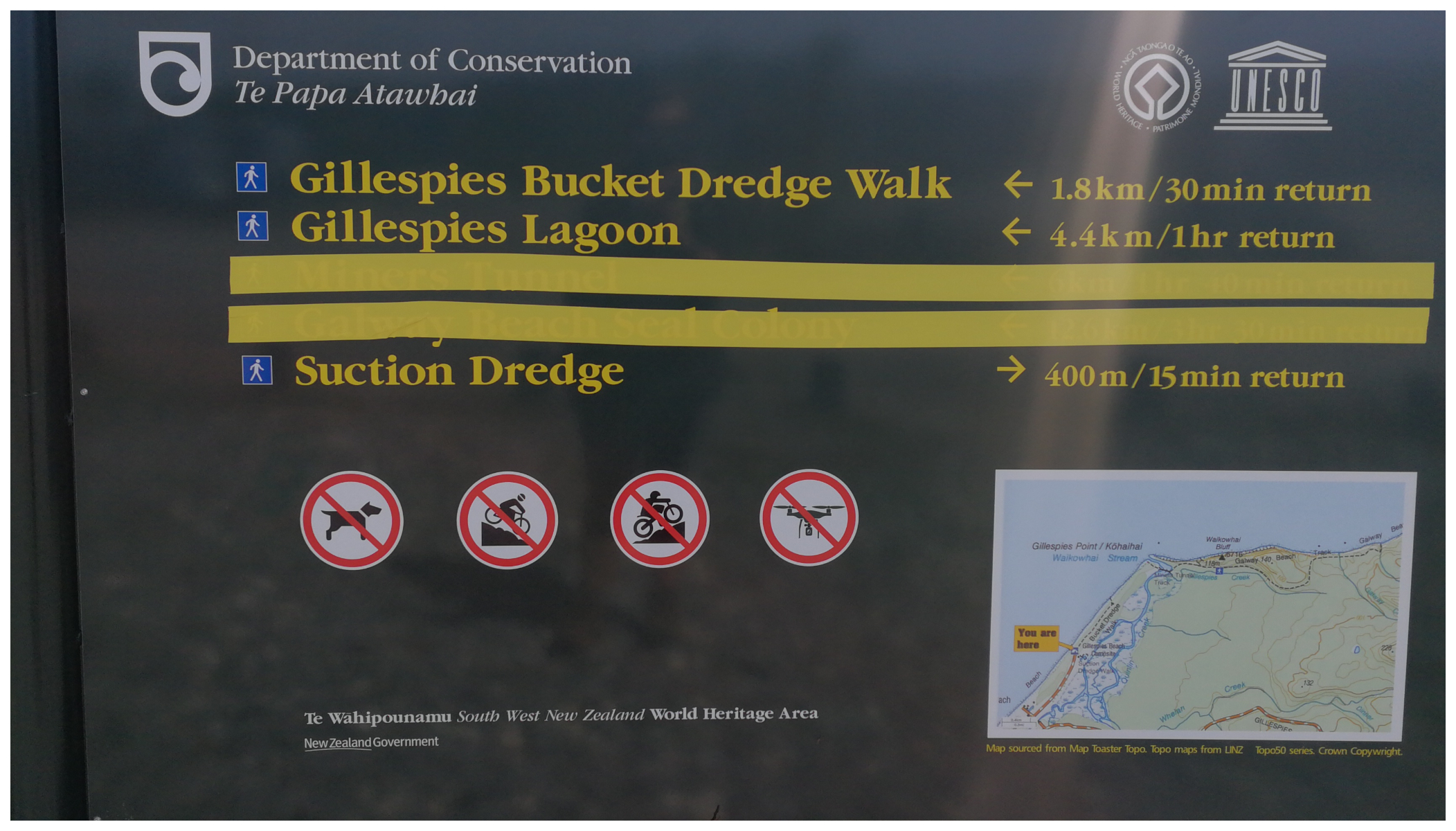
All the walks start/finish at the DOC Camp
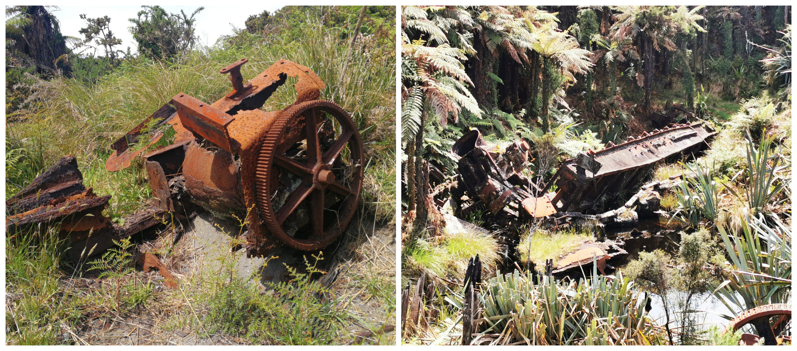
Gillespies Suction Dredge Walk
This is the shortest walk being only a 15-minute loop track.
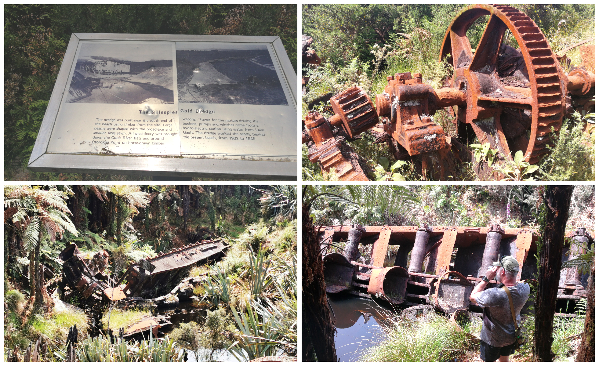
History boards tell the story, while relics show the story
There are relics along the track that are worth investigating. After setting off, you soon see the scattered remains of the suction dredge that operated briefly. It was specifically designed to loosen the sand, revealing the gold below. It was supposed to be the most powerful dredger ever located on the West Coast. The entire community must have been very excited by its arrival.
It was plagued by problems as mentioned earlier. Not only by stones and driftwood, but the engineer in charge of the dredge was tragically pulled into the machinery, watched by his assistant, which was also his son.
Gillespies Lagoon Walk
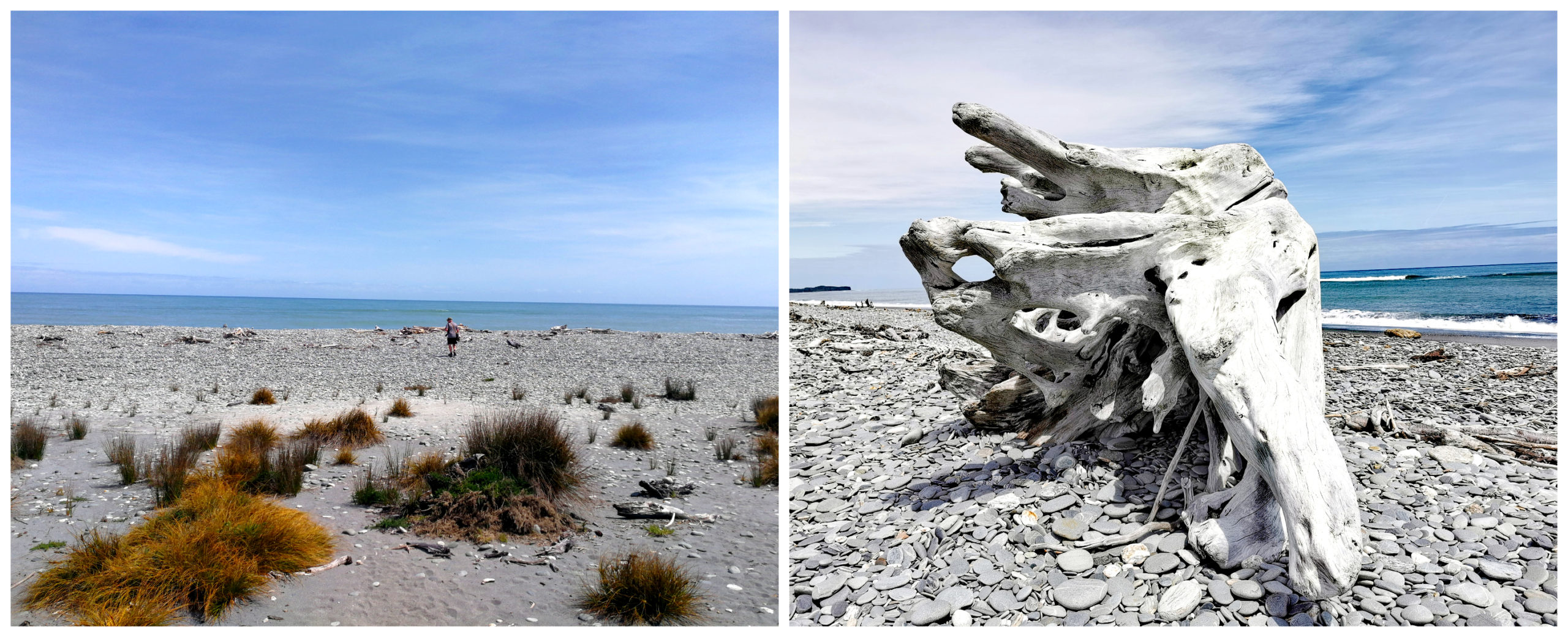
Carrying on from the Suction Dredge Walk, we wandered north along the beach, looking out for pounamu and watching the mesmerising crashing waves. We were heading to Gillespies Lagoon which is approximately 40 minutes one way.
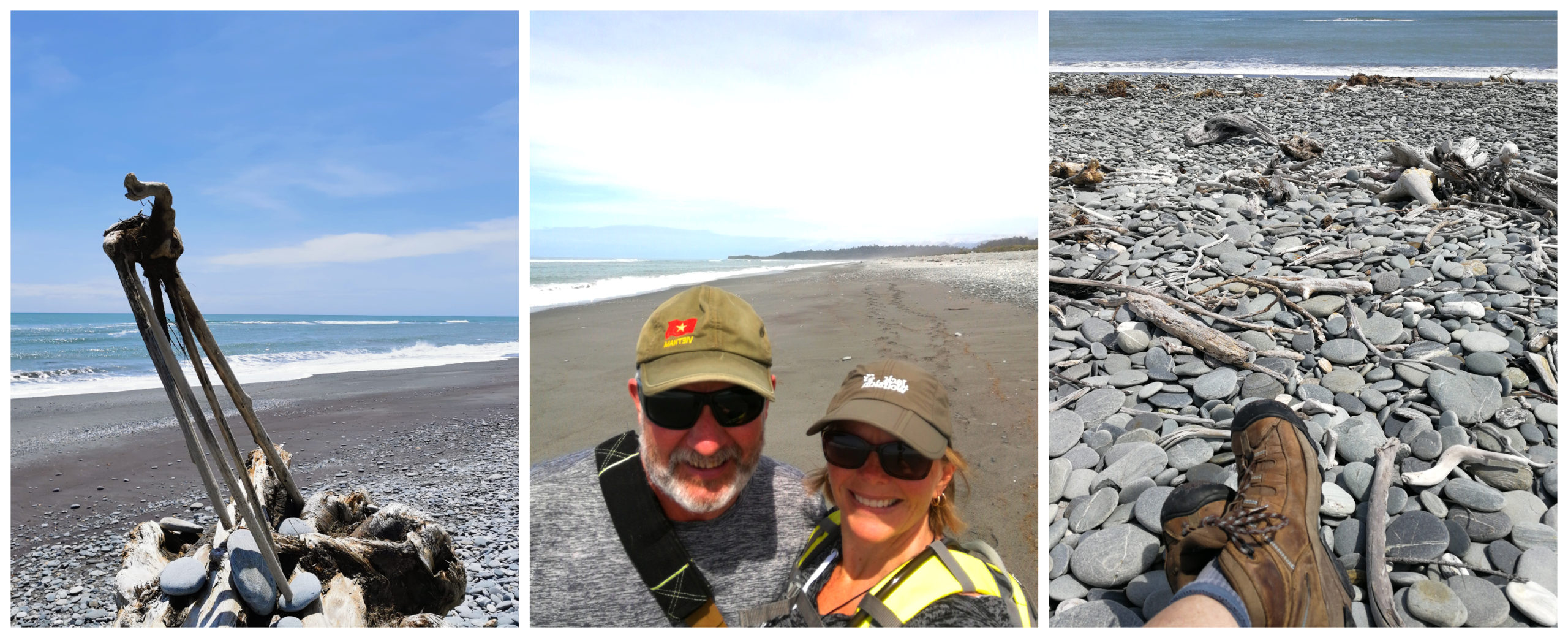
We were the only ones on the beach
Often landlocked by the tide, the lagoon is popular for those who want a more tame option of swimming than the wild beach. It isn’t really an inviting looking lagoon as the water is stained from the tannins of the nearby trees.
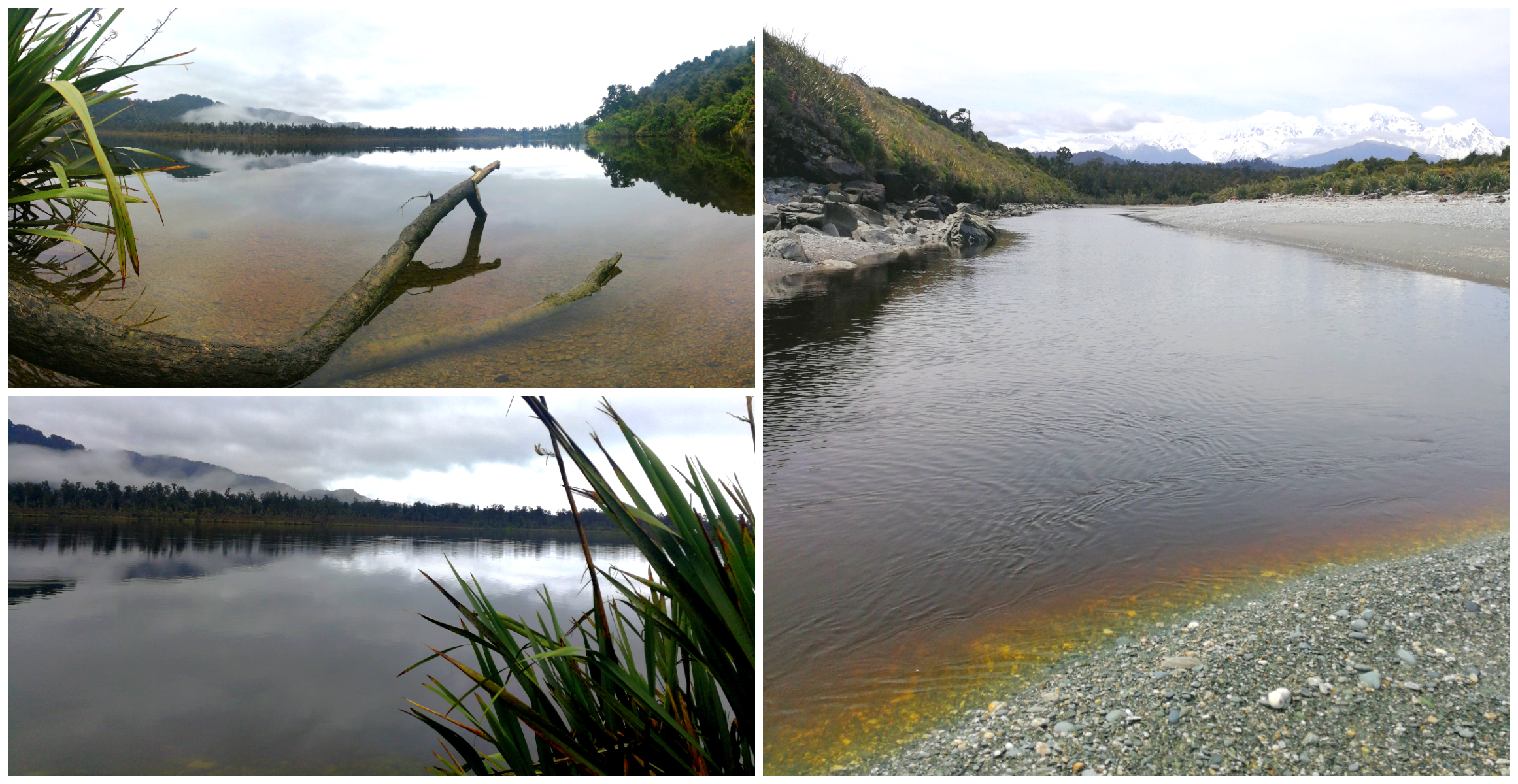
the tannin in the water makes it a little less desirable for a dip
There is a boardwalk that crosses over the lagoon, giving access to the walking tracks leading to the Miner’s Tunnel and onto Galway Beach.
Unfortunately, this was taped off with ‘danger – no entry’ signs erected at the start of the boardwalk across the water. It appears that the decking is in a state of disrepair after flooding in the area. It’s a shame as we would have liked to have continued on. However, heeding advice, we did an ‘about turn’ and wandered back along the beach towards camp.
Gillespies Bucket Dredge Walk
Similar to the Suction Dredge Walk, there are rusty relics of the past, peeking out from the scrub. There are interesting history boards showing how it was back in the 1930s when the gold dredge was in operation. Gorse-covered dredge tailing is still evident as you wander around the 30-minute return track.
The miners thought the modern machinery was the answer to all their problems
Historic Miners Cemetary
Carrying on with our walk, we retraced the road back out that we had driven into to get to the camp. About 1 km back up the road, you will find the signage to the Historic Miners Cemetary. It is located off the road via a short path to a small clearing surrounded by bush.
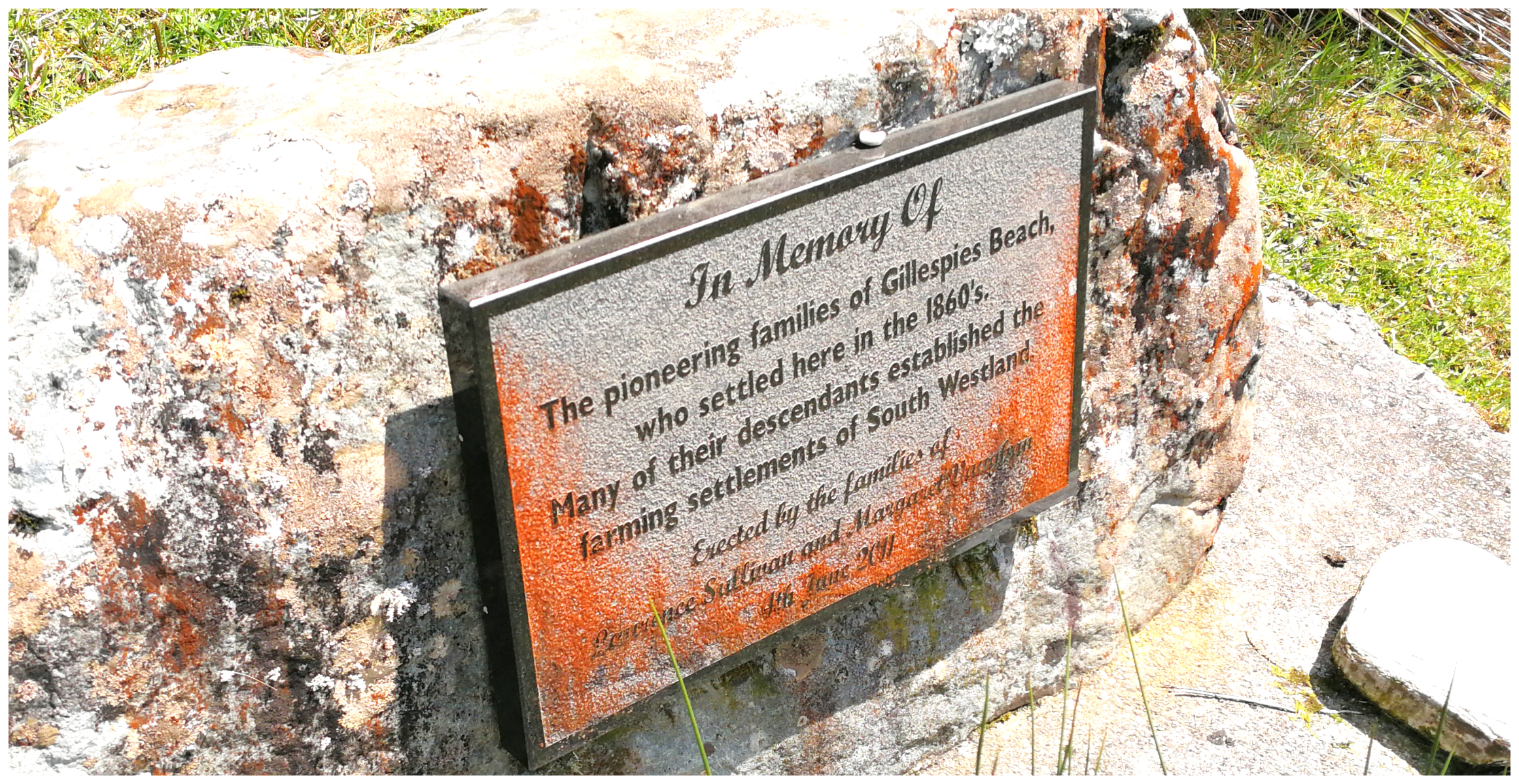
The memorial to the pioneers, to ensure their memory will not be forgotten
The cemetery is a reminder of the harsh environment the early gold prospectors lived and worked in. We first came across a memorial which acknowledged the pioneers, a lovely tribute to those people who arrived here and never left.
Officially, the cemetery was established in 1896 but may have well been used before this date. We did find a grave which is dated as early as the 1860s.
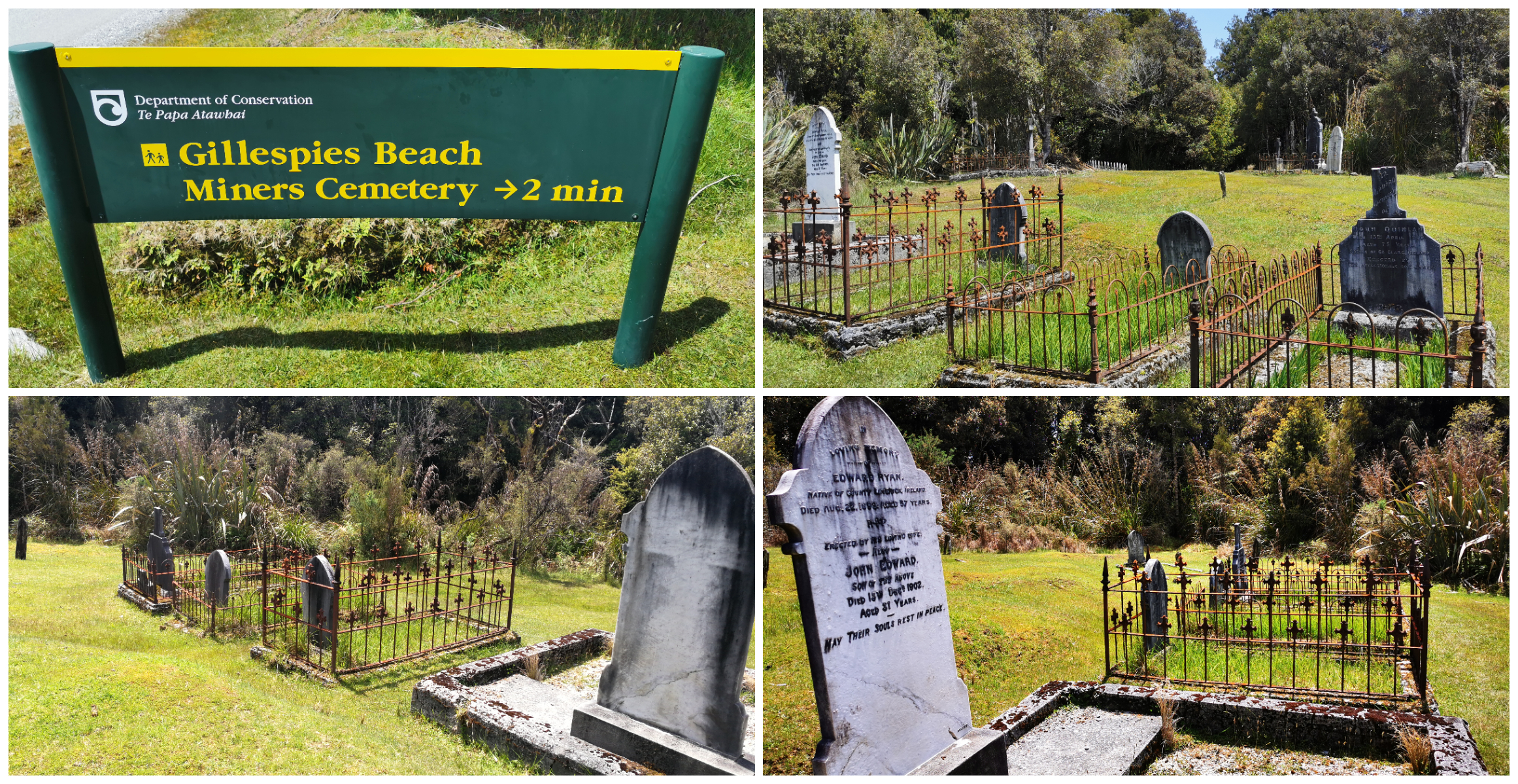
The gravestones tell the story of how harsh life was in the pioneering days
There were nine marked graves and several more that remain unmarked. On researching the cemetery, it seems that suicide was a common cause of death for West Coast miners. This could well be the reason for the graves to be unmarked. It certainly suggests that life in these rugged mining areas did not only take its toll physically but was psychologically difficult as well.
Retracing the Old Town
Instead of returning to camp via the way we’d come, we walked straight ahead and past some old dilapidated houses. Some had been resurrected but others lay exposed to the brutal natural elements that only the West Coast can turn on.
The town peaked in 1866 with 1500 people living here. There were 11 stores, 2 bakeries and 2 butcheries. With all of this infrastructure, you would expect there to be more evidence of what once stood. You really had to look hard and have a vivid imagination to work out just where all of these buildings were located.
Returning to Basecamp
We’d clocked up quite a few kilometres by this stage and happily returned to basecamp, tired, hot and thirsty. After all, it was nearing ‘happy hour’.
The weather was not playing ball with regards to offering us a stunning sunset. We did, however, have wonderful views towards Mt Cook and Mt Tasman. We could also see glimpses of Fox Glacier.
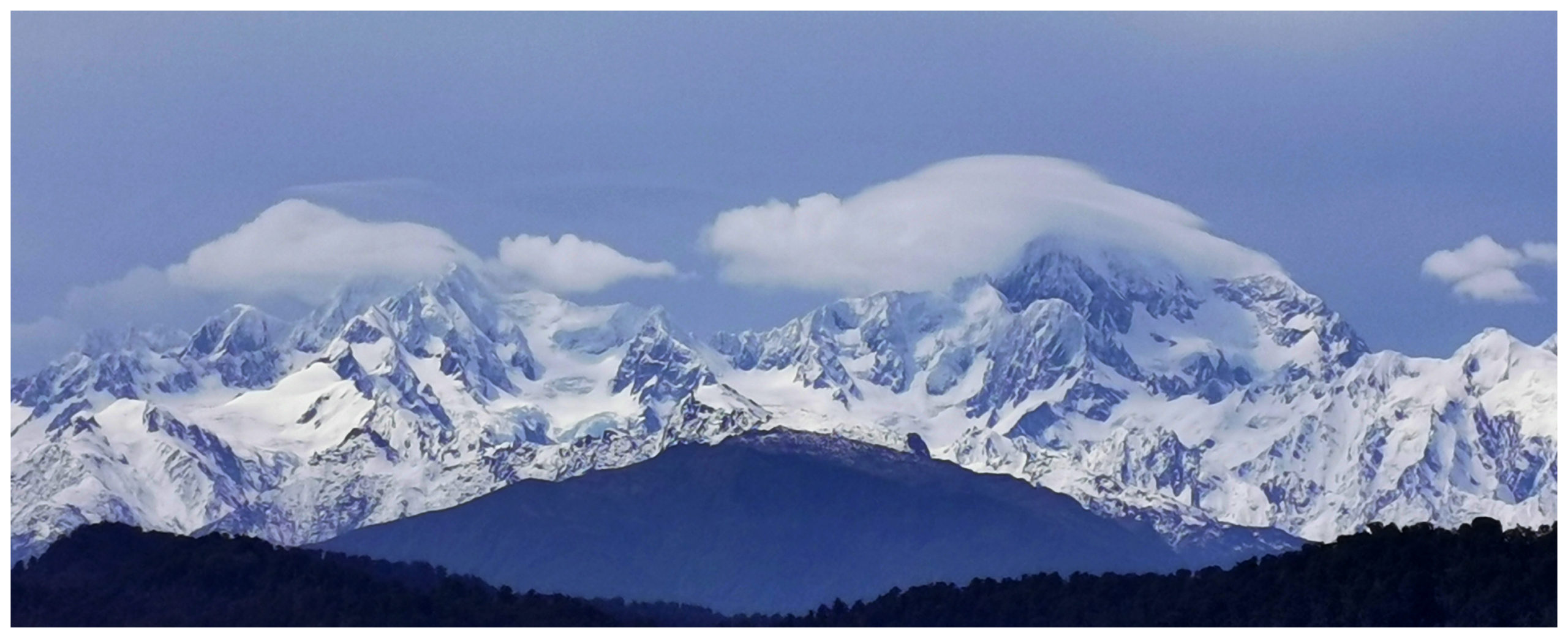
Although robbed of a sunset, we were treated to the sun setting on Mt Cook and Mt Tasman
The camp was full by the time night descended. We counted 12 rental campervans who joined us in that small DOC Camp. The last stragglers we heard coming in at around 10.30 pm.
While we were sitting there watching the comings and goings of our fellow campers, it did sadden us to see that only one of the occupants of all the campervans seem to make the trip over to the self-registration station and put cash into the donation box.
We find this really frustrating when, as NZ’ers our taxes go towards helping to keep these facilities operating. The tourists who are usually the majority of campers at sites like this, use these great facilities without paying for them and we pay for them twice (taxes and donation).
Click on the link below to view a video of our highlights at Gillespies Beach.
Thanks for the read and photos Linda (and Scotty). Always interesting. Shame that so many tourists appear to be free-loading on DoC campsites. I guess they just view these sites as freedom no-cost camps like elsewhere.
Great post. We preferred Fox Glacier when we visited years ago as, then, it was much cleaner that Franz Josef. Could be different now of course. (Have you ever been to Glacier Bay?)
Such interesting history of Gillespies Beach – I love storyboards because they condense the information down into a nutshell making it easy to take a photo of the information.
How smooth are those stones on the ‘beach’! You could take a few carloads to the local nursery/landscaping place and make a small fortune 🙂
Fantastic photo of Mt Cook – it was hiding in the clouds when we were there, although the peaks were just poking through when we flew over it on the way home.
How miserable can some tourists be for not donating towards the upkeep and maintenance of such amazing attractions! Same all over the world I’m sure – the givers and the takers.
I really enjoyed reading this post on a miserable wet day here in Beachmere.