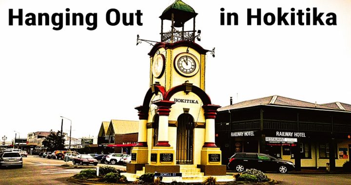
Hokitika Bound
Hokitika is another place where we have visited a few times but we never seem to have had the time to stop over for a decent stay and do justice to what the area has to offer. This time around we set aside 3 nights and 4 days to explore the surrounding area.
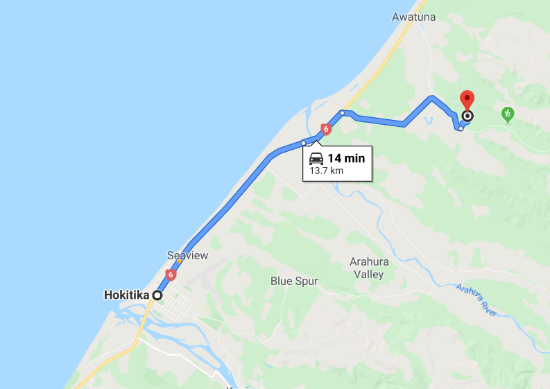
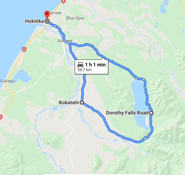
We had a lovely and very scenic drive down the coast from Barrytown. We arrived early afternoon and headed to the Southside NZMCA Park (#6718) situated beside just over the Hokitika River Bridge.
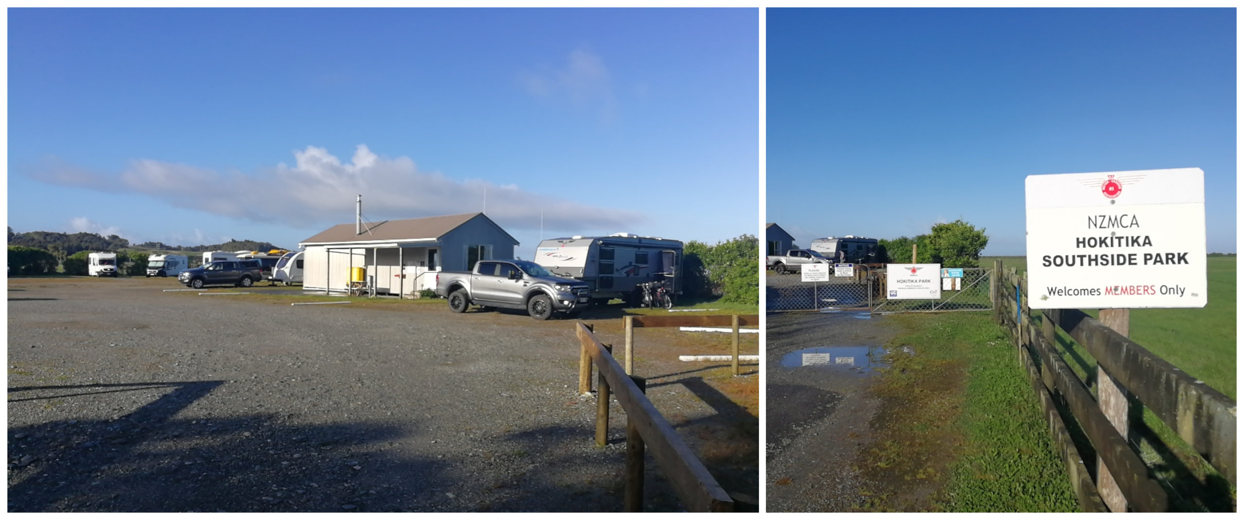
Our base camp for the next 3 nights
There were a lot of tracks and trails we wanted to tick off the list. We had a really wet and windy night. It rained all night so we thought that it wouldn’t be a good idea to get on our bikes and ride some of the mountain bike tracks – so it was walking tracks for us on the first day.
We kept an eye on the weather as it was supposed to pack in around 2 pm. We headed off nice and early to make the most of the day.
Stafford Cemetery
We travelled north out to a little township called Stafford. We were headed for the Tunnel Terrace Loop Walk but stopped off at the Stafford Cemetery for a look around the headstones
Stafford is an old mining town situated on the Waimea creek 13 km from Hokitika. Gold was first struck in 1865 and the town sprung up quickly with 37 hotels and 17 stores. The population of over 5,000 consisted of many immigrants including a large proportion of Scandinavians.
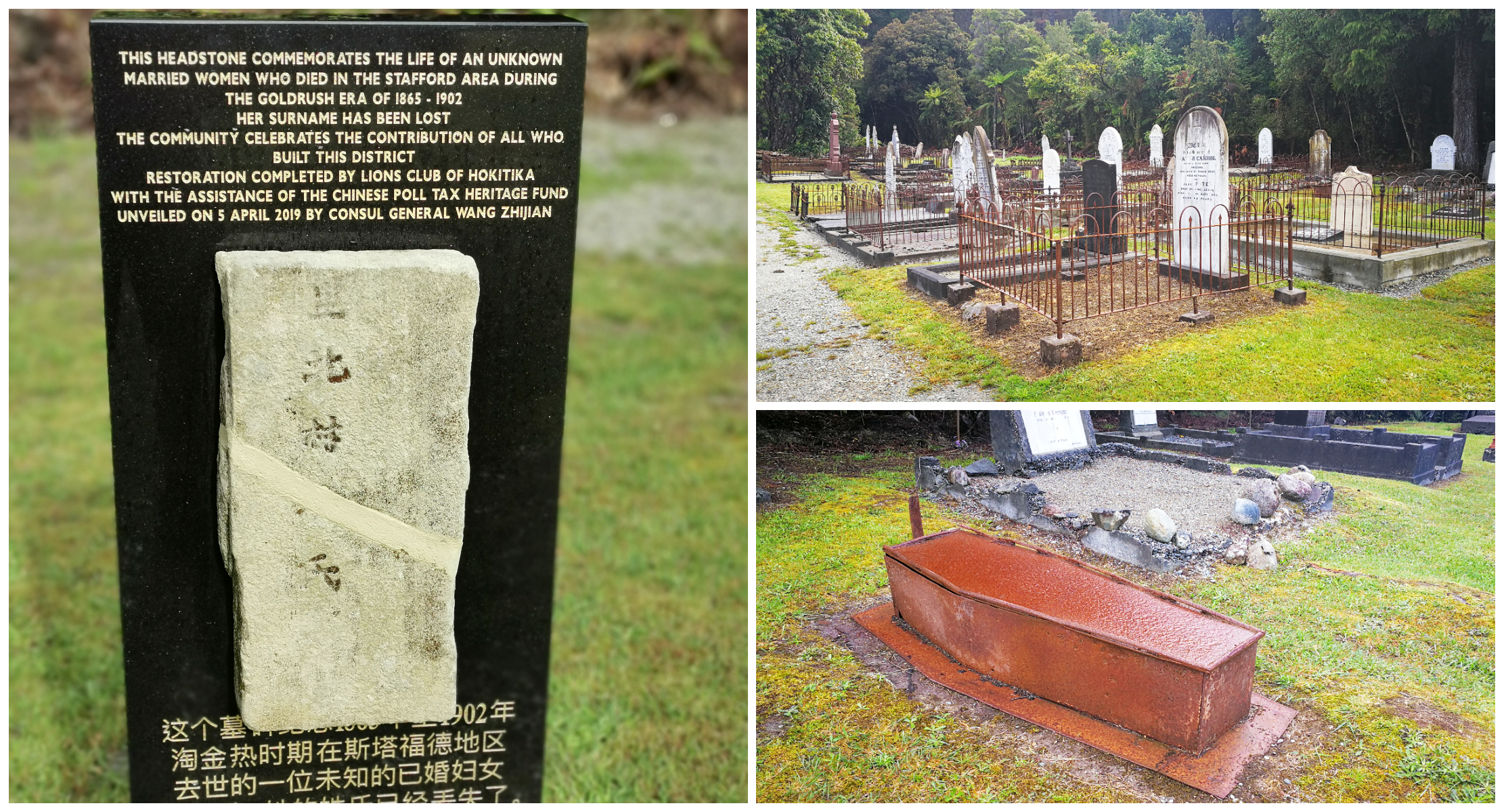
We spent some time wandering the old graves and what’s with this cast iron coffin!!!
We spotted many headstones from all sorts of nationalities and ages. It was a bit freaky to come across a cast-iron coffin sitting on top of the ground. Luckily it was empty.
Tunnel Terrace Loop Walk – Goldsborough
Just a short distance up the road from the cemetery is the Tunnel Terrace Loop Walk. Although it is only a short loop walk it is packed full of mining history. We soon saw evidence of the miner’s diggings, tunnels and tailraces.
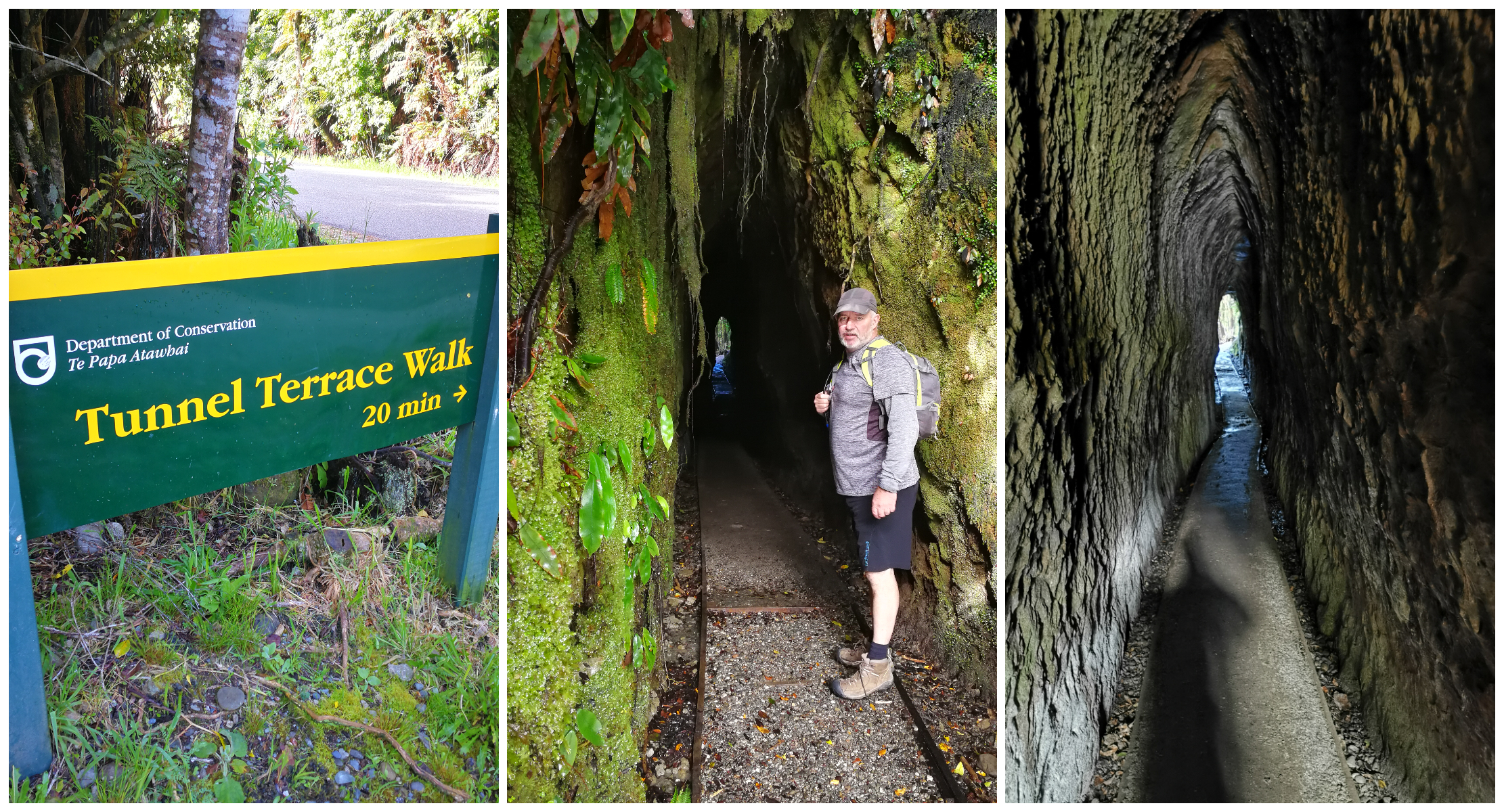
The start and the end of the track leads through a long tunnel
You wouldn’t even know the track was there and easy to miss as it starts and finishes with a walk through a tunnel. This was part of the miners old tail-race. Once you emerge from the tunnel, you are straight into regenerating native forest. Nearly all of the timber was felled to build homes and support structures used in the sluicing of the gold.
Blue Spur Bushwalk
The next track on our list to do was the Blue Spur Bushwalk. Leaving from the car park on Blue Spur Road, it is a 1.5hr loop track. Thanks to the recent downpours, the start of the track was quite wet, slippery and water-laden. We worked our way up the hill track which was actually a stream.
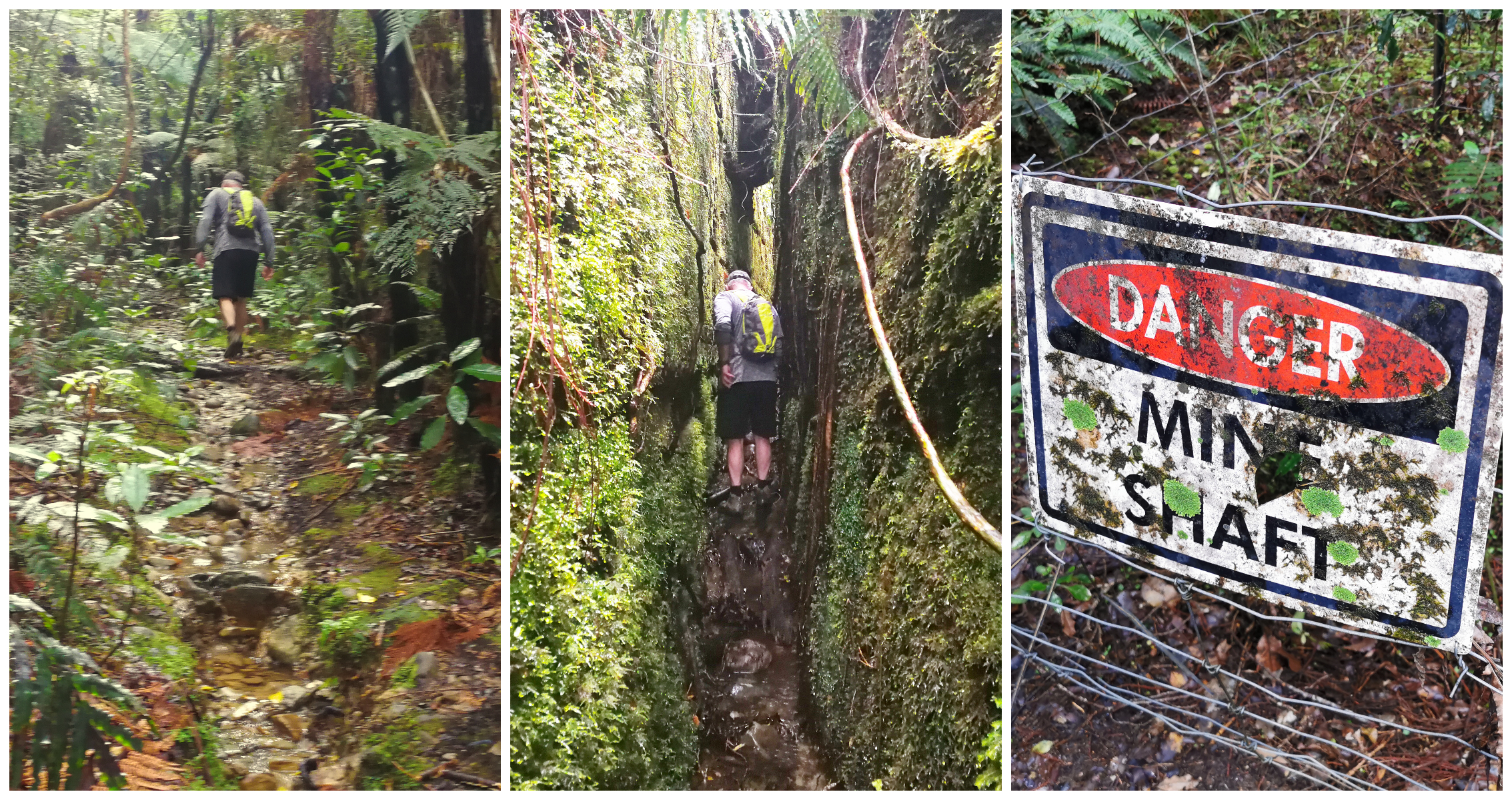
winding our way up the steep stream, shimmering our way through deep tailraces and keeping out of the mine shafts
Once again we were soon treated to old Chinese gold mining workings. Races, stone walls and shafts intermingled with regenerating native forests. The piles of tailings evident on the sides of the tracks, covered in lichen and moss.
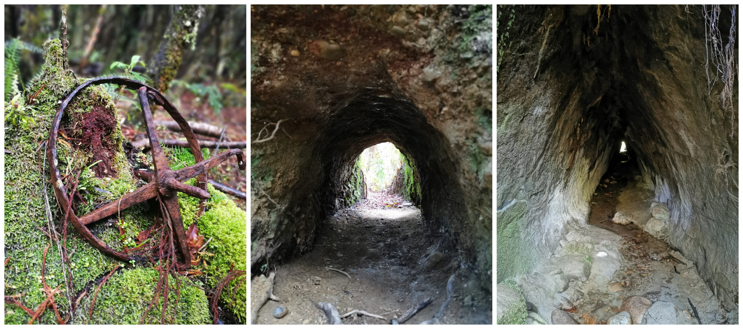
mining relics and old mines dotted the landscape
There are many hidden shafts and steeper sections of the trail so care and attention are required and it’s essential to stick to the track. Even the toughest of footwear isn’t going to help if you fall down one of the many shafts that run deep into the layers of earth.
Rimu Hill Lookout
Heading inland from Hokitika for 8km (past Kaniere) is the Rimu Hill Lookout at a small settlement called Woodstock. We decided to walk the 1-hour loop track.
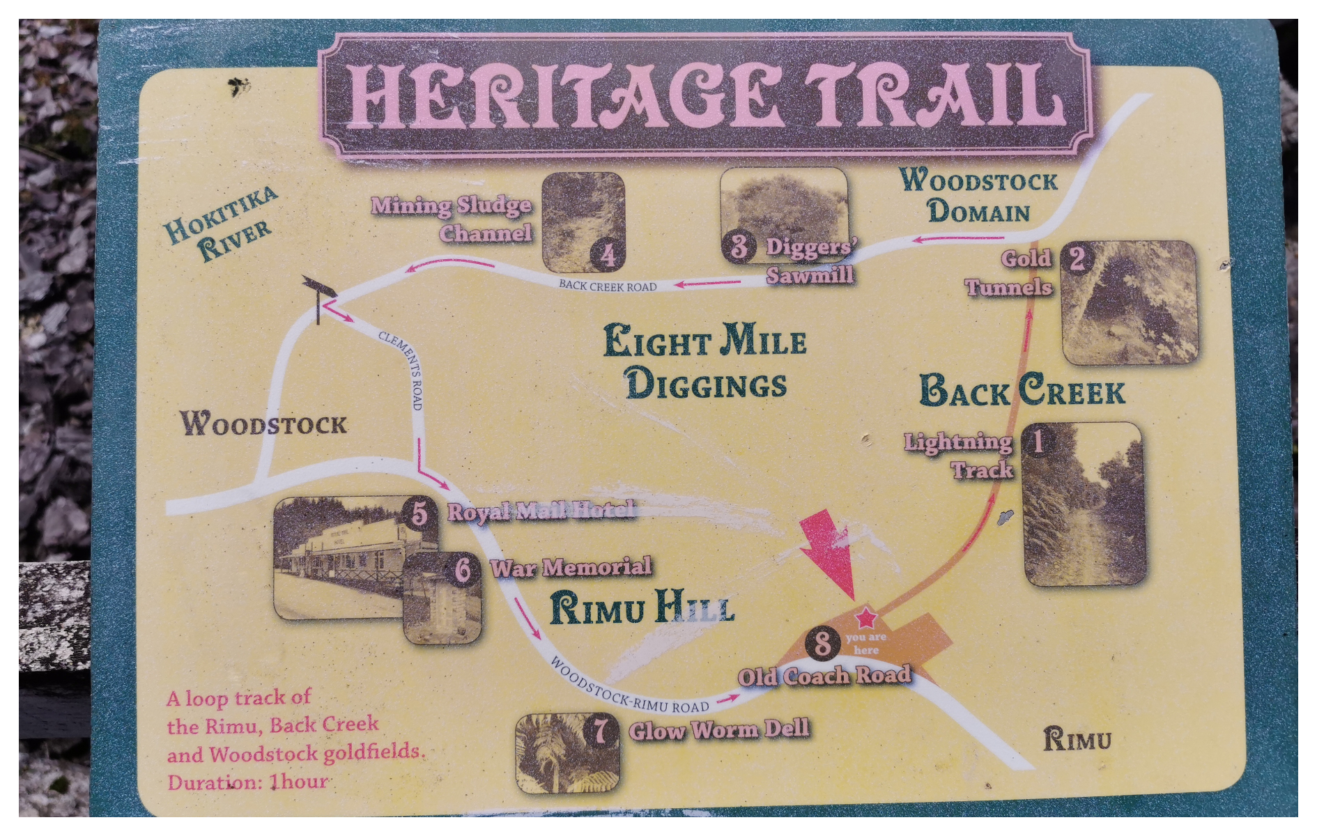
The Rimu Heritage Trail map
From the top of the lookout, we had panoramic views of the Hokitika valley and read various history boards on the gold mining heritage in the area.
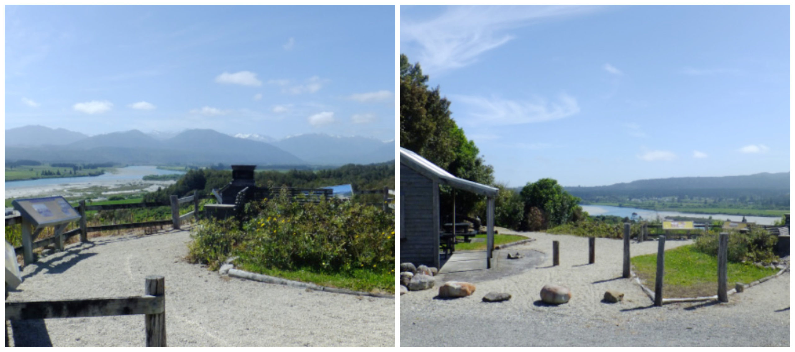
The views a short walk from the carpark
Woodstock is yet another town with a gold mining past and was once a bustling area. Of course, there were the necessary hotels that always sprung up so that the miners could quench their thirst.
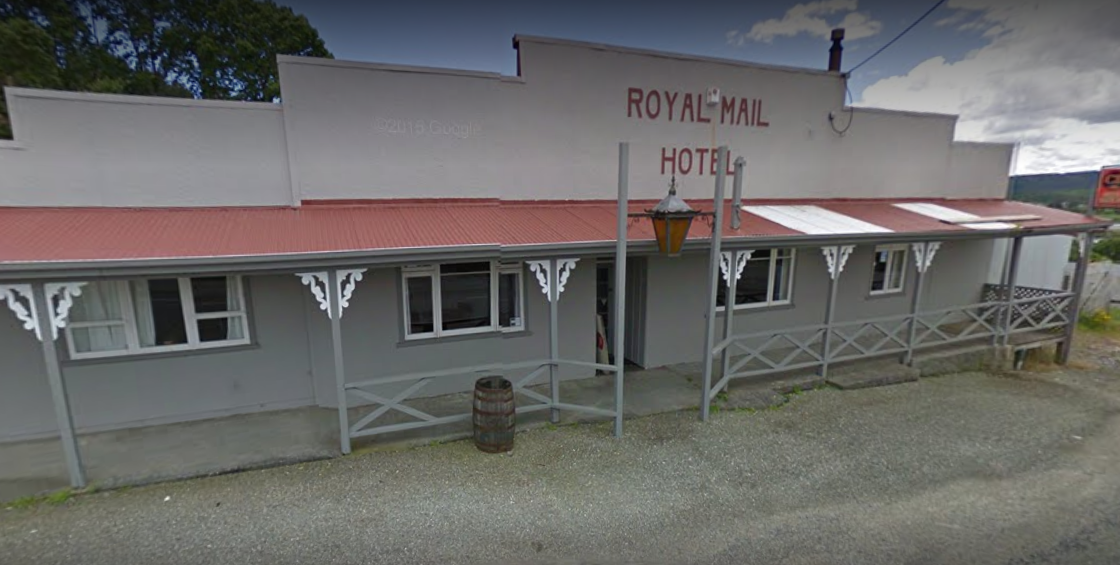
A small pub with a BIG history
Only one of these pubs remain – The Royal Mail Hotel. it began its life in 1865 but not on the original site where it currently sits. It was 200 yards further down the road. In 1878 it was jacked up and rolled on empty beer barrels and pulled by horses to its present site.
It used to be called the Woodstock Hotel and has played many roles over the years. A public house, meeting place, post office and even the local morgue!
Hokitika Gorge
The incoming weather was holding off surprisingly well. It was nearly 2 pm so we took off towards the Hokitika Gorge to visit the popular Suspension Bridge.
Approximately 34 km from Hokitika is the beautiful and very popular gorge and suspension bridge.
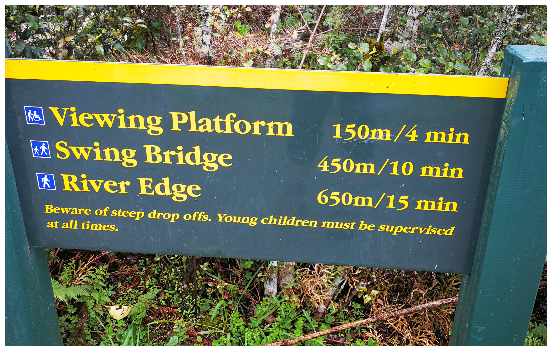
The start of the well used and well-signposted track
You find that most tourists will pay a visit to the suspension bridge so there is quite a sizable car park at the start of the walk. The track is very well-formed to the first lookout point. Carrying along the track, there are boardwalks which take you to the suspension bridge over the aqua blue Hokitika River. However, the river wasn’t so aqua on our visit, thanks to the high rainfall.
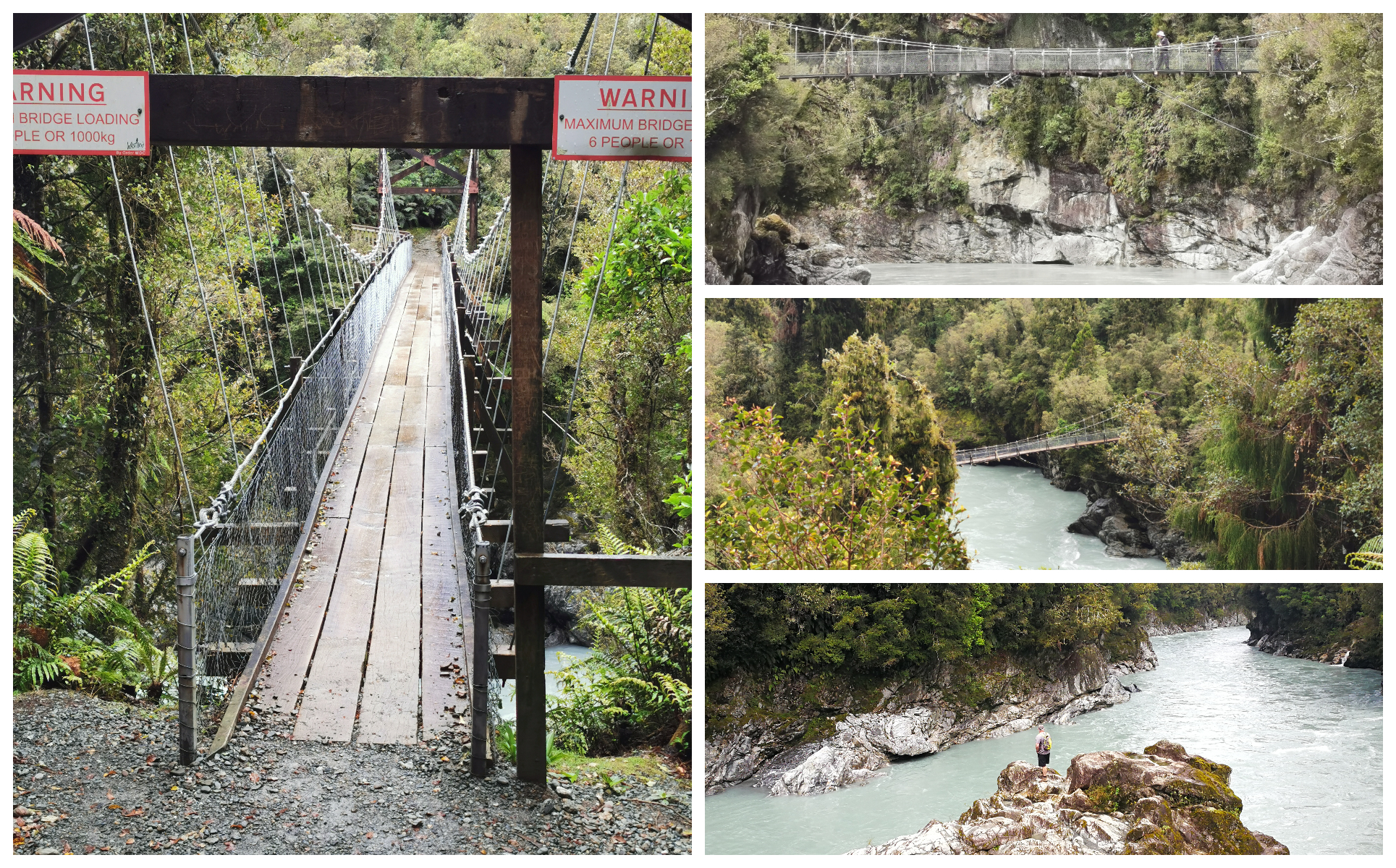
The Hokitika Swing Bridge
Once across the bridge, the track continues for another 200 m through the bush to another viewing platform which looks out further upstream through the rock-edged valley and river.
The mozzies at this lookout were unforgiving. I managed to kill 5 of them in one slap!
The Kowhitirangi Incident Memorial
On your way to the Hokitika Gorge, you pass through a small settlement called Kowhitirangi. Now I’d never heard of it before but during my research, the Kowhitirangi Incident kept popping up.
On 4 October 1941, a local farmer Stanley Graham went on a deadly rampage. By the time it ended on 20 October (after a lengthy manhunt) 8 people were dead including Graham.
What triggered his rampage is still not clear but he was in financial strife and the police had confiscated most of his firearms for the war effort (except he still had a shotgun and two Winchester Rifles).
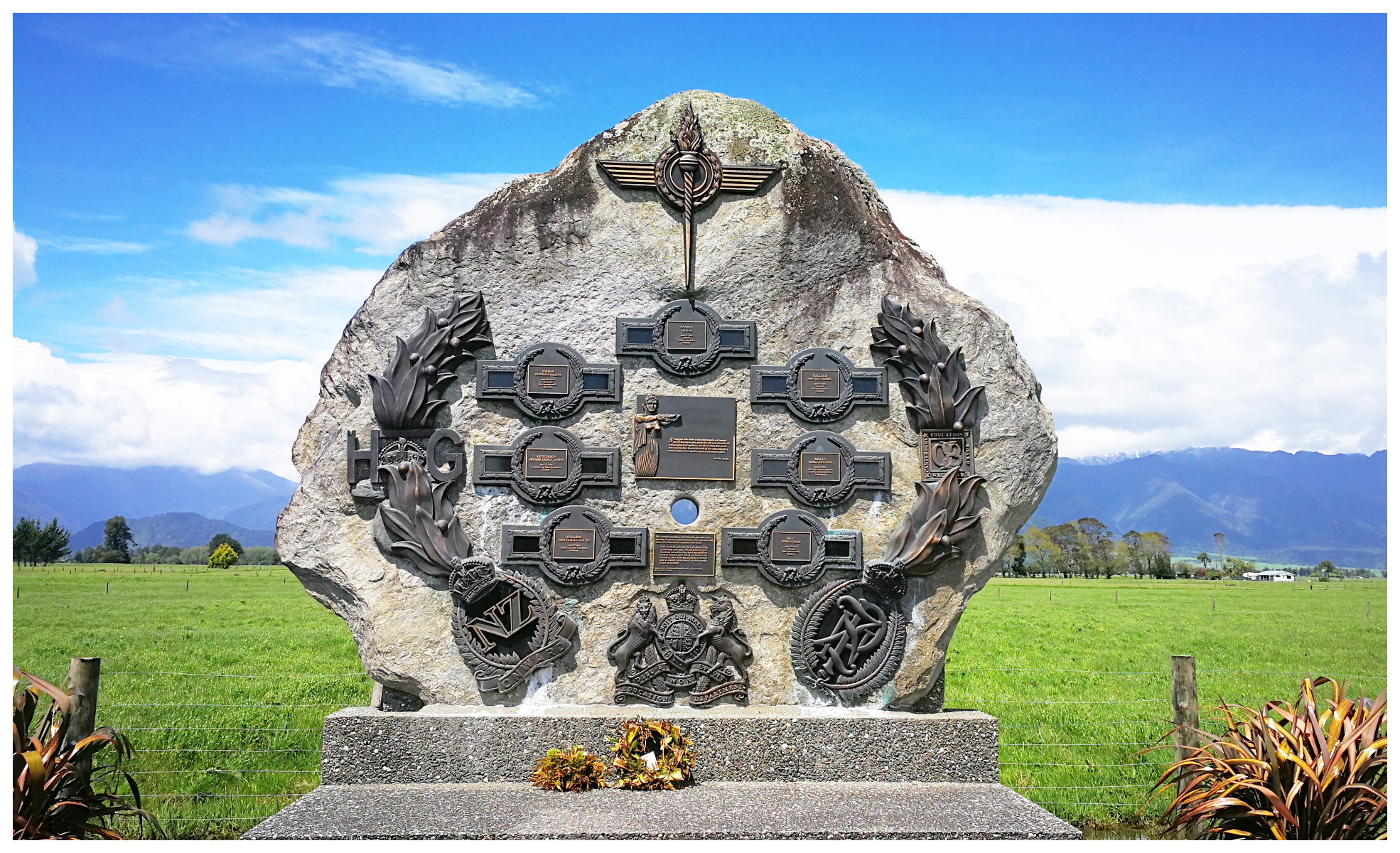
A beautiful tribute to the 7 victims of Stanley Graham
We stopped at the memorial to the victims, unveiled on 8 October 2004. It has been created from a large boulder from the nearby Diedrichs Creek. Each person who died is commemorated by a bronze plaque. In the foreground is the site of the Graham homestead which has since been demolished.
Lake Kaniere
Beautiful Lake Kaniere lies 30 km southeast of Hokitika. It’s 22 square km and is the second-largest West Coast lake (Lake Bunner pipping it at the post for size).
There are a variety of walks and mountain bike tracks that were on my list but alas, the weather Gods had different plans. We had to be content on a drive around the lake, stopping off at different points along the way for some great photo opportunities.
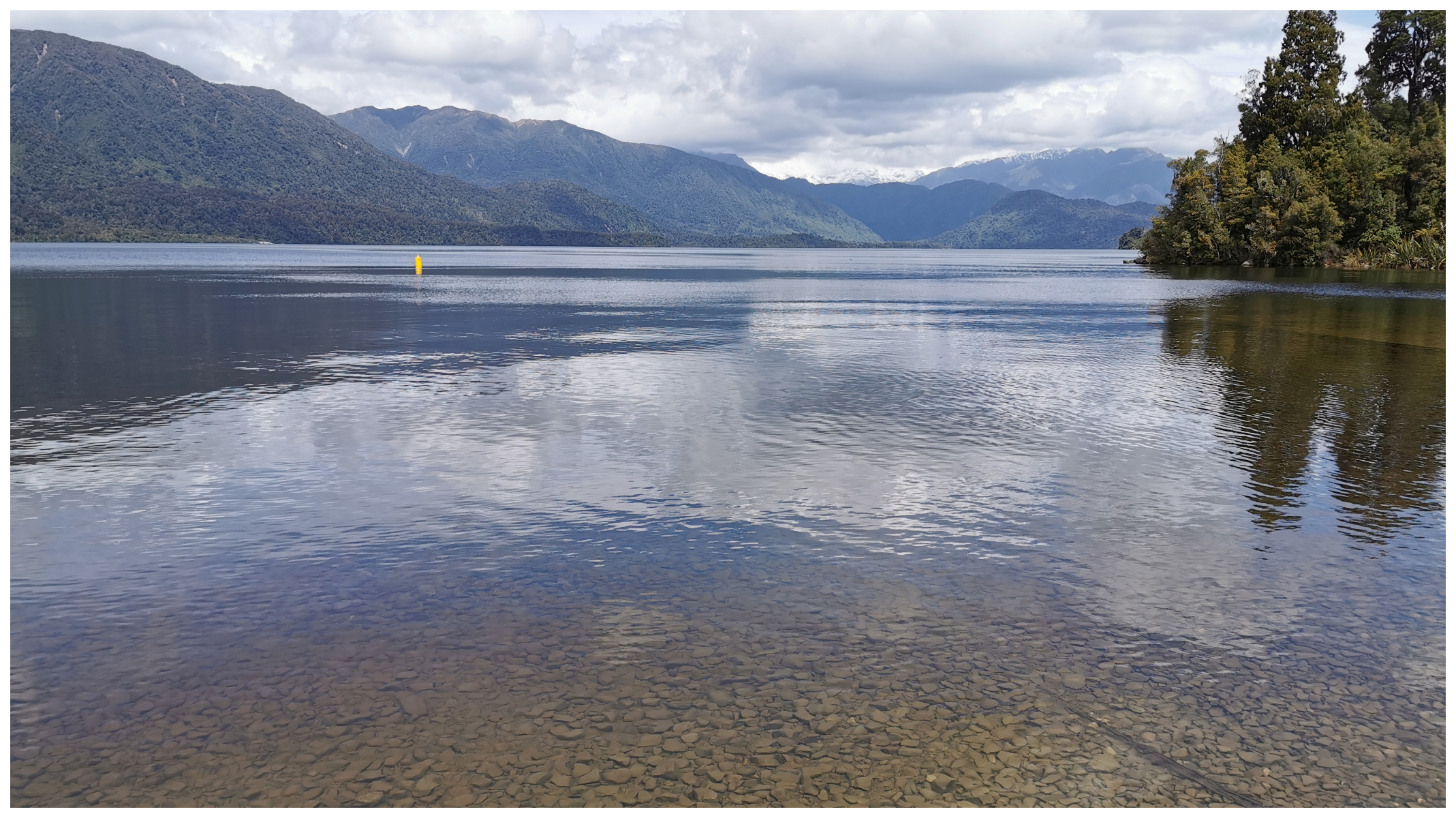
There are plenty of camping and picnic spots around the banks of the lake
Lake Kaniere is a popular spot for holidaymakers and in the summer is a popular water sport, fishing and camping destination.
We stopped off at the spectacular Dorothy Falls. The falls can be seen from the small car park but we prefer to get as close to a waterfall as possible so wandered up the small track to feel the mist on our faces.
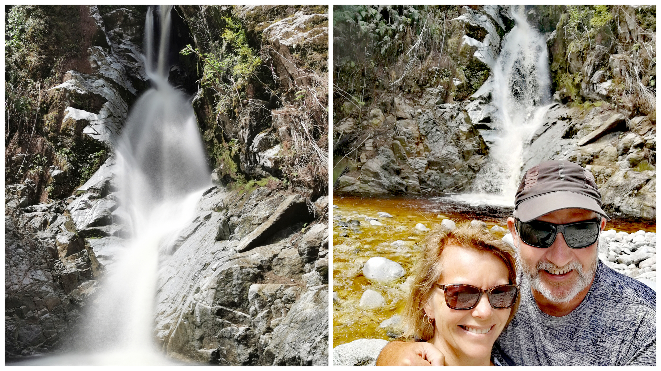
The Dorothy Falls beside Lake Kaniere
Despite the difficulty of taking a photo of the whole waterfall (64m tall!), it’s impressive and photogenic for sure. The plunge pool is popular with swimmers in the summer. The one-lane bridge is right opposite the falls which make for a great photo spot.
It had recently flooded and took out half the road. We could see where extensive restoration had taken place. Now that would have been spectacular to see.
There is approximately 4 km of gravel road but the surface is good and the road is normal width.
The Seaview Asylum
We took a drive to the old Seaview Asylum. This was also known as Seaview Lunatic Asylum or Seaview Psychiatric Hospital.
Originally founded in 1872 it was once the town’s biggest employer.
Three units were closed in the 1990s, the nursing school closed in 1992 and in 2002, the hospital board sold the asylum to a property developer.
In 1955, Seaview housed 549 patients but by 1996 they were down to 100 and eventually dwindled down to 22 before closing its doors.
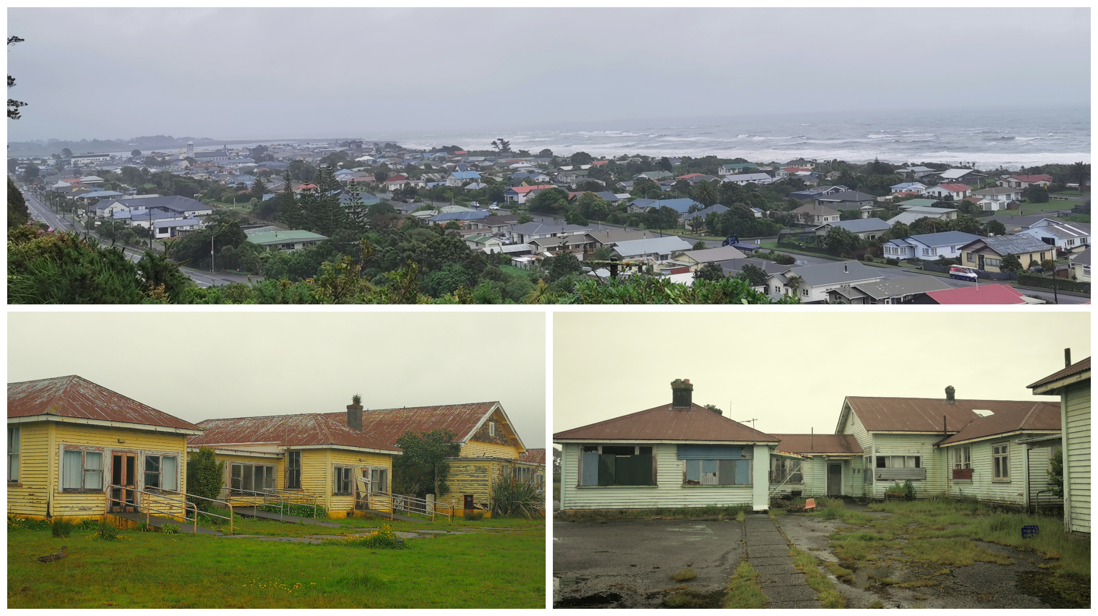
It’s position overlooking the town makes it a property developers heaven and the creepy decaying villas
It was a bleak, dreary day when we drove around the old villas, hospital dormitories and cemetery which just added to the airiness of the establishment. Once pristine grounds, gardens and buildings are in a sorry state of disrepair, although there is evidence that there are lodgers still residing in some of the rooms. There were a couple of buses parked up which clearly have made it their home. Seaview Lodge still offers holiday accommodation and some parking spots to stay overnight.
The entire property is sitting on prime real estate and I suppose one day it will serve as a wonderful residential subdivision.
Since the facility closed it has been used on numerous occasions by the NZ Defence Force to stage urban warfare, search and rescue and public disorder exercises. I’m kinda glad that wasn’t going on when we visited!
Hokitika on Foot
The incoming bad weather that we were bracing ourselves for was on its way. This wasn’t going to put us off, so we set out on foot with our ponchos and waterproof boots. We walked the long Hokitika River Bridge into town (only a 15 min walk) to wander the streets, learn the history and grab a bite to eat.
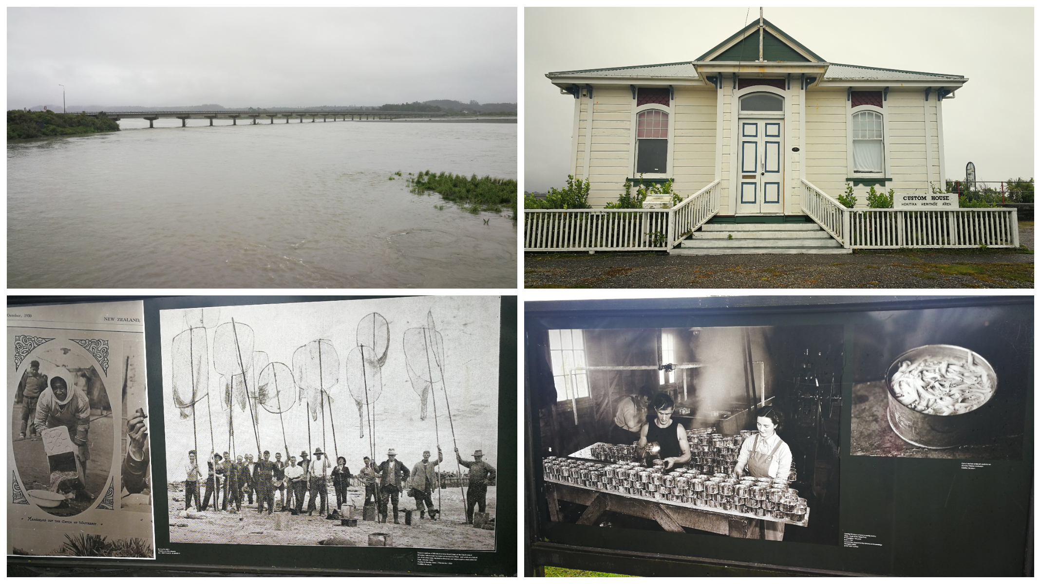
Hokitika has also a rich history in whitebait fishing
Hokitika has a fascinating history. It was the centre of the West Coast gold Rush and sprung up in 1864 becoming one NZ’s most populated centres. What interested us was the extent of the wharf at the time. It was recorded that sometimes there could be up to 41 vessels alongside the wharf, three or four deep. So hard to imagine now, but remnants of the old wharf can still be seen and there are plenty of history boards depicting life as it was back then.
What’s it Famous for Now?
Back in the day, greenstone (pounamu), gold, coal and forestry was what forged Hokitika’s history. They have all dwindled over the past centuries but there seems to be a growing tourism industry and the town is reaping its rewards. It has become a major tourist stop on the West Coast’s main highway route. Carving of greenstone is an important local industry with loads of shops populating the retail areas.
It is also gaining a reputation for its annual Wild Food Festival which has been running since 1990.
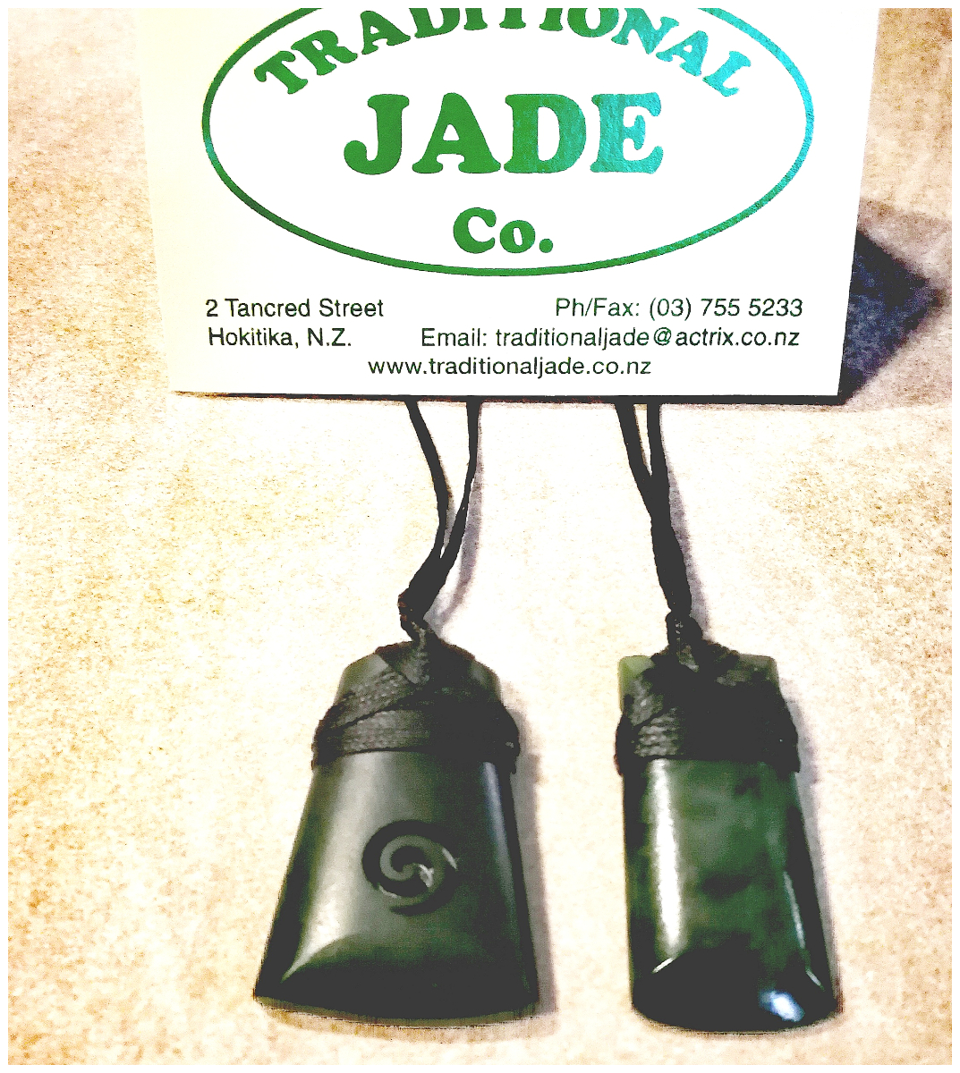
our beautiful Pounamu necklaces carved by a local Maori family
We’ve been keen for a while to purchase some pounamu. We didn’t want to frequent one of the many ‘tourist’ shops so found a lovely little shop down one of the side streets. It is a family-run business so we were pleased to be able to support a local family who has been collecting and carving local pounamu for many years.
By this time, the rain was pouring down, in a horizontal direction. We really weren’t looking forward to walking that long bridge back to base camp. The lovely lady at the pounamu shop gave us a lift back which we were eternally grateful for.
Lake Mahinapua
After a rough night (weather-wise) it dawned fine and still so we set off early on the bikes to cycle part of the West Coast Wilderness Trail.
The entire trail stretches from Ross in the south to Greymouth in the north (just over 120 km). You can do the entire trail or just sections of it. We set off from basecamp to head towards Lake Mahinapua.
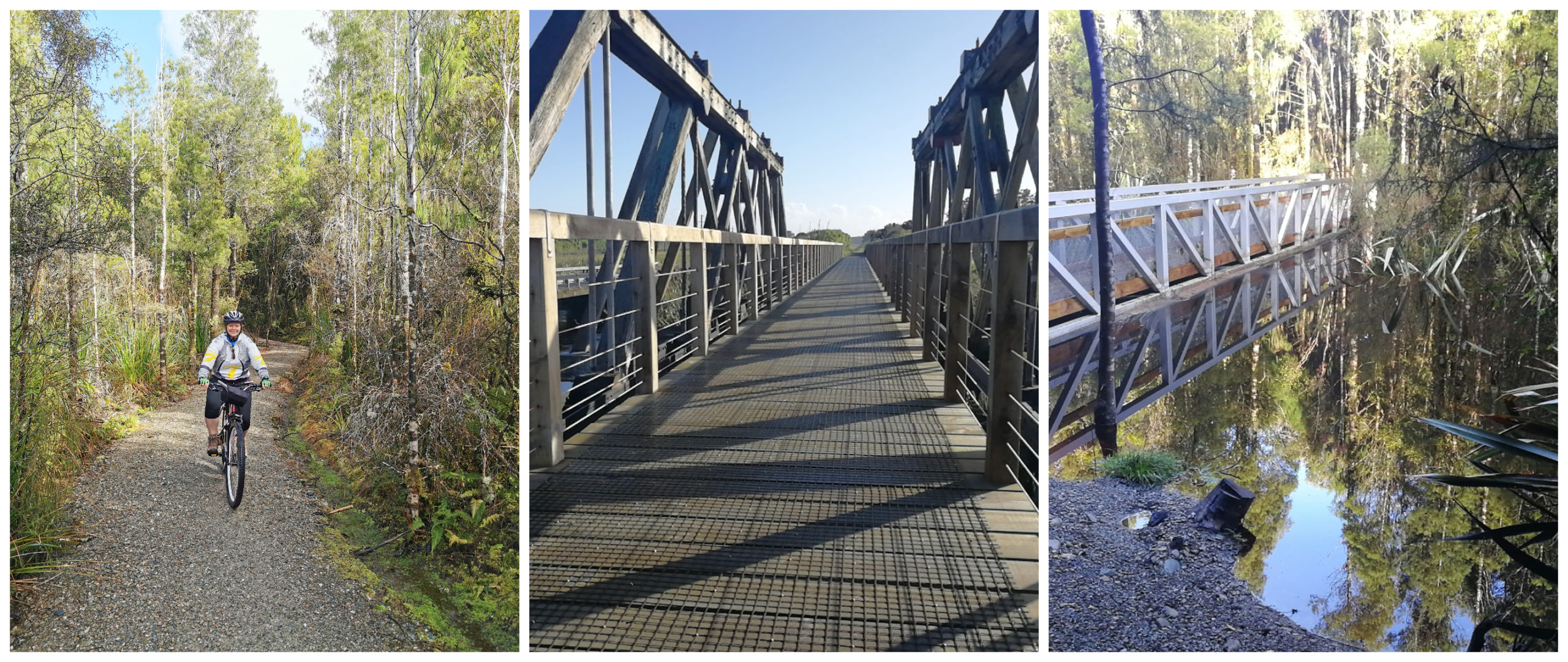
Bridge crossings and beautiful native bush
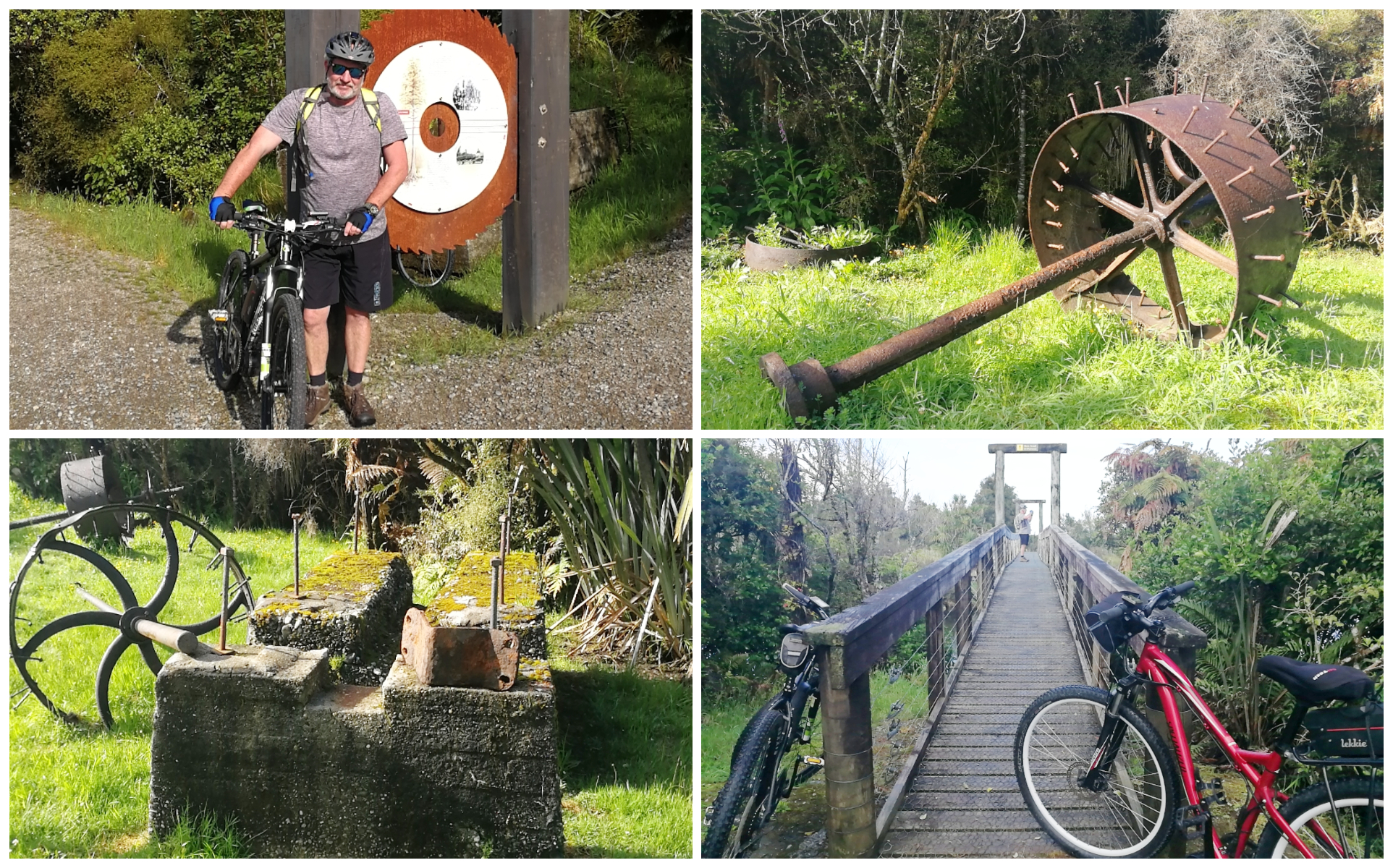
Cycling through the old mine sites
We crossed bridges and cycled through beautiful forest tracks and old mill sites. The trail was well-formed, easy cycling and very picturesque.
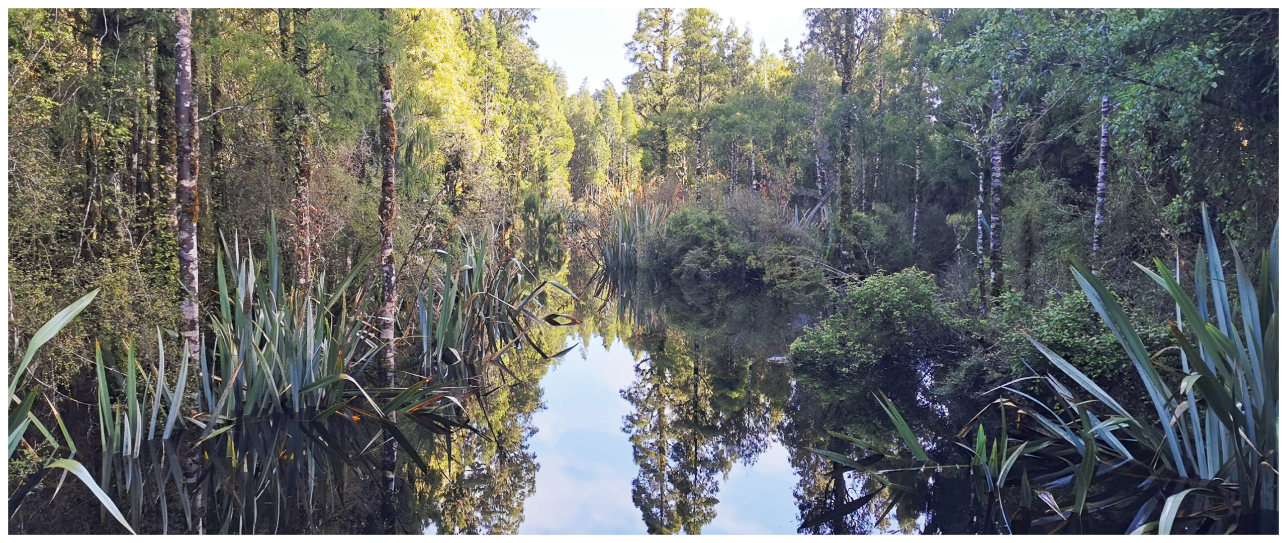
How beautiful does this look?
Getting That Sinking Feeling
We were embracing our surroundings until we came to the ‘wetlands’ area. Thanks to the overnight deluge during the night, the ‘wetlands’ took on a whole new meaning. A large portion of the trail was submerged underwater. We could just make out the boardwalk under the water as it disappeared off around a corner out of sight.
Now being the team player that I am, I nominated Scotty to go first, just to gauge how deep it got. I watched from a safe point as he tentatively cycled deeper and deeper. He had to admit defeat as the level starts inching closer to the battery which is not a good thing to happen to eBikes. I thought it was even funnier when he had to put down his feet upon stopping, fully submerging his hiking boots all the way past his knees.
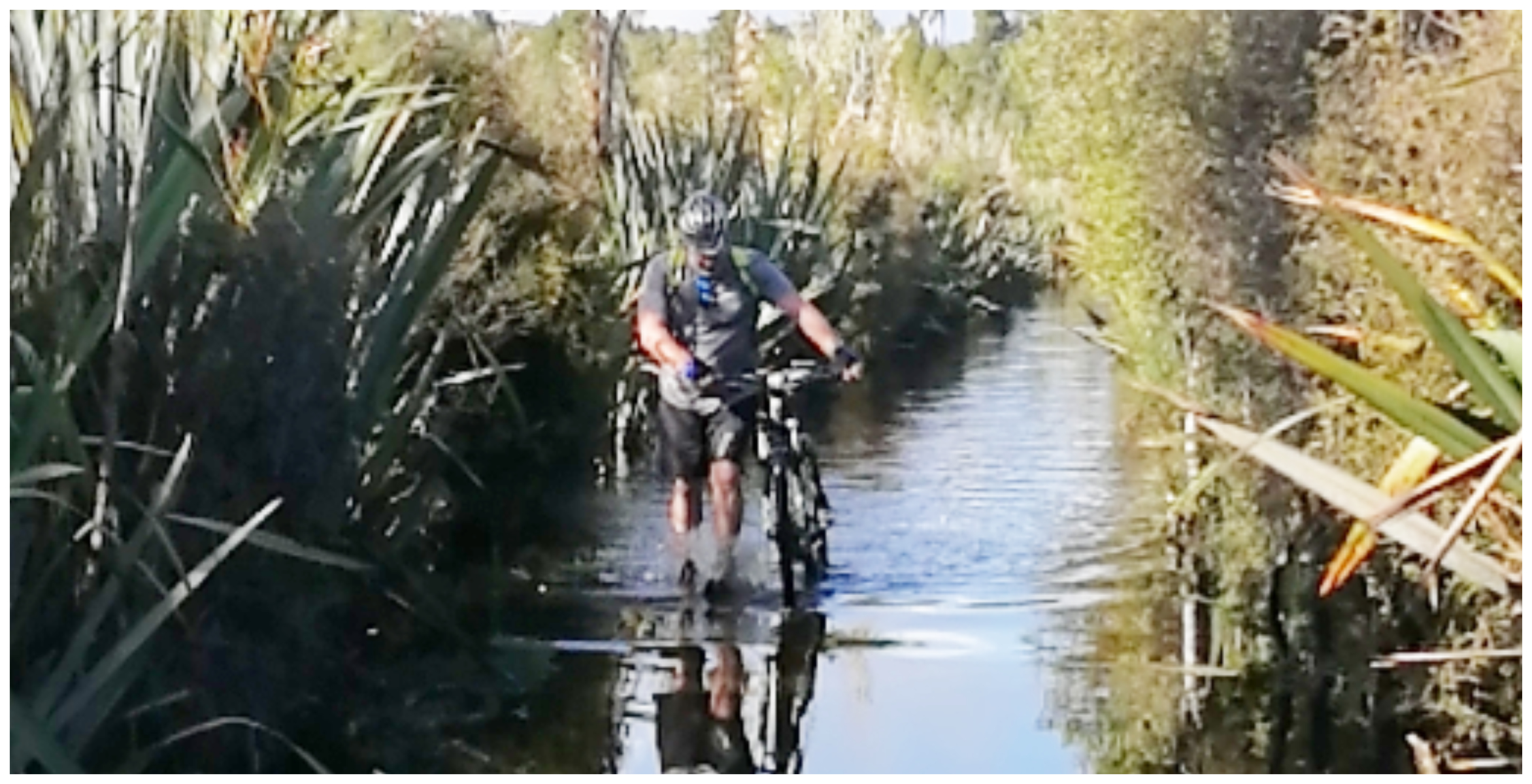
Scotty taking one for the team! For some reason, he wasn’t laughing as much as I was!!
We decided it would be best to turn around and head back as it was time to pack up and carry on with our journey south. The rest of the track, plus more sections of the Wilderness Trail will have to wait for our next visit to Hokitika. Yes, it is a destination we’re not finished with so it remains on my very long list of things to do and places to revisit.
Click on the link below to view a video of our highlights.