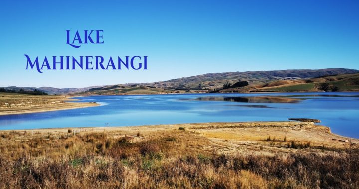
Where is Lake Mahinerangi?
As there are still a few ‘gaps in our map’, we thought that we would revisit the small Otago township of Lawrence and set about exploring the nearby Lake Mahinerangi and Waipori Falls areas.
Lake Mahinerangi lies only 35km west of Dunedin and approximately a 35km drive from our base camp at Gabriel’s Gully.
Gabriel’s Gully/Grey’s Dam
Before I launch into all about our ‘loop roadie’ to Lake Mahinerangi, let me give you some information on the freedom camping spot at Gabriel’s Gully (NZMCA#8887). It was the site of NZ’s first major gold rush back in 1861. Today, you can camp in the area where history was made.
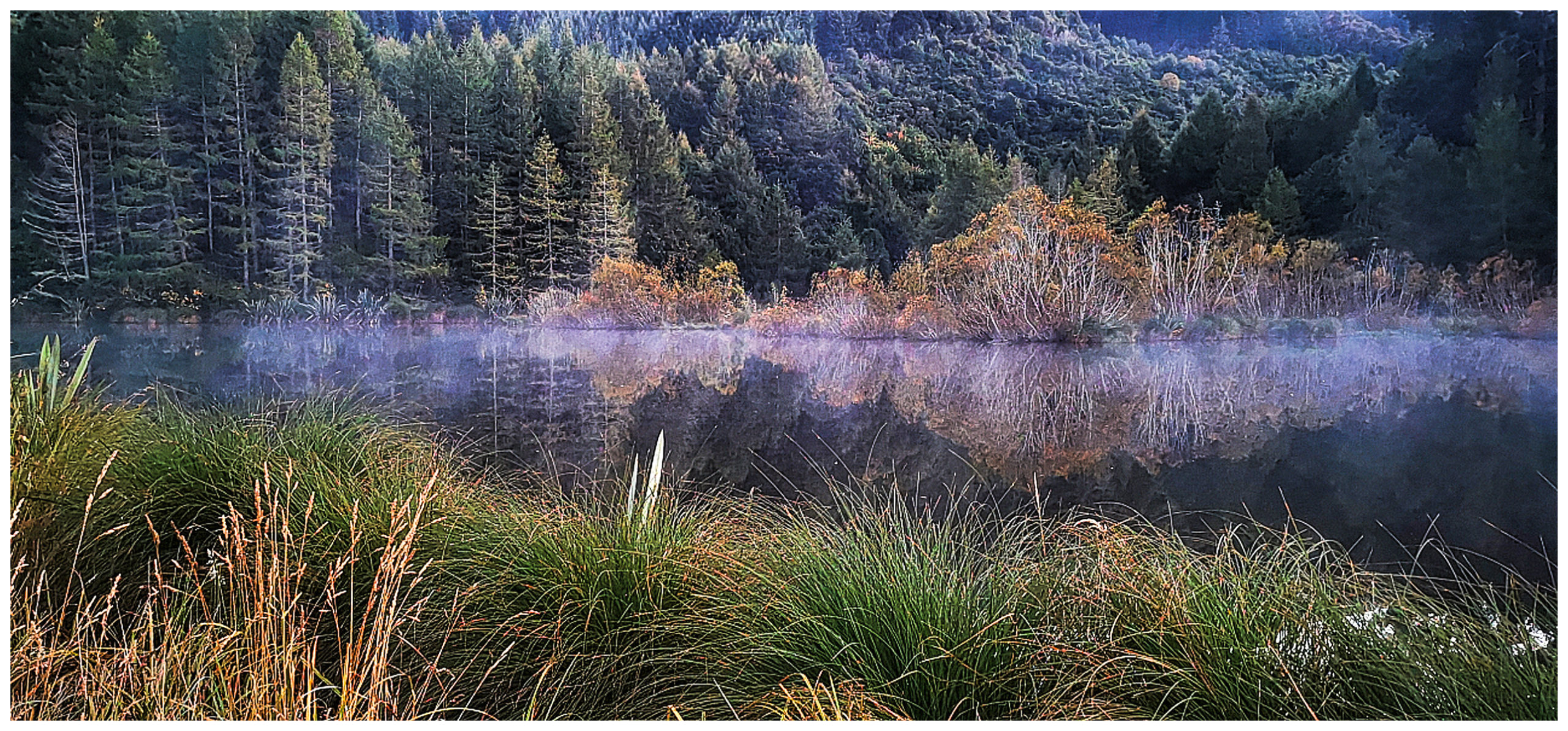
the early morning mist settles just above the water, turning it into an eerie and silent vista
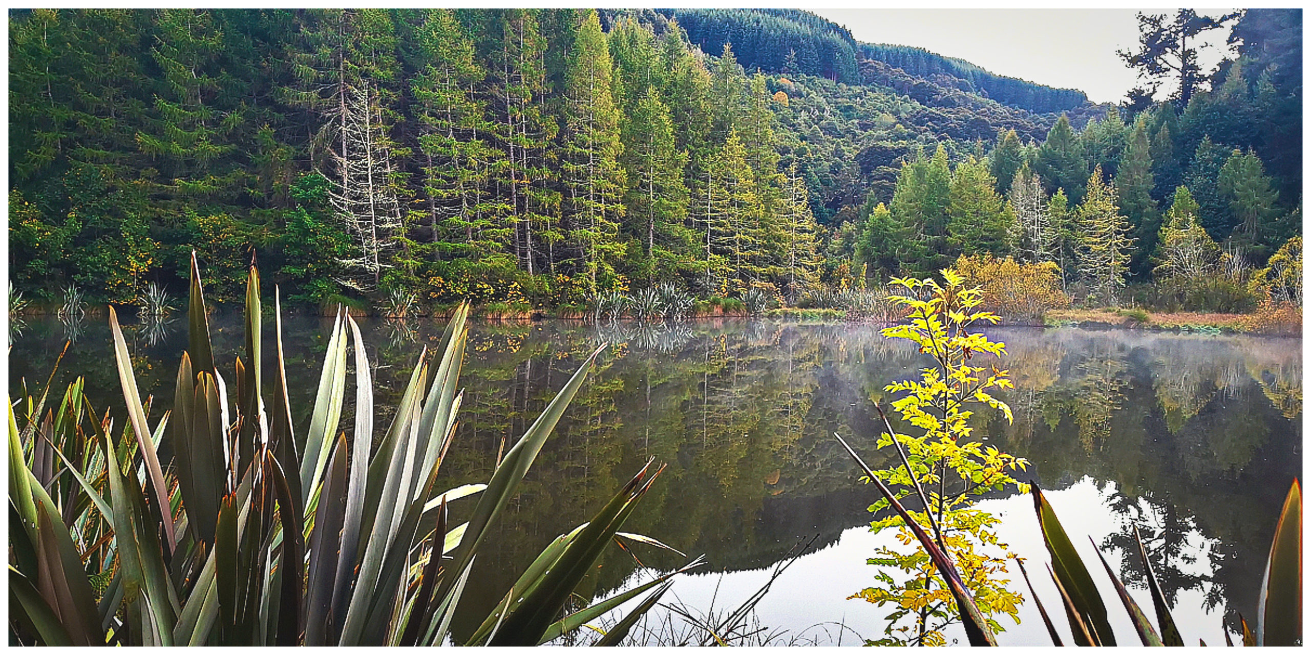
the reflections are best during the stillness of the mornings – the trees are just starting to turn for the upcoming Autumn
This is our second time we’ve camped at this delightful and serene spot in Gabriel’s Gully. It was the ideal base for us to cycle part of the Clutha Gold Trail. We also enjoyed walking the various tracks and trails that are available in the immediate area. I’d fully recommend walking the Interpretation Track, dotted with history and picture boards which gives you the best information on what went on in the area.
the camping area was surprisingly quiet with just a few of us overnighting beside the dam
The spot is also only around 4km out from historic Lawrence. Click here to read more about our previous stay at Gabriel’s Gully.
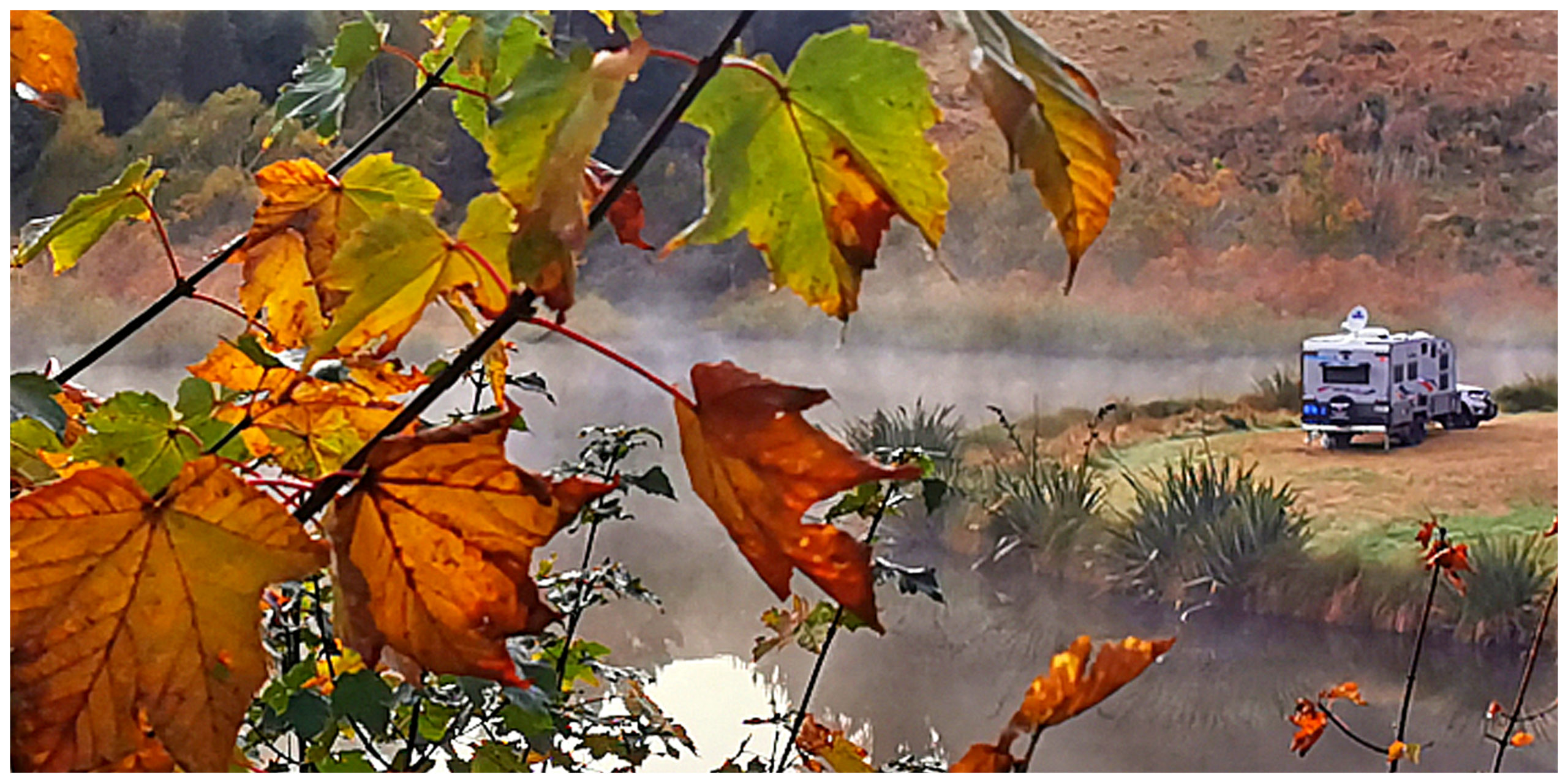
the Autumn colours transform the hillsides which will only get brighter as the days draw in towards Winter
Our Drive to Lake Mahinerangi
To get to Lake Mahinerangi, we drove out through the township of Weatherston. Like Lawrence, this once small settlement has some history of its own.
It has quite a following, especially in the daffodil season (September/October) when people flock to the Weatherston Brewery to witness the yellow blanket of daffodils on display. Unfortunately, we’ve not been in the area during spring. One day we’ll get to visit the brewery ruins, vintage rhododendron forest, waterfall and woodlands gardens.
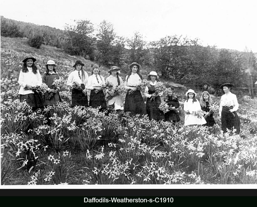
the daffodils at the brewery at Weatherson have been bringing joy for over 100 years
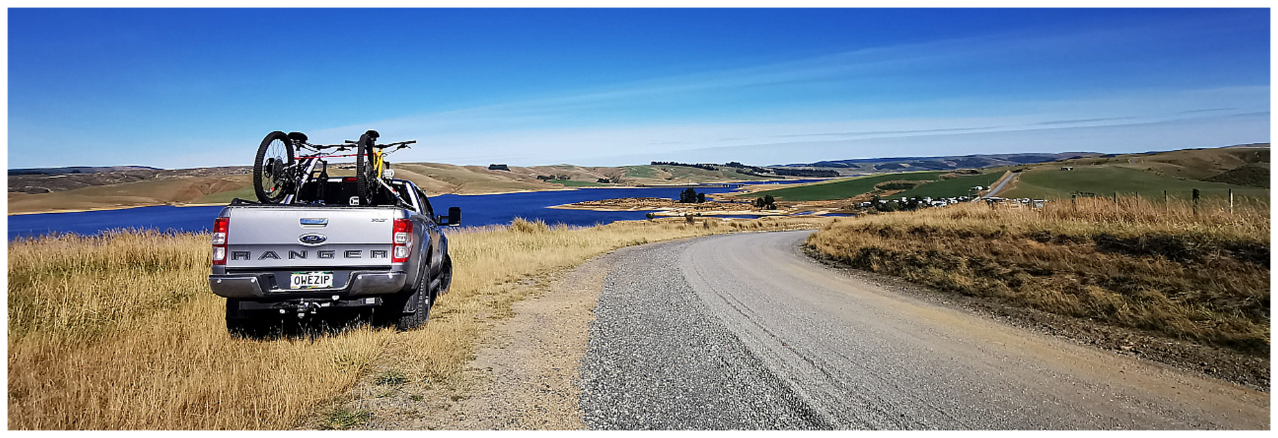
Not far past Weatherston, we get to the gravel road which will take us to Lake Mahinerangi. It is an area that is blanketed in forestry so care is needed when the logging trucks are travelling along this portion of the road.
Although gravel with some tight corners and corrugations, it is wide and fairly well-formed. We did experience some places where the ‘sun strike’ is quite bad. The day was sunny and it was early morning so we had to take it slowly around some of the hilly corners.
How was Lake Mahinerangi Formed?
This man-made 12km long lake was formed when a dam was built on the Waipori river for a hydroelectric scheme. The building of the dam started in 1903 and by 1907, power was being produced to supply Dunedin city and surrounding districts.
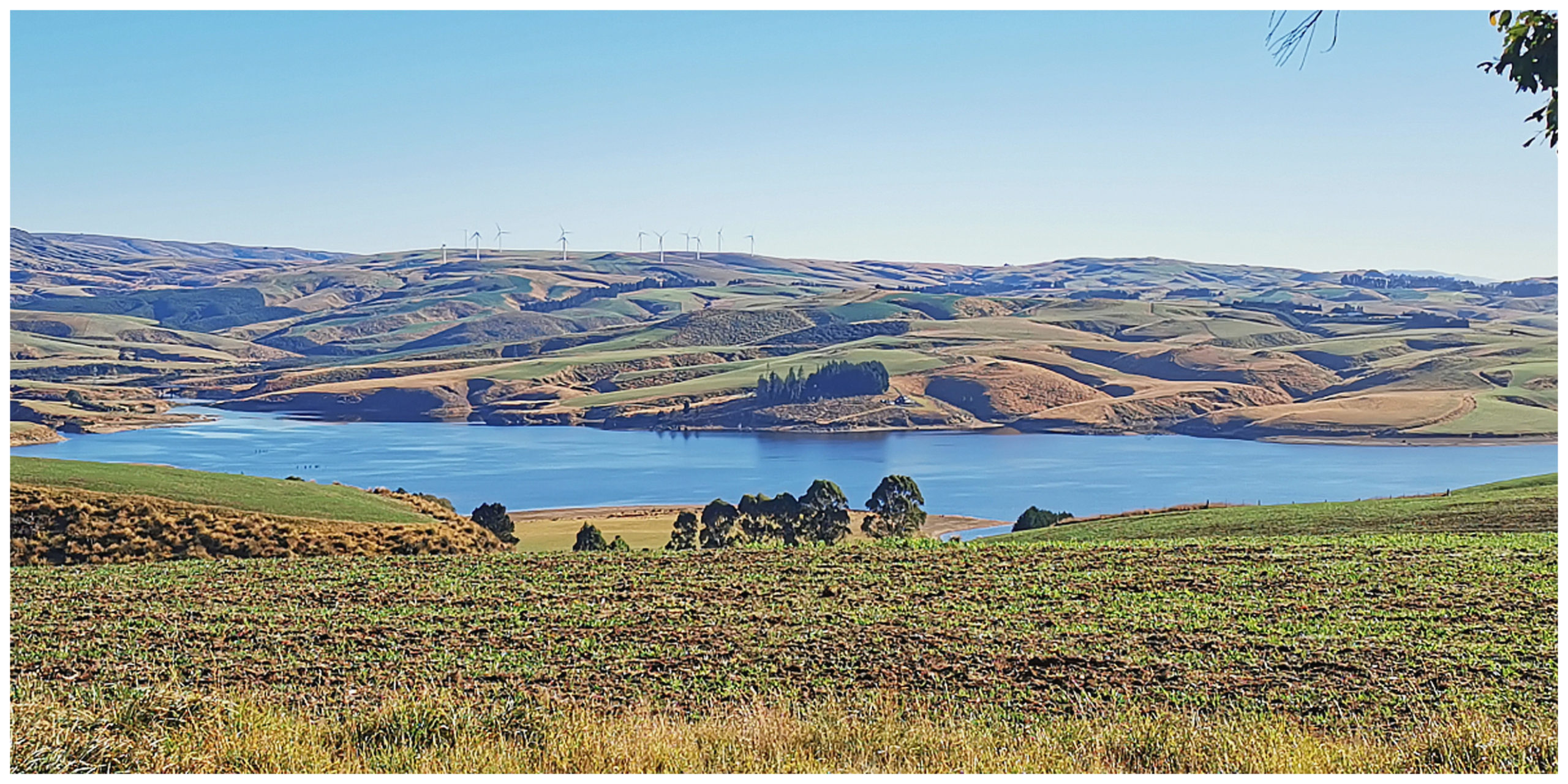
our first glimpse of the man-made Lake Mahinerangi with the Mahinerangi Wind Farm dominating the skyline. Resource Consents were granted in 2011 to allow for the construction of up to 100 wind turbines
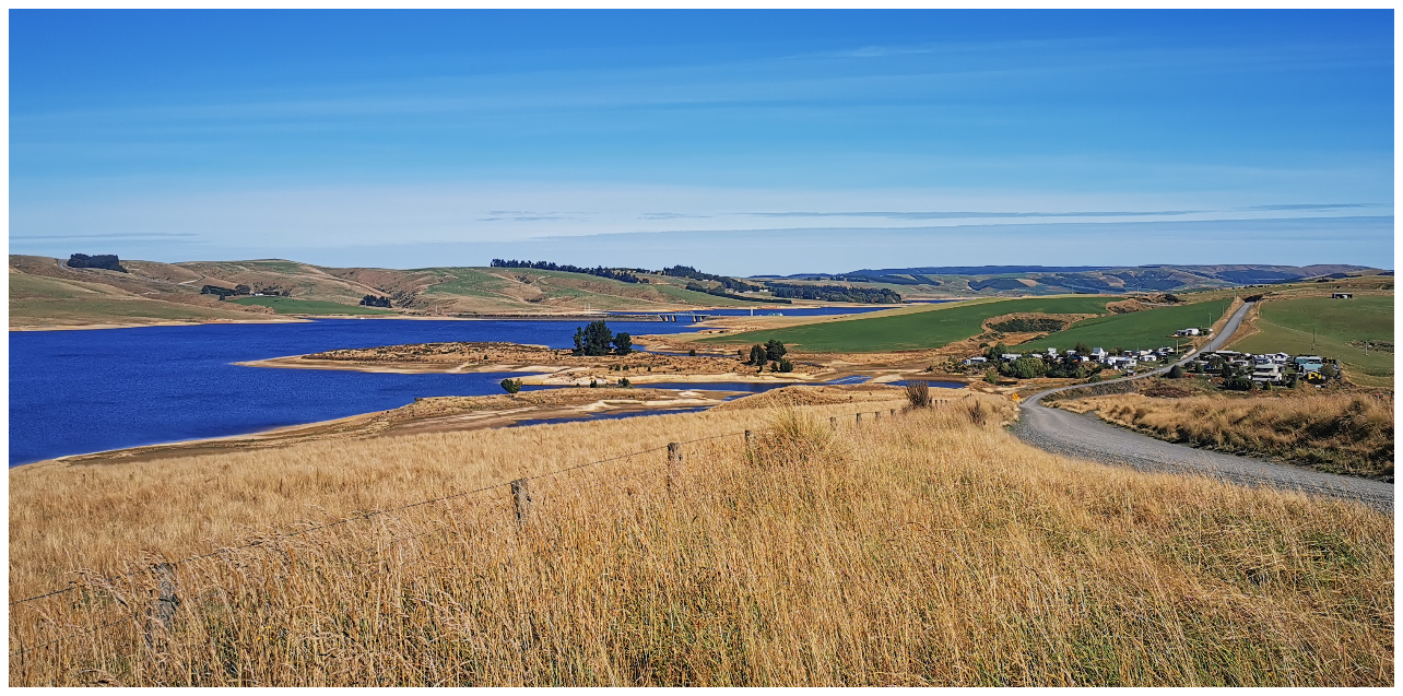
As we drove over the top of the hill, we were greeted by the brilliant blue hues of what is often referred to as ‘The Lost Lake’. The blueness looking even more prominent as the lake sits nestled amongst forestry, farmland and tussock grasslands. The Wind Farm dominates the skyline.
It had felt like we’d been climbing for quite some time before arriving at the lake and I was right. The lake sits some 600m above sea level.
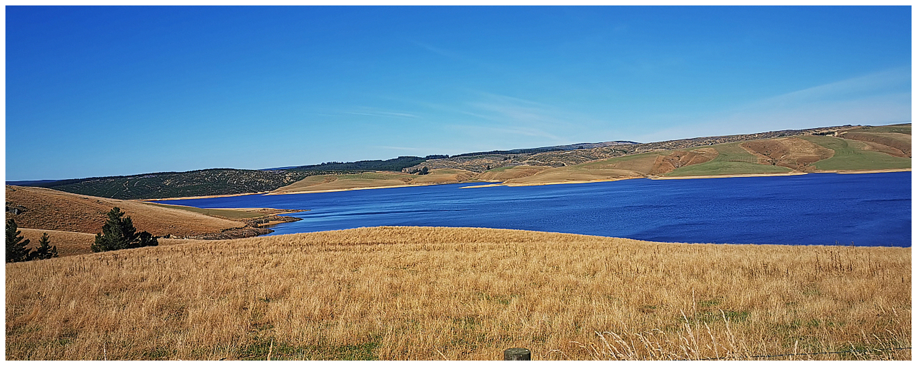
it was tricky to get the entire lake in a photo as it is long and narrow and stretches out for 12 km
Additional Dams
More dams were added to the Waipori River, creating further storage lakes and eventually raising the level of Lake Mahinerangi. This resulted in the submerging of the mining township of Waipori (more on this later in my blog).
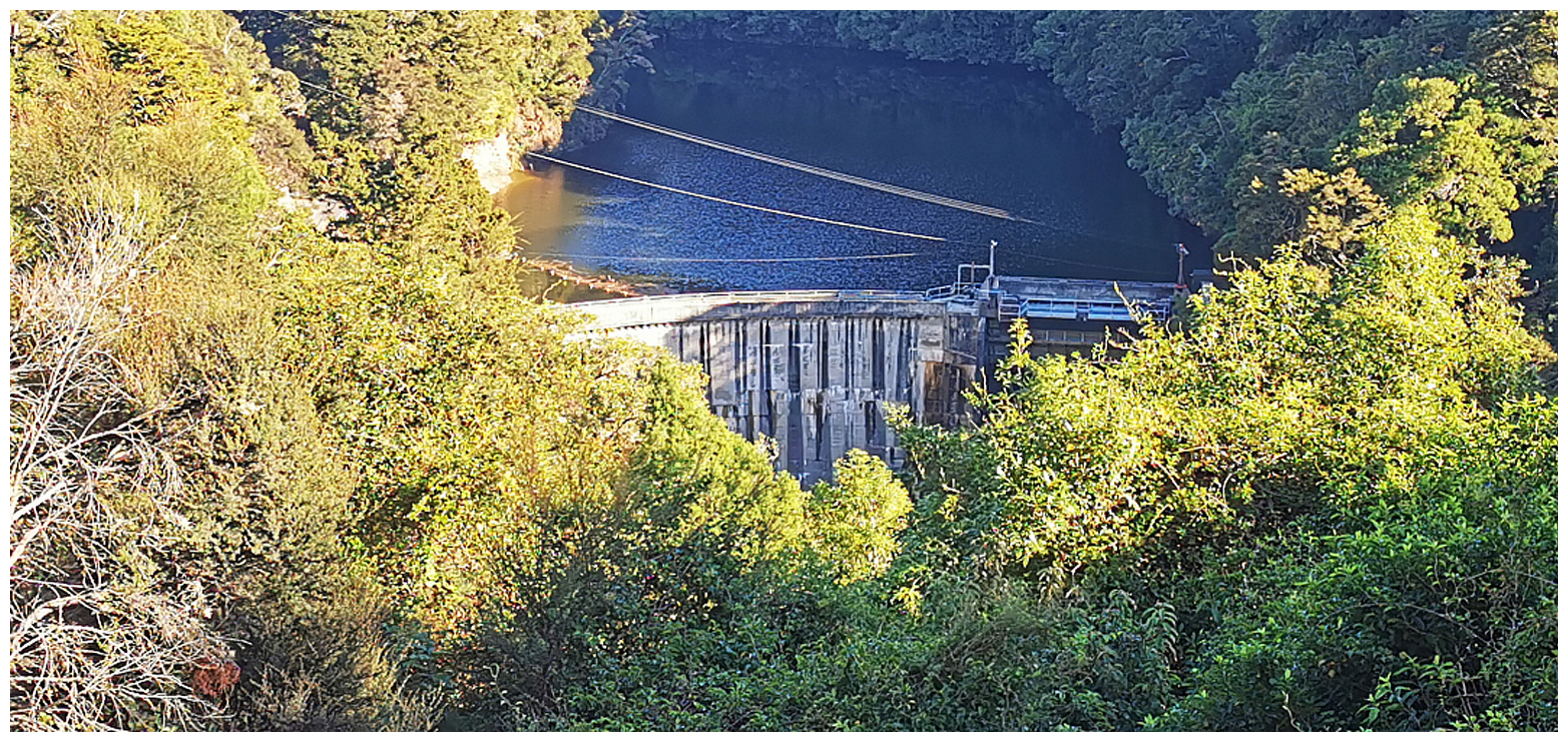
one of the few spots that we managed to view one of four dams
The Waipori hydroelectric scheme now includes a network of four dams and power stations. All of the dams are tucked away from public view and access. There were gates across all the access roads with signs clearly stating that we weren’t even able to walk in to view them.
At the southern end, Lake Mahinerangi has two major arms, called Loch Luella and Loch Loudon.
A Fishing Mecca
If you love fishing, you will enjoy Lake Mahinerangi. The remote lake is stocked with perch and brown trout making it a favourite fishing spot for keen fishermen.
spot the fishing village full of cribs to the right of the photo
there was quite a collection of cribs, different designs and levels of comfort
We spotted the small fishing village consisting of a group of cribs, all bunched together in a small nook on the far side of the lake.
You would need to be a keen fisherman (or woman) to fish here any other time but summer. Because of its high altitude, it can get very windswept and cold making it a spot best suited to the warmer months. The water level is prone to quite large fluctuations as water is regularly drawn for power generation.
Waipori Falls
Continuing on with our ‘roadie’ we wound our way through the gorge and past the rest of the dams (although we only managed to spot two of them from the road and at a distance).
We had read various reports about the walk into the Waipori Falls (also known as Crystal Falls). Most of them stating that the longer track is still washed out, however, the 20min track to the official lookout platform only offers a view of the very top of the falls.
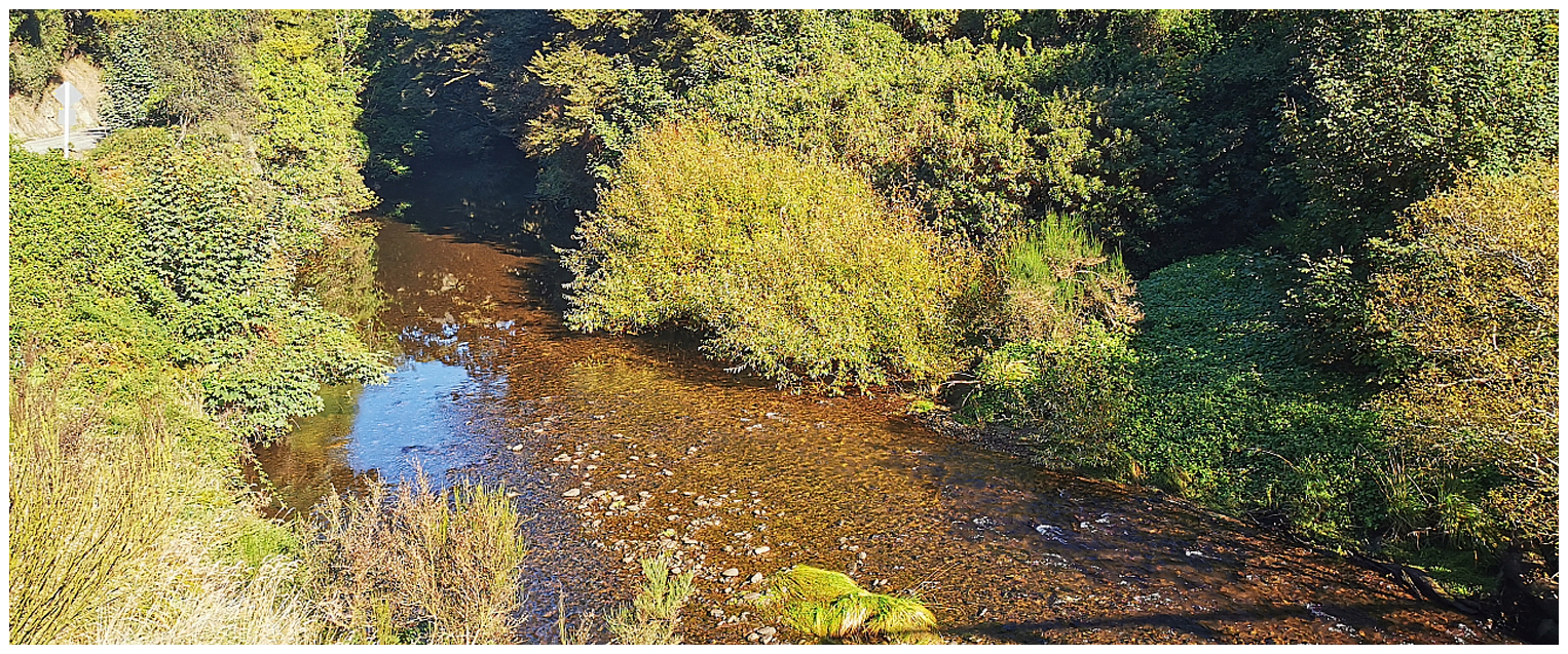
although we didn’t walk to the falls, we drove alongside the river which helps form the cascading Crystal Falls
You are able to descend further from the platform but there were plenty of warnings about slippery surfaces and the risk of falling into the river. That was enough to encourage us to keep driving and skip the walk to the waterfall.
Waipori Falls Village
We carried on driving and headed for Waipori Falls Village (see map above). Now, this is where the road gets narrow and twisty. We came across a sign stating “no articulated vehicles or vehicles longer than 9m”.
It really is a village with a difference. Consisting of 33 houses which are nestled on the tree-clad hillsides, there are no letterboxes, not one shop or service station…….and no street names.
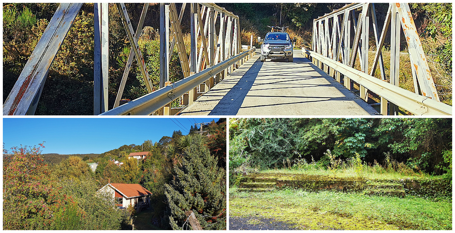
the small settlement at Waipori Falls Village was nestled between twisty roads and bushes, some of the foundations from its heyday still evident amongst the moss and ferns
We diverted off the main road (if you could call it that) and drove the loop road which was a tangle of twisting roads, weaving its way past the town’s housing network. The homes are spaced out far enough as to not encroach on anyone’s privacy, separated by bush.
History of Waipori Falls Village
The town was originally established by the Waipori Falls Company in 1902. This was to house workers who were building the company’s hydroelectric scheme. By driving around, it is obvious that most of the homes there date from much more recent decades.
Dunedin City Council bought the power scheme and the village in 1907. The power scheme was onsold to TrustPower in 1998. The township was bought by a Body Corporate of residents in 1997. They own and control roading, bridges and fresh/wastewater infrastructure which service the 33 homes.
Onwards to Outram
I’ve never visited Outram but was aware of its history connected to the great gold rushes of the mid to late 1800s. I learnt all about the important staging post for those early travellers of the Old Dunstan Road (click here to read more about our travels over the Old Dunstan Road).
Considering its history, there isn’t much left to show just what a busy place this used to be. This is possibly due to the fact that the original town was formed at a river crossing (ferry then bridge) on a route to the busy Old Dunstan Road and the Central Otago goldfields. The village was moved following a flood in the late 19th century and relocated to its current location.
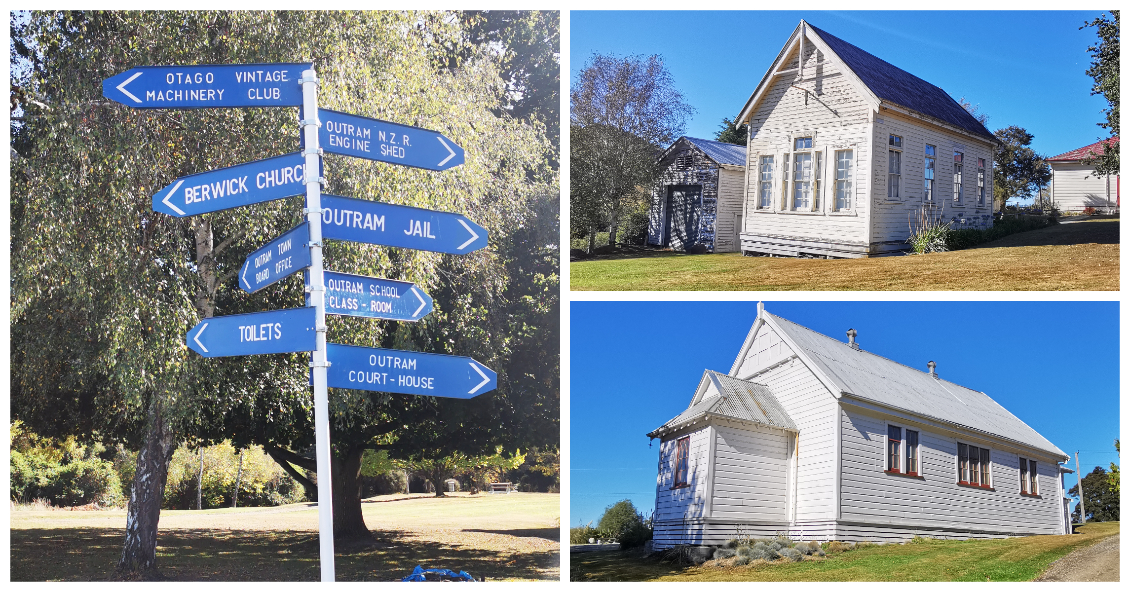
Taieri Historical Museum and Park
We made our way to the Taieri Historical Museum and Park. This Historic Park is located just outside of Outram up a gravel driveway above Outram Glen. It depicts how life used to be on the Taieri and reminded me of a movie set. There are a variety of historic buildings which include a courthouse, jail, school, church and steam engine shed.
The grounds are beautifully maintained and dotted around picnic tables and tended lawns, are vintage farm equipment everywhere.
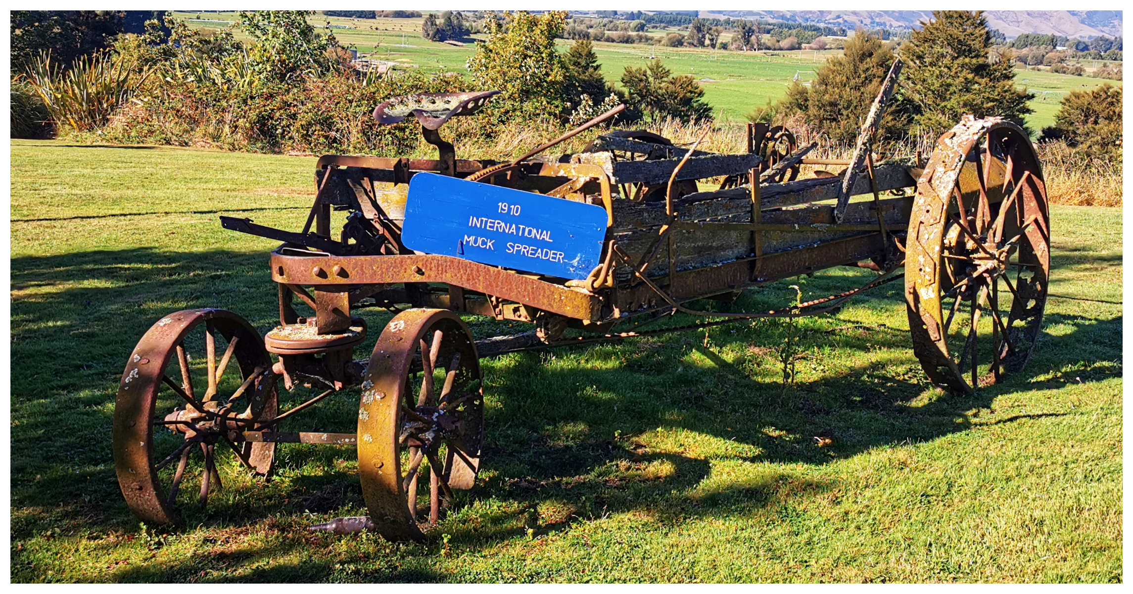
I don’t think I’ve ever come across a ‘muck’ spreader before!
We wandered around the buildings which had signage explaining where they originated from and when they were moved to their current spot.
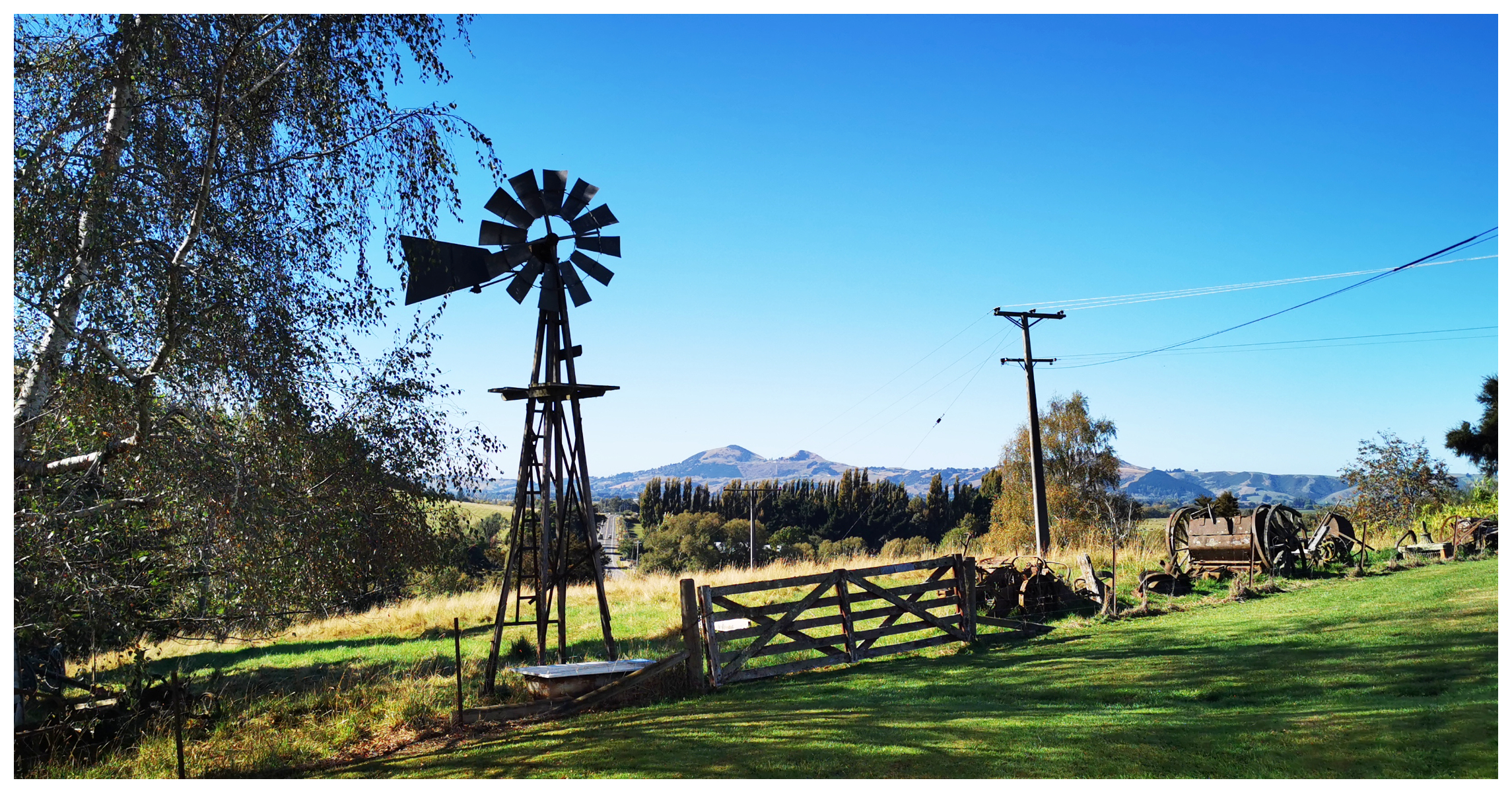
there are some beautiful views of the Taieri
It was a peaceful spot to enjoy the views out over the Taieri.
The Machinery Museum is right at the top of the drive and is jam-packed with tractors, engines and vehicles. Unfortunately for us, we couldn’t wander through any of the buildings or collections as the Museum and buildings are only open Sundays from October to May, 2-4 pm. Make sure you factor this into your visit if you are wanting to wander through the buildings.
Before leaving Outram, we stopped off at the Outram Butchery. I can fully recommend their bacon and sausages……“outstanding in Outram!”
Waipori Township and Cemetery
Completing the ‘loop roadie’ had us heading back to Lake Mahinerangi. We were keen to explore the site of the old Waipori Cemetery and learn about the flooded mining township of Waipori situated on the far side of the lake.
If Lake Mahinerangi was to be drained, there would be multiple evidence of Otago’s gold mining and rural past. Many gems are still hidden underwater to this day.
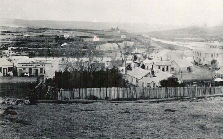
What lies beneath! In its heyday, the town consisted of schools, 11 hotels, 11 bridges, two banks, two bakers, dance halls, blacksmiths, six billiard saloons, many gambling dens, and even an undertaker.
Flooded Township
The Waipori township was flooded in 1924, completely erasing a once-bustling gold-mining town. It was home to more than 4,000 people and was settled in 1861 which was the same year that gold was struck at Gabriel’s Gully.
It was a melting pot of nationalities, which included Irish, English, Scots, German, Italian and Chinese miners.
Waipori Cemetery
Thankfully the Waipori Cemetery still sits on the hill overlooking Lake Mahinerangi. The mixture of nationalities is reflected in the many headstones. When reading through the list of names on the signboard, there is obviously so many more that are resting here that is not indicated by a headstone. About 200 people are buried at the cemetery, although only 40 headstones remain.
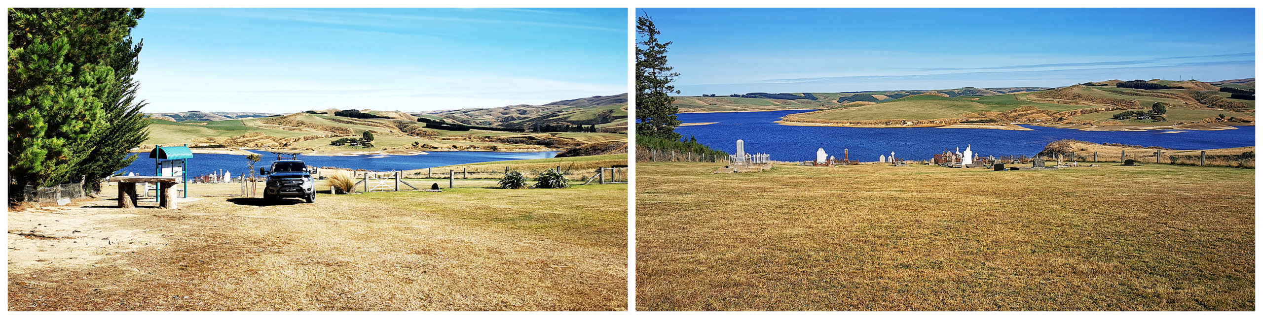
the final resting place of over 200 gravesites certainly commands a beautiful lake view
Their final resting place now boasts beautiful lake views, which would not have existed when the cemetery was initially established. The township was located further down the hill towards the left-hand side of the photos above.
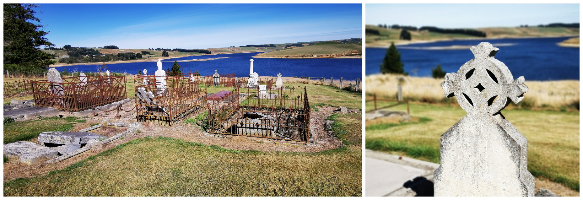
there are many unmarked graves that lie within the fenced-off area of the old cemetery
The headstones date from 1865 and are memorials to several well-known families of the district. However, it seems likely there were burials there as early as 1861 although these have not been proven.
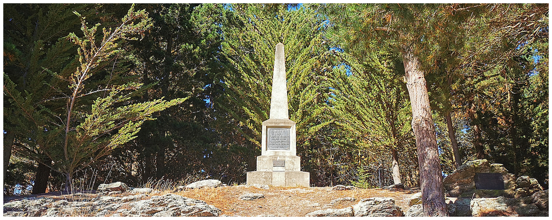
the memorial to Wilfred Victor Knight
Situated among the pine trees are two Memorials. The tall solitary monument commemorates Wilfred Victor Knight, the first New Zealander reported killed in Gallipoli in 1915. He was born in the mining settlement of Waipori.
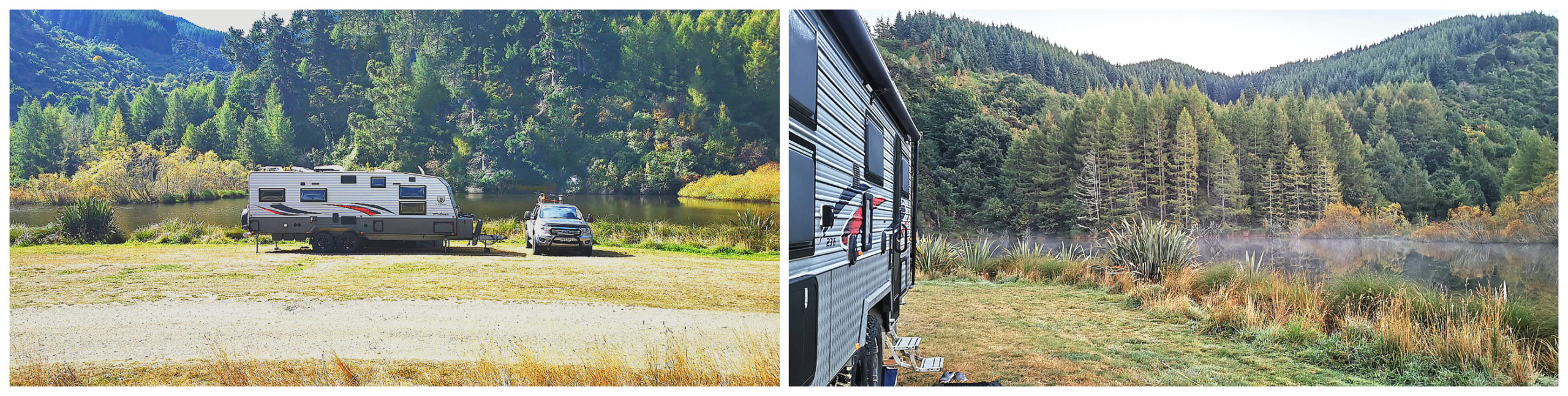
Is There Camping Spots?
I’m sure this is a question going to be asked by the travelling fraternity. We kept a watch out during our ‘loop roadie’ for possible places to return to with the caravan in tow.
Although the map shows multiple access roads leading towards the lake, most of these are forestry tracks that are gated and locked. Other access roads lead to private farms and just stop with no turnaround area.
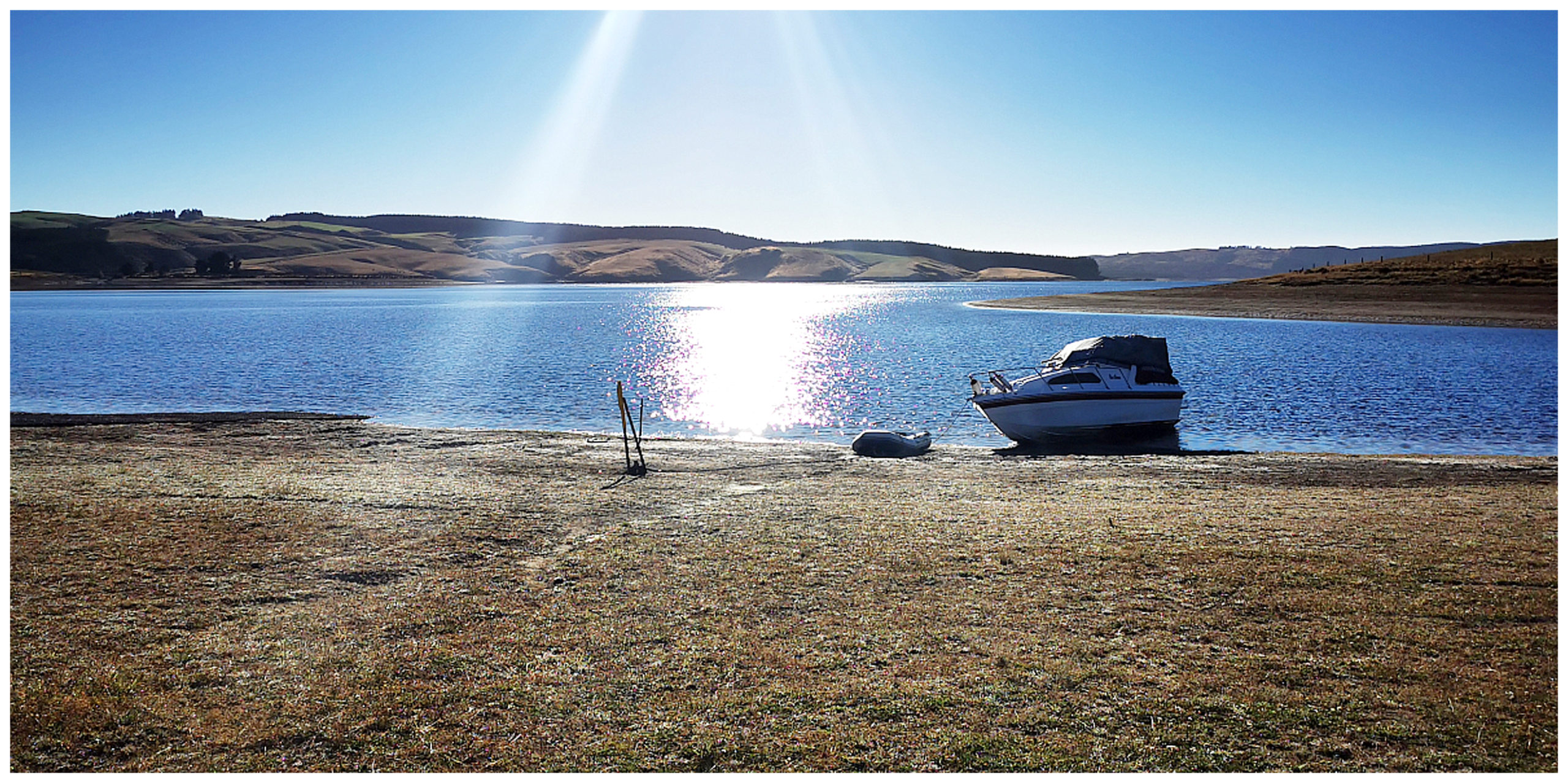
the public boat ramp was the only suitable spot we found for a possible overnight stop – but it would be extremely exposed to the elements
The best chances of finding a place to stop would be the public boat ramp close to the fishing village. Be careful not to upset those that want to use the ramp facilities. Also, remember that there is no shelter available so keep in mind the exposed landscape and the high altitude.
Canton Stamper Battery
On our final homeward stretch, we noticed a POI (Point of Interest) come up on Google Maps. We followed the directions and it led us to the Canton Stamper Battery, located within the OPQ (Otago Pioneer Quartz) Historic Reserve.
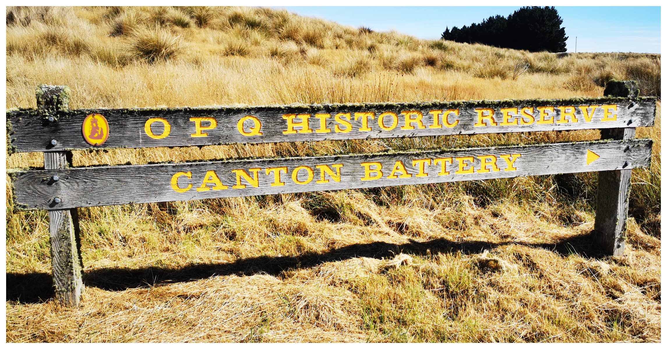
the sign directing us to the stamper battery relic
The Canton Stamper is a short walk from the roadside and lies at the site of an abandoned gold mine.
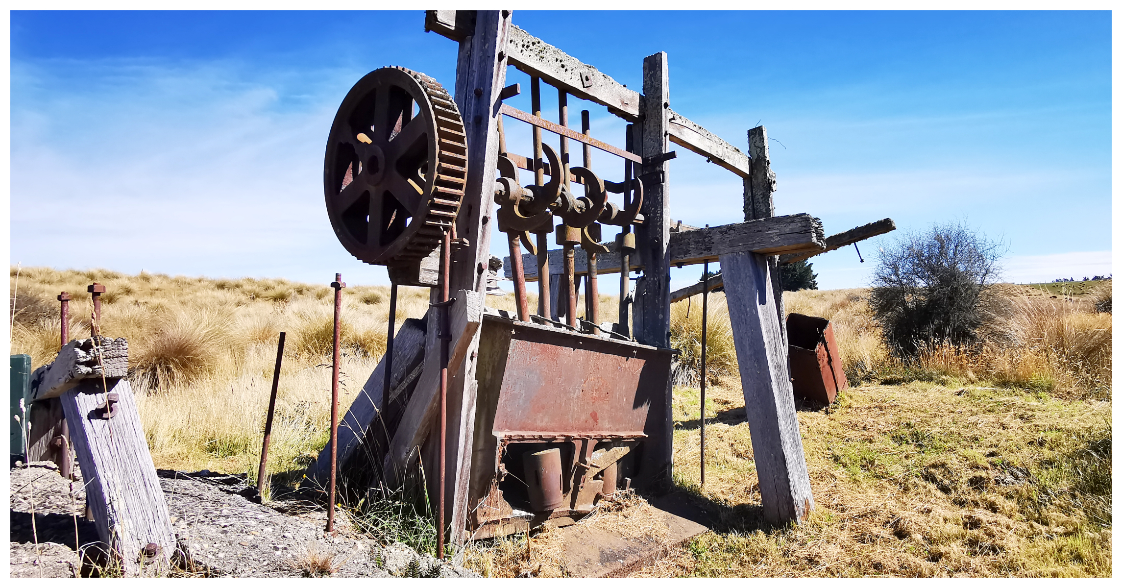
What remains of the Canton Stamper Battery
The site was first worked by a group of Chinese miners who spent a considerable amount of money to sink a shaft (180 ft). This proved unsuccessful and activity ceased until the second group of Chinese miners attempted to extract the lucrative gold. Alas, this was also quite unproductive.
The mine changed hands a number of times but never led any of the owners to strike it rich. It is unclear exactly when the stamper battery was erected.
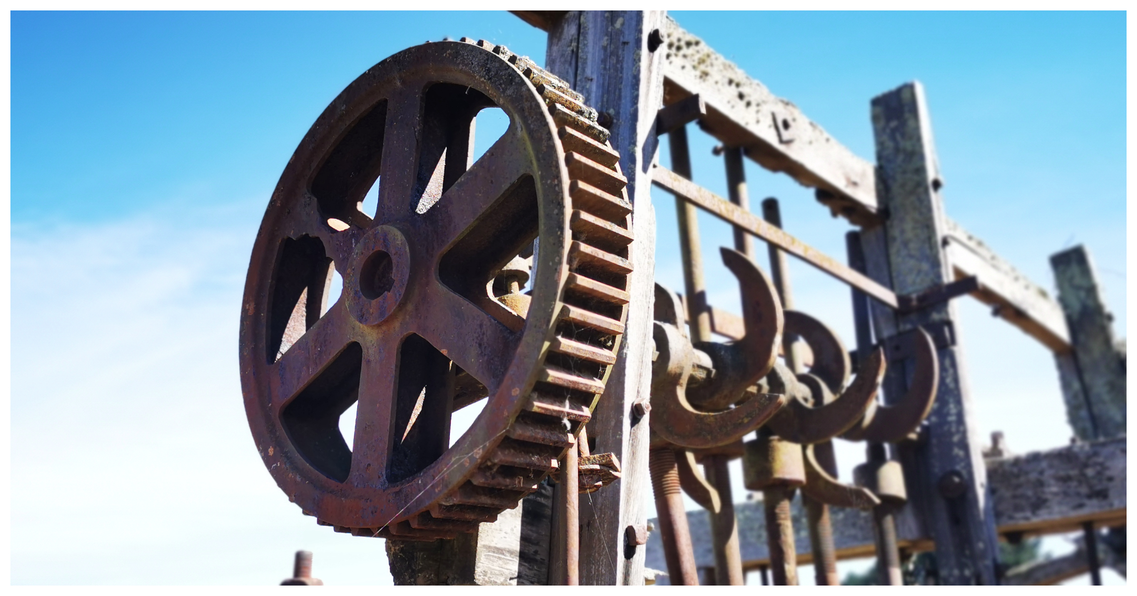
The stamper consisted of 10 stampers but only 5 remain today. It was driven by a steam engine.

It can still clearly be seen, along with a half-buried waterwheel, concrete foundations, metallic relics and tailing pipes.
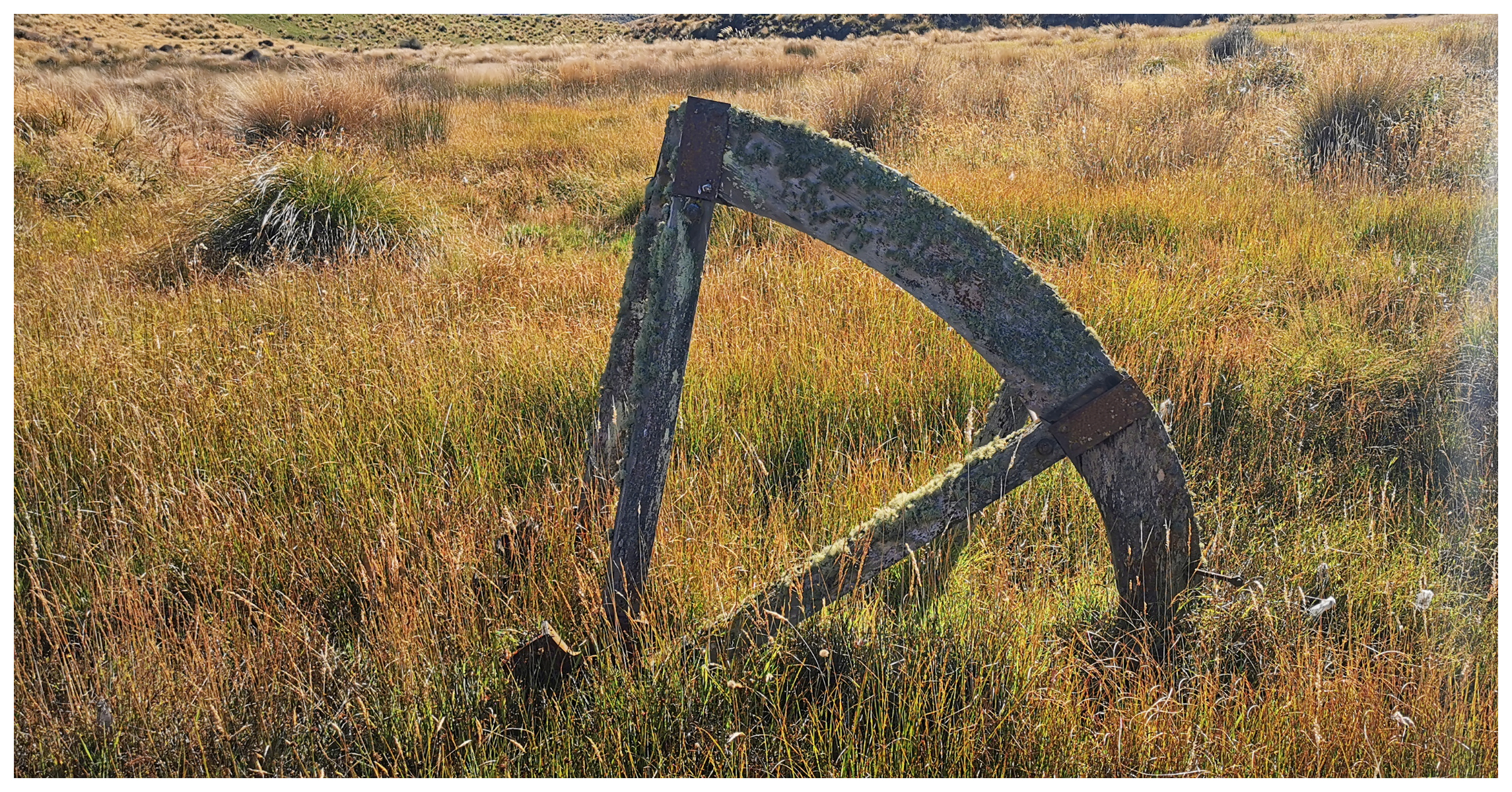
the remains of the half-buried water wheel
Summary
This concluded our ‘loop roadie’. It was a great day of exploring an area that we both had not travelled to before. It was a total of just over 100km and took us the best part of the day with plenty of stops for photos and to read the history of the areas we visited.
I love these explorations of places that most New Zealanders have never heard of and your beautiful photos. I’d like to visit Lake Mahinerangi if there’s no logging going on when I’m in the area. My camper van may only be 6m long, but I don’t fancy meeting a large truck on one of those corners!
Thank you for yet another fascinating blog.
My wifes family owned many of of the cribs at Mahinerangi, had many holidays there exploring especially when the lake water was low. Her uncle found many artifacts as he lived there permanently. Wonderful fishing and great water activities to be had there
Oh how interesting, I’d love to fossick around the old townsite when the water is low. It a beautiful spot to make special memories. Linda
Thank you for sharing this. Very interesting
Thanks June, glad you enjoyed reading. Linda
My wife and I had a place in Waipori Village from late 2011 to 2018.It was a wonderful place to live, with an air so fresh and dust free. Beautiful views and some great neighbours. We rue the day we sold it!
It’s certainly a special place for sure – it’s wonderful that you have such fond memories of your time there.