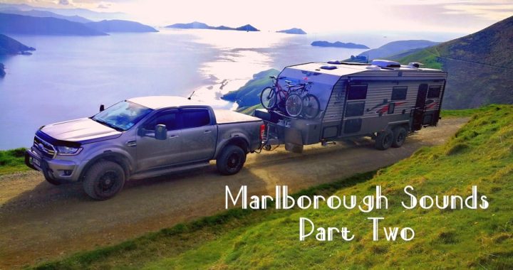
Marlborough Sounds Magic
Our first taste of the Marlborough Sounds did not disappoint. (Click here to see Part One). Keen to discover the next leg of our journey, we made our way from Okiwi Bay to Havelock, in rather dreary weather.
Havelock
Havelock is only a 52km drive from Okiwi Bay. Once again it was going to be a short travel day for us.
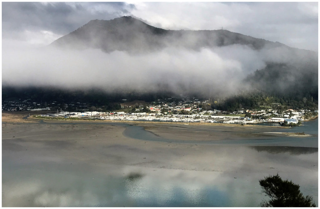
the small quaint town of Havelock on the banks of the Kaituna Estuary
There aren’t many camping options to choose from at Havelock. We were keen to hook onto power for the night. We made the decision to set up camp at Havelock Kiwi Holiday Park (NZMCA#6883). It was at the upper end of our budget at $36pn (even after the NZMCA discount).
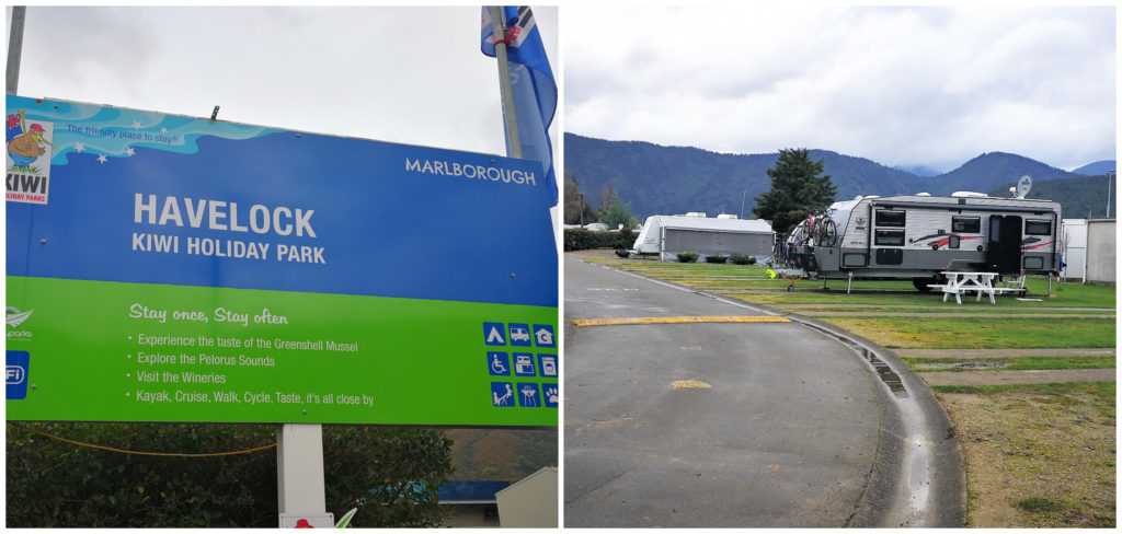
It’s all about location with this clean and tidy camping spot
It is a lovely camp with friendly managers. The location is perfect and is really close to town, supermarket, pubs, restaurants and marina.
Flexing our Mussels
Havelock calls itself the ‘Greenshell Mussel Capital of the World’. It would be rude not to indulge in its namesake. The Captain’s Daughter provided us with our fix of some beautiful fat and juicy green lip mussels.
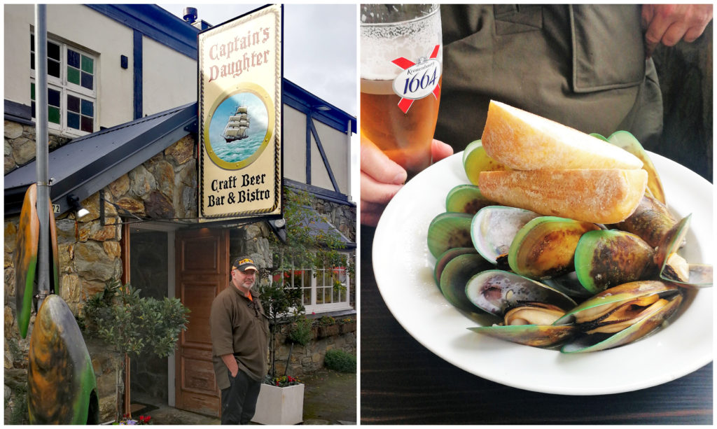
When in Rome……..well in this case ‘Havelock’!
We needed to walk off lunch. It was the perfect opportunity to wander the main street. We visited the small but well laid out museum and wandered around the marina. There are numerous charter boats and water taxis based at Havelock. They ferry homeowners to the various houses and lodges in the Pelorus and Kenepuru Sounds which only have access by water.
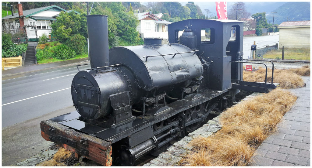
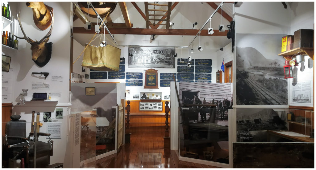
The town has done well setting up the small museum which explains the history of the area – entry fee is a donation
The town is full of quaint colonial buildings which are home to boutique galleries and eating places.
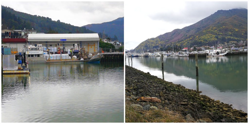
The walkway offers great views of the estuary, mussel boats and marina
Motuweka Pathway
We took the Motuweka pathway which provides walking access to the end of what they call the South Mole. This is a breakwater that shelters the large marina. There were various information boards helping you to identify the varied birdlife that makes their home in the Kaituna Estuary.
Best Bang for our Buck
We wanted to make sure that we were getting the most out of our visit to this area of the Sounds. Once again it was research, research, research. We needed to make sure the roads and access were suitable at this time of the year.
Wanting to optimise the best use of our time (we had a house sitting assignment pending in Blenheim), we once again decided on the furthermost most point we could get to and work our way back from there – this time with our caravan in tow.
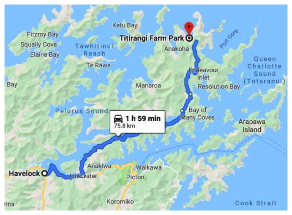
With caravan in tow, we headed to the far reaches past Kenepuru Sound
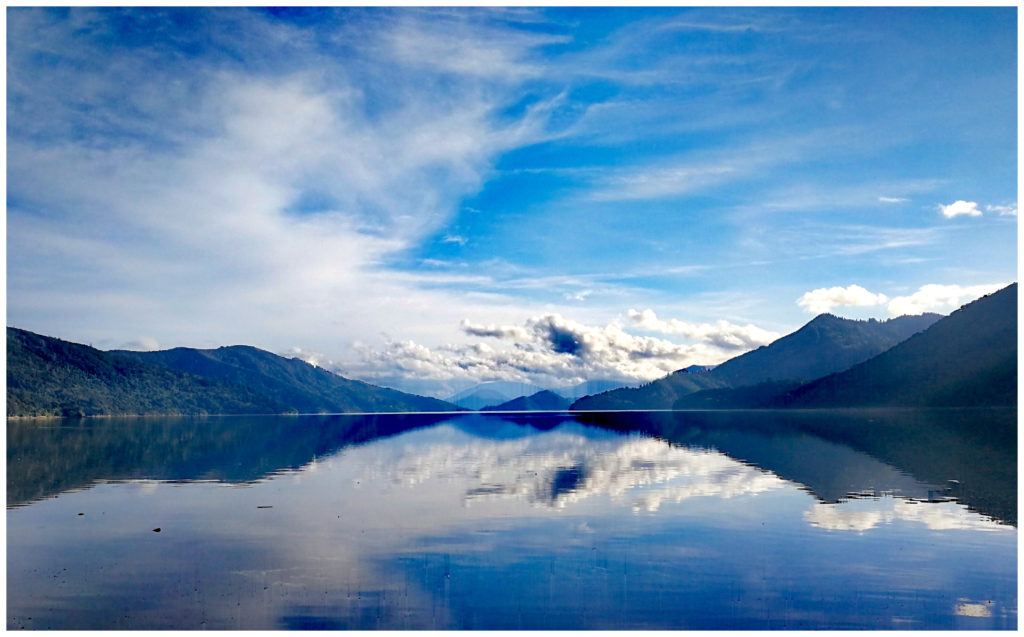
Pelorous Sound
Pelorus Sound is the largest of the sounds which make up the Marlborough Sounds. The entire Malborough Sounds is actually a collection of drowned river valleys which were formed over 10,000 years ago. The main channel of Pelorous Sound is 55 km long, from Cook Straight to Havelock.
Pelorus has several major arms which include Tennyson Inlet and Kenepuru Sound. With 380km of shoreline, only a small portion has road access. This is why places like Havelock and Picton have so many water taxi and ferry services running constantly to private homes and lodges dotted amongst the hilly coves and bays.
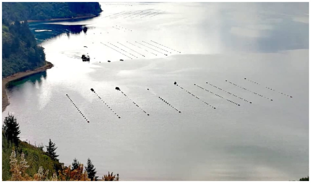
The mussel and sea sponge industry are going strong in the Sounds. So many farms dotting the coastline
As 80% of NZ’s seafood exports (worth $200m pa) come from the Marlborough Sounds, we saw many marine farms as we traversed the Pelorus and Kenepuru Sounds. Green-lipped mussels and NZ sea sponge (many believe the key to an anti-cancer drug) are farmed extensively in these areas.
Titirangi Farm Campground
From our camp in Havelock, it is a 76km drive to Titirangi Farm Campground on the far reaches north of the Kenepuru Arm.
Once again, I can only describe the drive-in as ‘WOW’. Don’t let google maps fool you. It was never going to take us only 2 hours to get there from Havelock. Great care is needed to navigate these roads.
Always time for a lunchtime stop – the view from The Portage on route to Titirangi
The road climbs up a large ridge above Endeavour Inlet of the Queen Charlotte Sound and skirts around the edge of the impressive Mt Stokes (a walkway sign said it was a 5-hour hike to the top!).
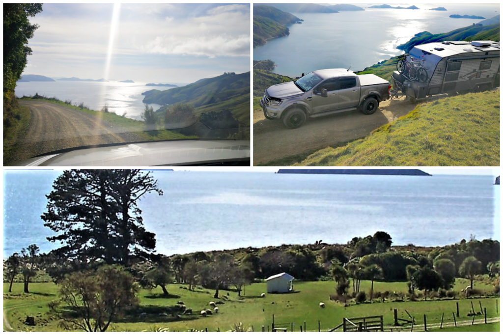
Just a few ‘hold your breath’ moments on the drive-in but what a prize at the end
Getting to the Camp
If you search on google maps for Titirangi Farm Campground, the official road stops a wee way from the camping ground (approx 3km). Crossing over the cattle stop at the top of a massive hill, you look down at a narrow, winding road which eventually ends up at the sheep and cattle farm. From a distance, this resembles nothing more than a farm track. I did hold my breath a couple of times as Scotty negotiated some of the hairpin corners which seemed as if we were turning ourselves inside-out whilst facing downhill on a rather perilous gradient.
With stunning views to Chetwode and Titi Islands, the long sweeping sandy beach must be such a drawcard in the summer months. The fishing, swimming and walking make it the iconic Kiwi summer holidays that we all adore.
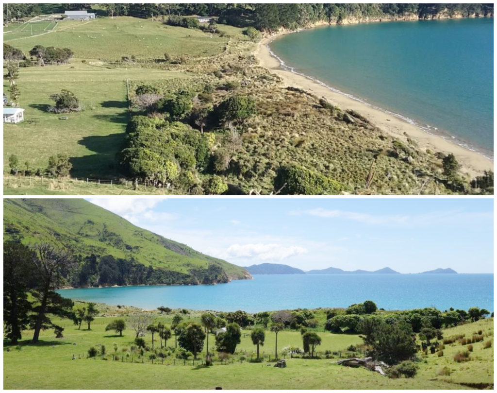
located close to a safe, sweeping sandy beach – just what kiwi holidays are made of (these photos courtesy of google)
The ‘rustic’ camping facilities consisting of flushing toilets will cost you $7 per person and there are plenty of camping spots to choose from. There is also a cold-water shower and tubs which double as kitchen and laundry facilities.
It is somewhat sheltered from the coastal winds as it is set back from the beach a bit so you don’t get ‘absolute beachfront’.
There is a lodge which sleeps up to 29 people in bunk style rooms.
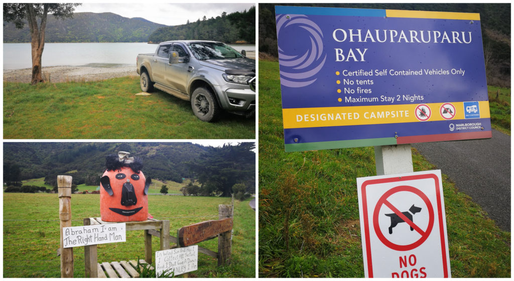
The Farm Park is a 900-hectare recreation reserve administered by DOC but is leased out for beef and sheep farming (358 hectares for grazing). As it is a working farm, no dogs are allowed.
Plan B
We had achieved what we had set out to do and that was to make it to ‘roads end’ on this arm of Marlborough Sounds. Now what?
We had been keeping our eye on the weather forecast for the next couple of days and it wasn’t looking too favourable.
The road in and out of Titirangi Farm Campground is steep and it is a tough ask hauling our caravan out under average conditions let alone potentially slippery and boggy unsealed tracks. We were also limited on time as we needed to get to Blenheim to start a month-long house/pet sitting assignment. I would hate to think we could potentially be stuck here, back of beyond with no cellphone coverage and not be able to fulfil our commitment!
We agreed to put Plan B into action.
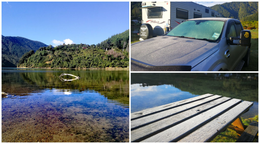
Kenepuru Heads
So after a wander around the camp at Titirangi Farm, we turned the beast around and started the long steep haul out. Why is it that it never seems as long departing a place than entering!
We recalled seeing a DOC camp on our way in which looked large enough to accommodate us and wasn’t too far from where the road meets the tarseal.
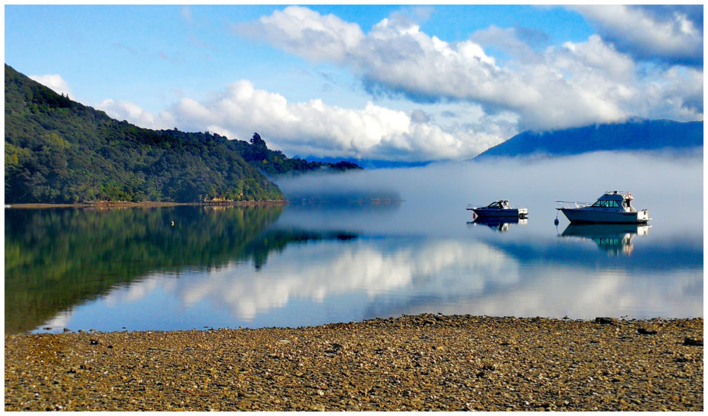
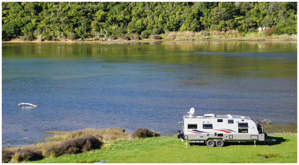
Kenepuru Heads is the furthermost inland point of the Kenepuru Sounds. The DOC Camp (NZMCA#6919) sits right on the water, has flush toilets and non-potable water supply. It cost us $8 each per night.
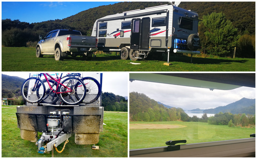
Made it!!!! I think Scotty will be busy washing the caravan when back in civilisation!!! Our view outside our lounge window.
As we were the only ones there, and with a heap of room, we angled the caravan towards the sun to ensure our best chances of catching some good solar power for the next couple of days.
The view from base camp – looking up the Kenepuru Sounds
and the view from our doorstep
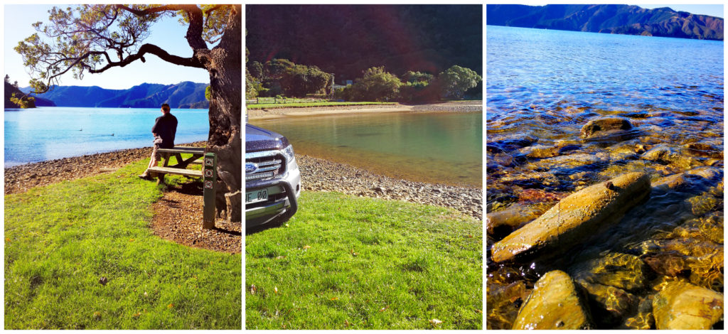
Out and About
This was to be our ‘home base’ for the next 2 nights so that we could continue with exploring more of the Marlborough Sounds without the caravan behind us.
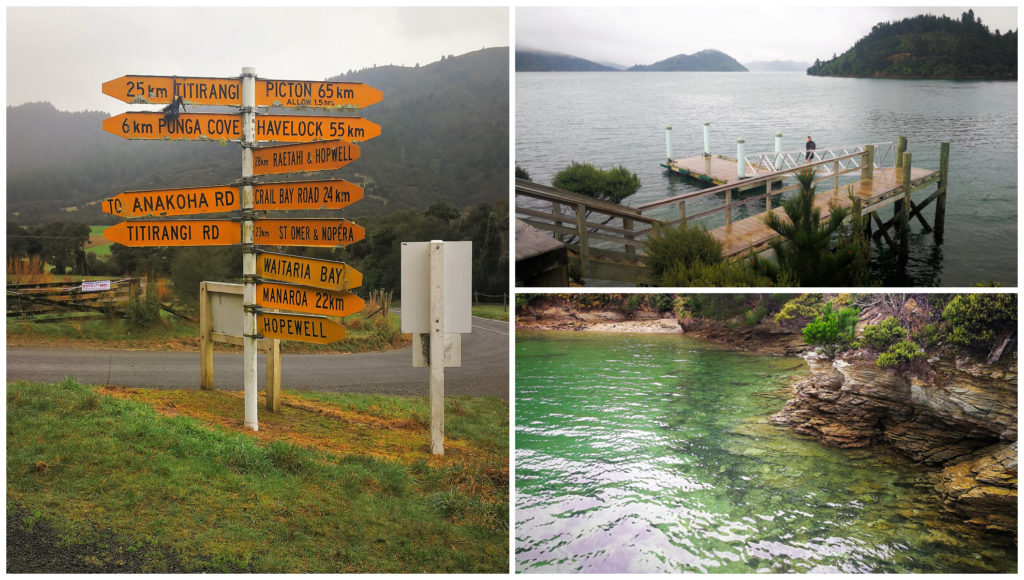
Just follow the signs….so many options, so many stops to make along the way
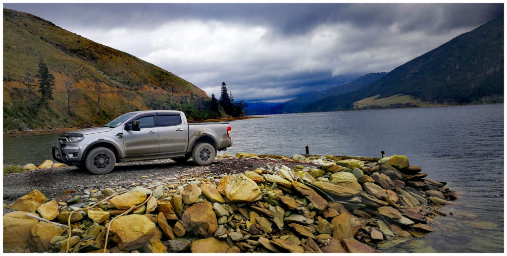
We spent the next day cruising the roads around the far side of Kenepuru Sound. We took many side roads and laybys to discover private little bays and coves.
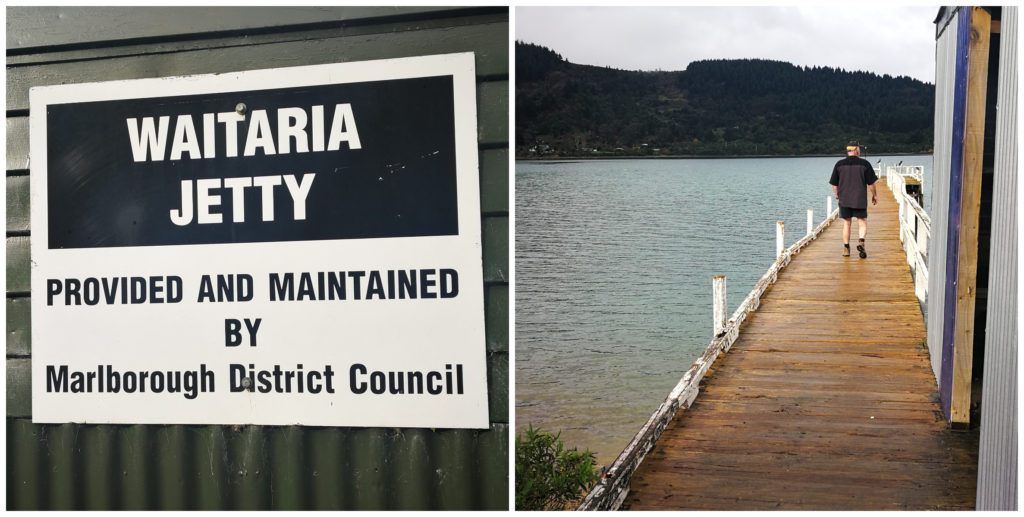
Waitaria Jetty was our turn-around spot to explore the other side of the sounds
Hugging the coastline of the sounds we reached the small settlements of Waitaria Bay and Goulter Bay. We then headed inland to Manaroa which was on the other side of the arm.
Manaroa, another lovely spot on the Pelorus Sound
Another great option for freedom camping – our choice next time we visit I reckon – and I love the local sense of humour with one of the best letterboxes I’ve seen
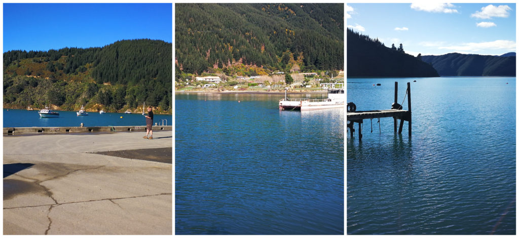
Whatamango
After two nights in Kenepuru Sounds, we were Picton bound.
The same spot as last time – would be rude not to!!!
This was to be our second time staying at the Whatamango DOC Camp (click here to read Picton Blog). We found this camping spot (NZMCA#6964) to be handy to Picton and this time we were keen on driving the loop road around Port Underwood. We didn’t get the chance to explore this area the first time around.
It may have been a cold start but worth it to get a stunning day like this!
Port Underwood
With Whatmango as our base camp, we took off the following day to drive the loop road.
one of the many private, secluded and unspoilt bays
Port Underwood is a very sheltered harbour in the north-eastern side of the Marlborough Sounds.
When Europeans arrived in Marlborough, Port Underwood was the first place to be settled as it offered a sheltered port to anchor ships, had ample timber, and good access to Cloudy Bay.
This is probably why it has a strong historical connection with the whaling industry in the 1800s.
Kakapo Bay
Kakapo Bay was set up as a whaling station and attracted the largest concentration of Europeans in the South Island at the time. Large numbers of southern right whales and humpback whales were hunted in the bay. This, unfortunately, led to their near extinction with dwindling numbers today.
We came across a small memorial and plaque, marking the location of the station at Kakapo Bay.
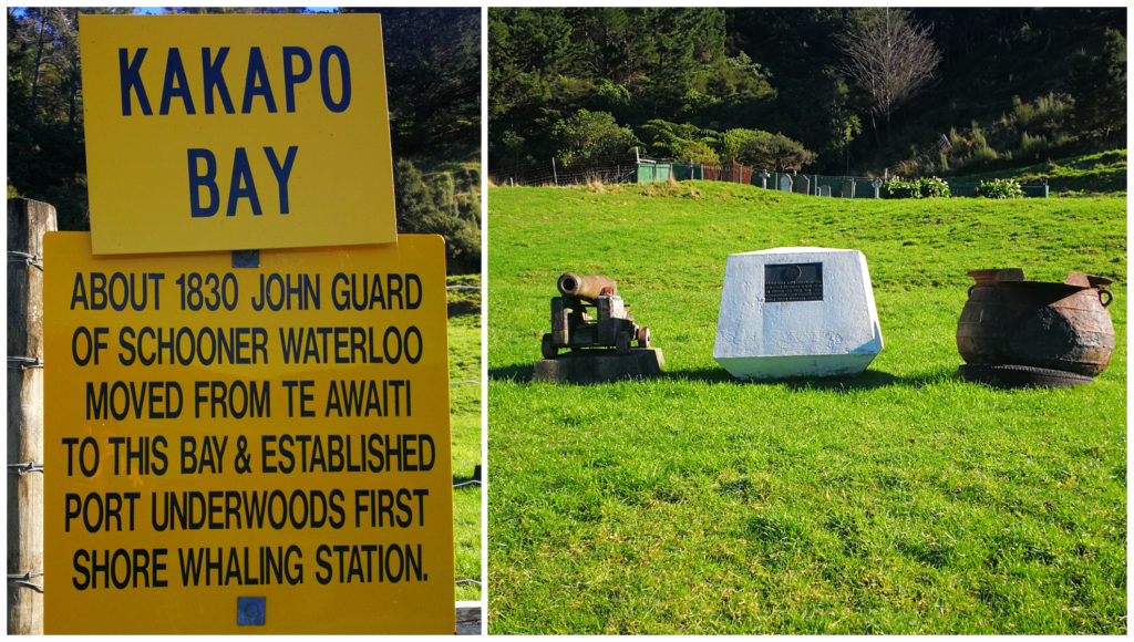
The small memorial behind a fence on private property at Kakapo Bay
Whites Bay
We called into the Whites Bay DOC Campground (NZMCA#6994). Many of the camping areas were closed off for winter which only left a small area in which to stay. It has a beautiful sweeping white sandy beach which looked great for swimming in the summer.
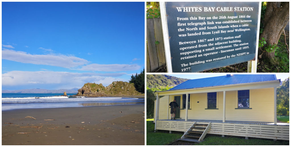
there’s history and great walking tracks at Whites Bay
There are numerous walks to do in the area of various lengths and to suit different abilities.
Whites Bay’s claim to fame is that in 1866 it became the South Island’s terminus for the inter-island telegraph cable from the North Island. The original cable station still exists in the camping ground and has been restored and well maintained.
What a way to celebrate our very successful adventure around the Marlborough Sounds
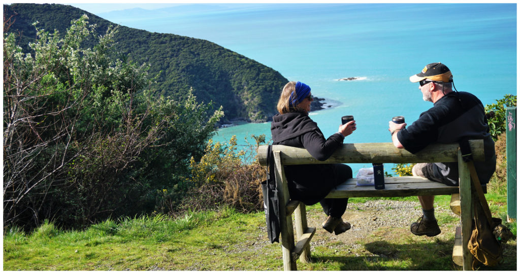
We stopped for a lunch break at a superb viewpoint on the edge of a bluff where we could see Port Underwood, Cook Strait, Cape Campbell and the North Island.
Rarangi
From this bluff, the road dropped steeply back down to sea level to the small settlement of Rarangi. There is another DOC camp located on the beachfront.
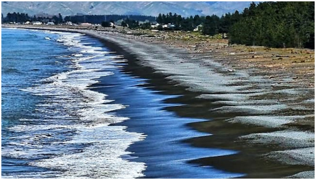
sweeping, stony Rarangi Beach
To the north of the settlement, there is a sea cave with glow worms and two walking tracks, including the Whites Bay Track and a short track to Monkey Bay.
It was then just a short drive back to SH 1 which took us back to base camp at Whatamango. The entire loop drive is 145km.
Like the rest of the roads we have explored in the Marlborough Sounds, caution needs to be taken when driving.
The Port Underwood Road between Oyster Bay and Whites Bay is an unsealed, narrow, winding and in places steep road. It requires extreme care and concentration and low speeds are essential. It is also the most accessible road in the Malborough Sounds, therefore has a lot of traffic during the summer months.
I would recommend that if you are wanting to camp at Whites Bay, then access it from the Rarangi end, rather from Whatamango.
Summary
Our stay at Whatamango, marked the end of our Marlborough Sounds adventure. In total, we spent 8 nights exploring three areas of the sounds. More time can certainly be spent relaxing and walking some of the many tracks in the area. With the limited timeframe we had, we can certainly say that we covered off all the areas we wanted to explore. Summer would be a great time to visit but then you have the problem of many others wanting to do the same thing at the same time.
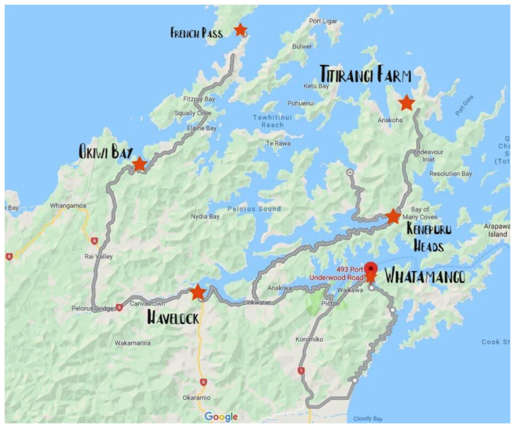
An overview of our adventures around the Marlborough Sounds
Winter, I think, is a wonderful time to travel. Sometimes, it’s like having to spin that roulette wheel with regards to the weather. But I would rather have to deal with this than hoards of holidaymakers that descend on some of these hot spots during summer.
Click on the link below to view some of the highlights (of which there are many!!) of our adventures around this area of the Marlborough Sounds.
Thanks for the blog posts, photos and videos of both Part 1 & Part 2. They were really interesting and enjoyable to read. Cheers.
Thanks for your feedback Kevin. Hopefully, it’s showcased the Marlborough Sounds as well as being informative and helpful if you ever get the chance to explore.
This seems like it was quite an adventure in more ways than one. Outstanding views without the crowds makes it worthwhile and I wonder if many people get to see this natural beauty. Food for thought for a long overdue return visit to New Zealand.
You certainly need to come back!! So much more to see and explore. Thanks Elizabeth.
Brilliant, great adventure you had . Was one of our favourites too..
Thanks Rosi, it’s a pretty special part of the country and so worth exploring. L