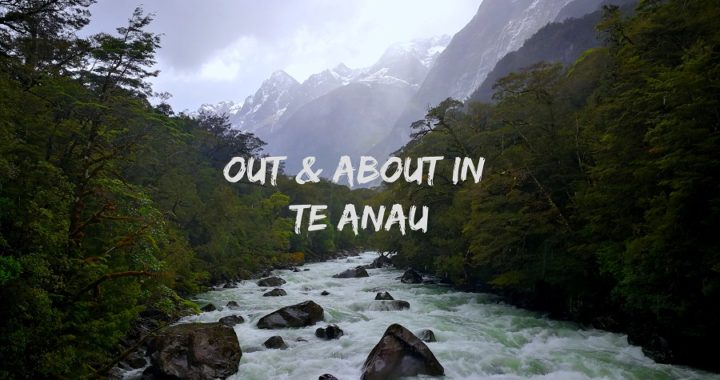
The Village of Te Anau
Te Anau township sits on the eastern shores of Lake Te Anau in the Fiordland region. It is a little tourism haven as it lies on the border of Fiordland National Park and is the gateway to nearby Milford and Doubtful Sounds. More on these later in the blog.
The town’s population temporarily has a surge every morning and evening as coach loads of tourists call in on their way to or from their day trips to the nearby Sounds.
Accommodation
We headed for Alpine NZMCA Park (#9101) which is located just out of town. It is a large area with easy access with the option of hard or soft stand around the perimeter. There is a spacious shed which proved to be very handy for combined happy hours in the evenings.
The location is great with a newly opened fuel and dump station right across the road. There is also the Alpine Cafe and Bar if you are wanting a cuppa, cake or a sit-down meal at the pub.
It is approximately a 20-minute walk into town.
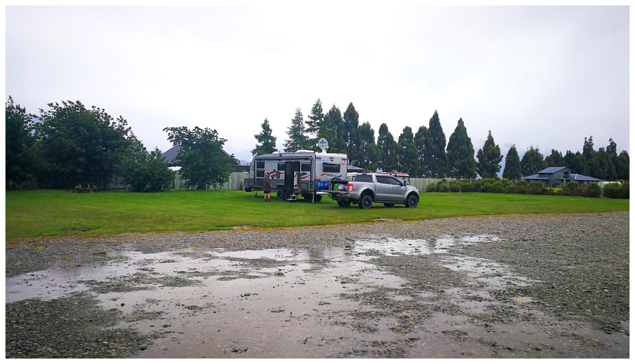
It was gumboot weather for our arrival set-up
Mother Nature’s Fury
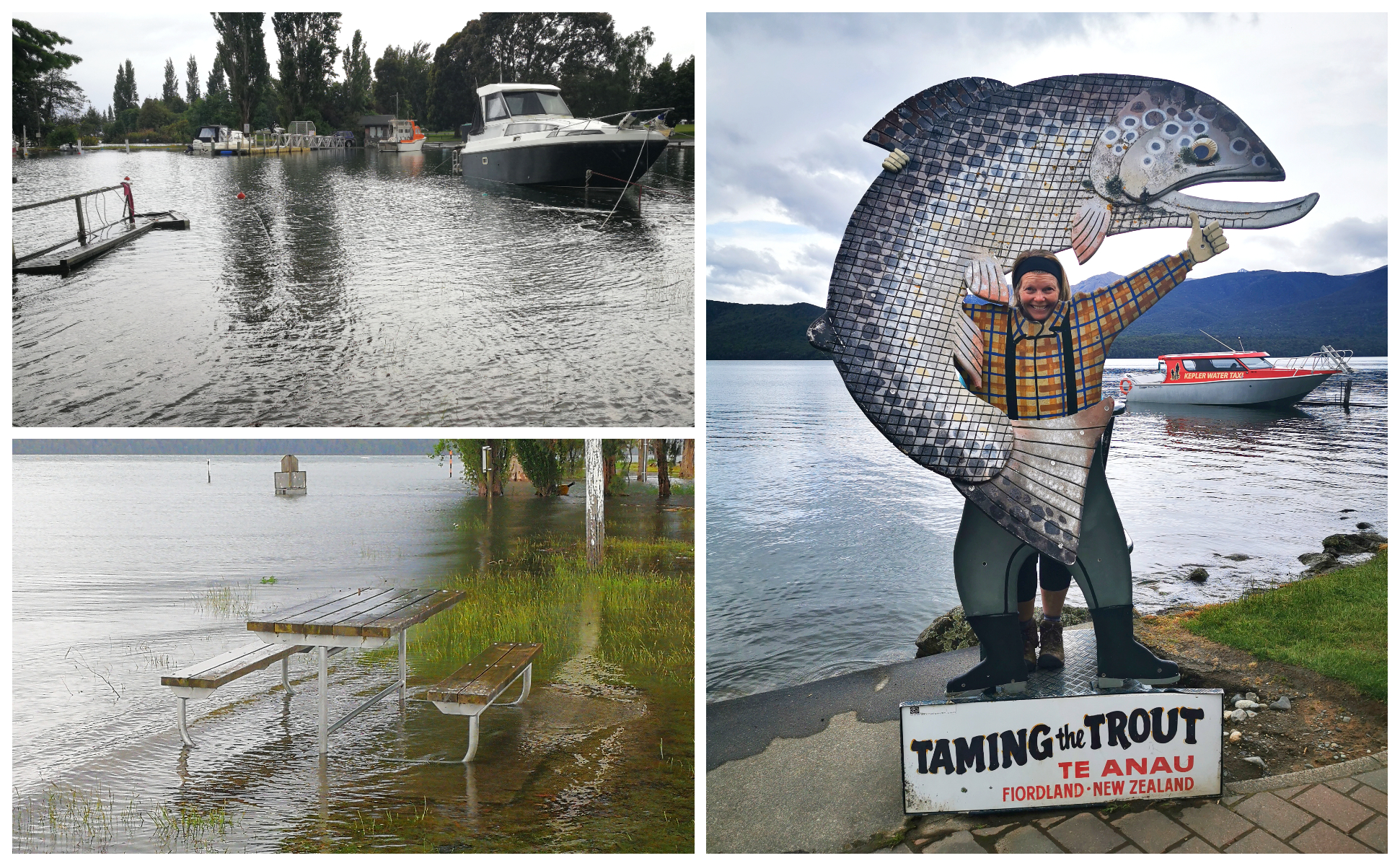
The South Island was under attack from mother nature with weather warnings in place for much of the lower half of the island.
These warnings were to come to fruition it would seem. Torrential downpours resulted in many areas flooding including Wanaka and Queenstown. Te Anau was not spared as the lake started to rise and burst its banks.
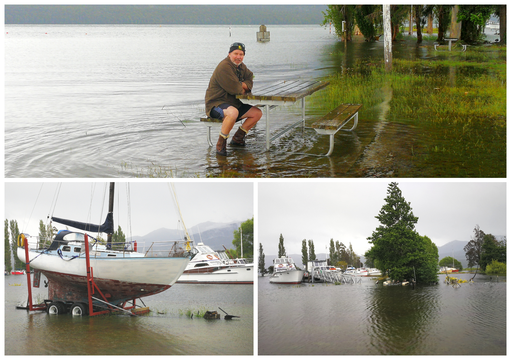
The lake burst its banks and the marina was rising up to meet us
The township was not threatened by the rising waters and most of the built-up areas are set back from the foreshore. Road closures were happening further up the island along the West Coast and just south of Timaru. All routes further north were closed.
Still making the most of it despite the weather
Milford Sound
NB: we stayed in Te Anau prior to Christmas so this was before the terrible damage that was done to the Milford Road during the torrential downpours that occured in February ’20. At the time of publishing, the road is still only open to a select number of tour coaches. More than a metre of rain fell in just over 60 hours causing major flooding, landslides and trapping hundreds of tourists and trampers
Our friends from Auckland who were staying with us for a few nights had managed to get to Te Anau safely. We decided that although the weather had been atrocious, the Milford Sound would be in ‘fine form’.
Milford Sound has often been described as the ‘8th wonder of the world’. It was originally carved by glaciers during the ice age so the fiord’s cliffs rise vertically from the inky coloured waters. Mountain peaks seem like skyscrapers while the waterfalls cascade downwards from as high as 1,000 metres.
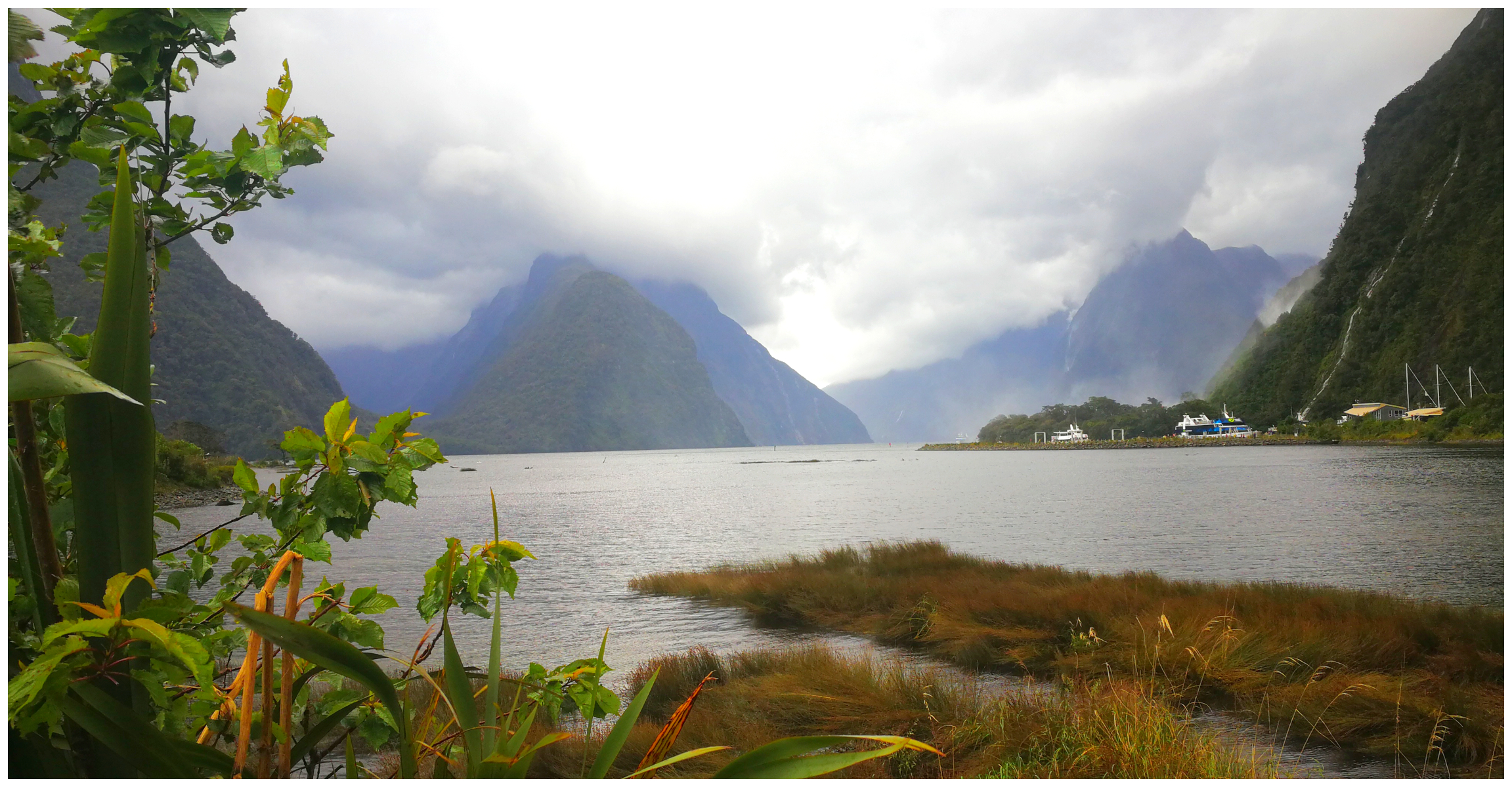
It was a very ‘moody’ Milford Sound
Once you arrive at the end of the road, it all turns very commercial. There are numerous options for different cruises, from 3 hours to overnight (or longer).
It is worth noting that it is now $10 per hour if you wish to park your car at the ferry terminus. You can avoid this costly parking fee by travelling by coach from Te Anau or parking at Deepwater Basin which is free. You can walk to the terminal or take the free shuttle that collects visitors every 15-20 minutes.
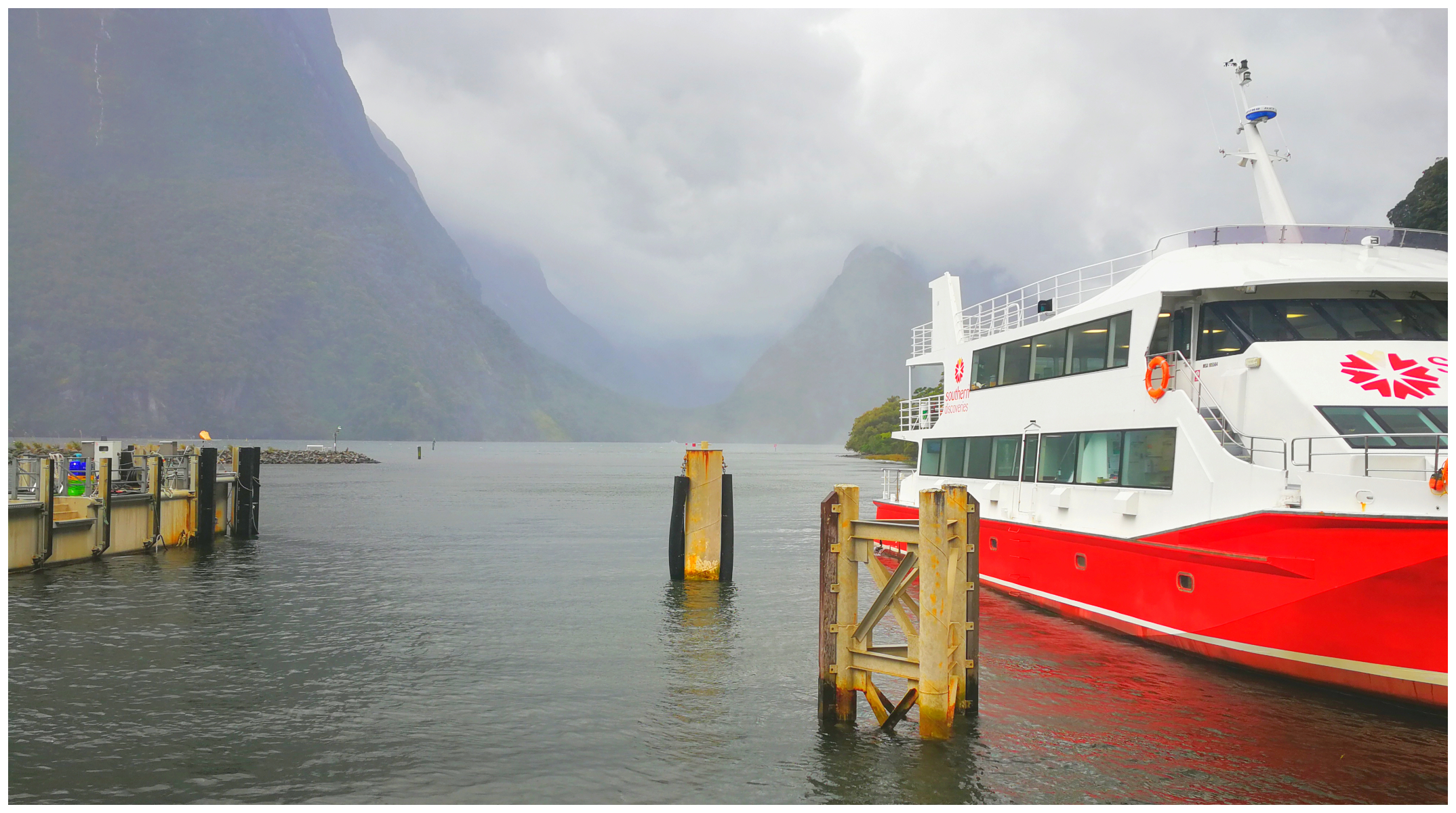
The commercial hub of Milford Sound
The Road to Milford Sound
It’s approximately 120kms from Te Anau to Milford Sound and it is probably the most scenic in the country. It is too often rushed in a desperate attempt to get to a Milford Sound cruise on time.
It is up to the individual to decide how they best want to travel the road to Milford Sound – and how many stops they have time to make.
There are definitely places that are worthy of making a stop at. For us, it was all about the drive into Milford Sound, rather than the destination itself.
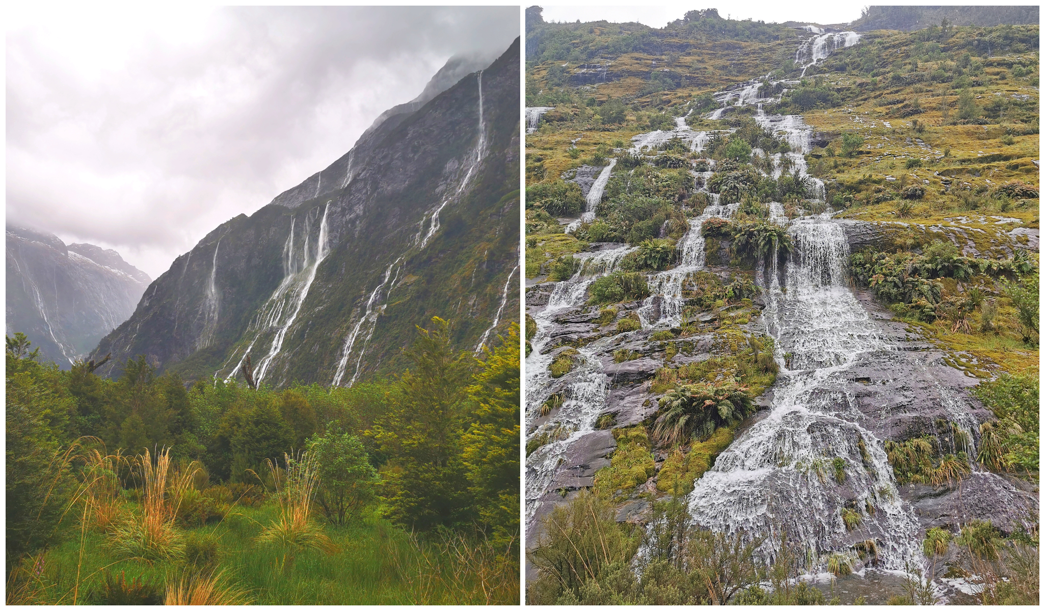
It was like the alps were crying waterfalls
With the extremely high rainfall over the past couple of days, the waterfalls had multiplied which had a magnificent effect. It seemed like all the mountains were crying as we drove along the Milford Road.
“It’s all about the jouney, not the destination”
I’ve listed below some of the points of interest that you may want to make either a stopover at or even camp for a while. The weather prevented us from ticking them all off our list so it does pay to keep your plans flexible to make allowances for adverse conditions.
Eglinton Valley
You can’t help but notice this stunning valley formed by a glacier as you drive right through it approximately 53km on route to the sounds. There are plenty of places to park on the side of the road to get snapping.
Mirror Lakes
Mirror Lakes offers a good place to stretch your legs during the drive to Milford Sound. Although it is only a short walk, the small tarns provide outstanding reflective views of the Earl Mountains. There wasn’t any point in trying to capture the natural phenomena thanks to the wild weather mother nature was dishing out to us. There was no way there was going to be anything close to a reflection (hence no pics)!
This is a very popular tourist stop so you may want to choose your timings carefully.
Knobs Flat
This is another opportunity for you to stop on your journey to Milford Sound. It is interesting to note that it is the last opportunity to use a flush toilet until you reach the sounds. It was the site where the workers building the road to Milford Sound/Homer Tunnel camped right up until the 1980s.
Today it still offers accommodation, camping and a Visitors Centre where you can check the current road conditions. During the winter months, you will see many drivers having to make a stop here to attach snow chains if the need arises.
Henry Creek DOC Camp
The Henry Creek DOC Camp is smaller than Cascade Creek Camp and is closer to Te Anau. It’s a very picturesque area on the banks of Lake Te Anau.
Cascade Creek
Cascade Creek DOC Camp is the end of the line when it comes to do-it-yourself camping near Milford Sound. A big blue sign warns tourists that it’s the “Last DOC Campsite on the Milford Road”. It is no wonder that it can be heaving during the summer months. It is not unusual for there to be 140 vehicles staying the night at the campsite.
The Divide
This is the lowest east-west pass in the Southern Alps (531m) and it marks the start of the Routeburn, Caples and Greenstone Tracks.
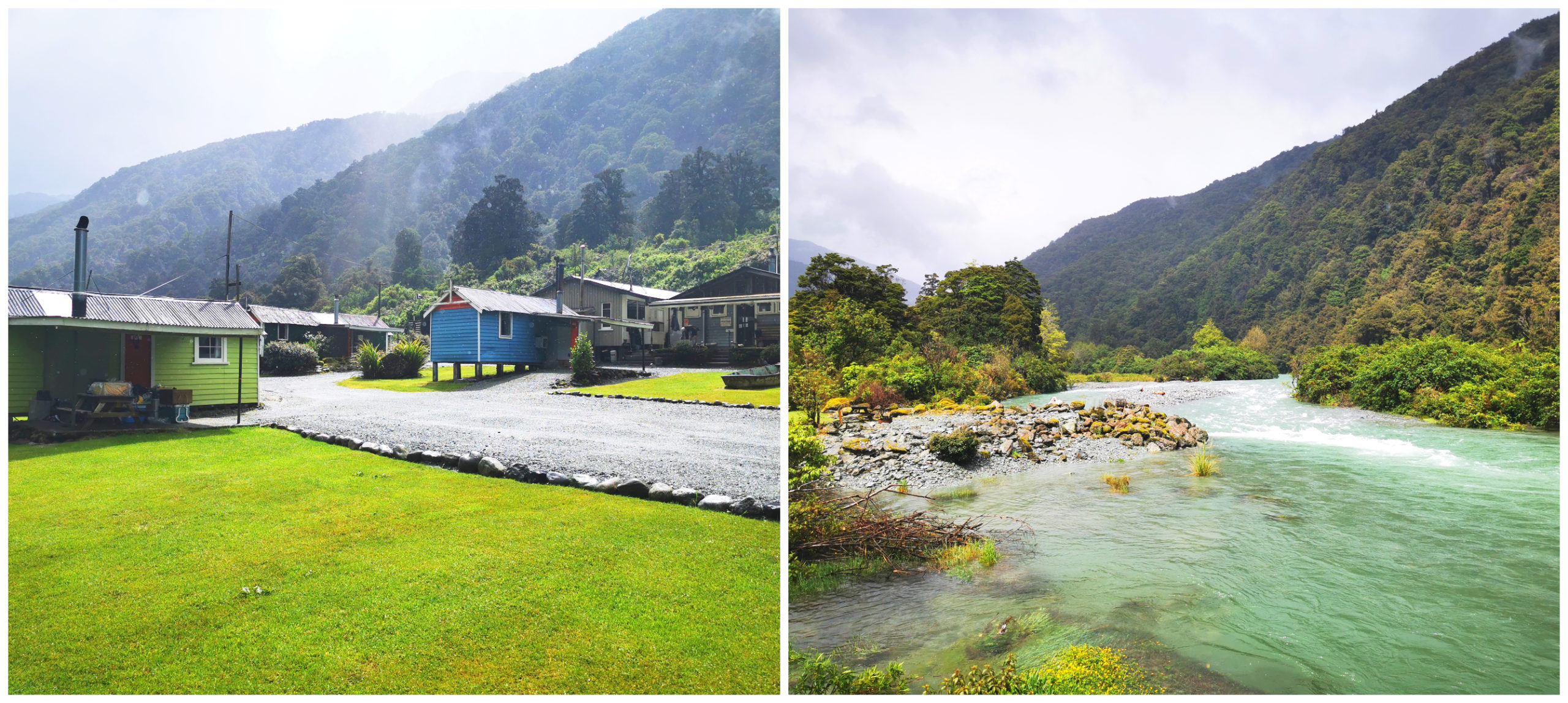
Gunns Camp
Located 8km off the main Milford Road, you will find Gunn’s Camp (also known as Hollyford Camp). It was a collection of 25 cabins which began life in 1938 as a Public Works Dept camp. It was built to accommodate married men who were working on the Hollyford-Okuru Road.
Thanks to WWII, road working stopped so many of the cabins were looted of their stoves, tubs and roofing. Only 15 remained after the war finished.
Wandering around Gunns Camp as it was in December ’19
It was eventually brought by Davey Gunn and he used it as a base for his farming and tourism ventures. It’s a donation to wander the small Settler’s Museum where we learnt about this historic camp and of course the legend of Davey Gunn. There were also stories behind the construction of Milford Road and the Homer Tunnel.
We wandered around the camp which is used as a basecamp for those tramping the Milford, Routeburn and Hollyford Tracks.
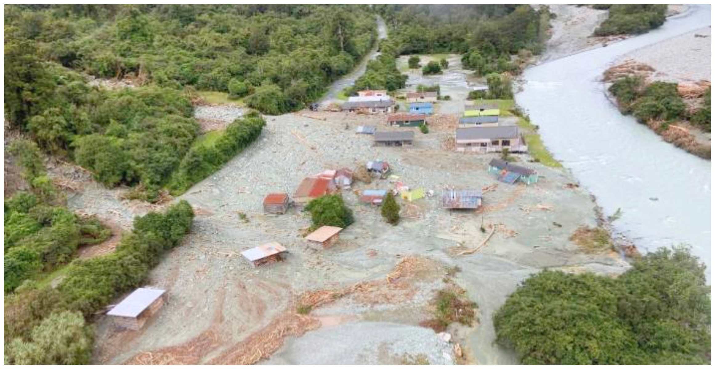
Photo courtesy of stuff.co.nz. The camp post the February ’20 flooding and slips. You can see the blue cabin where the photo above was taken.
As mentioned earlier, the flooding and slips of Feb ’20 tragically washed away many of the huts and sadly the museum. The camp is closed indefinitely.
Homer Tunnel
The Homer Tunnel sits 945 metres above sea level and is 1.2km long. Although it is wide enough to take a bus and a small car, it now has traffic lights so no longer do you have to play ‘Russian Roulette’ with oncoming traffic. You do need to wait up to 20 minutes sometimes for the lights to change to green. It gave us a chance to gaze at the wonderful landscape which surrounded us.
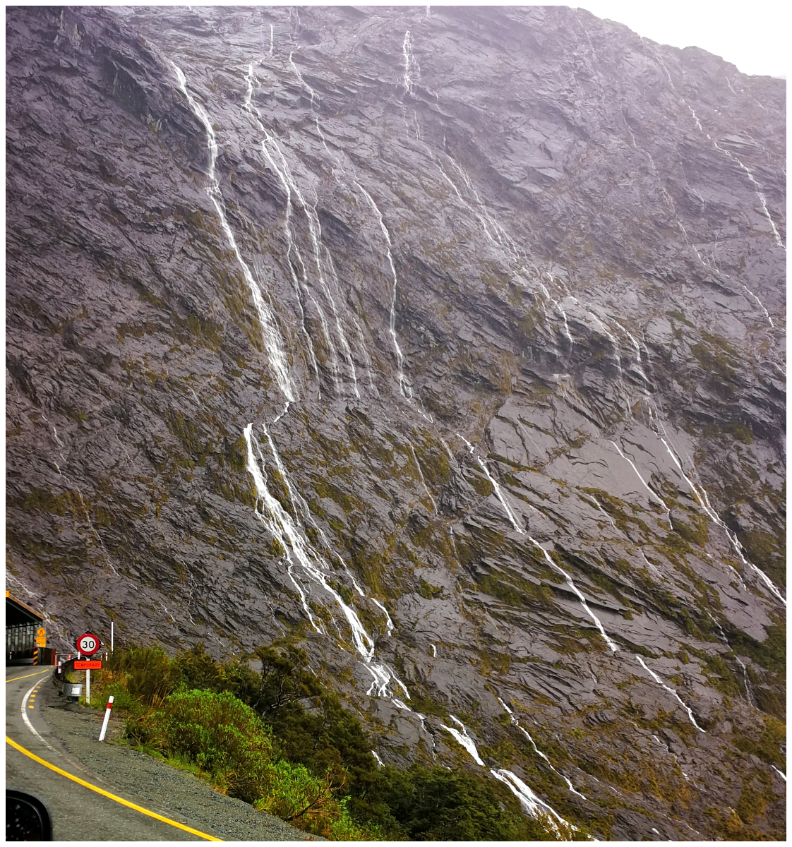
a great opportunity to take in the scenery while waiting for the lights to turn green
The tunnel was completed in 1954 by what was then known as the Public Works Department after 19 years of construction. It was named after William Henry Homer who died in 1894. Him, along with George Barber discovered the Homer Saddle way back in 1889. Prior to the tunnel opening, there was no road access into Milford Sound.
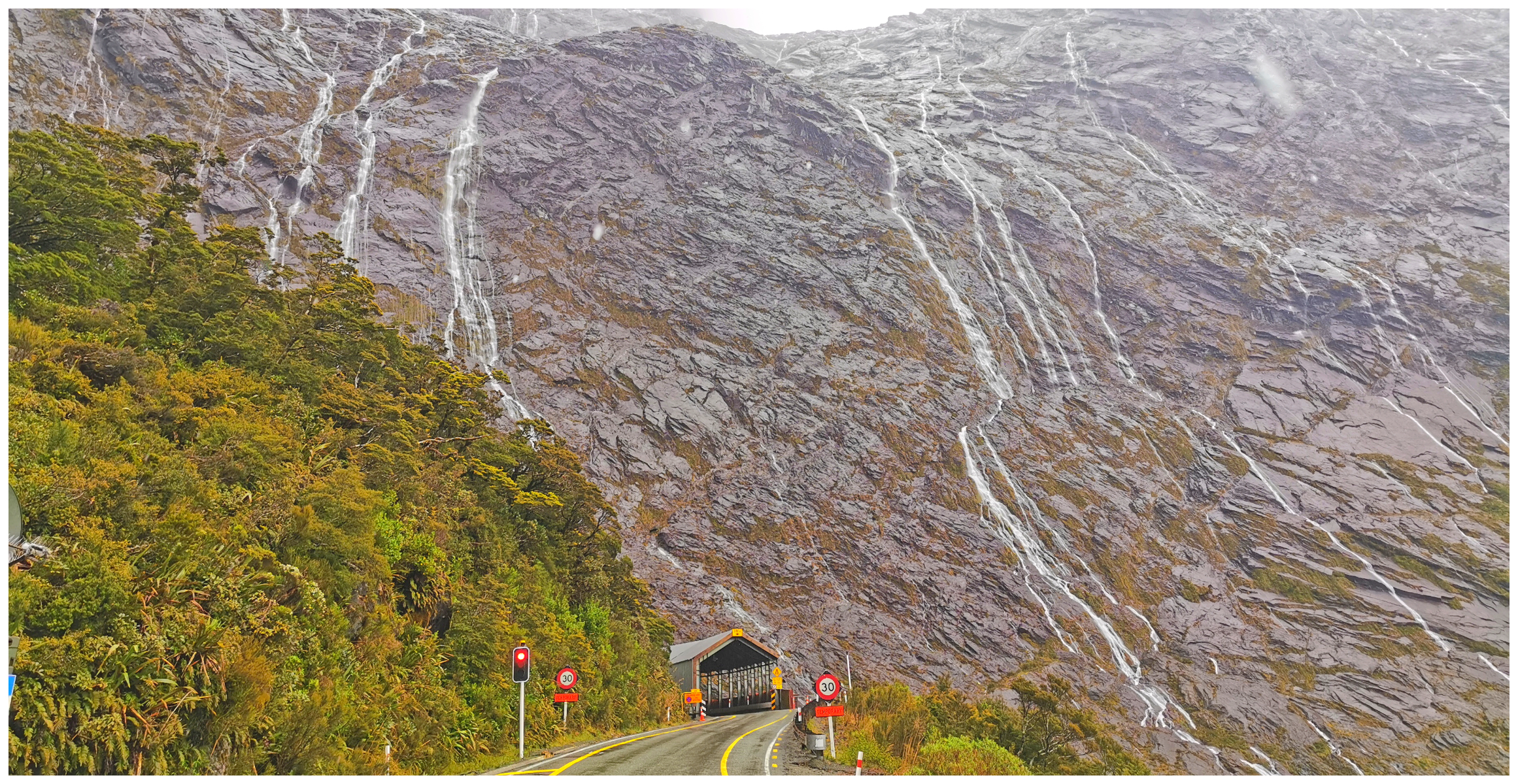
Even by today’s standards, the Homer Tunnel is still an impressive engineering feat
The tunnel is a fairly steep 1:10 gradient running east to west and was carved out of the solid rock.
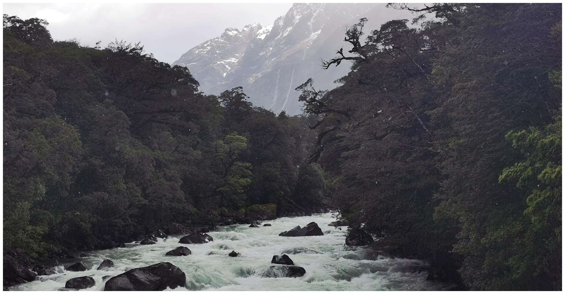
The Chasm
It’s a 20-minute loop walk into the rainforest and an impressive chasm. The floodwaters from the Cleddau River has carved a display of potholes and waterfalls.
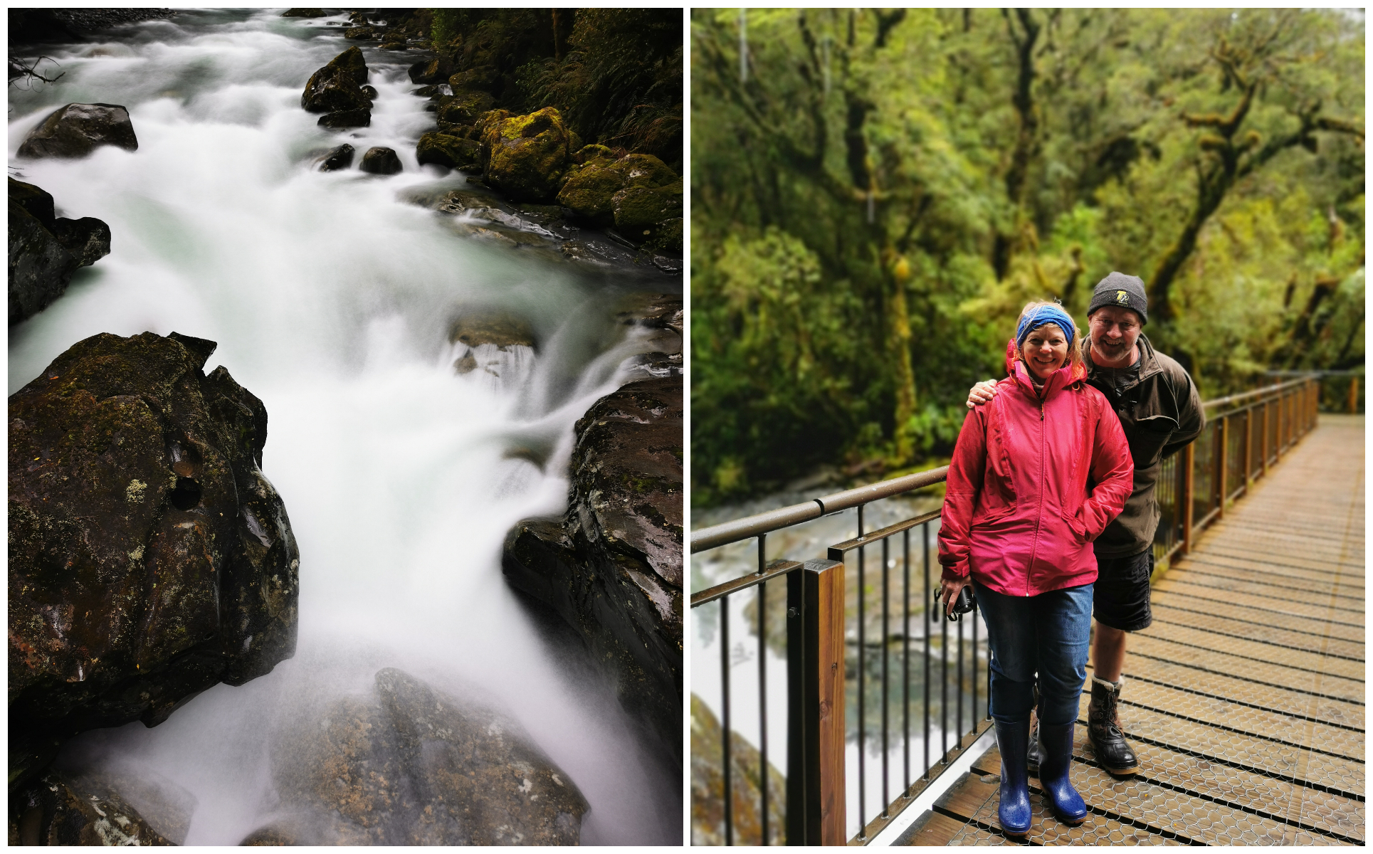
The roar of the water is deafening as it winds its way through the narrow gaps
A series of bridges crisscross the thundering waters, making a roaring sound as it squeezes and thrusts its way through the narrow arches of solid rocks. It was quite mesmerising peering way down through the rocks, watching the water disappear only to reappear further downstream.
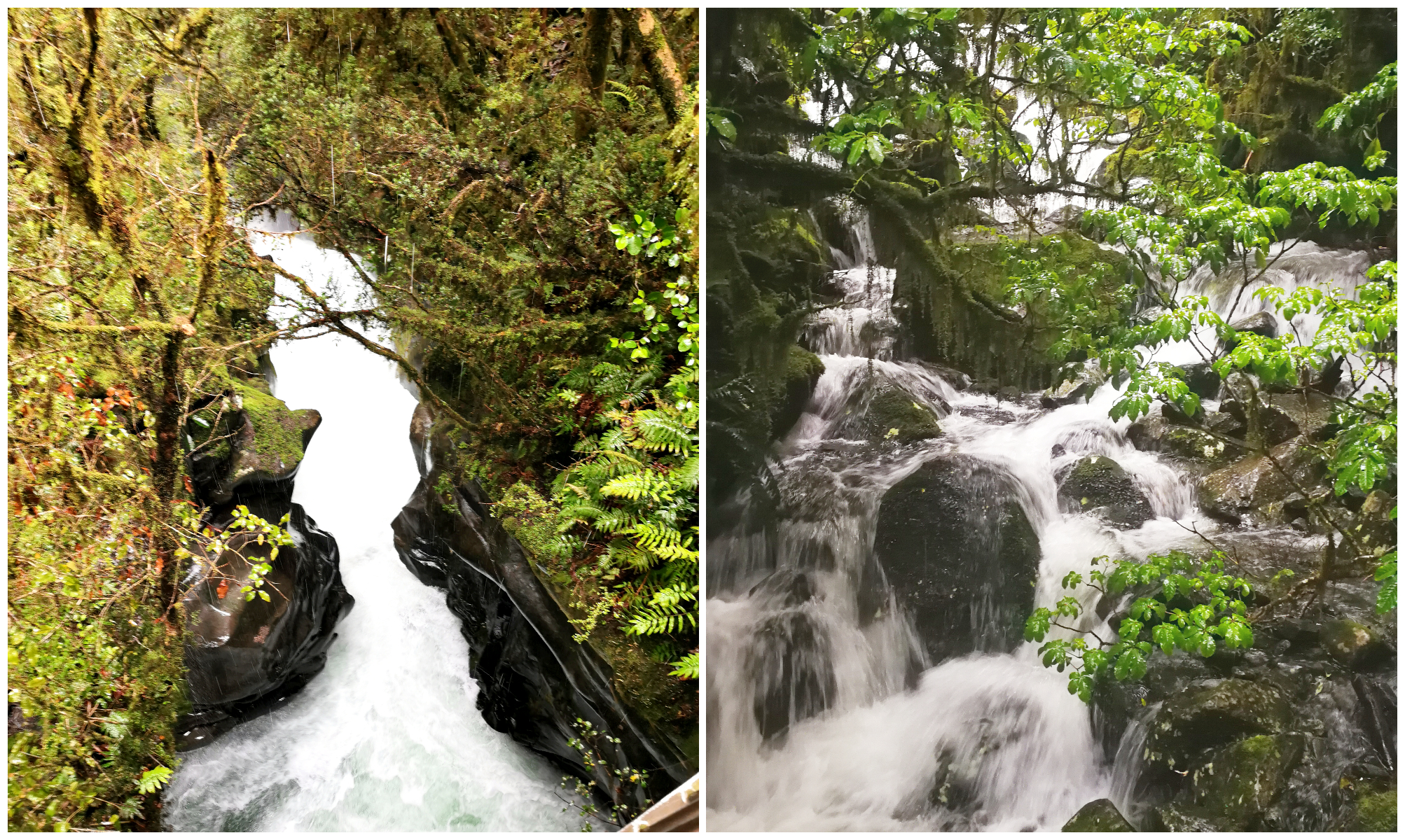
The flow of water was in full flight
It is notoriously difficult to photograph. It’s challenging to capture the depth and volume of these waterfalls from any one angle.
Tutoko Suspension Bridge
The 75m Tutoko Suspension Bridge over the Tutoko River was completed in 1940 and it’s the last remaining steel suspension bridge on the Milford Road.
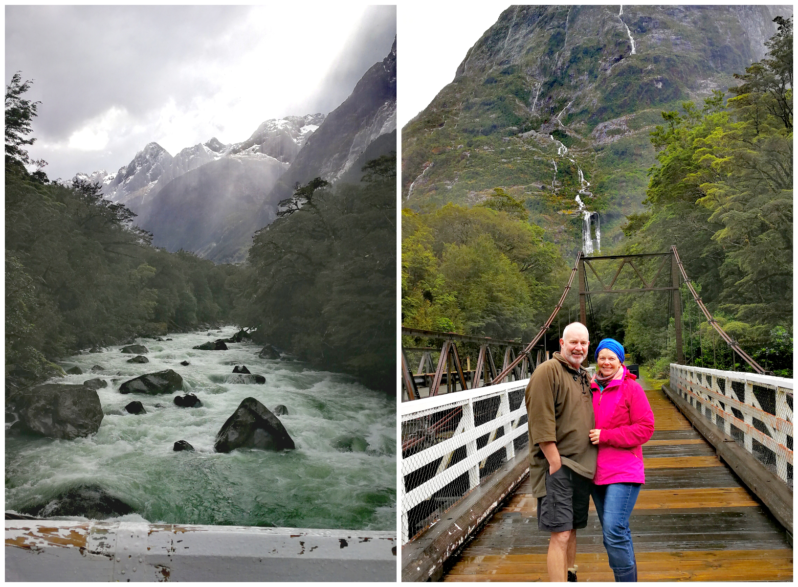
The ‘pedestrian only’ suspension bridge over the Tutoko River
The style of bridge, featuring steel towers with a timber deck and sides was commonly built over flood-prone rivers on the West Coast and Fiordland during the 1930s and 40s.
It was replaced by a more modern bridge in 1984 which could take heavier loads. Thankfully, the Tutoko Bridge was retained and restored in 2010 because of its historic significance. It is open for pedestrian traffic only and offers some pretty spectacular views.
The Tutoko River looking towards Milford Sound
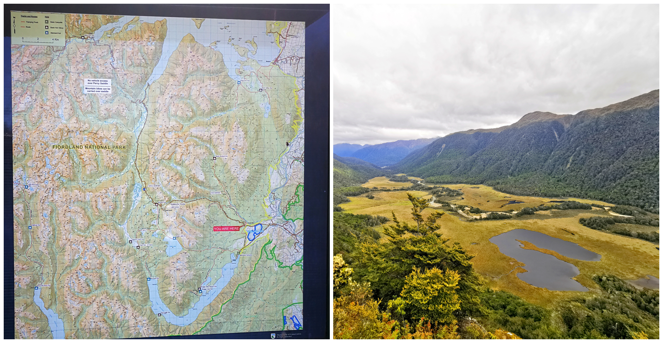
Borland Saddle via Lake Monowai
Lake Monowai
Located 70kms south-west of Te Anau is Lake Monowai. It is quite a large lake (31 square km’s) and is nestled in a long curved valley. Looking at the lake on a map, it appears like a letter ‘U’.
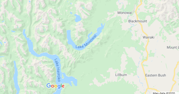
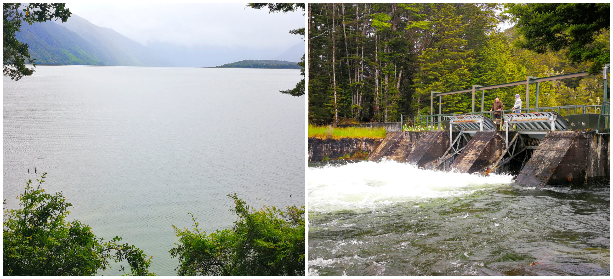
The two short walks will take you to the lookout and the small dam
It is surrounded by the beautiful mountainous terrain which makes it particularly picturesque and definitely worthy of a photo stop. There are a couple of short walking tracks, one to the small dam and the other to a lookout point which offers views across the still lake waters.
One of the South Island’s oldest hydroelectric stations is powered by the waters of the Monowai. It is located at the junction of the Waiau and Monowai Rivers and it was opened in 1925.
The Monowai DOC Campsite is a small free camping area. Be prepared to share your site with the sandflies.
Borland Road
The Borland Road which extends past Lake Monowai is a gravel road (44kms) which takes you across the Fiordland National Park and then over the wonderful Boreland Pass to the South Arm of Lake Manapouri. The steep hills and hairpin bends take you to the shores of Lake Manapouri.
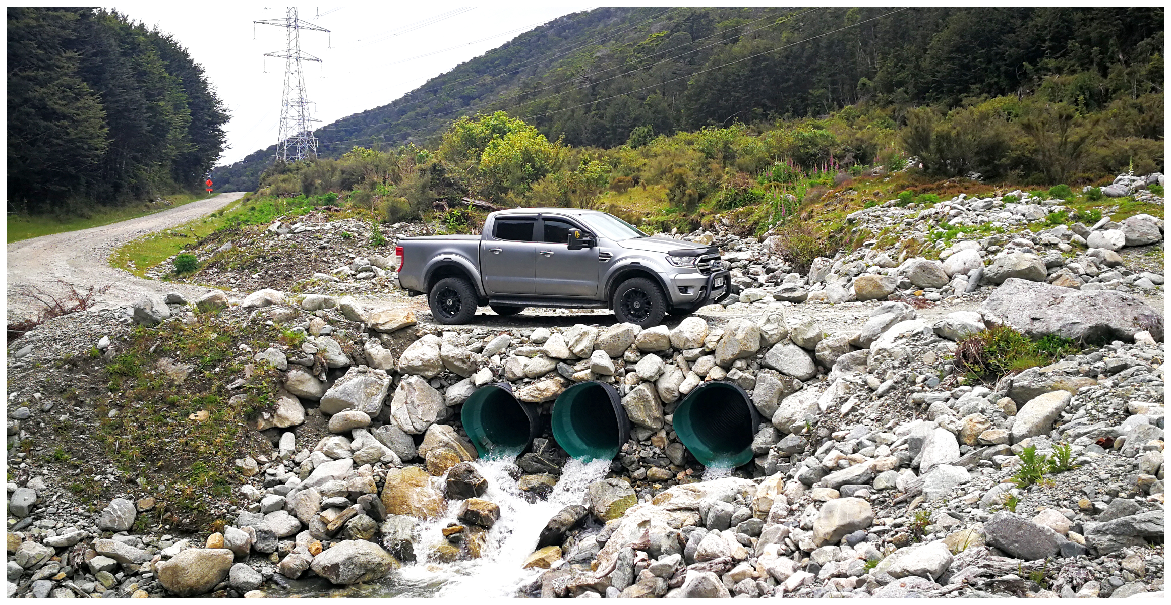
Although 4×4 not essential, it did come in handy
The road doesn’t bode well for motor homes or caravans. There is the option to camp at Borland Lodge (NZMCA#9143) and explore the area with your tow vehicle. Borland Lodge began life as the Pig Creek Hostel – providing accommodation for power project workers. On completion of the project, the buildings were left behind to become a valuable outdoor base for school groups.
Although we needed to engage the 4×4 a couple of times, it is doable in a 2×2 with some care (providing you have good clearance). The road does not connect any towns. It is a real wilderness road. The only reason it exists is thanks to the hydro-electric power station on Lake Manapouri. The Borland Road is a service road created to maintain the electricity pylons that also follow this route. Construction of the road started in 1963 to develop and service the Manapouri Power Station and the transmission lines went live in 1971.
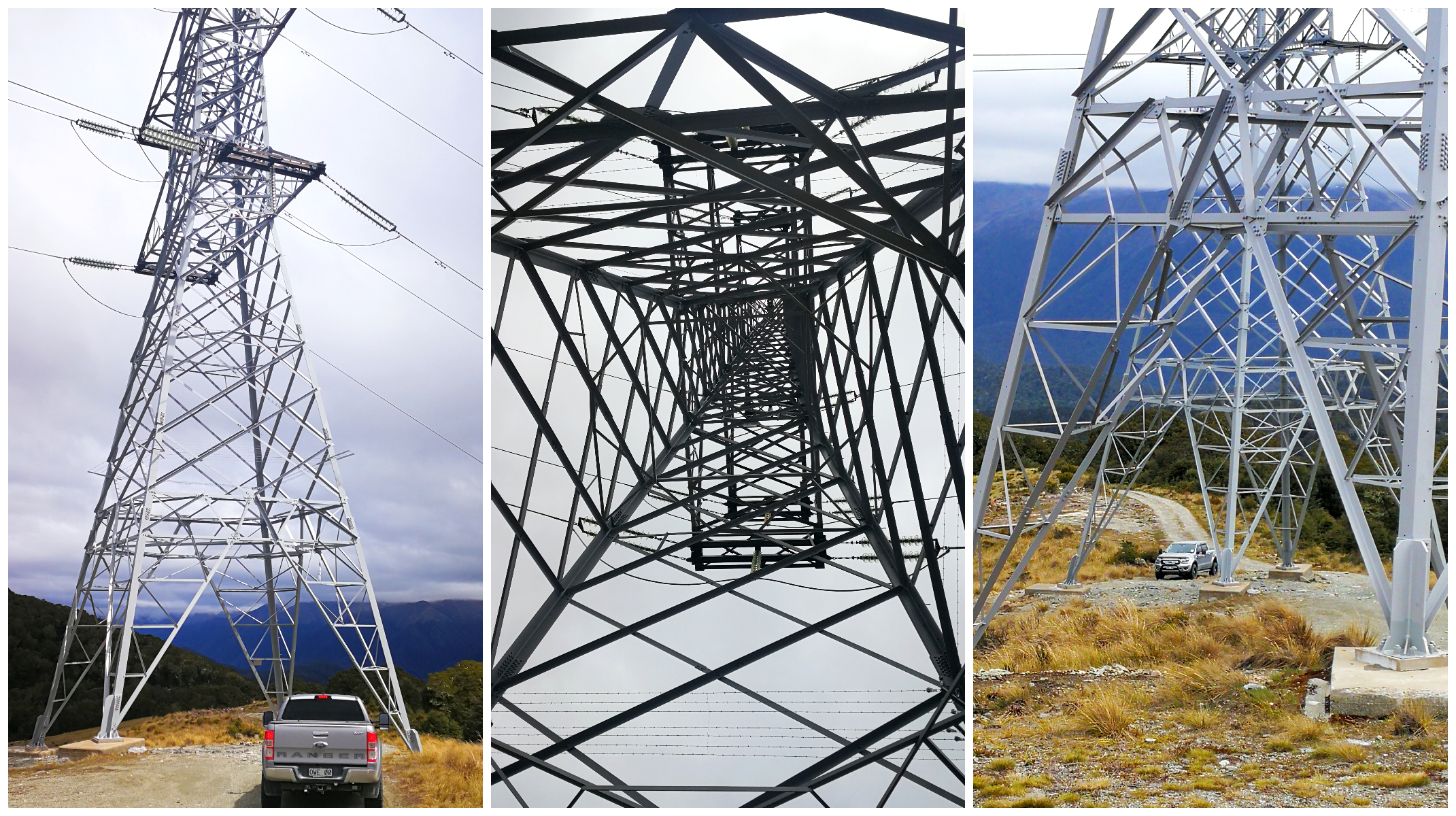
It’s all about the pylons, the very reason the road is in existence
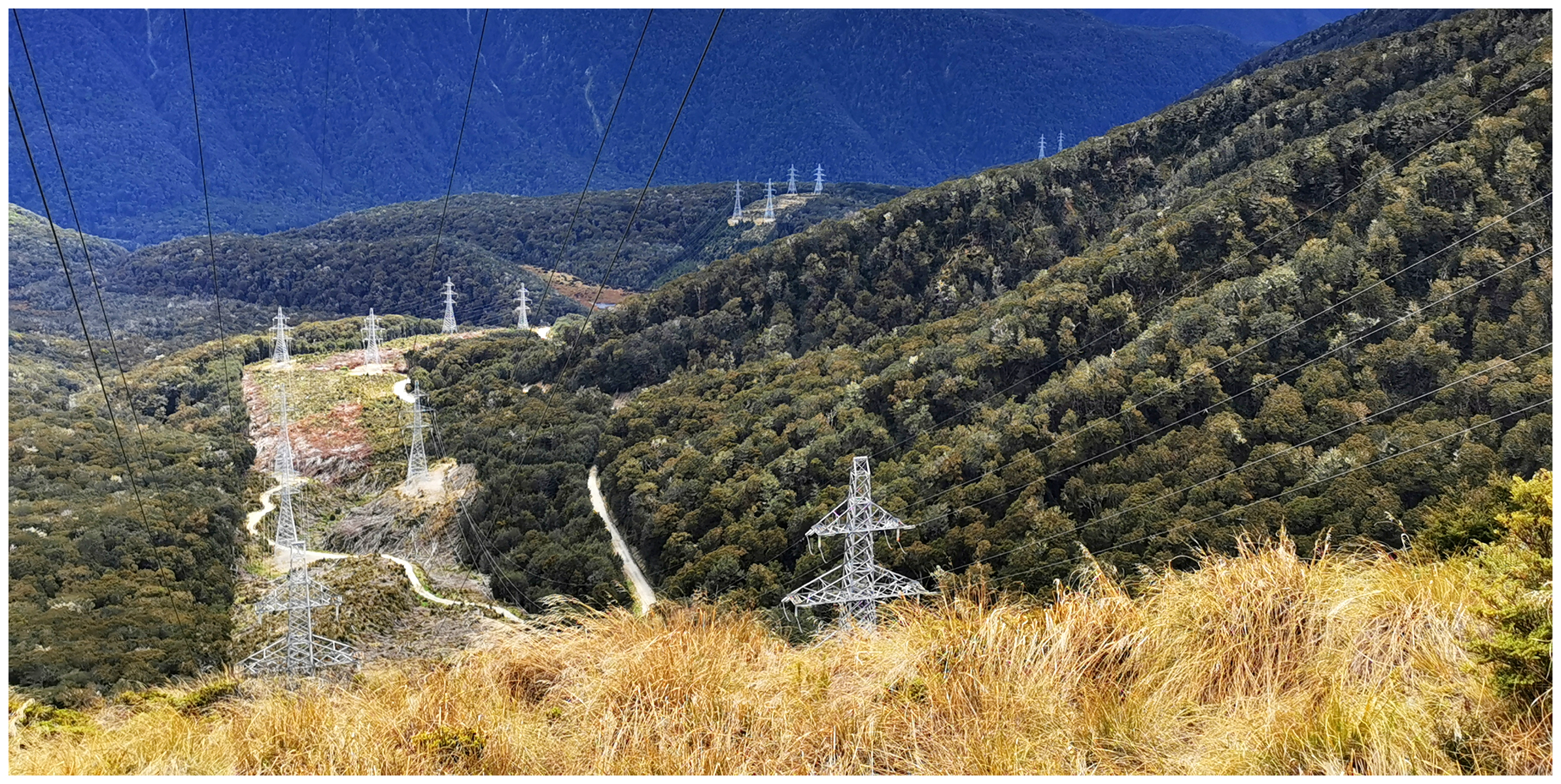
The pylons stretch from Manapouri to Tiwai Smelter in Bluff….160km in total
Borland Saddle
The Borland Saddle is 990m above sea level. We decided that this was the ideal spot for a ‘tailgate picnic’ (our favourite style of eating whilst exploring). The ute is reversed up to the most stunning scenery we can find, tailgate dropped, mat laid down and we have a grandstand view! A little like being in the ‘corporate box’ during a concert.
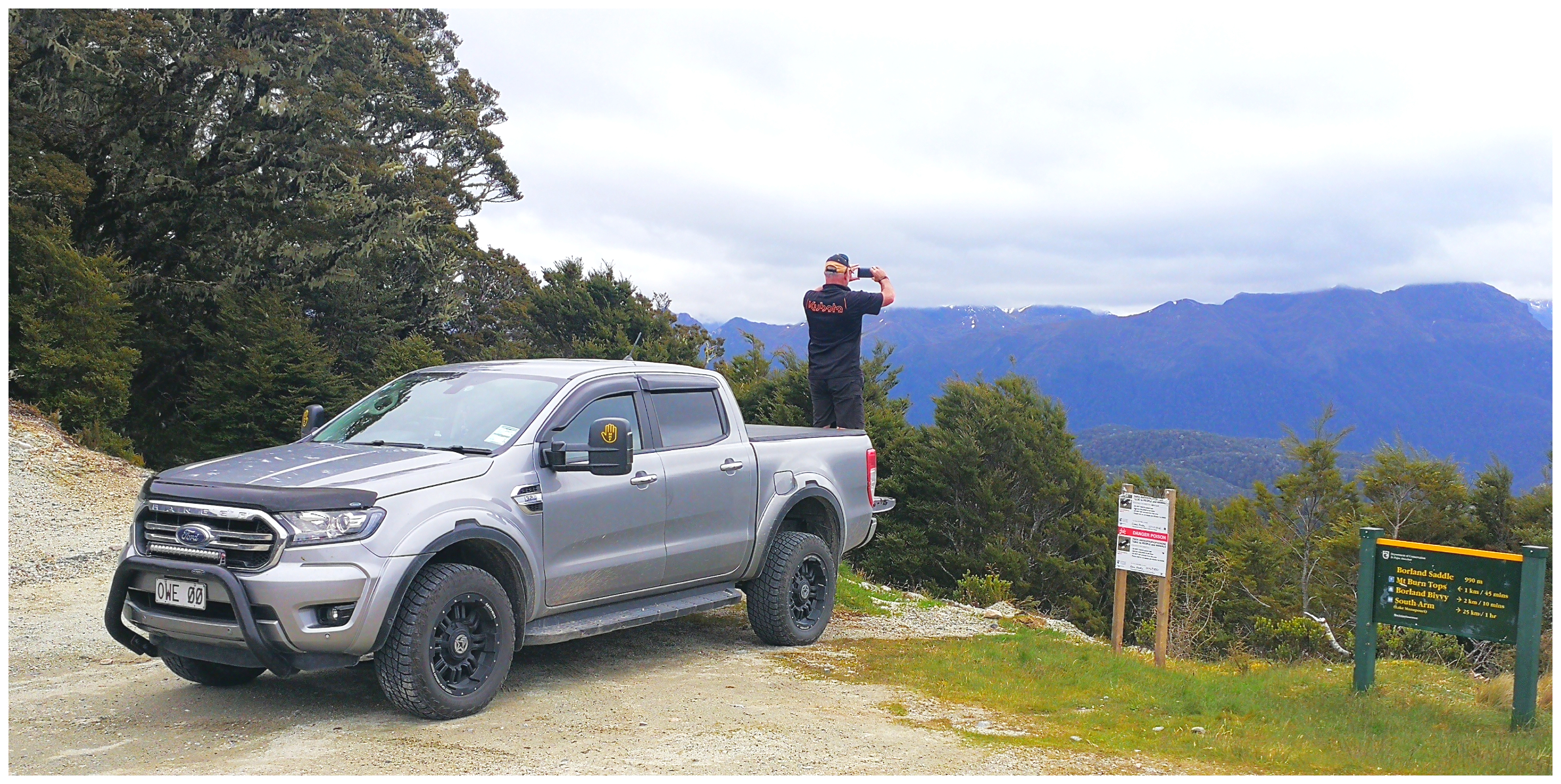
A grandstand view of a world record landslip
Stopping at the top of the Borland Saddle, we looked down the Grebe Valley at a World Record! Around 13,000 years ago, the earth shook and 27 cubic km’s of a mountain collapsed and fell in front of where we were sitting. It is the largest documented landslide of its type IN THE WORLD!! Scotty had to stand on the tailgate to get that perfect shot.
There are several walks you can do along the way including the Borland Saddle Alpine Walkway. This hike takes you past some pretty spectacular Tarns. We saw glimpses of the alpine Tarns in the distance but time constraints and dodgy weather prevented us from wandering too far from the ute. Under the right conditions, the photos would be spectacular.
It’s not very often you get to see a World Record landslip, get up close to pylons and travel one of the most remote roads in Fiordland.
Alpine Tarns just some of the spectacular scenery
South Arm
After a slow, winding and steep gravel 44km you reach the South Arm of Lake Manapouri. We had to take the ute for a bit of a swim to reach a small clearing where hardy campers had obviously set themselves up. Unfortunately, some had made themselves at home a little too much and had left behind their calling card……empty cans and rubbish. We spent some time picking it all up and bagging it to take with us. Such a shame that anyone (whether they are locals or tourists) feel the need to ruin paradise.
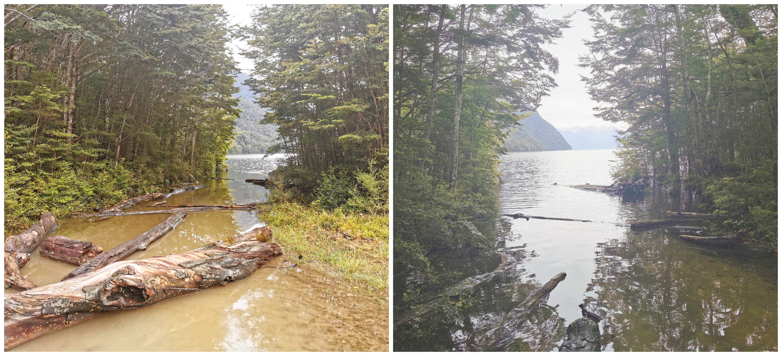
the flooded South Arm of Lake Manapouri
Because of the intruding lake levels, we couldn’t explore the ‘end of the road’ too much so retreated back to the ute to make the journey back. Luckily the water levels didn’t exceed the height of my gumboots!
A Good Old Fashion Christmas Parade
As our stay in Te Anau drew to a close, we thought we’d pay a visit to the local Christmas Parade.
It’s been many, many years since we’ve attended a small-town Christmas Parade. What a breath of fresh air it was to see the locals gather and participate in the annual event.
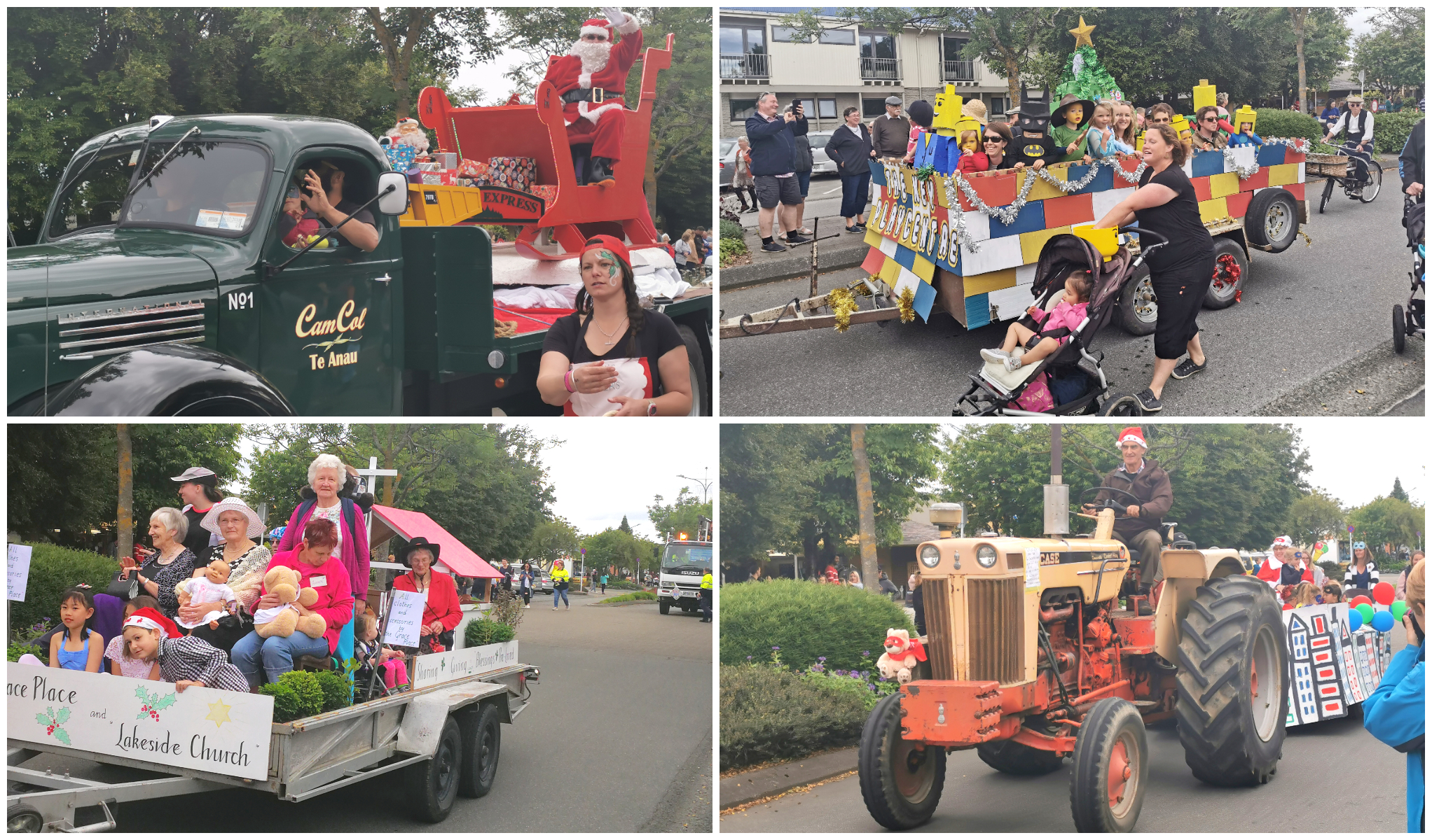
Parades, how they used to be. They even threw lollies and no one got hurt!!!
It was a parade which reminded me of how it used to be before the PC Police stepped in and deemed good fun much too dangerous. It seemed all the children of Te Anau and surrounding districts turned out donned in all sorts of costumes. The adults embraced the festive activities and showed no shame in ‘rocking out’ in all sorts of ‘get-ups’.
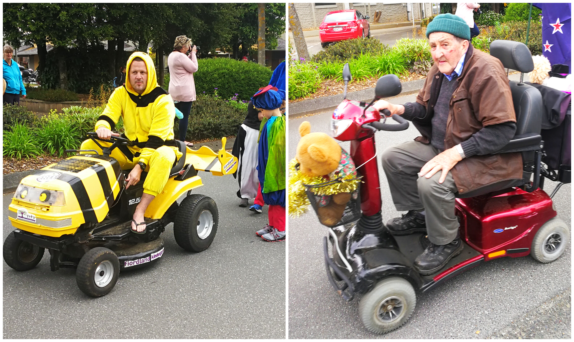
My favourite floats – Dad Bumblebee and Grandad on his scooter.
My favourite would have to be the ‘Dad’ dressed up as a bumblebee. He was on a ride-on lawnmower and called himself a ‘float’. Then there was the elderly pensioner on his mobility scooter. It was decorated in tinsel. His smile was wide and he was having a great time taking his place in the parade.
There was a Christmas Market, a stage with music, and of course heaps of food stalls and a great local turnout.
Summary
Although the weather dealt us a savage blow, it didn’t deter us from extending our stay in Te Anau to 10 days.
Keep an eye out for my next blog when we treated ourselves to our yearly extravagance! We went on an overnight charter on Doubtful Sounds.
Click on the link below for a video of our highlights.
Enjoyed your blog on TeAnau and surrounding areas.
Met up with you at Edendale Crankup and some of Southland rallies.
Oh thanks Joan! I remember us meeting up. Appreciate your feedback and hopefully, our paths will cross again in the near future.
Just stumbled accross your blogs, just read the tuatapere and now the te anau
My favourite corner of nz, we were in south arm looks like a few days after you, we generally make a habbit each year to setup in the old nzec workshop building for 4/5 days each year, was the old guy setup with his caravan at the grebe look out when u were there?
Hey Stuart, thanks for your feedback and yes, I can understand how it’s your favorite spot in NZ!! Pretty special to go to the old NZEC workshop each year. We’ve watched quite a few YouTube videos on how it all looked when they were building it all! And yes, that caravan was at the lookout but no one home. What a spot eh???