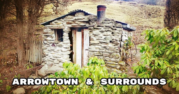
After pressing pause on our explorations of the Catlins (see our previous blog here), Arrowtown was next on our sights. When it comes to Arrowtown for us, it’s a case of ‘never say never’!
The Timing was Right for Arrowtown
Now, we admit that we’re not fans of the Queenstown/Arrowtown area. It is not the easiest place to get around or park, nor is it the cheapest destination when it comes to camping options.
We prefer to ‘go bush’ whenever possible and we don’t make it a secret that we love ‘small town’ NZ rather than large cities and towns.
In order to live our lifestyle, we need to have budgeting in mind and anything that we spend money on has to be value for money and in our eyes, be worth the expense. We both agreed that we were overdue for a ‘treat week’ and decided Arrowtown would be an ideal spot.
Reduced Visitor Numbers
We had been toying with a visit/stay at either Queenstown or Arrowtown due to the fact that there are way fewer foreign visitors in the country. It would make a visit to this area a lot more manageable. Then came along the ‘Auckland Lockdown’ and that ‘sealed the deal’ for us. Let’s make the most of yet a further decline in visitors and take advantage of a situation that may (or may not) ever crop up again.
Arrowtown’s main street was still relatively busy
Arrowtown Holiday Park
After doing some research, we came to the conclusion that the camping ground prices were still up there for a powered site. As this was our ‘treat week’ we settled on the Arrowtown Holiday Park. This is a Top 10 camping ground and in all our time of living full time on the road, we’ve never stayed in one as they have been cost-prohibitive.
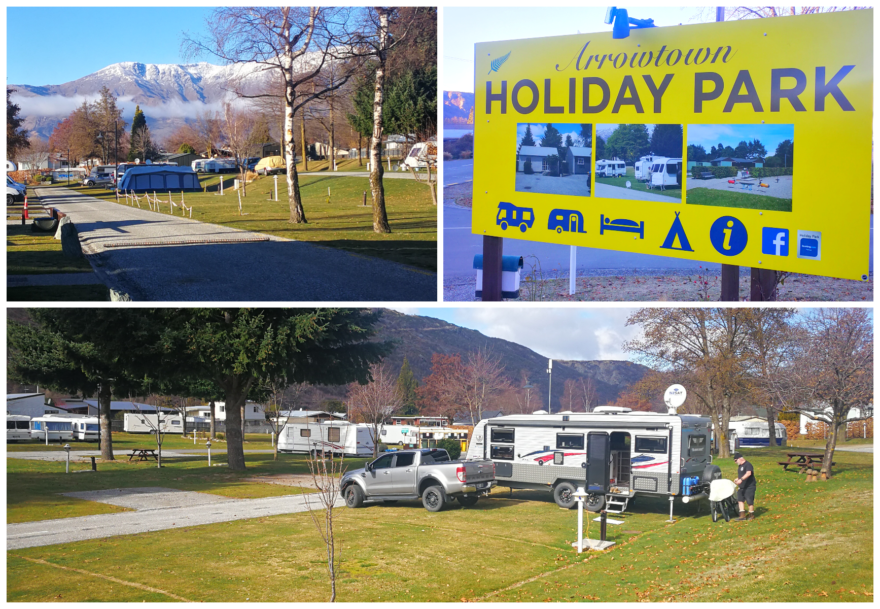
Well maintained, clean, modern and perfectly located, thumbs up to the Arrowtown Holiday Park
The Arrowtown Holiday Park was offering a special of ‘pay for two, stay for three’ nights. This worked out at $90 for three nights which we thought was pretty reasonable for this area.
What we liked about the camping ground:
- easy access for larger rigs
- friendly Managers and very informative when checking in
- flat sites, with some being hardstand
- our site had its own water supply
- extremely clean and modern ablution blocks
- during the time of our stay, the showers were free (usually $1)
- free daily wifi to a maximum of 100MB
- a short 15-minute walk to Arrowtown township and Arrow River
- public bus stops close-by so easy transport to Queenstown (free during our stay)
- close to various cycle and walking trails (more on this later in the blog)
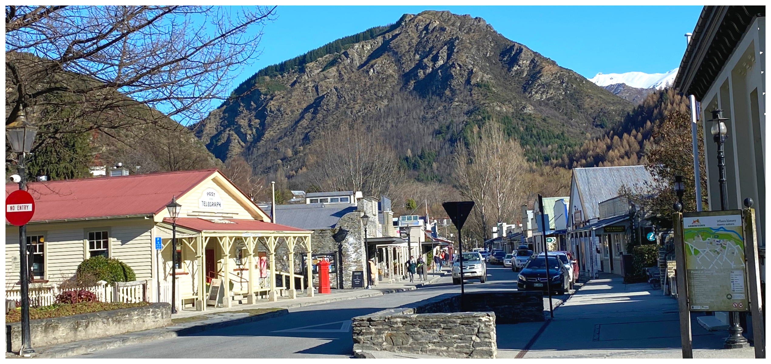
What’s So Special About Arrowtown
I have to admit that I’ve always been a little bit enchanted by historic Arrowtown. It is where history meets nature and is only a 25-minute drive from Queenstown.
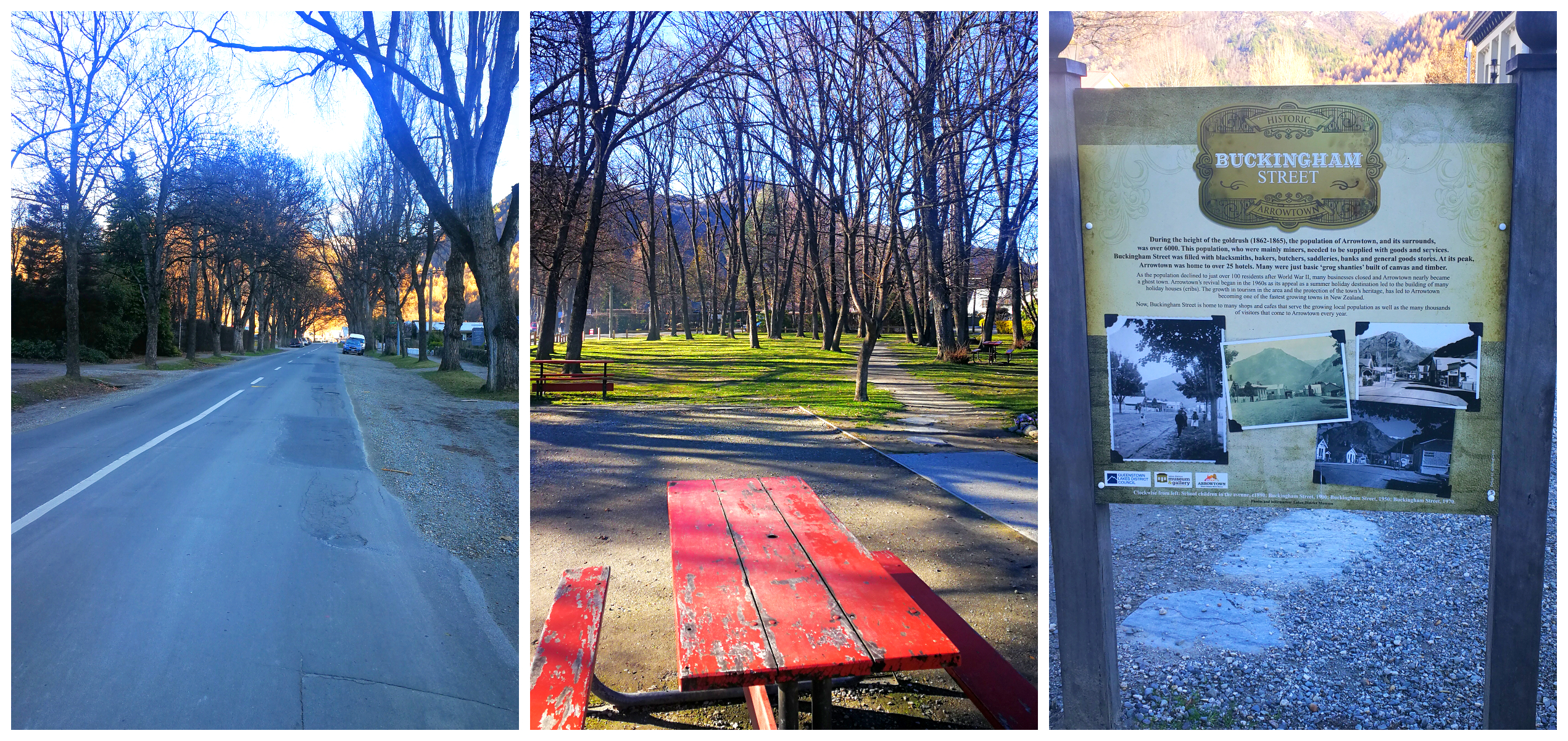
just a short 15-minute walk from basecamp, along tree-lined streets
In ‘normal’ times, it always seemed to be heaving at the seams with visitors. However, with all its popularity, it is still charming and quirky with a procession of heritage buildings that stretch into a tree-lined avenue of tiny miner’s cottages.
Buckingham Street is full of galleries, bars, restaurants and many classy boutique-style shops.
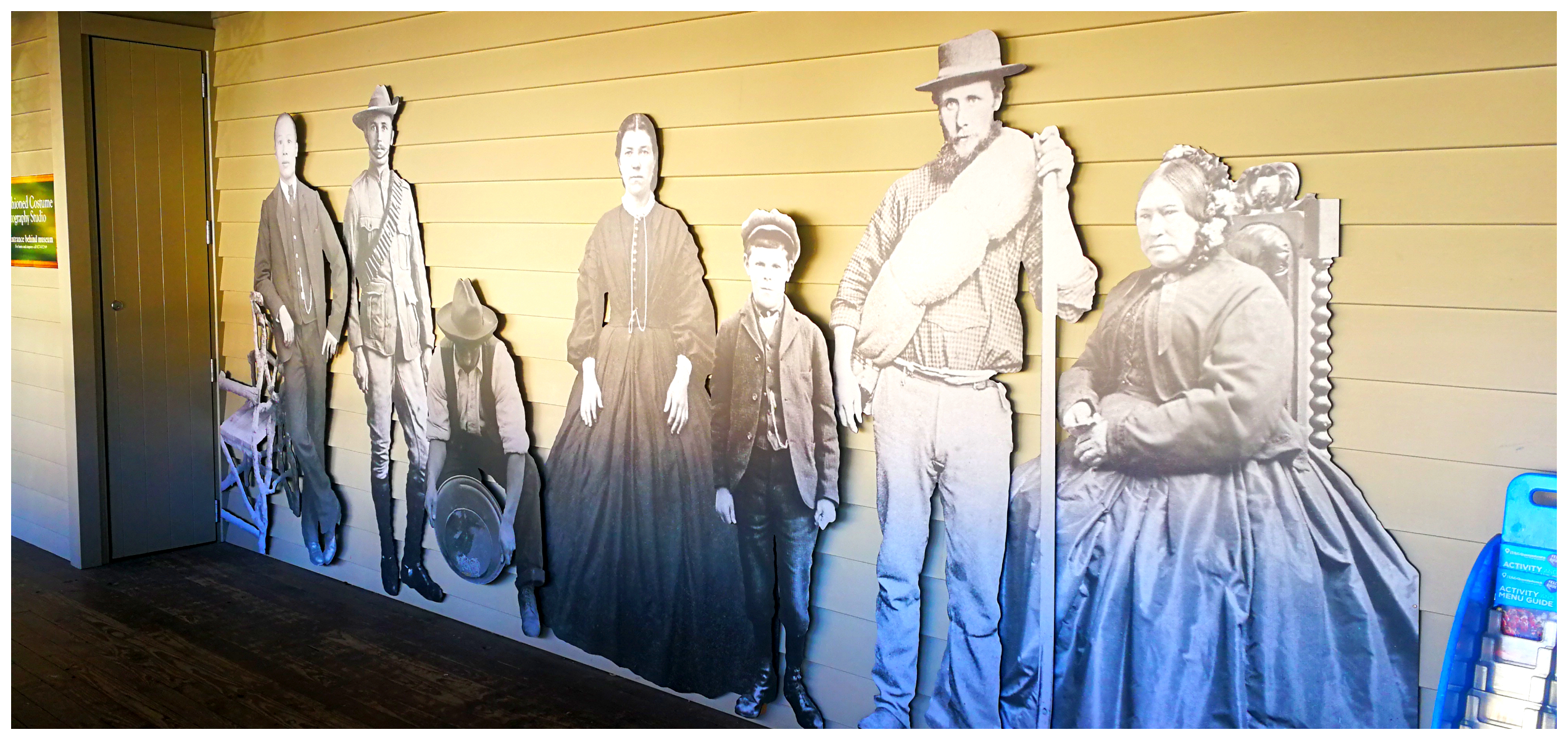
Arrowtown Museum
Although we’ve visited Arrowtown many times, we’d never actually been to the Lakes District Museum. Seemed like a great time to pay it a visit. It is also an Information Centre with loads of pamphlets and flyers on things to see and do in and around the district.
keep a lookout for the Lakes District Museum, well worth a visit
It was well worth spending time wandering the two floors with some amazing sets depicting what life was like in a goldfields town.
The building itself is quite fascinating. The museum was initially established back in 1948 in the billiard rooms of the Ballarat Hotel. It was shifted to its present site, the former Bank of New Zealand, in 1955. It now incorporates three historic buildings and covers two floors, depicting the harsh pioneering days of the European settlers and gold miners, through working displays.
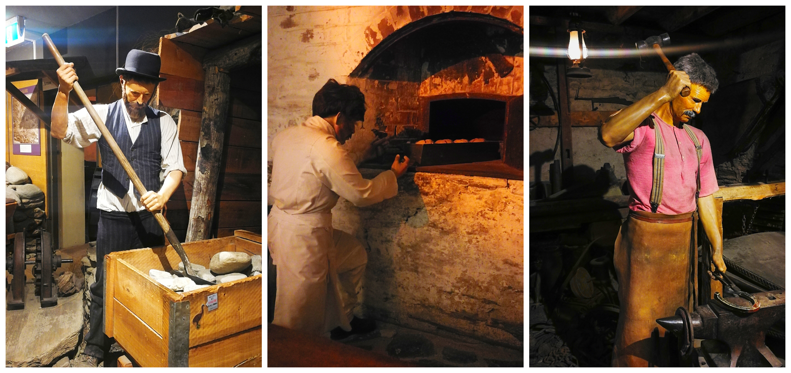
we met a few mates, a miner, a baker and a blacksmith
We Hit the Cycle Trails
Oh my goodness…….we were spoilt for choice when it came to choosing cycling trails in and around Arrowtown and Queenstown. They are all very accessible and right on our doorstep. The Lakes District has done a fantastic job in linking them all up so that you can join various trails at different points along the way.
Although we have apps and the advantage of the great wide web, there is nothing better than having a ‘real’ map to refer to get our heads around what direction we wanted to take. Click here for a great website which covers off many of the trails. We picked up a very informative pamphlet from the Information Centre at the Lakes District Museum and this proved to be our bible during our explorations by bike.
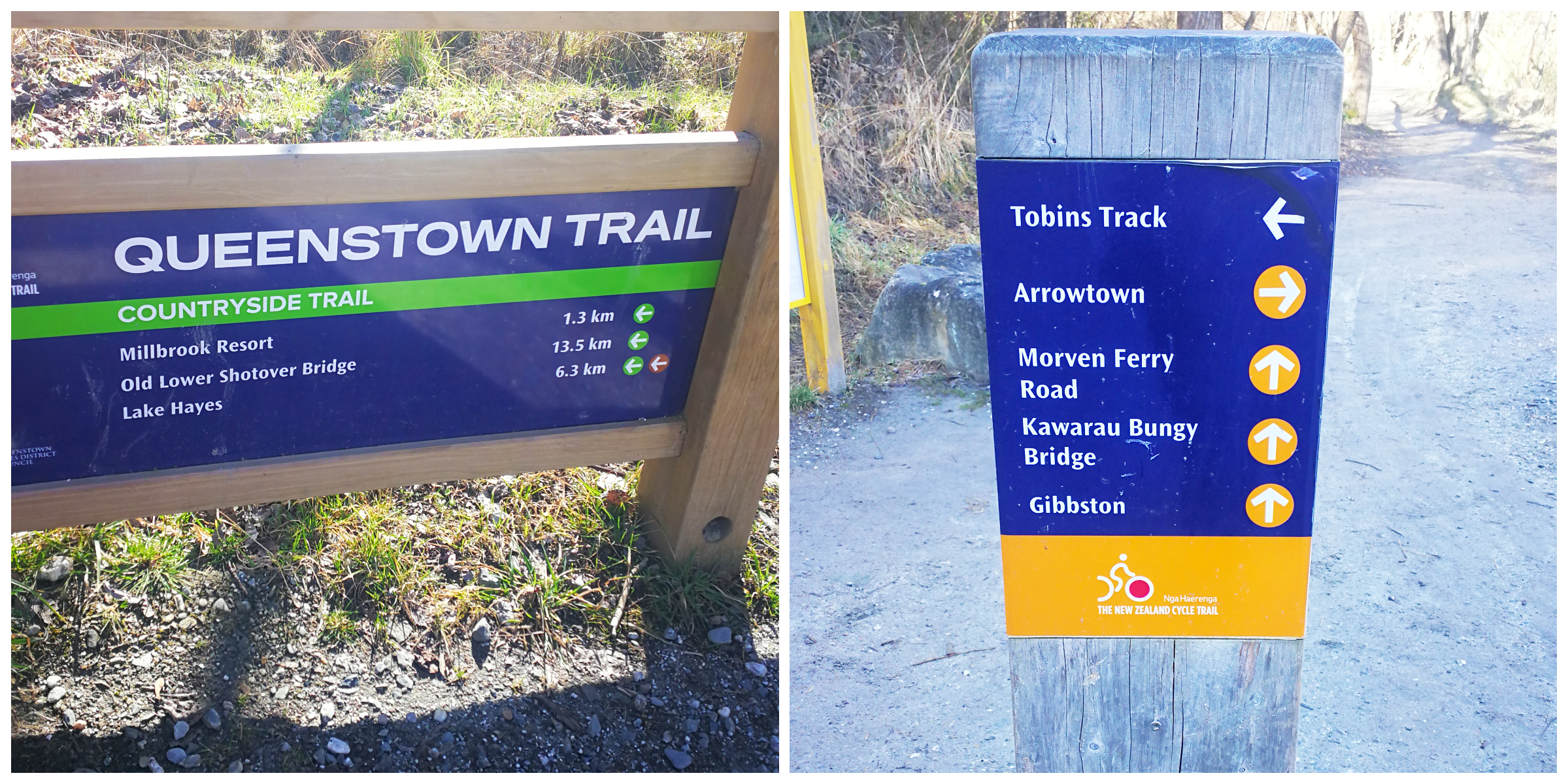
although there are a myriad of trails, there’s great signage pointing you in the right direction
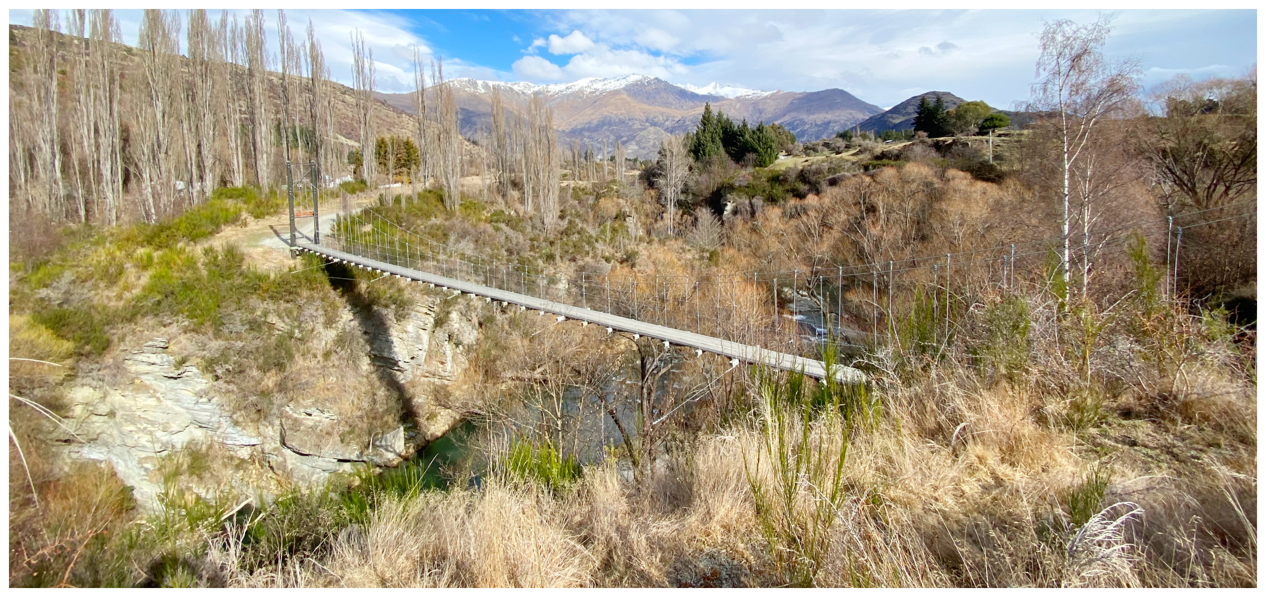
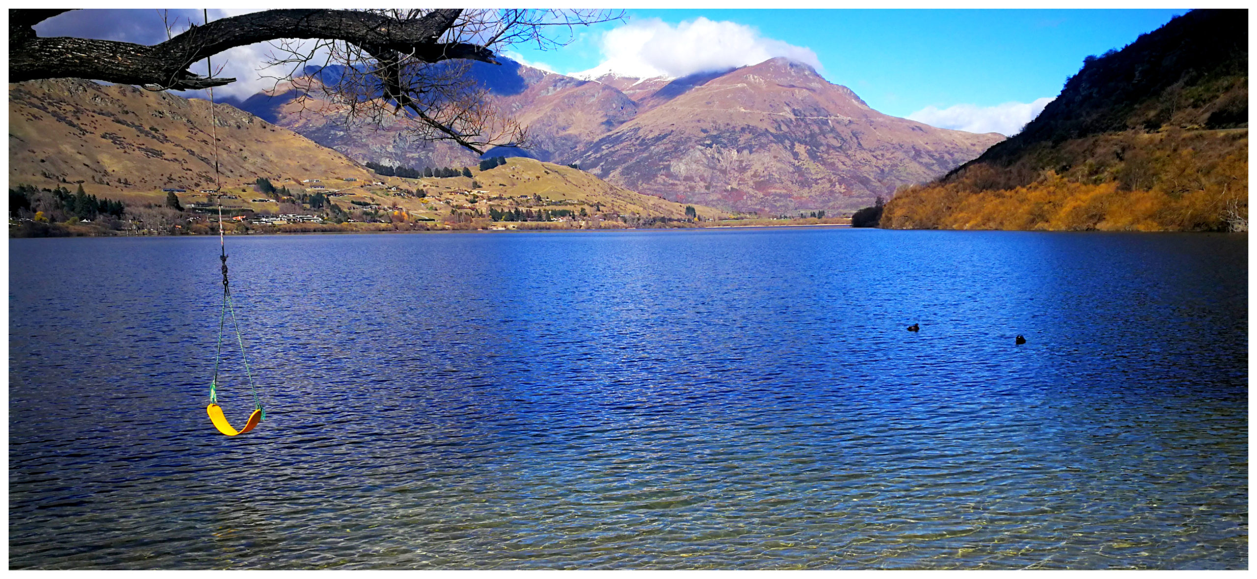
Arrow River Bridges Trail
The Arrow River Bridges Trail is a track that we have ridden before (about 6 years ago) and we remembered how much we enjoyed it. Seemed like a great idea to do it again to refresh our memories.
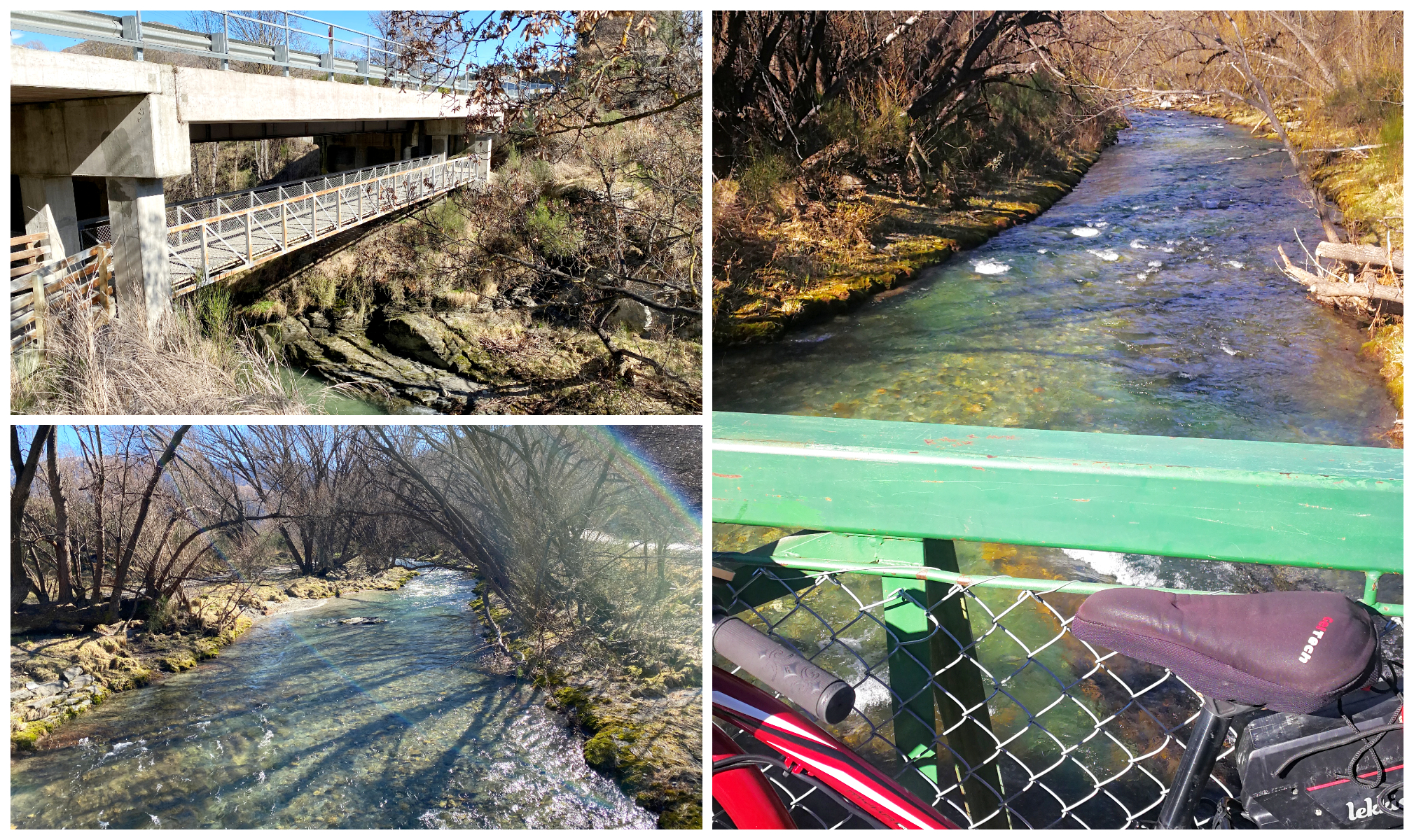
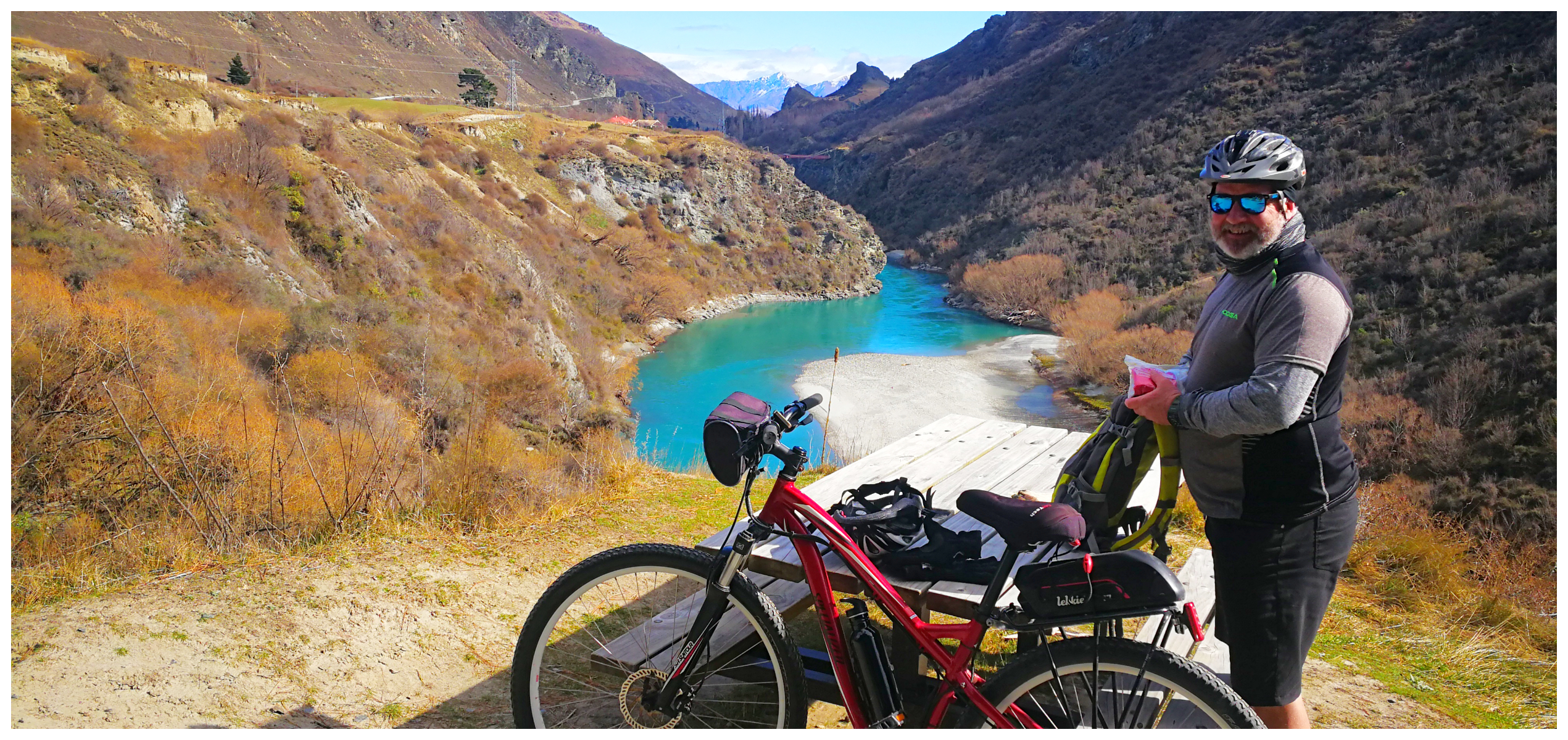
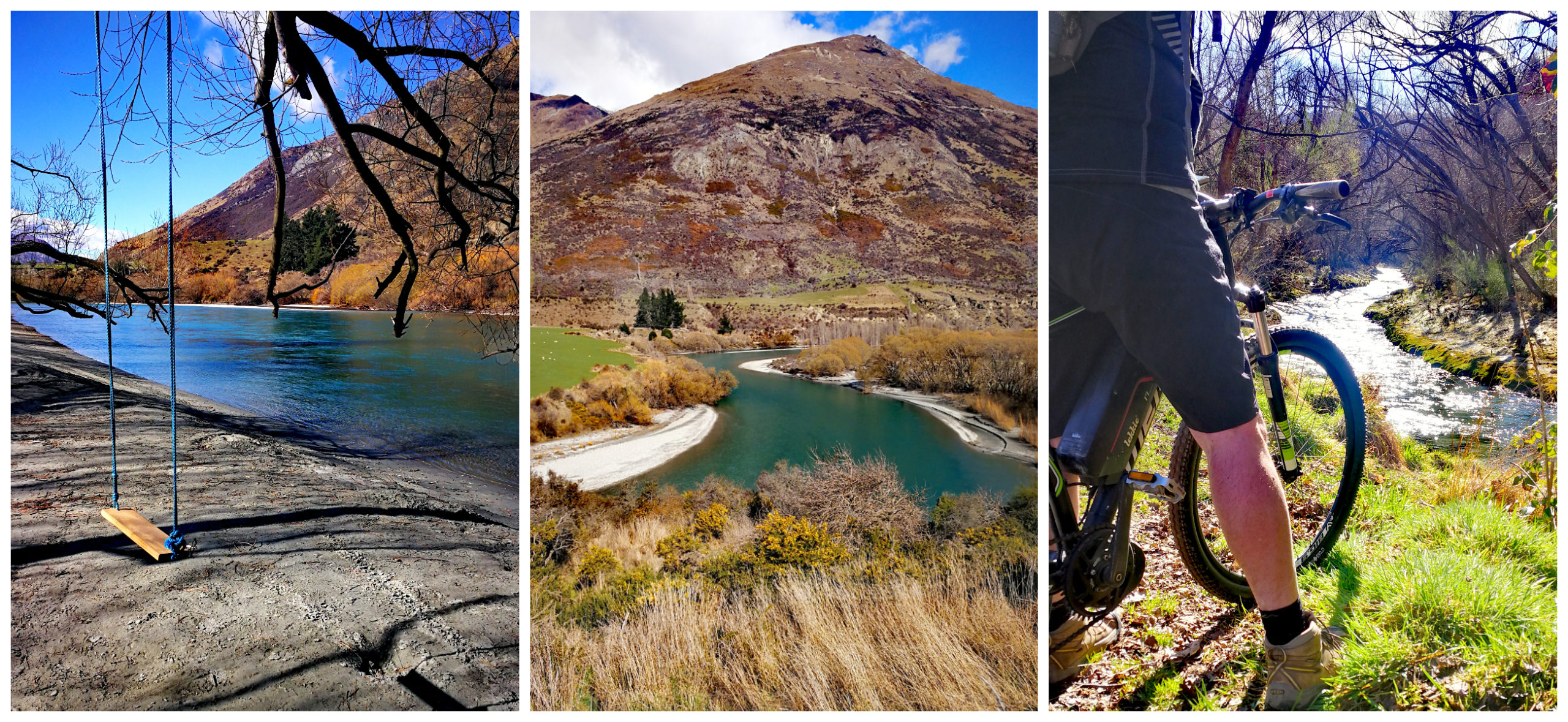
the track starts beside the picturesque Arrow River
This trail starts in Arrowtown and crosses a total of five bridges over the Arrow River as it winds its way to Gibbston Valley. It covers 13.7km (one way) and although a bit undulating, it is relatively easy and very scenic.
Bridges Galore
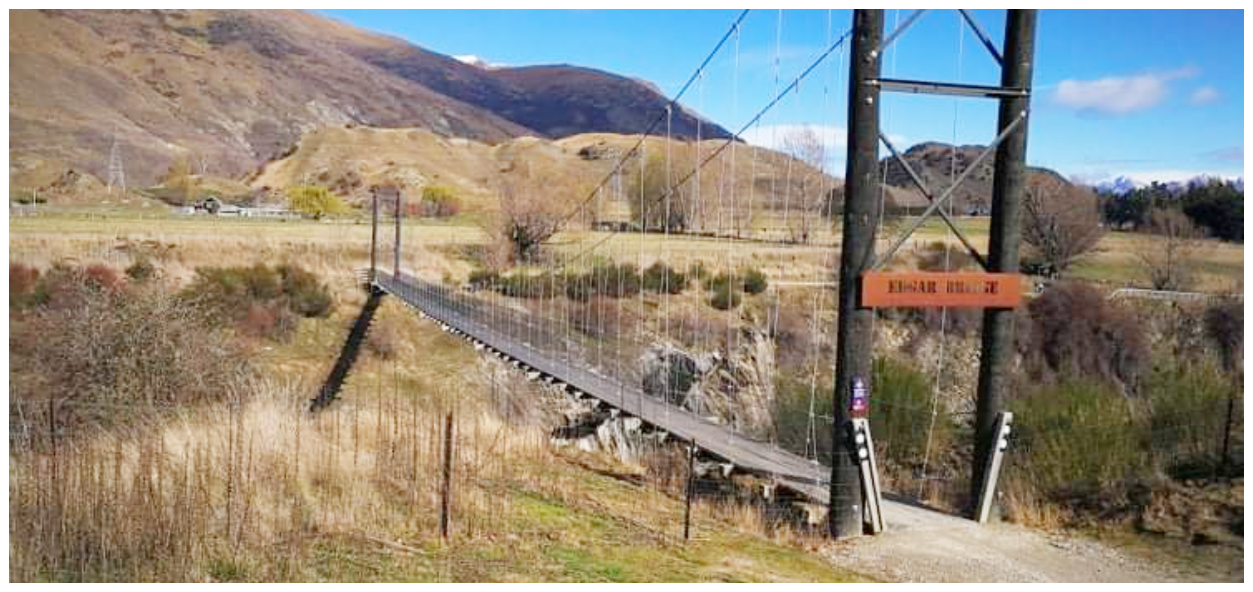
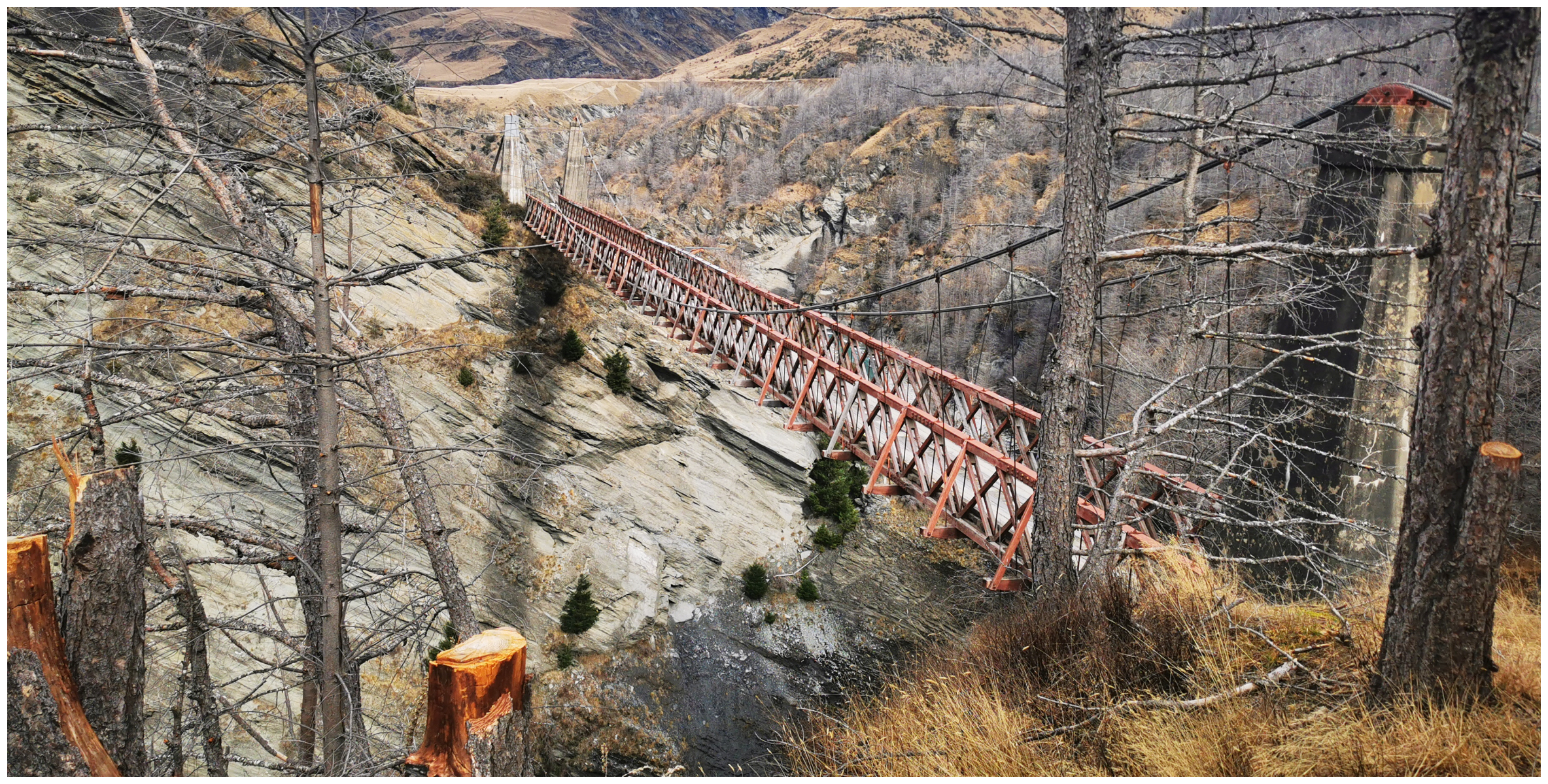
There’s no shortage of photo ops at each bridge. A couple of them certainly demands some concentration as you peddle your way across them. The Southern Discoveries Suspension Bridge and the awe-inspiring Edgar Suspension Bridge, in particular, offers some calendar shots down into the Arrow Gorge.
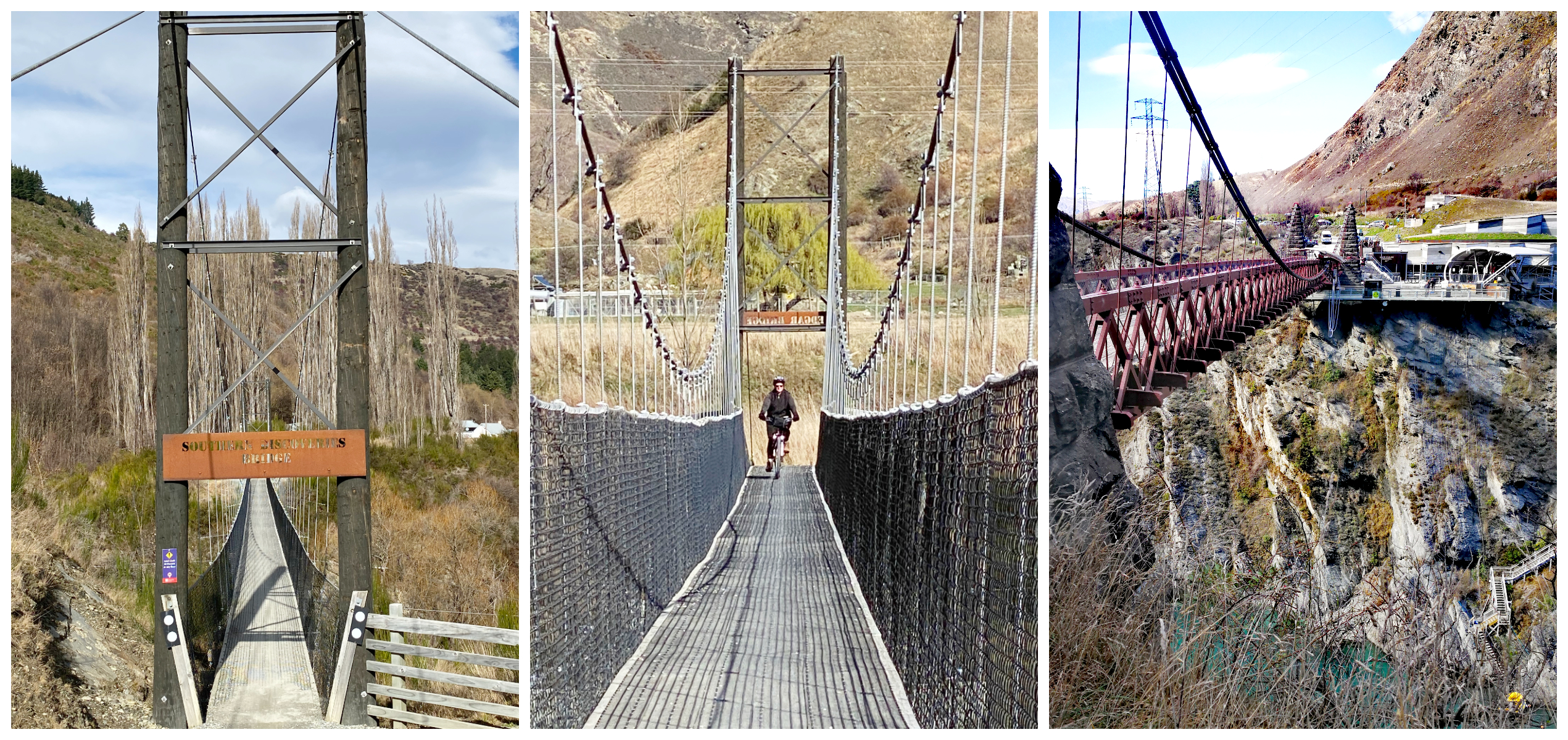
some concentration is required navigating your way over some of these suspension bridges!
Once we cycled the underpass beneath SH6, we continued along part of the trail which follows the original gold miners’ road into Queenstown.
it’s a long way down!
there’s been a lot of work involved building these bridges over the swift-flowing river
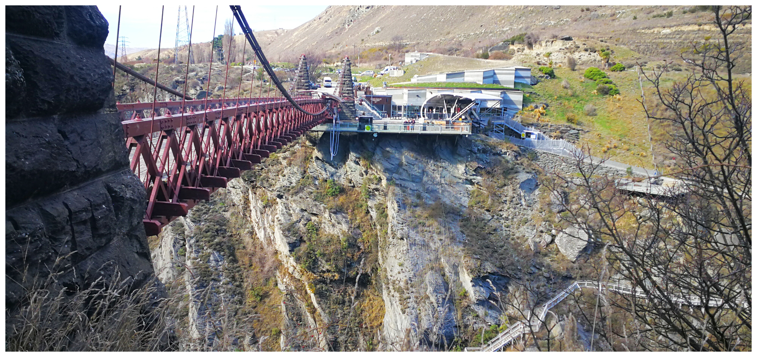
The historic Kawarau Suspension Bridge soon came into sight. This, of course, is the home to the world’s first commercial bungy jumping operation. The AJ Hackett Bungy Centre is normally heaving with tourists, but not so much today. It made our crossing of the bridge a bit easier as we passed the jumping platform.
the old Kawarau Bridge, the home of the AJ Hackett Bungy Jump
This is where this part of the trail finishes. From here, you can continue on to the next trail which is the Gibbston River Wine Trail.
Gibbston River Wine Trail
This section of trail is 8.7km (one way) and classed as ‘easy’. It winds its way high above the Kawarau River. We were now entering Central Otago’s premier wine-growing region. Gibbston is fondly known as the ‘Valley of Vines’.
there are some attractive spots for a picnic lunch along this part of the trail
As we cycled along, we glanced up to our right and could easily see the winding Chard Road which was cut into the rockface which takes you to Chard Farm Vineyard (one of my personal favourites). If you would like to call into this vineyard, a detour along this side road for a few km’s is required.
A bit further along the trail is another very attractive detour (only 600m) and you will find yourselves at Gibbston Valley Winery, Restaurant and Cheesery. It was difficult to stop my bike from turning to make the short detour, as I fought the urge to stop for a wee tipple. Having been there before, we preferred to keep going to get to the end of the trail…..sigh!
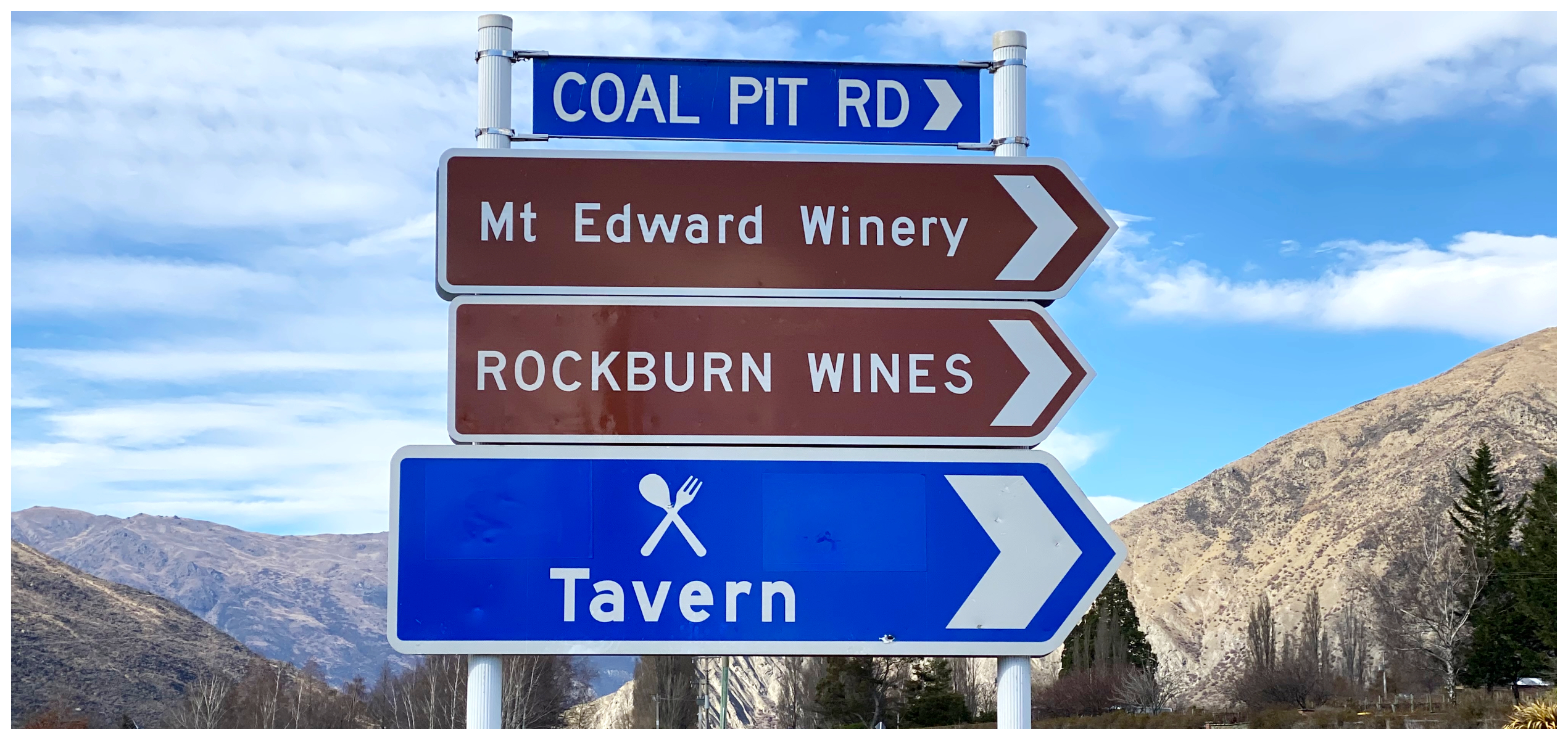
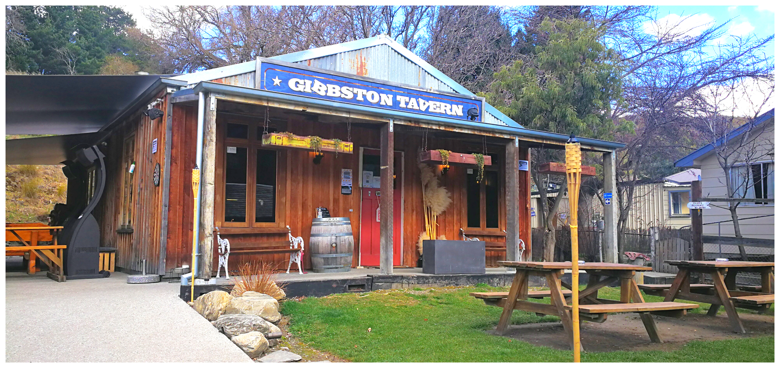
Gibbston Tavern
And like an oasis in the desert, we came upon the Gibbston Tavern located by the turnoff to Coalpit Road. If you were to carry on and reach Gibbston Back Road, you’ve reached the end of the trail. There are plans in the pipeline to continue the trail all the way through to Cromwell. Now that will be well worth coming back to do in the future.
it’s hard to ignore a sign that says ‘Tavern’!
As this was to be our ‘turnaround’ point, we agreed that the tavern would be an ideal waterhole.
With all the character of an authentic 1800s tavern, it isn’t the original structure. It is, however, sitting on the site of the single-story wooden hotel which was built in 1867. It was popular with the miners making the arduous journey from Cromwell to Queenstown. The coach went right past the hotel’s front door.
our oasis at the end of the trail
As was quite often the case back then, it burnt to the ground in 1912 and was never rebuilt. There was, however, a total of five hotels in the Gibbston Valley so plenty of others took its place.
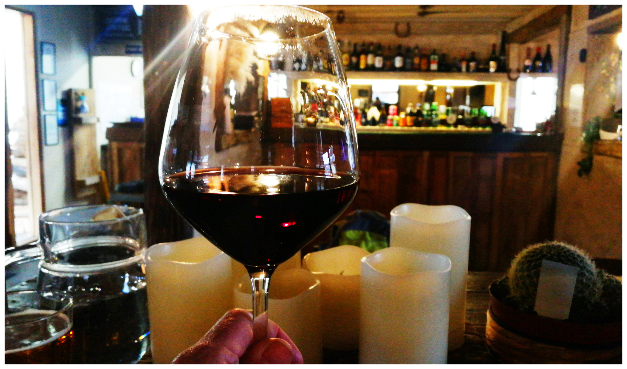
a glass of local Pinot went down a treat
My wee drop of local Pinot Noir didn’t even touch the sides as we prepped ourselves for the cycle trip back to basecamp. By the time we arrived back in Arrowtown, we had clocked just over 37km.
Tobin Track
Taking advantage of the fine weather, it was back in the saddle for us. Although not part of the Queenstown Trails, the Tobin Track is a popular trail that can either be walked or cycled (particularly handy if you have an e-bike!).
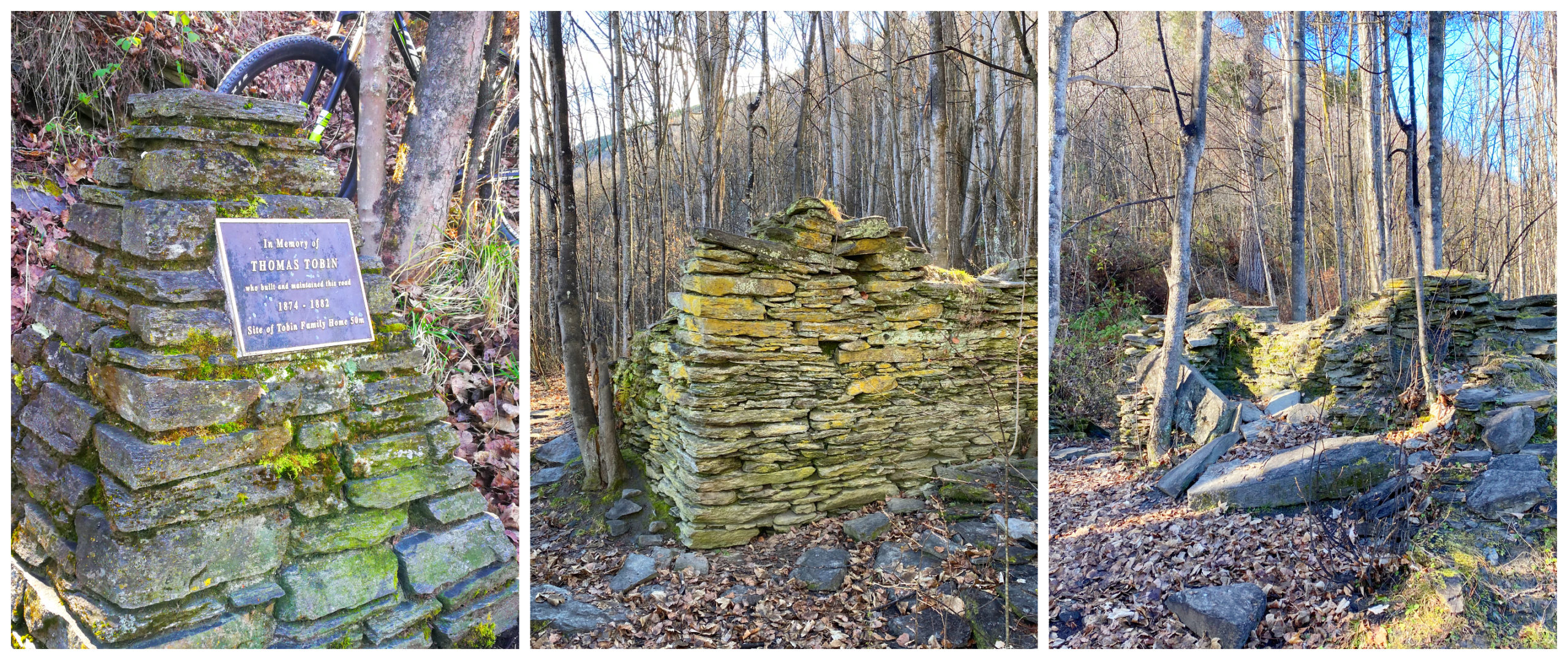
the memorial plaque marks the entry track to view the ruins of Tobin’s house
The trail was originally built by Thomas Tobin. The remains of his house can still be seen a short distance up the trail. He built and maintained the access track which took travellers to Wanaka.
If walking, it will take you around 30 minutes, all uphill. It was a constant slog for us to reach the top. It would have been way worse (if not impossible) if we didn’t have e-bikes that’s for sure!
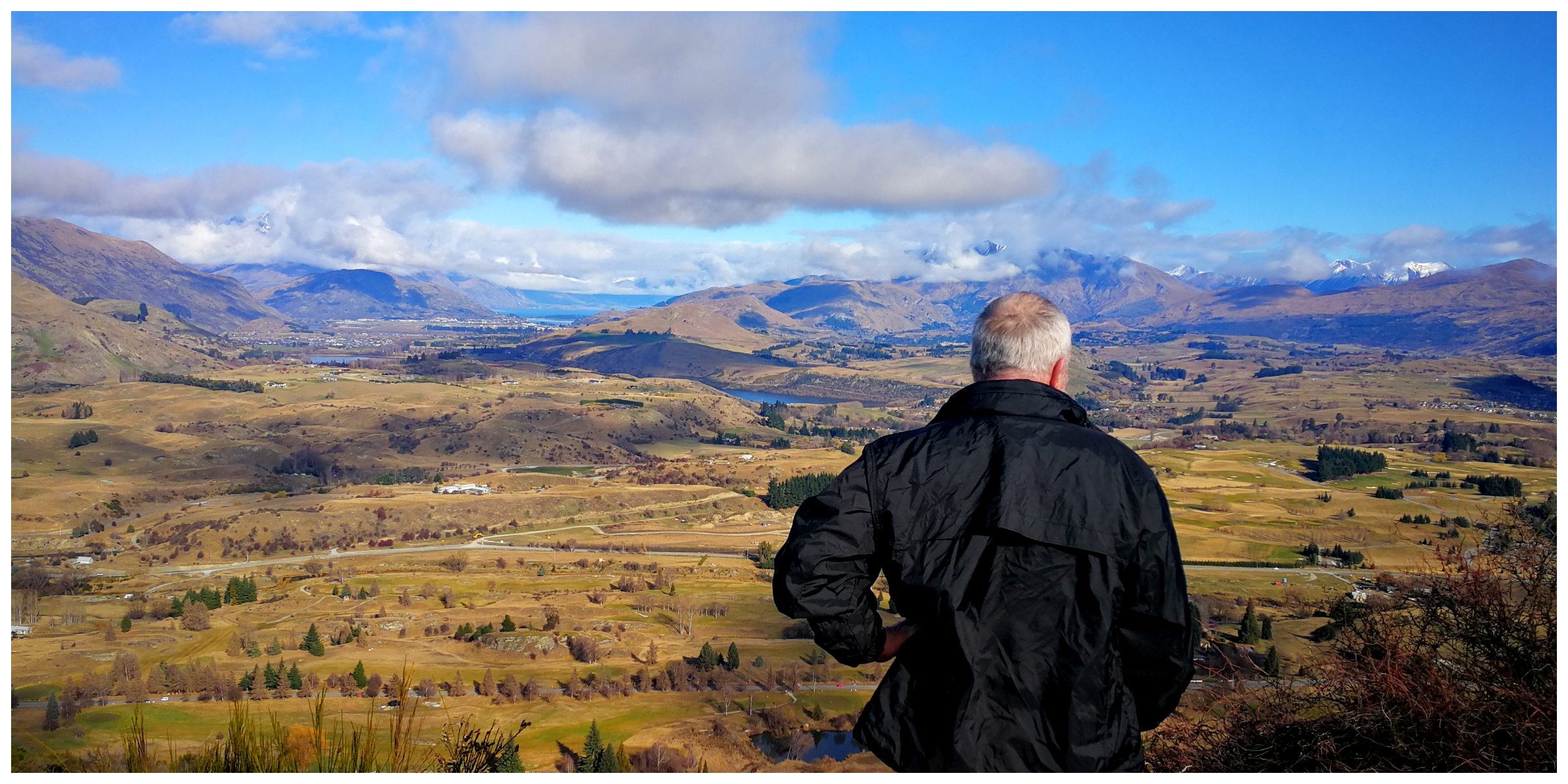
the Wakatipu basin stretched out before us
The steep climb rewarded us at the top with spectacular views over Arrowtown and the wider Wakatipu Basin. A trig station and a couple of seats are provided, just to sit, reset and enjoy the views.
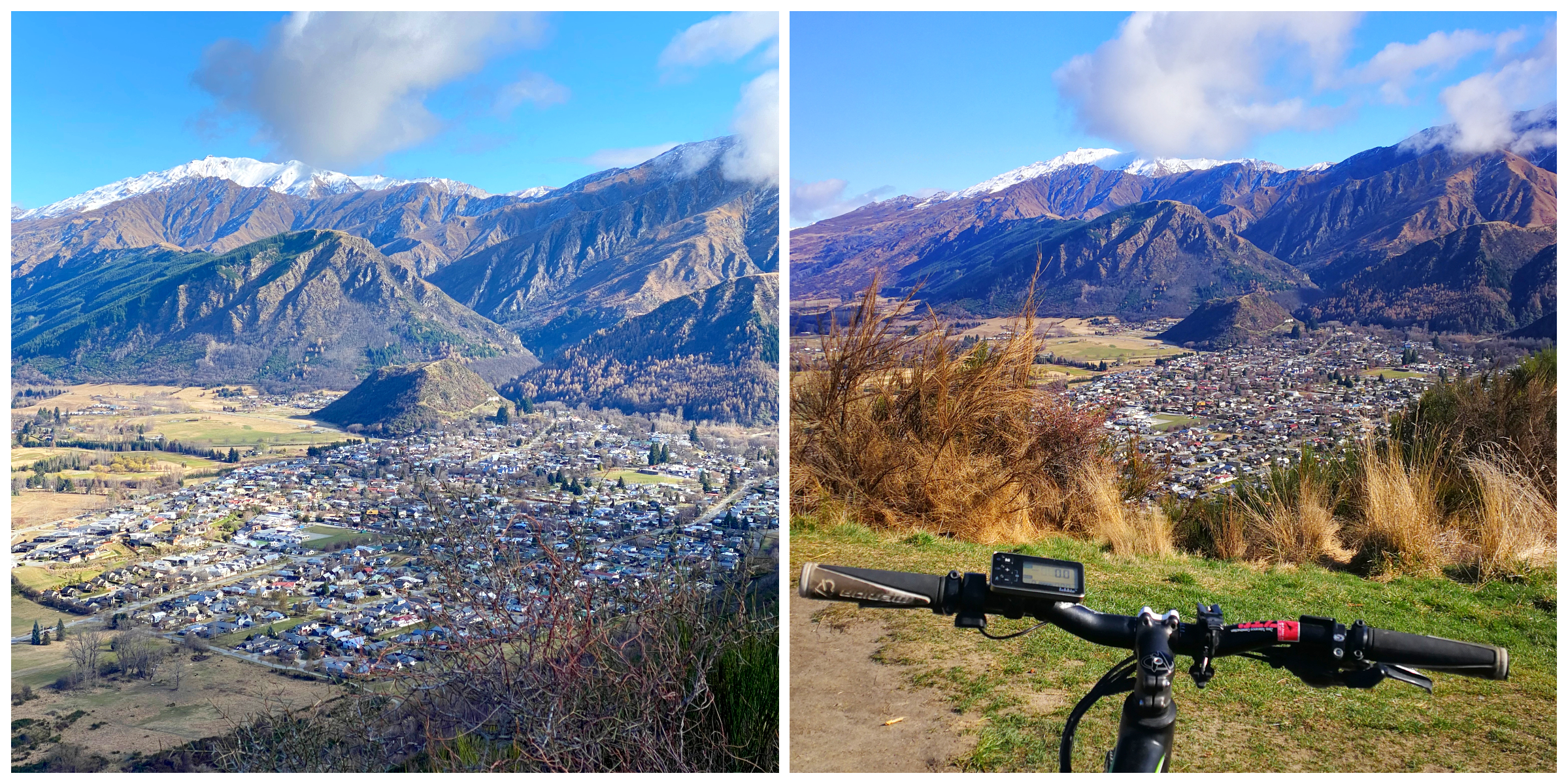
Arrowtown nestled amongst the towering mountains
We returned down the way we came. Going downhill was a bit challenging and I’m sure the brakes on my bike got rather hot by the time I reached the bottom of the hill.
Countryside Ride
After the Tobin Track, we found ourselves at the start of the Countryside Ride. If you wanted to do this track from start to finish it covers 13.5km and you would end up at the historic Shotover Bridge.
We wanted to divert off this trail to join up with the Lake Hayes Circuit Track. However, before getting to the junction we cycled through the iconic and beautifully landscaped Millbrook Resort. The trail is well-signposted, indicating where we needed to go to keep to the trail.
cycling through the pristine landscaped grounds of Millbrook Resort
It is probably the closest we’ll come to stay at this rather posh resort. I wouldn’t have a thing to wear anyway!!!
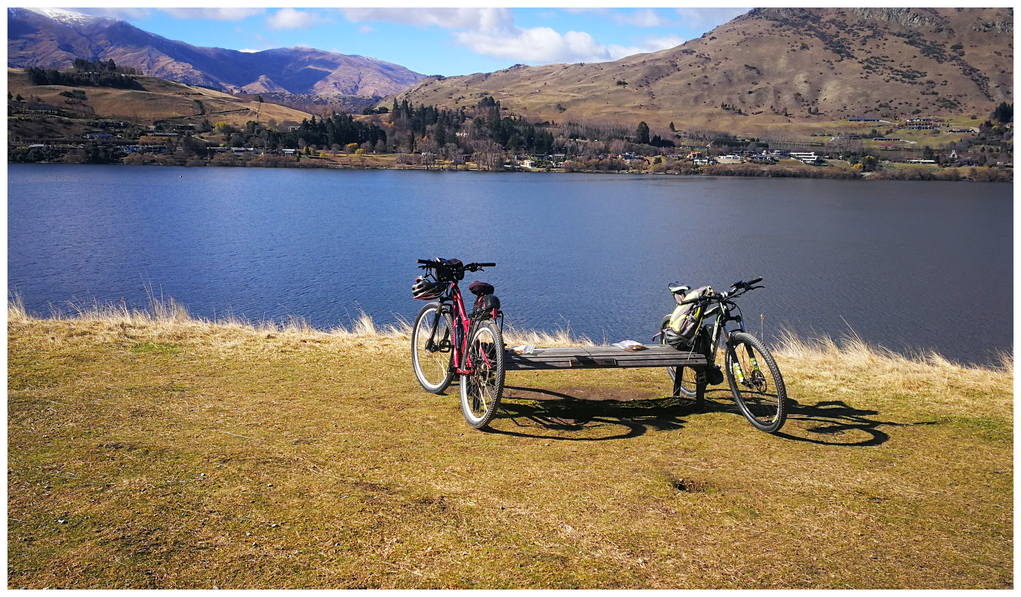
Lake Hayes Circuit Track
The relatively new Lake Hayes Circuit Track is an 8km popular biking and walking track. It is an easy 700m ride along Rutherford Rd to connect to this trail from the Countryside Ride.
and just like that, Lake Hayes stretched out before us
This is an incredibly scenic loop track so because of its popularity, care has to be taken in some of the more narrow spots. There are some rather steep drop-offs on the side of the track which could make for some tight squeezes! Luckily for us, we were there mid-week and the trail did not have the number of its usual visitors.
a ‘primo’ spot for our picnic lunch
We had a bit of a stiff breeze, therefore couldn’t quite get a good photographic reflection of the mountains on the lake. Nevertheless, it was still a stunning ride and a perfect spot for a picnic lunch.
more outstanding views on the Twin Rivers trail back to basecamp
We diverted off again to join the Twin Rivers Track which took us back to basecamp. Today’s effort in the saddle covered just over 36km.
Skippers Canyon
So after checking that the weather was going to stay fine, we decided to extend our stay in Arrowtown for an extra couple of nights. There were a couple more things we really wanted to tick off our list. Especially before the travel bans for some parts of the country were lifted.
I’d never been to Skippers Canyon and Scotty was last in there behind the wheel of an army Unimog in the late 80s.
Heed the Warnings
Firstly, there is no insurance for rental vehicles on this 22km stretch of road. There are a series of warning signs on your way in. Make sure you read them and be prepared.
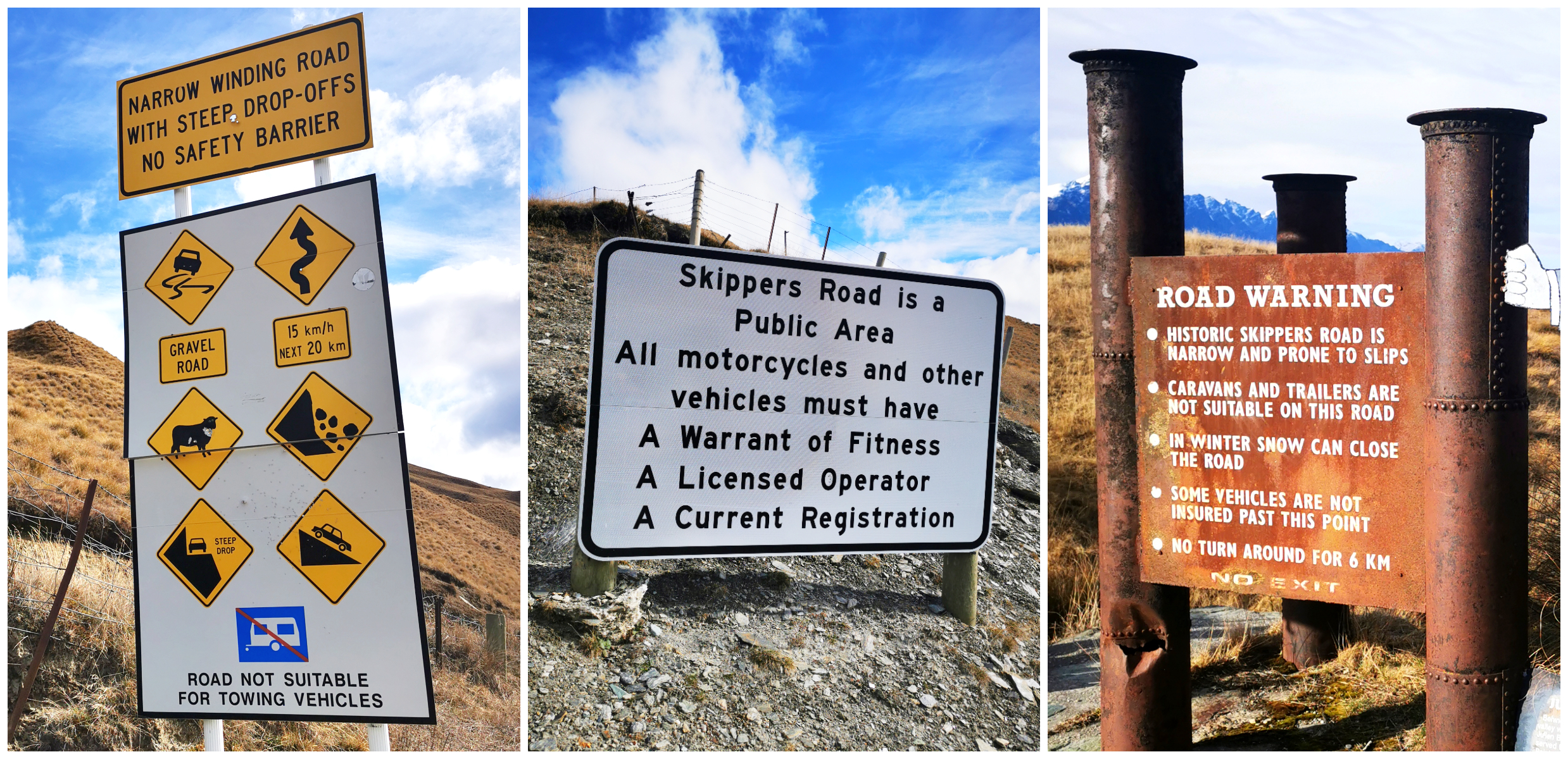
you can’t say that you weren’t warned
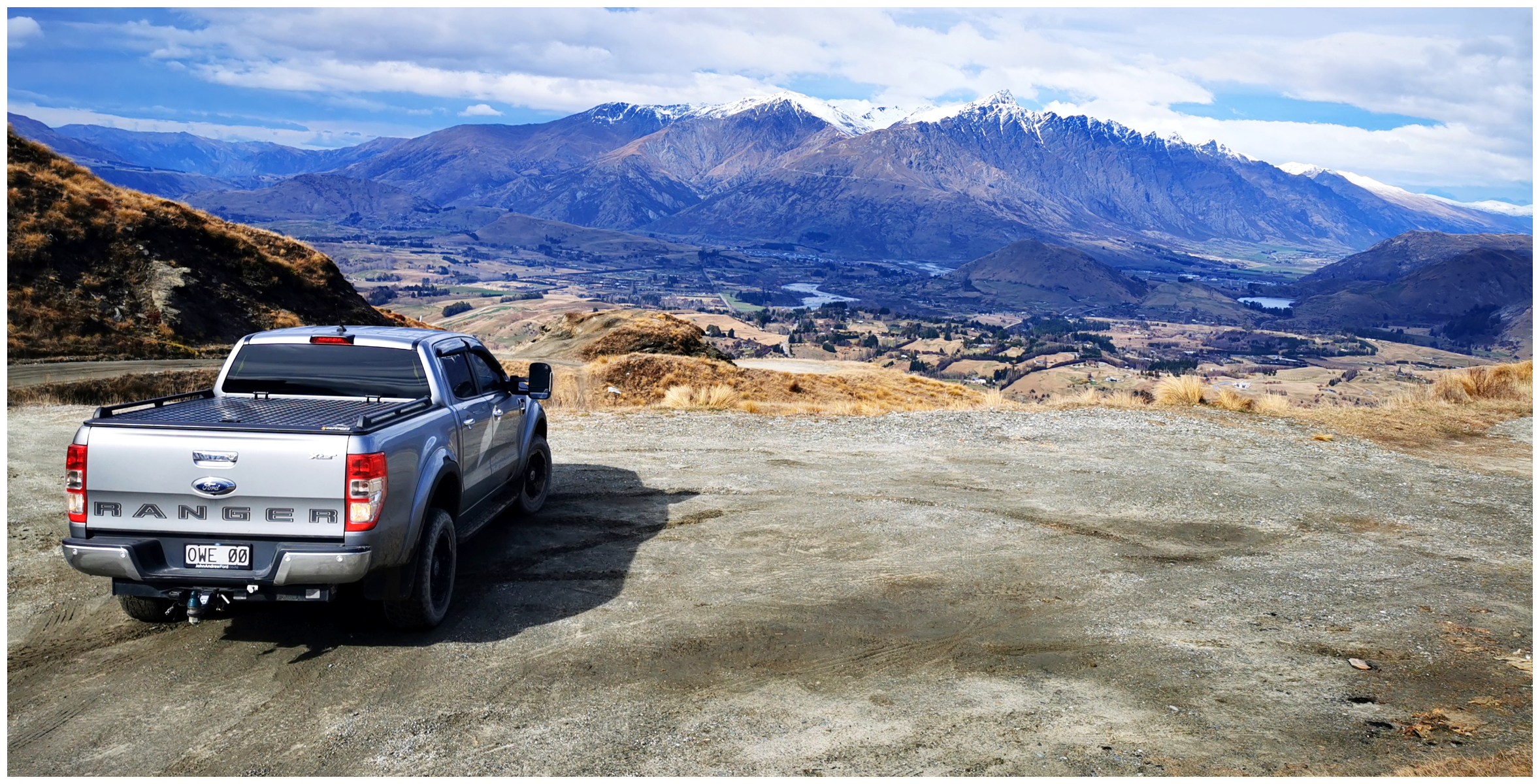
My comments and observations are based on what we witnessed and experienced on the day we ventured in. Many people who have travelled this road will have their own experiences and opinions on the road conditions. Some say it’s perfectly okay in an ordinary 2×4 vehicle and have completed it many times. HOWEVER, we drive a 4×4 Ford Ranger with good clearance and in some parts of the road, we were in boggy mud and deep ruts up over our hubs with the chassis scraping along the surface.
There are places where there are multiple deep ruts formed by the 4×4 buses that traverse this road daily taking visitors in to partake in the jetboating and rafting on the Shotover River. It is impossible to straddle some of these ruts, therefore your direction is determined for you as your wheels find the ruts and take you along for the ride.
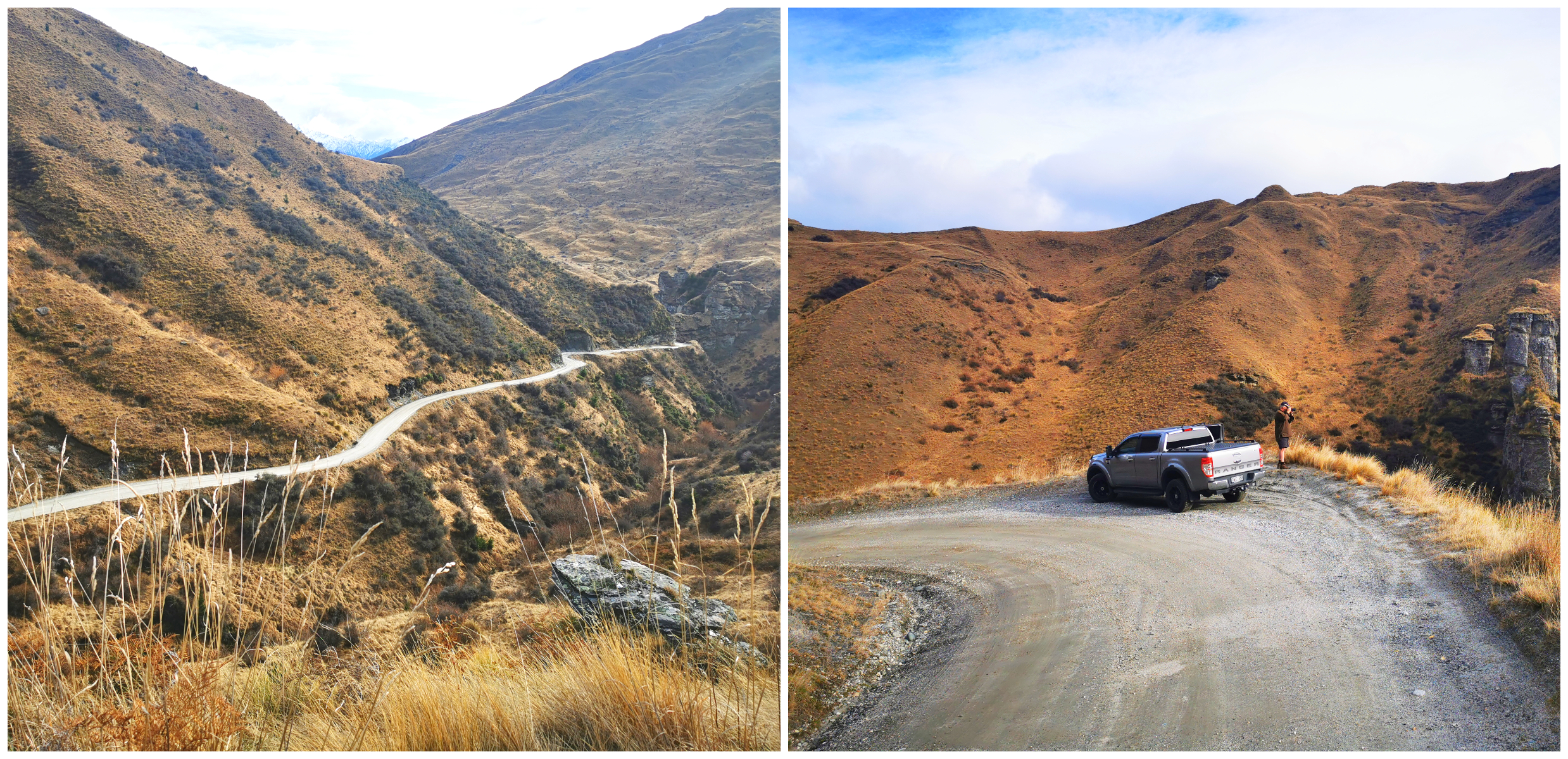
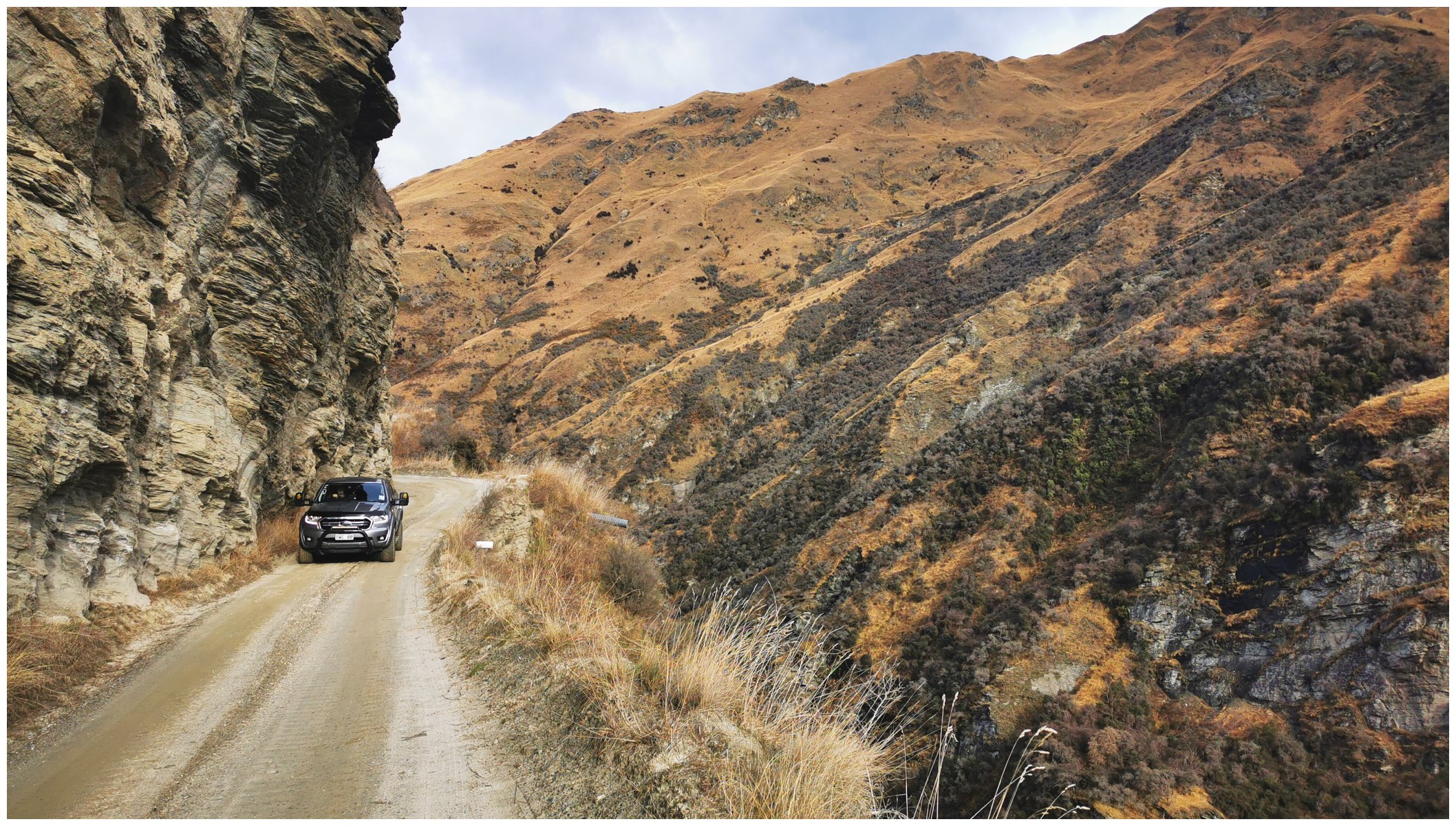
the road started off quite well, we soon arrived at Big Bend, Castle Rock
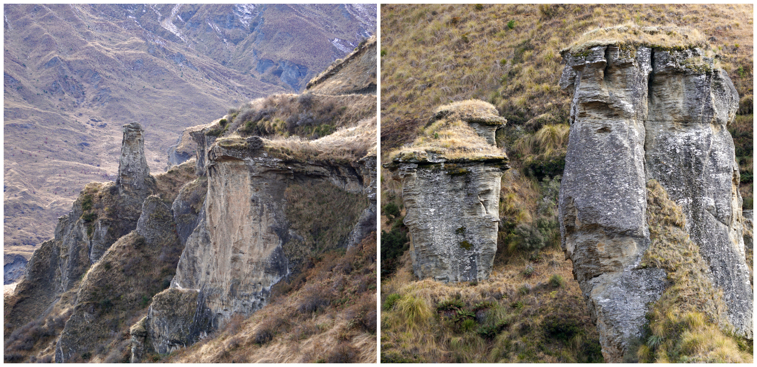
stunning rock formations are certainly eye-catching
There are no barriers to protect you from the sheer drops, some are 100s of metres high. The road is narrow, only one way in some places. It can be a little like Russian Roulette on some of the corners. Thankfully, we didn’t meet too many vehicles coming in the opposite direction so we didn’t have to play the reversing game.
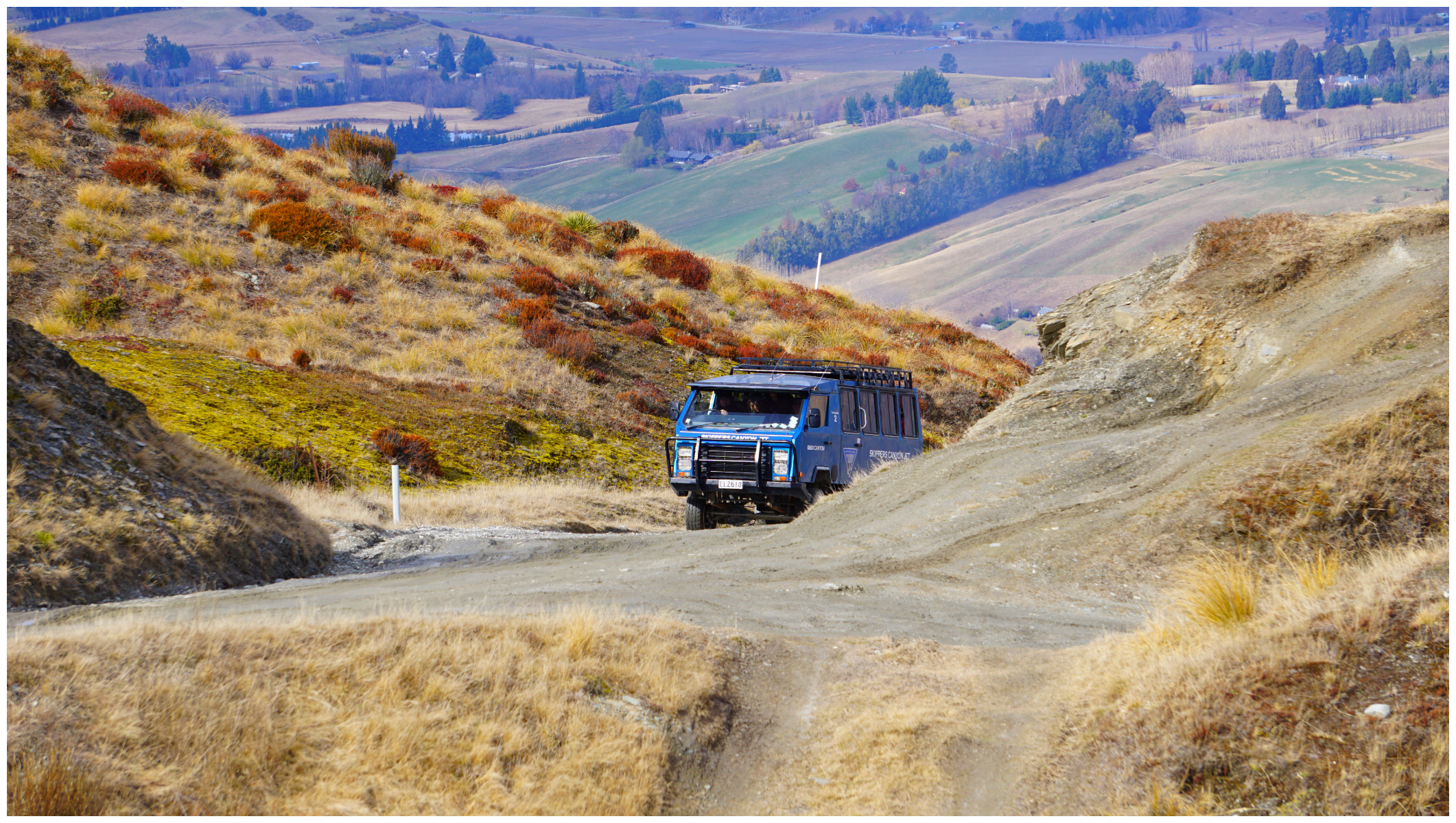
you need to keep a lookout for oncoming 4×4 buses
Skippers Road
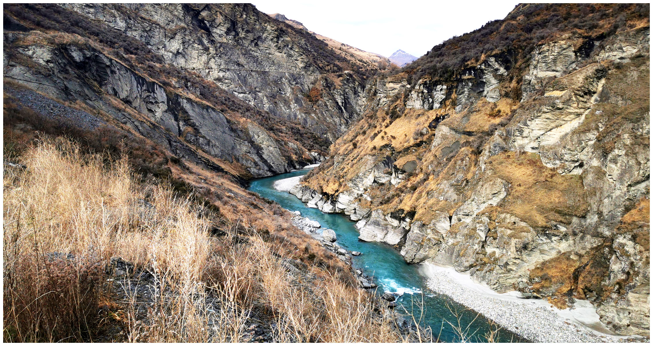
All warnings aside, Skippers Road would have to be one of the most scenic road trips in the world. With its dramatic landscape, towering mountains and deep canyons, all set off by the beautiful Shotover River weaving a path along the canyon floor. No wonder the view of the ‘The Remarkables’ from this area was used as a background of Mordor from Lord of the Rings.
I did have to concentrate on the view rather than the road – I left that to Scotty!
I can understand why the road took over 8 years to build, starting in 1883. A lot of lives were lost while it was being built, some say around 200 although some of the reported deaths were more like 800.
the road started to get narrow and boggy in some places
Many sections of the road remain today very much as they were in 1890.
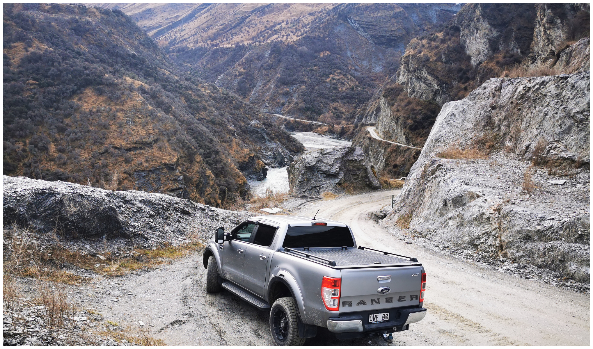
had to make plenty of photo stops along the way
History Abound
The road is chockablock full of history, thanks to the discovery of the shiny precious metal called GOLD! It is believed that it was the richest areas in the world.
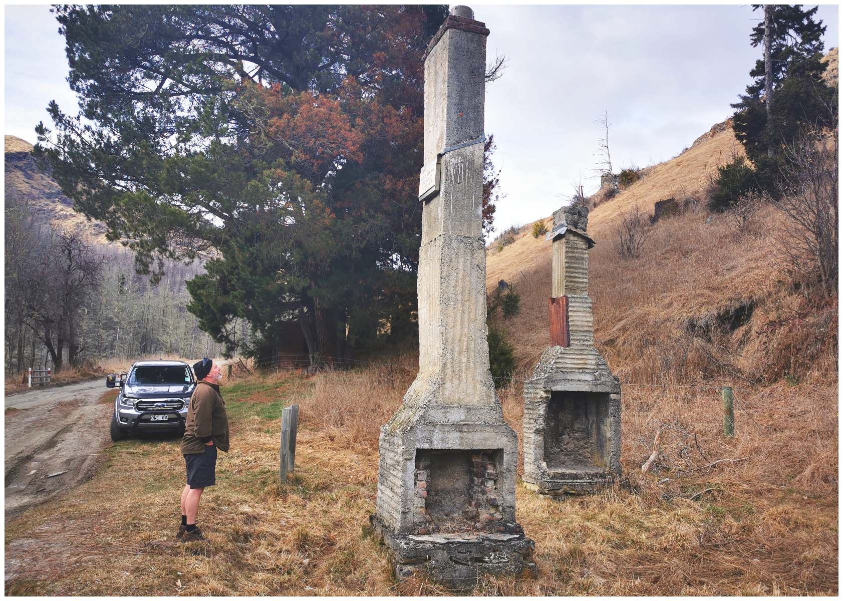
Scotty was looking for the bar at ‘Welcome Home Hotel’
We stopped to have a read of a sign at the ruins of the Welcome Home Hotel. There were several hotels built in Skippers Canyon to help quench the thirst of the miners of Charlestown and Skippers Point. Each town having a population of approximately 1,000 people during the peak of the mining.
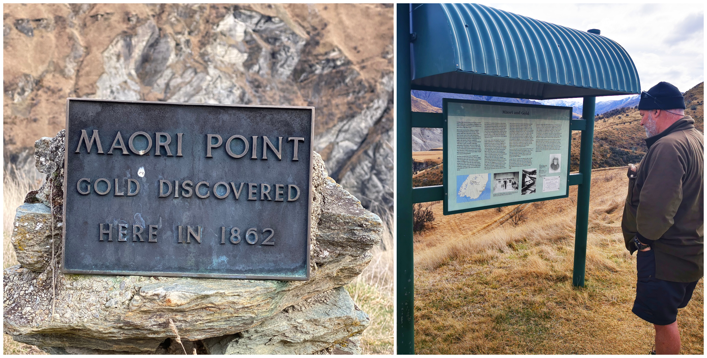
Maori Point – where it all began – the miners referred to the Shotover River as the ‘richest river in the world’
Skippers Bridge
We eventually reached Skippers Bridge. This bridge is actually the 3rd attempt at bridging the Shotover River. The first attempt in 1866 was only 6 metres above the waterline and soon succumbed to the raging river waters. Unfortunately, they didn’t learn their lesson and built the 2nd bridge in the same spot. The approaches proved too steep so plans were made for a 3rd, much higher bridge. After 2 years of construction, the current bridge was opened for business in 1901.
Version three was certainly built to last
They certainly didn’t take into account the width of modern-day vehicles. We had to fold in our wing mirror in order for us to be able to drive across.
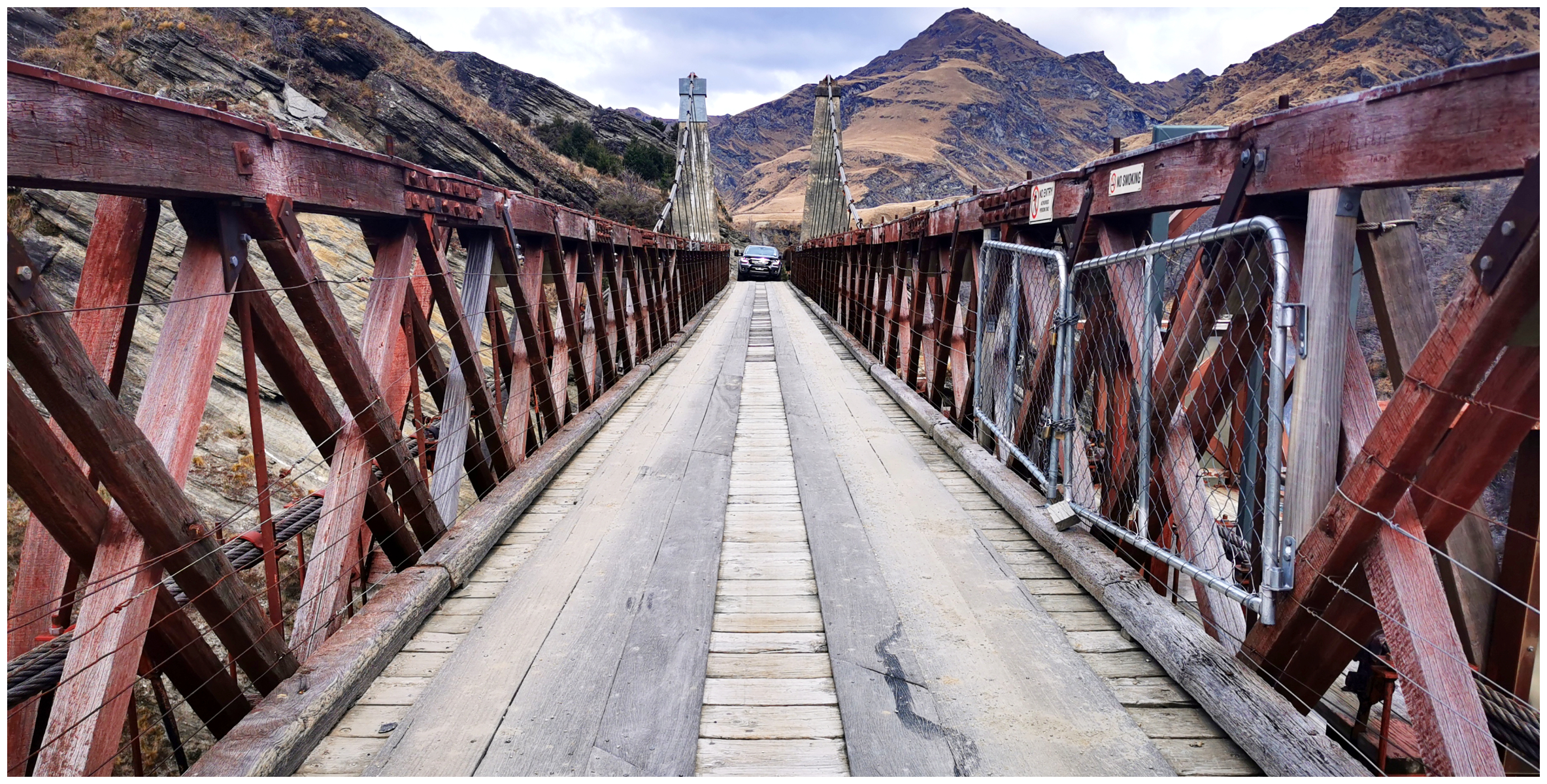
they didn’t build it to accommodate modern, wider vehicles than horse and cart!
Even though the completion of the existing Skippers Bridge was done after the gold rush was over, it is today one of the major attractions for visitors to Skippers Canyon as it spans a gorge with sheer rock faces on both sides and is about 100 metres above the river. This is probably why it is the perfect spot for AJ Hackett Bungy Jump during the summer months.
Skippers Point
A couple of kilometres further along from the bridge we made it to Skippers Point. There is a DoC camping ground there with some long-drop toilets.
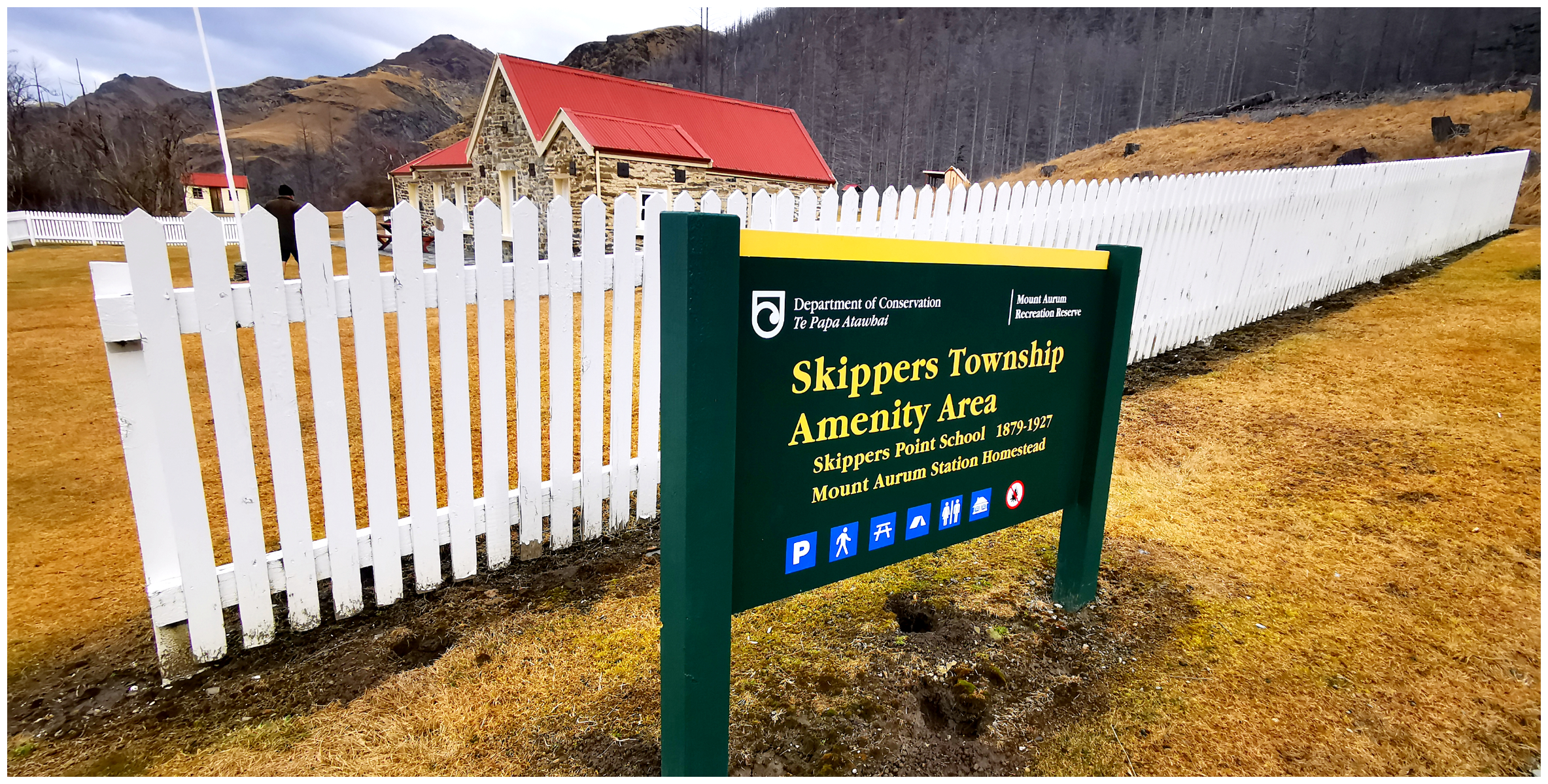
the site of the Skippers township
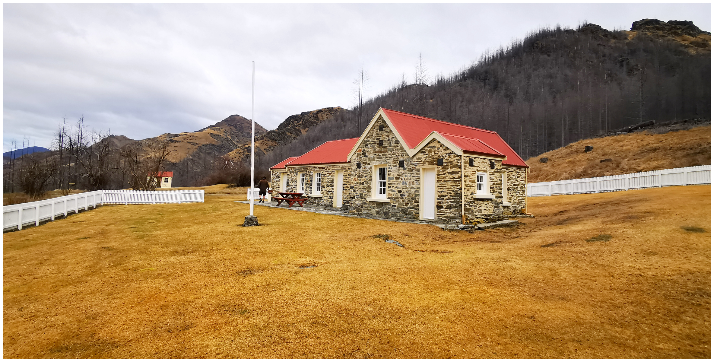
the beautifully restored and maintained schoolhouse
As mentioned previously, Skippers Point was home to up to 1,000 miners and their families during the peak times of the gold rush. Now, all that is left is a beautifully restored schoolhouse and cemetery. Unfortunately, the Mt Aurum Stanion’s Homestead was destroyed by fire back in 2018.
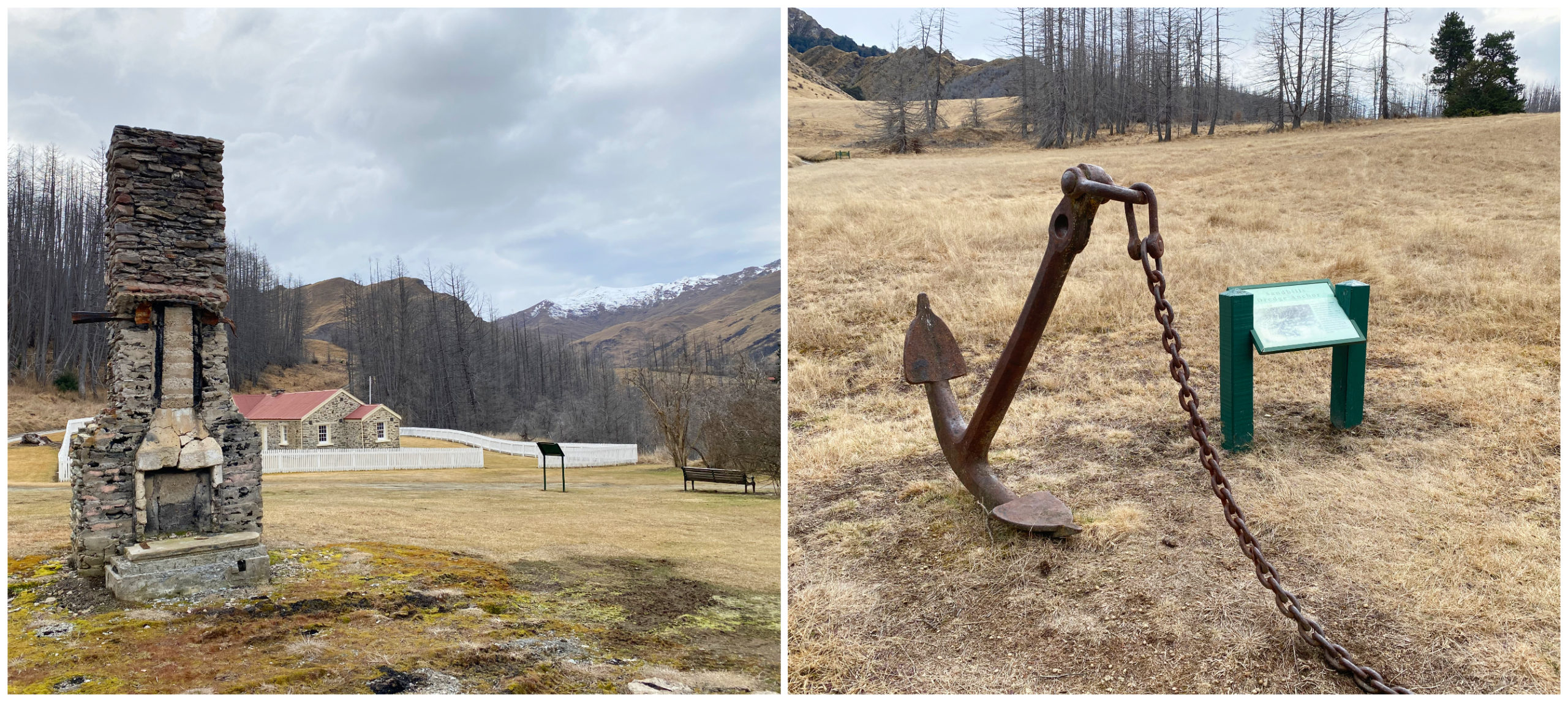
all that is left of Mt Aurum Stanion’s Homestead and an anchor which came off a dredge that worked the Shotover River
We had a quick wander around the grounds and browsed the information boards and photos that are on display inside the schoolhouse.
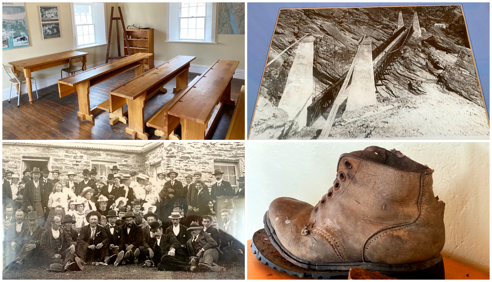
it was like stepping back inside when we wandered around the interior of the schoolhouse
After a stopover at the cemetery, we had to make a hasty retreat to start our journey back along the notorious road as the black clouds started to gather.
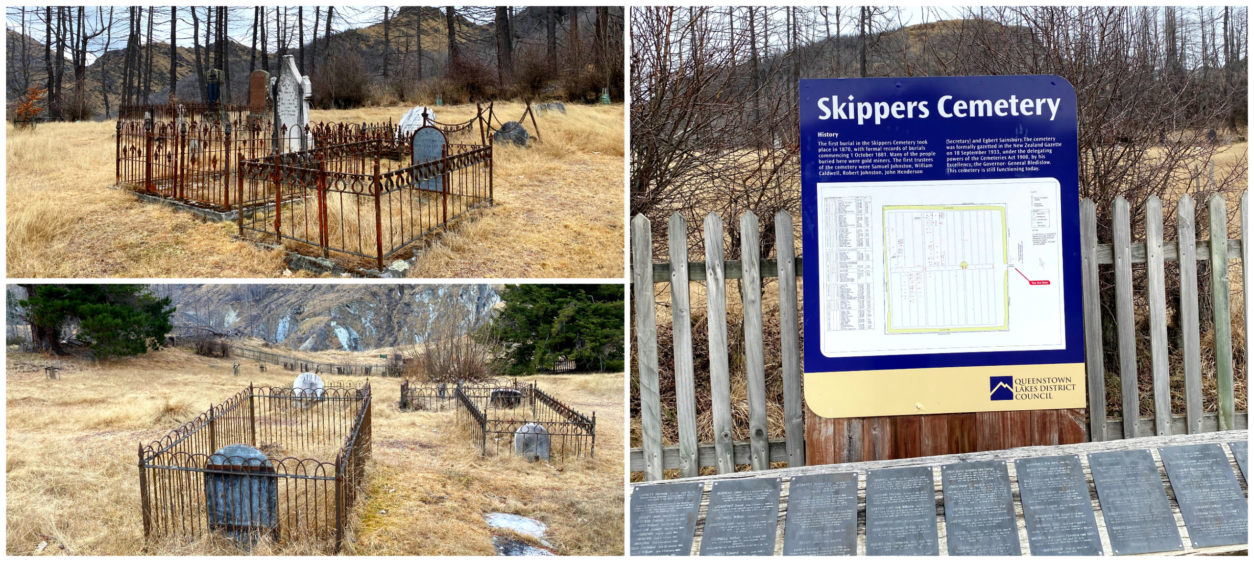
it was worth a wander through the historic cemetery
I was already nervous enough, without having to contend with the road being wet and adding to the already boggy conditions.
It was with much relief (well to me anyway) that the rain didn’t really come to much and we made it back out in one piece.
I would explain Skippers as a trip I love to hate. I sometimes hated it at times but would love to do it all again.
the perfect spot for a ‘tailgate’ lunch
Crown Range & Cardrona
It was the last day of our ‘treat week’ and the weather was still holding. It had been quite a few years since we’d been on the Crown Range Road and stopping off at the iconic Cardrona Hotel.
Crown Range Road
Now, this is another one of ‘those roads’. It conjures up all sorts of comments, opinions and advice from those who have travelled the zigzagging road that traverses the Crown Range.
Firstly, if you are in a rental vehicle of any kind, you need to check your Rental Contract to make sure you are covered by insurance on this road. Many companies won’t cover you if you decide to take this route.
Heed the Warning Signs
Once again, heed the signs at the start of the road.
“Signage states that the maximum length allowed (including a trailer) is 12.6m. There is another sign stating ‘Not suitable for towing’.”
Regardless of the signage and warnings, there are many people that still drive the road no matter what vehicle they’re in and claim that ‘you’ll be right’. The road is sealed and in good condition but the wide swings required to get larger rigs around the hairpin corners could prove difficult let alone inconsiderate to other travellers if you still wanted to drive it.
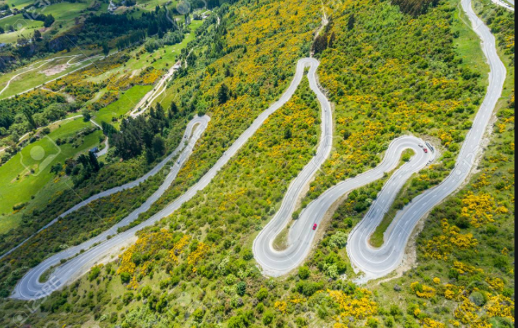
aerial shot of the hairpin corners courtesy of Shutterstock.com
While the Crown Range Road is the shorter distance to travel between Queenstown and Wanaka, allow for extra travel time because of the twists and turns up the Crown Terrace and steep climb up the 1076 metres.
In winter, the road is often covered in snow and ice, making for very difficult driving conditions. Always check on the road conditions if travelling over in winter. You may need to carry chains and be able to fit them if required.
Crown Range Summit
You should also allow time to stop and admire the massive views, which are often accompanied by amusing encounters with kea (mountain parrots). The views over Arrowtown nestled in the Arrow Valley, the Wakatipu Basin and across to the Remarkables Range is, well, ‘remarkable’!
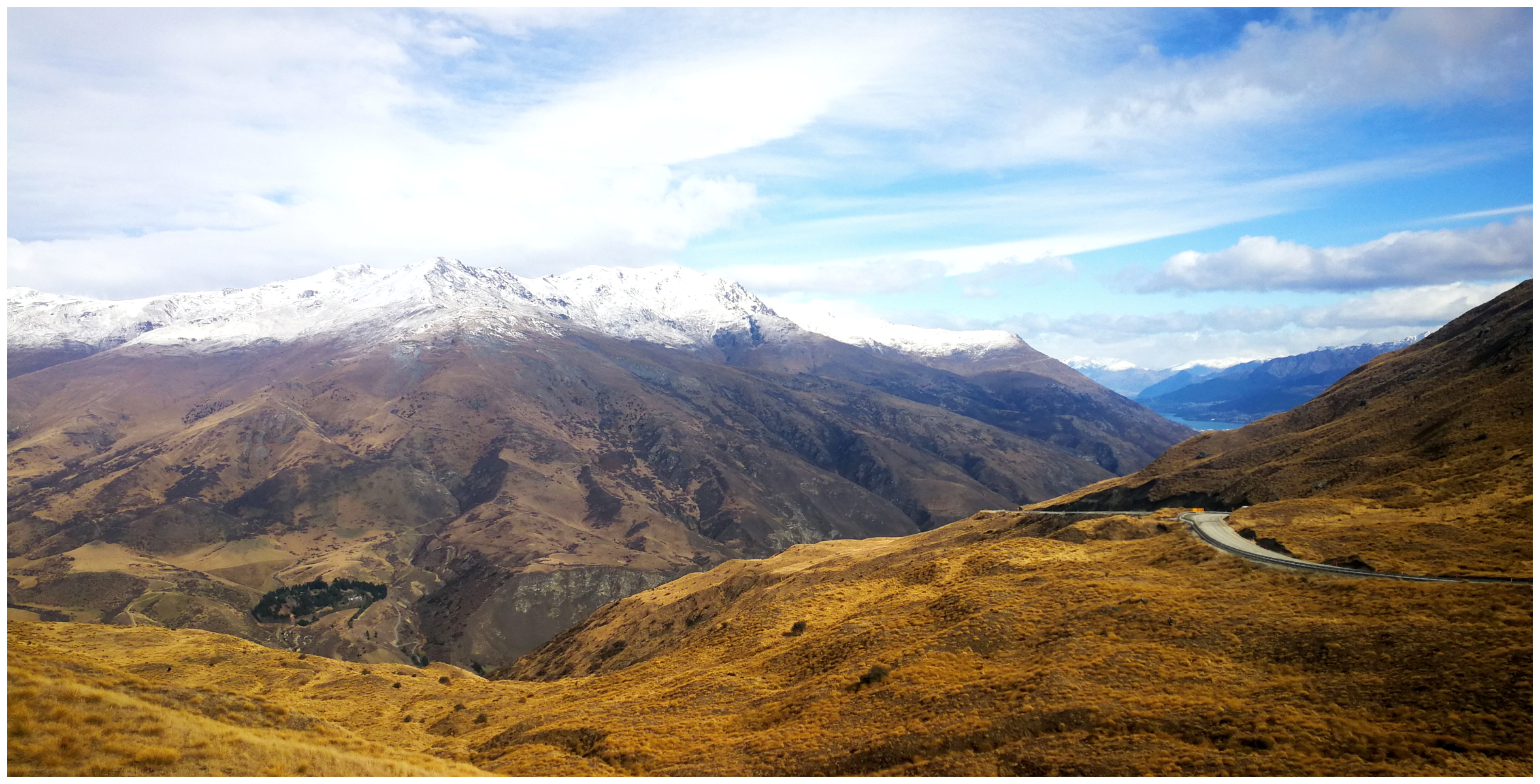
we had a beautiful clear day for our stop at the Crown Summit, but it doesn’t capture the winds howling through the valley!
If you did not want to tackle the zigzagging Crown Terrace from the Arrowtown side, then the summit is quite accessible from driving up from Wanaka.
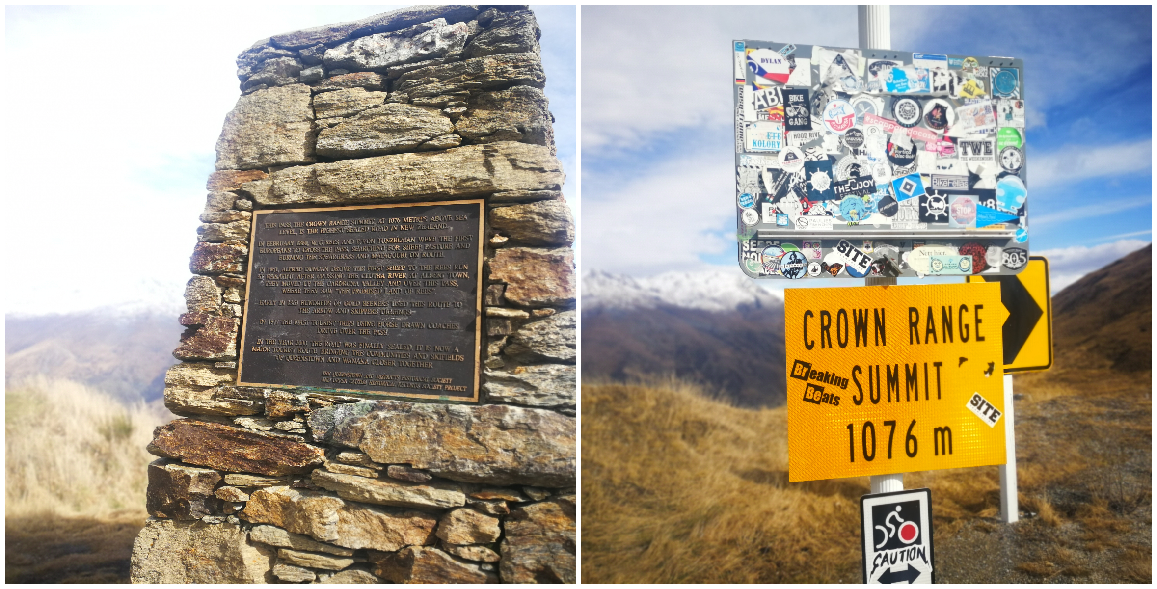
we had to hold on tight to get some ‘summit shots’
There is the opportunity to freedom camp at the summit. I would recommend you check the weather reports before deciding on parking up for the night at the top of the Crown Range. The day we visited and stopped at the top, we got a real buffeting from rather strong gusty gale-force winds. It is a very exposed site with very little shelter.
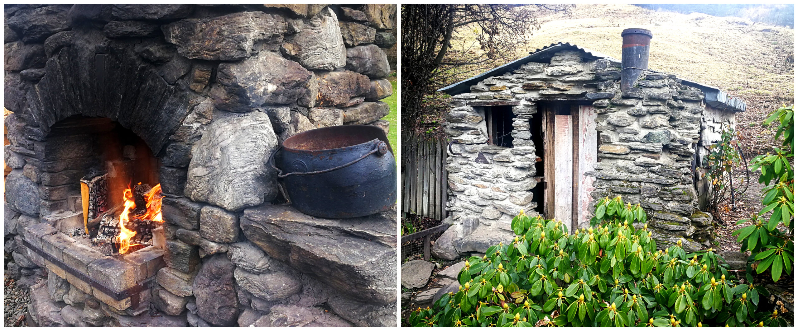
Cardrona Hotel
The very photogenic Cardrona Hotel is one of NZ’s oldest hotels and was established in 1863. In its hey-day, Cardrona was a bustling and very prosperous settlement. There were a total of four hotels in the township and this is the last one left standing.
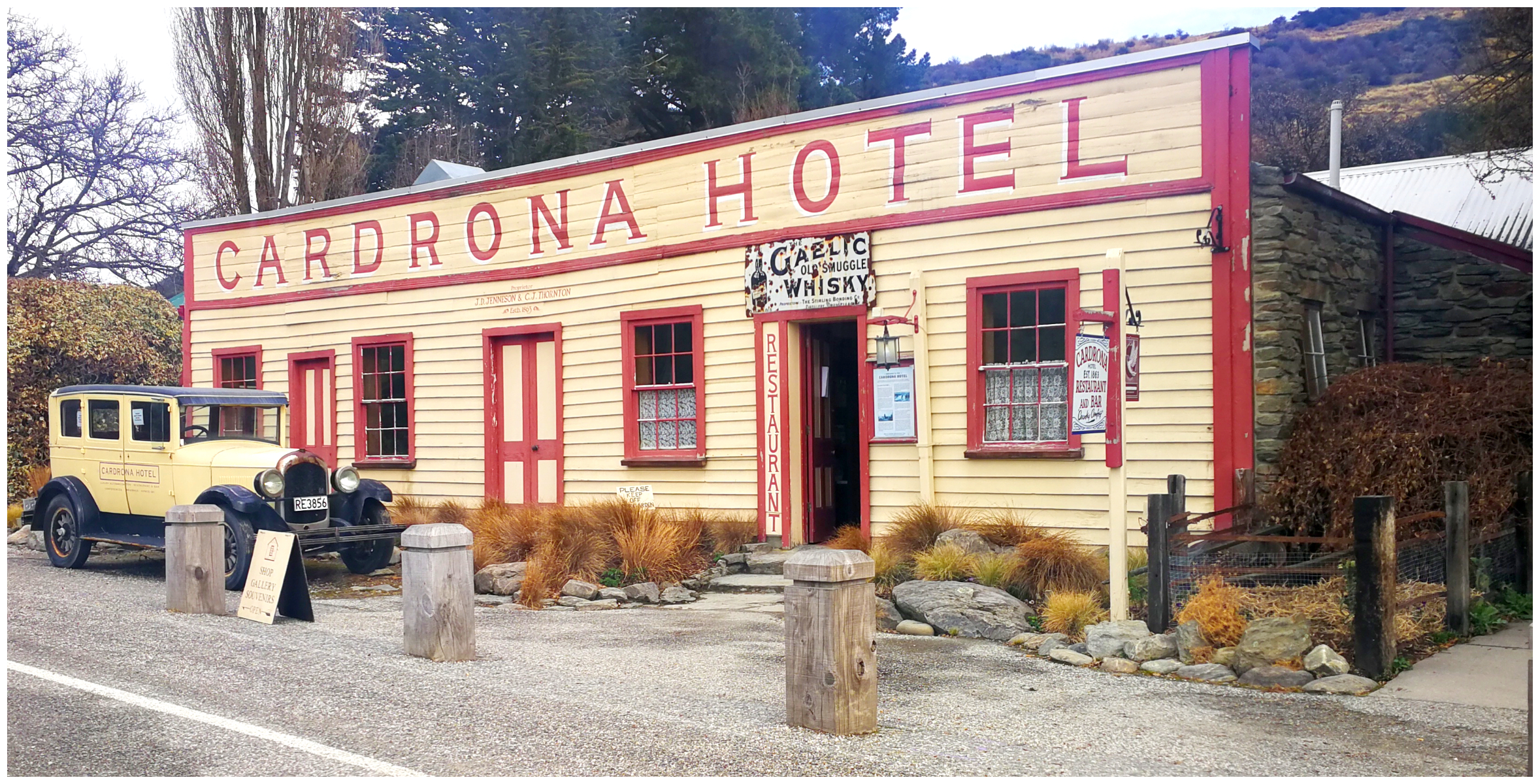
the most photographed pub in the country
The hotel was lovingly restored and saved from its derelict state and a restaurant opened for business in 1983. It now also boasts an accommodation block consisting of 14 hotel rooms.
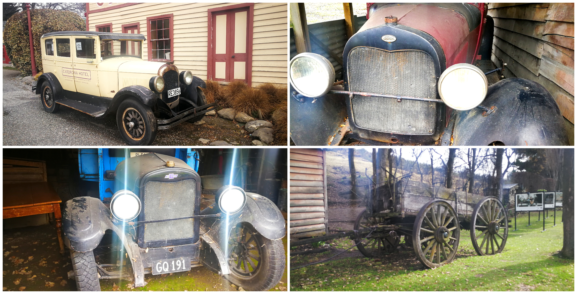
the cars of Cardrona
It is a very popular stopover for travellers and the day we called in was no different. We were there early. This helped us to secure a bar leaner for a drink or two and a bowl of potato wedges.
the outside fire proves very popular with the punters, especially in winter
Summary
We stayed a total of 5 nights in Arrowtown before our ‘treat week’ came to an end. We enjoyed our stay more than we expected to and glad we made our decision to visit when we did. Our timing was perfect. We could enjoy a load of attractions without having to contend with crowds of others.
Click on the link below to see a video of our highlights.
Hi, love reading and watching all your blogs. Must admit agree with your comment about a ‘real’ map perspective seems much better with real maps. Every time I read your blog I come up with more and more places we must get out and see – roll on retirement. Trouble is I now have over 10 pages and getting bigger all the time. Thanks for sharing our special land with us all.
Haha, thanks Gill, we too STILL have a very long list of things to see! Glad you are enjoying travelling along with us through our blogs and lens. L