This is Part Two in our journey to explore The Catlins. We want to do justice to this amazing area of New Zealand. The trick is to ‘rush it slowly’ and peel back the layers. Check out our Catlins – Part One here.
We departed Niagara after a two-night stay and headed towards our next destination – Papatowai.
The tiny settlement (only about 30 permanent residents) is around a 35km drive from Niagara.
Papatowai, meaning ‘where the forest meets the sea’, is located close to the mouth of the Tahakopa River.
Scroll in or out on the map above to follow the route of all the places we visited in Part Two of our Catlins explorations
Papatowai DoC Camp
Putting to use our annual NZMCA DoC Pass ($295) we set up camp at the Papatowai DoC Camp (NZMCA#9430) for the next few nights.
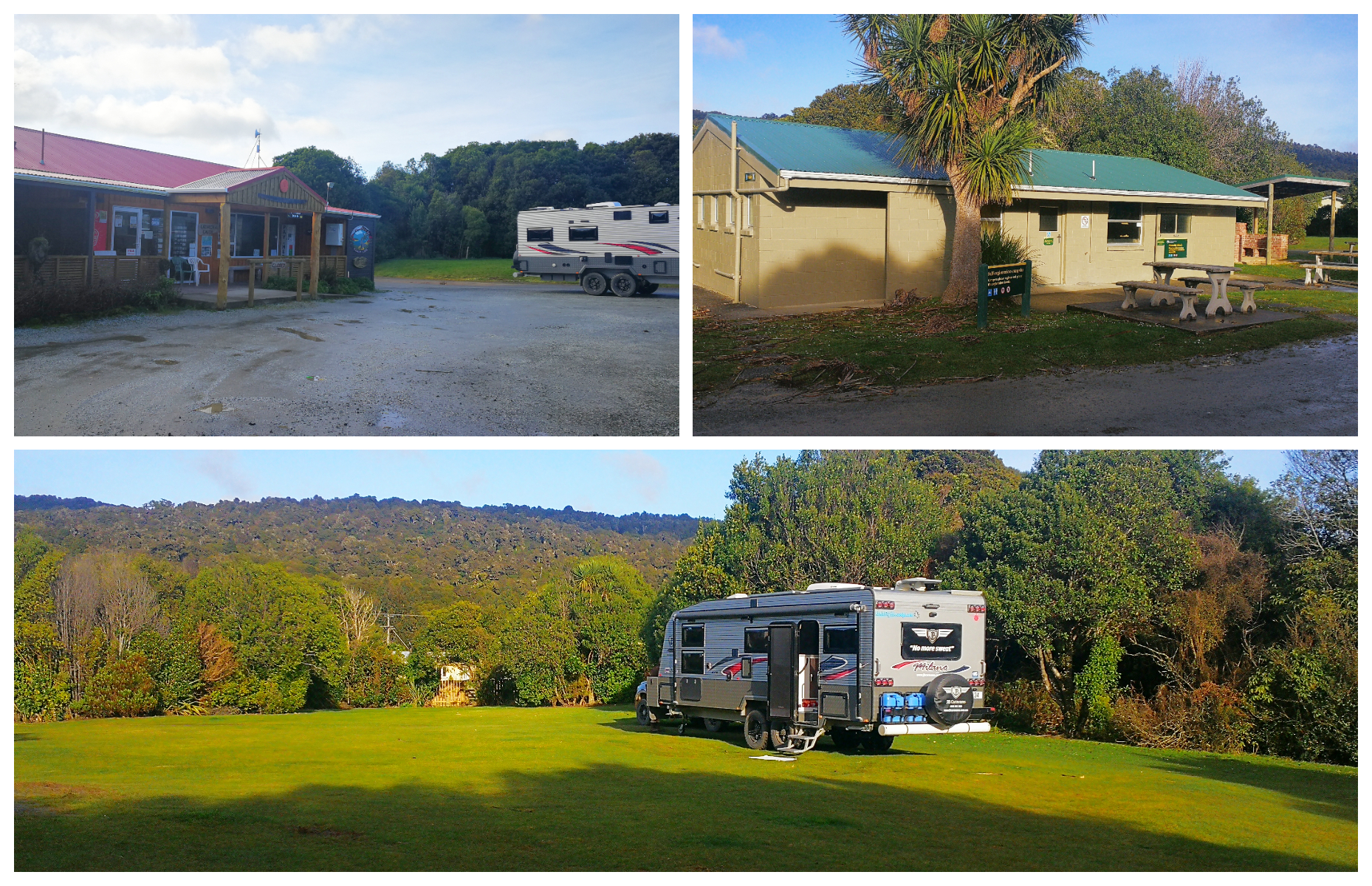
It is a large camp with many spots tucked in between trees for extra shelter, well-established toilet/kitchen block, shop/fuel at the entrance
There are officially 116 unpowered sites and they lay tucked in behind trees and scrubs to offer maximum protection from the strong coastal winds that frequent the area.
Walks and Views
There is a ‘Beach Access’ sign close to the ablution block where you can wander to the river. On low tide, you can walk to Picnic Point which will take you around 20 minutes. If the water is too high, you can walk via the road to Picnic Point. You can choose to continue onto King’s Rock, which is around a further 20 minutes.
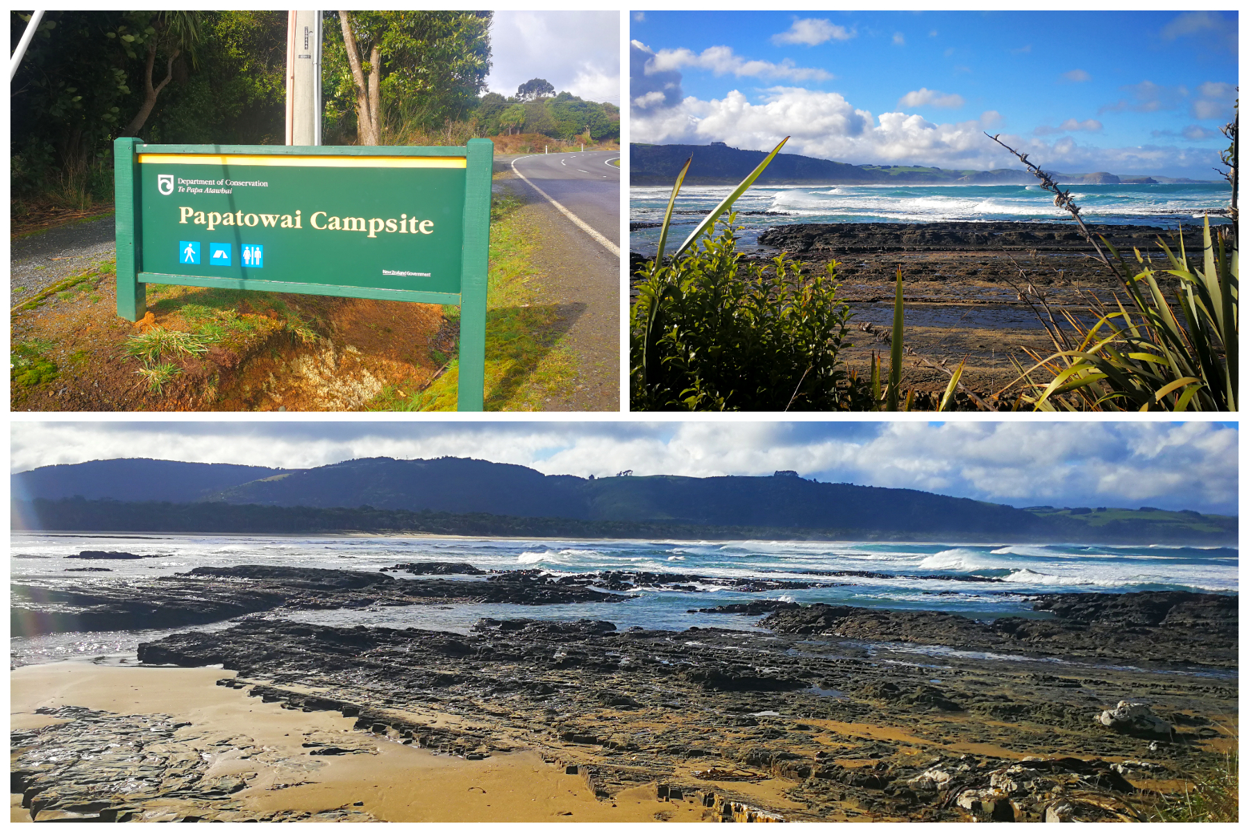
Picnic Point offers wonderful views and longer walking options
Purakanui Falls
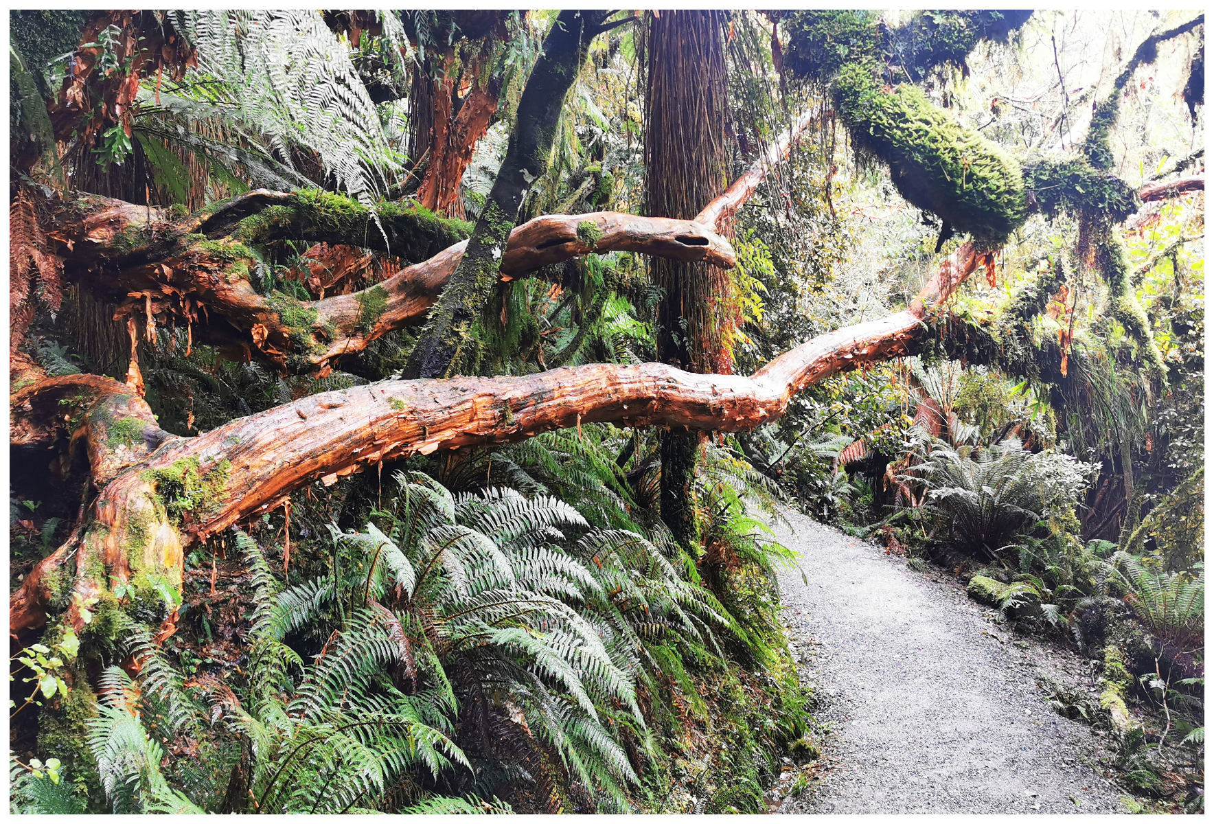
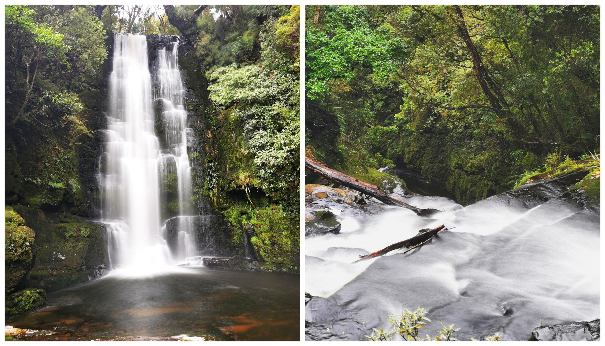
Using Papatowai as basecamp, we headed off to explore our surrounding area. We ended up at the most photographed falls in the Catlins – Purakanui Falls. A three-tier, layered waterfall, which cascades down the various rock faces. It’s only a quick 10 min walk into the falls so easily accessible to most people.
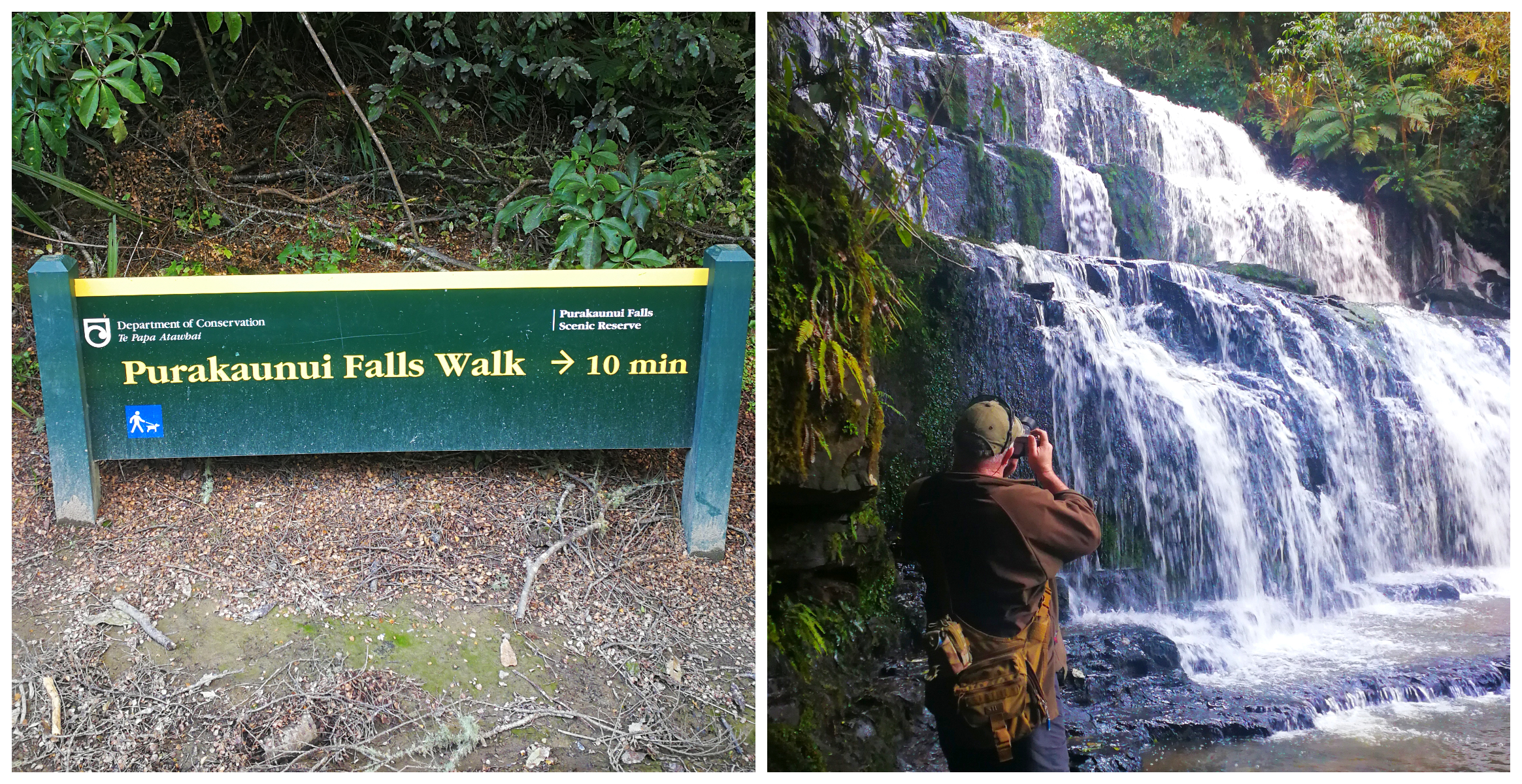
easily accessed means that this is a very popular stop
We wandered through mature beech forest, to the top viewing platform. From there the track descends to give the view of the three-tiered falls that’s often seen on calendars and postcards.
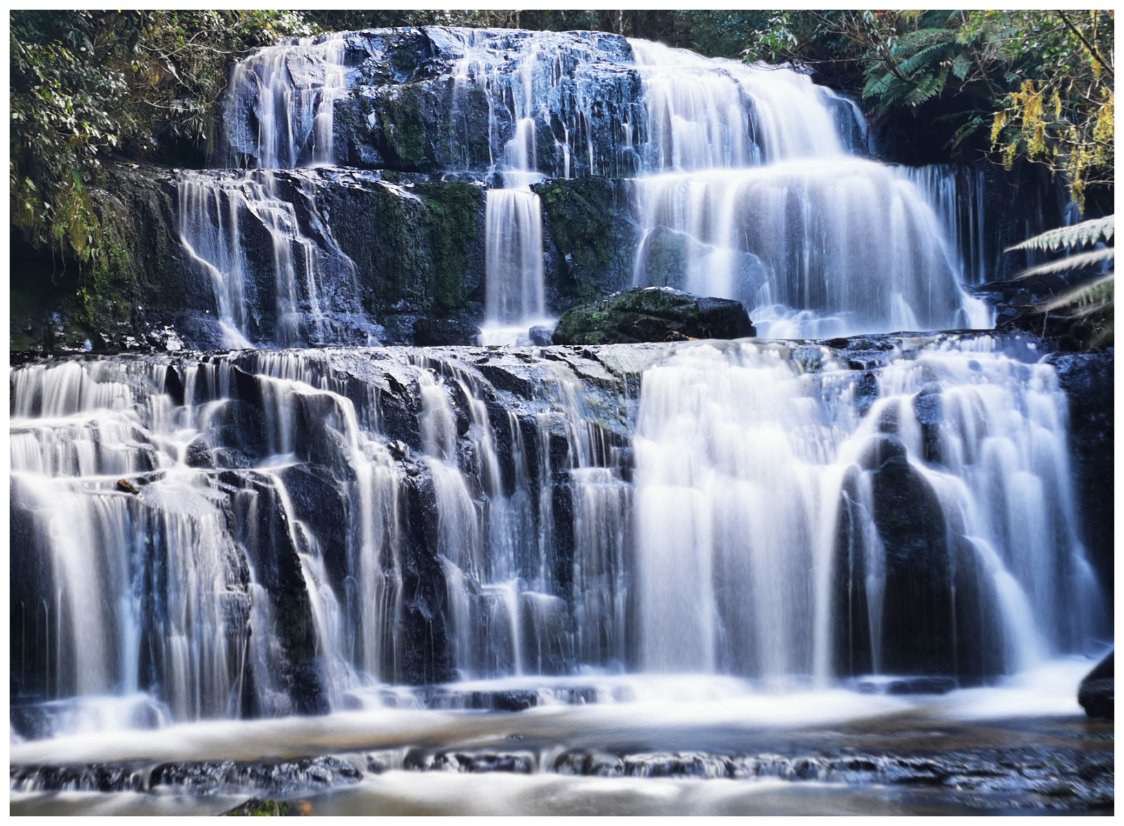
capturing the 3-tiers of the waterfall
so pretty regardless of the angle
Purakanui Bay
We were curious to check out Purakanui Bay. During our research, we read that there is a camping spot out on the coast but the parking was limited and a bit boggy in the wet season. The access road was narrow and gravel but certainly doable.
There were some surfers there and the comments were correct when it stated that there are limited parking spaces available. We picked out a couple of possible sites that we could fit into and it looked reasonably firm enough for us to be able to camp.
I think a couple of days camped here, looking out towards the beach and surf may just be on the cards. Certainly a contender for Part Three of our travels.
Helena Falls Beach/Long Point
We took a side road which ended up at Helena Falls Bay and Long Point.
Long Point Reserve was purchased by the Yellow-eyed Penguin Trust back in 2009 for the conservation effort of these rare native penguins.
We walked a few hundred metres along the stream to the coastline and a beautiful sweeping sand beach greeted us. Unfortunately, so did the wind racing straight in from Antarctica!
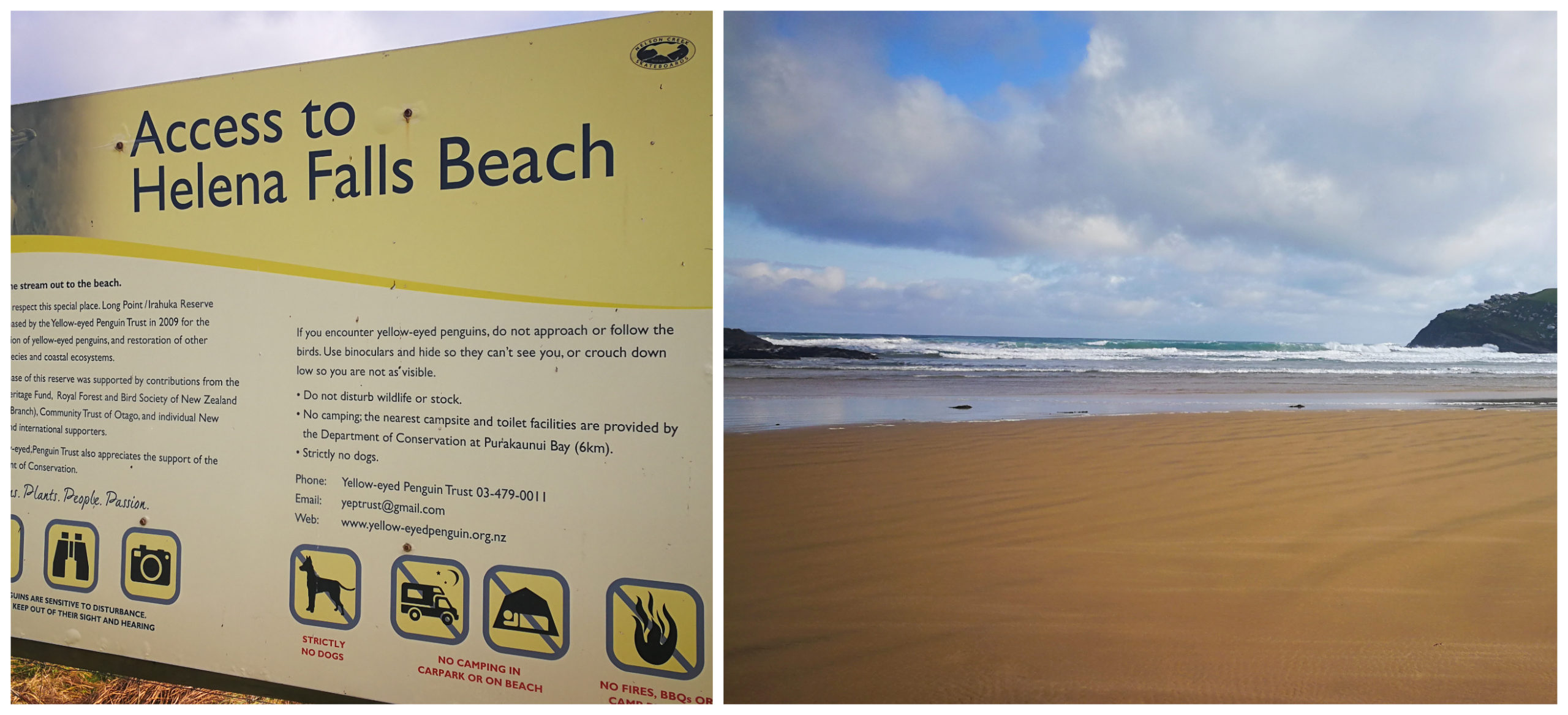
Helena Bay ticked off the list
We didn’t dally long on the beach, just long enough for a few photos before we retreated back to the ute.
Next day we were keen to continue to explore the Catlins so we packed a picnic lunch and set off – back towards where we had come the day before. There were some places we passed that were on my list of places to visit.
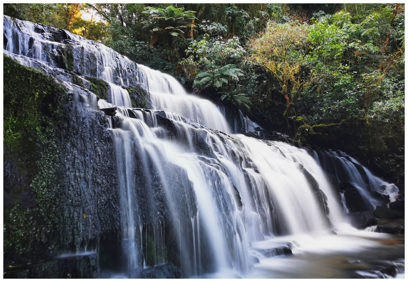
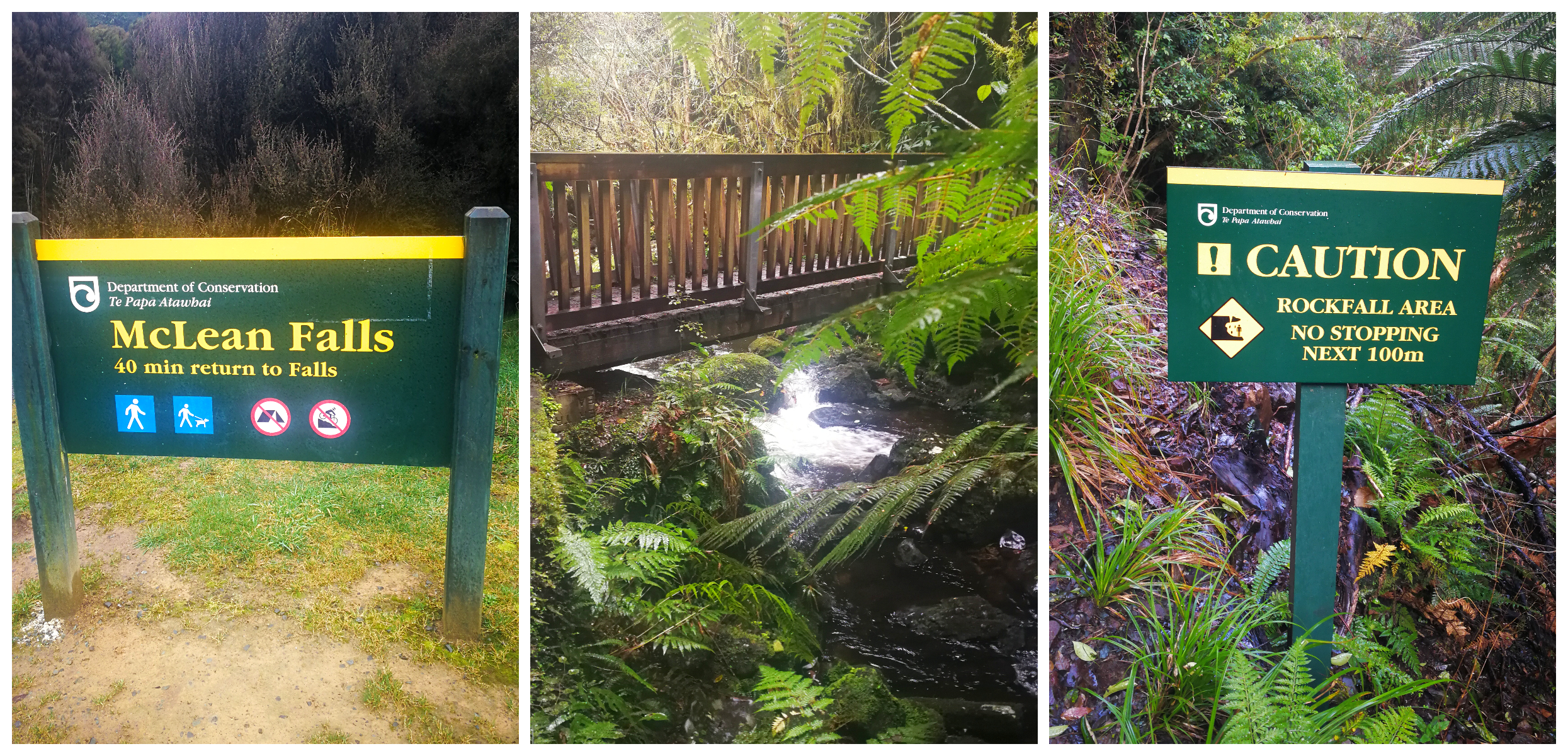
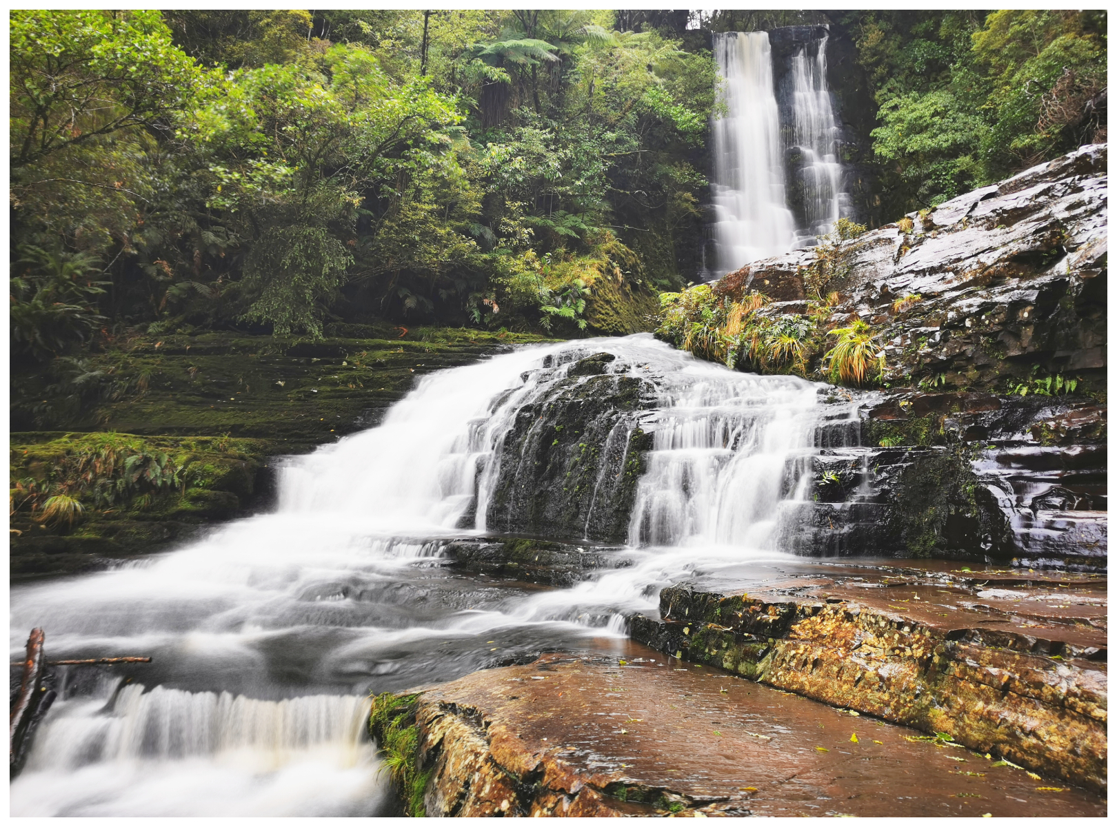
McLean Falls
A 15-minute drive south from Papatowai, we found the McLean Falls.
It is a 40min return walk into one of the tallest falls in the Catlins. There are a few steep steps to climb and some parts are wet underfoot. The striking finale is worth the effort though!
McLean Falls consists of 2 waterfalls, lower and upper. Both of them are easily accessible and it is another ‘must-see’ waterfall when visiting the Catlins.
the track to the falls is as pretty as the destination
The walk-in is very picturesque and it follows a cascading Tautauku River.
a very popular spot on the Catlin coast, you may need to pick your times during peak season
hard to get all the layers of the waterfall in the shot
These picturesque falls are enhanced by the beautiful Southland bush as a backdrop. It is a spectacular 22-metre cascading waterfall surrounded on both sides by dark-green mossy rocks.
yup, certainly the tallest on the Catlins
Cathedral Caves
These popular attractions are currently closed for the winter although the sign does say “until further notice”. There is a $10 per person charge to see the caves.
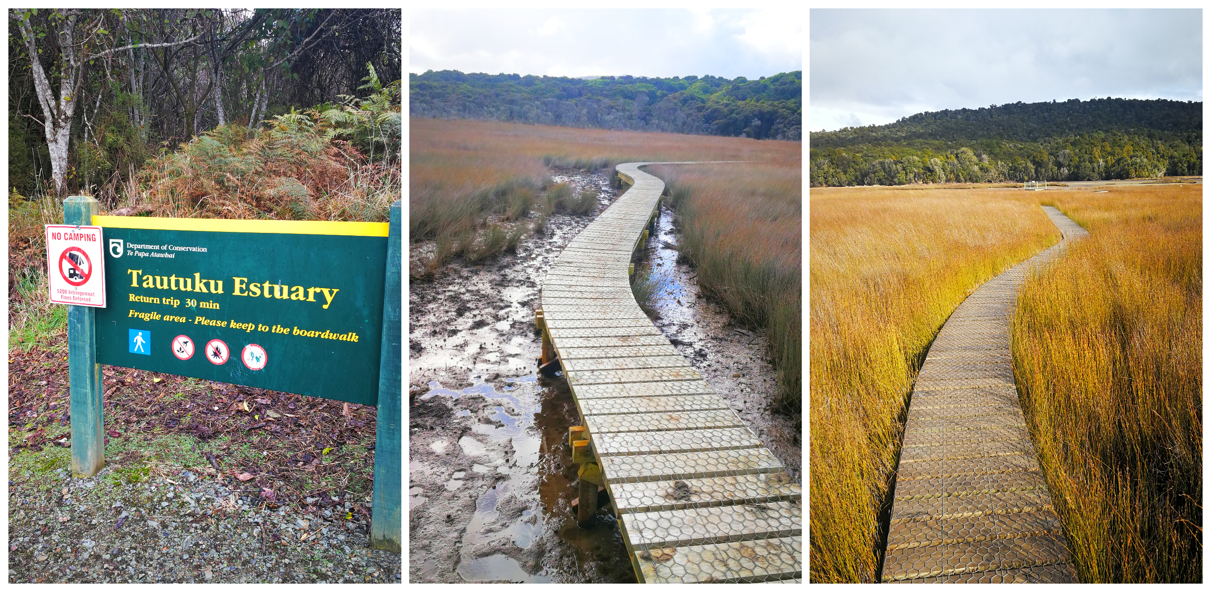
Tautuku Estuary Boardwalk
A 30-minute walk which takes you way out into the estuary. These boardwalks are an amazing building feat as they erected a thin walkway over some rather muddy surrounds.
the very elaborate boardwalks
The track is partly board-walked and also incorporates a section of the Old Coach Road. We set out surrounded in podocarp forest before the estuary flats opened out before us.
The vibrantly coloured jointed rushes made a vibrant contrast as we walked the boardwalk. There was also quite a lot of resident birdlife which have made their home amongst the rushes.
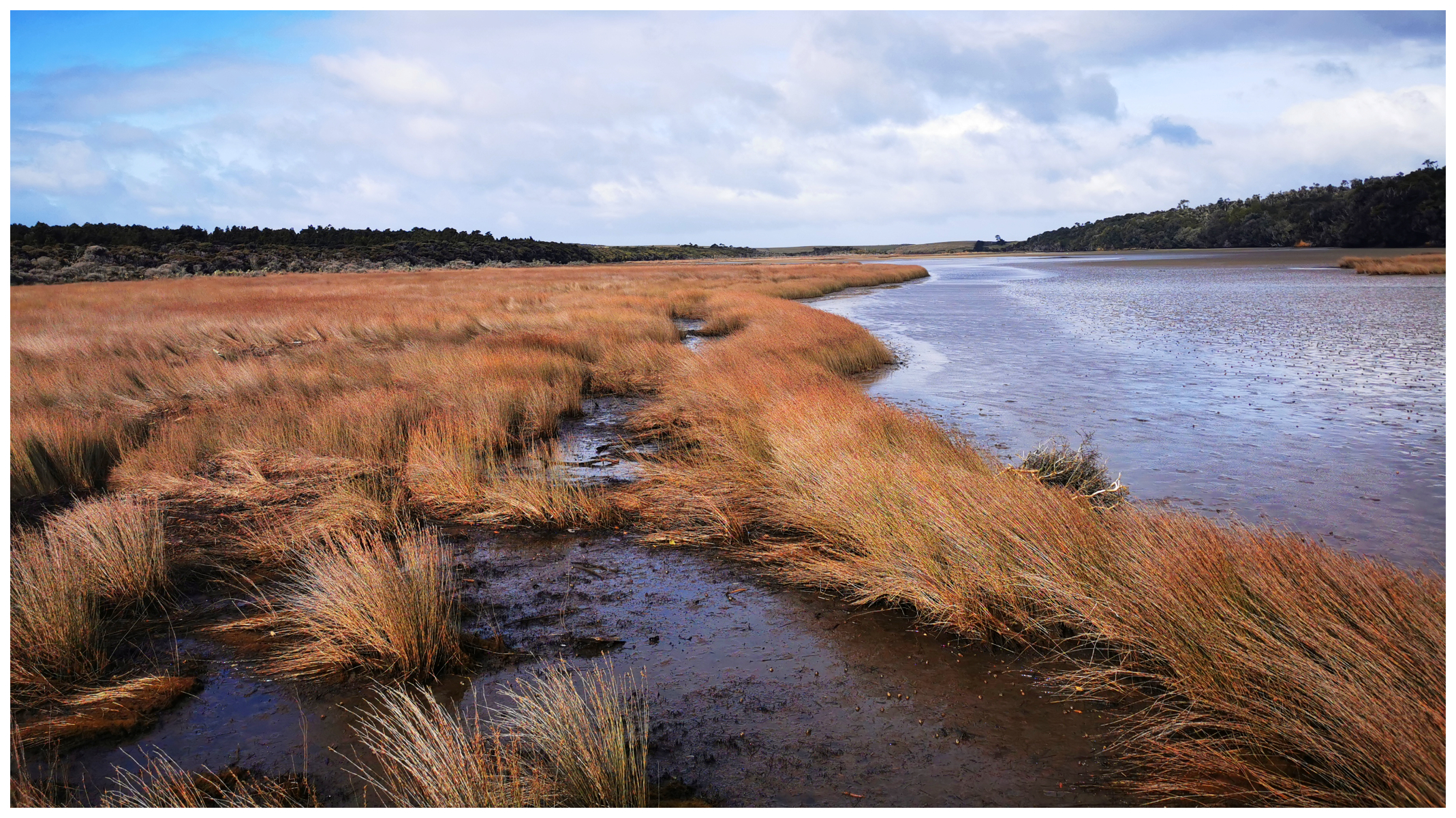
viewing platform juts out into the estuary
Tautuku Beach
This is the beautiful beach that you look down onto from the popular Florence Hill Lookout.
Tautuku is a spectacular, forest-fringed bay that sweeps round to an impressive headland. It felt so isolated on the day we visited with not another soul in sight.
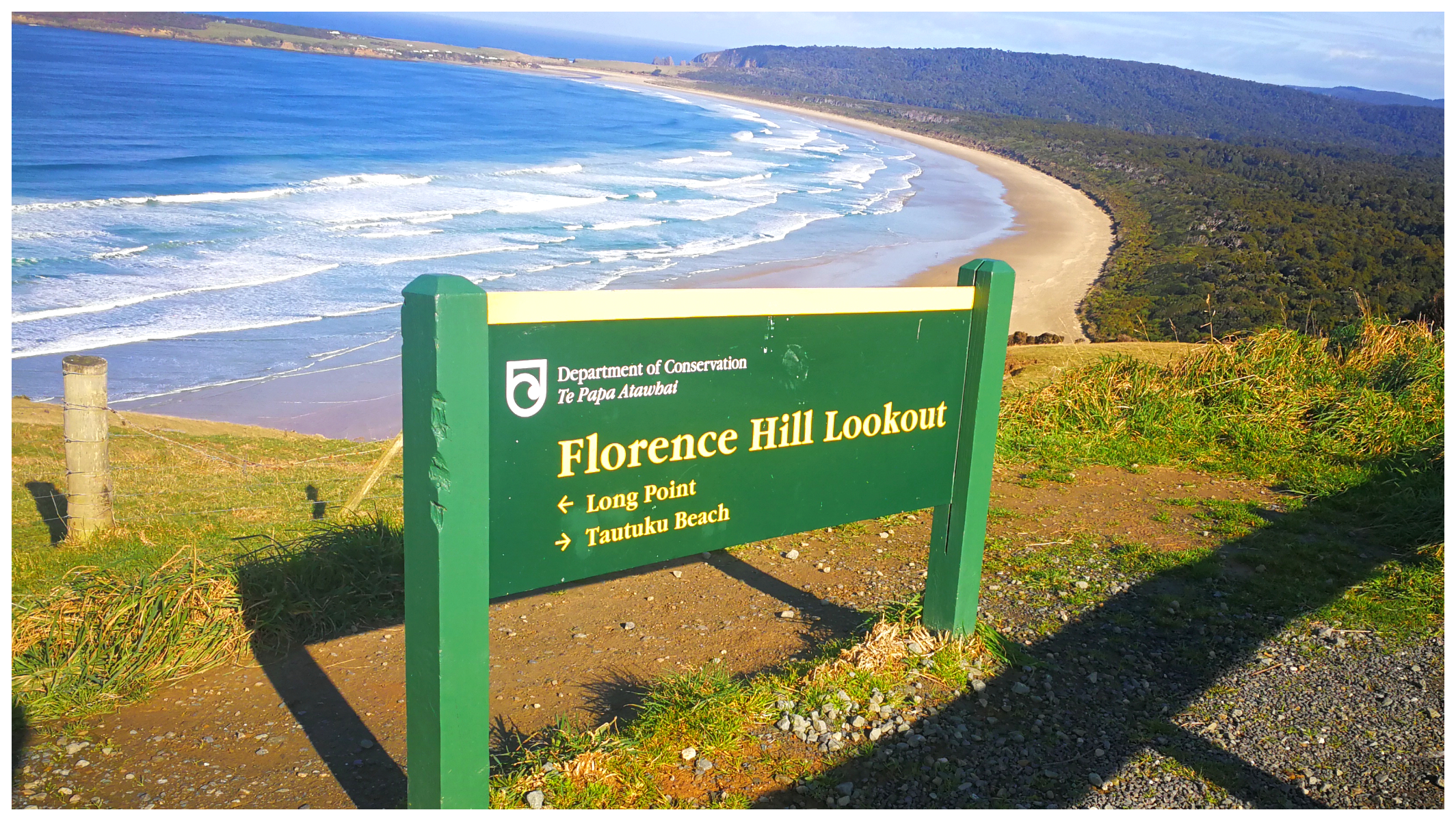
possibly the most popular lookout on the Catlins
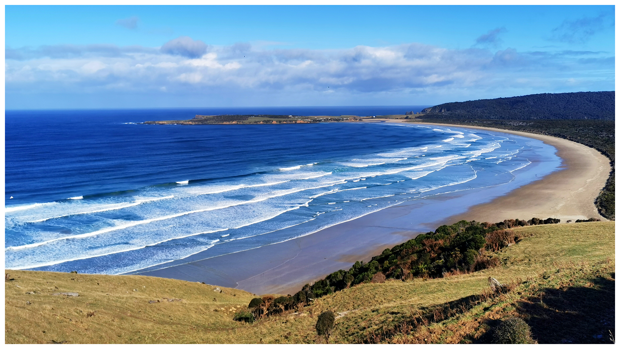
no a soul in sight on the sweeping, sandy beach below
We drove down onto the large expansive pristine sandy beach. We quickly decided that it really wasn’t ‘tailgate lunch’ type weather as we watched the sand shifting in the unrelenting winds coming in from the ocean.
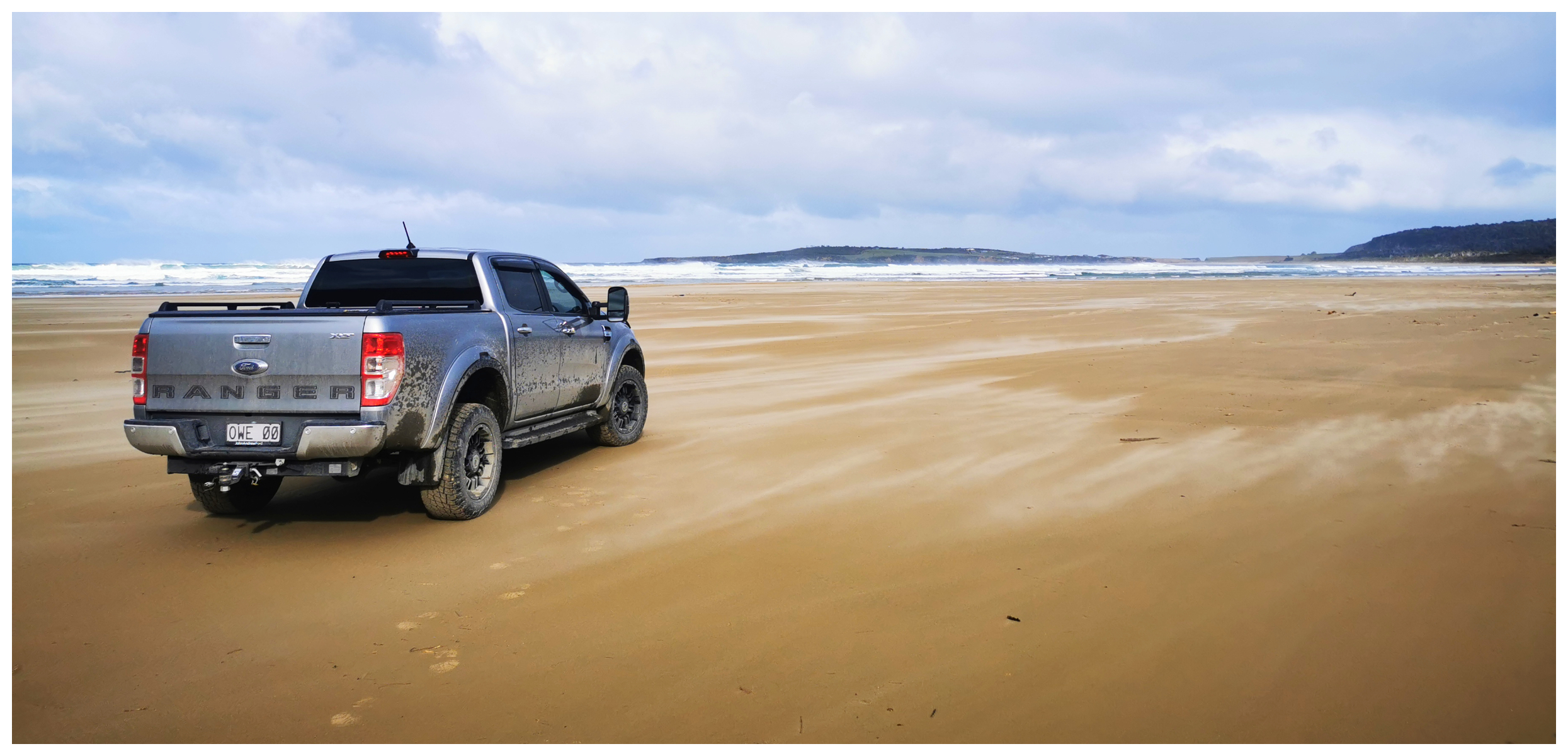
certainly not ‘tailgate’ weather as the wind whips up the shifting sands
We had been dodging showers and there were some pretty nasty gusts of winds. So we sat in the cab to enjoy our coffee and sandwiches.
Lake Wilkie
It’s easy to spot the signage on the main road, indicating the start of the 30-minute return walk to Lake Wilkie.
This seemingly small ‘bog lake’ was actually formed around 13,000 years ago after the last ice age. It is trapped from the coastline by a cliff, so water accumulated. Today it is very shallow and the water appears brownish and dirty which is from organic acids from peaty soils.
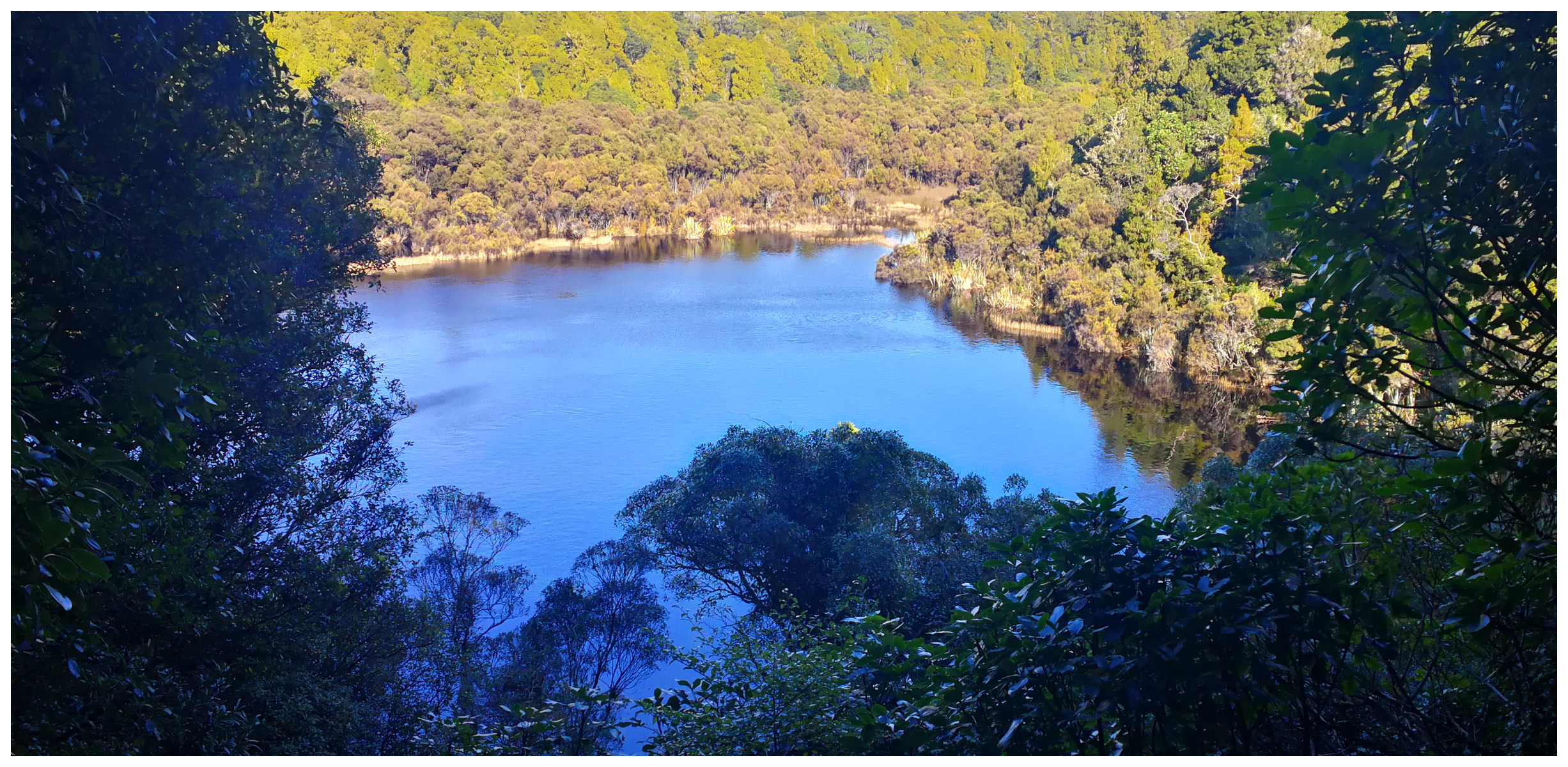
too much wind to get that perfect reflection
It has gradually shrunk and now covers 1.7 hectares (4.2 acres).
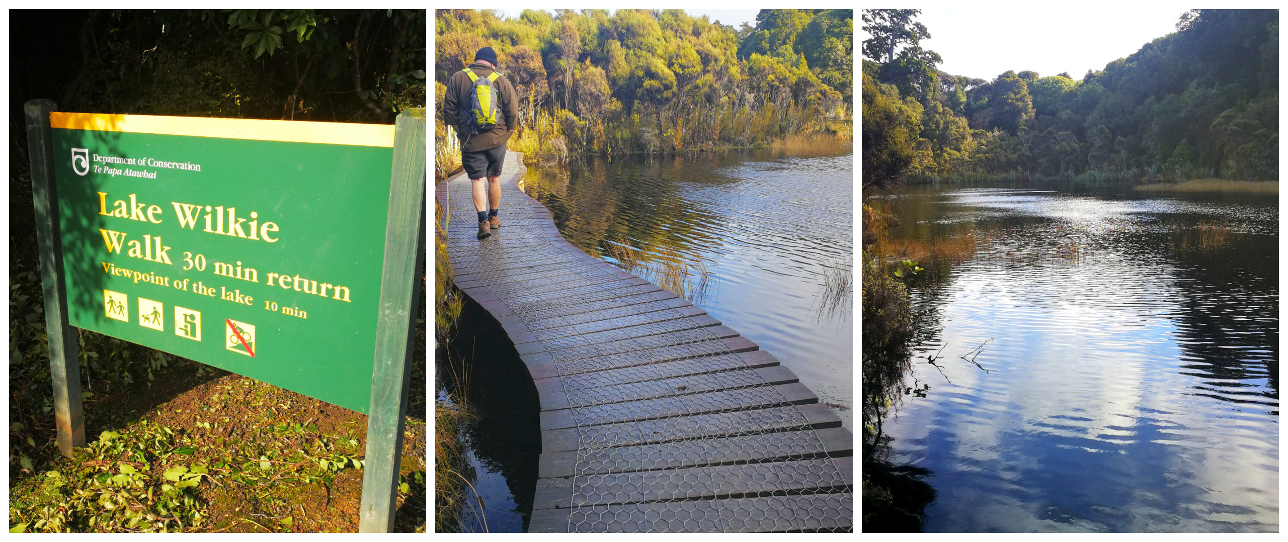
it’s an easily accessible walk to the lake
We found some great interpretation panels explaining the lake’s formation and how the vegetation has taken over as the lake shrinks.
Tautuku Sawmill
Situated opposite Lake Wilkie, we spotted the sign leading to a historical sawmill. Well, that got our attention so we decided to find out what it was all about.
Interpretation panels illustrate the history of the area during the busy days of the sawmilling industry.
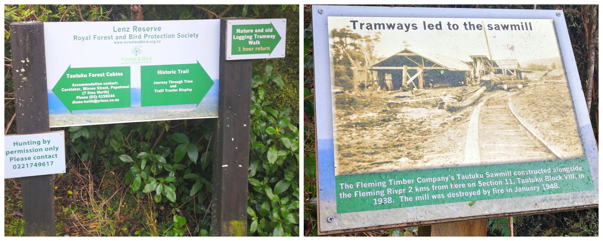
we took the trail to the right and ended up at the sawmill site
The Traills Tractor site and relics of the sawmilling era at the Lenz Reserve are the start of the various walks you can choose from. It is located around 10 minutes from the carpark.
We wandered around the historic bush tramway locomotive engine and powered bogies. This was used in the sawmilling era, with a Fordson farm tractor converted for use on wooden rails in 1924.
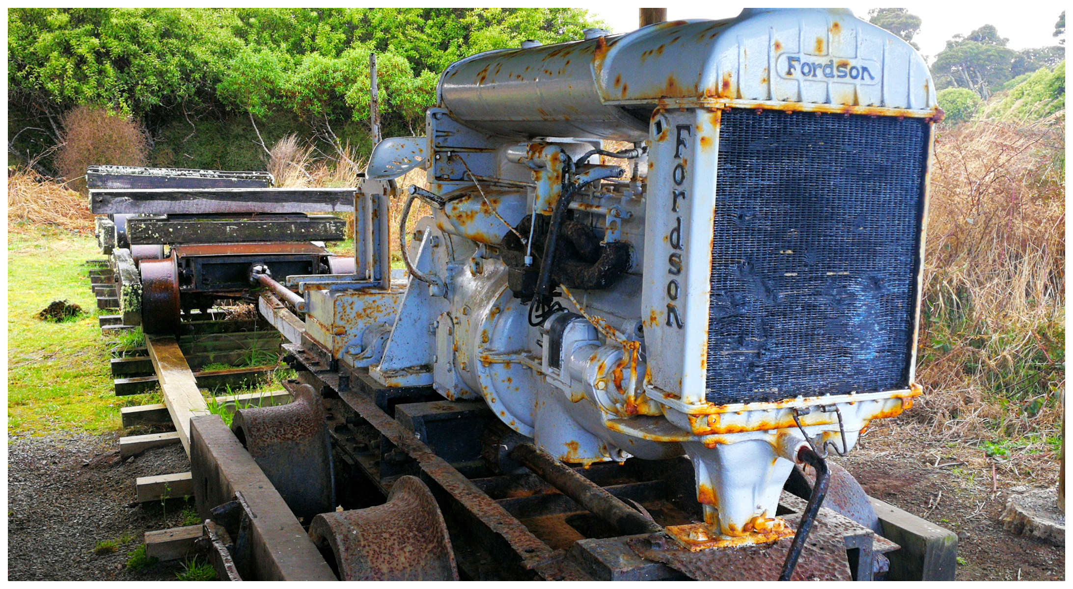
we soon found some relics of the past
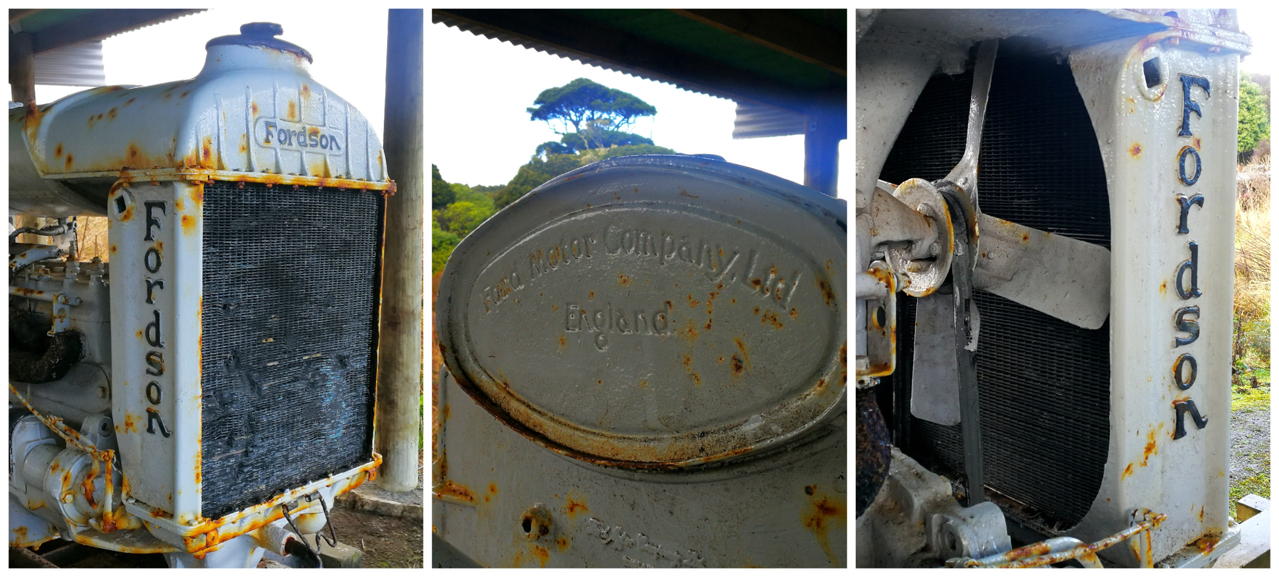
an effective way to move the logs
From the Traills Tractor site, we continued up the Nature Walk Loop Track. This track crosses from the mill and then links up to a logging tramway route where felled trees were brought down to the mill.
The Lenz Reserve Nature Walk follows a roughly circular route and takes about an hour of easy walking.
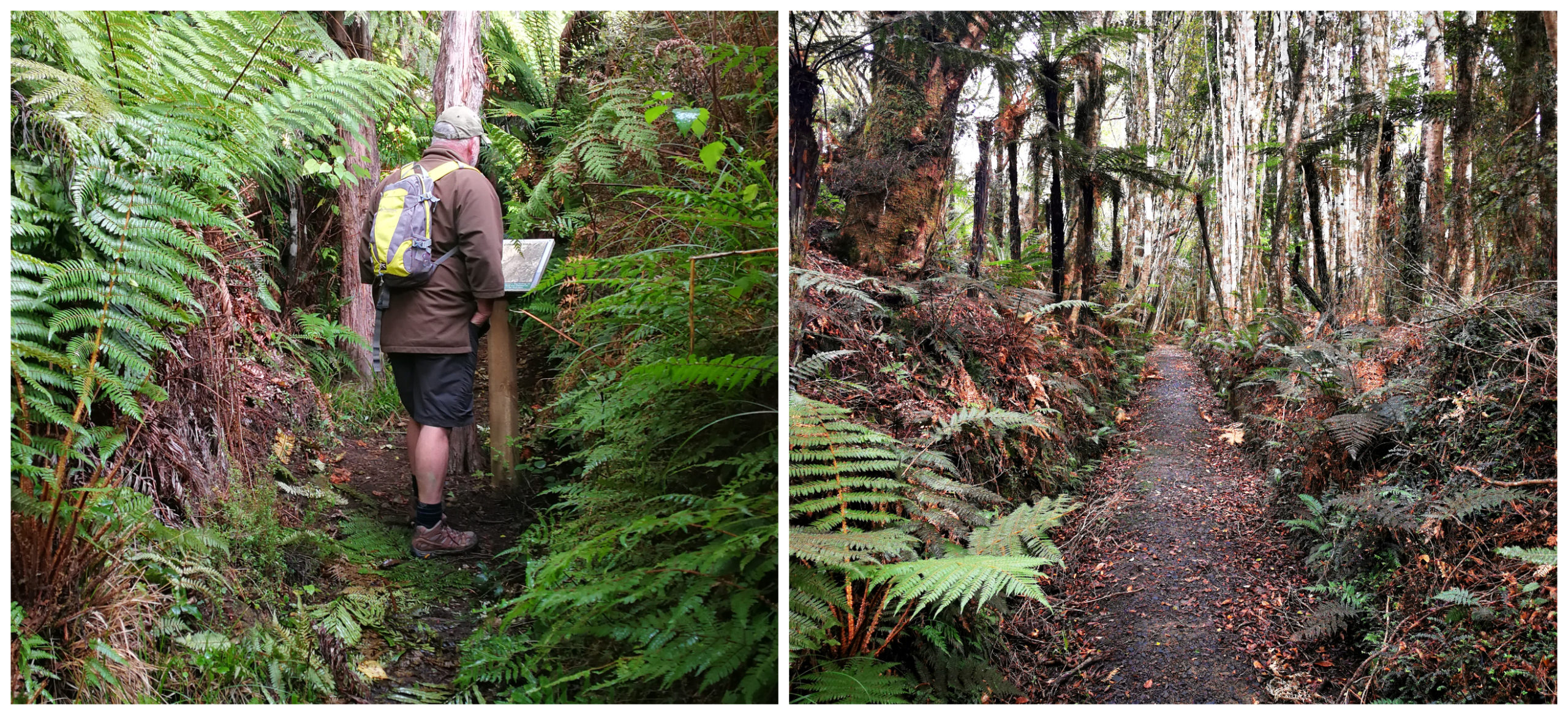
more than just a walking track but a step back in time on the old tramlines
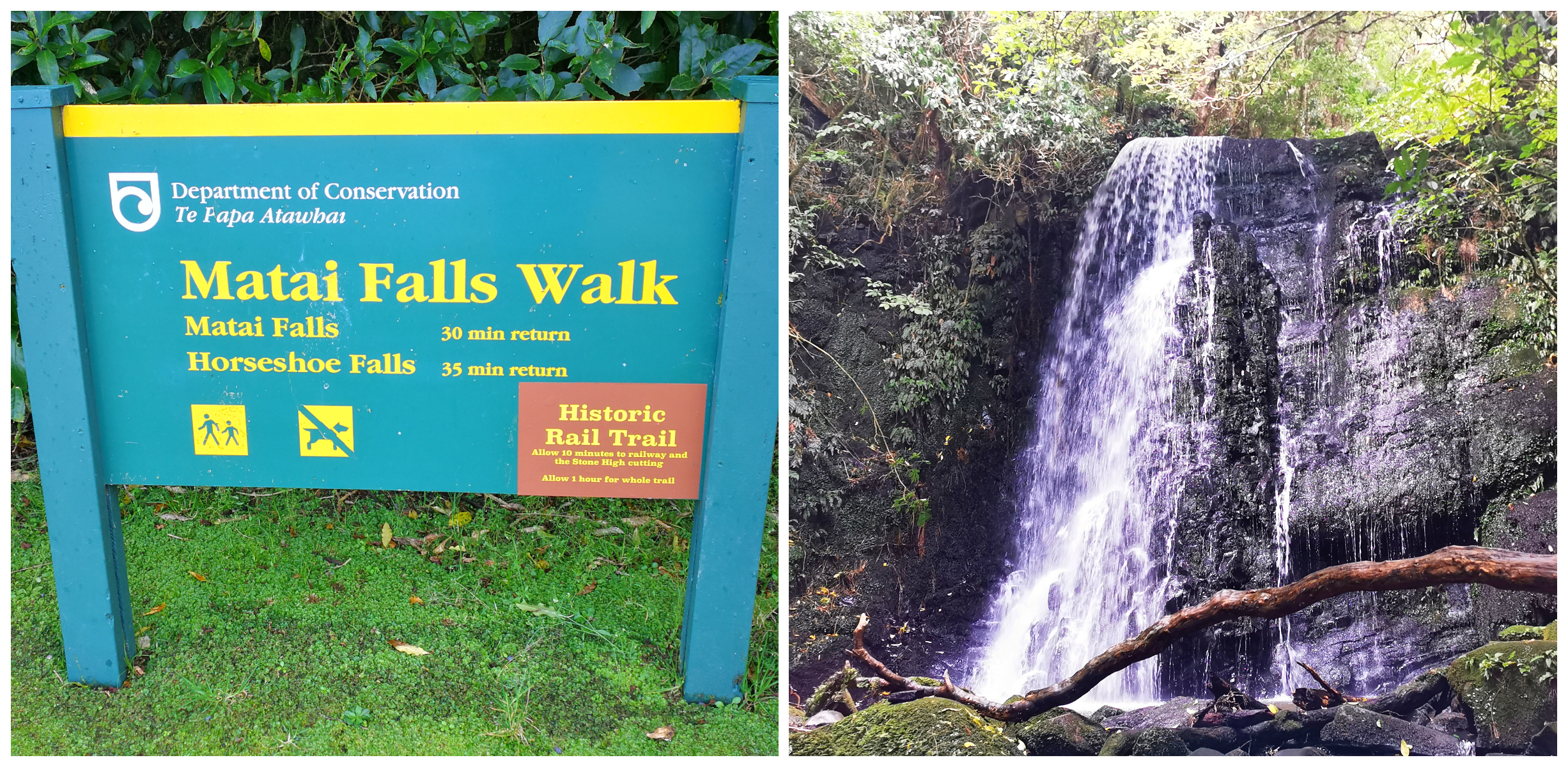
Matai/Horseshoe Falls & Catlins River Branch Railway
An 8km drive north of Papatowai (towards Owaka) is the start of the Matai Falls Walk.
It’s an easy 30-35 minute walk to get to the Matai and Horseshoe Falls. It also caught our attention as there is a chance to walk part of the Catlins River Branch historic rail trail, which adds another 1 hour.
the walks to the falls and rail trail
The Matai Falls is about 10m high and set in lovely surrounding podocarp and broadleaf forestry. The Horseshoe Falls is just another 5-minute walk uphill. As the name suggests, they are in a U-shape and wrap around the viewing platform.
Catlins Railway Line
You can gain access to the Catlins Railway line from the Matai Falls track. This is a return walk of up to an hour through forested cuttings and embankments of the old line.
There are views, historic and natural history information as well as a convenient picnic table at the top end of the walk.
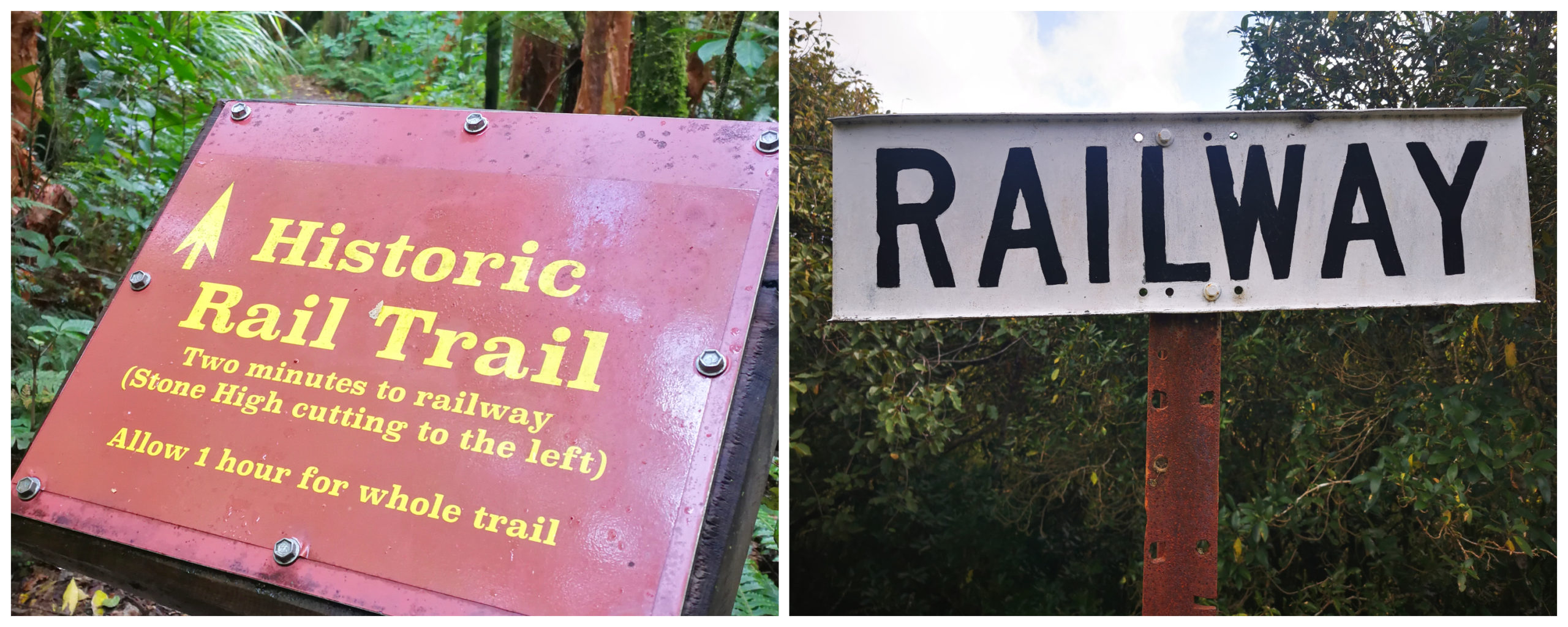
the start of the rail trail, allow an hour for this section of the walk
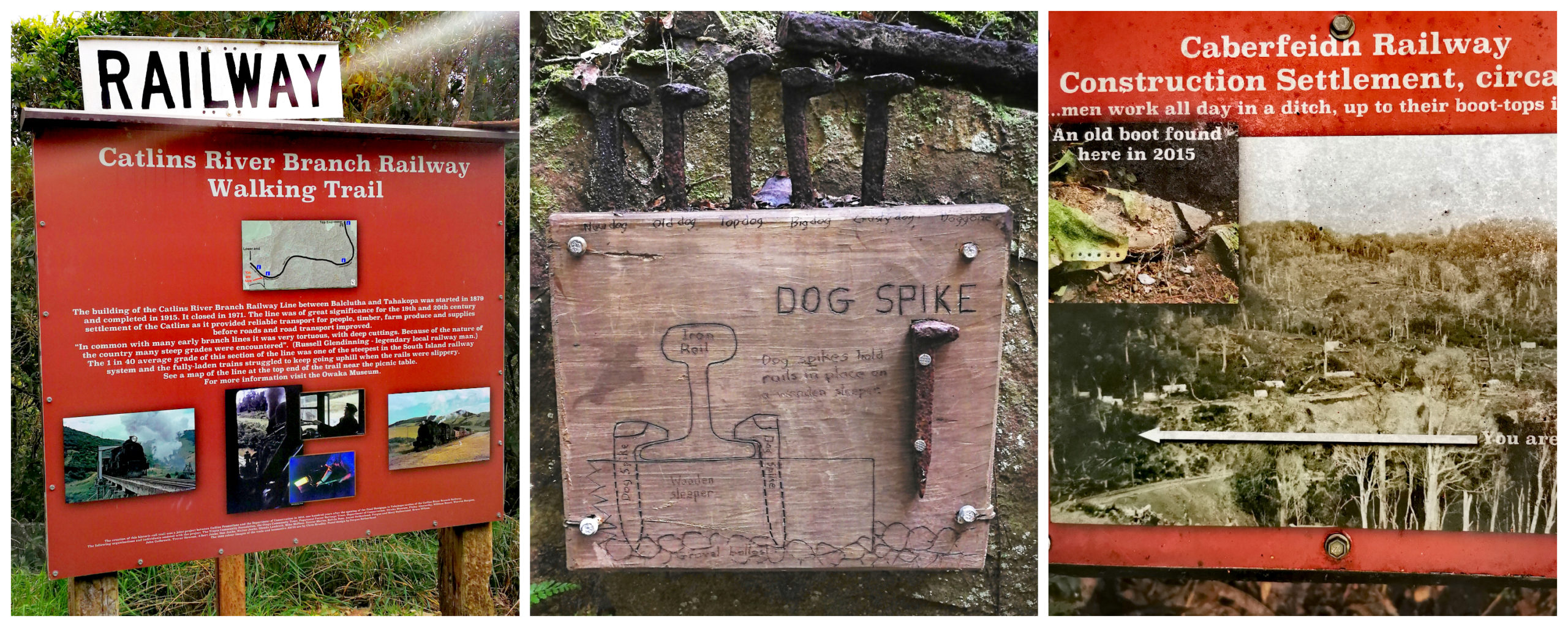
plenty of information panels along the track
This formed part of the NZ’s national rail network. It ran through the Catlins region and was built in sections between 1879 and 1915, closing in 1971. Prior to the line being built, access to the heavily wooded Catlins region was very difficult for the logging companies.
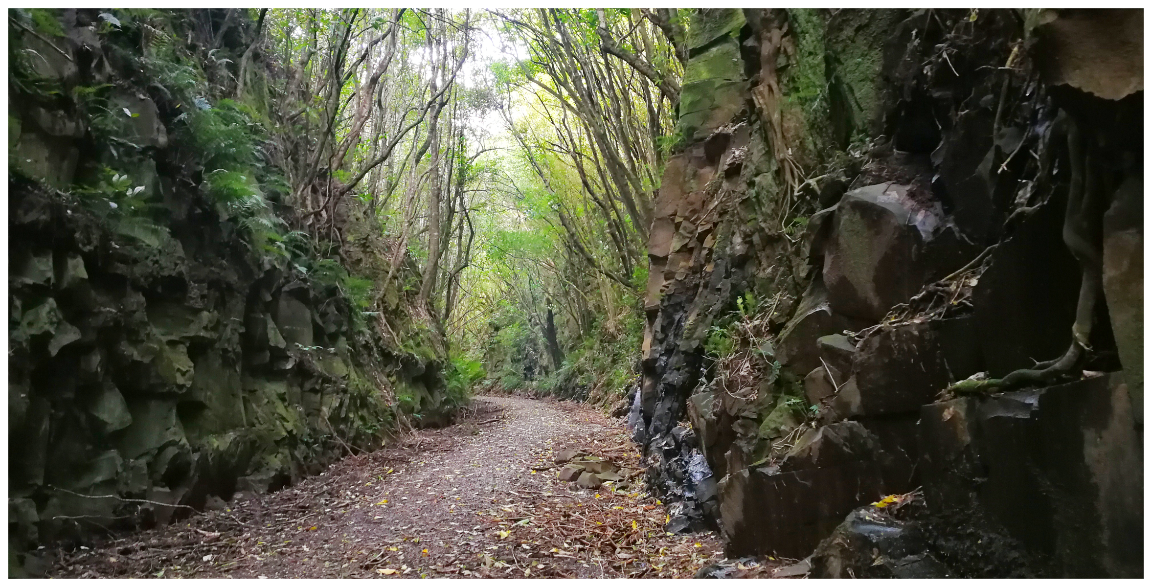
they used explosives to cut through the solid rock to form the deep cuttings
Summary
Part Two of our explorations of the Catlins proved just as interesting and spectacular as our Part One adventures. We’re looking forward to completing Part Three as we’ve still got quite a few attractions on our list to tick off.
Click on the link below to see some highlight of our Part Two Catlins escapades.
Fantastic blog. Lots of notes taken for our upcoming trip. Cheers
Wonderful, glad it helps in the planning. If you’d anything like us, it’s a long, long list
Fantastic blog. This helped us in our travels through the Carlins – thanks for taking the time to put this out there.
Hey Neil, thanks for your feedback and I’m so pleased my blogs were a help in planning your explorations of the Catlins. It’s an amazing part of NZ to discover. Happy travels. Linda