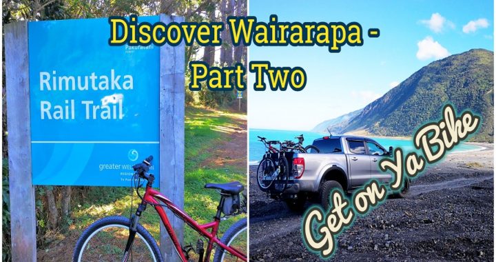
Get on Ya Bike in Wairarapa
Discover Wairarapa – Part One was all about us travelling to the furthermost south we could go, both in the Wairarapa and the North Island.
Part Two of Discover Wairarapa is all about us getting on our bikes and exploring some of the cycle trails in the area.
Read our blog on getting our mountain bikes converted to E-Bikes – We’re Converted. Without this conversion, we would not have had the ability to ride some of these trails.
“E-Bikes do not make you lazy!”
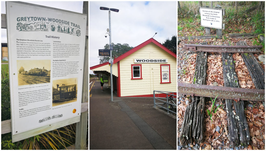
Greytown to Woodside Trail
Before we were converted to E-Bikes we gave the Greytown to Woodside Trail a go. We researched the track and it appeared to be flat, easy cycling and was only 10km return.

The fully fenced trail has a slight incline to the Woodside Train Station, with views of paddocks, the Tararua mountains and impressive stands of oak trees.
History
When the main trunk line was built through the Wairarapa, the line bypassed Greytown. The residents were up in arms and several meetings were held in an attempt to change engineers’ minds. Eventually, the project to run a 5km line from Woodside Station to Greytown was approved in 1878. It was hoped that this would transport goods and passengers to the wide open countryside of the Wairarapa from Wellington City.
So much history along the trail through the lush green Wairarapa countryside
The track opened in 1880, and initially, it was reported that the passenger numbers were satisfactory. In reality, they never met expectations and diminished steadily.
It continued to run on a limited passenger and goods service until it eventually closed in 1952. During the last year’s it received little in the way of maintenance. In 1954 the rails were lifted and today the only remnants are the goods shed and loading bank.
After securing funding from the Government of $30,000, the trail was opened to the public as a cycle and walking trail in 2013.
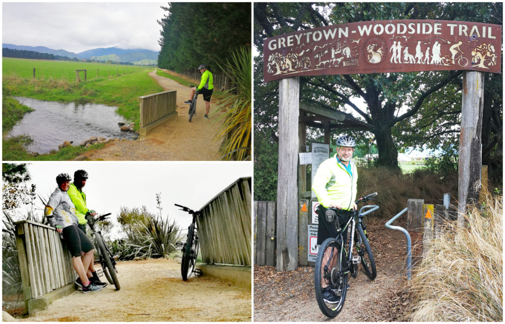
It was a great little trail for us to get back in the saddle
The Remutaka Cycle Trail
The entire trail stretches from Petone to Orongorongo and covers a total of 114km. It is divided into 4 sections, we decided to cover off 2 of these sections.
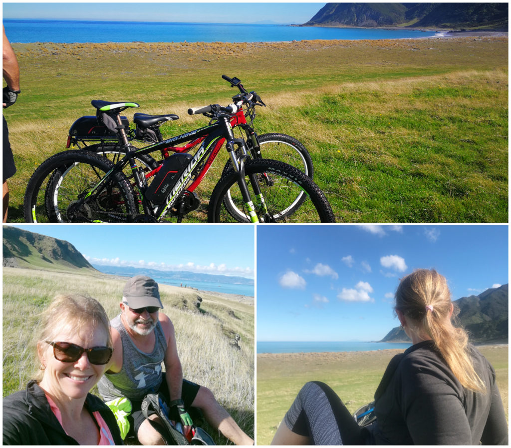
Ocean Beach to Orongorongo
This section of the trail runs right along the coastline at the bottom of the North Island and covers 18km. It is a Grade 3-4 (intermediate to advanced) so we knew that it would be a little challenging.
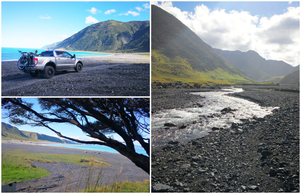
Even the views on the way to the start of the trail were spectacular
It was Anzac Day, so after attending the Dawn Service, we got ourselves organised and headed down to Ocean Beach. From Martinborough, it is about a 50-55 minute drive.
We arrived at the Corner Creek DOC camp, unloaded the bikes and headed off. Although it was only 17km long, we soon realized that we were not going to be able to complete the return trip to Orongorongo today. We did get a later start (around midday) so an earlier start would be needed to complete it.
Certainly keen to return another day to do the track justice
We did, however, cycle around 8km in and the scenery we saw, made us want to come back another day and complete the entire section.
Two weeks later we returned. We started off from the DOC camp at around 10 am and made it all the way through to Orongaronga and return.
Just Stunning But Challenging
It would be fair to say that this would have to be the most stunning cycle trails we have ridden. The coastal scenery was breathtaking (if you had time to glance away from the track you’re trying to negotiate!). It isn’t for the faint-hearted and is not suitable for road bikes.
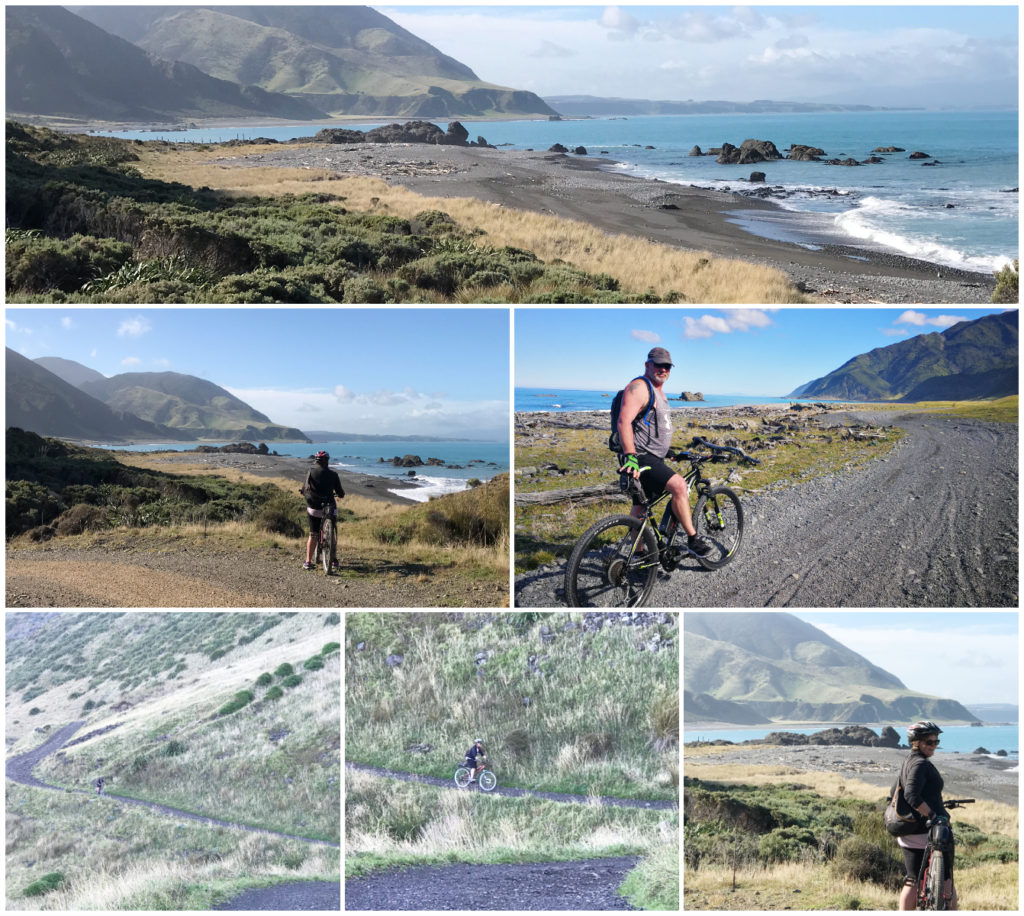
The changing views around every corner
A portion of the track has been wiped out by a large shingle slip which required us to dismount and walk our bikes over rocks and silt. Extra care needed to be taken as there were numerous pockets of fine silt. There was no recovery when your tires sunk and you came to a screaming holt. Only found out after I landed in an ungraceful heap. At least it was a soft landing. Once again, we needed to dismount and walk through these drifts.
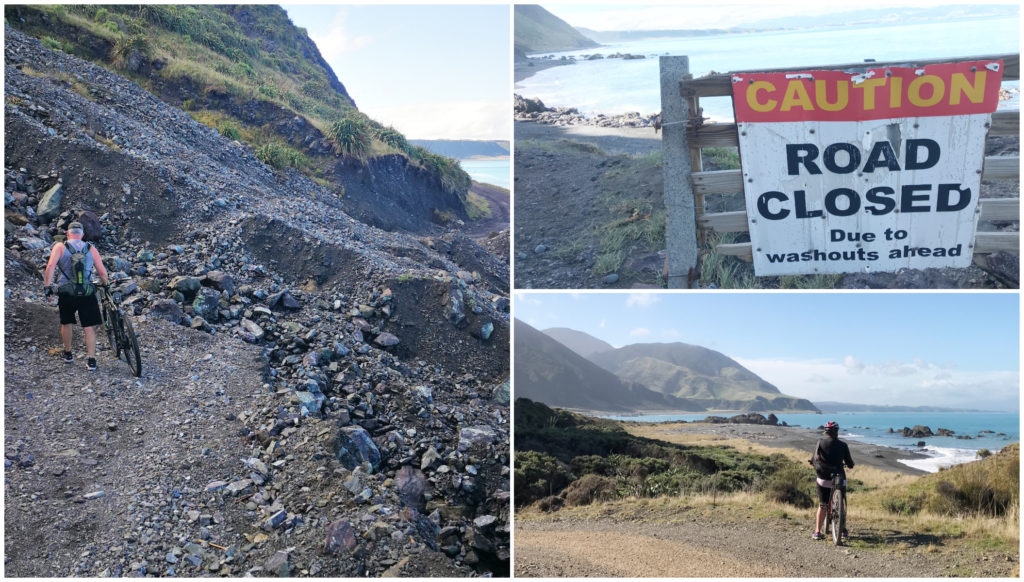
A minor hurdle like a huge slip wasn’t going to get in our way!
Some of the ascents and descents required a lot of concentration and there were numerous stream crossings.
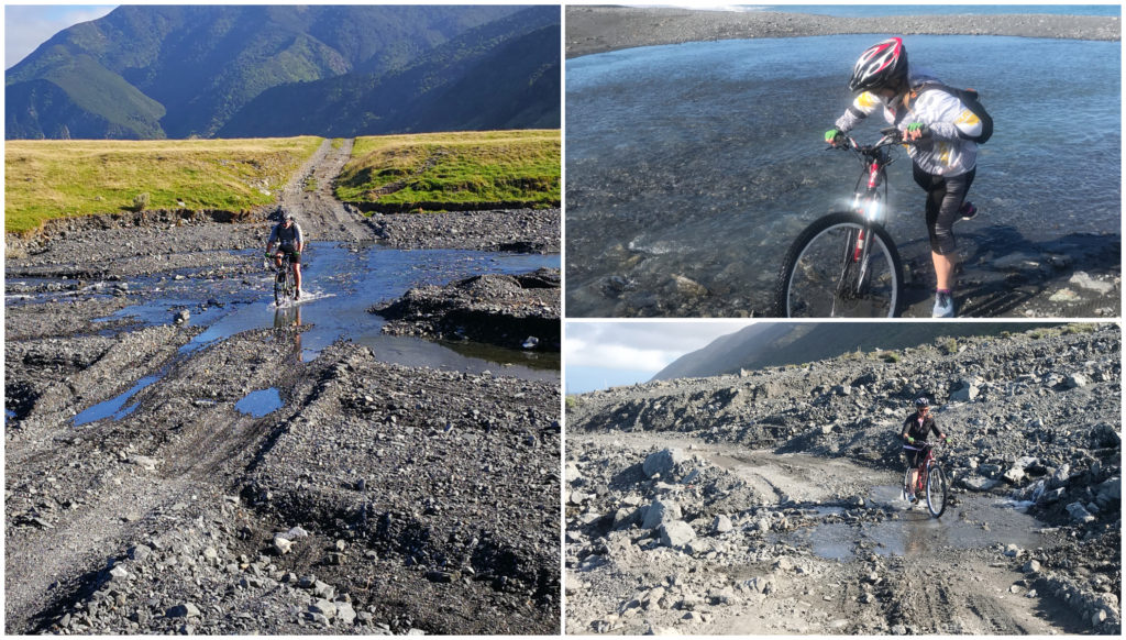
With many stream crossings, it was inevitable that we were going to get wet feet!
We were blessed with wonderful weather both days. You would need to choose your days carefully. Our mild, sunny and windless days was the icing on the cake. It would certainly be a different story if you had to contend with those Cook Straight winds, driving rain and the cold.
This coastline is also home to up to 500 fur seals which come ashore each winter.
Click on the link below to see a short video of some of our highlights of the trail.
Cross Creek to Kaitoke – The Rail Trail
Located 12 km from Featherstone, Cross Creek is the start of one of the middle sections of the trail. This is part of the old railway line which was established in 1878 which ran between Hutt Valley to Featherston. It was still in use up to 1955 when the Rimutaka rail tunnel opened.
Fell Engine
What made it quite unique was that parts of the railway line were so steep, it was only possible to travel up and down it by Fell Engines. There were 6 of these Fell Engines in use on this section of the track. The engines had an extra set of centre wheels which were lowered onto an additional rail track to give it more traction.
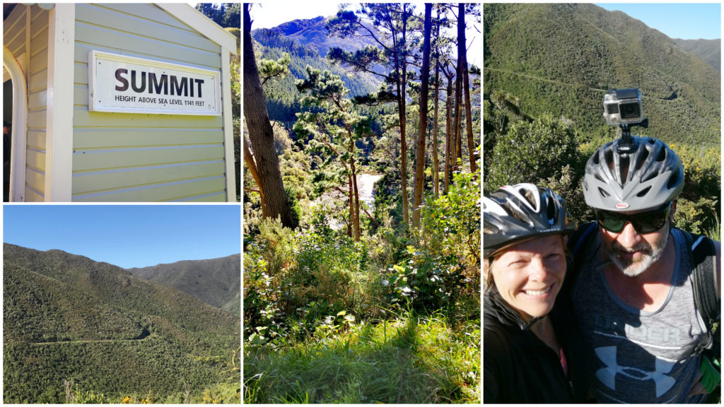
The steep incline winds its way up the ridgeline of the mountain range to the summit
They were specifically designed to negotiate the steep grade while hauling larger loads. Fell Engines were only used on a section 4.8 km long. The rest of the trip was made by the standard locomotive.
The entire section runs all the way to Maymorn (a total distance of 25km). We stopped and turned around at Kaitoke (around 18km one way).
Information Boards
We always enjoy trails that have information boards dotted along the trails. We make sure to stop and read the history of the area we are riding along. There were plenty of these boards, telling the story of the small communities that existed along the track. The story of the building of the tunnels, the lives lost and how the Fell Engines operated.
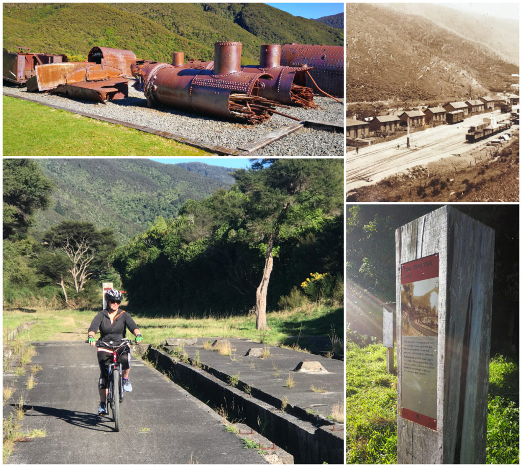
So much history along the way. Old workshops, engine bodies and signboards
The trail is graded 2-3 (easy to intermediate). There is only one part of the trail which required us to dismount and walk our bikes up and down a rocky steep section (Horseshoe Bend). Apart from that, it was easy going – especially with E-bikes to tackle that constant incline all the way to the summit.
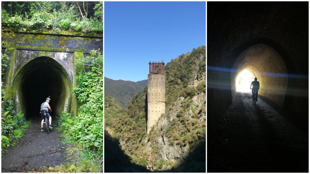
The old structures of the tunnels and bridges are still evident
Click on the link below for highlights on our cycle ride along the Rail Incline section of The Rimutaka Cycle Trail.
The Rimutaka Cycle Trail
This is one of New Zealand’s greatest rides and part of The New Zealand Cycle Trail. We’re stoked to have been able to tick parts of this trail off our list of rides to complete. Click here to find out more information on the trail.
We’re full time living on the road in our caravan and house/pet sitting as we travel the length and bredth of our beautiful country. Click here to read more about us.
Hiya. I won’t be over in Wairarapa Martinborough now until next week. I’m still keen to meet you. Cheers. Kevin
Hey Kevin, we’re leaving Martinborough on Saturday, staying the night at Petone Workingman’s Club before crossing over to the mainland on Sunday morning. Never know, we might see you in the South Island one day. Linda
The Rimutaka Cycle Trail looks so exciting and adventurous. I enjoyed reading your adventures here and good tips on your E-bikes.