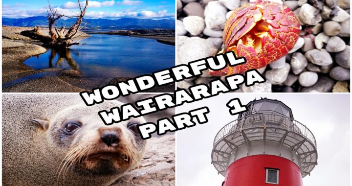
Wairarapa – House Sit Destination
The Wairarapa was our next destination. See our blog on how we got here – Heading South – Farewell Auckland.
Mixing house sitting with living full time on the road means we have the best of both worlds. We get to explore areas that we would have previously just driven through, or not even detoured off the main route to spend time there. Wairarapa was no exception.
I’m Guilty
I’m the first to admit that the Wairarapa is one of the places that I’d previously just driven through to get from point A to B.
Sure, I had visited some of the Wairarapa towns on the ‘way through’ to somewhere else without really researching the area and finding out exactly what there is on offer.
Martinborough
We were thrilled to be accepted for a house/pet sit in Martinborough in the heart of the Wairarapa. It was for just over 4 weeks which is plenty of time to really get beneath the skin of the area. To find out what it’s like to live like a local in this very ‘wine orientated’ town and it’s surrounding areas.
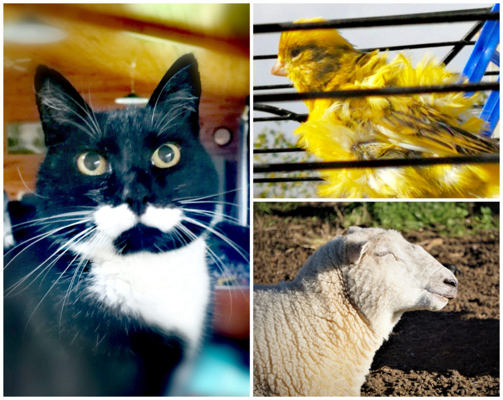
Sox the cat, 2 canneries (1 with a really bad hair day) and 9 sheep
Martinborough is located 65km east of Wellington. The closest larger town is Masterton which is 35km away. But what gets me most excited about Martinborough is the fact that there are no less than 20 Cellar Door vineyards. These are located all within cycling distance of each other and more importantly, from where our house sit is located!
John Martin is regarded as the town’s founder and set out the first streets in the pattern of the Union Jack. He subsequently named some of those streets after places he and his family visited on a world tour in 1875.
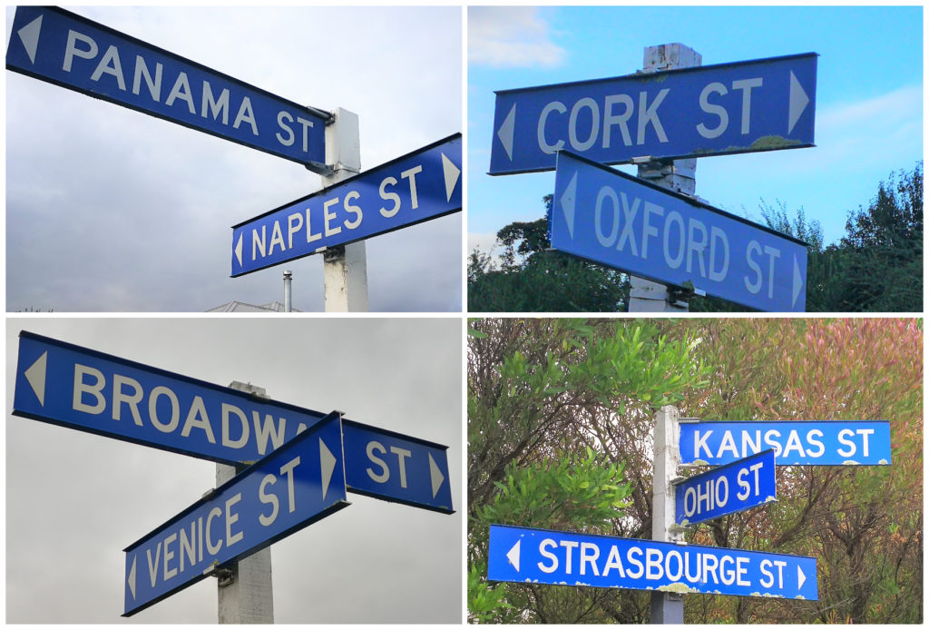
Names of roads from all around the world
I never realised the history that surrounds these towns in the Wairarapa and I’m loving the beautiful old buildings. The Martinborough Hotel stands proudly by the Town Square. It is now a very popular restaurant and boutique accommodation.
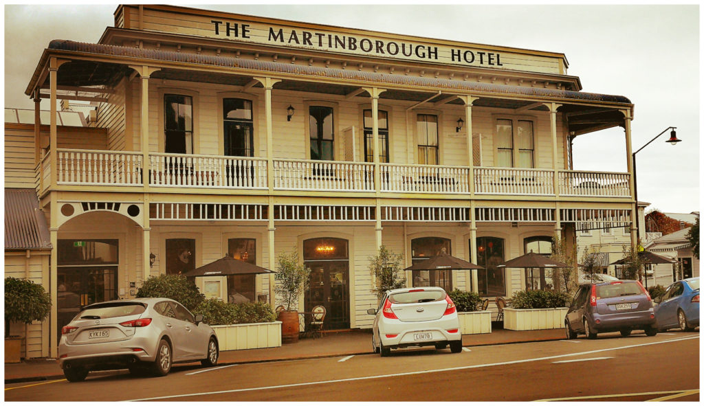
The very grand Martinborough Hotel overlooks the Town Square
It was originally built in 1882 and was once a way station for travellers from the south Wairarapa’s huge isolated sheep stations. Oh if only those walls could talk!
Lake Ferry (Lake Onoke)
With the caravan unhitched and us settled into a ‘normal house’, it was time to spread our wings and see what all the fuss was about when it came to Wairarapa district.
Just half an hour’s drive from Martinborough (south) is Lake Ferry. A sleepy beach village on the shores of Lake Onoke. Lake Onoke empties out into the rugged Palliser Bay.
It got its name as it was once the site of a ferry service that operated across the narrow lake outlet.
Lake Ferry Hotel
Initially, the ferry service was operated by local Maori. Following serval drownings, a ferryman was appointed to carry out the work. To supplement his income, he opened a hotel in 1851 and combined the role of publican and ferryman.
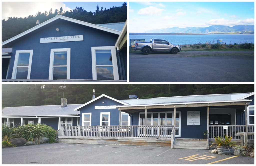
The iconic Lake Ferry Hotel overlooks the large lake.
The original building was a cross between a Maori whare and a shepherd’s hut, using timber from the many shipwrecks that occurred in the area.
This was later rebuilt in 1919 and this is what still stands today.
This hotel still proves popular for local residents, farmers, day-trippers and foreign tourists. They have a reputation for selling the best whitebait fritters and fish chips. Alas, it was closed when we drove past! I’m thinking that it may warrant another drive out from Martinborough, at least for a feed of fish and chips!!!
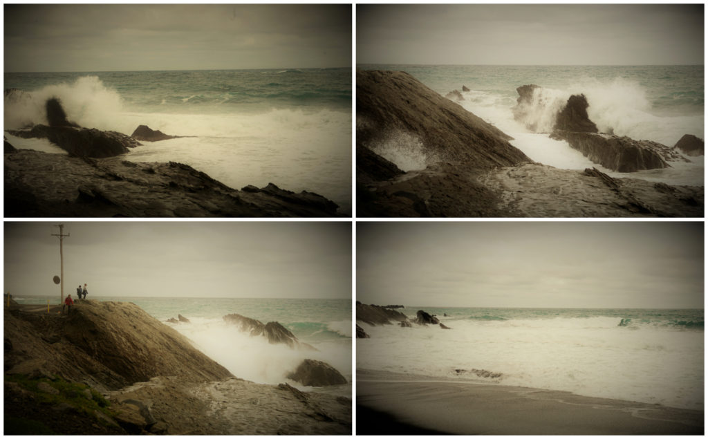
Palliser Bay
We drove a short distance past the hotel and onto the rugged, exposed Palliser Bay. I just love our wild, windy coastlines. They just have so much character! The Wairarapa is full of them.
Rugged Palliser Bay stretches for 40 kilometres along the Cook Strait coast from Turakirae Head to Cape Palliser. It is the North Island’s southernmost point.
The coast is fully exposed to southerly swells. Its mudstone cliffs are undermined by waves and prone to collapsing. I made a mental note not to go wandering too close……just my luck!!!
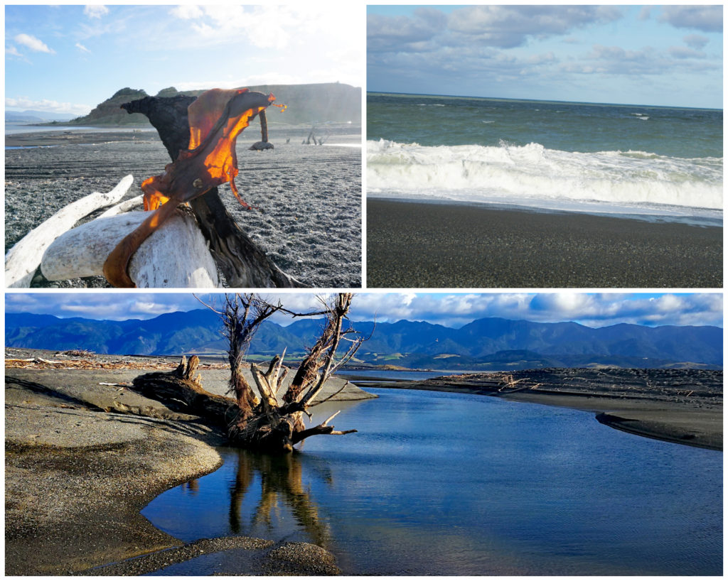
The wild characteristics of Palliser Bay
There were fishermen making the most of a clear day. Although there was no rain, there was certainly a brisk wind coming through. I could see in an instant why there are signs up warning people not to swim. The waves that were crashing close to shore would certainly swallow you up in an instant.
From a Camping Perspective
There are two Holiday Parks in the area. Lake Ferry Holiday Park and Gateway Motel Holiday Park.
Others may be able to correct me, but there were very few spots where you would be able to freedom camp. We did stop off at some public toilets, I don’t recall seeing any ‘no camping’ signs. You may be able to take the risk but I think that a camping ground may be your best option at Lake Ferry.
Ngawi
Heading towards Cape Palliser, you pass through a small fishing/holiday town called Ngawi (‘naa-wee’). There were some pretty quirky looking holiday and permanent homes in the village.
What I found quite fascinating was the fact that there are more bulldozers per capita than anywhere else in the world.
You would need to be quite the hardened fisherman/fisherwoman to fish these waters. Both commercial and recreational vessels line the bay. The bulldozers and tractors are the only way that these boats can be launched and retrieved. There is no wharf or any other access to the ocean and it can be notoriously rough.
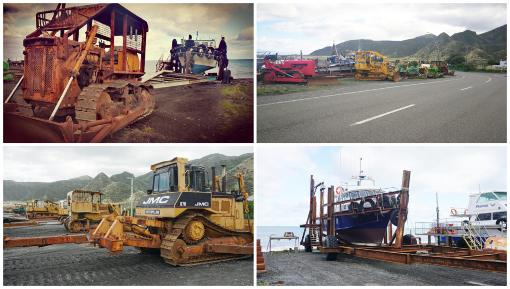
More bulldozers per capita than anywhere else in the world
They fish for paua, crayfish and cod. It is also a popular spot for spearfishers.
Unfortunately, there were no boats coming or going the day we drove through. I would have been mesmerised watching them launch and retrieve their boats. Maybe next time.
Cape Palliser
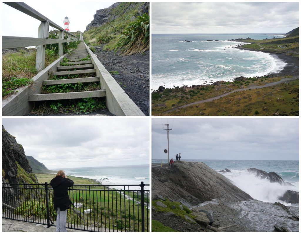
Only another 5km on from Ngawi is Cape Palliser Lighthouse.
The solid cast iron Cape Palliser lighthouse has stood on the cliffs here since 1897 – and still going strong.
Six months before the lighthouse was completed a ship was wrecked just miles from the new lighthouse. Twelve people lost their lives that day.
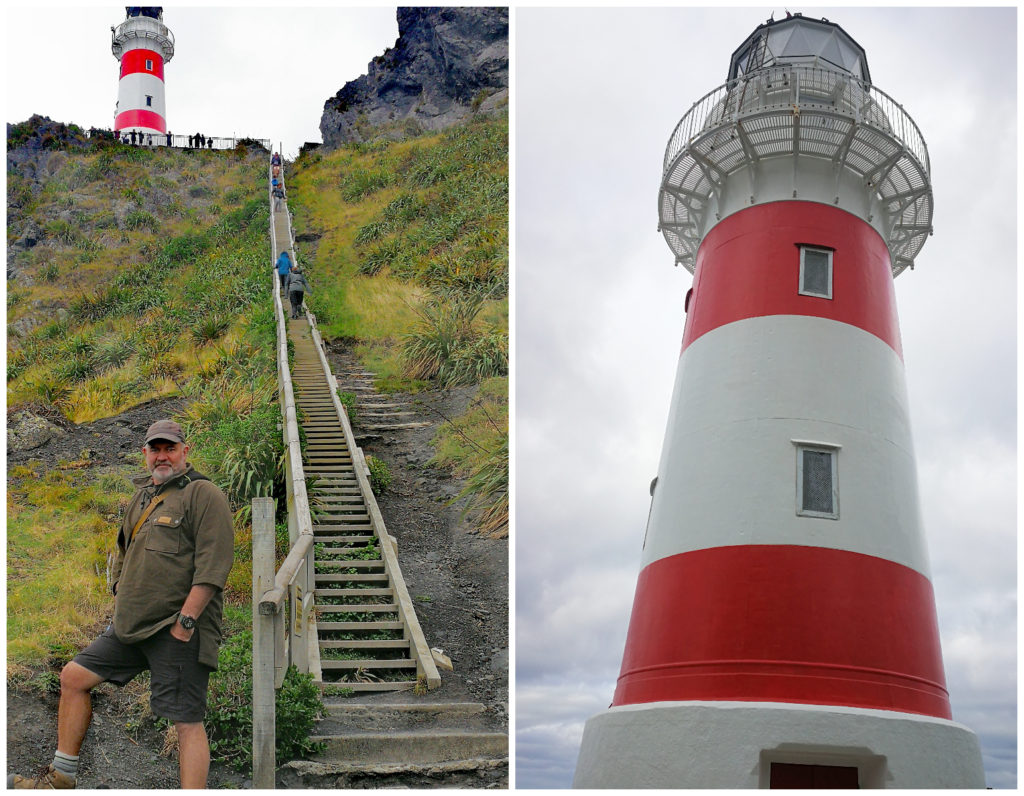
Sigh – 253 steps!!! The cast iron lighthouse at the top of the stairs.
Back then, oil lamps were used until as late as 1954. It was then switched over to a diesel generator until 1986 when it was fully automated and controlled from Wellington.
The bulbs flash 2 times every 20 seconds and can be seen an astonishing 48 km out to sea.
The lighthouse is 18m tall and there are 253 steps to get to it. Needless to say, I had to stop a couple of times – purely to admire the lovely view!! Truth be known, it was actually to make sure my lungs stayed in my chest!!
The dreaded stairs, but what a view of the wild and rugged coastline
I had to spare a thought for those early lighthouse keepers who had to haul oil and kerosene cans up a dirt track before the steps went in – constructed in 1912.
Not For Large Vehicles
We did not have our caravan in tow today. It is an off-road caravan with great ground clearance and suspension. The ford crossing would not have been an issue for us if we did have our caravan behind us. However, the tight curves and overhanging rocks would have been.
The wilder the better – the road to the lighthouse
The most narrow part is just past the ford crossing. It would certainly pay you to obey the road sign. There were a few mobile homes and smaller cars parked up. It is only a 2km walk to get to the lighthouse from this point.
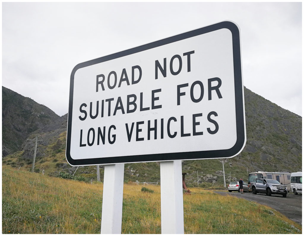
Always take note of the signs
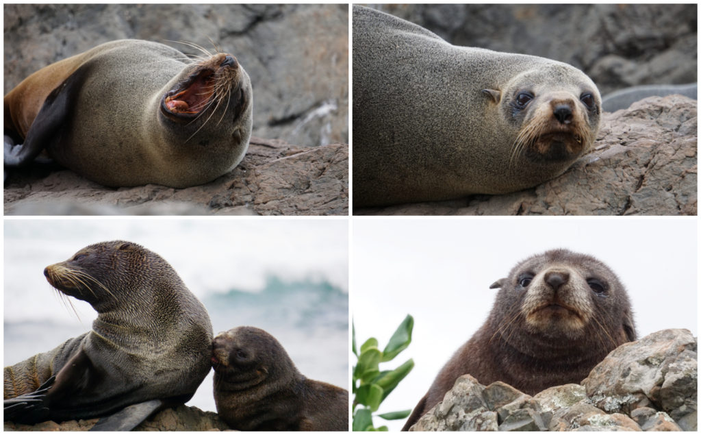
The Fur Seals of Palliser
Not far from the lighthouse on the roadside, you will find the largest breeding colony of native fur seals in the North Island.
At first, you may not notice the seals because they blend into the rocks perfectly. Once you’ve seen a couple, they become easier to spot. You can certainly smell them before you see them.
There are hundreds of these wonderful creatures along the rocks. There are so many, you need to be careful when parking and walking.
It is seriously a great photo opportunity. It is nature up close and personal but they need to be treated with the utmost respect. They are wild animals so will become aggressive if they feel threatened.
So many photo opportunities – all at a respectful distance
We maintained a healthy distance from them and thankfully, so did the other visitors that had stopped off for a look (apart from one plonker in a car who thought it was easier to drive up to them rather than walk!). You have to make sure you don’t get between the seals and their escape route to the sea.
It was at this point we were very pleased to have a camera with a great zoom lens. It appeared that we were only metres away, yet quite a distance from the sunbathing seals.
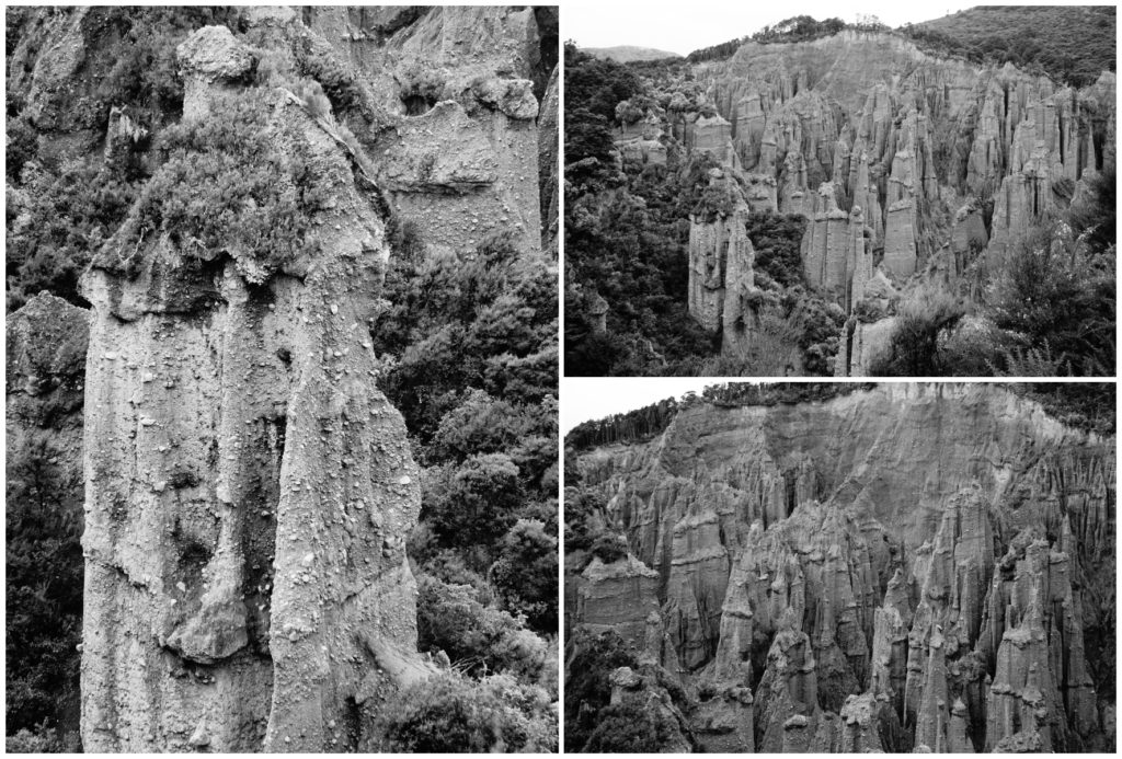
The Putangirua Pinnacles
On the road to (or from) Cape Palliser, you don’t have to travel far to find yourself in another world. Resembling something like Mars, the Putangirua Pinnacles tower up out of the ground like some sort of unearthly landscape.
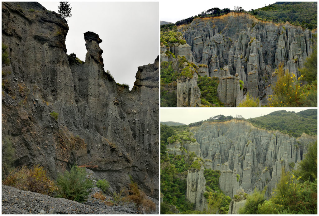
Can you see the side profile face in the LHS pic?
Apparently, as history goes, the Aorangi Range was an island. The mountains eroded and gravel was washed down to the coast. It then took a mear 120,000 years for the Putangirua Stream to expose an ancient layer of gravel during rains and floods.
Some of the sediments stayed concreted together, while others washed away. The result is these huge pinnacles called hoodoos.
This barren landscape was used as a filming location for the ‘Paths of the Dead’ in the 3rd movie the Return of the King, in the Lord of the Rings trilogy.
Three Routes
You can choose whichever track you like to view The Pinnacles.
They all start and finish at the carpark. The track will split about 500 metres along the path and we took the left-hand track which was to the lookout.
Hill Climb to Lookout
It was fair to say, we had way too many layers of clothing on. This was to combat the windy, cold conditions at the lighthouse. We didn’t take into account a long hard slog uphill, stairs and negotiating steeper sections of the walking track. The layers HAD to come off one by one, which meant having to carry them!
The lookout offered us some amazing views and our first glimpse of the hoodoos.
I can understand the movie set appeal
Loop Track Downhill
This is a loop track so on our way down we took the fork to the left again and started our descent down to the base of the pinnacles.
We arrived at the streambed which today, only had a small amount of water coming down. We could certainly see where it had once been a raging river, hence the resulting formations.
It was another walk up the riverbed, jumping from rock to boulder. After about half an hour of this, we decided that we’d got close enough. Going any further wouldn’t have offered us any better views.
Streambed Track
We diverted off the loop track to take the streambed route back to the carpark. This did involve a couple of stream crossings, wet boots and trousers and some careful negotiating of the loose shingle. At times we were perched perilously close to a rather swift, deep flowing stream.
Allow Enough Time
We spent around 3-4 hours to do the three tracks so make sure you allow plenty of time if you want to do this attraction justice.
From a Camping Perspective
We saw some opportunities for freedom camping. We also saw many ‘no camping’ signs. Pick your spot carefully if you are wanting to camp for free in this area of the Wairarapa.
Ngawi offers a free camping spot and a POP (Park Over Property if you belong to the NZMCA) and the Waimeha Camping Village.
Our exploring of the wonderful Wairarapa is to be continued.
Click on the link below to watch a video on some of our highlights.
This is a beautifully written blog. Especially liked the Martinborough Hotel and the light house – the 253 steps is well worth the climb. I like lighthouses and I have the Cape Palliser one on my list – hope to visit one day 🙂
How very interesting, I have been to Auckland frequently to visit our daughter and help her set up house, but next time we hope to see more of the island and your descriptions will be a great guide!