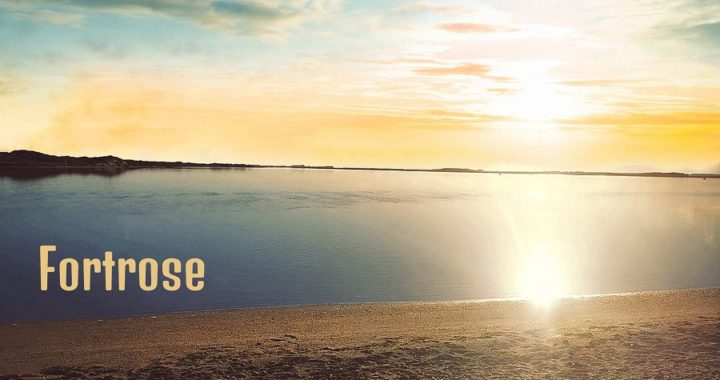
It’s such an unusual name – Fortrose. There just has to be some history to it, surely!
Where is Fortrose?
After breaking camp at Waikouaiti Beach (see the previous blog) we had to head south to Invercargill for some ‘life admin’. We had a night to fill in first so decided to stop over at Fortrose, a 243km drive from Waikouaiti.
We have visited Fortrose on our way to or from destinations along the Catlins coastline. Click here to read Catlins Part One. We were familiar with the area, and to be fair, it has always been blowing rather hard the times we have stopped in.
This would be our first time overnighting in Fortrose and the weather Gods were smiling on us this time.
Fortrose is the Southern Gateway to The Catlins coastal route. It sits approximately 40km from the city of Invercargill. Often the first or last port of call for many travellers who enjoy this beautiful and rugged coastline.
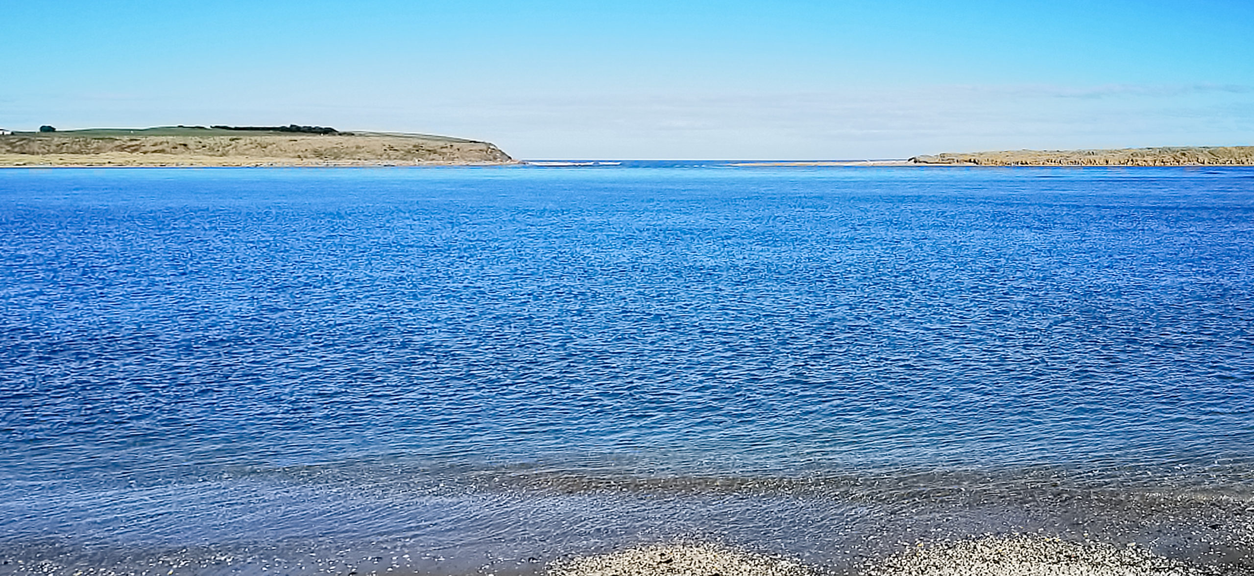
Fortrose is situated on Toetoes Bay, right across from the mouth of the Mataura River.
Where we Stayed
Thankfully, Fortrose is ‘freedom camping friendly’ and there is a large area, right on the water’s edge. It is an exposed possie so there is the potential for some pretty violent gusts coming through.
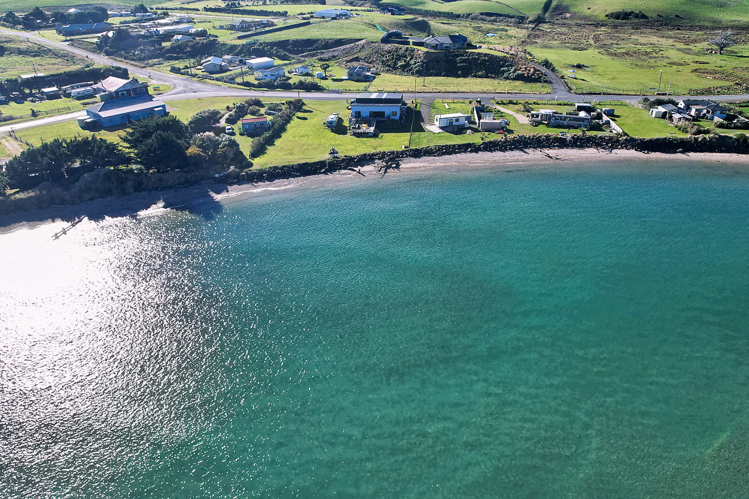
Hoover House is located right on the water’s edge
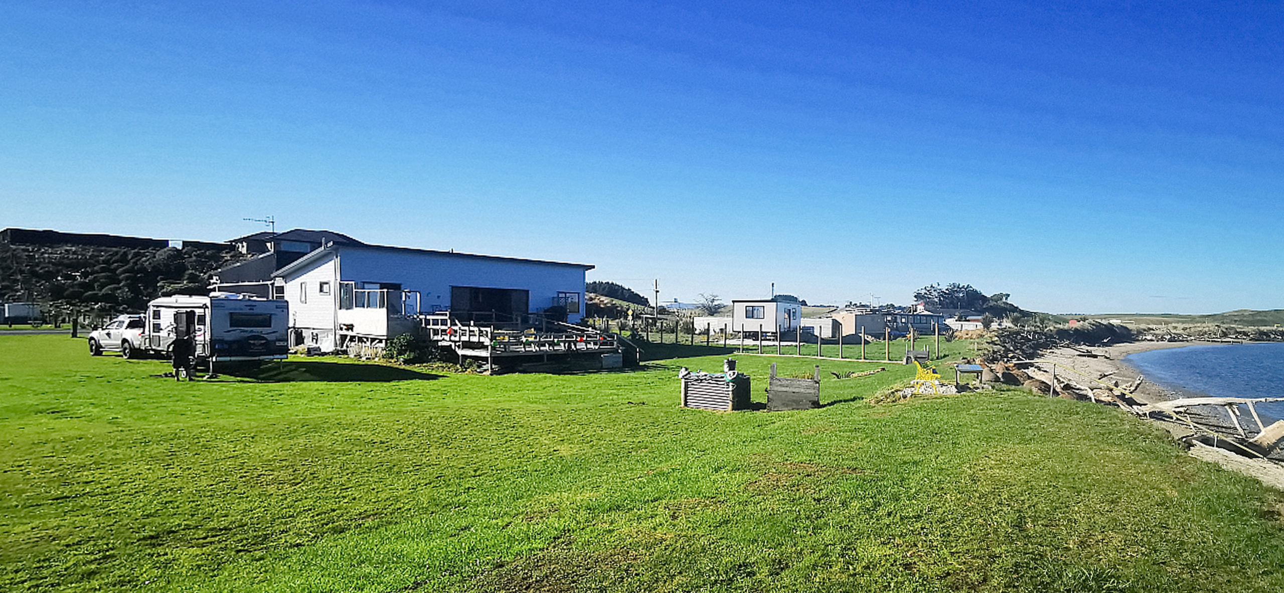
We opted for a POP (Park Over Property #9247). POP’s are private properties, often owned by fellow NZMCA members who generously offer their slices of paradise for fellow campers to park up.
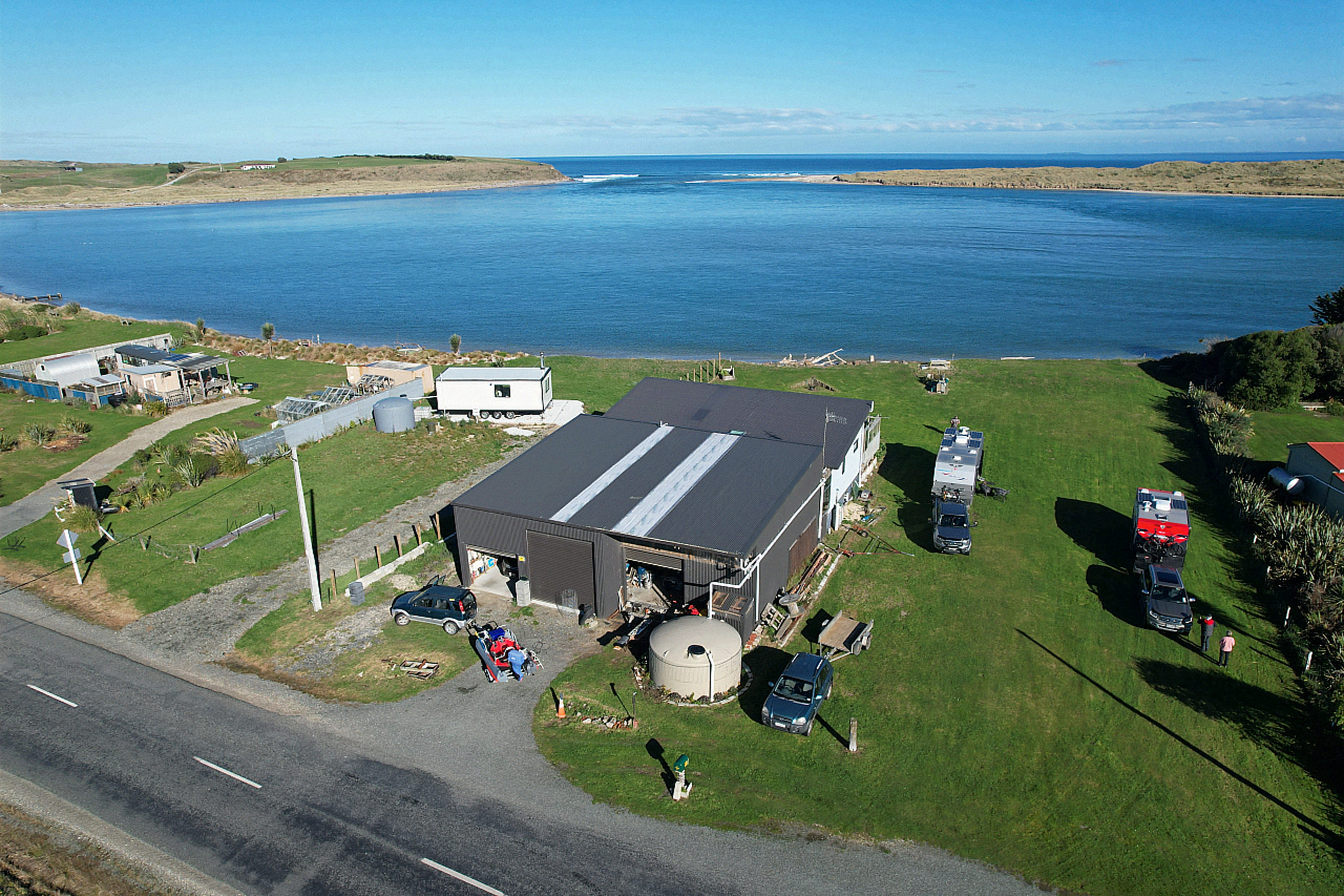
the views look straight out towards the mouth where the Mataura meets the ocean
Hoover House is owned by Hilary and Harry and is just up the road from the freedom camping area. Their property looks out towards the mouth of the river, where the mighty Mataura meets the ocean. There are views towards the cliffs, golf course, shipwreck and dunes.
The History of Fortrose
Like most early settlements along this coastline, whalers set up camp as early as 1834 and initially called the area Russelltown. The name was changed in the mid-1800s to Fortrose. A tribute to Fortrose in Scotland, named by a Scottish drover.
Because of its location, settlers thought it would be advantageous to build a 61m long jetty. The settlement became a busy port from which grain, wool and logs were exported. However, the completion of the Tokanui Branch railway in 1911, meant that there was a much quicker option for transportation into the area and onwards to Invercargill. Fortrose’s economy then started to decline.
The river mouth became impassable due to the sand bar so there ended the coastal shipping into the settlement.
Fortrose Shipwreck – The Ino
The signage pointing to where the shipwreck lies is clear, what isn’t so clear is the actual wreckage. The frame of Ino’s hull lies on the muddy bottom like the ribcage of a skeleton.
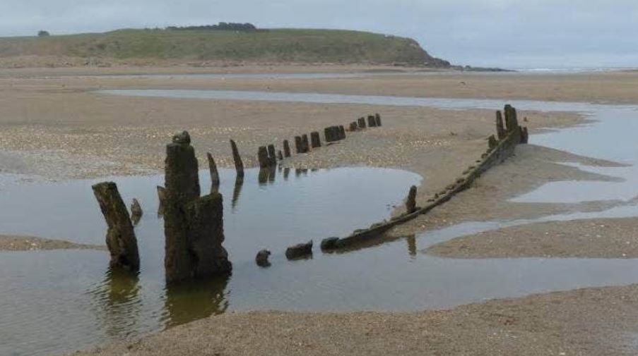
photo curtosy of www.stuff.co.nz
The tide has to be exceptionally low to see any signs of the Ino. We spotted the top of what must remains of the highest post. She’s now listing to the left, leaving the right-hand side more exposed.
you’d never know what lies beneath the water during high tide
A few interesting points:
- The Ino is only one of the 160 or more shipwrecks in Foveaux Strait
- The ship weighed 46 tonnes and constructed in Hokitika in 1874
- She provided regular service between Fortrose and Dunedin since 1882
- Only 4 years later, she ran aground on the ocean side of the Fortrose Spit while attempting to enter
- Once they stripped out her engine and boiler, the much lighter vessel drifted into the harbour
- As her hull filled with water, she gradually settled into the mud of the estuary where she remains
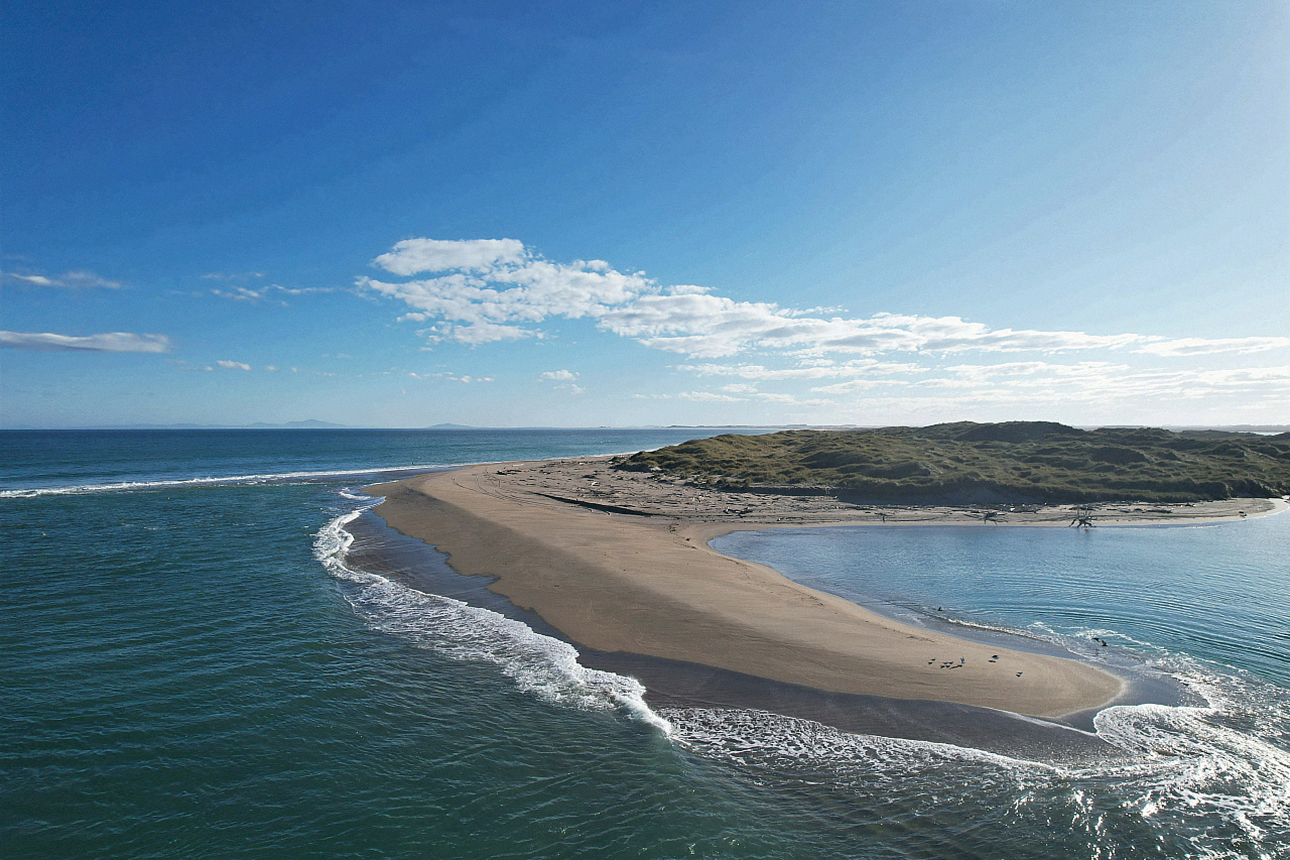
the sandbar that was the demise of The Ina
Fortrose Cliffs
The top of the Fortrose Cliffs offers panoramic views across the entire area. If you want to camp up here, you would certainly need to check the weather forecast as it would blow the milk out of your coffee.
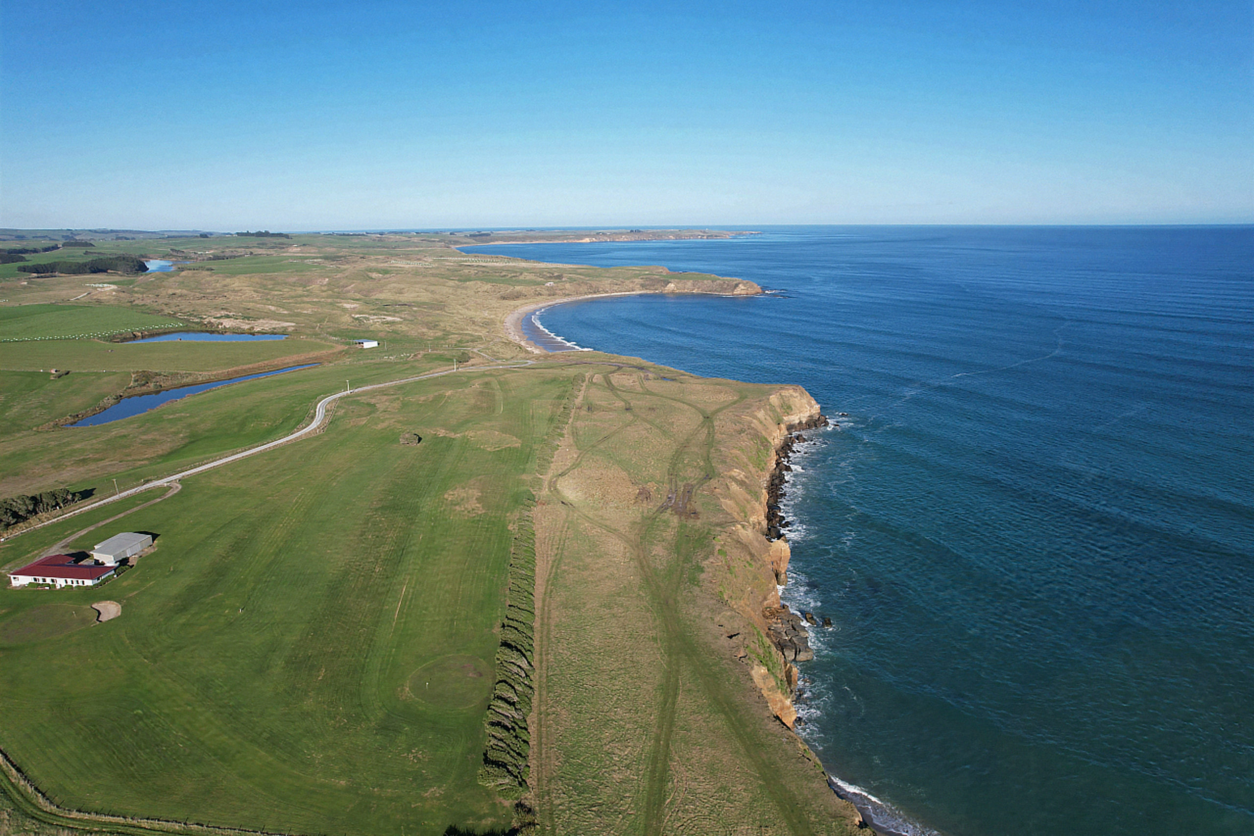
the majestic Fortrose cliffs tower up from the ocean floor and a birdseye view of the southernmost gold course
The gnarly, leaning trees are a testament to which way the wind blows, and how hard. The golf course could be the only course where the ball would come flying back at you after a good whack. I guess that’s what you get when playing on the southern-most golf course!
They are certainly worthy of a great photo opportunity while you are in the area.
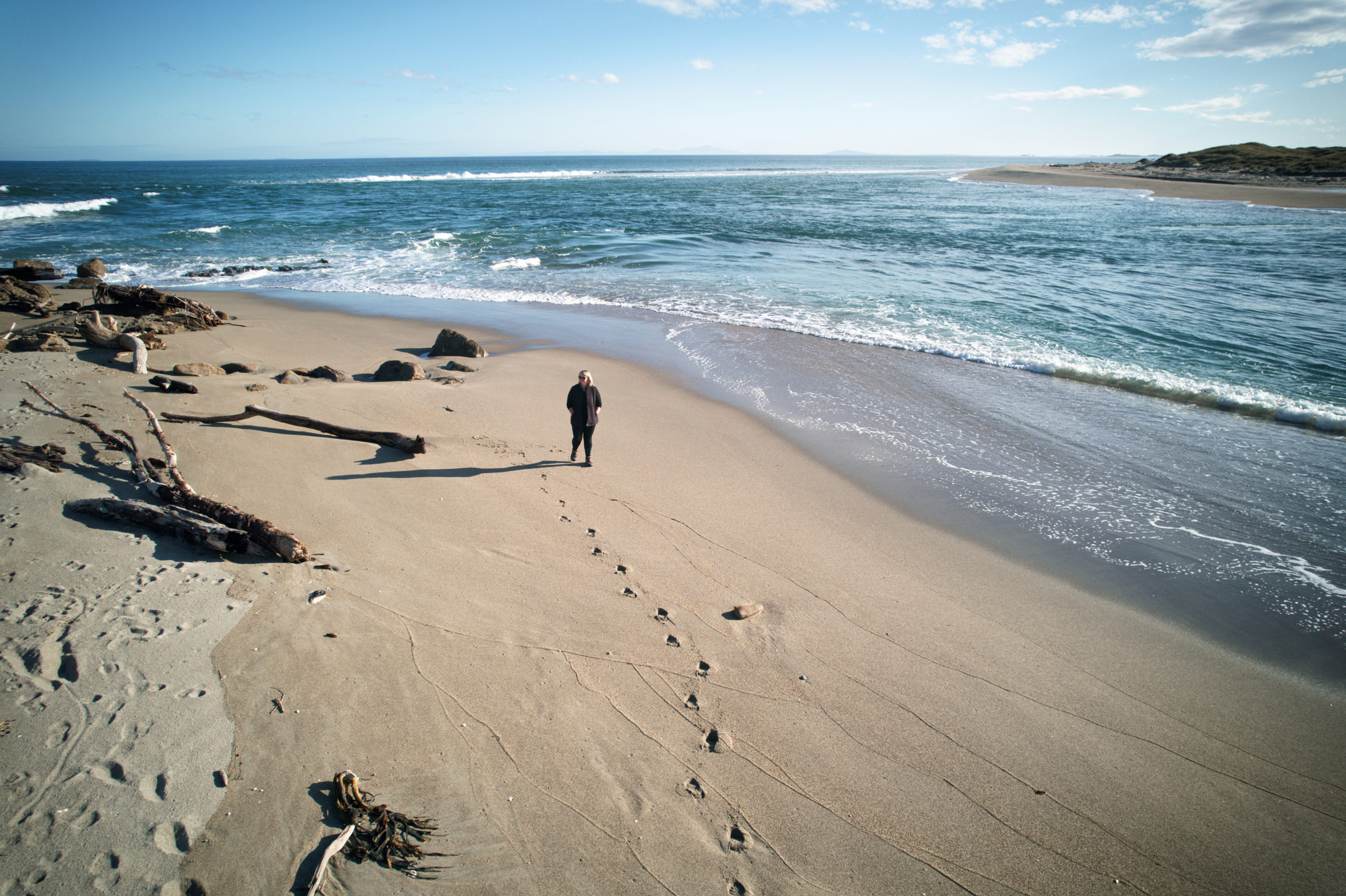
on an outgoing tide, it is a pleasant walk around the base of the cliffs adjacent to the river mouth and sandspit
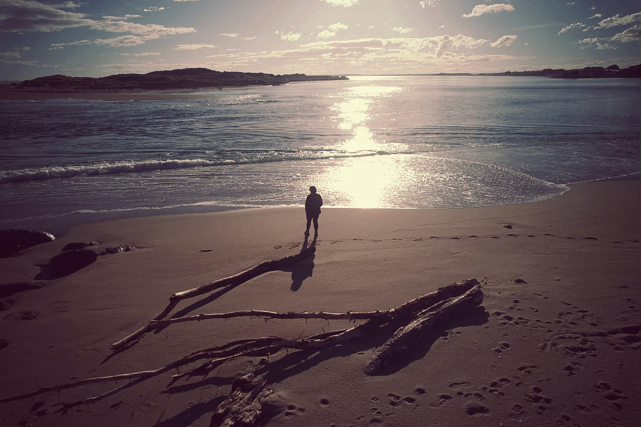
the wide expanse of water of the mighty Mataura River before it meets the ocean
Summary
Fortrose is certainly worth including a stop on your itinerary when travelling the Catlins. Make sure to check out the Information Centre at Stirling Tides Cafe. Enjoy a beach walk at low tide, marvel at the towering cliffs or even try a spot of floundering, whitebaiting or fishing. The historic cemetery also tells some fascinating stories and is worth spending some time wandering the headstones and reading the epitaphs.
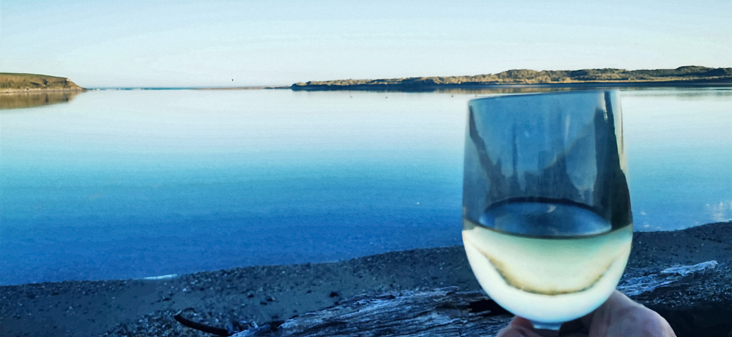
it doesn’t get much better than this when it comes to a Happy Hour location!
Just rest a while, watch the sun as it sinks below the horizon, setting the sky on fire, kissing goodbye to another day.
Click on the link below for a short video of the highlights of our stay at Fortrose.
Another intersting blog. Another wine 😁.
Wine seems to be quite a common theme 🤗