We had read quite a lot about Waikouaiti. We decided to stay for a while and spend some time exploring the surrounding area.
Before launching into our roadie adventures, firstly, a little about Waikouaiti.
Where is Waikouaiti?
Waikouaiti is a small settlement located in East Otago. It is surprisingly close to Dunedin and is within the city limits, approximately a 45-kilometre drive north and right on the coast.
Waikouaiti has a rich and colourful history. It promotes itself as the birthplace of Otago. The main activity back in 1837 was farming and also the site of a couple of whaling stations.
Where Did We Stay?
We headed for Waikouaiti Beach Motor Camp, (NZMCA TD #8331) which is located just off SH1, towards the coast.
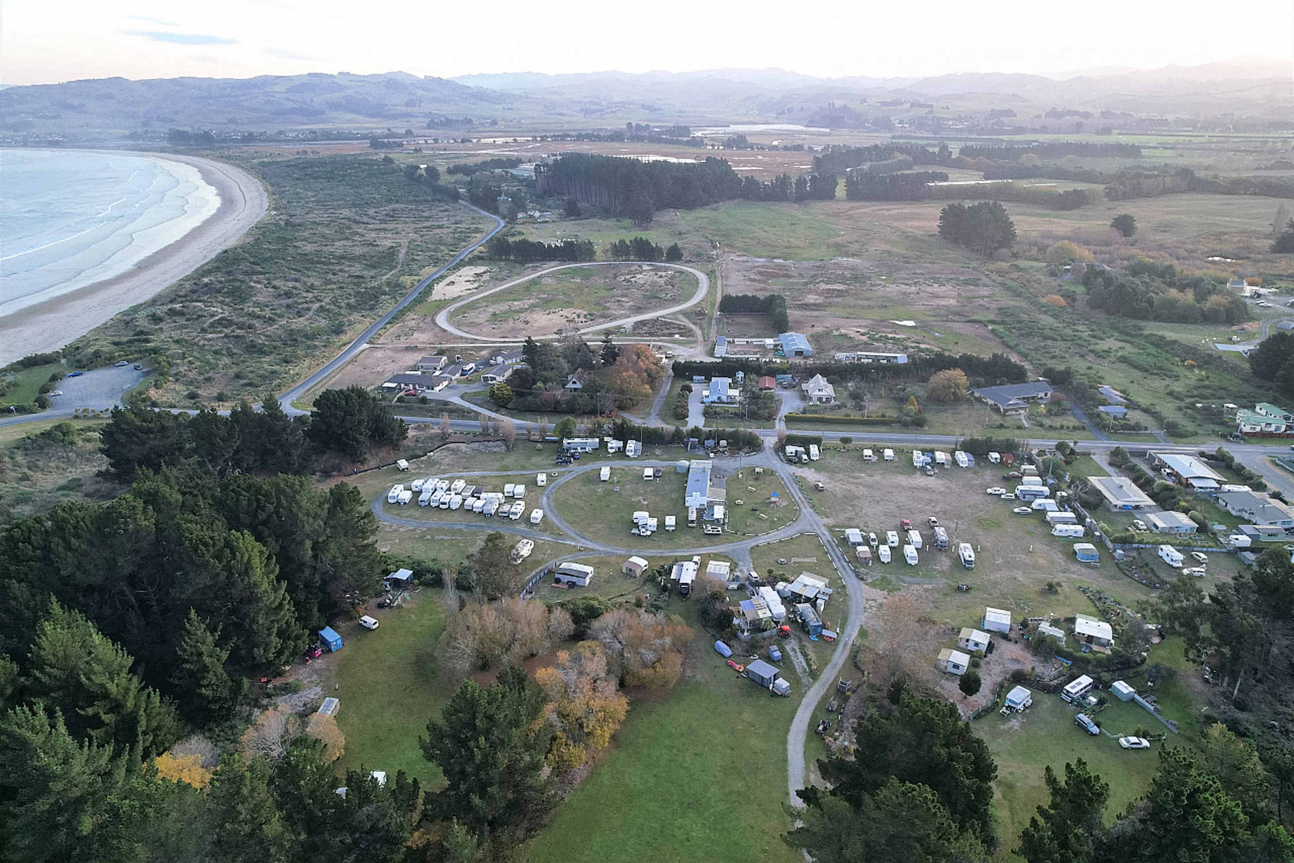
a bird’s eye view of the camp
Although there are powered and non-powered sites, we knew that there was a CAP (Charges Apply Property for NZMCA members) towards the rear of the property. It is $5pp per night with no facilities.
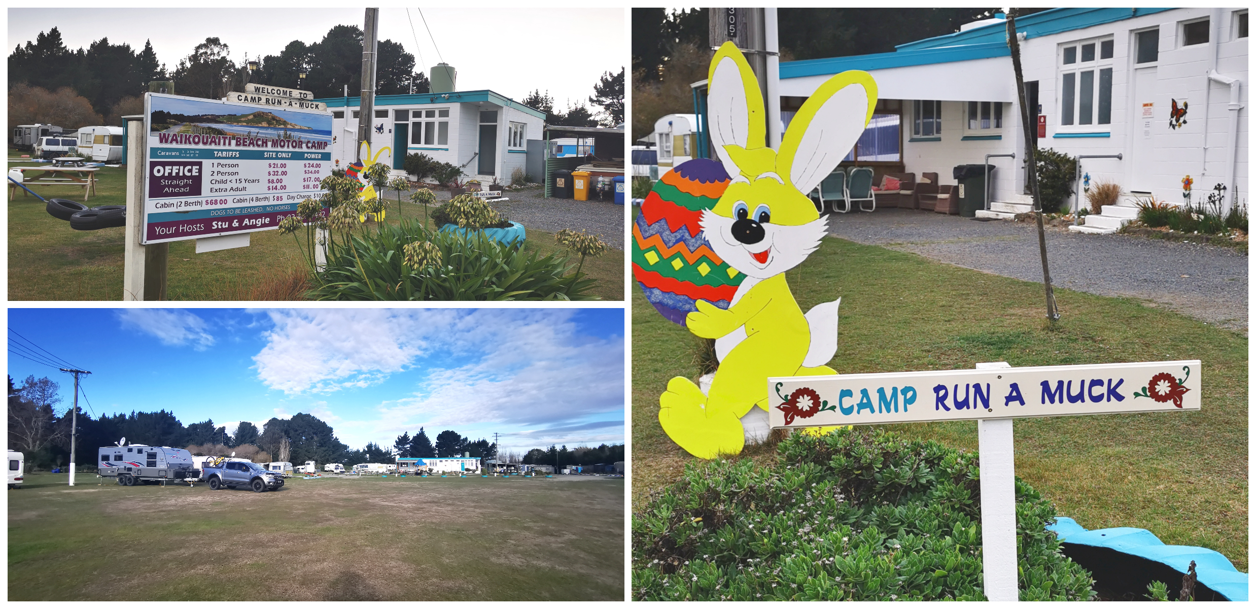
a powered site certainly a nicer option for winter
On arrival, we spoke with the manager who showed us the area of the CAP. With the winter sun in the south sitting quite low in the sky, it shades the parking area for much of the day.
Campsaver
They are also members of the Campsaver Scheme with NZMCA so we opted for a powered site for $22pn per vehicle. It made more sense for us to pay a bit more seem we were wanting to stay for 3 nights. So much nicer to be able to plug into power if the choice is there.
It is a short 10-minute walk through the trees to the beach, or the same distance if you walk down the road.
Don’t Drink the Water
You’ve probably heard in the media about the lead contamination in Waikouaiti and Karitane town water supply. The warning signs to not drink the water are still on display.
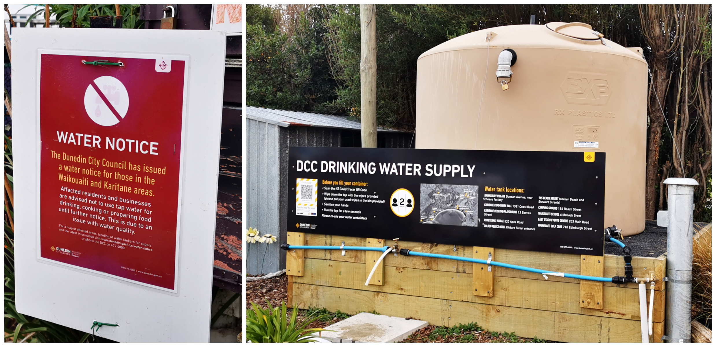
warning signs and a centralised water supply on-site
The council have placed temporary water tanks at strategic spots around the township, including the camping ground. This is where the locals are still filling containers for domestic usage.
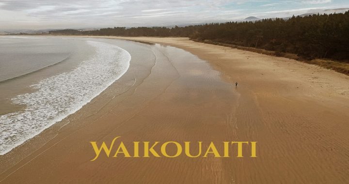
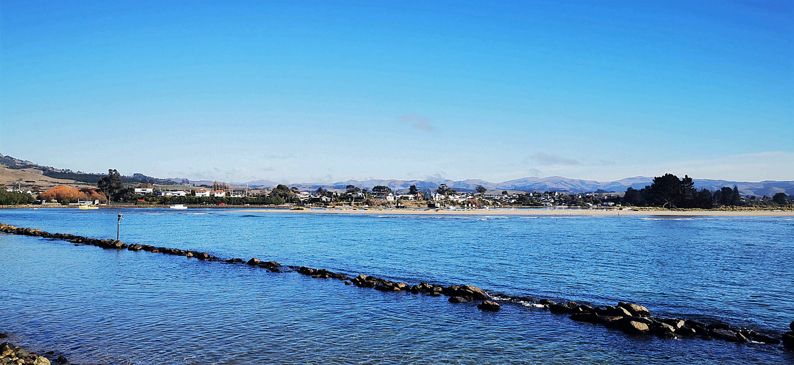
Waikouaiti Beach
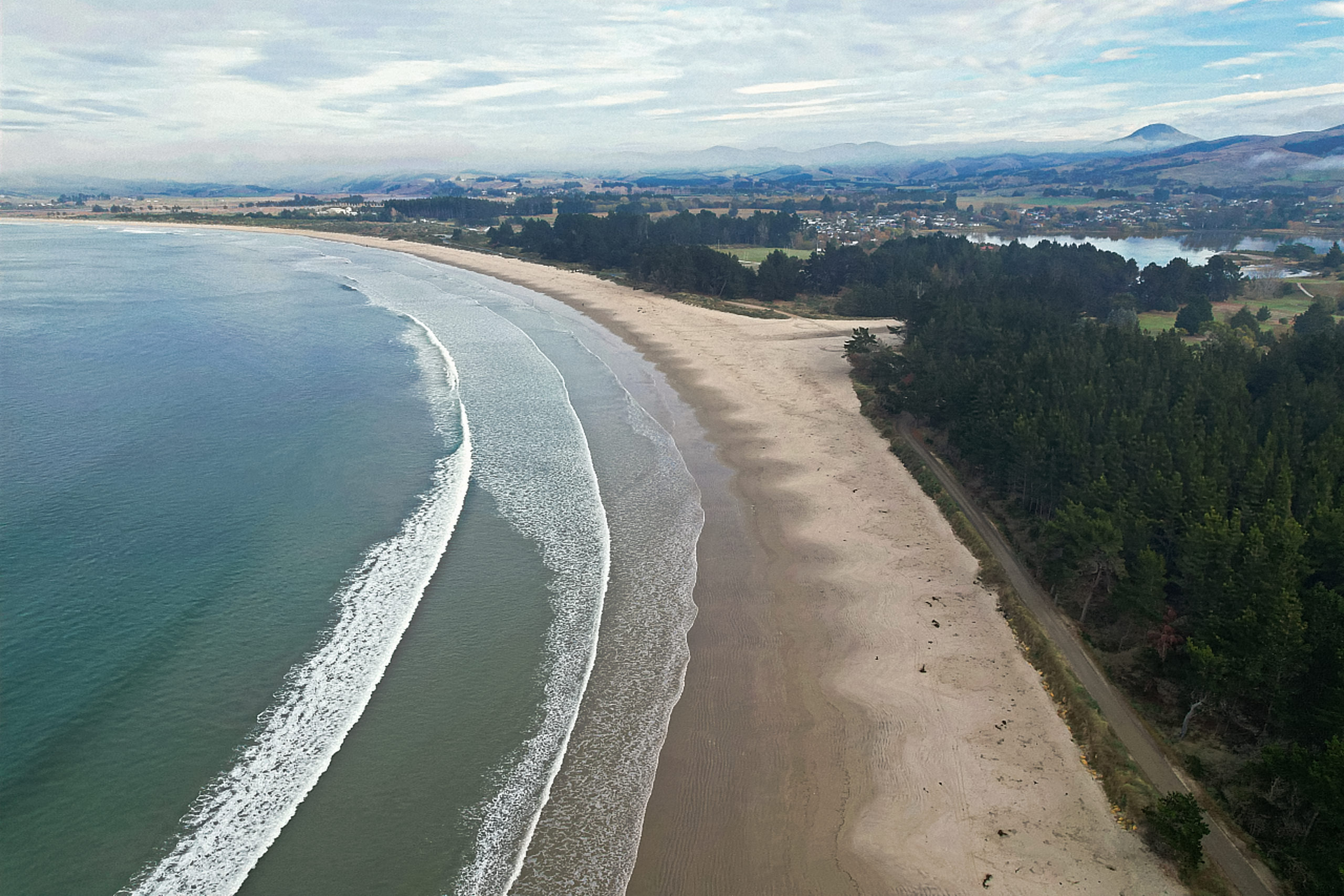
the long sweeping Waikouaiti Beach
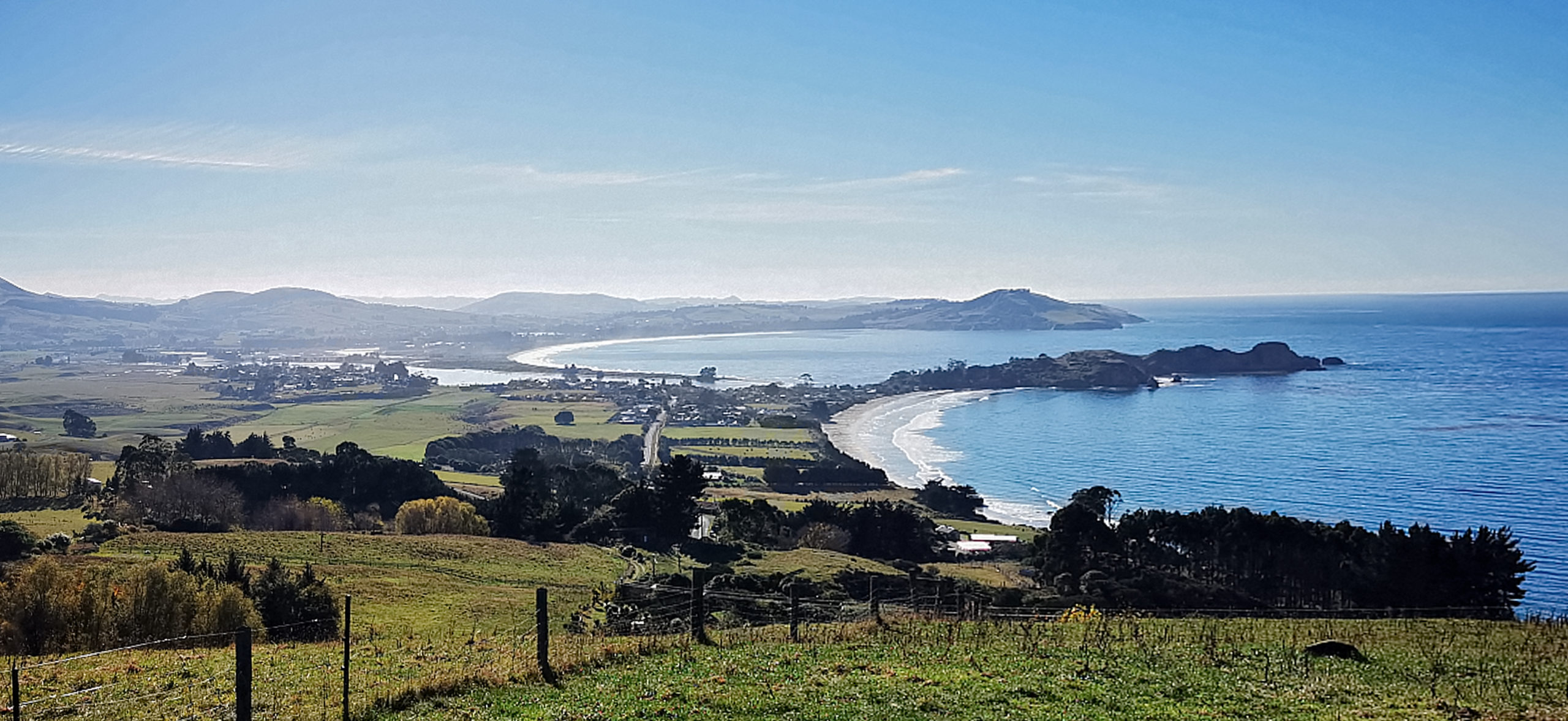
The beautiful sandy curved beach is 4km in length. It extends from Cornish Head in the north to Karitane inlet in the south.
It is a favourite spot for surfers, beach and dog walkers and day-trippers. We also saw groups of kayakers which I understand paddle to some sea caves towards the north.
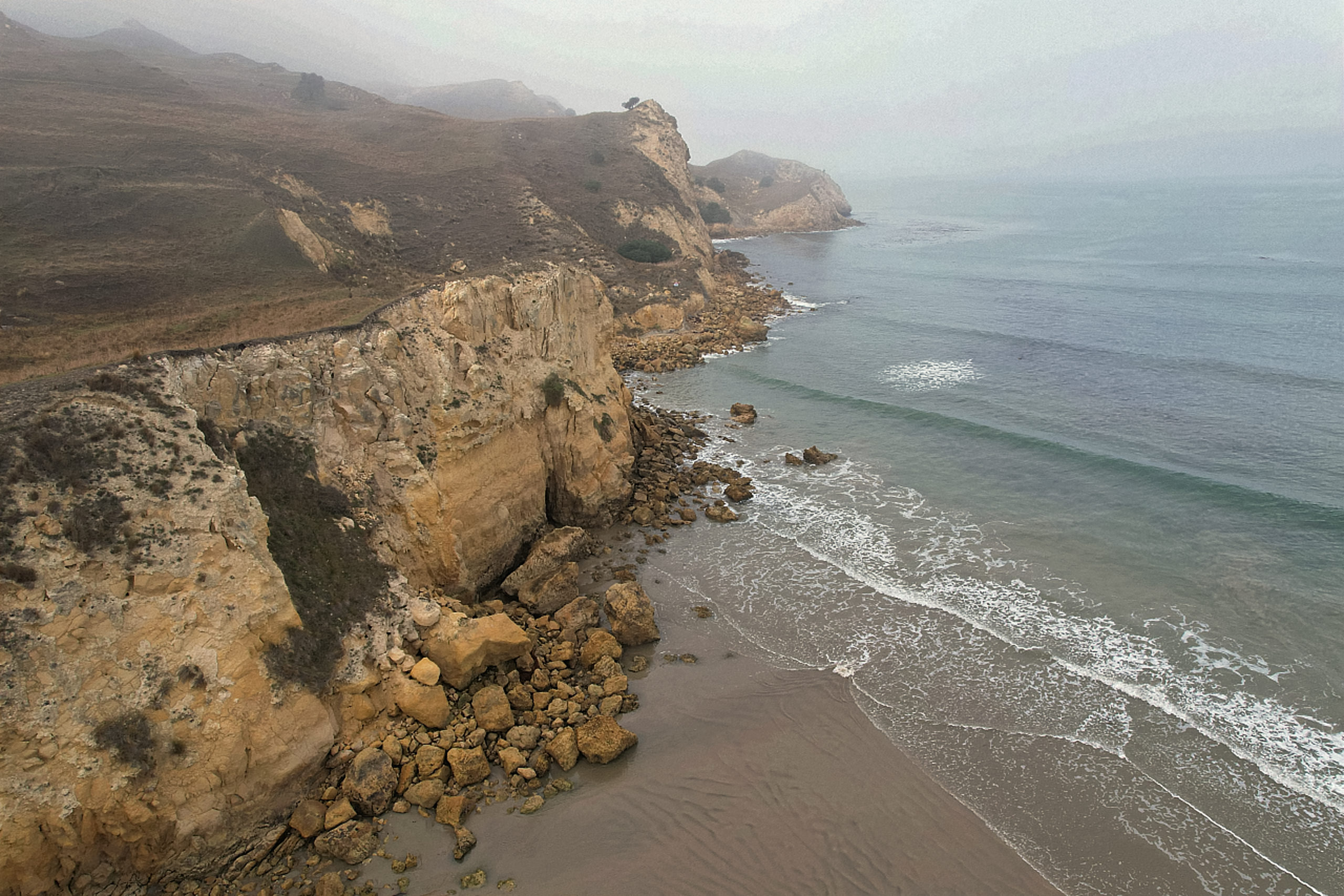
the striking cliff face towards the northern end of the beach
Matanaka Farm Buildings
Located only 4km north of the township, are the Matanaka Historic Farm Buildings. We drove up the private road to a large car park, then it was a short 10-minute walk to the location of the buildings.
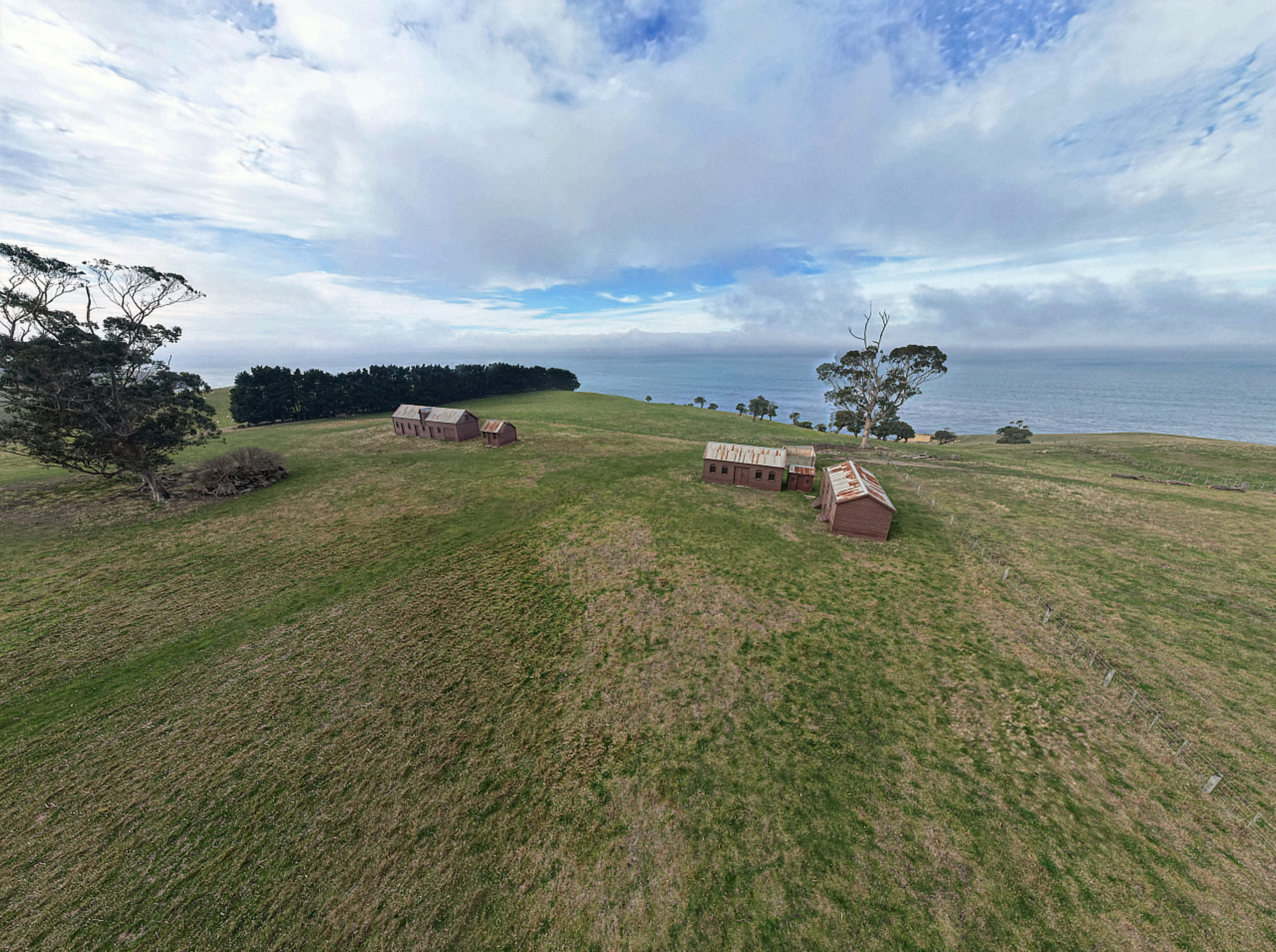
the farm buildings seem to sit perched on the hills overlooking the Pacific Ocean
This collection of 5 buildings dates back to the 1840s and it’s thought that they are NZ’s oldest surviving farm buildings which are still in their original location.
being void of any other visitors, it seemed isolated and exposed
They are painted a dark red and they are perched high above the Pacific Ocean. Hugging the edge of the land which was part of the first farm in Otago.
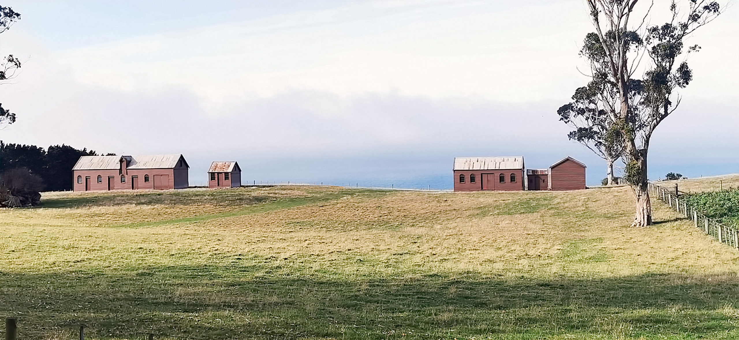
painted dark red, they blend into the landscape nicely
Built for the well-known shipowner, whaler and trader Johnny Jones, they include a stable, storehouse, granary, schoolhouse, and a 3 seater privy.
History Lesson
Located in the schoolhouse is a series of history boards that tells the story of Johnny Jones, his family and quite a lot of information on the local Maori and formation of Waikouaiti and surrounds.
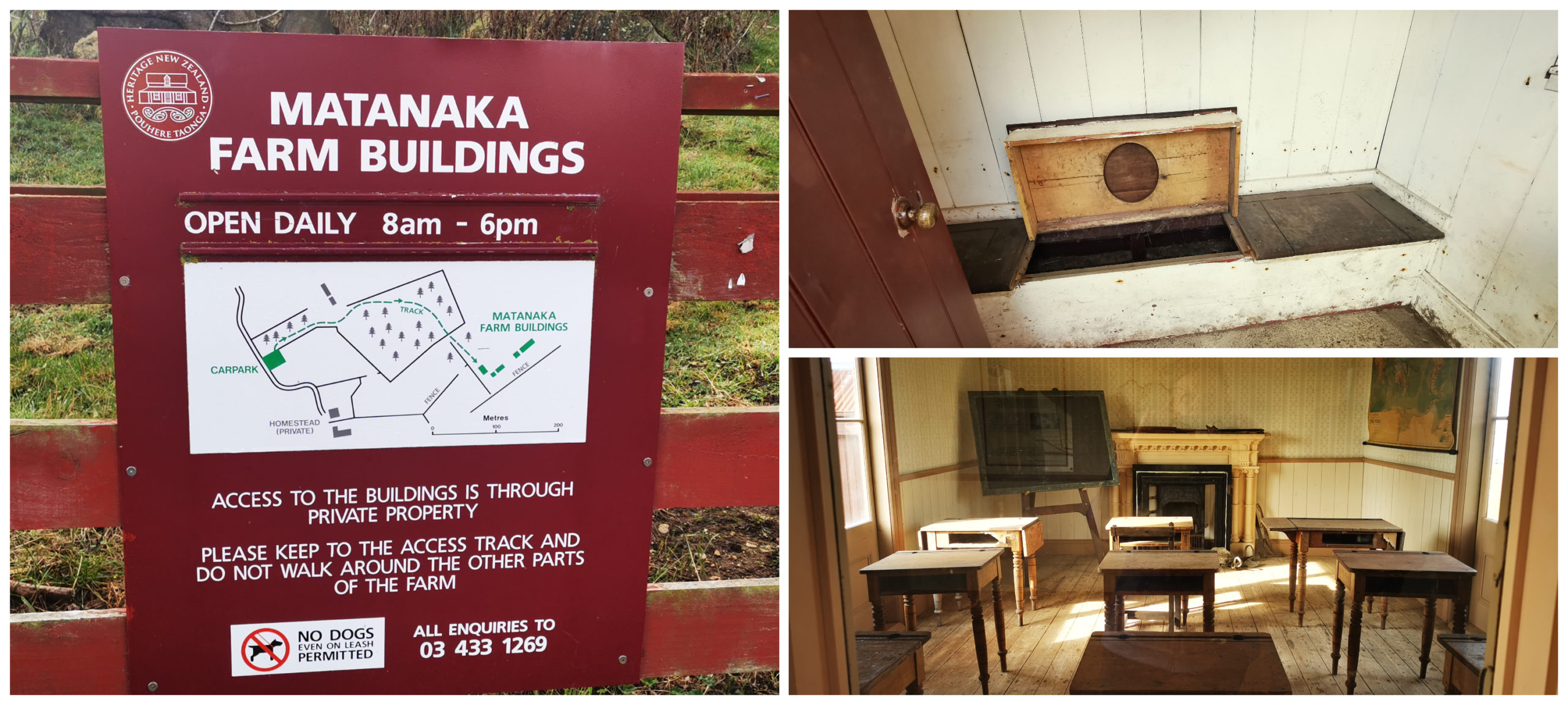
signage at the entrance by the carpark, the triple privy, and inside the old schoolhouse
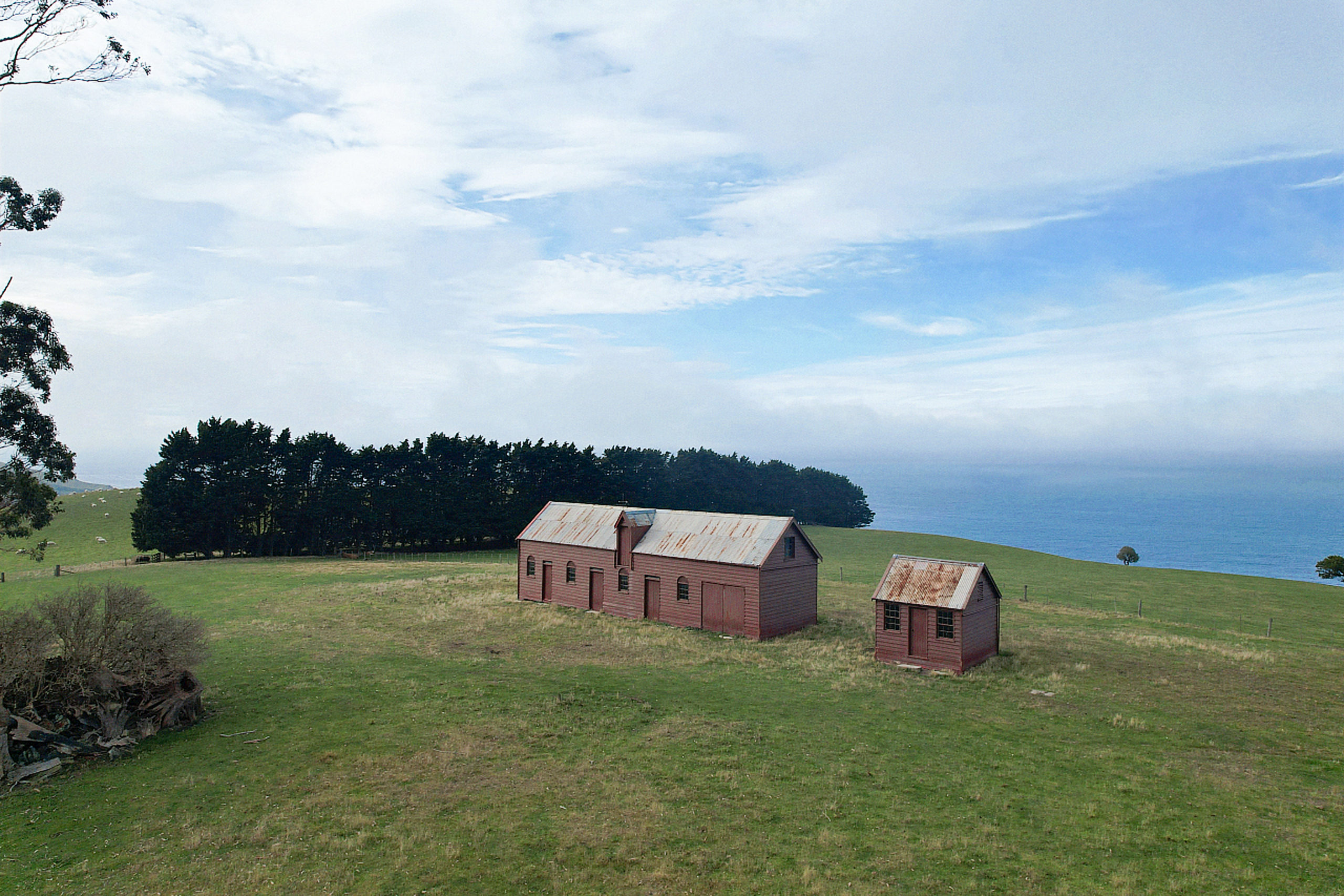
All the buildings are unlocked so you can wander through them. Amazingly, they are still constructed from the original timber which was brought across from Sydney.
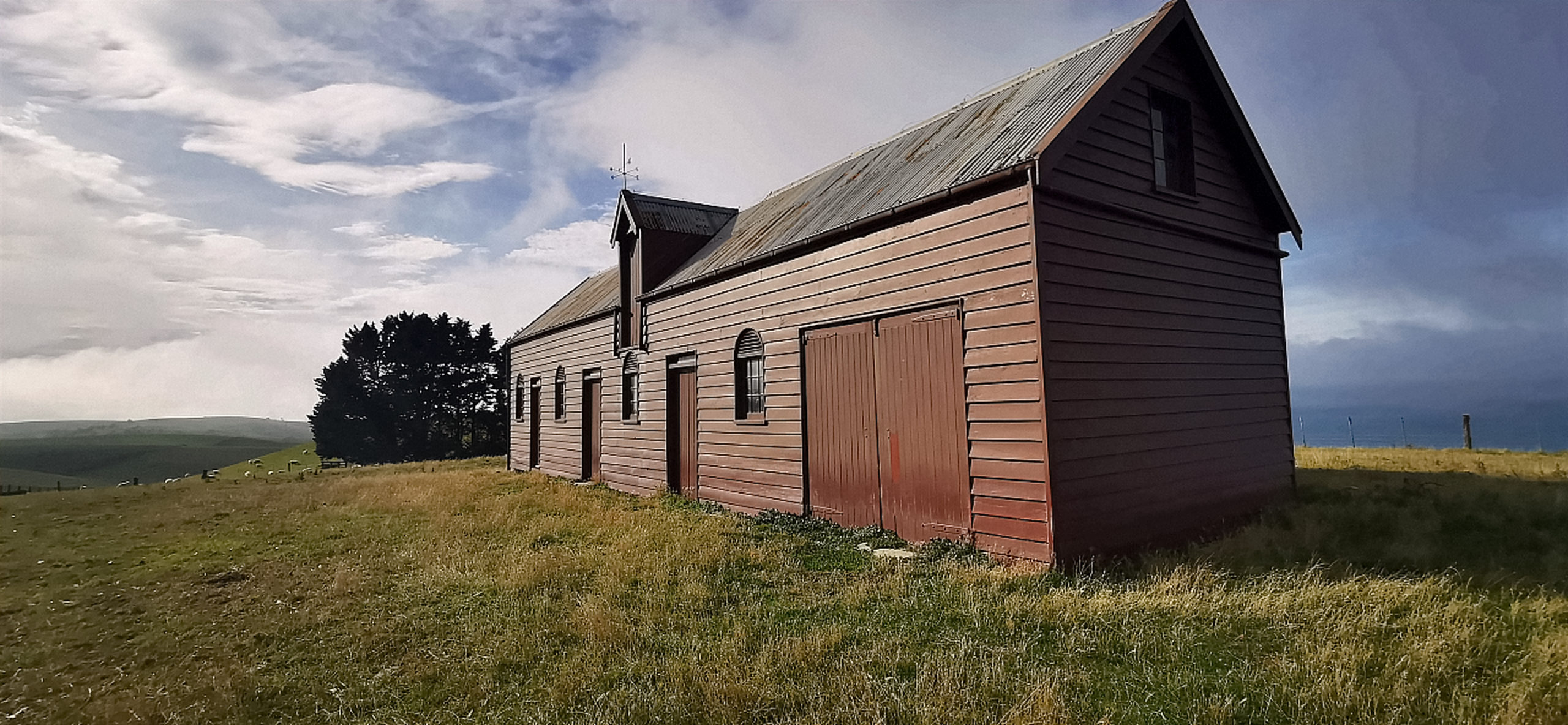
the very impressive stables
The most impressive building would be the stables. Not only is the timber still original, but so is the iron roof which is very impressive considering the salt sea spray it has had to endure all these years!
It is complete with a gig and harness room. All the horse stalls are intact, along with old saddles, harness and bridles. Overhead at one end of the building are a series of pigeon lofts.
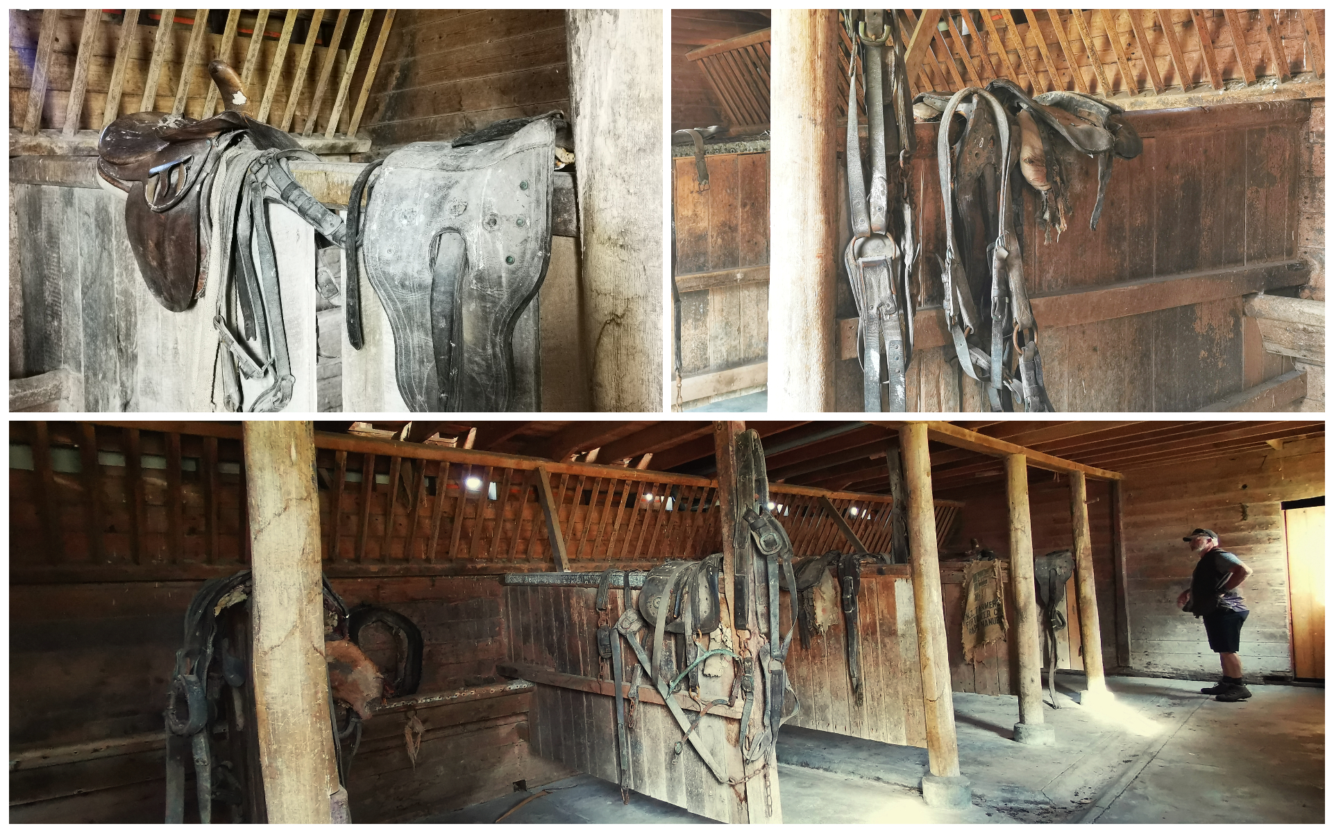
you could almost still smell the horses that must have been tied up in their stalls
Although this place is a little off the beaten path, the interesting buildings and awesome views make it well worth a visit.
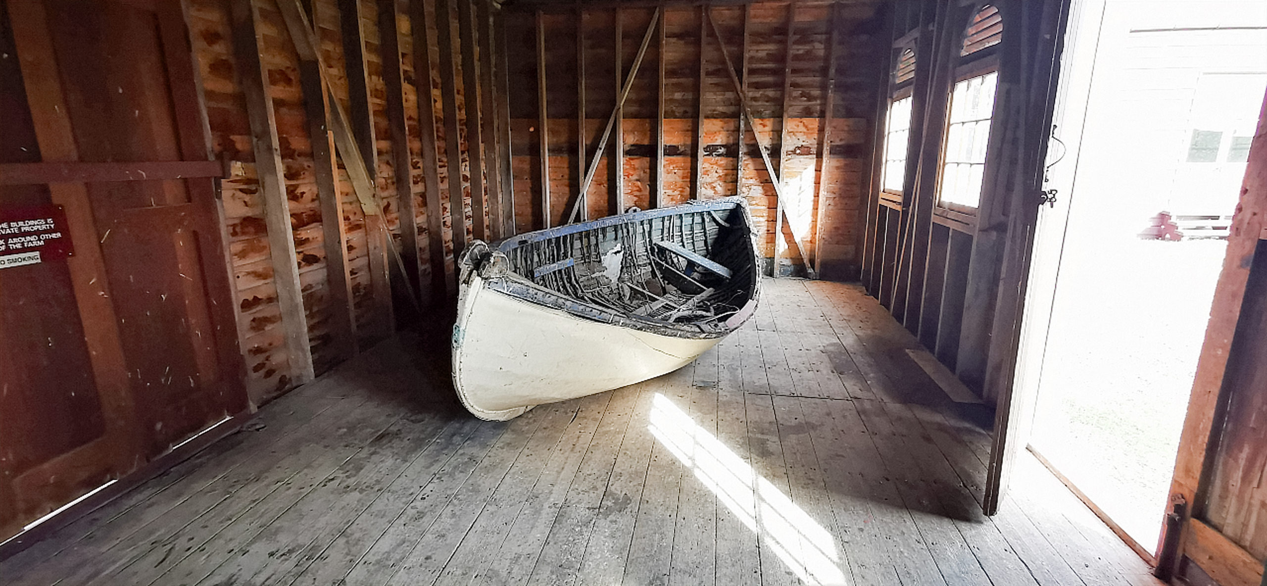
an old whalers boat was housed in one of the buildings
It is free to visit but remember it is on private land so keep to the road and marked tracks. It is closed for lambing from 14 August to 1 October. Definitely, no dogs allowed (even on a leash).
Hawksbury Lagoon
Conveniently located in the centre of the township of Waikouaiti is a 51-hectare wetland called Hawksbury Lagoon.
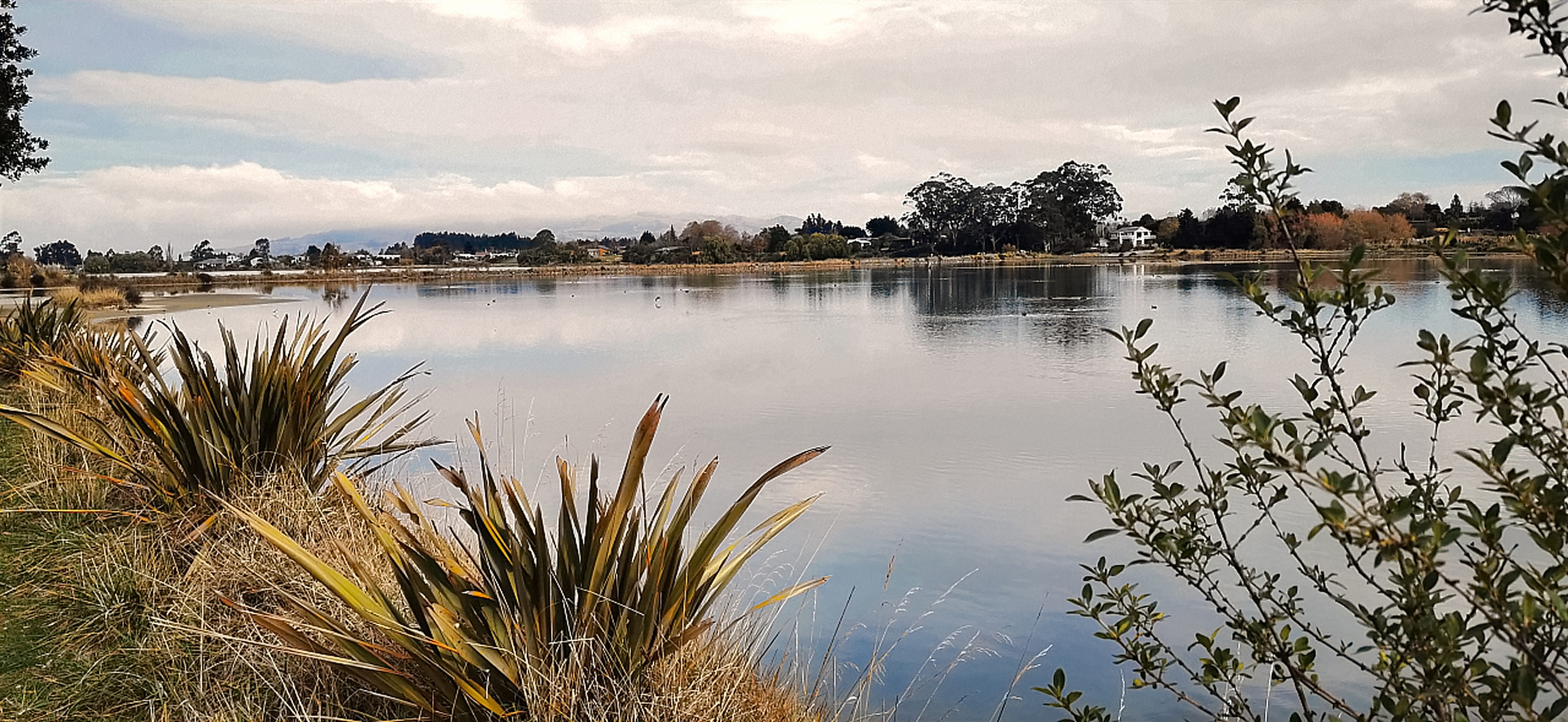
it was a calm peaceful day for our walk around the lagoon
The original lagoon actually covered most of where the township and racecourse are located today. The lagoon was drained way back in the 1860s and the causeways built, to drain more of the land for farming.
In 1912 the lagoon became a reserve for a Wildlife Refuge. It has remained under DoC protection ever since.
The surrounding area was originally covered in flax. There were three flax mills in Waikouaiti during the early days of European settlement.
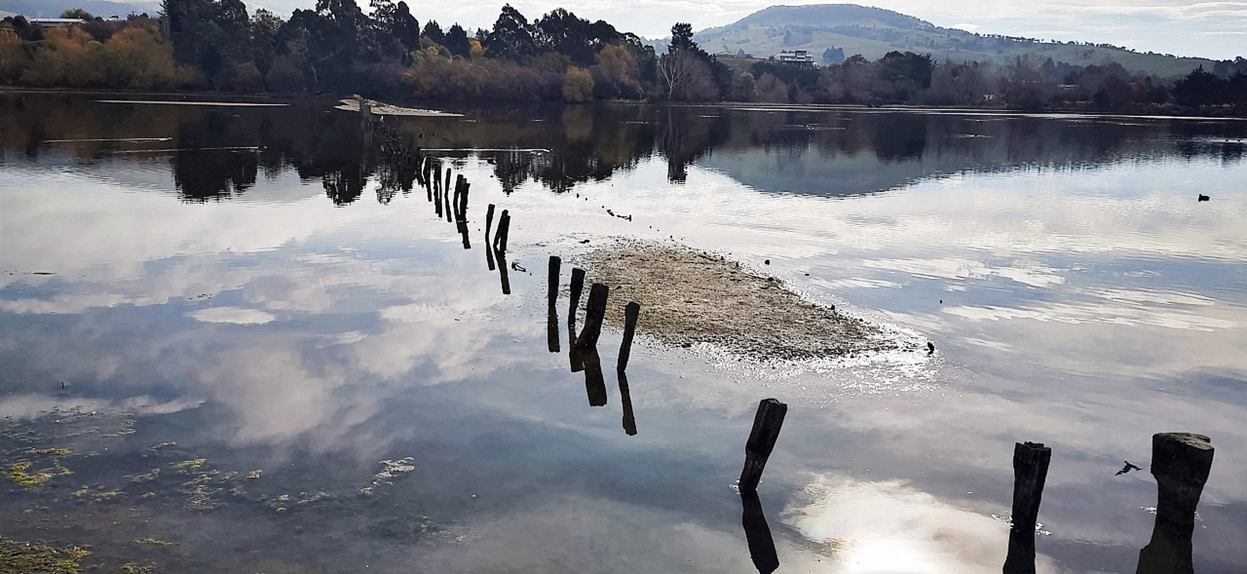
we could still see evidence of structures long gone with is passing of time
If you wanted to walk the entire perimeter, it is approximately 5km. However, we zigzagged our way across the causeways (built 1881-1883) and made our way back to the car. It is possible to walk all the way to Waikouaiti Beach. There are 3 entrances to the lagoon so you can wander as much or as little as you want.
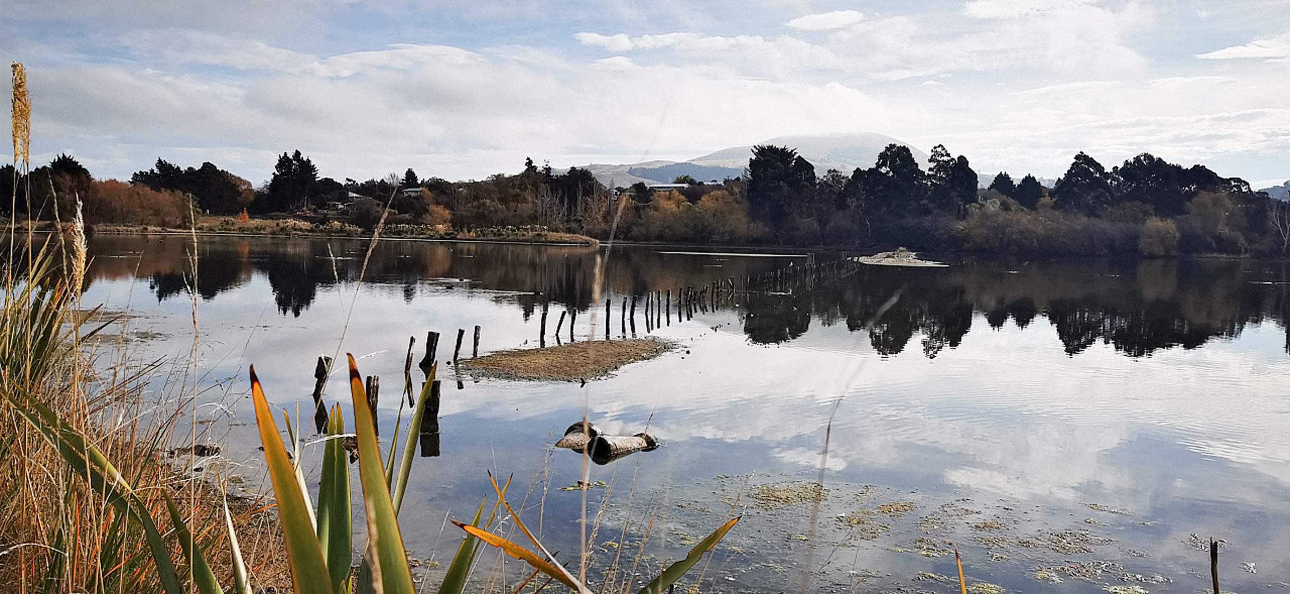
it’s the perfect haven for many species of birds
We spotted a large range of birds as we wandered the walkways and causeways. There were royal spoonbills, herons, ducks, shags and swans. At different times of the year, large numbers of birds use the lagoon as a stop-off place in their migration or for nesting.
And Now to our Roadie
We love to explore places we’ve never been before, and there was a gap in the map around the coastal areas of this region.
Karitane
Just a 10-minute drive from Waikouaiti is the delightful settlement of Karitane. It is only 35km to the north of Dunedin, which makes it a popular destination for a day trip or holiday retreat for the city dwellers.
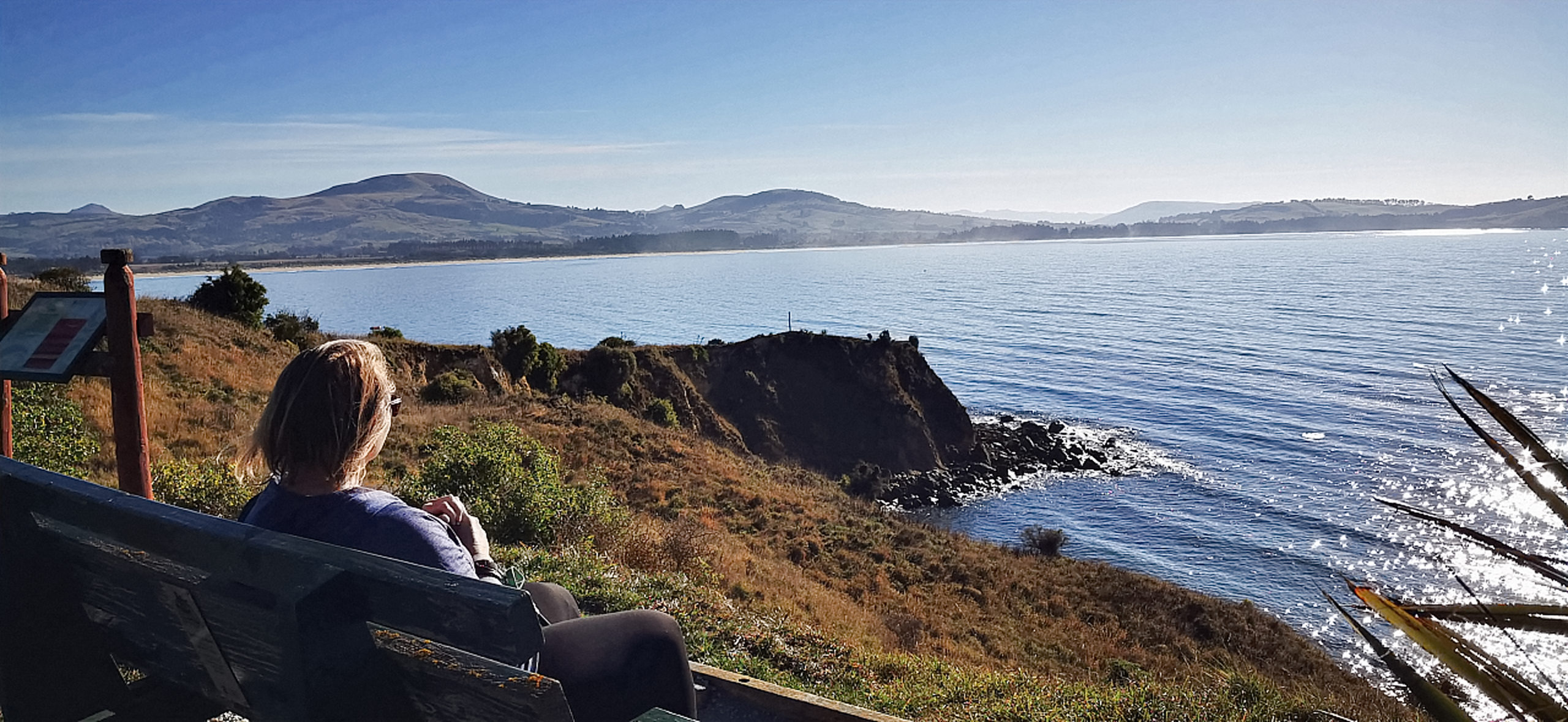
the main settlement of Karitane from across the estuary
I admit that I was pleasantly surprised by its scenic beauty. It has a lovely golden beach and the settlement has a tranquil feel to it. Fishing boats moored in the estuary, just shy of where the Waikouaiti River meets the sea.
History
European sealers and whalers began arriving at Karitane as early as the 1820s, setting up a whaling station in 1837.
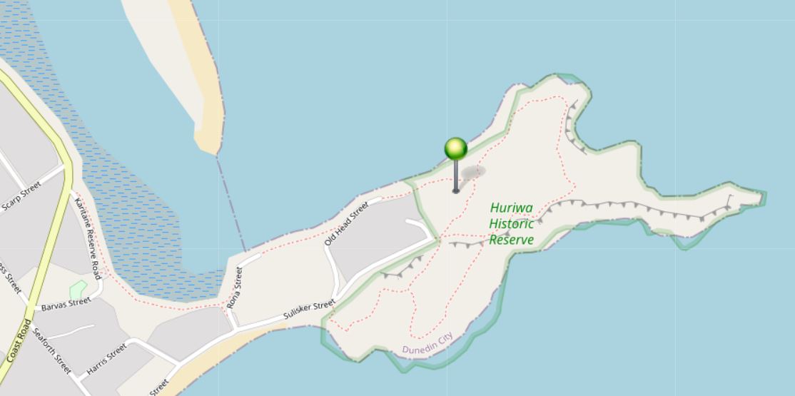
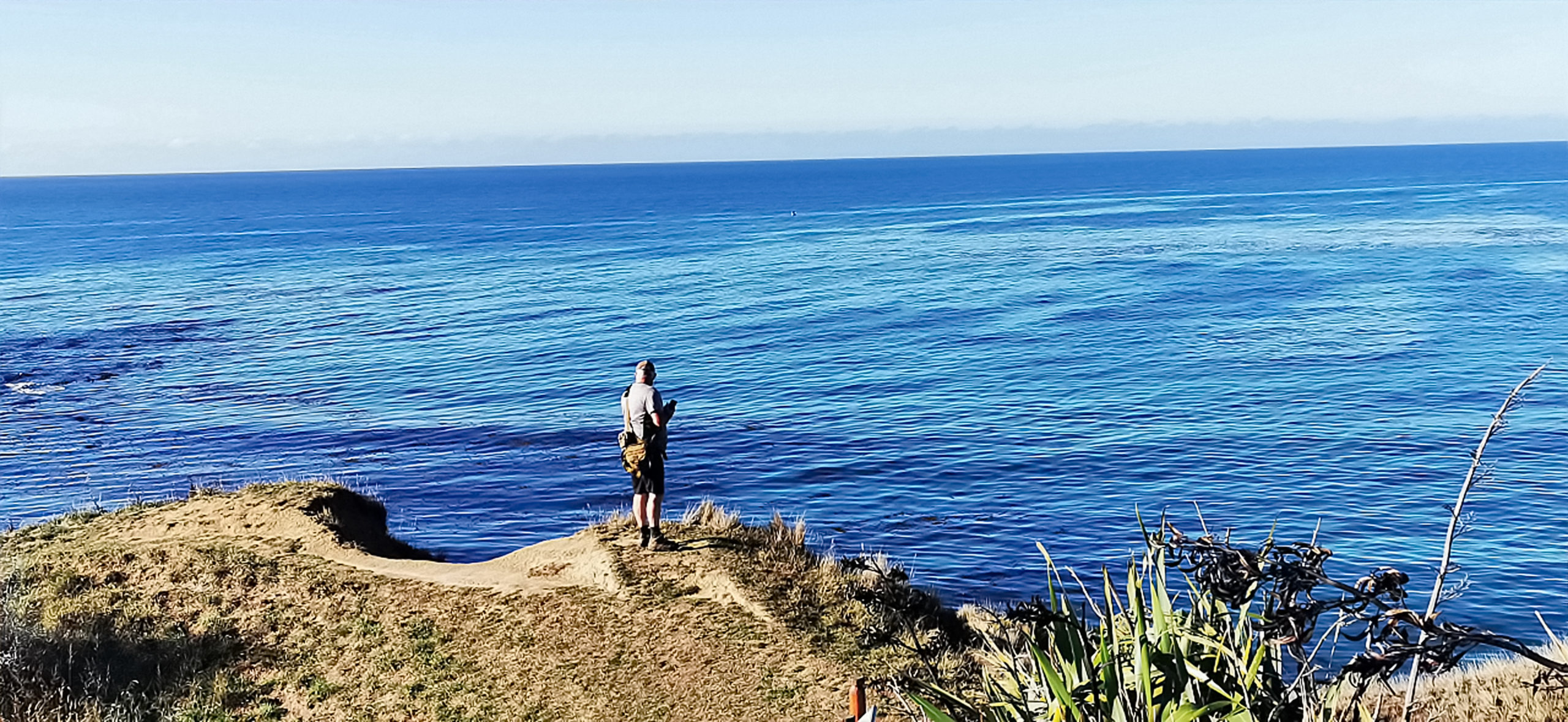
Huriawa Pa
We drove out to the headland where a knoll sticks out into the ocean. This is the site of the Huriawa Pa. A fortified Maori village was strategically set on the rocky promontory above the coast.
the loop walk is well worth doing
There is a pleasant loop walk which takes you out onto the high ground and offers some pretty stunning views in all directions. The 3 blowholes can be easily seen but the day was too calm for them to be performing.
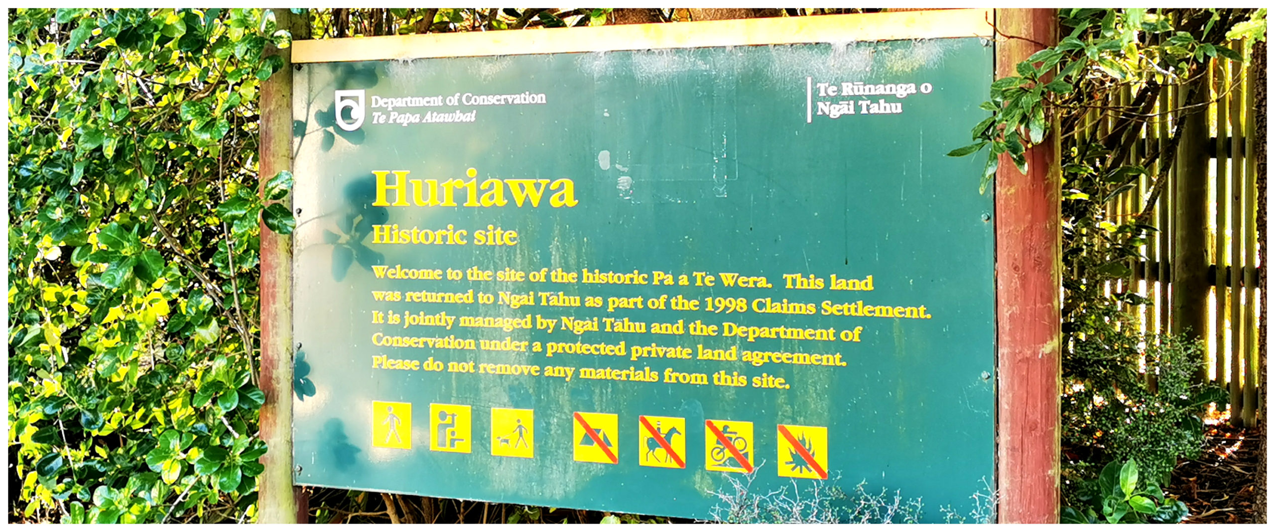
signage at the entrance to the historic Huriawa Pa
It was clear to us as to why they decided to set up a base for the village where there were uninterrupted views. It was to become one of the strongest defensive pa in Otago. They had plentiful food from the ocean and also the benefit of a natural spring for freshwater.
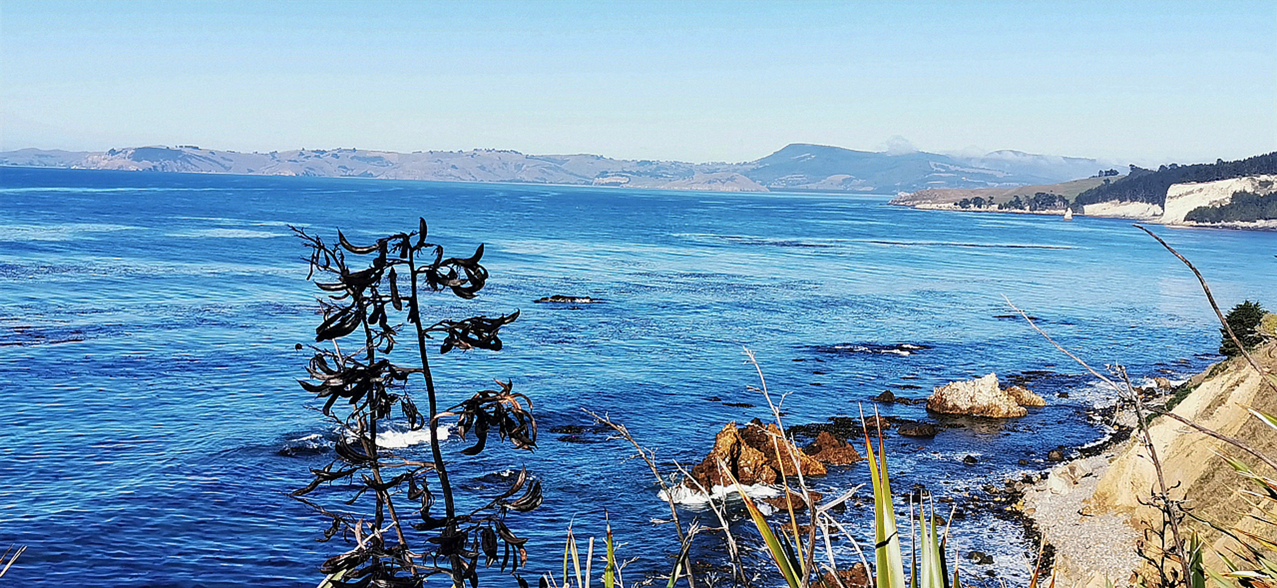
it wasn’t far into our walk before some pretty stunning views panned out in front of us
Evidence suggests that this pa was fully occupied up until the beginning of the 19th century.
the photo opportunities were plentiful
and a perfectly positioned seat to rest and take in the views
Truby King
Karitane is often associated with pioneering paediatrician and psychiatrist Sir Truby King. He was the founder of the Plunket Society.
There were the establishments of Karitane Hospitals, Karitane Nurses and Community Karitane.
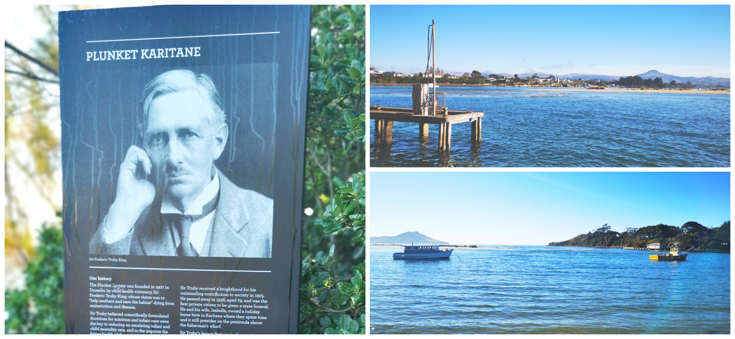
the history board telling the story of Ruby King sits by the jetty on the far side of the settlement
In 1889, he was the Medical Superintendent at the Seacliff Lunatic Asylum in Dunedin. He began to realise that principles of nutrition applied across many disciplines. By 1907, he established the Plunket Society for which he is best known.
There is an information board and plaque located at the base of the hill from where he once lived. Truby passed away in 1938 and he was the first private citizen to have a state funeral. Twenty years after his death, he was the first NZ’er to feature on a New Zealand postage stamp.
Puketeraki
We carried on down the road a bit and without knowing it, drove through Puketeraki. There is a fabulous lookout at the top of a hill that overlooks all of Karitane and the Huriawa Peninsula.
beautiful views from the lookout over Karitane and pa site
A little further along we spotted the Huirapa Marae, and sitting higher on the hill behind it is the Hui te Rangiora Anglican Church.
We’re always suckers for churches and cemeteries. We diverted off the Coast Road and drove up to the church grounds.
Hui te Rangiora Anglican Church
This lovely old wooden church and graveyard has glorious and peaceful views back over the beach and the Karitane Peninsula.
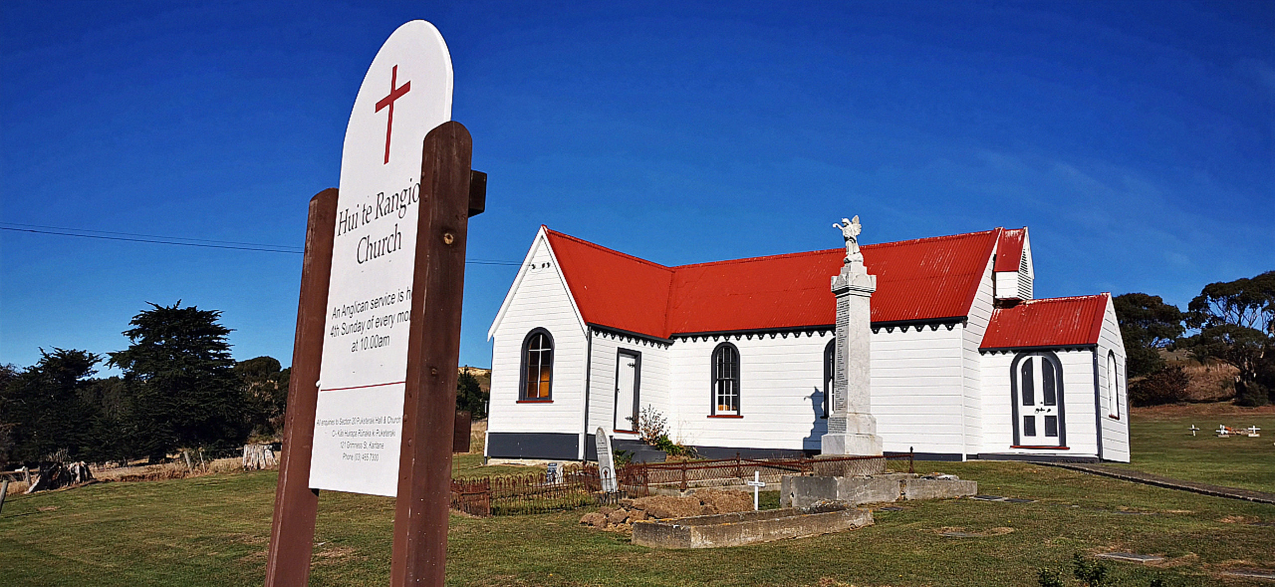
the wooden church sits high on the hill and has been lovingly restored
Johnny Jones (who I mentioned earlier in the blog) gifted 64 sections of what was then called Old Waikouaiti. This was primarily for the purposes to build a church.
Through the efforts of the Parata family, the church was erected and named Hui te Rangiora (the place of heavenly assembly). It was dedicated in 1873. The Parata family have many gravestones throughout the small cemetery.
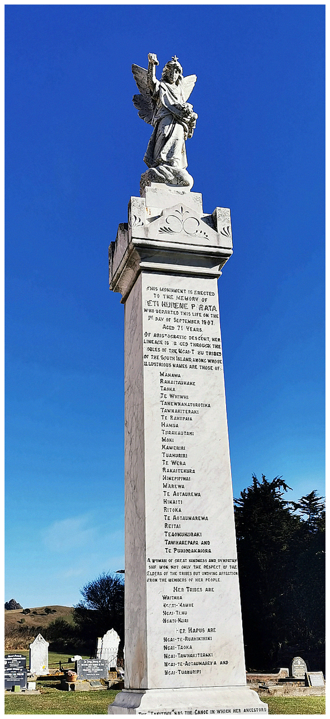
a lovely tribute to Peti Hurene Parata towers tall above all other headstones
One very majestic monument stands taller than the rest. This pays homage to Peti Hurene Parata. It lists the names of her descendants and describes her as:
A woman of great kindness and sympathy. She won not only the respect of the elders of the tribes but undying affection from the members of her people
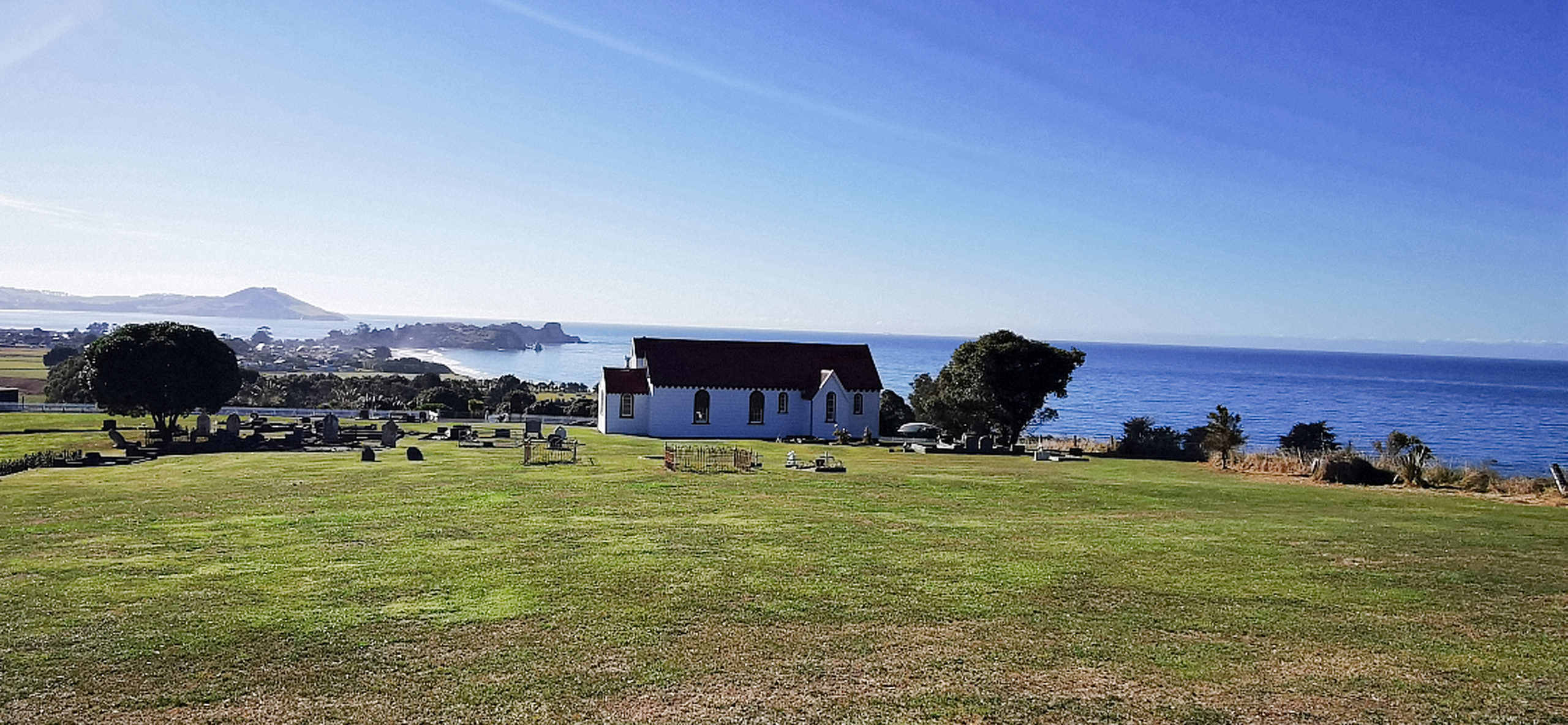
and the view the church and cemetery have is quite panoramic
Warrington
Carrying on with our roadie, we drove through Warrington, situated close to the northern shore of Blueskin Bay.
Yes, there was another church and cemetery stopover (seems to be a common theme with our roadies!). This time we had a wander around St Barnabas Church.
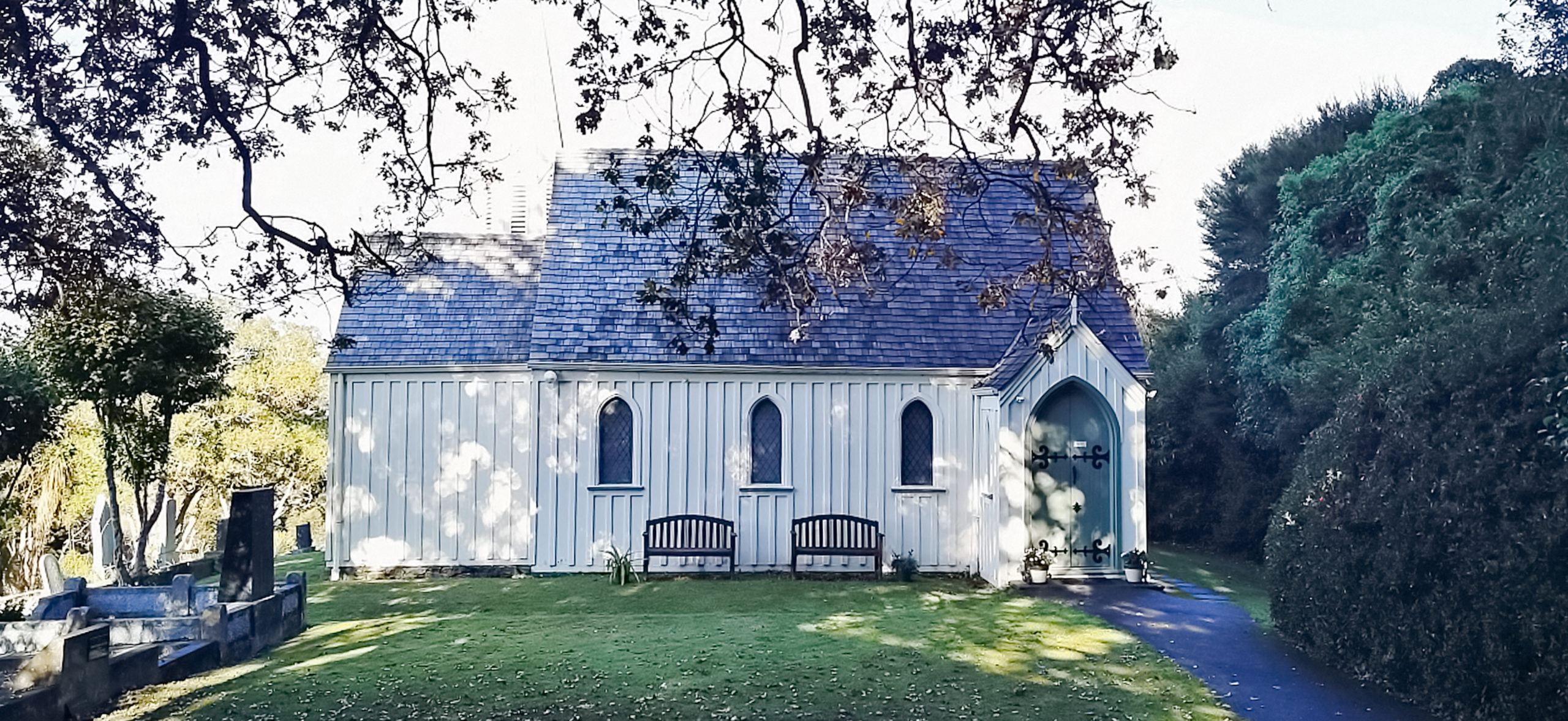
a very cute church surrounded by trees
Opened in 1872, this pretty little church is surrounded by woodland. The constant shade gives the cemetery a green mossy covering. The graves look incredibly old, but some of the moss-covered headstones were more recent than they look on closer inspection.
Otago’s first Anglican Bishop was buried here in 1921.
The church is built in board and batten, shingle roof and a small copper-tipped tower, complete with a bell. Although we were not able to wander through the inside, we could make out some pretty elaborate stained glass windows, especially for such a small building.
Blueskin Bay
After Warrington, we popped back out onto SH1 at Evansdale (yup stopped off to purchase some cheese!), only to turn off again at Waitati to explore the other side of Blueskin Bay.
This is another area that we were not familiar with. We spent time driving Doctors Point, Orokonui and up over Mopanui past the Orokonui Ecosanctuary
It was then onto Purakaunui and a small settlement called Osbourne.
Purakaunui should not be confused with the settlement in The Catlins (some 100km further south) which is home to the Purakaunui Falls.
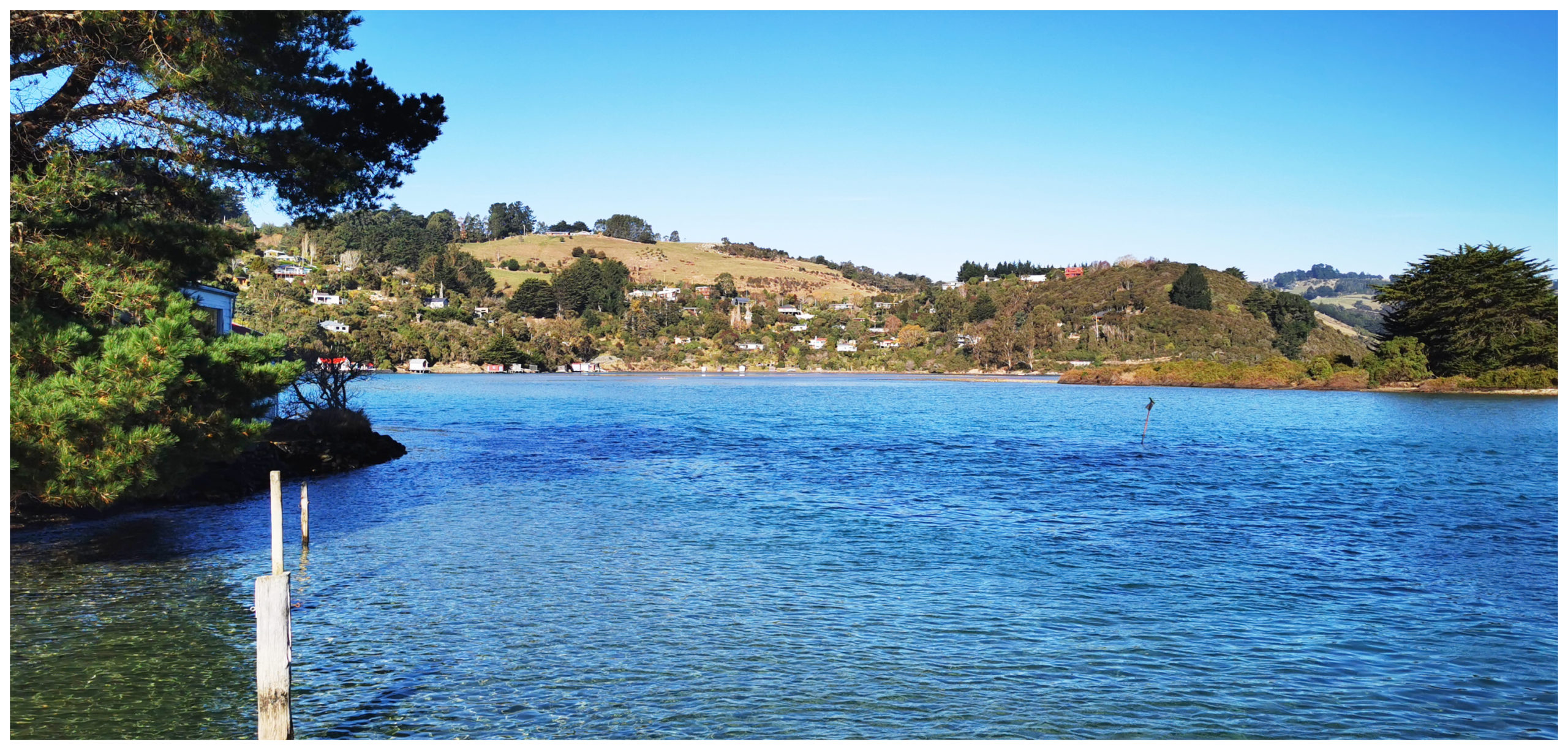
the views across the estuary to Osborne nestled on the side of the hill in the distance
This settlement is located on a peninsula between Long Beach and the Purakaunui Inlet. Osbourne is on the opposite shore of the inlet.
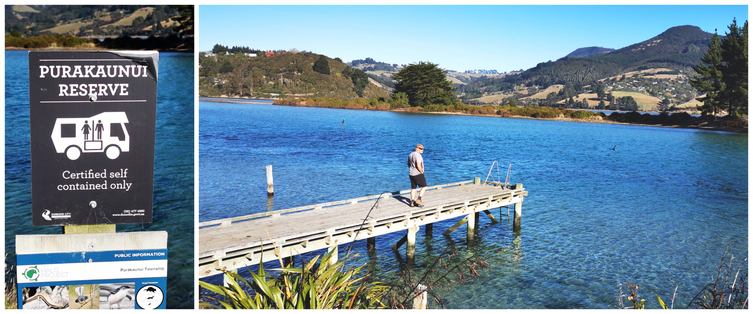
although freedom camping allowed, I wouldn’t recommend you attempt a drive in a larger rig or caravan – the road in is tight and there’s not much room to park up for the night
It was then a quick drive down the hill to Long Beach. It is obvious how it got its name – it’s a long beach! The cliffs that soar up skyward, is a popular spot for cliff climbers. Not something that I would ever be keen to partake in!
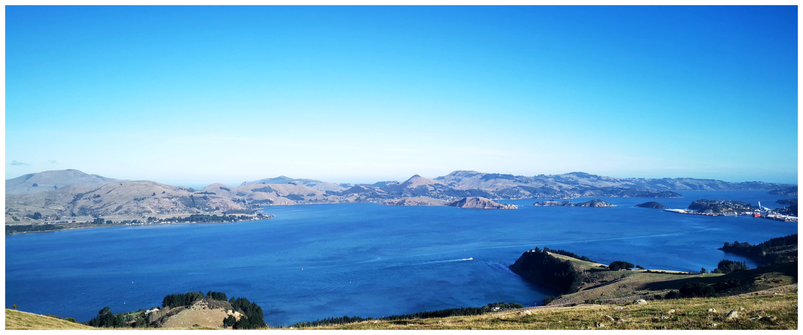
oh my goodness, the views over Port Chalmers and the Otago Harbour are stunning
We ended our roadie by driving out to Heyward Point which is pretty much as far as the road goes. This ended adjacent to Aramoana, and what seemed like a stone’s throw away from Taiaroa Head and the Albatross Colony on the other side of the Otago Harbour.
Return to Basecamp
Our roadie had finished so we headed for basecamp back at Waikouaiti. You can find places to camp if you want to spend a night or two in and around the area. Do your research before heading that way as some of the roads are a bit tight for larger rigs.
I can recommend stopping for ice cream at the Harvey Street Merchant, Waitati. They source all their products locally. There are all sorts of goodies and products on sale. The perfect ending to a great roadie.
Click on the link below for a video of our highlight (including some pretty impressive drone shots of the area).
Enjoyed reading your account. There is quite a story to the stained glass windows in the Church at Warrington and they are impressive. They were made in Bavaria and were shipped out to Australia to go in a Catholic Church in Brisbane (I think). The wharfies wouldnt unload them as they came from Germany(during WW1). They came on over to NZ and sat around the docks until they were given to the Anglican church in Warrington.
Oh wow, I love learning about these sorts of stories! There were so many windows for such a little church, I though there would have been a story around it. Thanks so much for sharing. Love it! L
Thanks Linda and driver Scotty. Another interesting road-trip blog post read and a great set of photos.
Thanks Kevin……certainly wouldn’t be possible without my trusty driver that’s for sure……now he thinks he’s Top Gun while driving our new drone……lol.
I do so enjoy your blogs – so descriptive and beautiful photography. Presume our 7m van would be ok on the roads in the Waikouaiti and surrounds area, providing we take it quietly?
Thank you! Your rig will be fine on the roads around the area. Take your time and admire the views.
Dont miss the Otago Peninsula. Theres scenic wonders that are truly magic to be discovered.
Yes you’re so right! We explored the Otago Peninsula last year – just magic!
Lovely area, you’ll have to come back to explore Truby King Reserve, which is the site of the asylum and the gardens that patients were allowed to wander. Also visit NZ’s tallest tree at Onokonui.
Oh yes, thanks, we’ve got that on our list for next time for sure
Making good use of your new toy. It has brought a whole new aspect to your stories.
great to look at. Love your adventures, end up going to some of your stop overs because of this.
Oh thanks Richard, yup that drone opens up a whole new world from above. Glad we’re inspiring you to visit some new places.
You passed the seacliff hospital on your way to warrington (it took it’s frist patients there in 1889), well worth a look around the trudy king reserve you can still make out the outline of the main hopsital in the grass.. the buildings behind are privatley owned. but stunning.
Love learning the history of these places, we’ve got it on our list for next time. Thanks! L