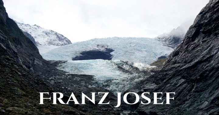
Southbound to Franz Josef
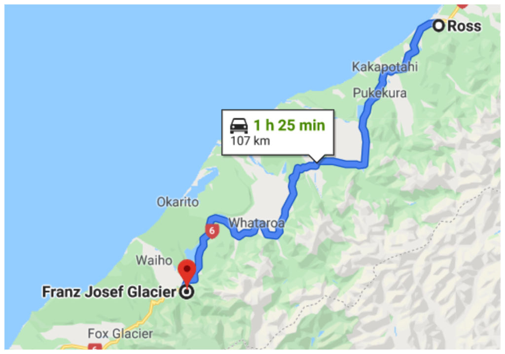
We love slow travelling so we like to keep our travel days short. Quite often our tyres haven’t heated up before we reach our next destination. Our overnight stay at Historical Ross (see the previous blog) meant that we only had just over 100km before our next camping spot at Franz Josef.
Short and sweet, just how we like it
History of Franz Josef
Franz Josef Glacier was first discovered back in 1865 by Julius von Haast and named it after the Austrian emperor.
The actual glacier is around 5km from the Franz Josef village. This village sprung up to service the many tourists and explorers and has grown in size since our last visit quite a few years ago. Nowadays, there are plenty of places to stay, eat, play or relax at the Glacier Hot Pools.
Franz Josef Glacier is approximately 7,000 years old and in 2008 was 12km long. I say ‘was’ as it is receding at an alarming rate. I would estimate it to be way less than that now. More on this later in the blog.
Camping in Franz Josef
Being members of the NZMCA enables us to use their parks that are dotted around the country. The NZMCA Park in Franz Josef (#6794) is conveniently located within walking distance to the village (approx a 15min wander).
It is has a large, flat metal area with water, dump station and rubbish facilities. At only $3 each per night, it is a great option that we made the most of.
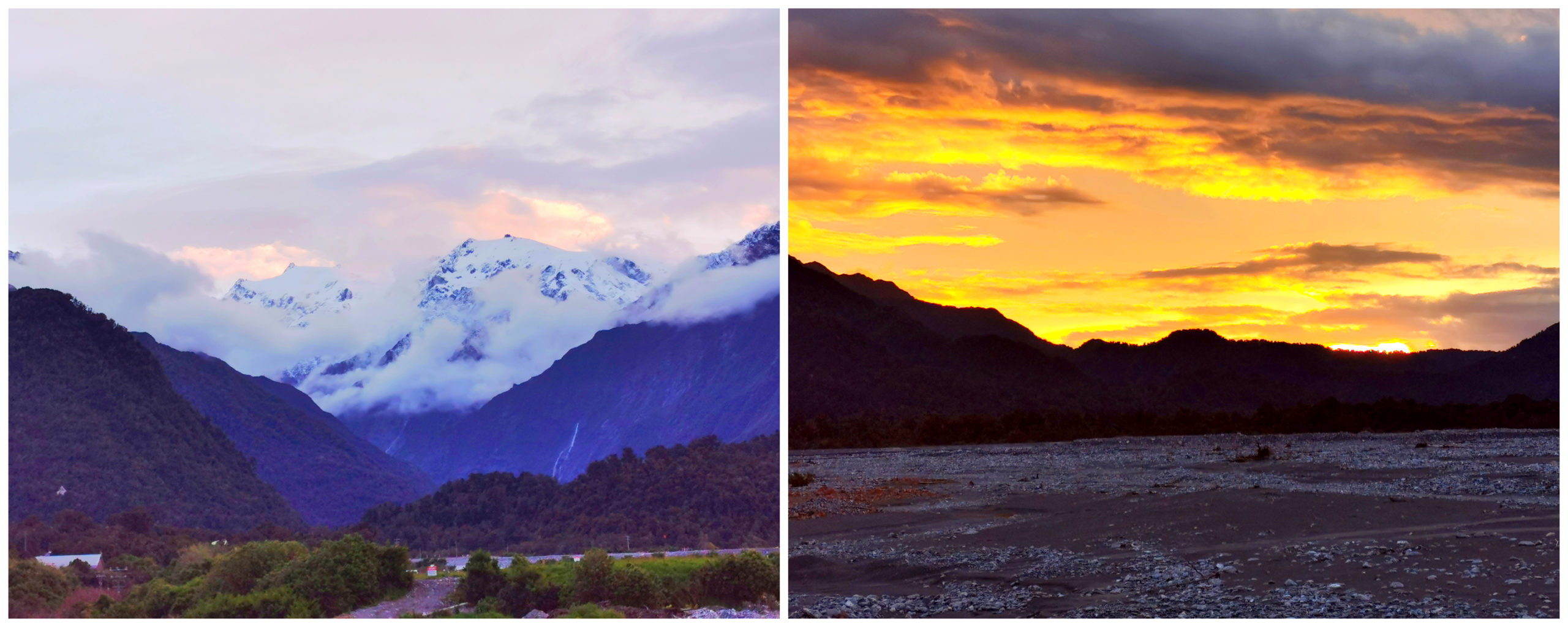
Just a few minutes walk from the camp, we watched the sun slowly setting over Franz Josef Glacier
Things to do in Franz Josef
We woke in the morning (actually around 3 am) to heavy rain beating down on us. This was to set the scene for the whole day so we hunkered down, caught up on admin duties and a few Netflix movies.
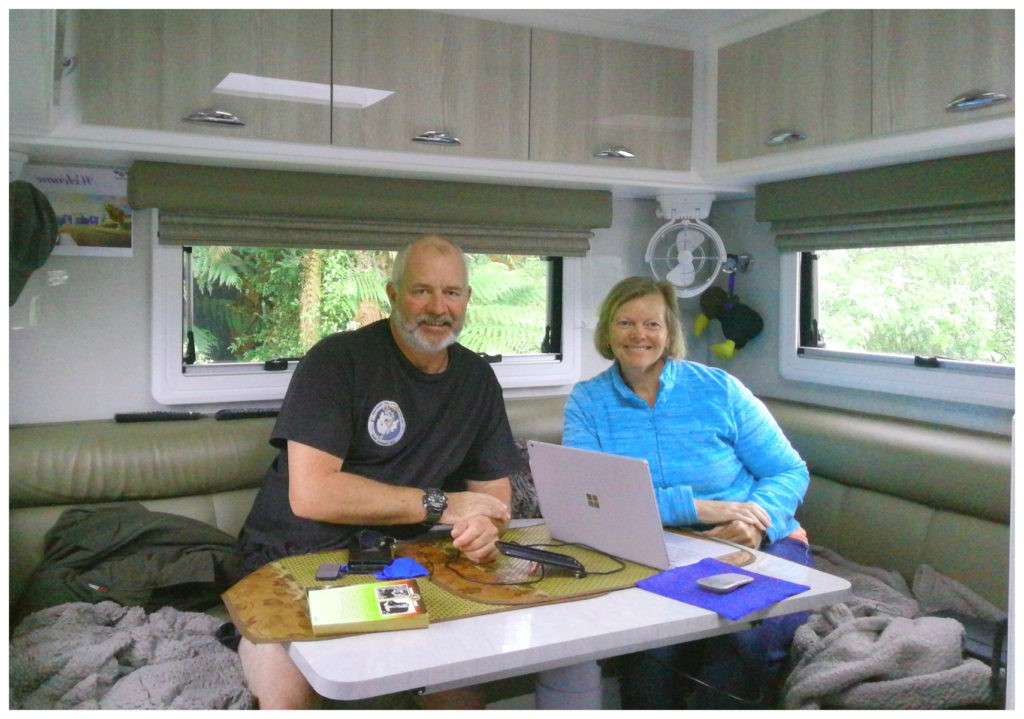
Everyone needs an admin day every now and then
We did brave the weather, put on our ponchos and wandered into town just to see how much it had changed. Turned out it has grown quite substantially since we were last in this area (about 20 years ago!).
The Glacier
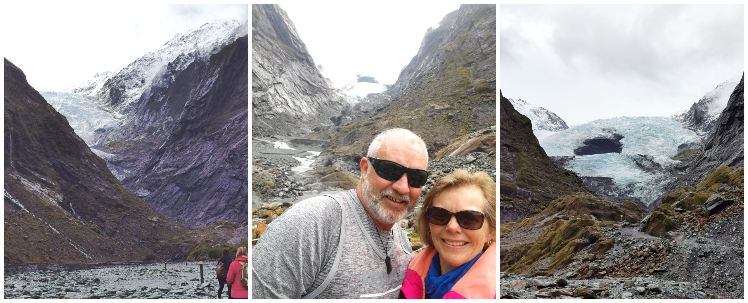
The next day was much more conducive to getting out and about. No visit to Franz Josef is complete without the obligatory visit to see the glacier (well what’s left of it). We knew that every other visitor feels the same so we were up and out the gate to make the 5km drive to the carpark area.
This has been enlarged substantially to cope with the number of visitors. Arriving earlier in the morning is definitely a bonus. The carpark was starting to fill up as we set off on the first walk at 8.30 am.
Walk One – Glacier Walk
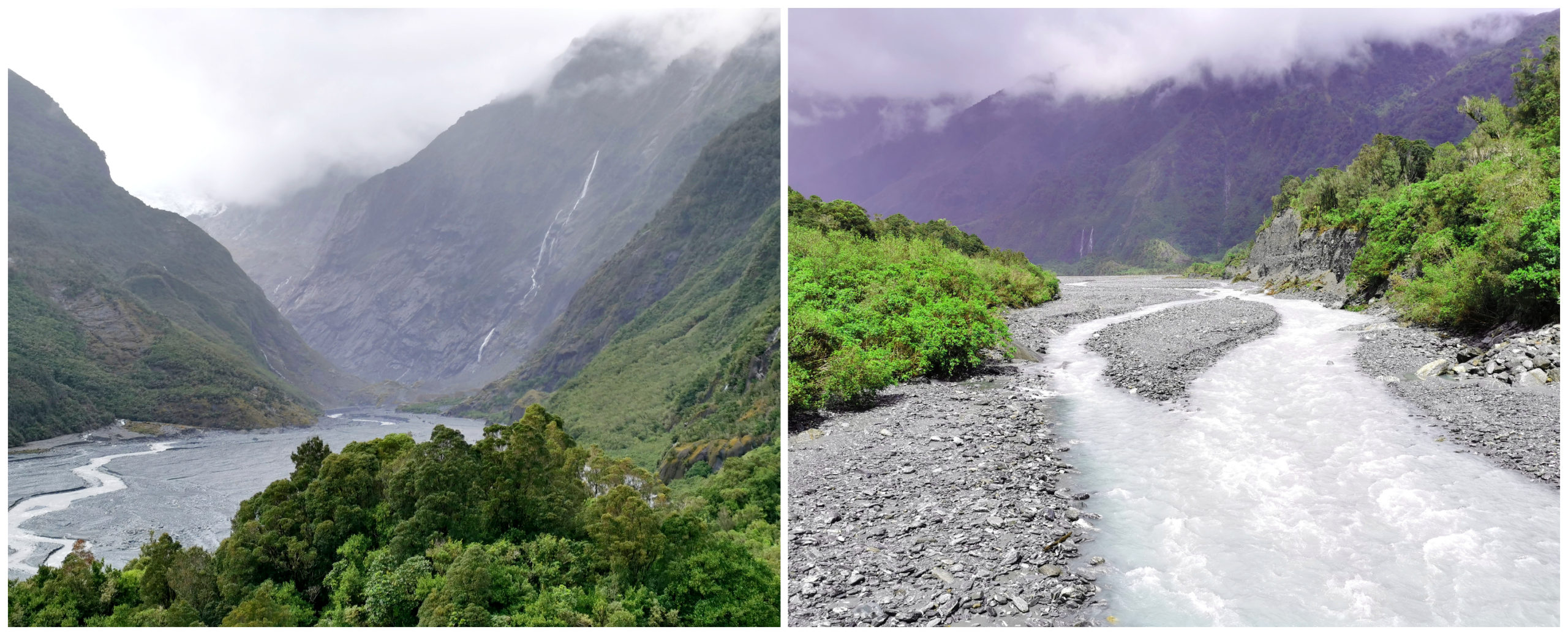
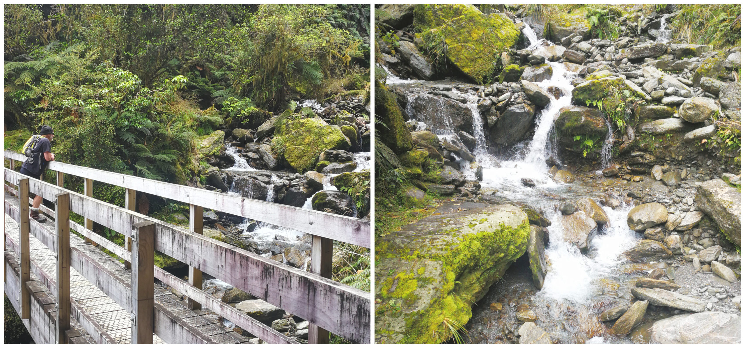
From the main carpark, the walk to the face of Franz Josef Glacier is around 40 minutes one way. The first 15 minutes are a breeze and the track winds its way through a forest to the first lookout – an amazing glimpse of the glacier. On a sunny day, the pure white and blue ice glistens and gleams.
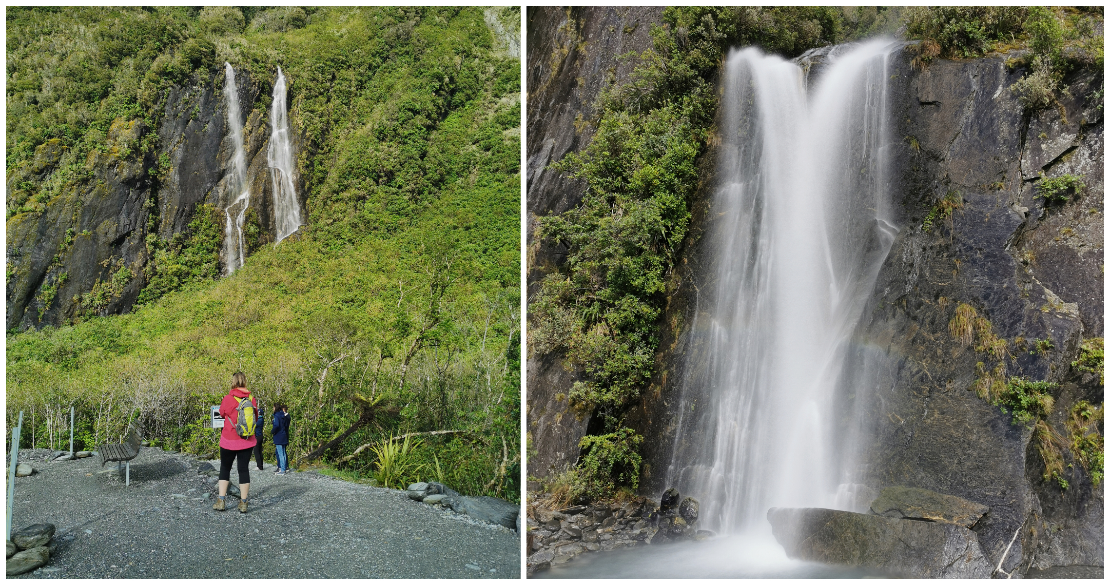
The track in is just as spectacular as the glacier itself
Carrying on along the track, it does become a bit more challenging and suitable footwear is definitely recommended. The track descends down to a rocky riverbed which took us as far as we could go – to 750m within the terminal face of this moving natural wonder.
Walking the valley carved out by the glacier requires co-ordination and good sturdy footwear
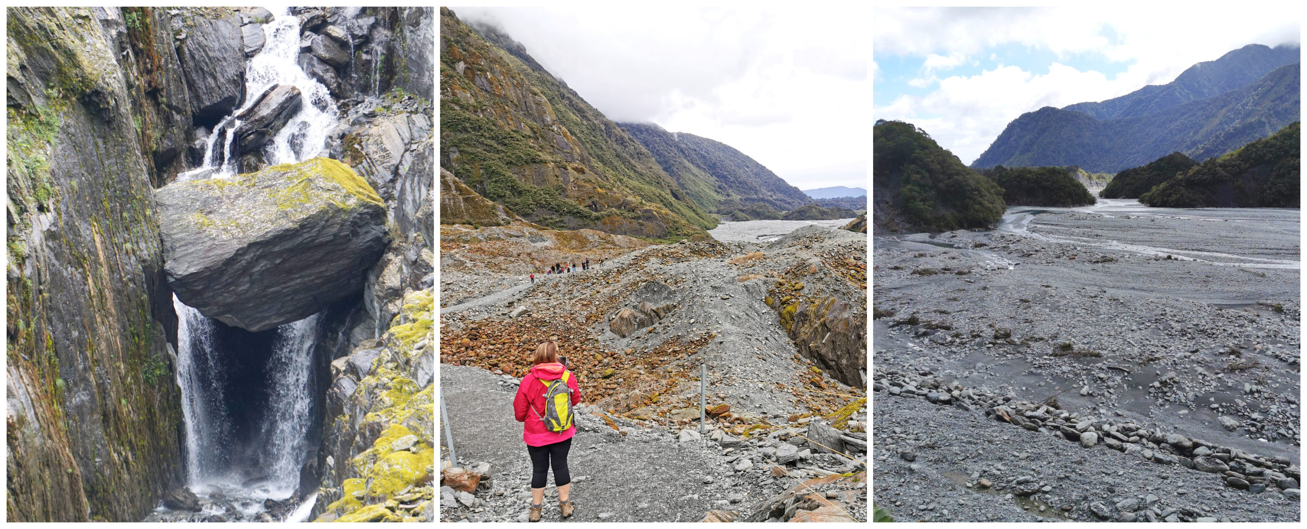
Although the whole vista of the Franz Josef Glacier appears serene, the glacier is constantly moving with ice and rock falling without warning.
Because of this, there are track conditions posted at the start of the walk. Always check on the latest warnings before setting off on the trail.
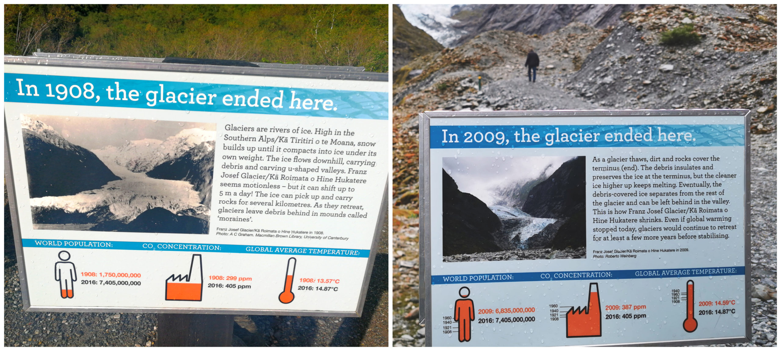
We managed to get the obligatory pics before the cloud descended
By the time we made it to the end of the track, the cloud still hadn’t descended so we were so lucky to get some great shots of the entire glacier. This doesn’t always happen so the timing was perfect. It was worth the striding out to get to it before the opportunity was lost.
We turned to look back at the glacier and yes, the cloud had come down, blocking the view of the top.
Walk Two – Sentinel Rock Walk
The main Franz Josef Glacier walk does split in two so on our return, we detoured off to explore the Sentinel Rock Walk which takes you uphill to a lookout over the glacier.
heartbreaking to see the evidence of just how fast the glacier is disappearing, signage along the trail points it out clearly.
This is the best spot to stand and read the information boards and see the photos depicting the glacier and how it used to look – some taken not that long ago. It was astounding to learn about just how rapidly we are losing this glacier as the atmosphere warms up.
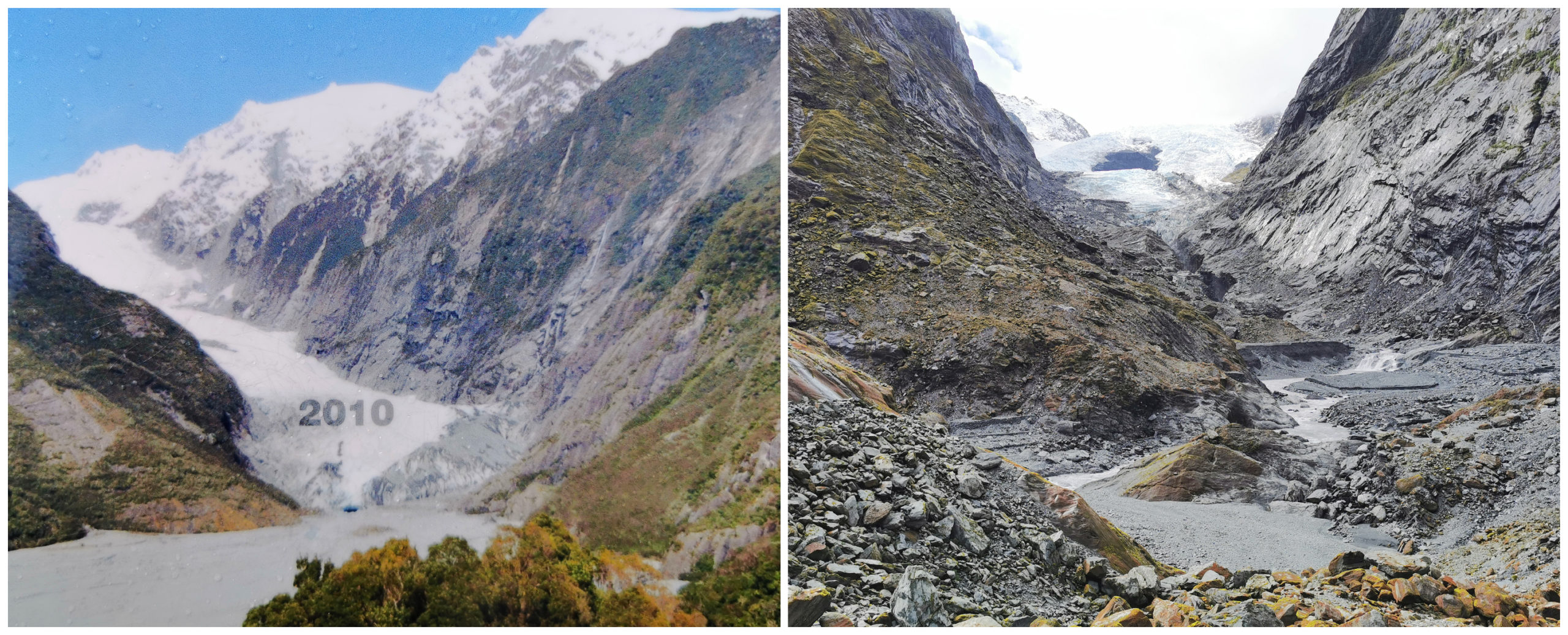
Signage at the top of the lookout. The photo on left was taken in 2010, photo on right was taken by us 2019.
The walk is around 10 minutes one way but take into account that it is all uphill.
Walk Three – Douglas Track
Back at the main carpark (which was getting rather full), we took the next track that branches off, the Douglas Track. This is a 1-hour loop track which took us past Peter’s Pool.
It would have made a great reflective shot had it been a better day weather-wise (glacier in the background)
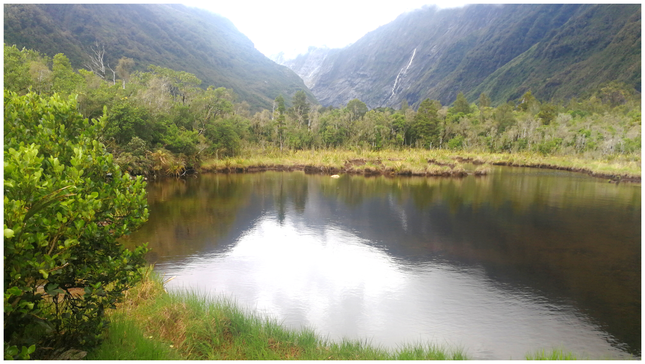
If you don’t want to do the full loop, then the walk to Peter’s Pool is an easily accessible 700m one way. Peter’s Pool is known as a small kettle lake. It was formed by melting glacial ice around 200 years ago. The water is highly reflective and provides stunning views of the glacial valley towards Franz Josef. It wasn’t the most ideal conditions for reflections but the history about how it was formed was quite interesting.
Although we didn’t get any good shots of Peter’s Pool, the rest of the walk was pretty spectacular
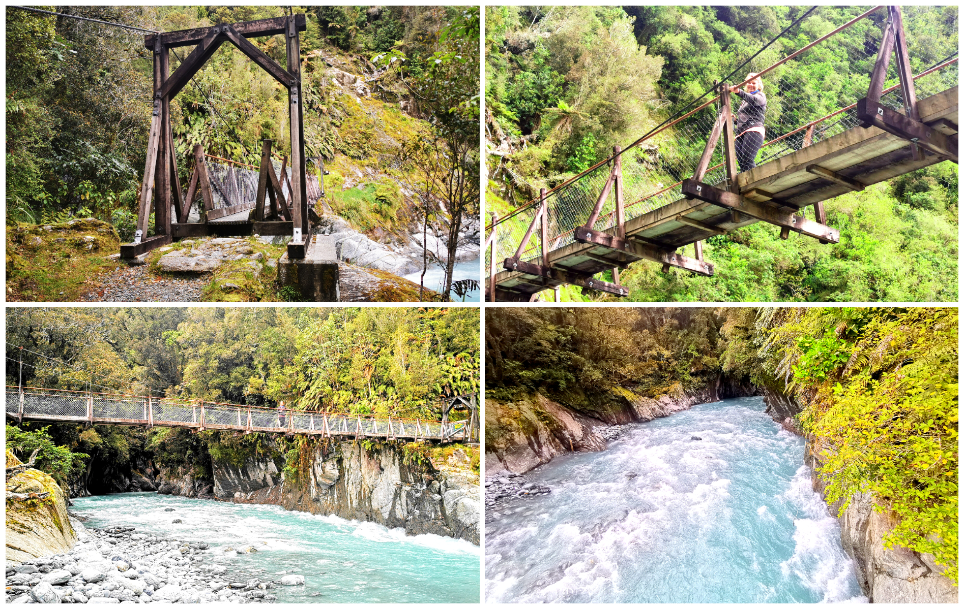
The rest of the Douglas Walk took us over a glacial landscape which is staggering to think it was formed between 1600 and 1750AD by continuous glacial advances and retreats.
We wandered through various vegetations that are at different stages of regeneration thanks to the retreating glaciers.
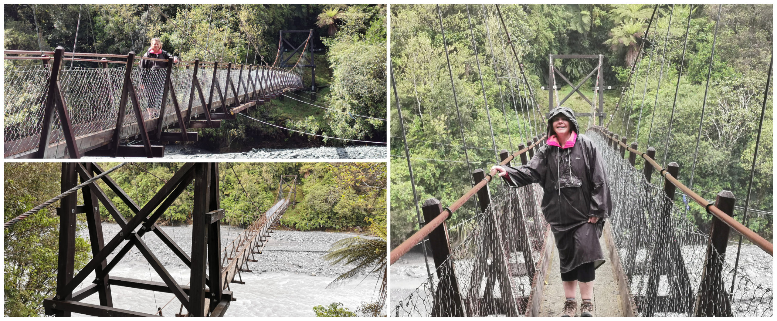
The stunning suspension bridge on the Douglas Track, still battling the elements
Lunchtime Entertainment
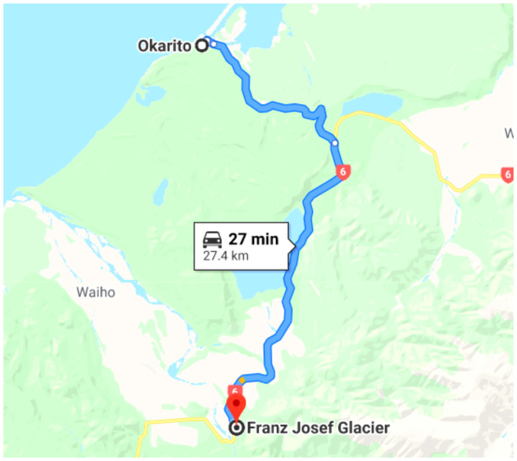
After completing all three tracks, we had our ‘tailgate’ lunch while watching the comings and goings of all the tourists in their rental campers, vans, cars and coaches. Maneuvering their way around pedestrians that seem oblivious to the fact that there is any moving traffic as they stalk the kea’s that wander the carpark, looking for their next morsel of food. All in the hope they get that perfect Instagram photo of one of our favourite native birds.
Total distance walked – 17 km.
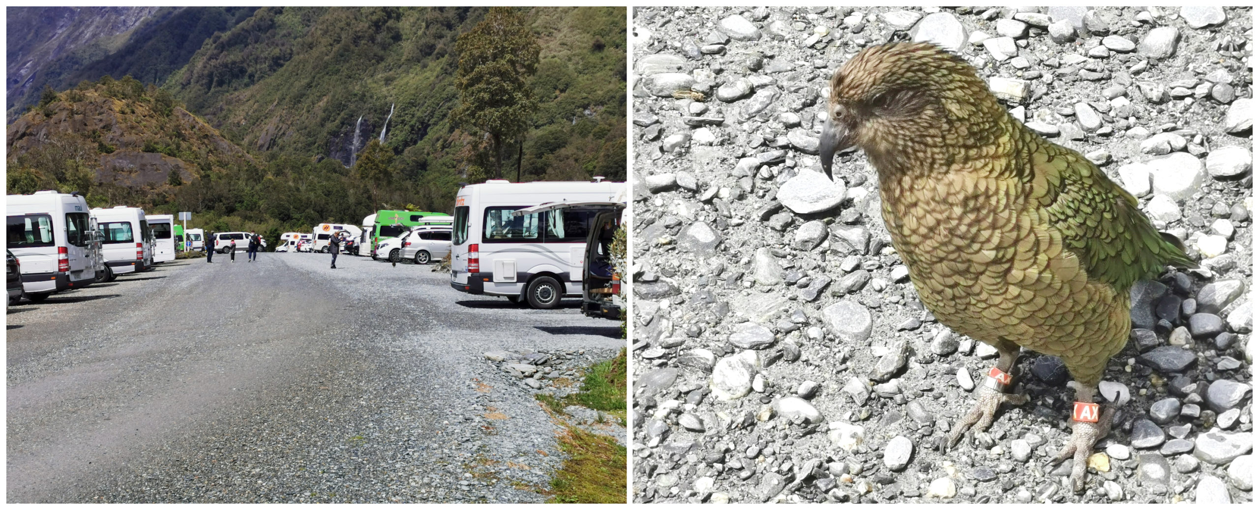
Quite entertaining watching the tourist mastering the carpark and our kea mate
Click on the link below to view a video of our highlights on our walks around Franz Josef Glacier.
Okarito
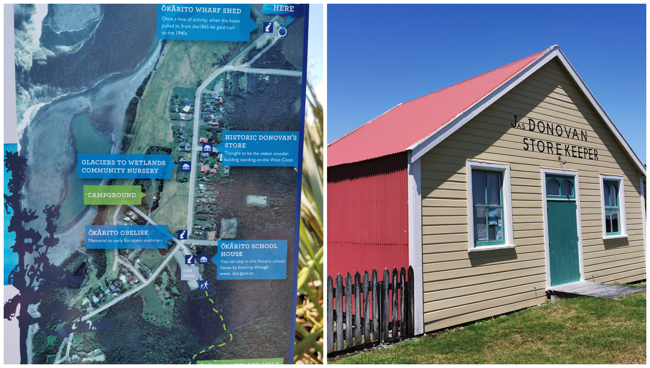
A 27km drive from Franz Josef will take you to the small coastal settlement of Okarito. Set on a sandspit snug beneath the Southern Alps.
It’s just a short drive from Franz Josef to Okarito
Okarito Lagoon is the largest ‘unmodified’ estuary lagoon in New Zealand. It’s a 2340ha lagoon, which makes it the ideal home to more than 76 types of bird species and thousands of wading birds. There’s a huge area of shallow open water and tidal flats so its the perfect location for kayaking and exploring. However, the weather didn’t make this a very attractive option for us on the day of our visit.
According to geologists, the lagoon itself wasn’t formed until the 1700s when a tsunami rearranged the geography of the land forever.
A Rich History
There is evidence that Maori occupied Okarito over 600 years ago and there was a big pa on the nearby Kohuamarua Bluff.
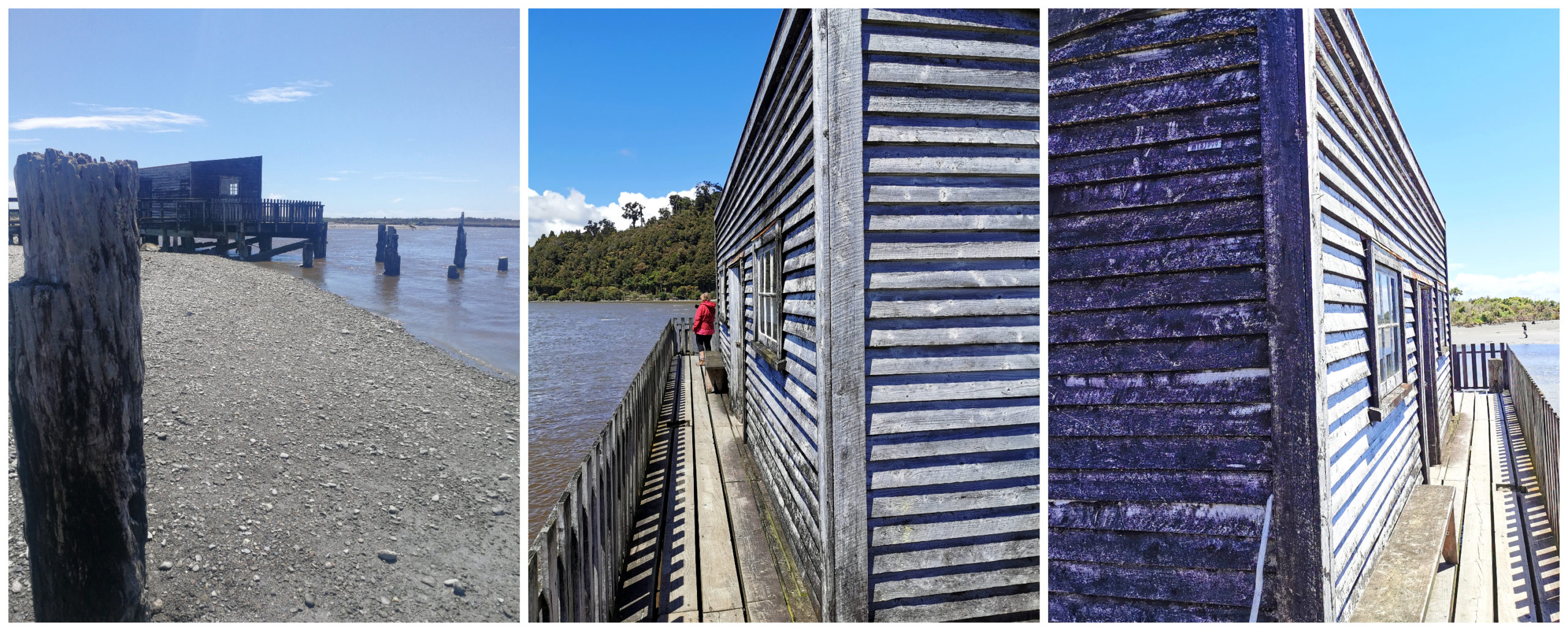
In 1865 the township of Okarito sprang into life on the low-lying frequently flooded land. They chose the spot as the entrance channel was the nearest place suitable for shipping for the goldfields to the south. It is recorded that as many as 500 men arrived in one day. It was home to over 4,000 gold miners all seeking their fortune.
Donovan’s Store is the oldest known building on the West Coast. With its colourful history, it has become an icon in Okarito as one of the last remaining buildings of the old town.
The main street used to be lined with over 30 retail shops and hotels. In fact, selling grog would’ve been a much better way of getting rich than panning or digging for gold because the diggers drank gallons of booze.
The historic wharf at Okarito Estuary
As the gold rush declined, so did the population. The port remained open until the 1940s and slowly the wharf fell into disrepair. In the 1970s, residents and supporters formed the Okarito Improvement Society to save the historic wharf from demolition. Thank goodness they did as it still stands proudly over the water. It has a host of history boards inside where we could read about the gold mining, flax and sawmilling history of the area.
Okarito Wetland and Trig Walk
At the old Okarito School House, you will find the start of the Okarito Wetland and Trig Walk. If you decide to just do the Wetland Walk, it will take you around 20 minutes return and is 1 km. The track winds through the bush before crossing the estuary on a curving boardwalk and to an estuary lookout.
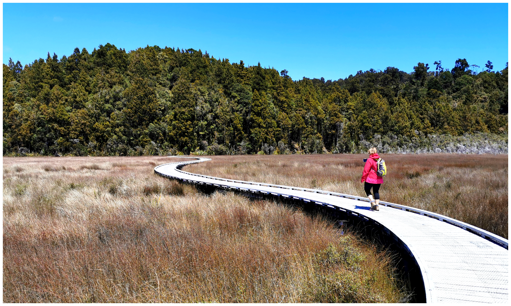
The winding boardwalks over the wetlands
We, however, continued onto the Trig Walk. As you would expect on any walk with the word ‘Trig’ in it – there is going to be a hill climb involved. We powered uphill, puffing and panting for around 45 minutes on a well-graded track before reaching the Okarito Trig Viewpoint.
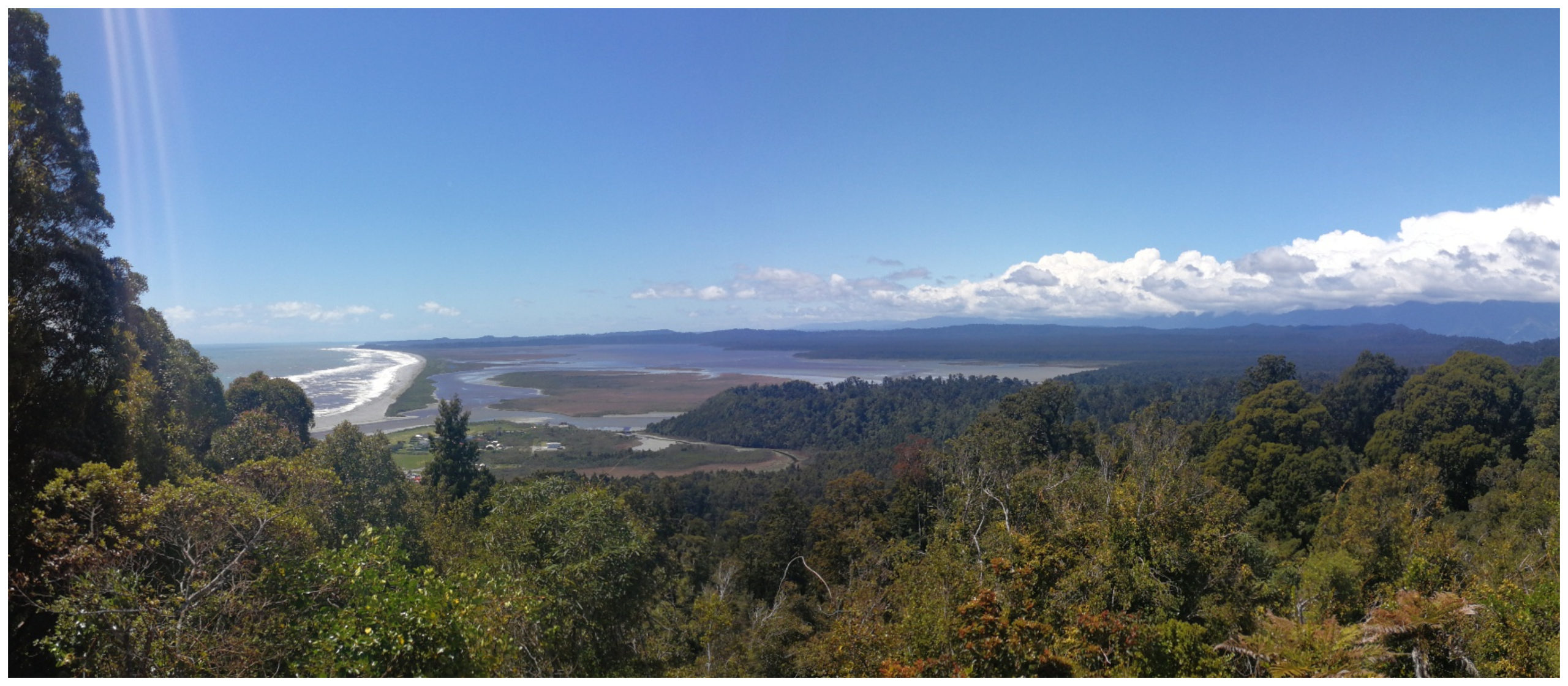
Gorgeous views awaited us at the top of the Trig Station
It was quite a clear day and the view was unbeatable. The snow-capped Southern Alps dominated the landscape. Thanks to the signage at the top, we could identify Mt Adams in the north, Mt Tasman and Aoraki/Mt Cook in the south. Native forests stretched out to the lagoon and beaches of the West Coast.
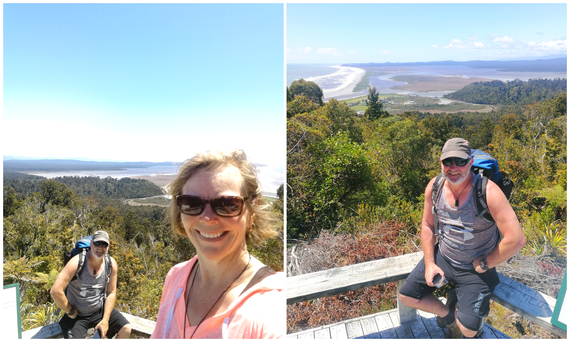
A bit hot and sweaty after our puffing and panting uphill
Trig Station History
There is also some history surrounding this Trig Station. This was the exact spot where Julius von Haast, Gerhard Muller and Charlie Douglas viewed the Western Coastline and the Southern Alps. Imagine what was going through their minds as they stood there with the views stretching out around them.
It is a 1.5hr (4.2km) return walk.
Three Mile Pack Track
There is another track – Three Mile Pack Track but is currently closed due to damage and flooding to the trail. This is a 3.5 hr (9.8 km) hike. We’ll save this for another day I think.
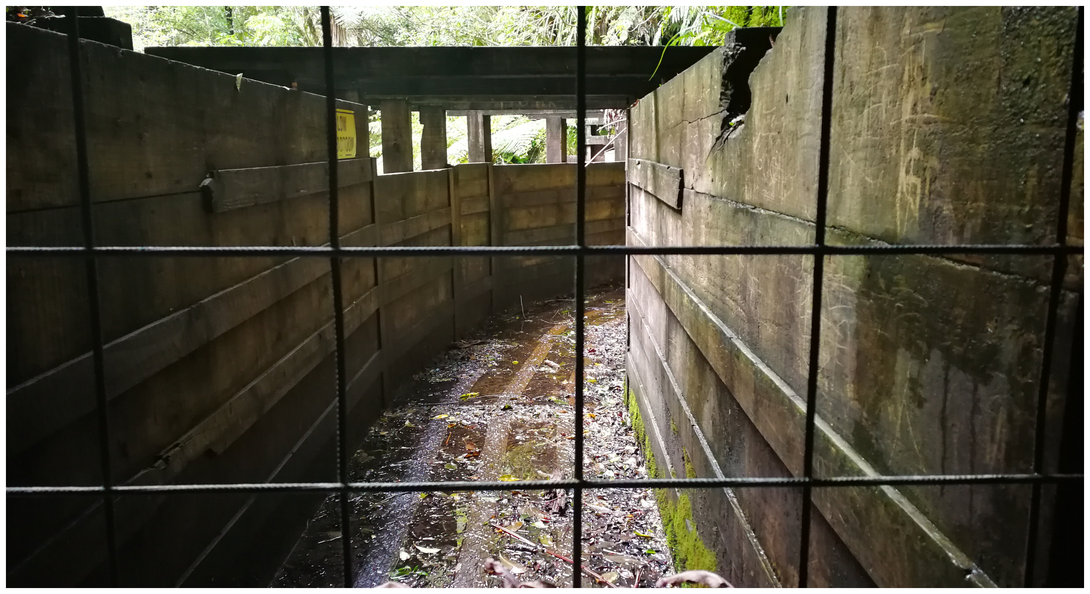
Callery Gorge Walk/Tatare Tunnels Track
Located more or less in the middle of the village at Franz Josef (at the end of Cowan Street) is the start of the Callery Gorge Walk and Tatare Tunnels Track.
Callery Gorge Walk
It is a 1.20 hr (5.2 km) return walk which climbs to a high terrace before descending to the Callery River. Five minutes into the walk, the track branches off towards the Tatare Tunnels Track (more on this later).
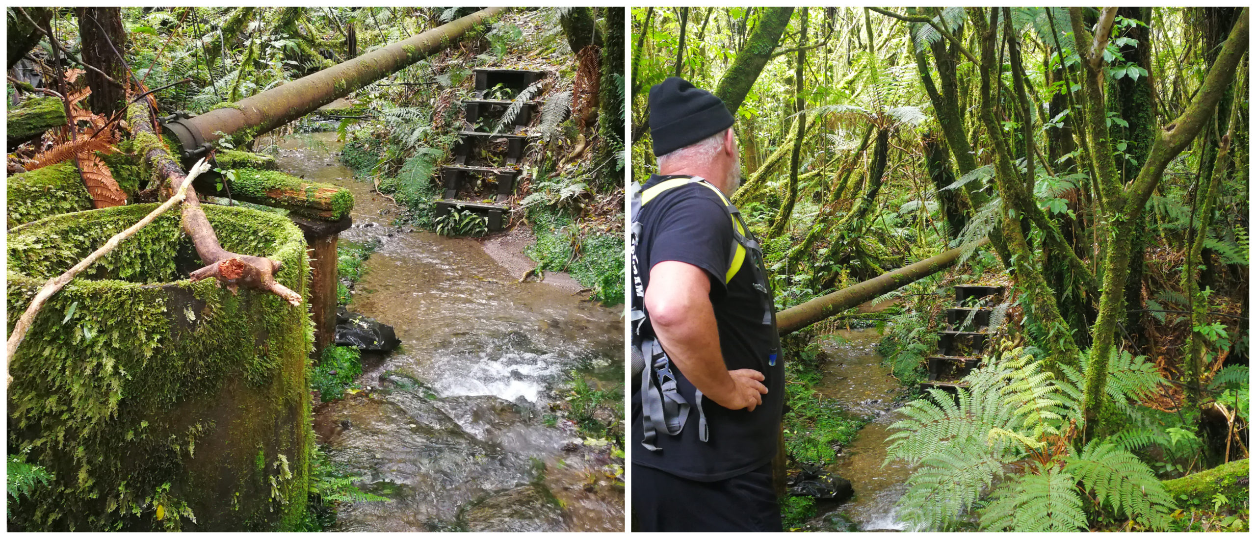
It was easy to spot the rusty relics alongside the trail (and I’m not talking about Scotty!)
We wandered uphill and came across the town water supply pipes and tanks. From here the track narrowed and took us through beautiful bush and alongside some of the old gold mining water races. We found some rusty relics from the past as we continued along following the steps of the old gold miners.
It passes old sluice pipes that were part of the three kilometres of pipeline laid by the Waiho Sluicing Company. These were laid in 1912 and used to transport water to the terrace gold sluicing face.
Don’t be fooled by the first bridge you get to. Although very pretty, there’s more in store further down the trail.
Historical Callery Gorge Bridge
We knew that there was a bridge that we would eventually get to. We did wonder if the first one we came across was the one. However, we kept walking (now downhill) and the track got a little bit rougher underfoot.
Well, we were well rewarded as we came across the historic Callery Gorge bridge. The steel suspension bridge (29m) was built in the early 1900s and restored in 1994.
We made it to the historic Callery Suspension Bridge
The track used to continue along the Callery River but the landscape has changed dramatically over the years and the rest of the trail is now closed. The river level has raised thanks to gravel deposits filing in the gorge further upriver.
We did notice that some people walk along the river (RHS) which would double back towards the township. However, we did an ‘about turn’ and walked back the way we had come.
Tatare Tunnel Walk
As mentioned earlier, we noticed the track branching off towards the Tatare Tunnels. We took this track which would take us around 1.20 hr return. The walk follows an old 4WD road and then climbs (narrow and steep) zig-zagging up to the old water tunnels.
Taking the left branch in the track to the Tatare Tunnels
In 1907 three teams of pioneer miners were employed to work around the clock to drive a 500-metre tunnel system through from the Tatare Gorge to pipe water to the gold mining sluices. They blasted their way through solid rock, without the aid of modern measuring equipment. It took them over a year working from each end. When they finally met, they were only a few centimetres off the exact alignment!
Unfortunately, the gold that was recovered from the site did not cover the mining costs and the company closed down in 1908. All, however, was not lost. From 1911, the sluice pipes provided a water supply for the old Graham Hotel.
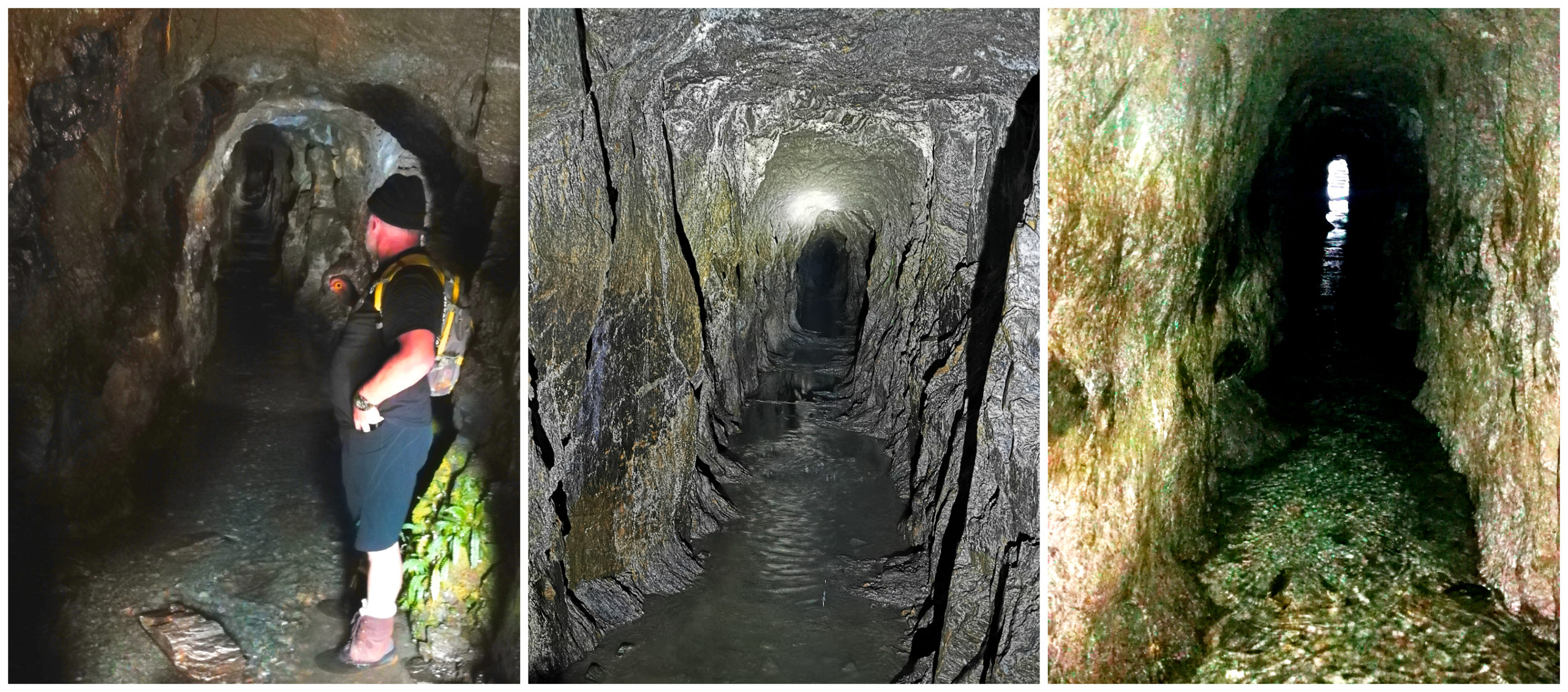
Looking into the deep abyss to head into the tunnels
We had read the warnings about getting wet feet while walking the tunnels. Sure enough, my hiking boots were fully submerged as we wandered the old water tunnels. I certainly had ‘boot envy’ as Scotty tramped his way through with dry feet in his Taranaki Boots! Also, a torch is a must so make sure you go prepared.
The end of the trail where the tunnel opens up and onto the old hydro-electric station which was washed away in the 80s
End of the Trail
After wandering through to the end, we came across the gate which seals off the exit. Unfortunately, due to a lack of maintenance on the old wooden bridge and aqueducts, we could not walk any further. We peered out between the gaps at the large expansive waterway that continued to the old power station.
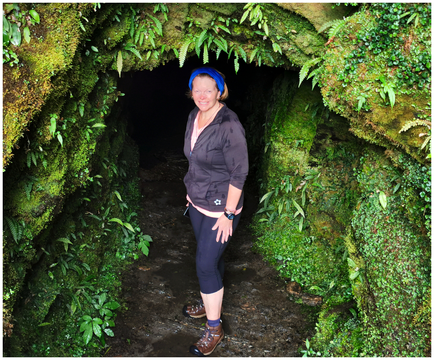
I emerged a little wetter than when I went in! 500 m in the dark and wet can seem a long way!
It would have been amazing to walk the entire way but instead, we had to go back the way we’d come and made our way back to the car. Including both tracks, we had walked 3 hours in total and covered 10km.
Summary
You don’t have to spend a fortune in Franz Josef to enjoy the attractions on offer. If your budget allows, you can enjoy various helicopter excursions, guided ice walks or a soak in the hot pools. You can do as little or as much as you want.
Click on the link below to view a video of our highlights for the rest of our stay in Franz Josef.
Loved the video, Okarito lagoon is on my list.
I always miss the keas. A great blog.
Thanks for your support, much appreciated. L
Great blog again Linda. Looking at your photos brought back memories of our time there and I look forward to returning soon to take on some of the walks you did that we didn’t
Wonderful photos and blog. I’m glad you revisited the glacier while it still exists. It’s good/sad to have a visual record of the shrinking process. The tracks to viewpoints away from the glaciers have always been my favourites. People stalking kea stalking people an be hilarious. I hope visitors are learning not to feed them.
I was ready to pounce on any tourists offering the Kea’s food but none did so that was great!. L
THanks for your updated blog post on Franz Josef glacier and tracks Scotty &Linda. AlwAys an interesting read and photos.
Cheers for that Kevin. L
What excellent photos in this post – they tell a fantastic story of all the places visited.
We met Franz Joseph Glacier 14 years ago, and yes it was raining then as well. Like you we were horrified at the rate the glacier is receding.
Trig Station looks very interesting, and it’s obviously time for us to again visit the Land of the Long White Cloud and hire a motor home again!
PS – I don’t like suspension bridges and just about need calm me down pills to go on them – whatever the height!
Great read.
Haha, thanks Joycee, drugs before suspension bridges would be a good idea!