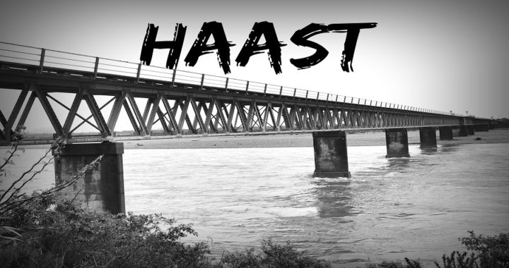
Haast was an area I was looking forward to visiting. It has been some years since I’ve travelled through Haast and never really stopped long enough to really discover what is in and around the area.
As usual, my ‘Lindy List’ (which I always seem to have one on the go) was quite extensive! So, get out the popcorn, settle down and have a read through our exploits in Haast.
We set off from our campsite at Gillespies Beach and headed for Haast. Click HERE to read all about our overnight stay.
Base Camp
We read through our options of where to stay in Haast. We weren’t all that keen on the camping ground options so chose to stay at a POP (Park Over Property through the NZMCA) at the local Knitwear, Honey & Gift shop (#6830). A gold coin donation is appreciated which goes towards the local St Johns Ambulance.
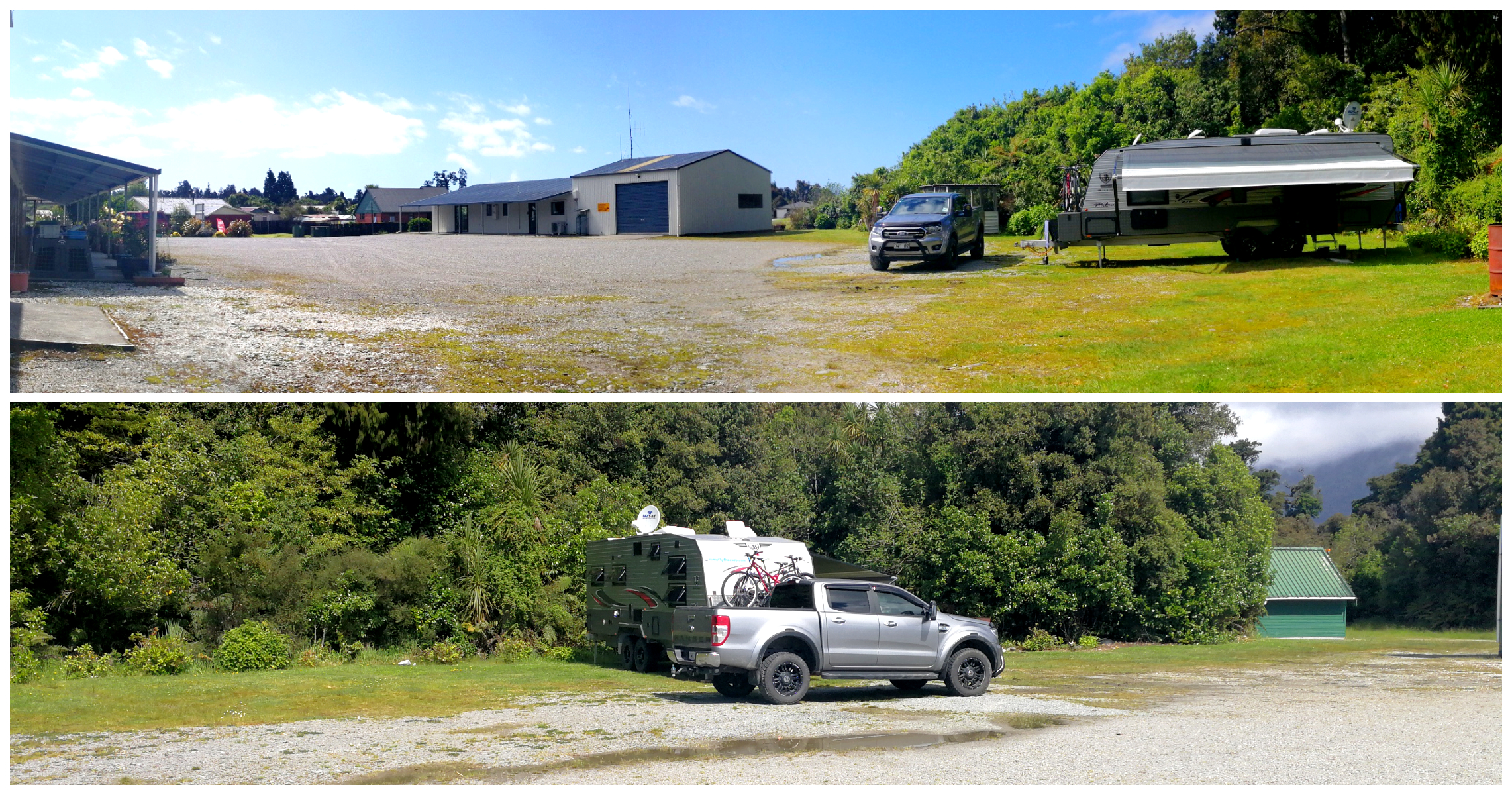
It is a large area towards the rear of their carpark and is close to groceries/takeaways (On The Spot), dump station (100m up the road) and cafe. There is also a toilet and water on-site which campers are welcome to use.
Ship Creek Walks
Just 18km north of Haast is Ship Creek (make sure you say that correctly!). It is a popular stop for the passing tourist population so early arrival is probably recommended.
Ship Creek is known by local Maori as Tauperikaka Creek. It is rain-fed and gets its dark inky colour from the swamp forests that populate its banks for around 11km further upstream.
History
The name ‘Ship Creek’ originally dates back to 1871, when a rather large fragment of a ship was discovered at the mouth of the creek. Back then, the type of wood was difficult to identify and had not been seen in NZ before. Four years later, more ship fragments were found. Unlike a giant jigsaw puzzle, the pieces, when fitted together started to look like a sailing boat.
These fragments married up to discoveries made off the coast of Victoria, Australia. Finally, in 1973 the ship was identified and confirmed as a boat made in Scotland, which was wrecked off the coast of Melbourne way back in 1855.
Remarkably, pieces of the wreckage drifted over 2,000km to this desolate stretch of NZ’s West Coast. Hence the name ‘Ship Creek’.
Walks
There are two walks you can do at Ship Creek.
Kahikatea Swamp Forest Walk
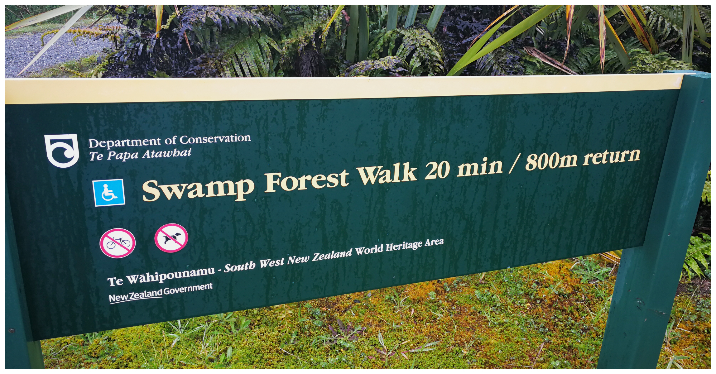
The tracks are well signposted
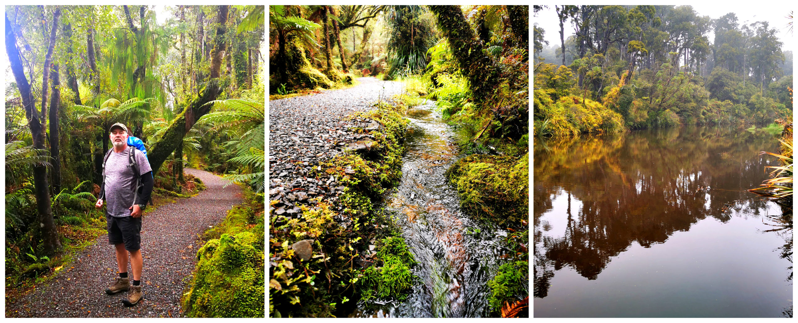
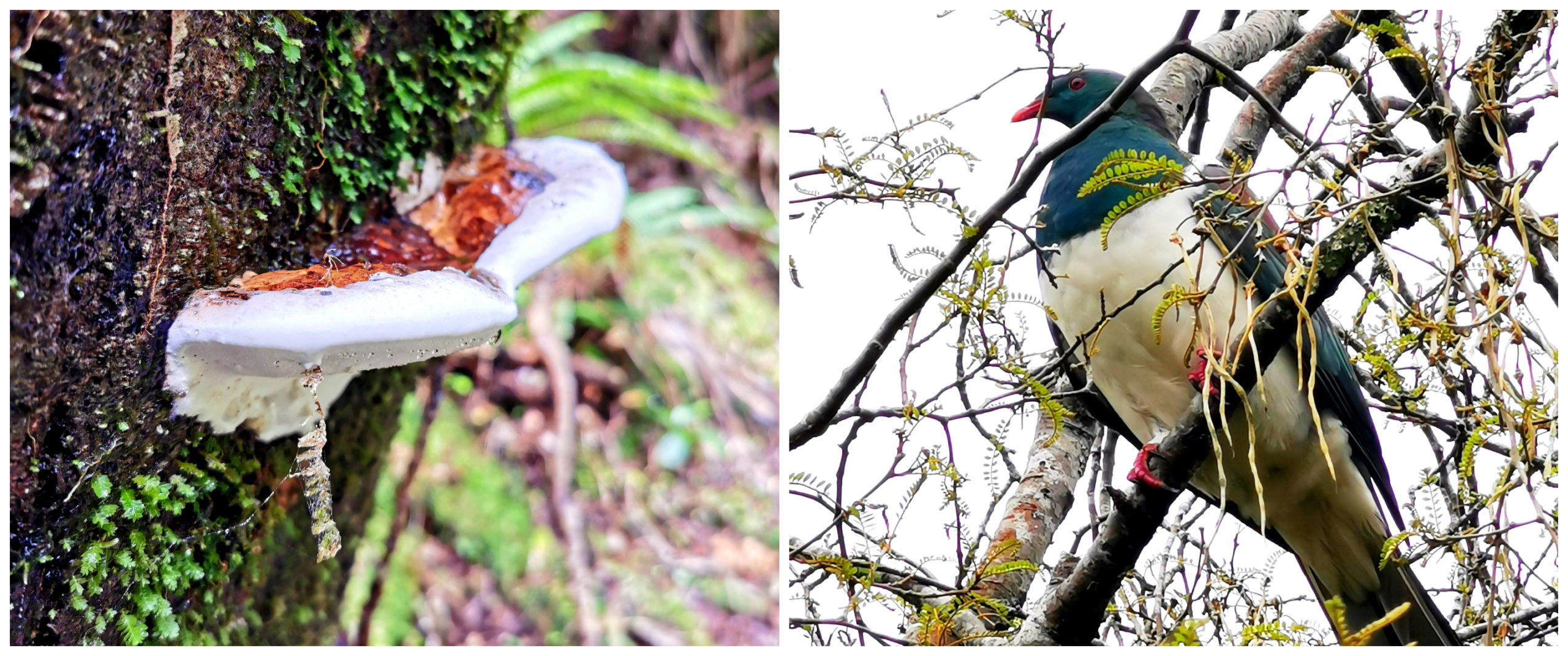
This walk will only take you around 20 minutes. There are boardwalks which pass through the most stunning examples of NZ’s tallest tree, the kahikatea (white pine). Trees can live for at least 600 years.
A photographer’s dream trail
The path follows the Tauparikaka Creek and on a fine day, offers the keen photographer some stunning nature shots.
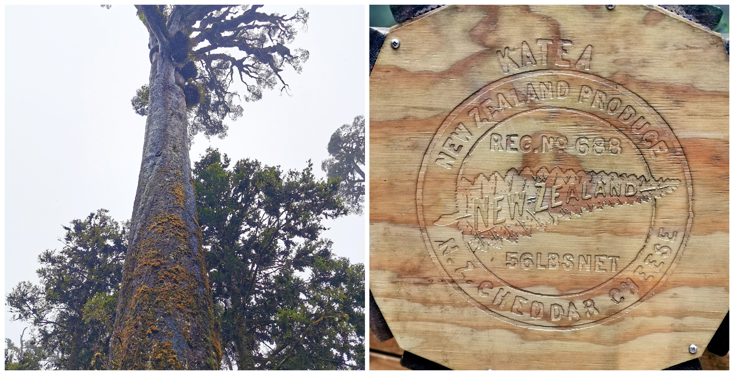
The mighty kahikatea tree used to make butter and cheese cases for the export market
We also learnt that it is an odourless wood, clean and lightweight. Therefore, it was used to make boxes for the exporting of butter, cheese and meat from NZ to Australia in the 1880s.
It was also very popular for boat building until the 1970s because of its long straight lengths and it was lighter in weight than kauri.
Dune Lake Walk
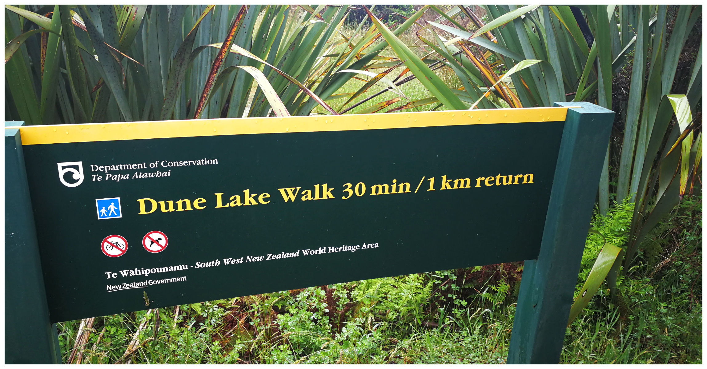
This 30-minute loop track follows the rugged dunes before heading into a dense windswept coastal forest. It leads you to the dune lake. Although quite common in NZ (400 in Northland alone), they are quite a geological rarity.
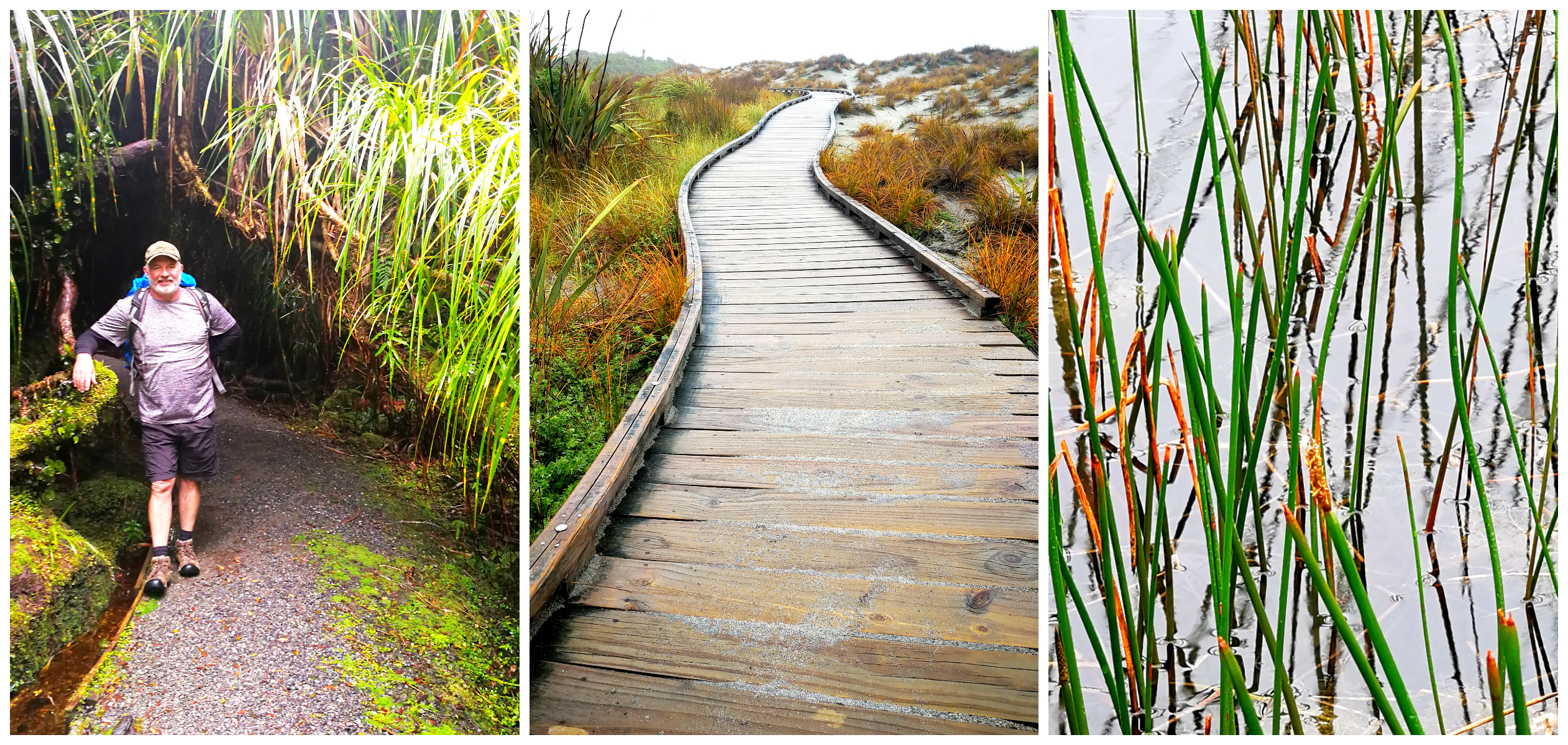
Tree ferns, boardwalks and rustling reeds
Sand dunes are sculpted by strong sea winds forming a hollow, which over time, fills with fresh water. It is then populated by plant and animal life and becomes its own little oasis in the dunes.
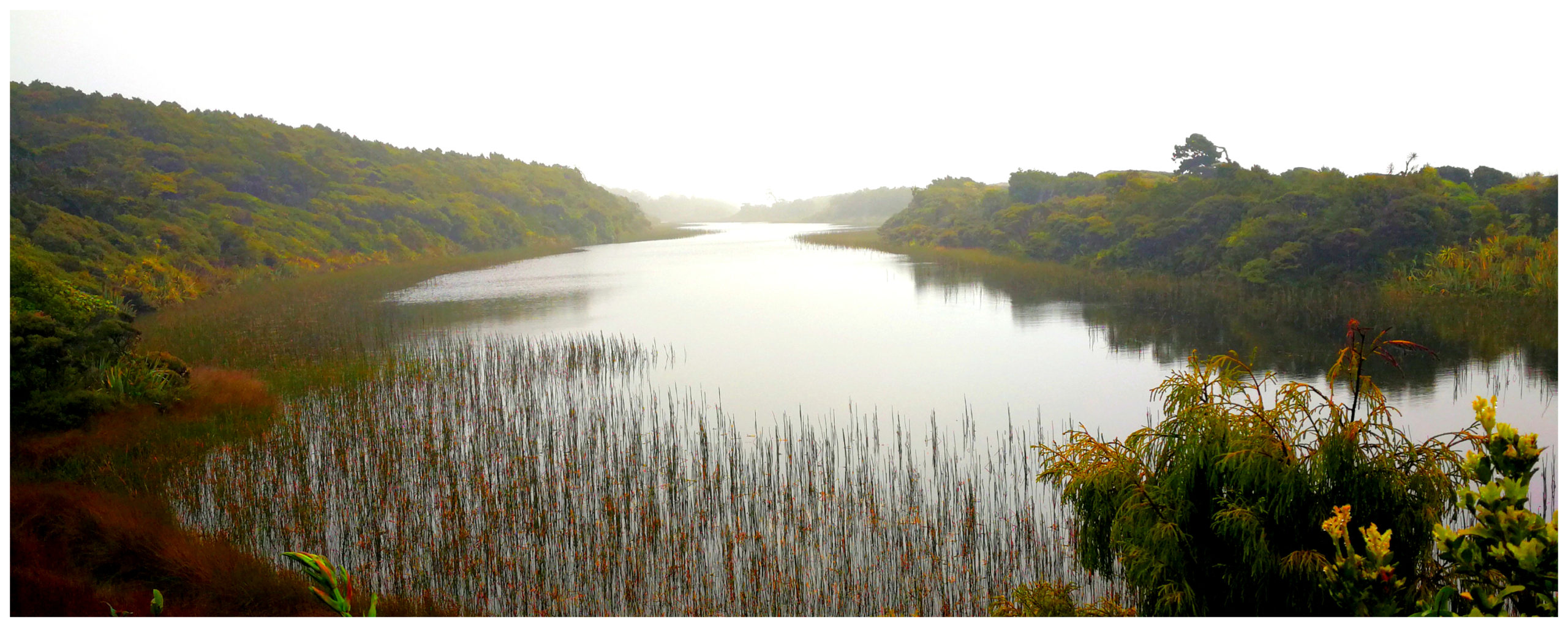
The Dune Lake
Ship Creek Lookout
A wooden tower has been erected close to the car park where you can climb up for a view of the wild and stunningly beautiful ocean beach. You can clearly hear the swirling sea grating beach stones and driftwood.
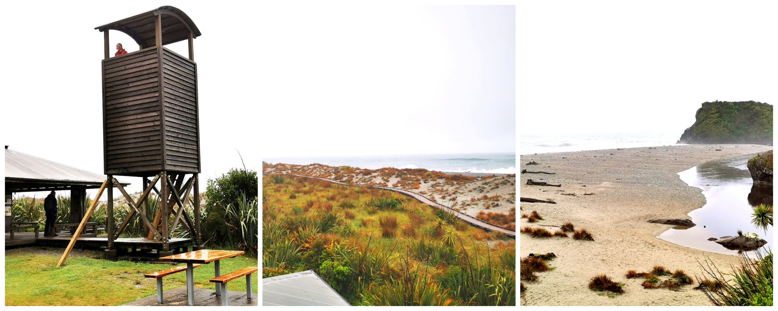
You are rewarded with panoramic coastal views after your climb to the top of the tower
Hapuka Lagoon Walk
The Hapuka Estuary Walk is located approximately 17 km south/west of Haast along the Jacksons Bay Road.
The loop track takes around 20 minutes to walk (depending on how many photo-stops you have to make!). You can also spend a lot of time spotting fish and whitebait in the tidal estuary, and the native birds in the trees.
Plantlife and wildlife thrive in the estuary
The Hapuka Estuary is a Wildlife Sanctuary which is looked after by the Department of Conservation.
Plenty of information boards along the trail
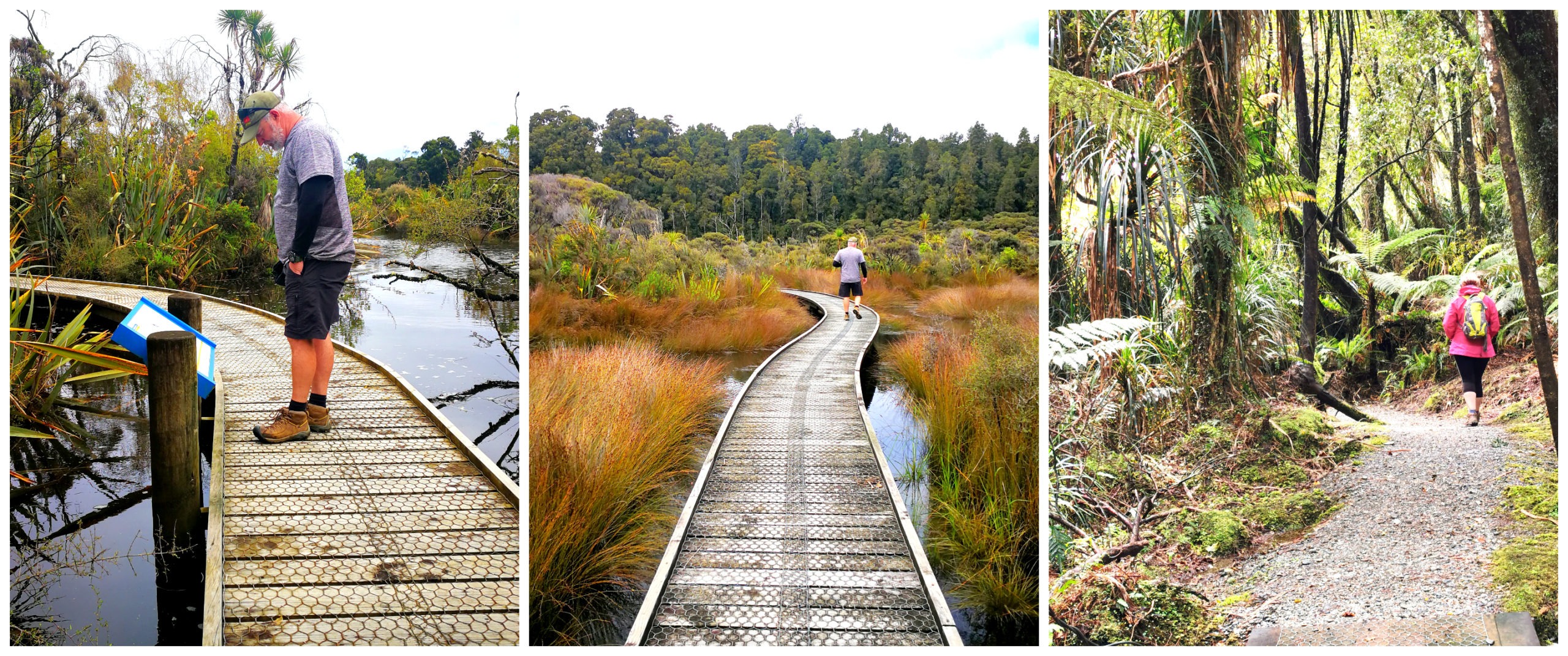
It is has been very well set up and the walk meanders out along boardwalks through the creeks and estuary waters. There are panels explaining the ecology of the bustling life and story of some of its inhabitants.
There is a great viewing platform which looks out on the estuary and reed grasses which sway delicately in the wind. If there is no wind, then it’s the perfect spot for some great reflections of those reeds and surrounding bush.
The short detour to the lookout is well worth it
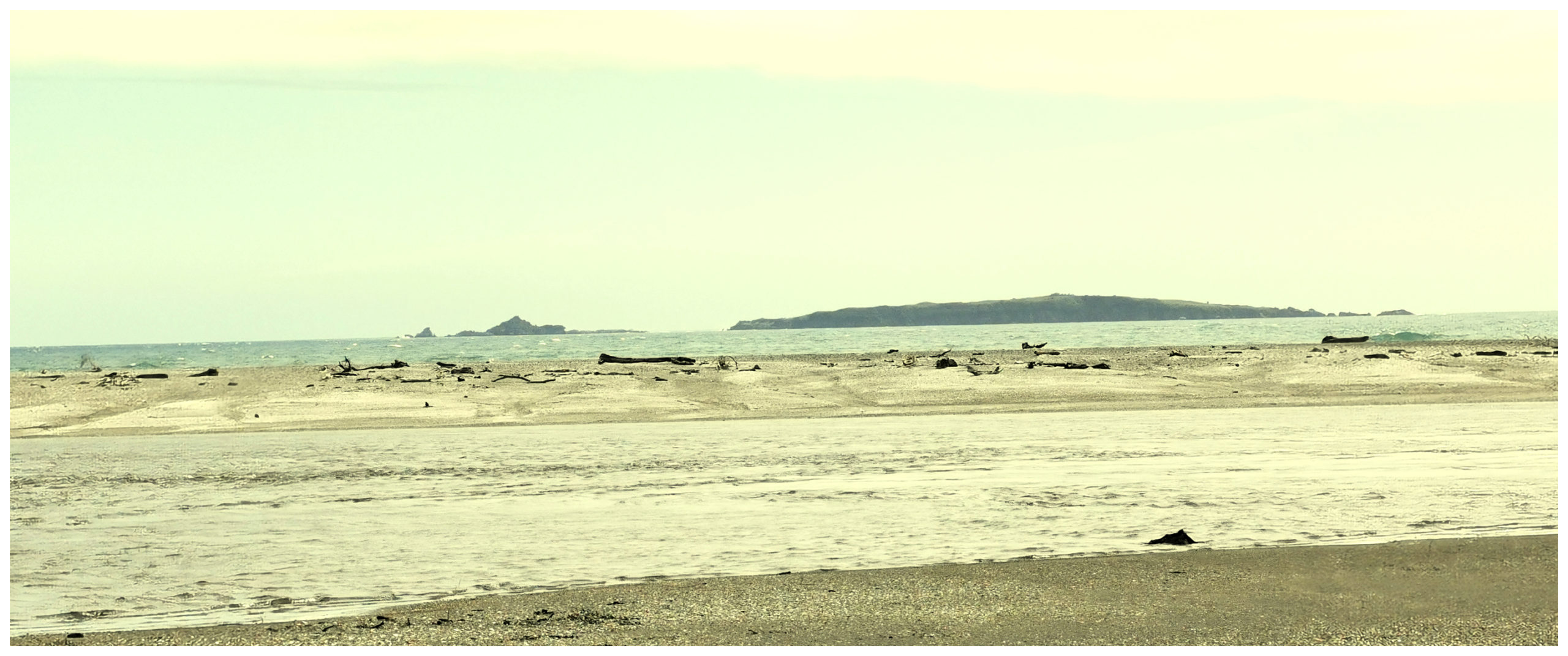
The boardwalk continues to meander through the wetlands before looping back around through native forests back to the carpark. Don’t forget to walk the short detour which offers views out to the Tasman Sea and Open Bay Islands.
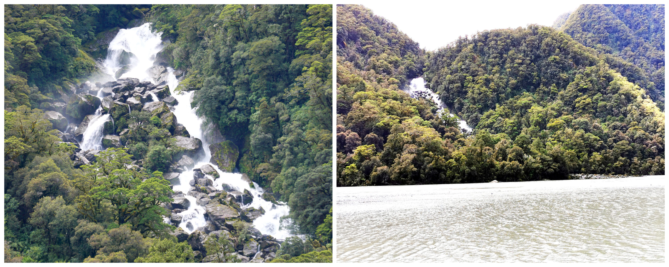
Roaring Billy Falls
A 27 km drive along SH 6 (towards Wanaka) from Haast, you will come across the large carpark beside the walk which will take you to the Roaring Billy Falls.
The falls is located in the Mt Aspiring National Park. It is an easy 40-minute return walk which follows the banks of the Haast River. You can’t get very close to the Roaring Billy Falls due to the wide river which flows in front of it. It is still an impressive sight from a distance as it crashes down a densely forested hill. It also has many different little cascading falls which are even more impressive after a decent rainfall.
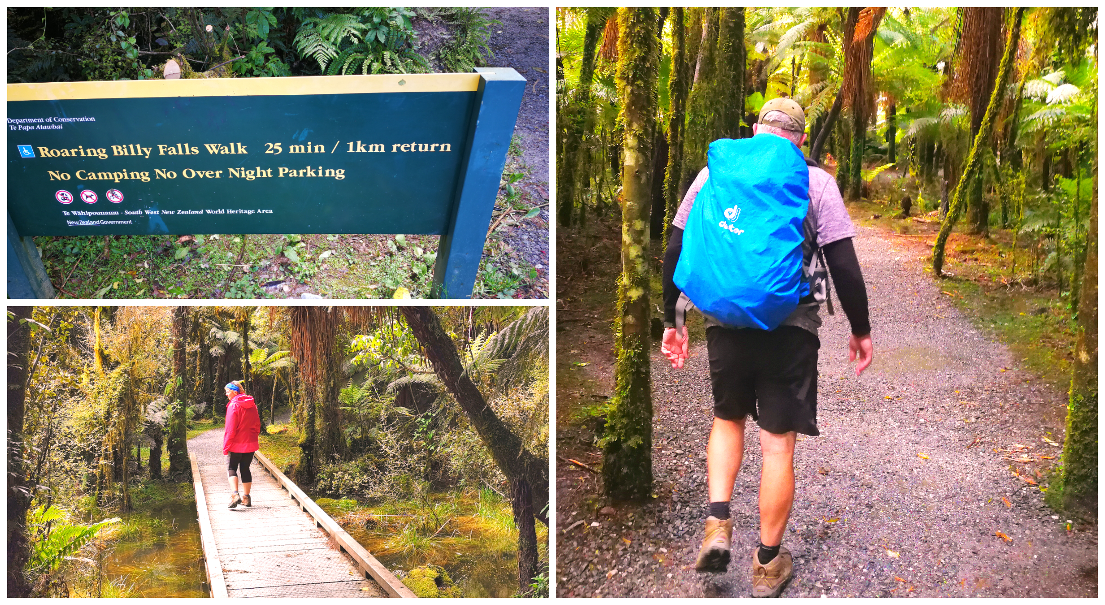
Beautiful trail through the mossy beech trees takes you to the view of Roaring Billy Falls
The walk along the track passes some great examples of miro, matai and silver beech trees.
This is as close to falls you can get
Now, this is a very popular stop for passing tourist traffic. There is a picnic table situated right in the middle of the turn around area. To be honest, we found sitting on this table more entertaining than the falls. The ‘interesting’ maneuvering tactics of the tourists as they attempt to park in an already congested area was cause for a few sharp intakes of breath as we waiting for the crunch or scraping of metal.
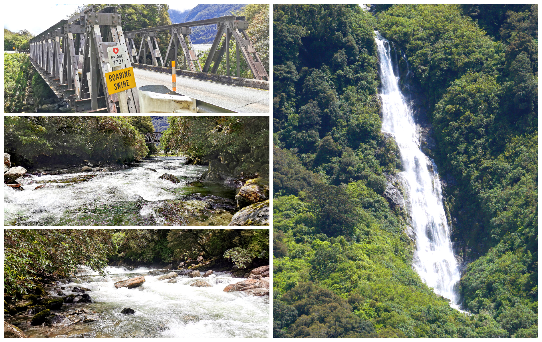
The drive back provided us with some spectacular photo opportunities
The Journey Rather the Destination
The drive to and from the Roaring Billy Falls from Haast, is in itself, just as spectacular as the falls. There had been some substantial rain overnight so the waterfalls cascading metres down the hillsides were amazing. There were a few roadside stops (in a safe pullover area) to get some perfect photos.
Jackson Bay
Jackson Bay is a 48 km drive from the turnoff at Haast. It is one of the most remote settlements (of about 15 houses) in the South Island and a place that has been high on my list to visit. I guess I really wanted to get to ‘road’s end’. To drive as far into the Fiordland wilderness on the northern side as far as we could get.
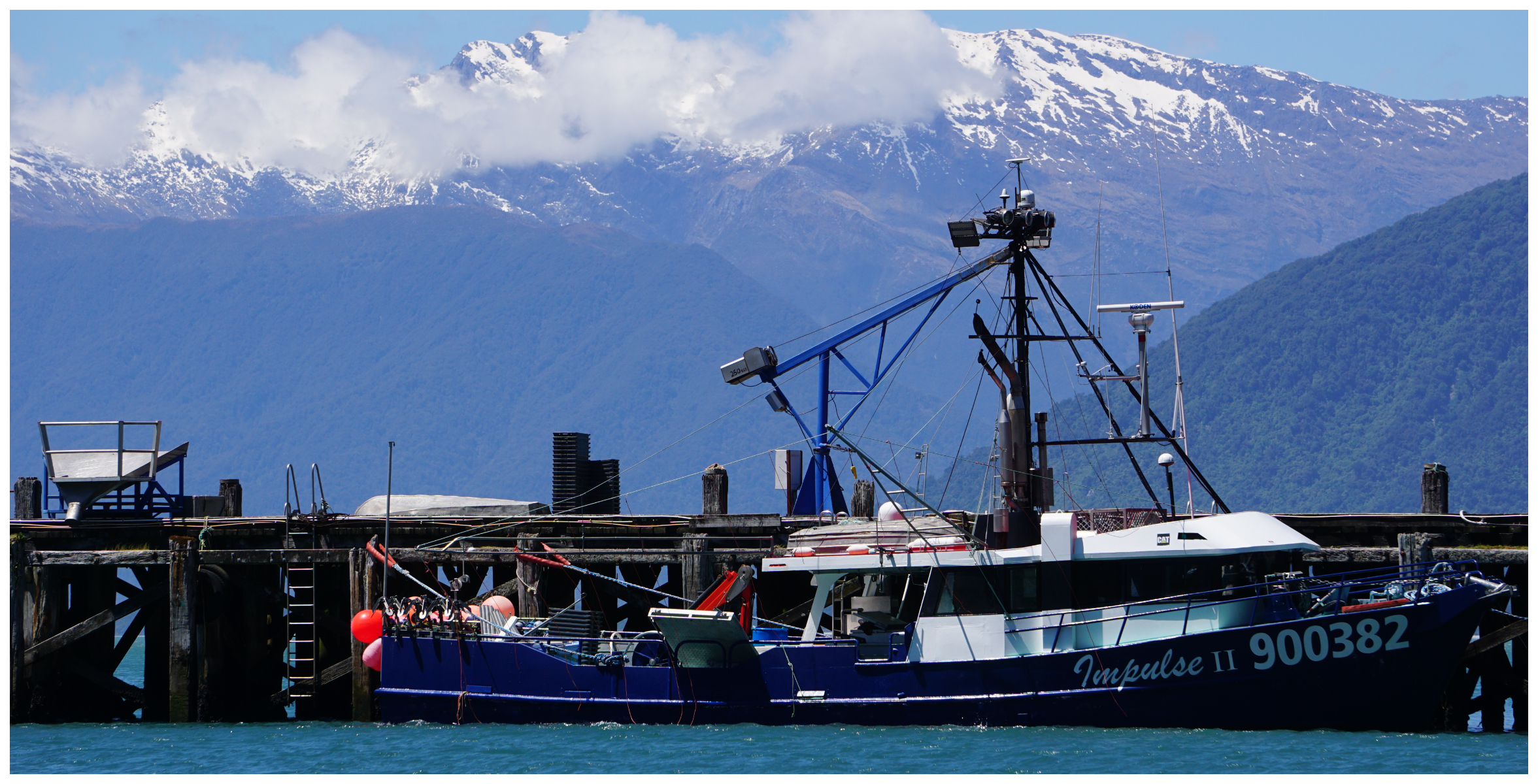
The Jackson Bay Wharf is mainly used as a fish landing facility for commercial fishermen
Road conditions are good, tarseal the entire way but do watch out for some interesting humps. We weren’t towing ‘the beast’ so it wasn’t as noticeable in the Ranger once the momentum started. The ups and downs could have the potential to dislodge belongings in the back of a campervan or caravan. Heaven forbid, the wine could be compromised!
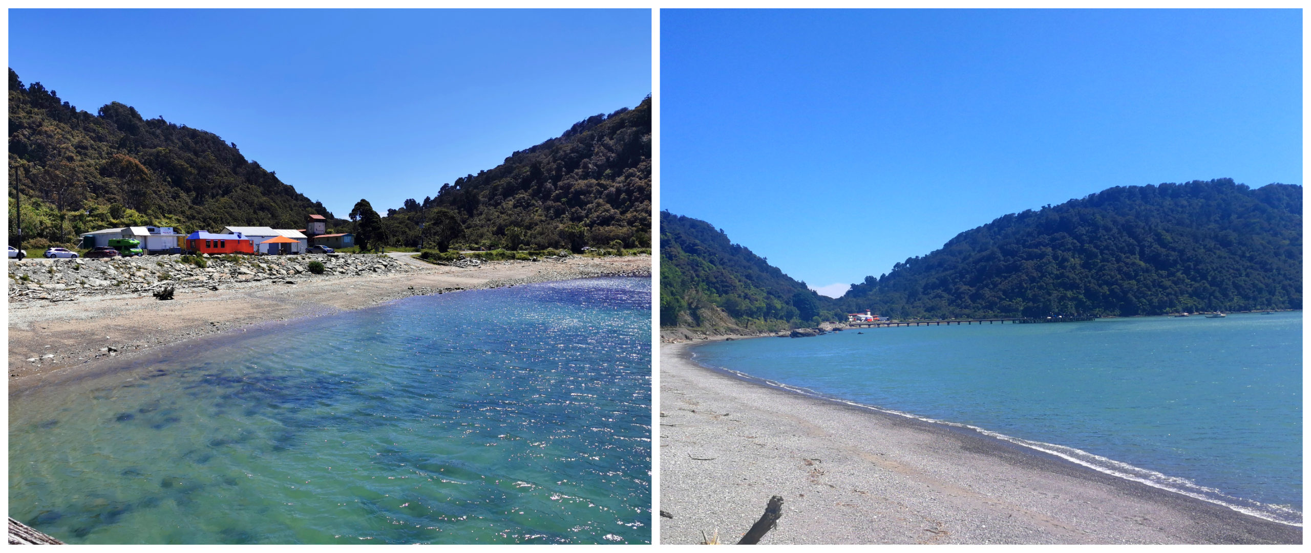
Jackson Bay is a natural harbour, 24 kilometres wide offering shelter from the prevailing winds
Arawhata Pioneer Cemetary
Located between Neils Beach and Jackson Bay we came across a sign for the historic Pioneer Cemetery at Arawhata. We needed no further encouragement to stop and explore the old headstones.
This is the burial site for some of the first European settlers to come to Jackson Bay. There was a rather unsuccessful settlement programme back in 1875. The headstones depicted the stories of the failed Arawhata settlement and it was clearly one of hardship, premature death and many crushed dreams.
Mother nature has reclaimed most of the graves, with only about 13 sites still recognisable. Thankfully, due to some hard work by the local community, nature hasn’t taken it over completely.
Wharepapa-Te Kou Walk
Located in the heart of Jackson Bay, there are a number of walks you can take. We opted for the short (40-minute return), interesting walk from Jackson Bay to the rocky shore at Ocean Beach.
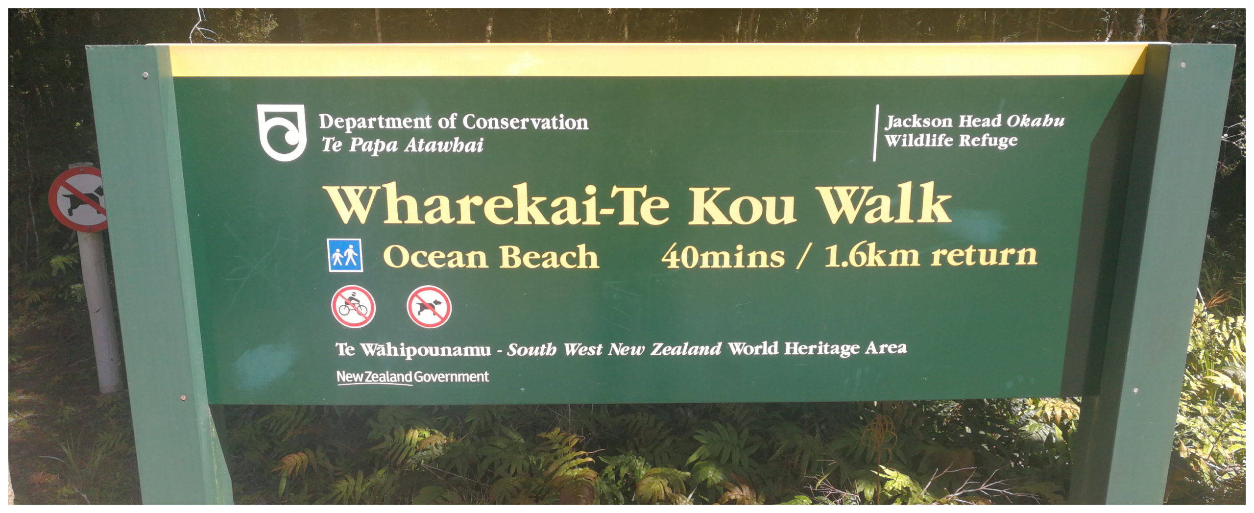
The start of the Wharekai-Te Kou is a short drive from the Jackson Bay settlement
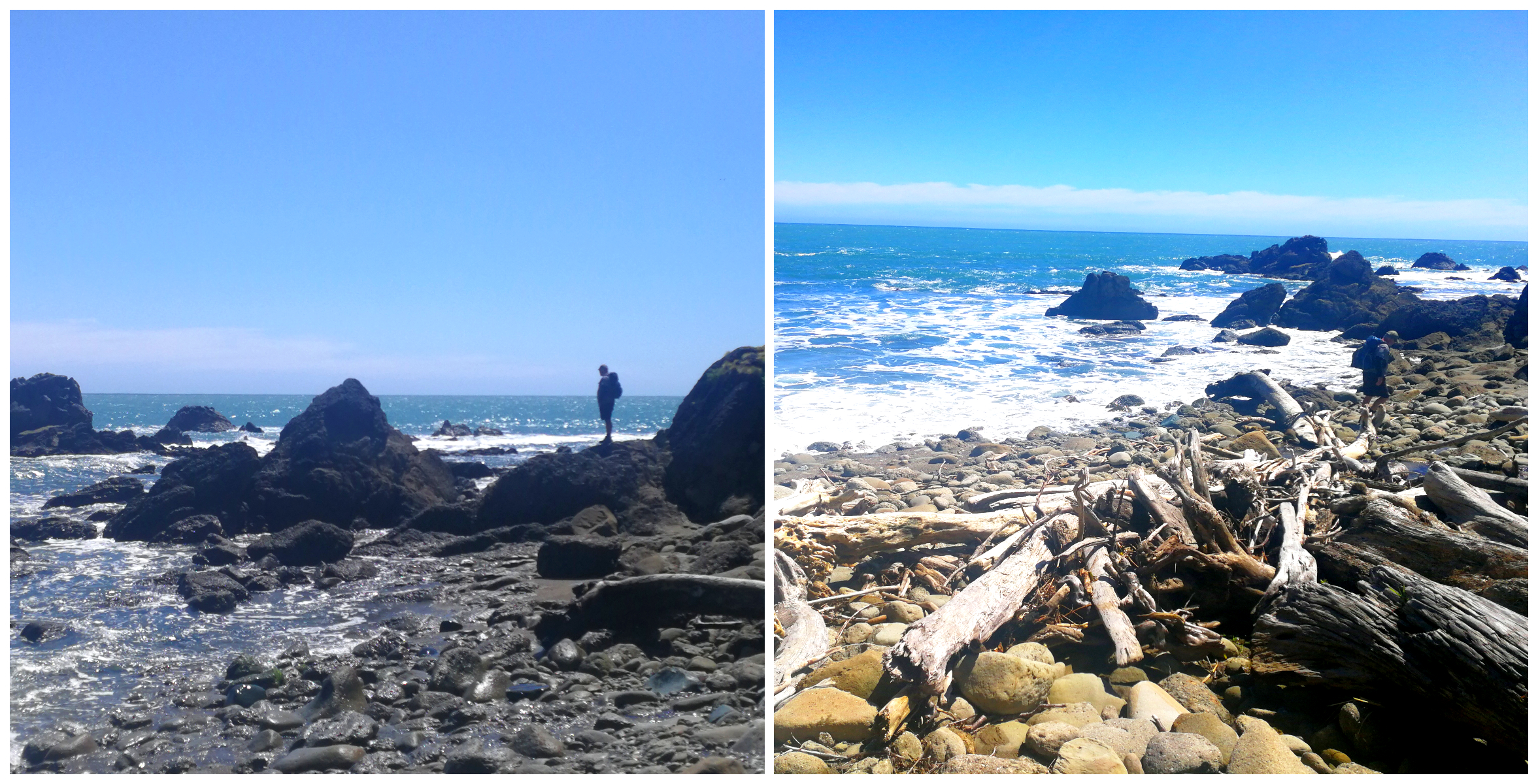
The track opens out onto the driftwood strewn rocky beach. Information panels along the trail tell stories about tidal pools and the life of the rocky shoreline.
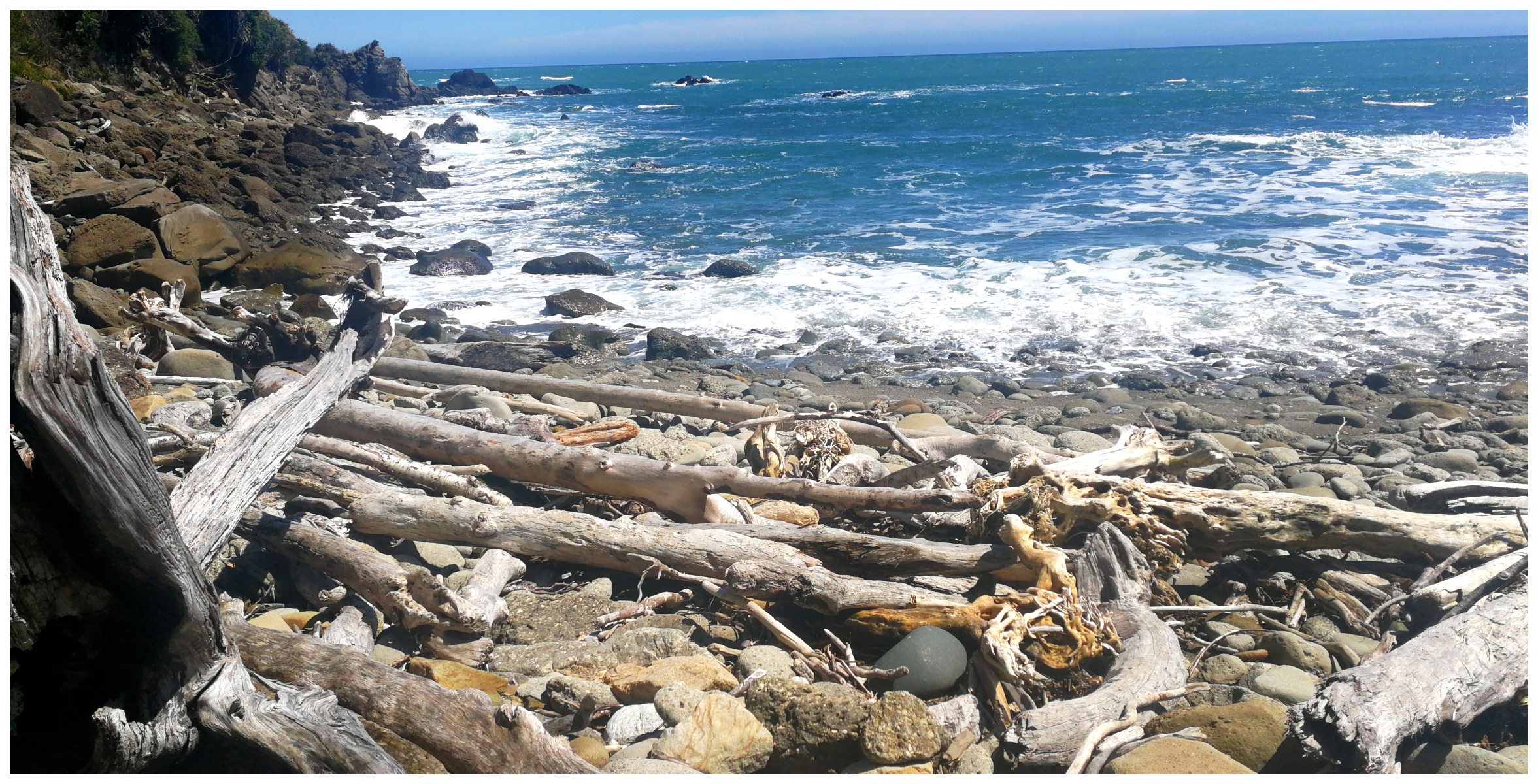
The rugged Ocean Beach and the end of the trail
The Lonely Grave
Jackson Bay has the earliest known European burial spot on the West Coast. The Information Shelter just prior to the settlement gives a poignant reminder of the harsh conditions faced by those earliest settlers.
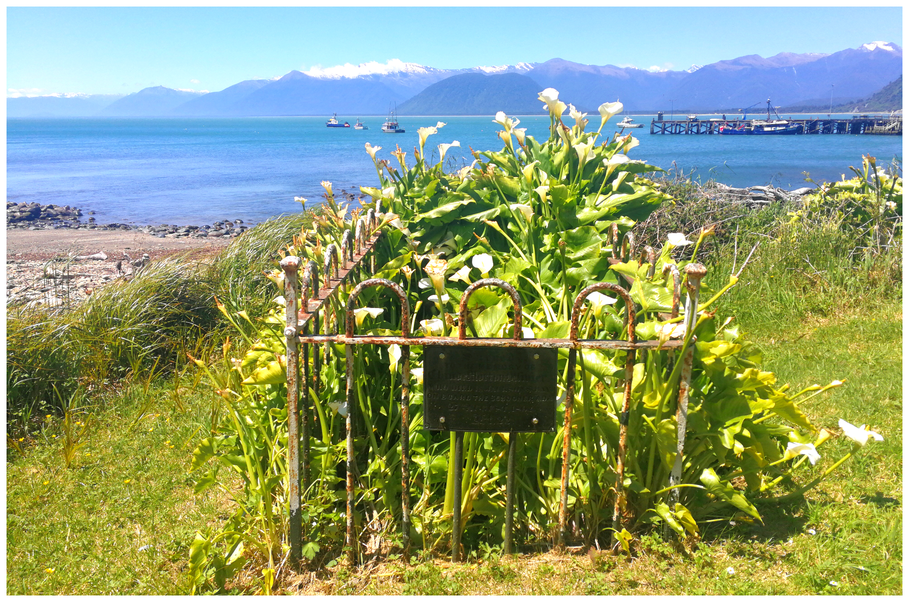
The iron-framed grave of Claude Morton Ollivier on the foreshore bears testimony to the misery they must have encountered. Interestingly, Jackson Bay was one of the most prosperous Maori settlements on the coast.
Claude Ollivier (22 years old), who arrived with his brother Charles on the schooner ‘Ada’ in 1862, caught pneumonia and died. The grave where Charles buried him is located close to the foreshore at Jackson Bay.
The arum lilies that surround the grave were planted by Martins Bay resident Alice McKenzie in around the 1900s.
Craypot Restaurant
We had heard great things about the blue cod from the Craypot Restaurant situated at Jackson Bay. My tastebuds were jumping at the thought of tucking into the tasty morsel and surely you can’t get any fresher fish than from Jackson Bay.
This brightly painted caravan style cafe/restaurant overlooking Jackson Bay is easy to spot. It has lovely views of the ocean and the bay’s deep water wharf.
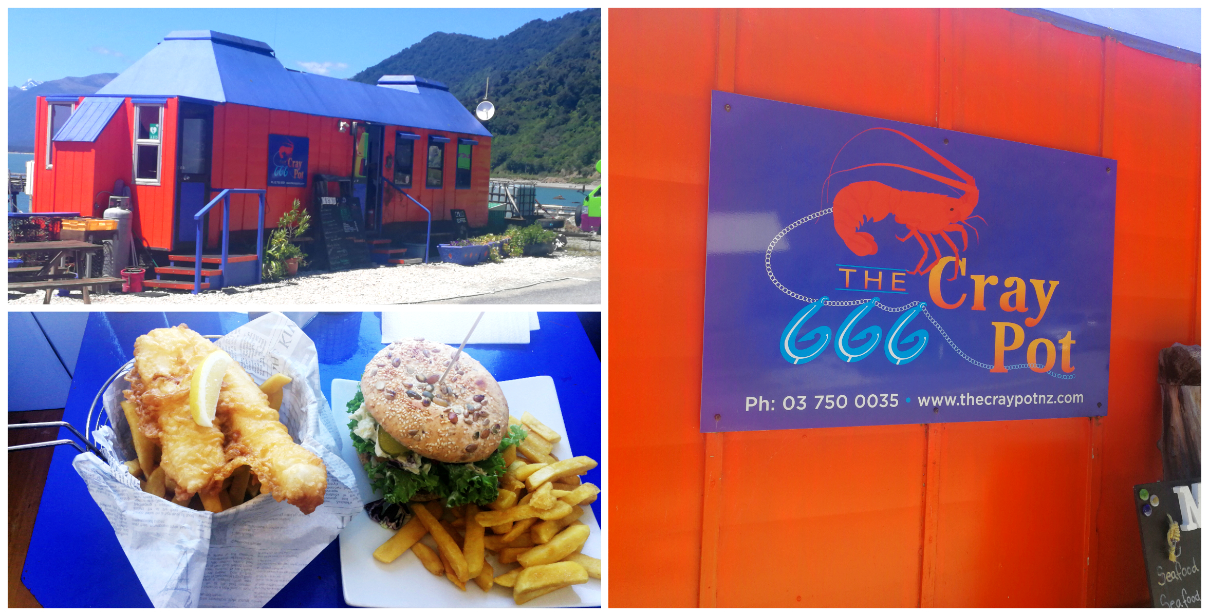
Once a pie cart, the Craypot serves up great Kiwiana kaimoana (seafood)
It was originally built in Timaru as a pie cart before being moved to Cromwell during the construction of the Clyde Dam. Then 17 years ago it was towed all the way over the Haast Pass behind a little tractor to be set up at its current location.
Blue Cod!!!
We got a small table inside the narrow dining area and placed our orders. Scotty went with the blue cod burger and mine was the standard blue cod and chips. I mentioned earlier about how fresh the seafood must be here. Well, oddly enough, the bounty of the sea does come right past the Craypot into cool stores across the road. It is then trucked to Timaru, only to have to make the trip back once a bulk order is placed. Their blue cod is flown into the country from the Chatham Islands. Gone are the days where retailers can purchase straight from the boats. Something is wrong somewhere.
Although the fish had done some miles before landing on our plates, it was still a delicious meal and it went down very well indeed.
Their opening hours can be a bit spasmodic so make sure you check before you go. There is usually a sign along the main road, just out of Haast to indicate if the Craypot is open.
Lake Ellery
Heading back towards Haast, we took a detour to walk to Lake Ellery. Approximately 14 km from Jackson Bay, turn off the main road on to the Jackson River Road. The start of the track is 3 km along this sealed road.
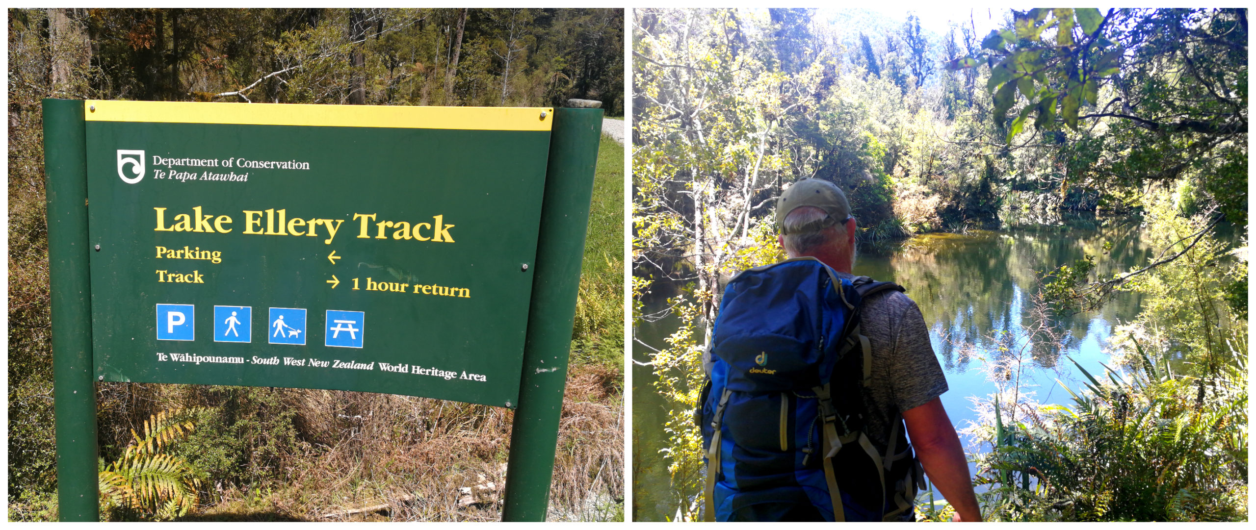
The start of the track is easy to find
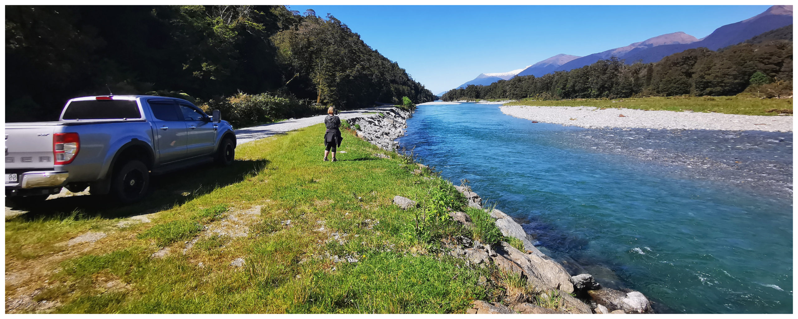
It is around a 1-hour return walk, which follows alongside the Ellery Stream. The walk into the lake was one of the prettiest walks we have taken for some time. The crystal clear stream had the rays of the sunshine dancing off it in all directions. The submerged logs peeping out occasionally added to the drama of the swiftly flowing water.
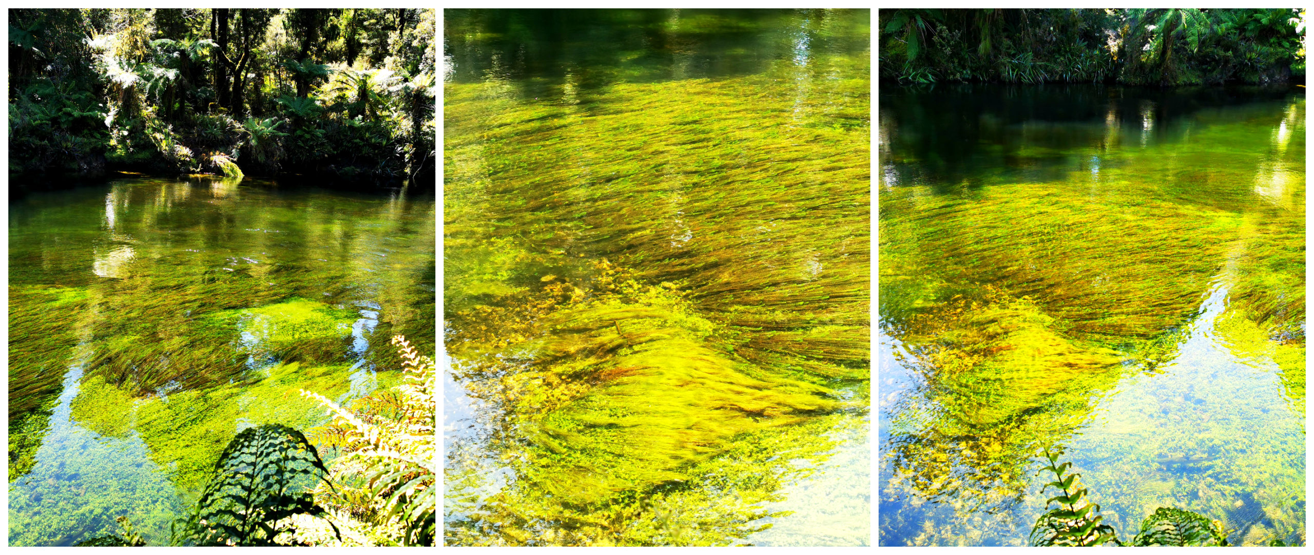
The crystal clear waters of the Ellery Stream
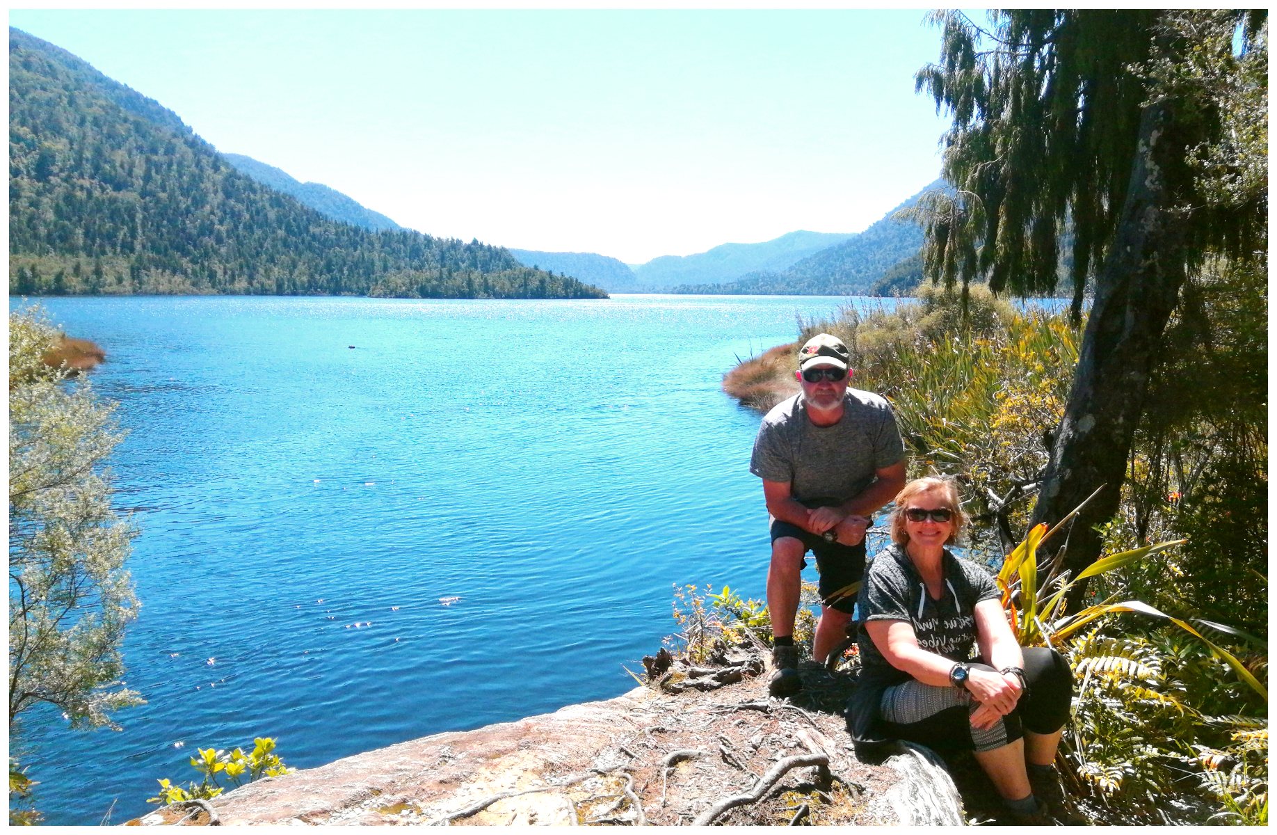
We wandered through the beech forests until we arrived at the glacier-formed Lake Ellery. The lake seemed to stretch out before us like a rising curtain at an opera performance. Surrounded by towering mountains and dense native bush certainly enhanced our feelings of remoteness and we felt that we were experiencing an unblemished nature at her best.
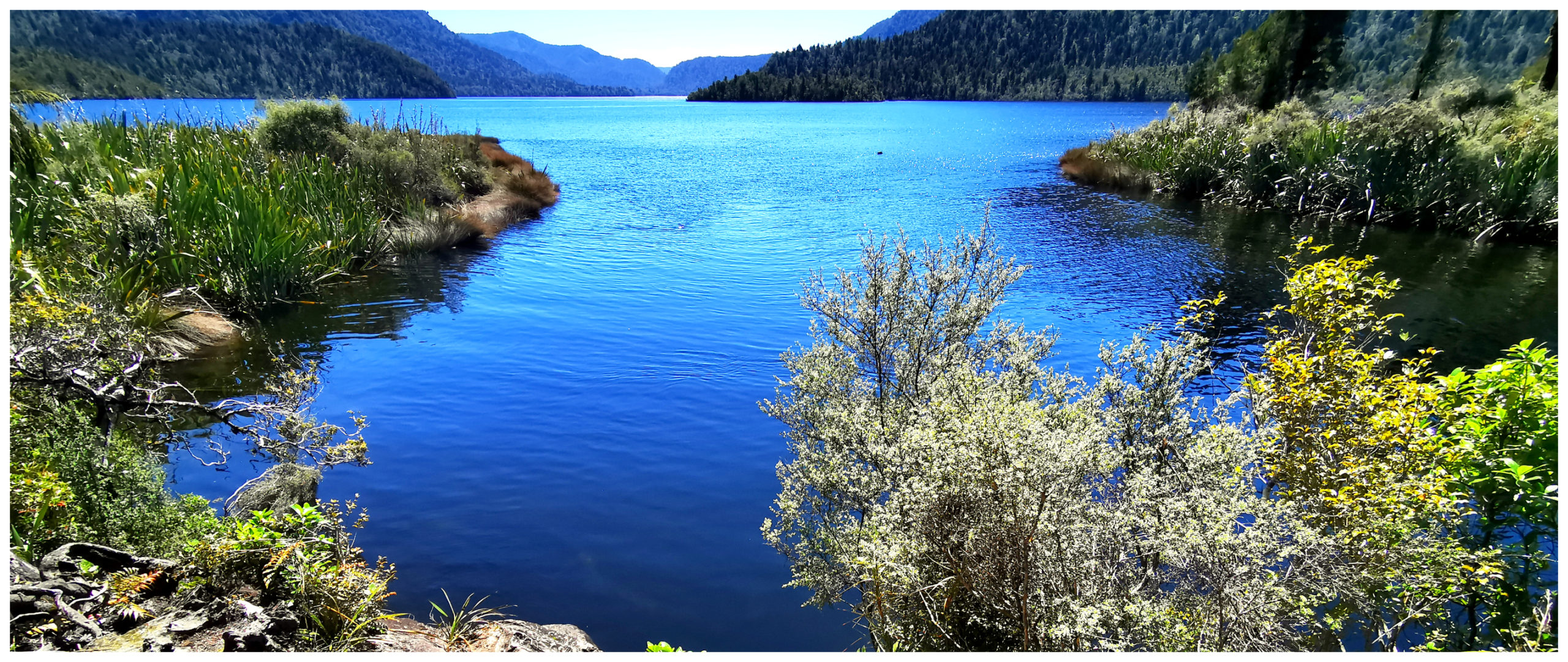
Beautiful Lake Ellery fanned out in front of us
Red Hills
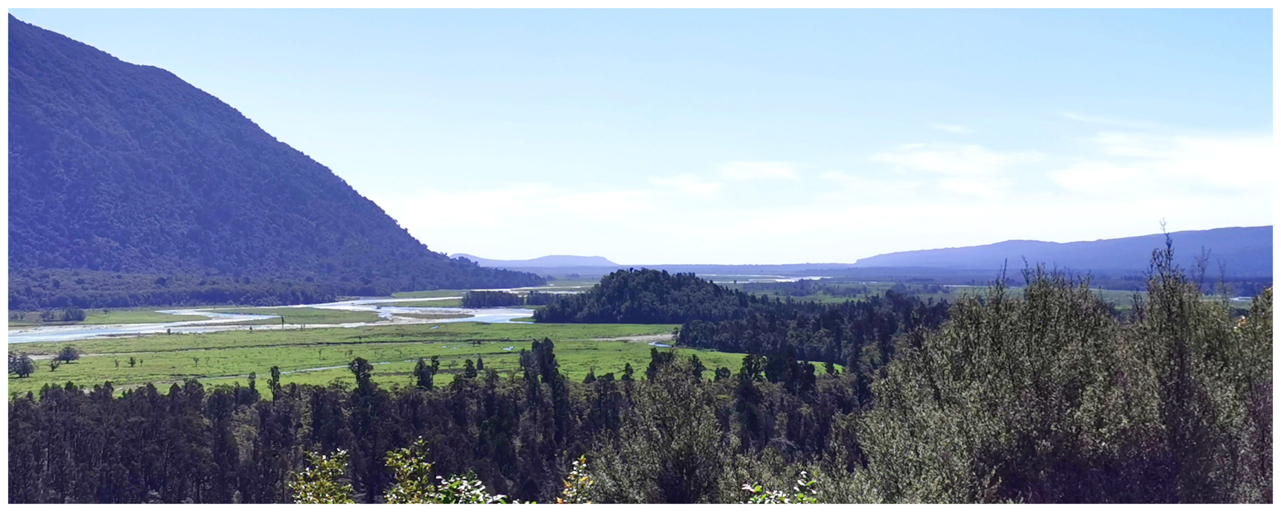
Returning back to the car from the Lake Ellery Walk, we decided to continue our journey along Jackson River Road. We had heard that the scenery is spectacular. According to the map, the road continued further south than Jackson Bay. We could truly say that we had driven as far south on the West Coast as you can.
As we lost sight of the Jackson River on our left, Cascade River soon emerged. There was evidence of some massive slips as the road got more narrow.
Jaw-dropping views meant there were plenty of stops along the way
We traversed Martyr Saddle and it was fascinating to watch the landscape morph from green lush foliage into something that resembled the surface of Mars. This barren area is Red Hills.
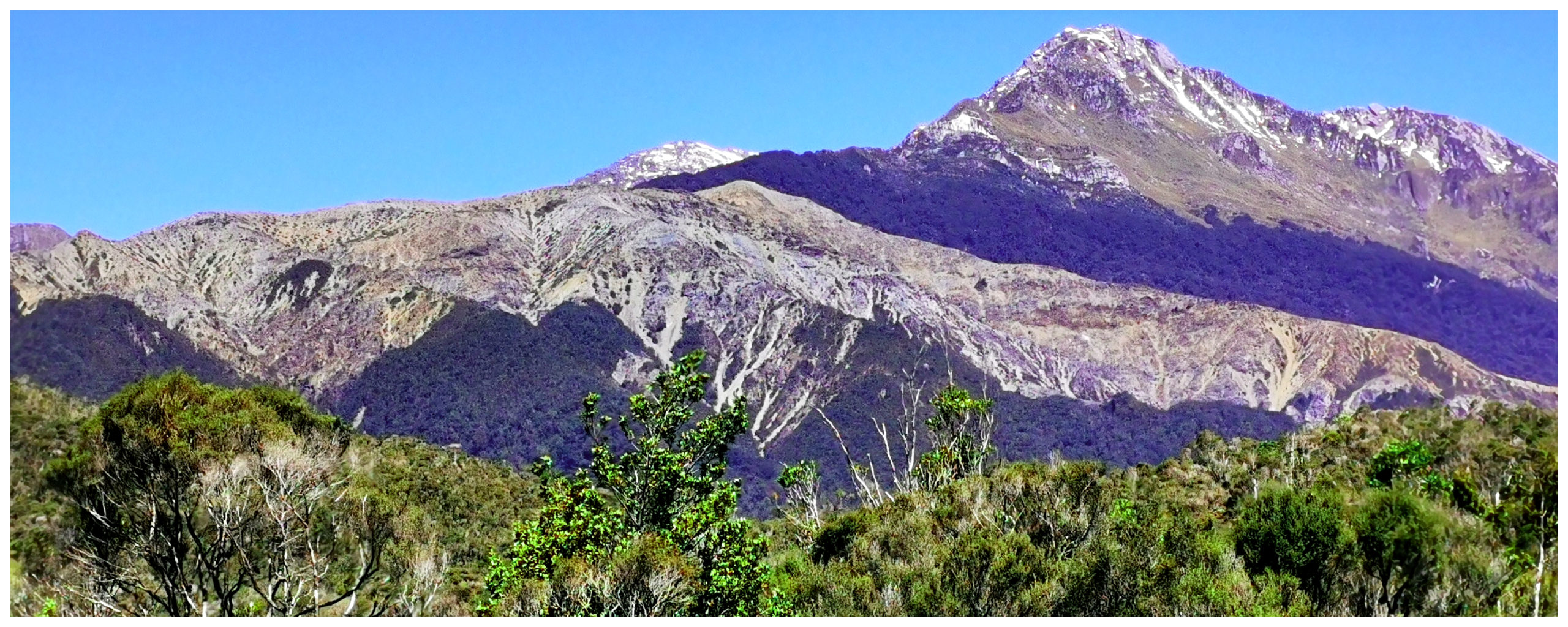
The barren landscape known as Red Hills
High levels of oxidised iron and magnesium cause the striking red appearance.
Cascade Valley Lookout
A lookout which overlooks the mighty Cascade River provides excellent views of the Cascade Valley. There is a history board which tells stories about the past glaciers and highly mineralised rocks, where nothing can grow.
The views from the lookout over Cascades Valley
There were attempts to mine asbestos in the Red Hills area but the quality was too low and the location was too remote for mining to be feasible (thankfully!).
Determined to reach ‘road’s end’ we continued on our journey and yes, we found it. A steel gate stopped us from proceeding any further.
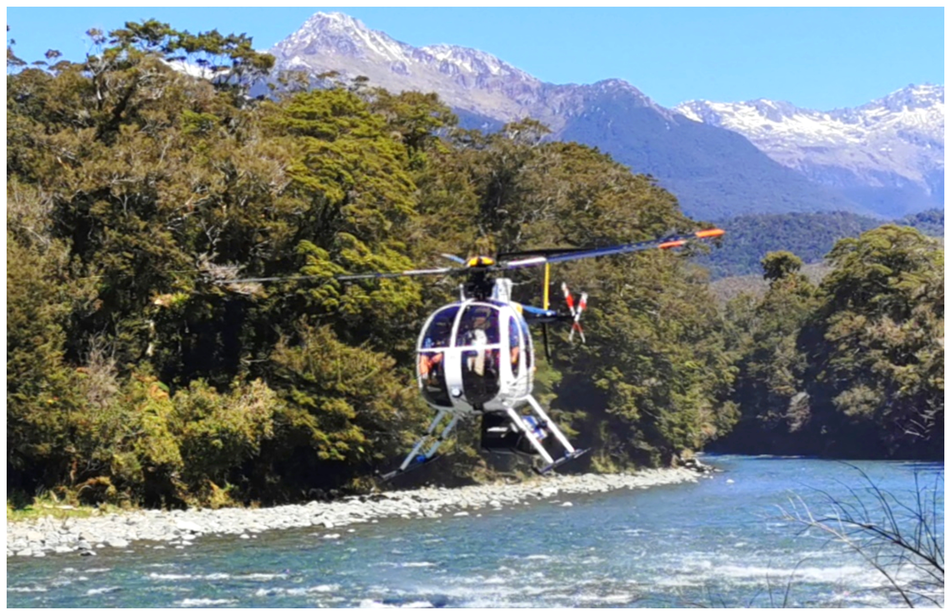
The chopper leaving with its hunters aboard
On arrival, we heard the thud of helicopter blades. Hunters were catching a ride to their destination. No doubt somewhere high up on the surrounding ranges.
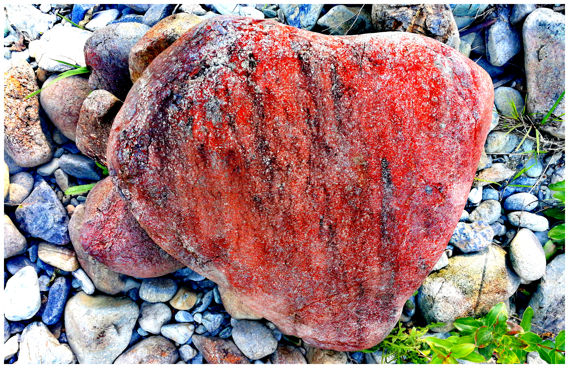
An oxidized rock laden with iron and magnesium
We enjoyed our sojourn through the striking mountains of highly oxidised iron rocks. The colours leapt out at us as glimpses of the sun hit different patches on the bare mountainsides, where mother nature struggles to make anything grow.
Summary
Haast has made the best basecamp for our exploration of the surrounding areas. Our stay here did Haast and local area justice and not just a fleeting stay.
Click on the link below for a video of some of the highlights of our stay in Haast.