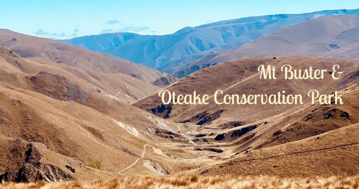
Keeping with the theme of backcountry roads, we decided to take on the Mt Buster Track within the Hawkdun Range. We had successfully traversed the Danseys Pass and Old Dunstan Road – See Part One and Part Two, so we were keen to tick this one off the list as well.
We were still at our basecamp in Ranfurly, so we headed back to Naseby, towards Danseys Pass and turned north on to Mt Buster Road.
Mt Buster Road
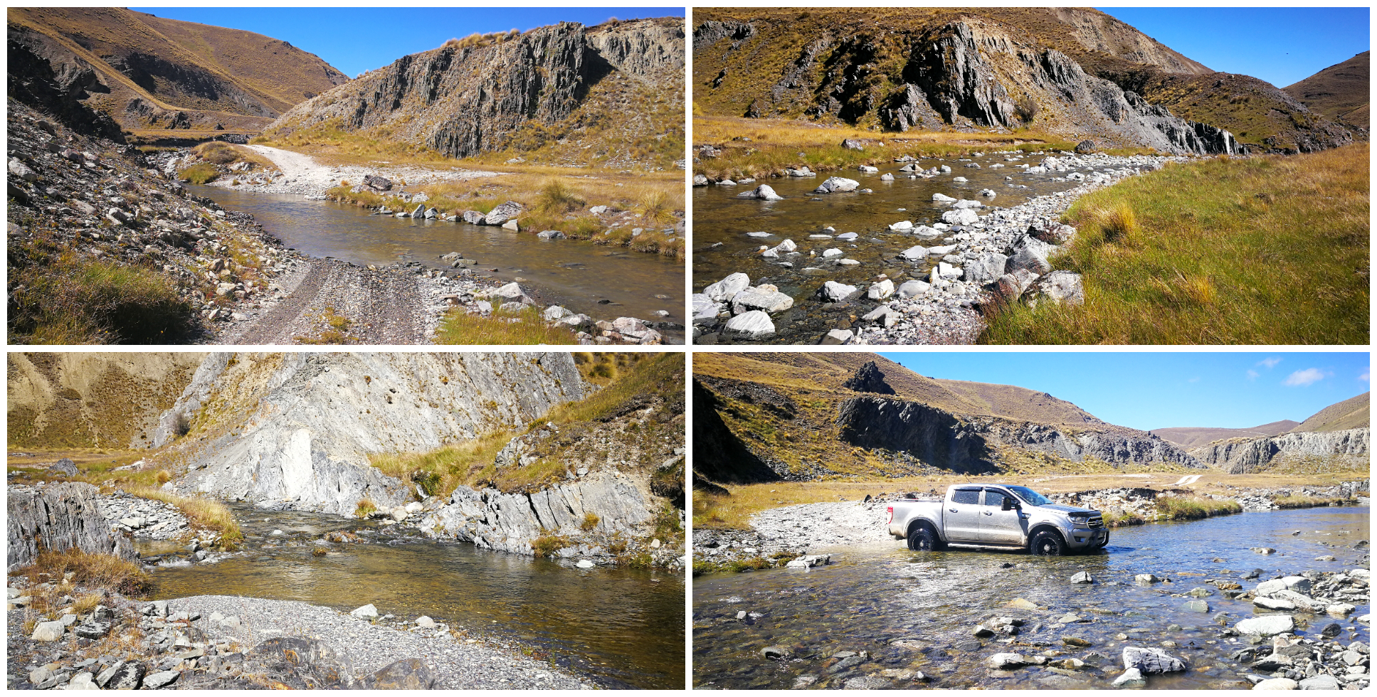
The drive along Mt Buster Road is a scenic experience in itself. We could still see evidence of sluicing along the cliff-like banks of Little Kye Burn. The hunt for gold was prolific right along from Kye Burn to Little Kye Burn and beyond.
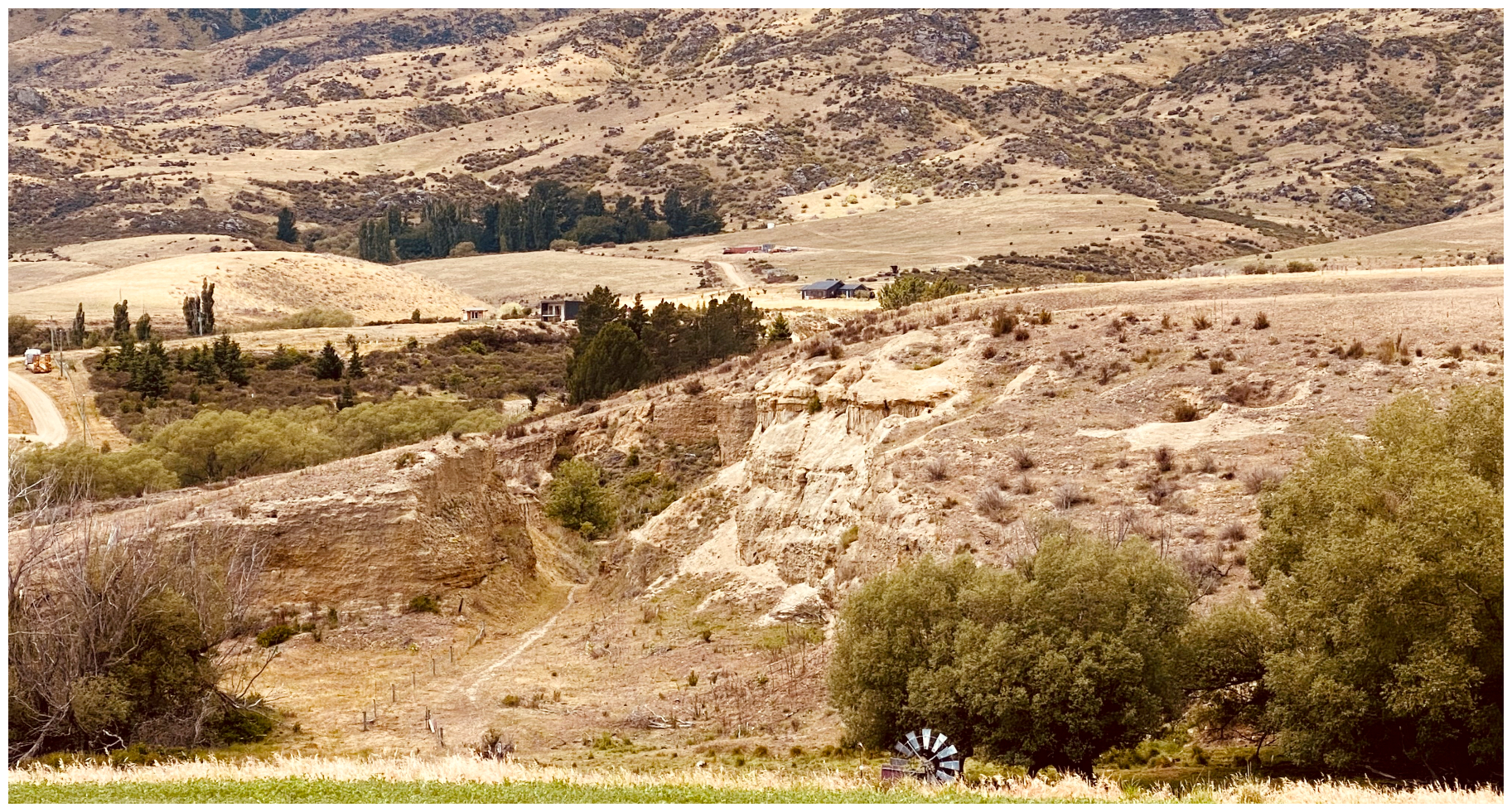
can you spot the scars left behind after extensive sluicing?
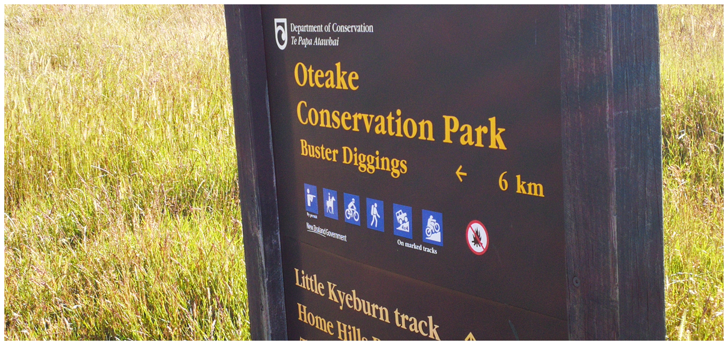
Crossing the ford over the Little Kye Burn, we continued a further 5km until we reached a closed gate which marks the entrance to the Oteake Conservation Park, at an elevation of 460m.
Little Kye Burn was alive with activity during the gold rush days
Oteake Conservation Park
Just inside the gate (make sure you shut the gate behind you) is an information board which includes a map on the tracks and trails. Make sure you make a note of which track you are wanting to follow as it’s a whole lot of country inside the Oteake Conservation Park! Most of the tracks aren’t marked or signposted so a topographical map would come in handy.
rmember to shut the gate when you enter the park
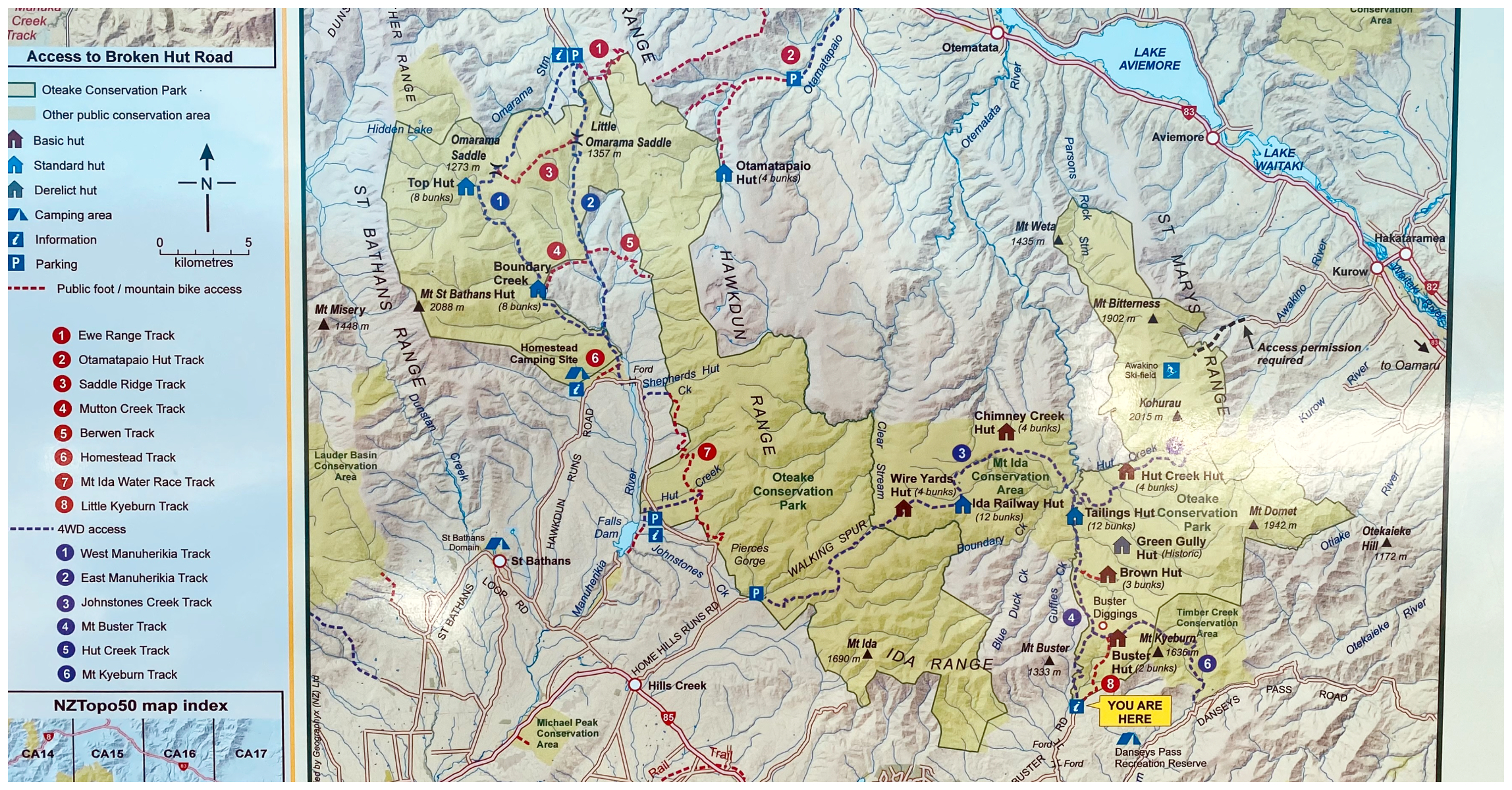
make sure you study the map
Oteake Conservation Park covers large tracts of the St Bathans, Ewe, Hawkdun, Ida and St Marys ranges, and parts of the upper Manuherikia Basin and Mt Buster. It is a whopping 67,000ha.
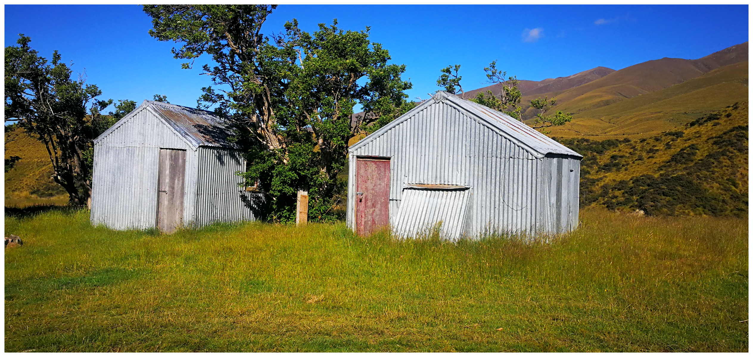
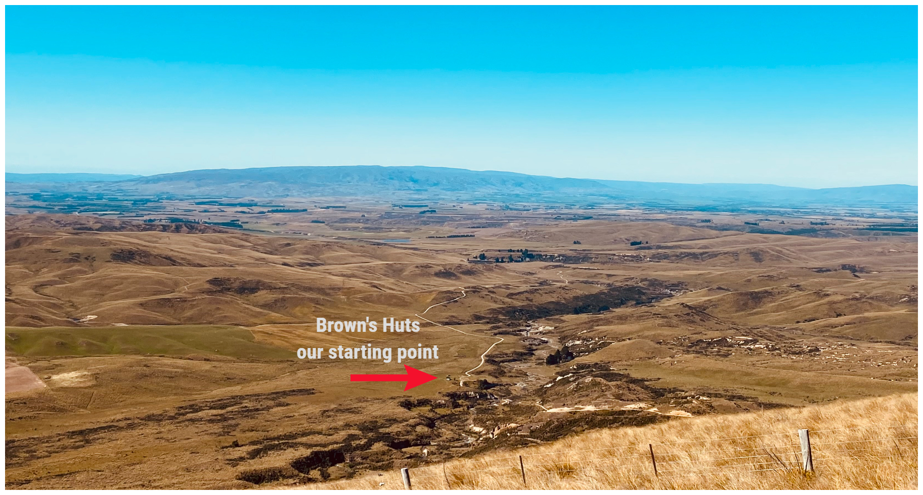
the two unassuming Brown’s Huts with loads of history, both shaded by the elderberry tree
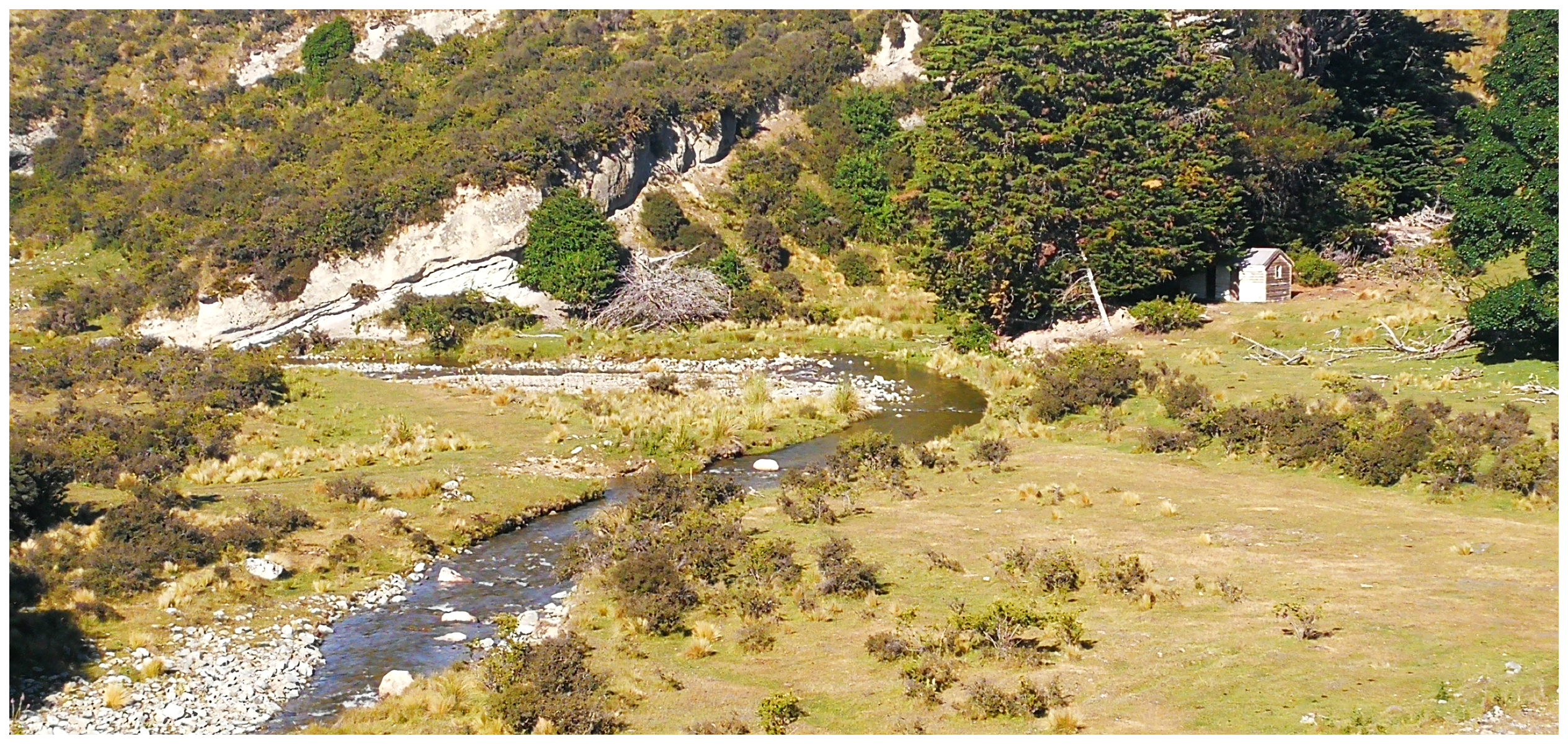
Just past the Information Boards are two tiny corrugated iron huts which are huddled together on the flat, in the shelter of a sturdy 150-year-old elderberry tree. This used to be known as Buster, or Brown’s Flat. It originally was the home of John McGinnel Brown.
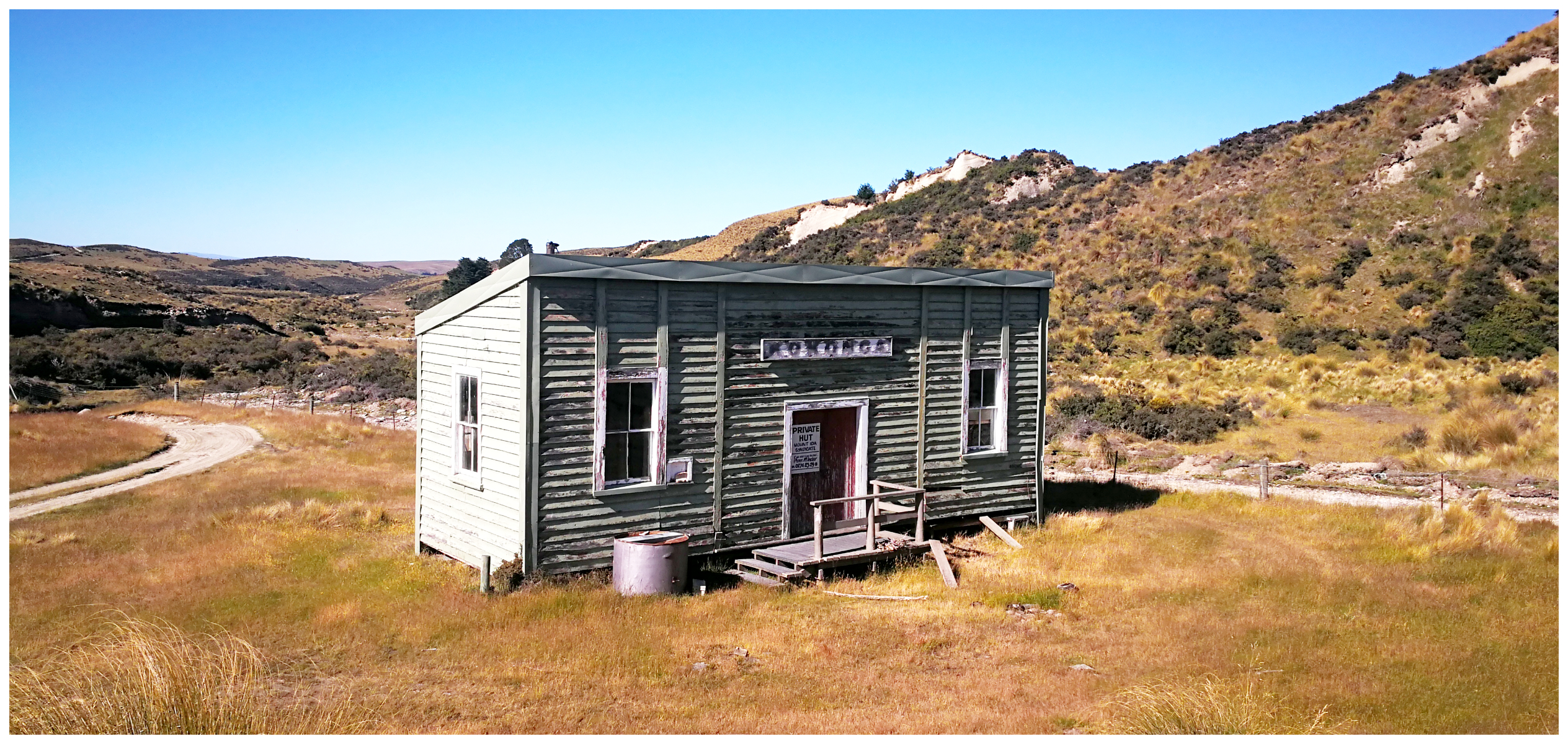
the old railway station dragged all the way from Kokonga
Just around the corner from Brown’s huts and over another ford is the old Kokonga Railway Station. It opened in 1897 but became surplus to requirements, it was dragged to its current spot in October 1986 to begin its life as the ‘new’ musterers’ hut to replace Brown’s Huts.
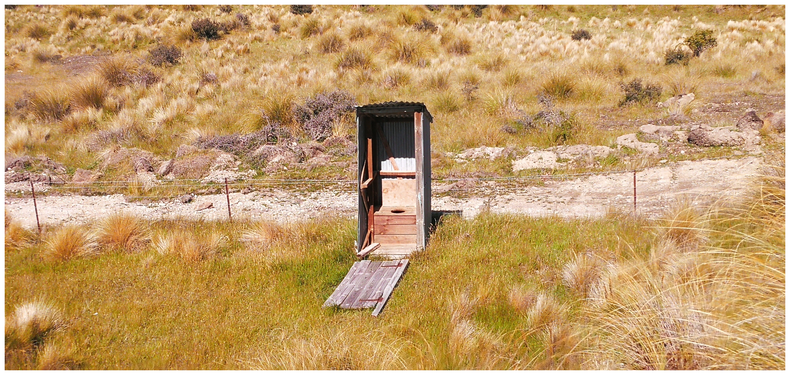
you know there’s strong winds when it blows the door off the dunny!!
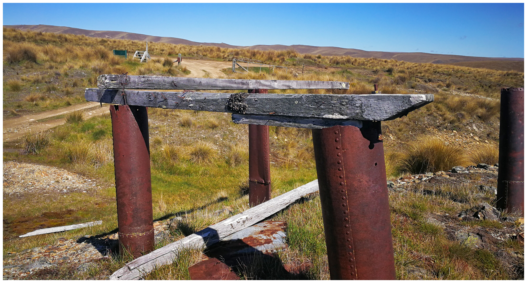
Start of the Climb
This marks the start of the climb up the flanks of Mt Buster to the site of Clarke’s (also known as Buster) Diggings – named after Samuel Clarke who discovered this high, remote field in 1863.
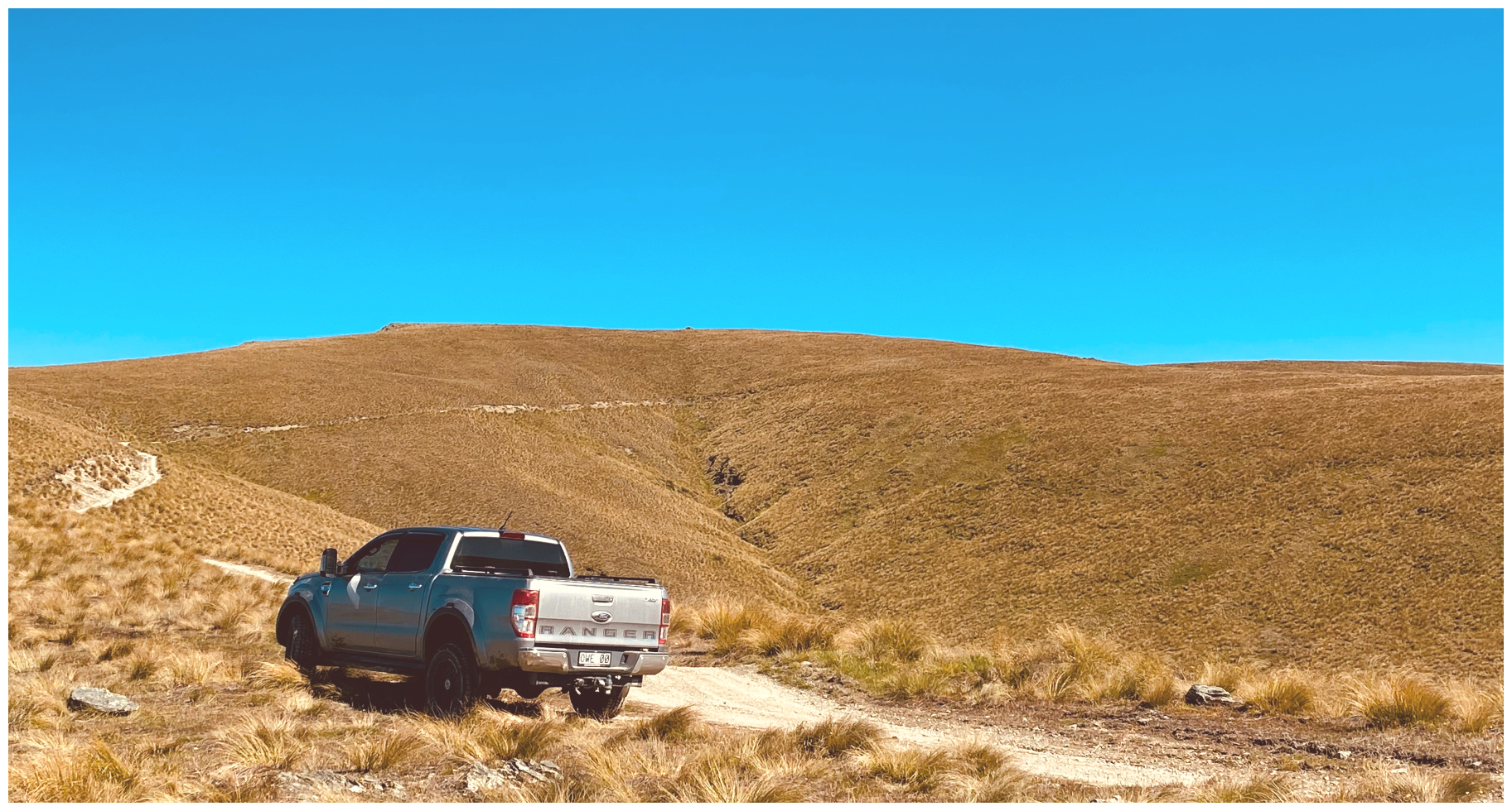
the track’s constant climb up Mt Buster
And what a climb it is! The steep, rough climb is nothing more than a narrow farm track. The hard, broken, rocky base is firm and hard on tyres so it was slow going.
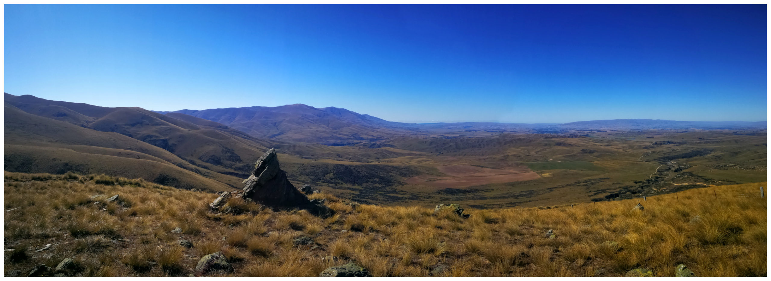
wow, we stopped to appreciate the view, and this was only halfway up!
The expansive views from the Buster track, back down towards the upper Maniototo Plains is nothing short of magnificent.
the two huts looked like tiny ants
Brown’s Huts where we started from resembled little ‘ant size’ objects, way below us. It was mind-blowing, just how much we had climbed in a short amount of distance.
Buster/Clarke’s Diggings
Approximately 6km from the start of our climb, we came across the Buster Diggings and was the country’s highest-altitude gold workings at 1200m. The diggings were worked from 1863 to the early 1900s. At their peak, there was a population of over 700 miners living here.
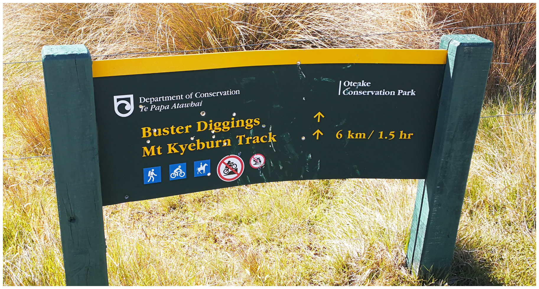
keep an eye out for the sign 6km into the drive
in the distance we also spotted the cliffs left by sluicing
Today, all that remains at the Buster Diggings are half-buried water pipes and the wonderfully sculptured, moon-like evidence of the extensive sluicing that occurred in the area. I was struck by the area of land it covered. It must have been a hive of activity back in its heyday.
how hard it must have been to lug these pipes up the side of Mt Buster!
Records show that heavy pipes and mining gear were lugged up the very track that we had just climbed. Teams of up to 18 horses were needed to haul a loaded wagon of pipes up to the main workings.

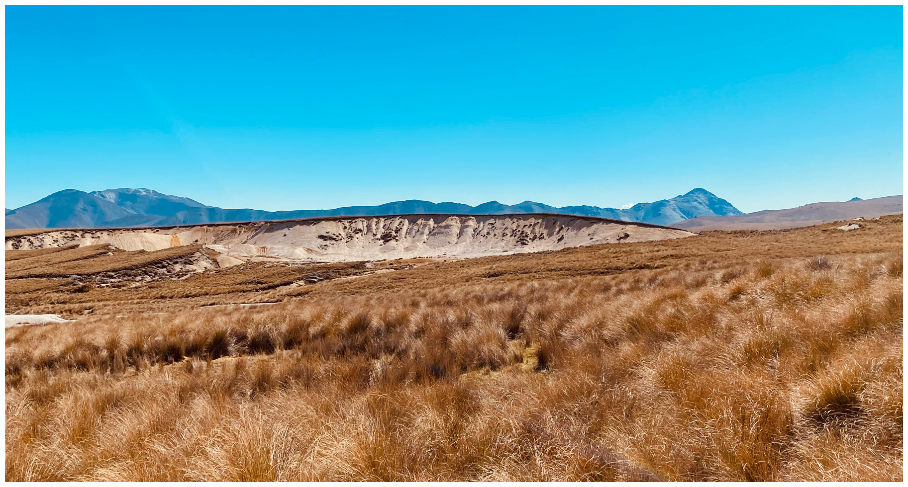
we entered the desert-like landscape of the Buster Diggings
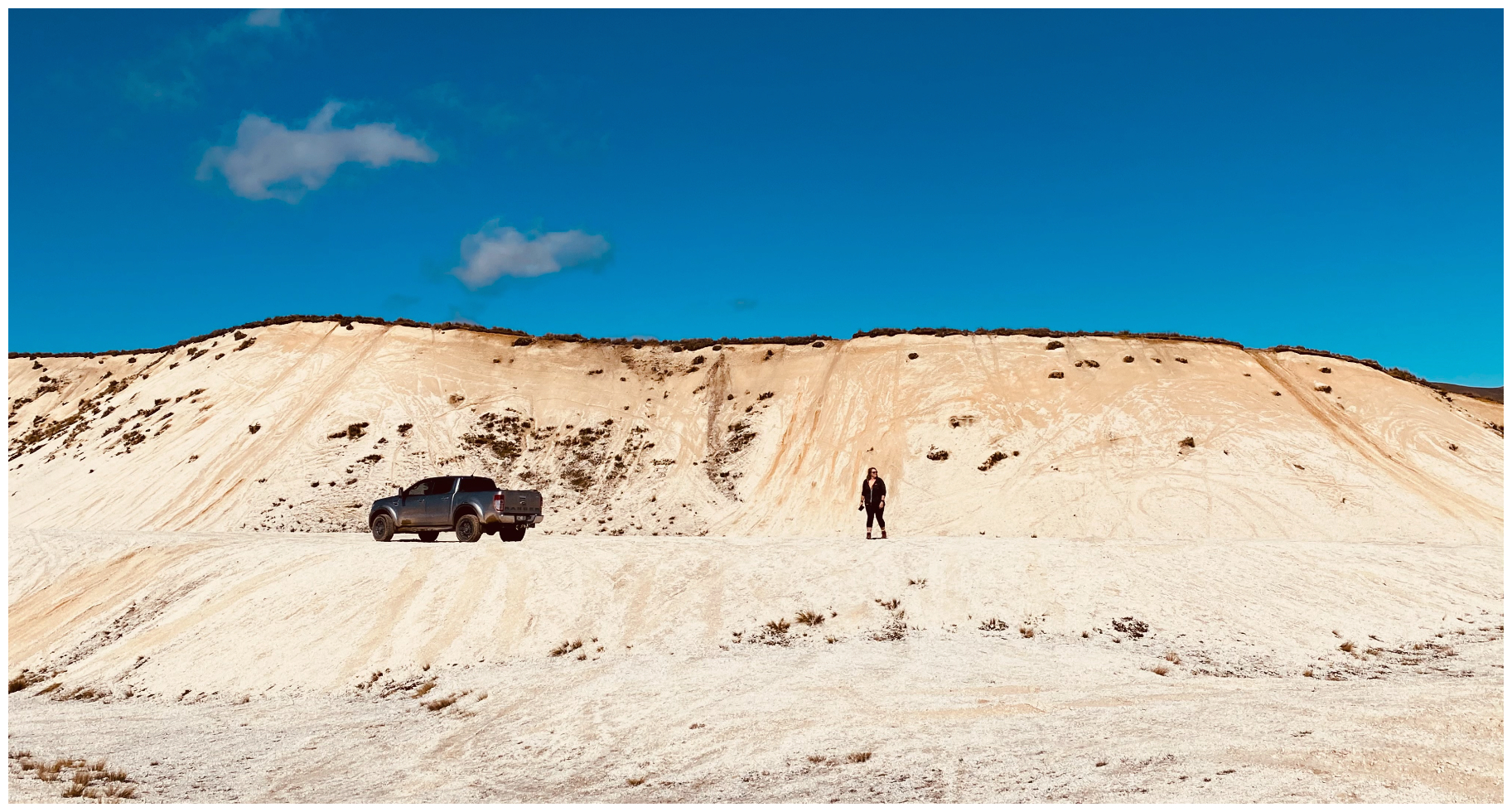
vegetation never grew back, leaving the area barren, but it looked like it was quite the playground for 4×4 enthusiasts which I don’t thing helps the chances of regrowth
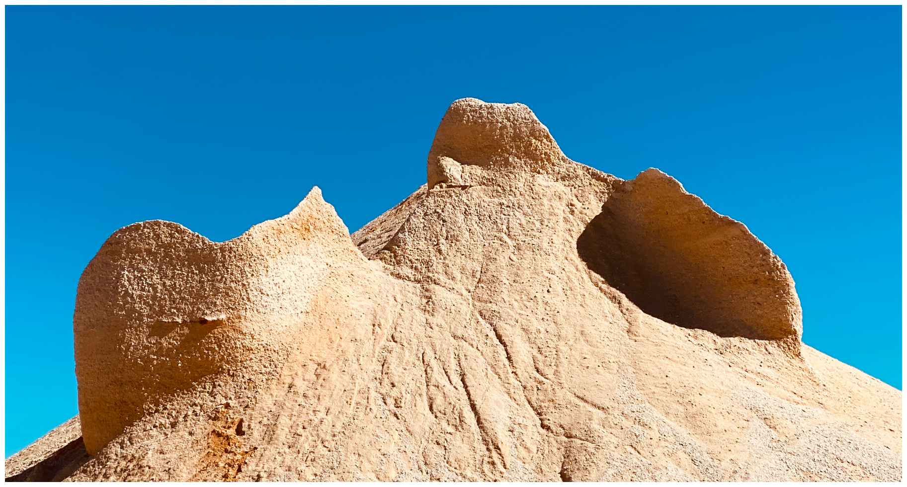
mother nature at work, forming her own sculptures for us to appreciate
As mentioned earlier, there are various tracks that dart off in different directions. Make sure you are aware of which track you want to follow as you can easily be led in a direction that you may have not been intending to go.
Tailings Creek
Leaving the diggings, the track finds its way across the plateau, crossing and following Guffies Creek (named after Anthony Guffies who was killed in a tunnel collapse in 1875) which leads into Tailings Creek. We continued to follow Tailings Creek all the way to Tailing Creek Hut.
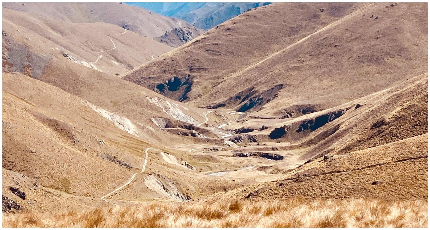
Tailing Creek Track is easy to spot, winding its way down into the gully below
As we bumped our way along the track, we were rewarded with impressive views and often gorge-like valleys. As you can imagine, there were numerous photo opportunities with ever-changing rock and cliff formations and tussocks which formed a multi-coloured tapestry.
In the early days, there were two musters a year, usually using trusty mules, but apparently, there is now only one muster which takes place in April. This is obviously before the harshness of winter sets in.
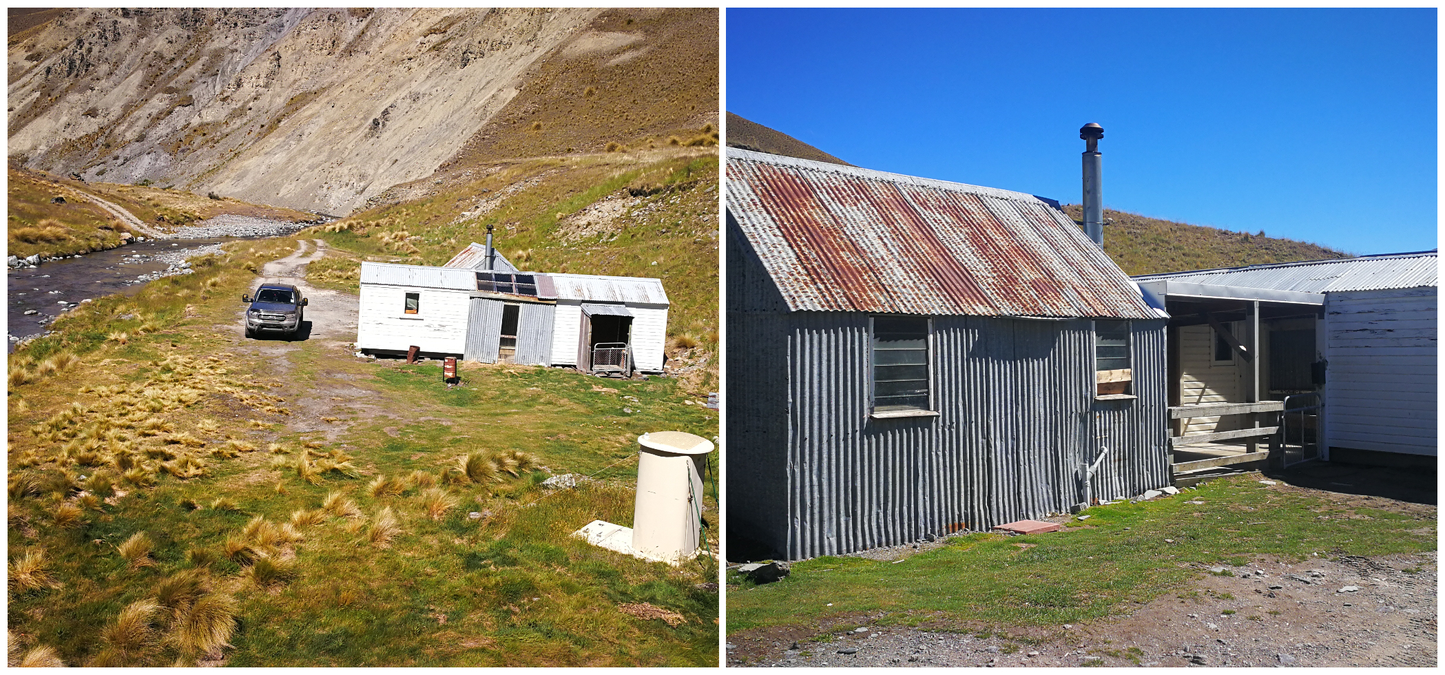
Tailings Creek Hut
We eventually found Tailing Creek Hut. This site has always been the place where musterers camped over. There was enough flat land for the yards and close to a neverending water supply.
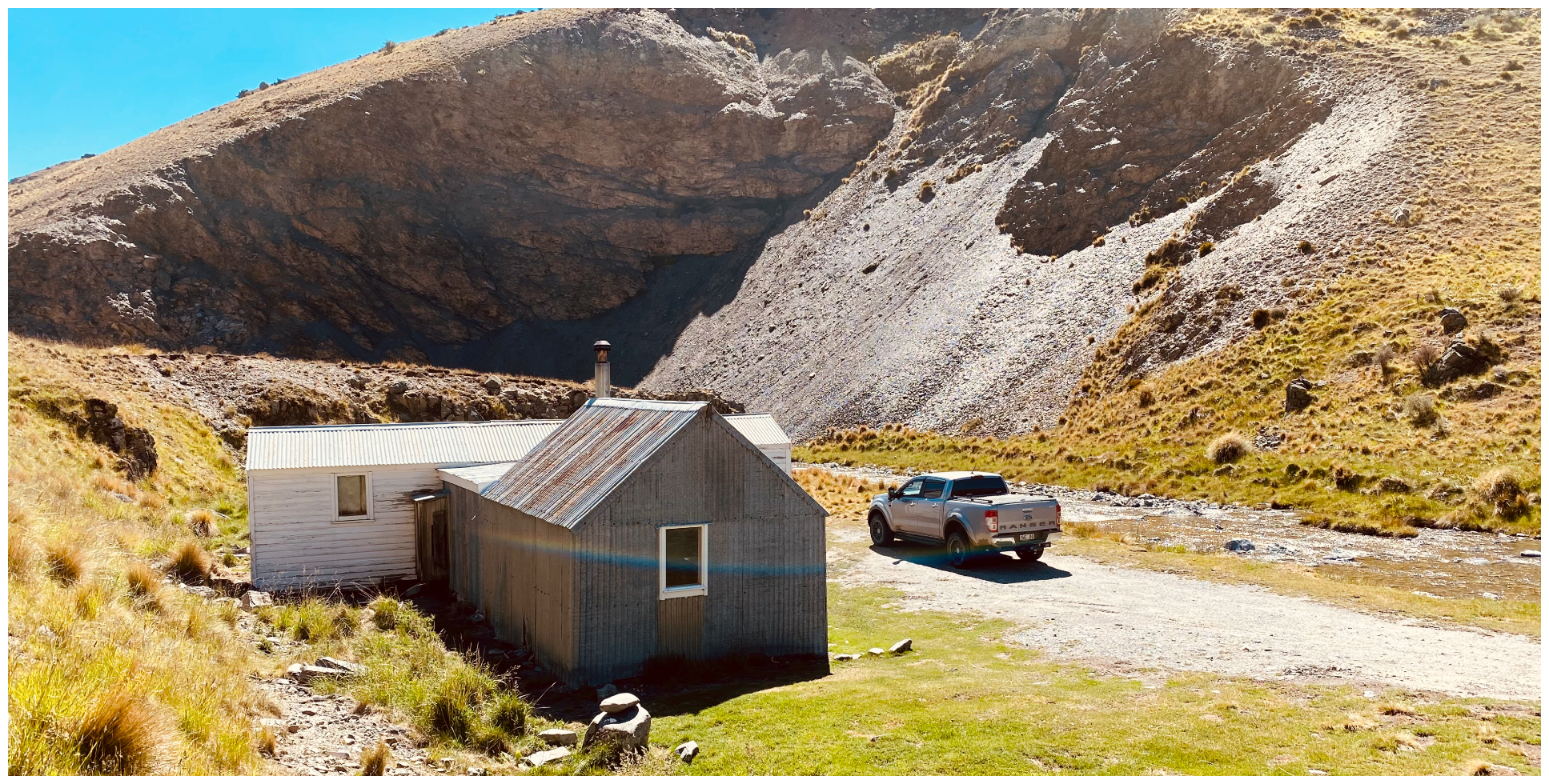
the Tailings Creek Hut certainly gets well used even today
For many years a simple tent was used to house the tired musterers, but eventually, in 1924, there was the start of a more substantial shelter erected.
it was a great rest stop and it was time for our picnic lunch
Over the years, the hut has been added to with two adjoining bunk rooms and covered centre section. I loved the typical high country humour of some of the signage around the hut. Tailings Creek Hotel seems an apt name, although I certainly didn’t spot any barmaids nor could we find any beer being served!
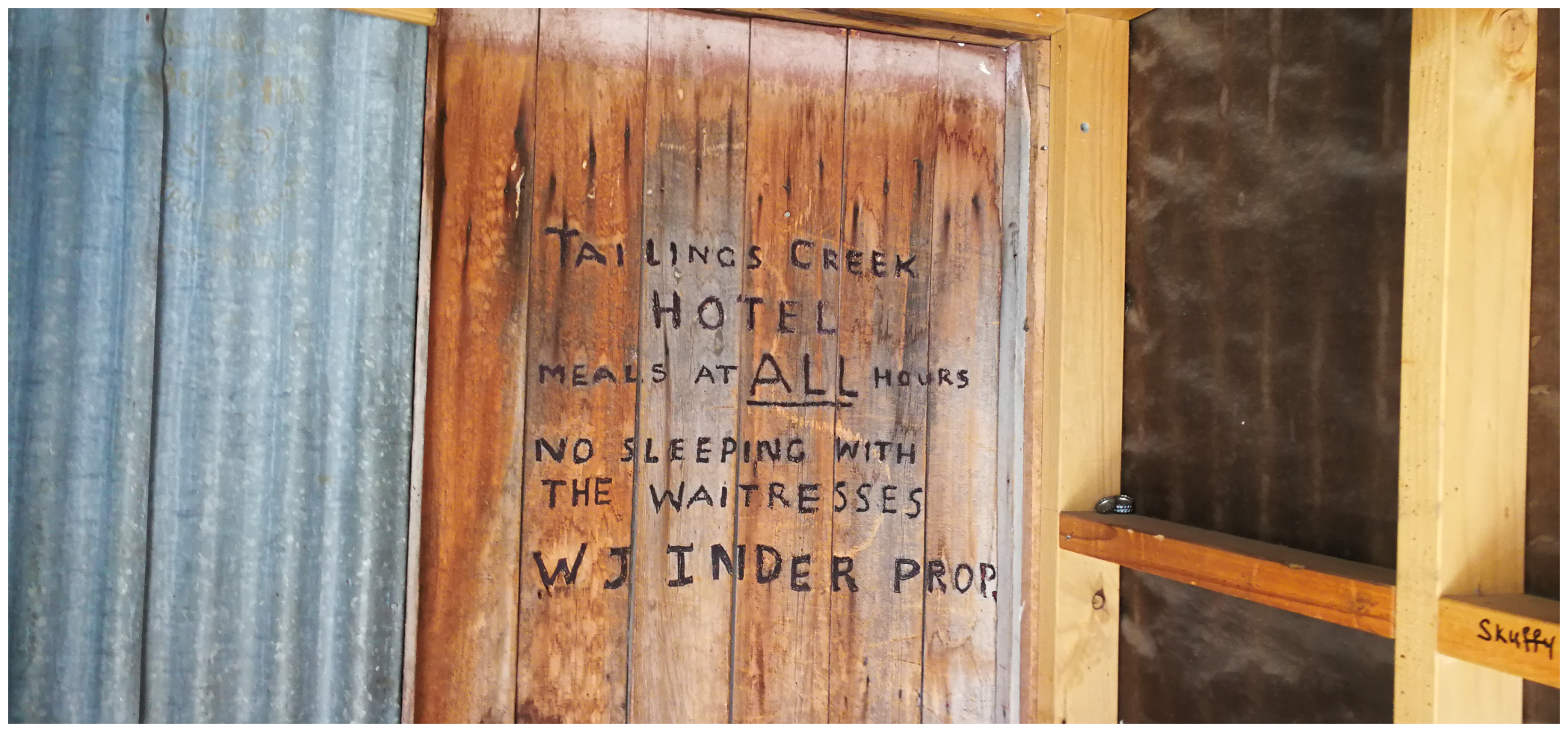
loved the sense of humour
It seemed like a great spot to bring out the thermos and sandwiches. We ate our lunch in the main dining part of the Tailing Creek Hotel – or should I say Hut!
Onward Trails
There are two tracks that leave from Tailings Creek Hut. One goes north-east and the other north-west. Neither one is marked and again, it is easy to get confused on which one leads where.
If you are wanting to continue on the track which brings you out on Home Hills Run Rd (not far from Falls Dam) then it is the north-east track. This is called Johnstones Creek Track. This is approximately 34km and is a narrow, rough and steep track over the Hawkdun Range. Best driven with another vehicle and is recommended for experienced 4WD drivers.
We’d already driven Home Hills Run Rd when camped at St Bathans (see my previous blog on St Bathans).
Sergeant Garvey’s Cairn
We were keen to try and reach Sergeant Edward John Garvey’s Cairn. So in order for us to get there, we needed to take the north-west track. It is located a further 5km along this track.
Well, the state of the track was deteriorating somewhat. I’m the first to admit that I can start to get a tad anxious when I feel that the path ahead feels a bit dodgy. Scotty can always tell when my anxiety levels increase as my conversation reduces and quietness ensues.
be prepared for quite a few ford crossing of varying degrees of depths and widths
Just a couple of kilometres along the track we were faced with what I thought looked to be a rather challenging river crossing. It entailed driving a little way downstream along the actual riverbed. We got out and scouted the route on foot as far as we could.
As we were solo-travelling, Scotty thought it best to preserve my sanity and not risk the crossing. We did walk a bit further along but could not make out how much further we had to go to reach the cairn.
The Tragedy of Sergeant Garvey
Although we didn’t quite reach the Cairn, I did some research. There is a sad story of poor Sergeant Garvey, who was a veteran of the Crimean War.
On his return to NZ, he joined the mounted police force that policed the newly created goldfields, based at Naseby. He and two others were ordered out in rather foul weather to check on the Mount Ida Goldfield. He was separated from his travelling companions and died in a snowstorm at Mount Ida Goldfield on September 25, 1863, aged 30.
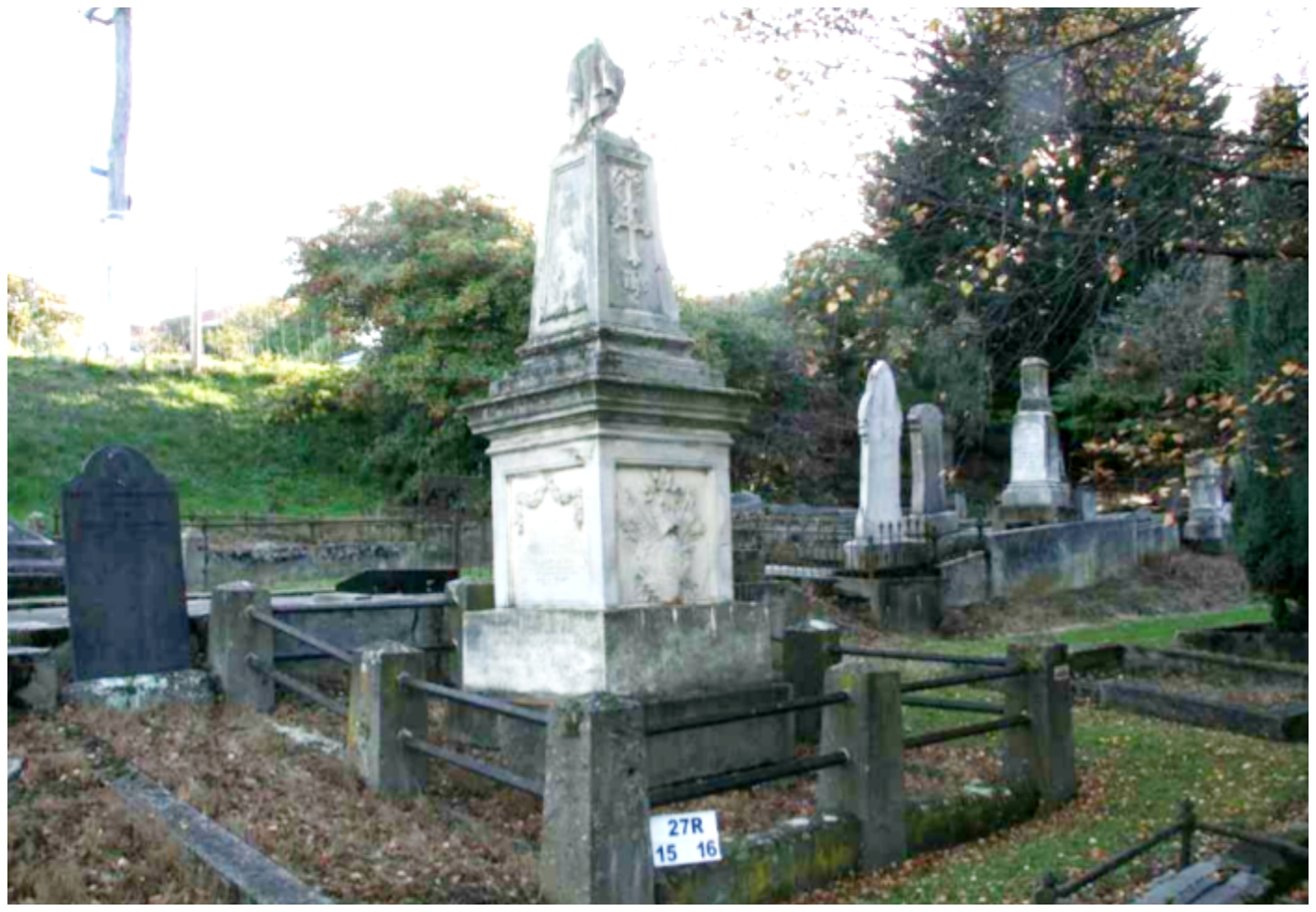
Sergeant Garvey and James Grennan’s impressive memorial in Dunedin
(photo courtesy of cemeteries.org.nz)
Sergeant Garvey and fellow Crimean War hero James Grennan are commemorated by an impressive memorial. It’s located in the Catholic section of the Southern Cemetery, Dunedin. Click here to read the full story and the aftermath of this tragic set of events.
A small cairn was erected on the site where his body was found. It was only rediscovered in 1999, and on 25 March 2000, a plaque was unveiled there. A protective post and rail fence around the cairn and plaque was erected to protect it from stock damage.
One day, we might return to locate the small cairn. We’d also like to return to tick off the rest of the track. Maybe through to the ‘other side’ of the ranges.
If you would like to check out more tracks and trails in the Oteake Conservation Park, whether it be walking, cycling or driving, click on the DoC website here.
“Know before you Go”
Hi again Lynda. Well you have nailed it this time for me. Tailings Creek Hut is base camp for mustering on Run 362B known as the Mt Ida Syndicate of which our family has been part of for over 100yes. My grandfather CJ Inder signed 21yr a lease in 1897 on behalf of a group of local farmers & my nephew is one of the remaining members of the Syndicate. About the huts Tailings Creek was the 1st built in 1924 followed by 3 others in 1934 all materials being packed in on the mules. In the early 60s when I was mustering they all had dirt floors & we had to cut snow grass to lie on. The old timers made hollows fot their hips. They take the sheep from the plain up the Buster track in the spring past the Tailings Creek Hut to the plateau above and let then go. A 3 day drove staying at the Buster Hut on the way. Then in April muster them back home for the winter. Thank you again for the Memories. I have a very good book called Beyond The Buster produced for the Centennial of the Syndicate in 1997 which gives a full history & yes we were still using the mule train in the 60s. No roads past the Buster Workings then. Regards Geoff
Hi Geoff, that’ really interesting history, thanks again for sharing. Quite often, these are stories and details that you just can’t research or find on google. Knowledge that only descendants can share. Love it! Linda
Hi again Lynda I started in the middle of the night and thought I had lostwhat I had written so it may be a bit mixed up so please edit it as you see fit. Well you have nailed it this time for me. Tailings Creek Hut is base camp for mustering on Run 362B known as the Mt Ida Syndicate of which our family has been part of for over 100yes. My grandfather CJ Inder signed 21yr a lease in 1897 on behalf of a group of local farmers & my nephew is one of the remaining members of the Syndicate. About the huts Tailings Creek was the 1st built in 1924 followed by 3 others in 1934 all materials being packed in on the mules. In the early 60s when I was mustering they all had dirt floors & we had to cut snow grass to lie on. The old timers made hollows fot their hips. They take the sheep from the plain up the Buster track in the spring past the Tailings Creek Hut to the plateau above and let then go. A 3 day drove staying at the Buster Hut on the way. Then in April muster them back home for the winter. Thank you again for the Memories. I have a very good book called Beyond The Buster produced for the Centennial of the Syndicate in 1997 which gives a full history & yes we were still using the mule train in the 60s. No roads past the Buster Workings then. Regards Geoff