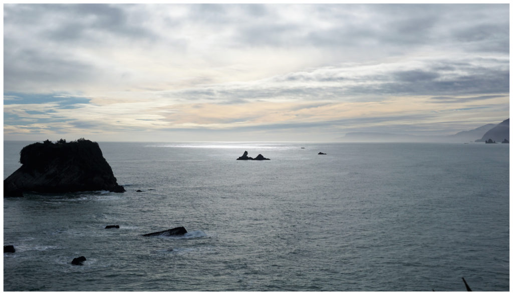
We’ve Found Ourselves on the West Coast
After finishing our House Sitting Assignment in Martinborough in the Wairarapa, North Island, we found ourselves on the wild West Coast. We’ve had 3 epic weeks exploring ‘small town NZ’ around the top part of the South Island.
See a list of our blogs and links at the bottom of the page.
West Coast Highlights
Our next House Sitting Assignment was in Barrytown, situated right on the West Coast, just 25km north of Greymouth.
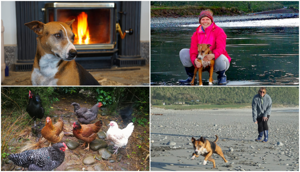
Roxy our fur foster girl and some of our 10 feathered friends to care for
Our assignment was for 7 weeks, looking after Roxy the rescue dog, 10 chooks and also managing their BnB. There are so many advantages of combining House Sitting with living full time on the road. We get the best of living like a local in some amazing places.
This is Part One covering some of the places we got to visit whilst staying at Barrytown. Locations that we would have normally just driven by to get to our next destination.
Barrytown
Barrytown is located between Punakaiki and Greymouth at the southern end of Pakiroa Beach.
Memories of the gold rush days in Barrytown
Blink and you’d miss it but it hasn’t always been like that in this area. Settled in the 1860s it was the centre for gold dredging. It once housed 2,000 miners, 11 hotels and went through various name changes including Fosberry and Barryville.
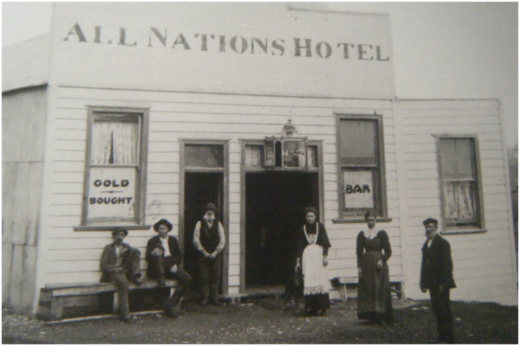
All Nations as it looked in 1898
The last remaining pub called All Nations is some evidence that remains from the original settlement. Pam in the kitchen made a mean burger, fresh and tasty fish and chips and could even whip up a pizza. It only felt appropriate that we try to support the local hostelry at least once a week. Their Friday night Happy Hours was a great chance for us to meet some of the colourful characters that live locally. It was good old Southern Hospitality at its finest.
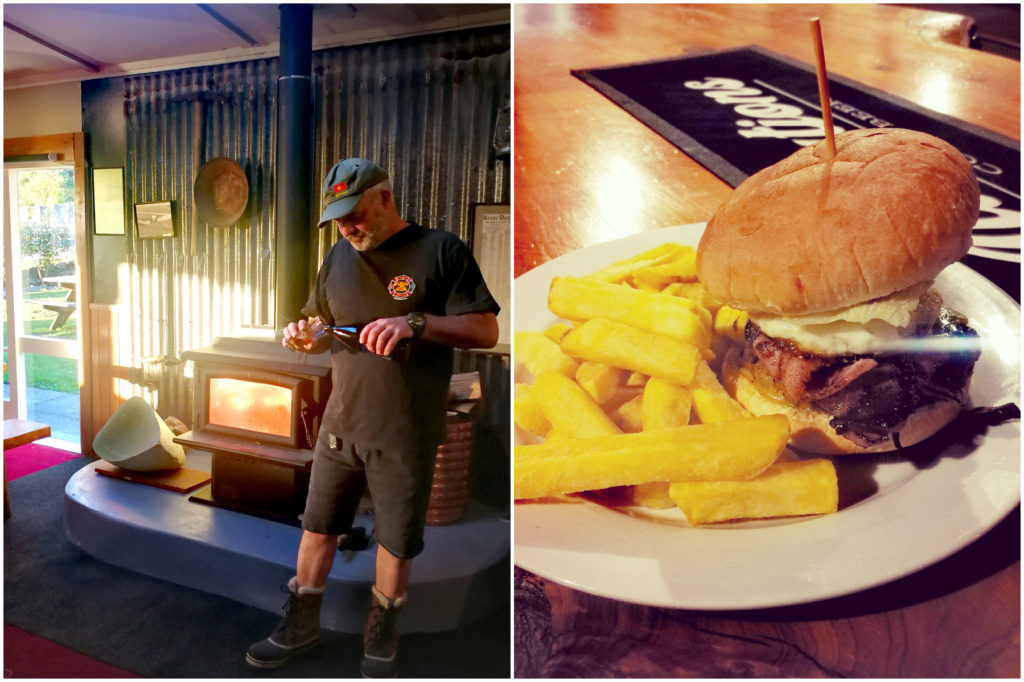
Supporting the local constabulary, and Pam’s Burger!
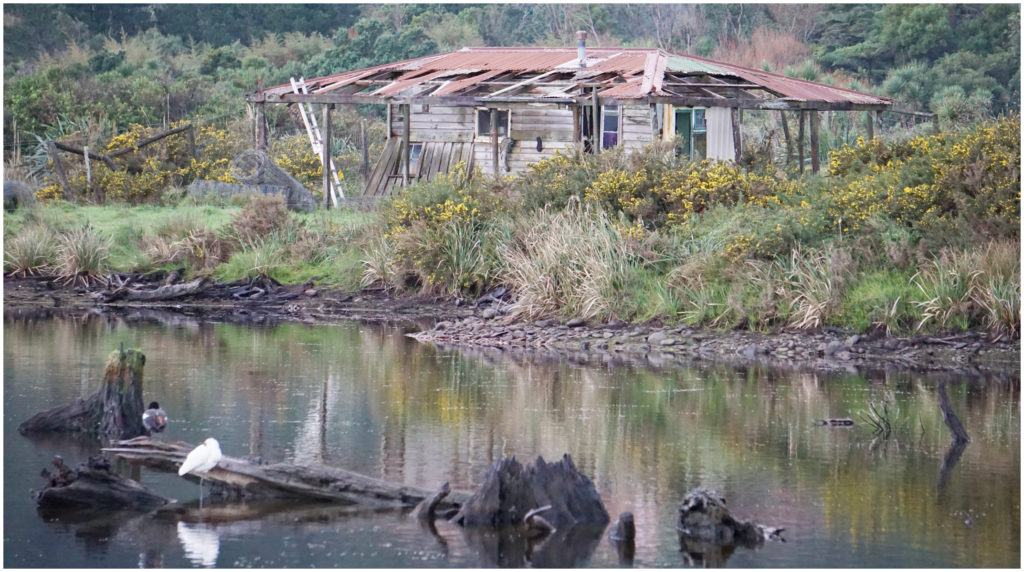
Every morning and afternoon, we’d walk Roxy down to the beach, very rarely seeing anyone and we soaked up the isolation of this stone clustered beach. We’d keep looking out for that pounamu or gold nugget but both remained elusive to us.
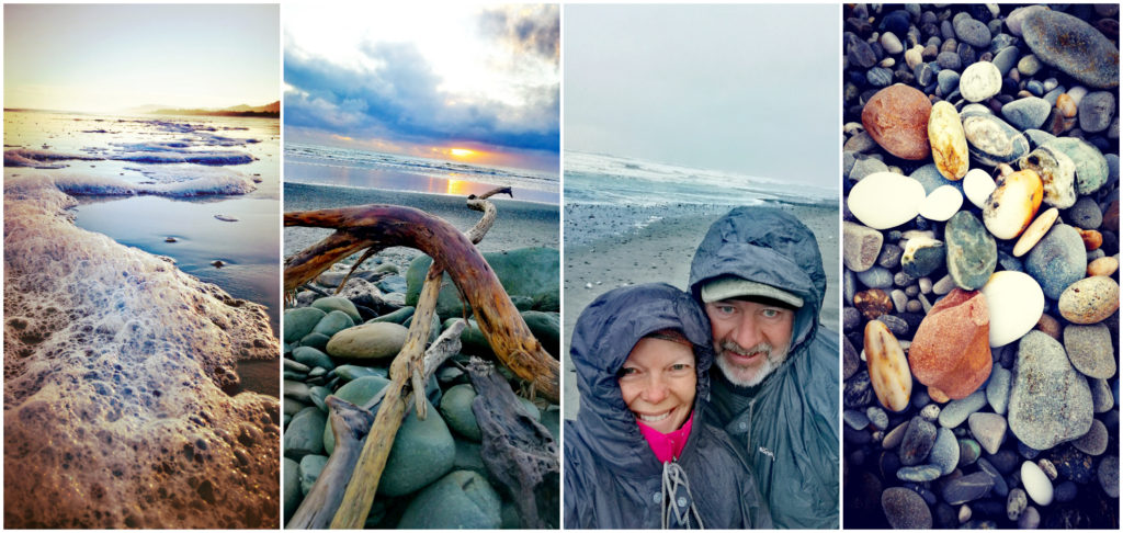
Too many beautiful shots – narrowed it down to the sunrise reflected foam, sunset on the beach, a very wet morning walk and just some of the polished stones which litter the beach
Scotty Made a Knife
An activity that has put Barrytown on the map for many a tourist is Barrytown Knifemaking.
Scotty decided to check it out and spent the day with Steve and Robyn making himself a masterpiece.
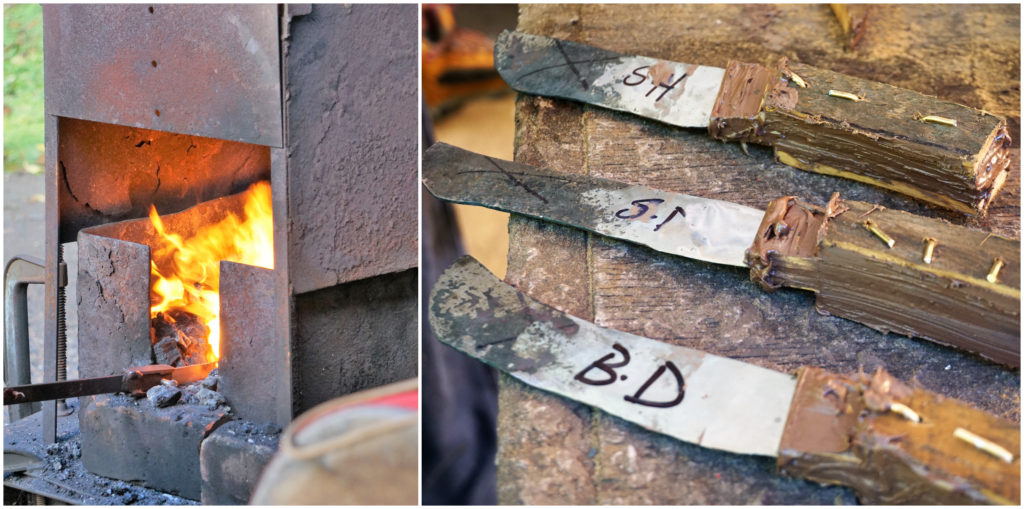
The steel goes into the fire and first versions are not too pretty!
The day started at 9.30am and finished around 4 pm. He forged his own blade from red hot steel and a beautifully finished off native timber handle. While Robyn and Steve spent time with each individual participant, others in the group could fill in time honing their axe throwing skills, hoop throwing and mastering the giant swing. Lunch was also included in the day’s activity. Cost $170 per person.
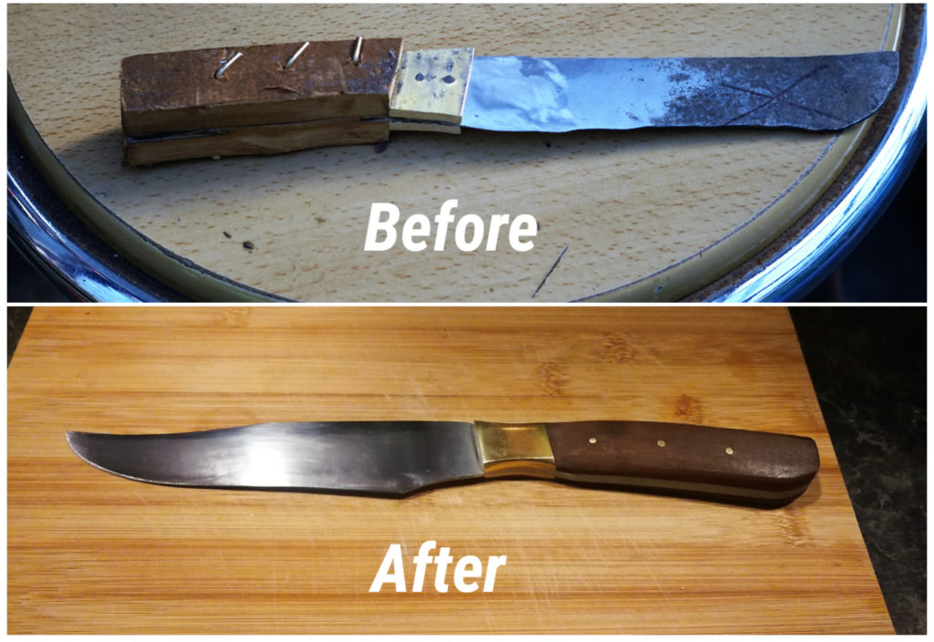
It hatched into a thing of beauty – thanks Scotty
Scotty’s knife is amazing (almost too good to use) and he also turned out to be a bit of a ‘closet axe thrower’. I wonder at what point I should become worried!!!
Punakaiki (Pancake Rocks)
Just 16km north of Barrytown is the famous Punakaiki (Pancake Rocks and Blowholes). We thought that we had better re-introduce ourselves to them as it has been some years since we’d seen them. They have been there for millions of years so they hadn’t really changed since our last visit. However, entry and accessibility certainly have.
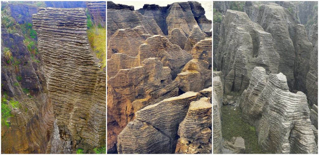
The perfectly stacked rocks looks like……well – pancakes!
The tour coach, car and campervan parking has been increased and the loop pathway around the rocks and blowholes have had a major revamp. This helps prevent the hundreds of daily tourists from climbing over the rocks and keeps everyone at a safe distance. I also don’t remember being able to view as many blowholes as you can today.
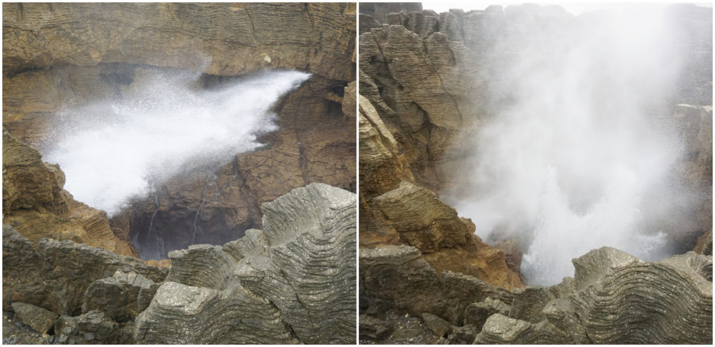
Waiting, waiting, waiting……QUICK – there she BLOWS!!!
It is all about timing when it comes to making the most of the blowholes. A really good high tide with a good swell conjures up the perfect storm. You can hear the blowholes before you see them perform.
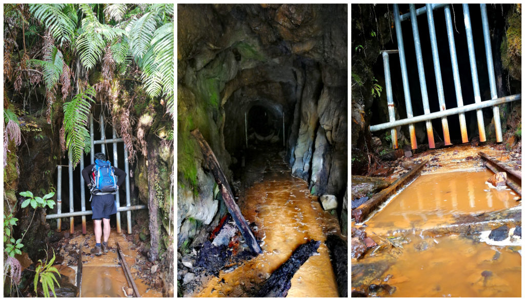
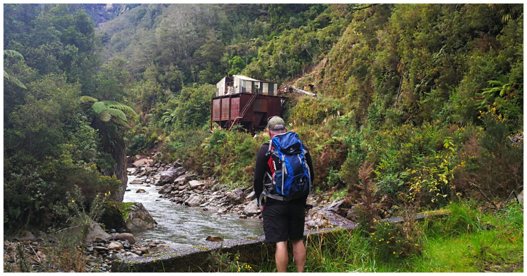
Rewanui Walkway
Situated in a tiny settlement called Dunollie (20km south of Barrytown) is the start of the Rewanui Walkway.
This is an easy gradual gradient track which takes you through historic mining territory with views to the Paparoas.
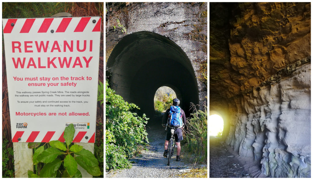
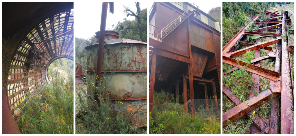
Keep a look out for the sign to find the start of the track and the two tunnels along the incline to Rewanui
Hike and Bike
We visited this track twice during our Barrytown stay, the first time was a hike to the end of the formed track, the second was with our e-bikes.
It is a 10.5km round trip through a couple of short but impressive tunnels and several rock cuttings. After 5km the track peters out. Here is where we ditched the bikes and waded across the two streams as this is where the majority of the mining ruins lie.

Keith Butler memorial and a couple of streams to cross
The 1988 Landslip
Just across the first stream, we came across the memorial to Keith Butler. He was the caretaker of the disused mine site when there was a massive landslip in September 1988. Poor Keith and his car were washed away, never to be found.
This slip changed the landscape forever and took with it loads of derelict mine machinery and buildings. Old photos show that there was quite the settlement at Rewanui. Many remnants have been destroyed but we could still see a coal loading bin and lots of coal tubs.
The coal bins still lie in disarray after the 1988 landslip
To say that the area is overgrown is an understatement. Gorse, trees, thick undergrowth and a rather mean swamp meant that we couldn’t continue any further along the disused train track. Mother nature was claiming back her territory and she’s not willing to share any of what once a thriving mining community.
One of the mines which has claimed lives in the past
If you are interested in finding out more about what went on in this area, click on the link below to read more details.
Point Elizabeth Walkway, Rapahoe
A 20km drive south of Barrytown (11km north of Greymouth) is the small seaside settlement of Rapahoe.
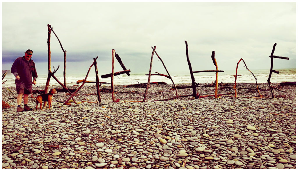
Driftwood art at Rapahoe
Rapahoe
This is a very pretty, sweeping pebble-filled beach with rolling waves. Accommodation choices are the Rapahoe Bay Holiday Park and the Rapahoe Beachfront Hotel which I understand they allow self-contained camping in their car park. There are also motels and some BnB’s. I’m presuming that the hotel is only open during the summer months as it was always closed whenever we drove past.
To the Lookout
Located at the southern end of the beach is Point Elizabeth Walkway. This is an interesting coastal/bush walk which links Rapahoe in the north to Cobden (Greymouth) in the south. You can complete it in its entirety or just a portion of the track to the lookout.
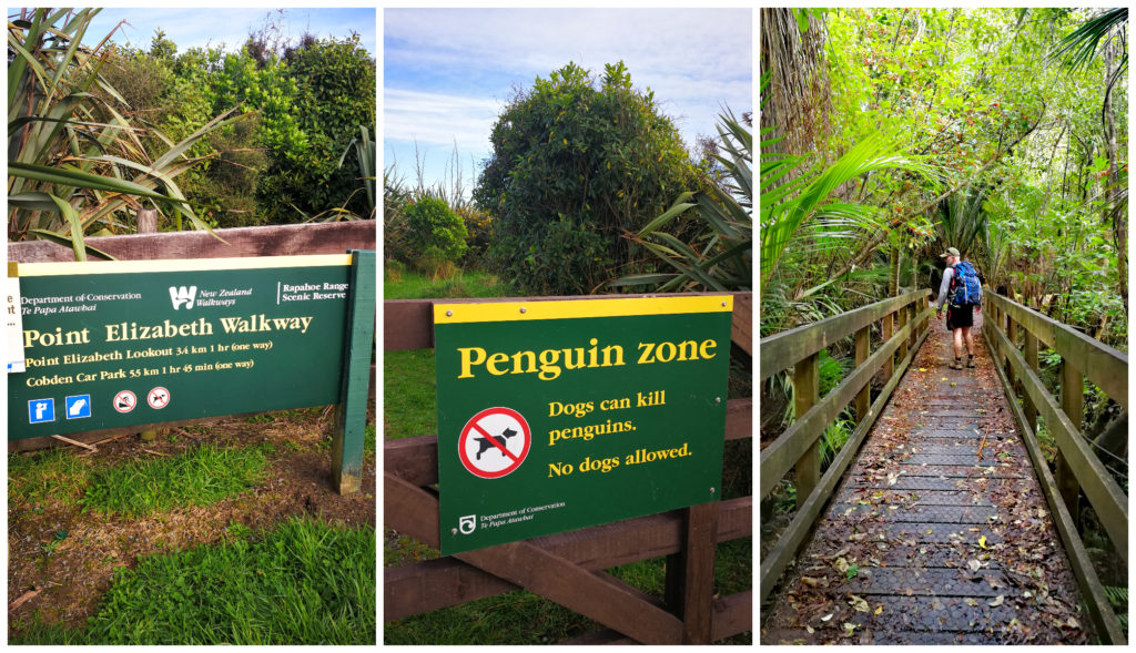
No dogs allowed
We set out from Rapahoe end and the track climbed steadily to the Rapahoe Scenic Reserve, full of mixed coastal forests.
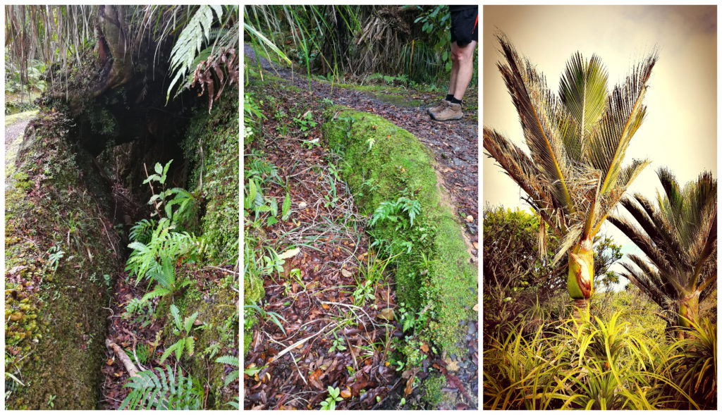
Keep a lookout for the water races and the most southern nikau palms
The track follows an old water race built by the 19th-century miners used to sluice their gold mining claims.
Slowly the bush gives way to waves of flax bushes and the sea can be heard again as we near the lookout on the Point Elizabeth headland. We also found what is said to be believed the world’s southernmost palm tree, the nikau palm, growing here near its southern limit.
This exposed rocky point lookout has views south toward Mt Cook and north along a spectacular rocky coast and inland to the Paparoa Mountain Range.
We watched the offshore ‘sea stacks’ being battered by the relentless waves and swells. It was evident that the point once must have extended much further out to sea.
Now this is what your slog uphill will reward you with
It took us 50 minutes to reach the lookout from the carpark. As is always the case with a lookout, be prepared for an uphill slog until you reach the Rapahoe Scenic Reserve. We decided to turn back at the lookout and head back to the car.
Coal Creek Falls
Located down a side street in Runanga (8km north of Greymouth), the start of the Coal Creek Falls Walk, which is signposted from the main road.
This is one of the most popular walks in the area. We got there early so there weren’t very many other walkers to share the path with.
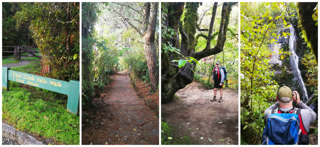
It’s an easy 1/2 hour walk in with a ‘teaser’ waterfall on the way
It is an easy path which gently descends down to the Coal Creek valley through a beautiful native forest. I understand that it is a particularly popular swimming hole in the summer. This being in the grips of winter meant that there were no hardy swimmers today.
Being the only ones there for a short while meant that we could enjoy the peace and quiet, apart from the sound of the cascading water flowing over the wide rocky tiers to the crystal clear stream below.
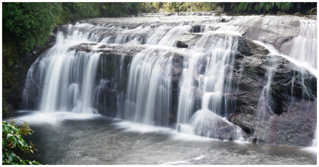
The track is a 1-hour return walk but I’d allow more time than this to truly take in the beautiful views of the falls, stream and native bush.
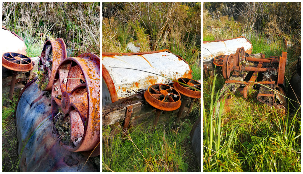
10 Mile Valley Walk
Located just 13 km south of Barrytown is the unassuming 10 Mile Valley Walk. I say ‘unassuming’ as there aren’t any signs to indicate that there is a walking track located here. There is a telltale cutting, into a sheer rock wall that is visible from the road. We thought that we’d park up and see just where this cutting leads.
It turns out that this area oozes mining history.
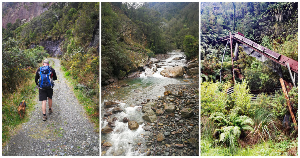
Scotty and Roxy on a mission, 10 Mile Creek and some of the many relics alongside the track
Carved through solid (and not so solid by looking at the slips) rock faces, this walk follows a shallow gorge, leading to abandoned coal mines and their long-forgotten disbanded relics.
Just left to rust and await mother nature to wrap herself around them
Apparently, a hive of mining activity in the 50’s to the ’80s, mother nature is reclaiming her space as the undergrowth takes hold and starts to bury the mining paraphernalia. Many relics were left behind including coal bins, sheds and old power poles.
We pause to imagine what went on all those years ago!!
We spent a good couple of hours exploring 10 Mile Valley, getting glimpses of how things were in the past on the West Coast.
Summary
It was becoming clear to us that there was more to the West Coast than meets the eye. More to come in Our Top Picks For the West Coast – Part Two.
South Island Blogs:
South Island Bound, Picton – The Link Pathway, Kaiteriteri – Gateway to Abel Tasman, Pohara – an Ideal Base, Pakawau – Farewell Spit, Murchison – More than a One Night Stand, Karamea – On the No Exit Highway, Laying Low in Westport.
Follow us on Instagram and Facebook.
This is such an interesting blog, who’d have thought this part of New Zealand would be so fascinating. I loved reading about all the little places and your escapades.
Thanks Elizabeth, it’s all about peeling back the layers to find what’s underneath. L
Thank you so much for sharing, more determined to get back and explore the walking tracks 👍😊🚶♀️🚶♂️
Thanks for your feedback. There are so many options to suit everyone – and they are all free! How lucky are we to have these choices in NZ. More to come in Part Two!
Great pics the coast is sure full of history did you walk Charming Creek at Seddenville
Thanks guys…..we had it on our list to do but the weather gods had other plans!! Still hoping to visit it next time in the neighbourhood as I’ve heard great things. Linda
I’ve been invited to drop a link for a Barrytown activity that was missed on this trip. Truly if you want to see everything you need to stay for a while!! Golden Sands Horse and Wagon Tours. http://www.wagontours.co.nz/
Thanks Sophie, that looks amazing. Certainly a different day out for sure. You’re just up the road from our house sit. Thanks for sharing.