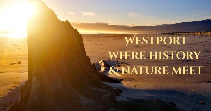
Westport Bound
Once we had finished our stay in Karamea (see the previous blog) there was no other choice but to back-track the way we’d come. Westport was going to be our home for the next 3 nights as we had time to fill in before our house sitting assignment started in Barrytown, further down the West Coast.
Westport on a Windy Day
I don’t like to stereotype places (or people!) but you do often hear people referring to Westport as ‘Wild Westport’, ‘Windy Westport’, ‘Wet Westport’……and the list goes on.
Whether you think it deserves these labels or not, there’s no denying that you do have to watch the weather forecast when stopping over in Westport.
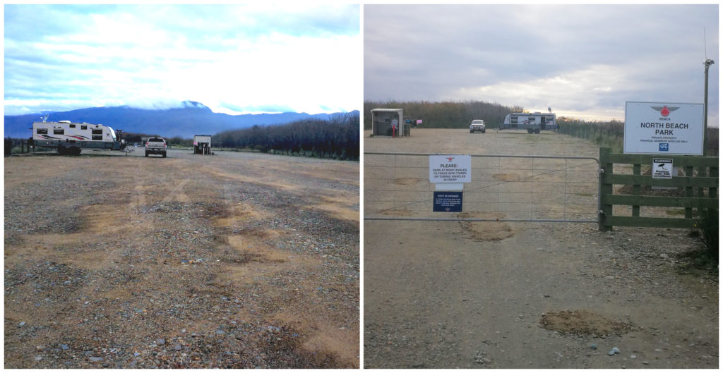
North Beach NZMCA Park
We returned to the NZMCA Park at North Beach (#6479) where we stopped over the night on our way up to Karamea. At only $3 each per night for members, it was our best option. We needed to hunker down for a few nights before gapping it to Barrytown for a 7-week house sitting assignment.
Just us and all our friends!
We knew that we were going to be able to explore the surrounding area of Barrytown/Greymouth so we didn’t want to venture too close and to save those places for future trips out and about. More to come in a future blog.
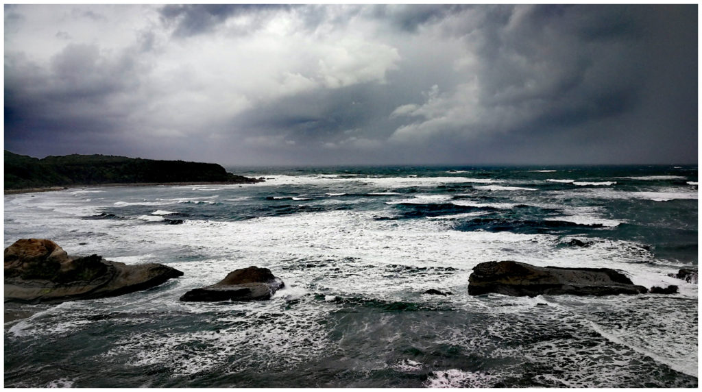
Woeful Weather
Back onto the subject of weather in Westport, the forecast wasn’t looking too rosy and we were aware of the warnings on the app for this camp in inclement weather. The park needs to be vacated in extreme weather due to storm flooding.
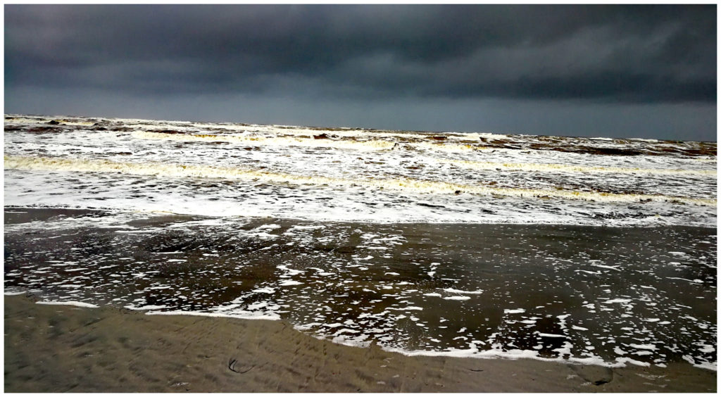
The incoming weather!
We kept a wary eye on the amount of rain that fell and wondered at what point did they consider it the appropriate time to vacate. There was a wee bit of comfort in the fact that our caravan is off-road with a raised suspension in case the need arose.
You will all be pleased to know that we didn’t need to ‘up sticks’ and although we got a hammering with some good gusts and downpours, the ground stayed firm and puddle free. We could see where the threat to flooding was in the entrance roadway which could be problematic.
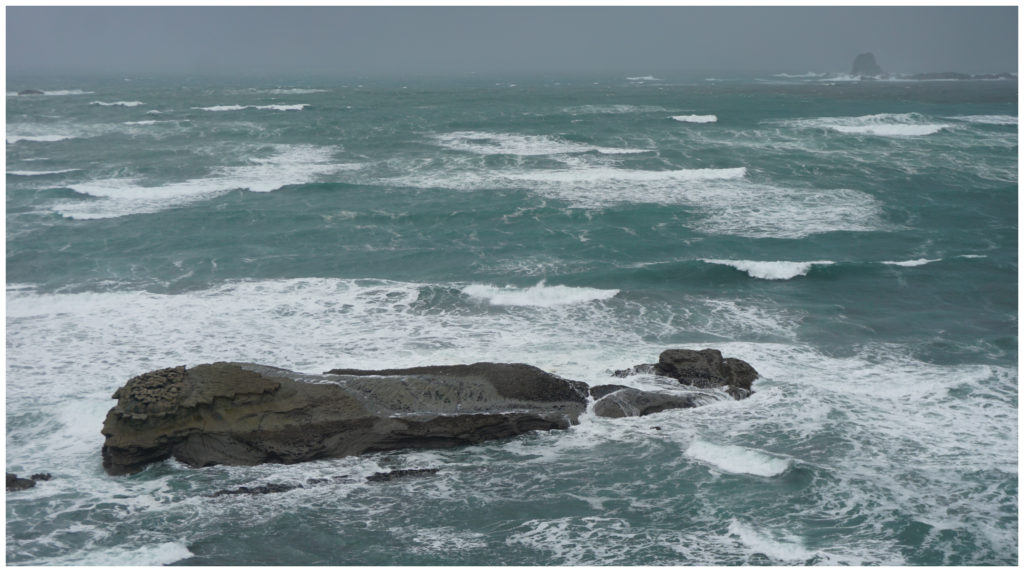
North Beach Character
Some may call the driftwood littered beach at North Beach ugly. I call it a character-filled, ever-changing landscape. The NZMCA Park borders the beach and we loved walking along the foreshore, especially after a big blow.
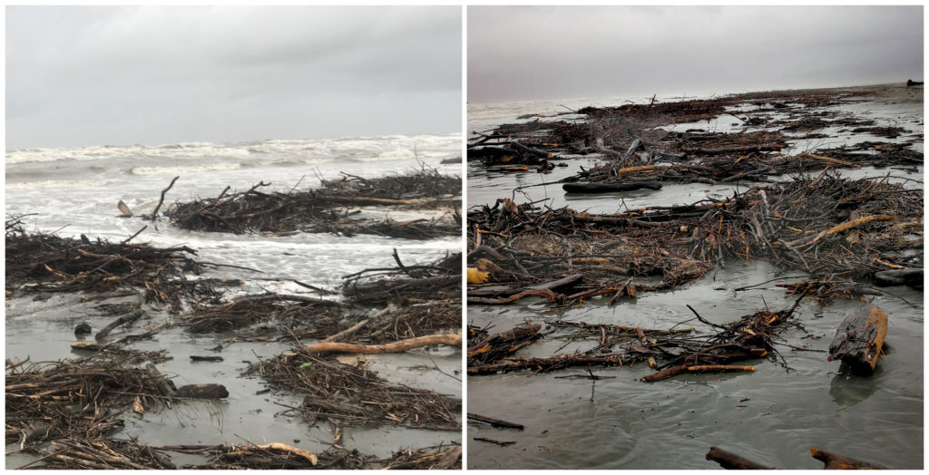
North Beach post-storm
The beach was literally chock-a-block with all sorts of wood. Big, small, broken and whole there was everything in vast quantities. The current swirls out of the mighty Buller River, into the ocean and clearly loops around and dumps all its cargo (wood from up-river) onto the section of coast which is North Beach.
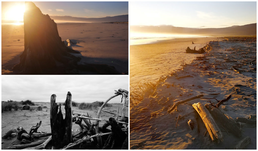
What a difference a day makes on the West Coast!
History of Westport
Gold was first discovered in the Buller River in the 1860s, hence a small settlement was set up on the northern side of the river. Later on in the 1880s, geologists and surveyors combed the area searching for valuable resources. They certainly found it in abundance in the hills in nearby Denniston. The area soon became much more famous for coal mining than gold.
With the coal mining and small gold mining activity came the building of the railroad. The first railway ran from Westport 18km to the coalfields in the north and eventually to Seddonville in 1895. It didn’t link to the main trunk line until as late as 1942.
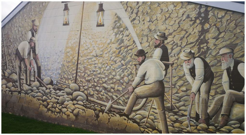
Street art pays homage to the mining history of the area
Westport has been damaged by several earthquakes, including the 1929 Murchison earthquake. Several buildings collapsed, including the post office tower. The town was reconstructed in the Art Deco era. These buildings can still be seen in the main street of Westport today.
Cape Foulwind
Cape Foulwind lies 10 km west of Westport. Being a rocky outcrop earnt its name when explorer James Cook was blown quite a distance offshore in the Endeavour.
Lighthouse
Our first stop is a car park on the lighthouse side of the Cape Foulwind Walkway. A wide and gravelled path takes you up fairly quickly to the top of the headland where, you guessed it, sits the lighthouse.
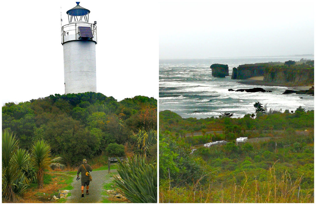
The concrete lighthouse and stunning coastal vista
The light was first lit in the original lighthouse in 1876. The original tower was built of rimu but suffered from rot. The foundations can still be seen, as can the foundations of the lighthouse keeper’s house.
The new concrete tower was built in the mid-1920s and remains pretty much unchanged today.
Soaking up what is Cape Foulwind
From this rocky outcrop, we got a good taste of the dramatic coastal formations. The rock has split off from the mainland to create its own tall island. Further out to sea, we could see smaller rocky peaks rising out of the tide that must have been part of the coast millions of years ago.
and we could see why there were so many shipwrecks in the past
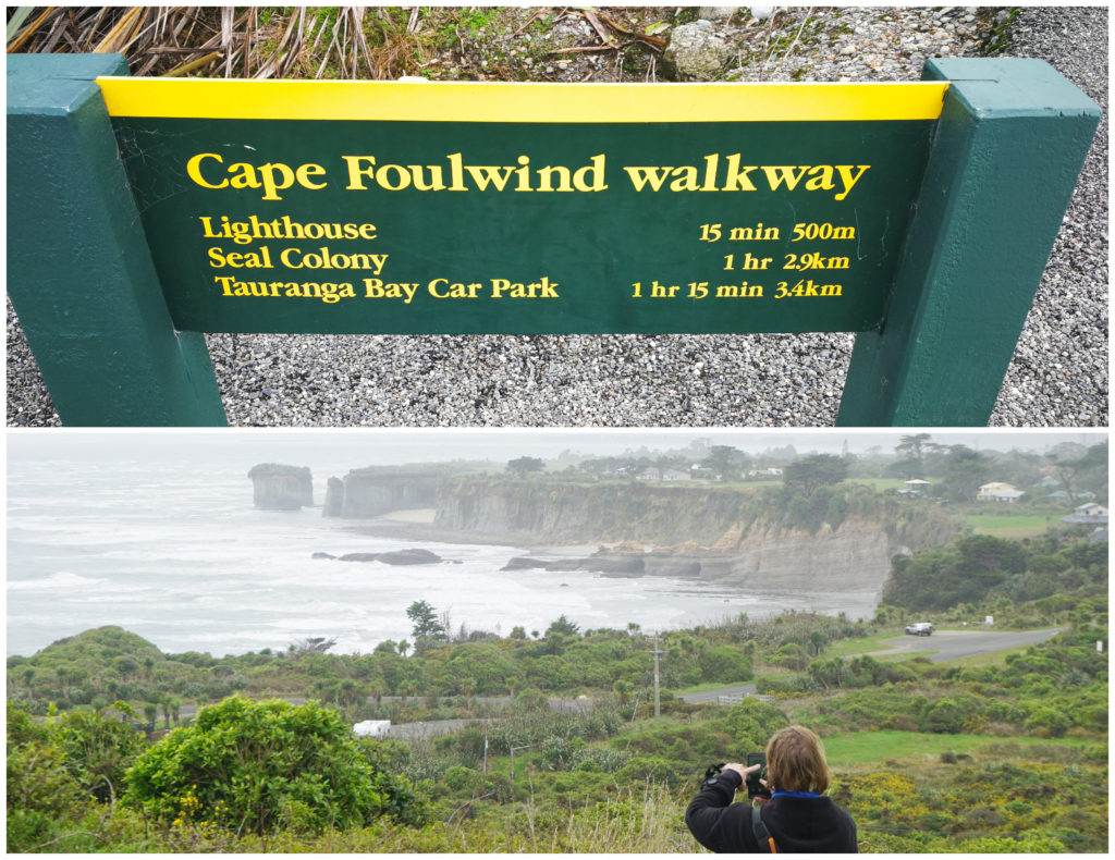
From here, the walkway goes over the headland and down to Tauranga Bay which takes about an hour one way. We didn’t have 2 hours to spare and the weather had other ideas so we decided to return to Tauranga Bay by car the next day.
Tauranga Bay
Returning to the area the following day, we parked up at the Tauranga Bay car park. From here there is a short 15-minute walk to the Seal Colony lookout. There are numerous history panels telling the story of early Maori history, sea voyages and early explorers.
As was the case the day before, the heavens opened up as we were busy reading some of these storyboards and we had to make a hasty ‘run for it’ to a conveniently placed shelter by the car park.
It was here that a committee meeting was held (well between myself and Scotty) and we both agreed that we’ve seen plenty of fur seal colonies and penguins and we weren’t too keen on getting a drenching for the sake of it.
The mesmerising thrashing waves pound the rocks relentlessly
Tauranga Bay is a great place to view the mightiness of the sea. The waves crash over the rocky points, leaving cascading waterfalls in their wake.
Never turn your back on the waves on the West Coast. They retreat out a long way, but also can quickly catch you out and that ‘one in every seventh wave’ catch many people unawares.
Denniston Mine Site
Just 27 km from town, this is probably one of the most visited sites in Westport – well used to be. After driving the steep, windy but well-maintained road up to the original Denniston Mine Site, we parked at the car park to take in the spectacular views of Westport and vast coastal vistas. Looking at the signage for ‘overflow’ parking, it used to be a very popular stopover. This was when it was operating as the Denniston Experience.
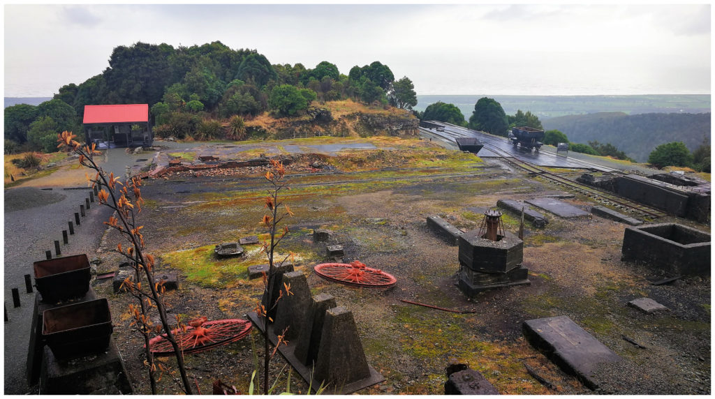
Denniston – where it all began
Denniston Experience
This operated safely for 6 years and took tourists back to the 1880s by recreating the life and work of a miner on the mountain plateau. A fully guided tour, visitors would be provided with a hard hat and lamp. A narrow-gauge train took them along a section of the old coal haulage route, then a walk into the Banbury Coal Mine.
After the Pike River Mine disaster in 2010, new regulations were brought in which did not differentiate between a producing coal mine and a tourist mine.
Even after an investment of $3.5 million to bring the attraction up to a high safety standard, it was not enough to satisfy the new regulations. An experienced Mine Manager had to be on-site at all times. It would be cost-prohibitive to employ a mine manager so the Denniston Experience closed in 2017 which was a bitter blow to the region’s tourism industry.
Coaltown
There is now a flash building in the main street of Westport that is called Coaltown.
Opened in 2013, it is the closest you will now get to experience a journey through gold rush days, the settling of the district and the early development of the coal industry.
Apparently, there are modern displays of the Denniston, Millerton, Stockton and Seddonville coal mining sites. It shows you the living and working environment of the people who made it happen and called these places home.
Now I say ‘apparently’ as we didn’t fancy paying $10 each to view modern displays. We prefer to get up close and personal when it comes to reliving history. There is nothing like walking the paths that these early pioneers took, seeing the marks of progress they forged. Viewing the pickaxe marks, crumbling foundations of the homes they lived in and wandering the once called ‘streets’ where children must have played.
Denniston Today
Even though the Denniston Experience has closed, it is still certainly worth the drive up and to do your own self-guided walk around the area. They have erected history and signboards so that you can learn as you go.
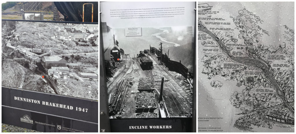
History boards tell and show the story of Denniston
I don’t want to sound like a Wikipedia site regarding the history of this place so I won’t rave on with all the facts and figures too much. What I will say is that the Denniston Plateau was the home to one of the richest, highest quality coal seams in NZ. For decades it was the country’s largest producing coal mine between 1879 to 1967.
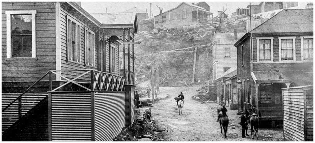
The main street of Denniston
It was definitely not a place for the fainthearted as it was dangerous and there were many deaths and injuries as a result of accidents in the mine or operating/riding the infamous Denniston Incline.
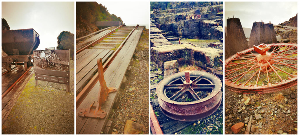
Denniston Incline
This incline was recognised around the world as a remarkable feat of engineering. This linked Denniston with the railway line below, following incredibly steep terrain over 1.7km.
the top of the perilous incline
This incline was essential to cart the coal down from the plateau and return empty wagons back to the top. Apparently, the fully laden wagons weighed 12 ton and travelled down at 80km per hour (what could possibly go wrong!!!).
All hell would break loose if there were any breakages in either shackles, ropes or brake failure. A free-wheeling 12-ton runaway wagon would collect anything or anyone in its path. For quite a few years (before the construction of a bridle path) this was the only way that men, women and children could get from the bottom to the top town, the runaways would not spare anyone in its wake.
But amid the notorious climate and bleak living conditions on the barren windswept plateau, these people “living on the edge” forged a close-knit community to be proud of.
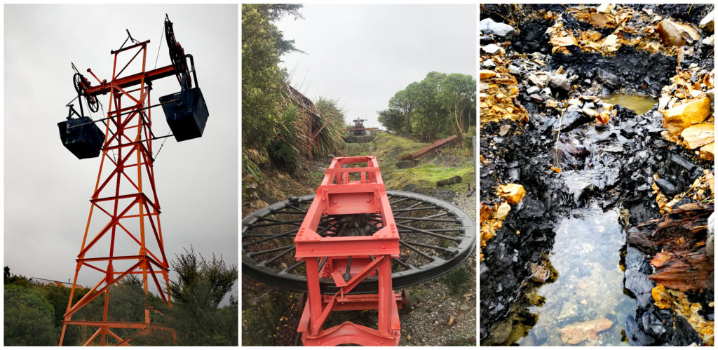
The ‘flying coat buckets’ were a modern invention, and we could still see the seams of coal in the ground – now left alone
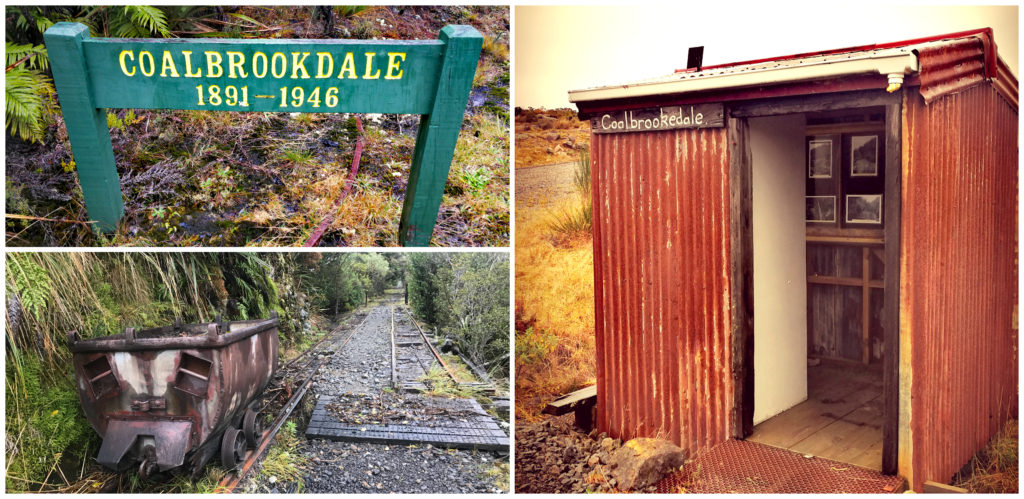
Coalbrookdale
After spending a lot of time wandering the pathways around Denniston, we continued driving along the access road for around a further 12km.
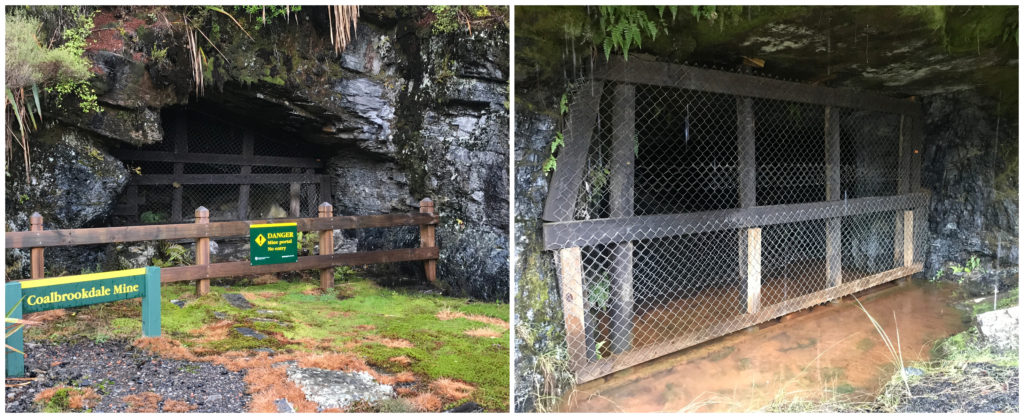
Denniston was not the only settlement in the area. Further up in the hills, small towns sprung up as exploration uncovered more coal seams. This drew the attention of the mining companies. Burnetts Face, Marshvale and Coalbrookdale are place names that are largely forgotten about. They were just as important in the scheme of things as Denniston.
Driving along the road there were small signs, identifying the names of the families and stores where they were located. There was no evidence that life ever existed there. Mother nature had claimed back her space, eliminating any proof of what went on all those years ago.
Coalbrookdale Walk
We located the start of the Coalbrookdale walk. This walk is 2km one way and follows the same tracks that residents and miners used over 100 years ago. There were still many relics visible as we walked the railway track in.
So much history at Coalbrookdale
There was a tunnel, foundations, a large haulage winch and the country’s best remaining example of a mine Fanhouse.
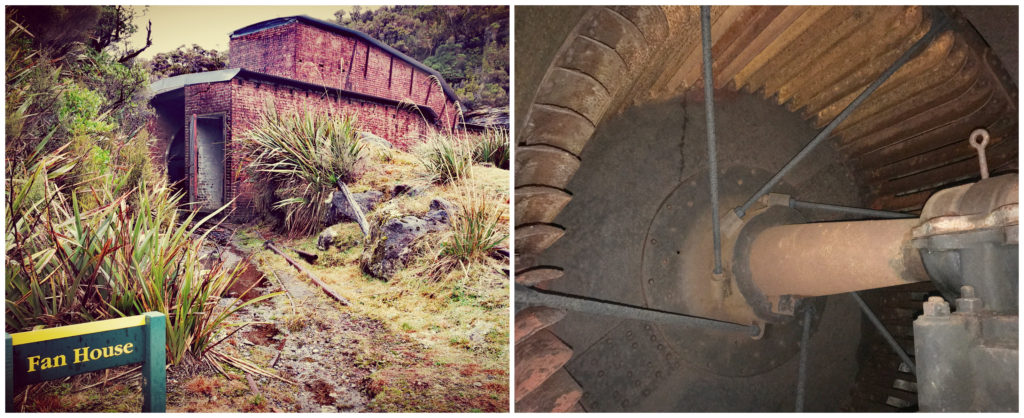
The best fully restored Fanhouse in the country – still with the fans intact
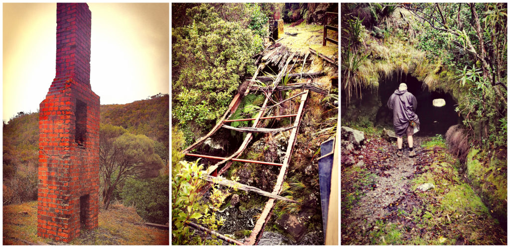
Plenty of relics and a shuffle through the tunnel
The atrocious living conditions for those early miners and their families did not improve with the development of Coalbrookdale. Part of the settlement here was known as Poverty Point as this is where the single men lived. Because building materials were in such short supply they lived in canvas shelters. They didn’t have far to travel to work as the mine was located just across the road. This saved them a long walk in sometimes hideous weather conditions.
The skeletons of the mines along the track
We crossed over the river and walked back down the old roadway back to where we were parked.
Summary
Once again, thanks to our mantra of ‘rushing it slowly’ we were glad we decided to ‘lay low’ in Westport. If we hadn’t, we probably wouldn’t have spent the time, done the research and soaked up the local history that forms the Westport of today.
Click on the link below to view a video of some of the highlights.
Another great blog, thanks. It’s interesting to see the history of New Zealand and how things are just left behind, eg rail wagons.
Thanks Ruth, yes a lot of these old sites is as if they just finished work and walked off leaving it all behind. L
Another place will get to one day, been to Westport, but didn’t venture to Denniston – next time. We have a Toyota Coaster camper – what’s your thoughts on the road up to Denniston for a bus. Thanks
Hi Gill, you would be absolutely fine to get up to Denniston in your Coaster. It is steep with some tight corners but completely doable. L