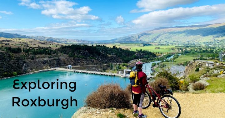
Nestled beside the magnificent Mount Benger range, the small sleepy township of Roxburgh sits in the heart of the stunning Teviot Valley in Central Otago.
Some of NZ’s largest and best summer fruits can be found here. They have been growing stone fruit here as early as the 1880s, starting off with a couple of wild cherry trees. Today there is an abundance of cherries, apricots, apples and peaches.
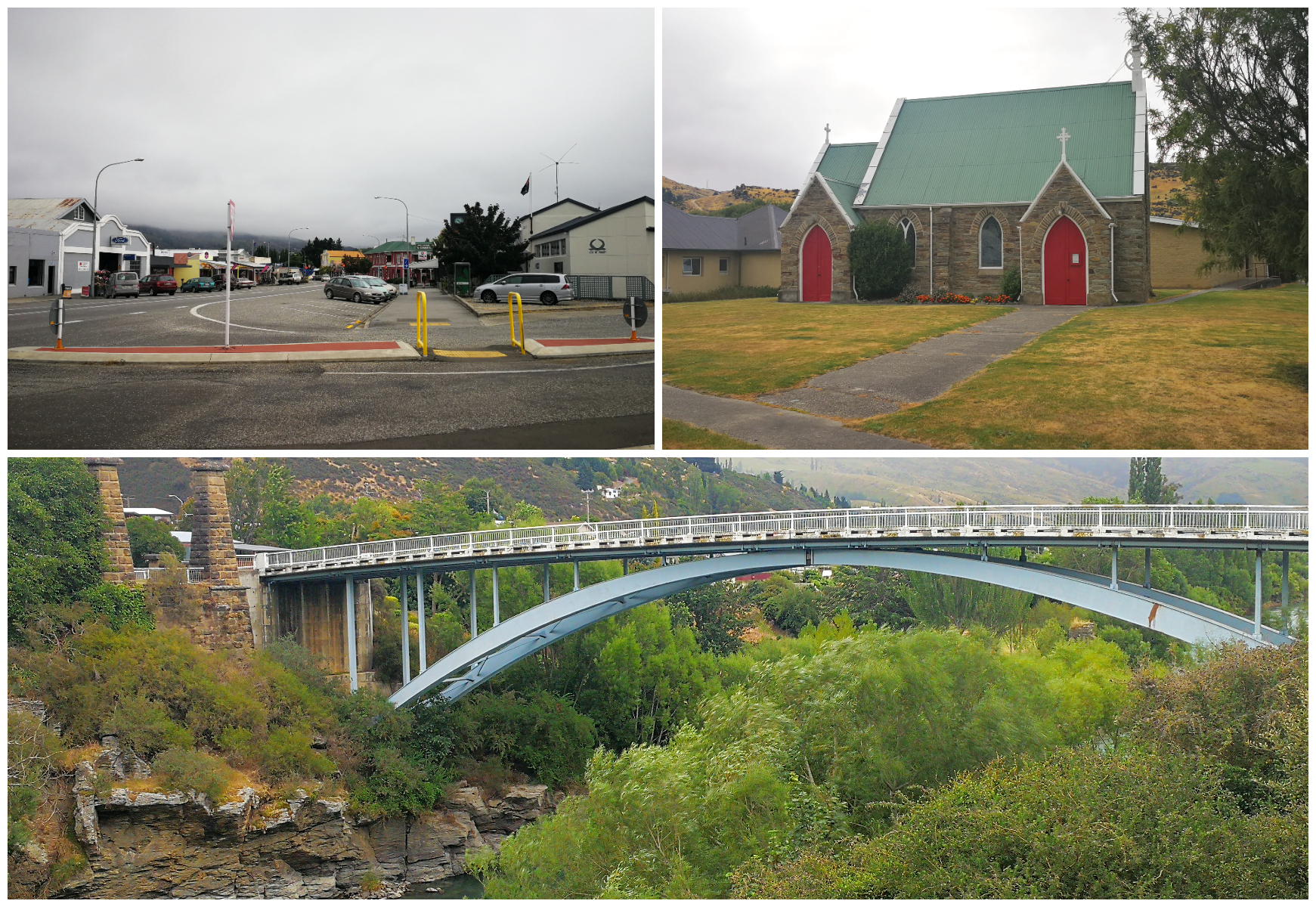
the newer Roxburgh Bridge stretches over the Clutha with glimpses of the old stone pillars of its predecessor
We had the privilege to visit and stay in Roxburgh earlier in the year. Our aim back then was to complete the Roxburgh Gorge Cycle Trail, on the back of cycling the Clutha Gold Trail but mother nature had other ideas. Actually, she had thwarted our efforts to do this trail on two occasions so now that summer is yet again approaching, we grabbed the opportunity to be able to knock off the trail (third time lucky).
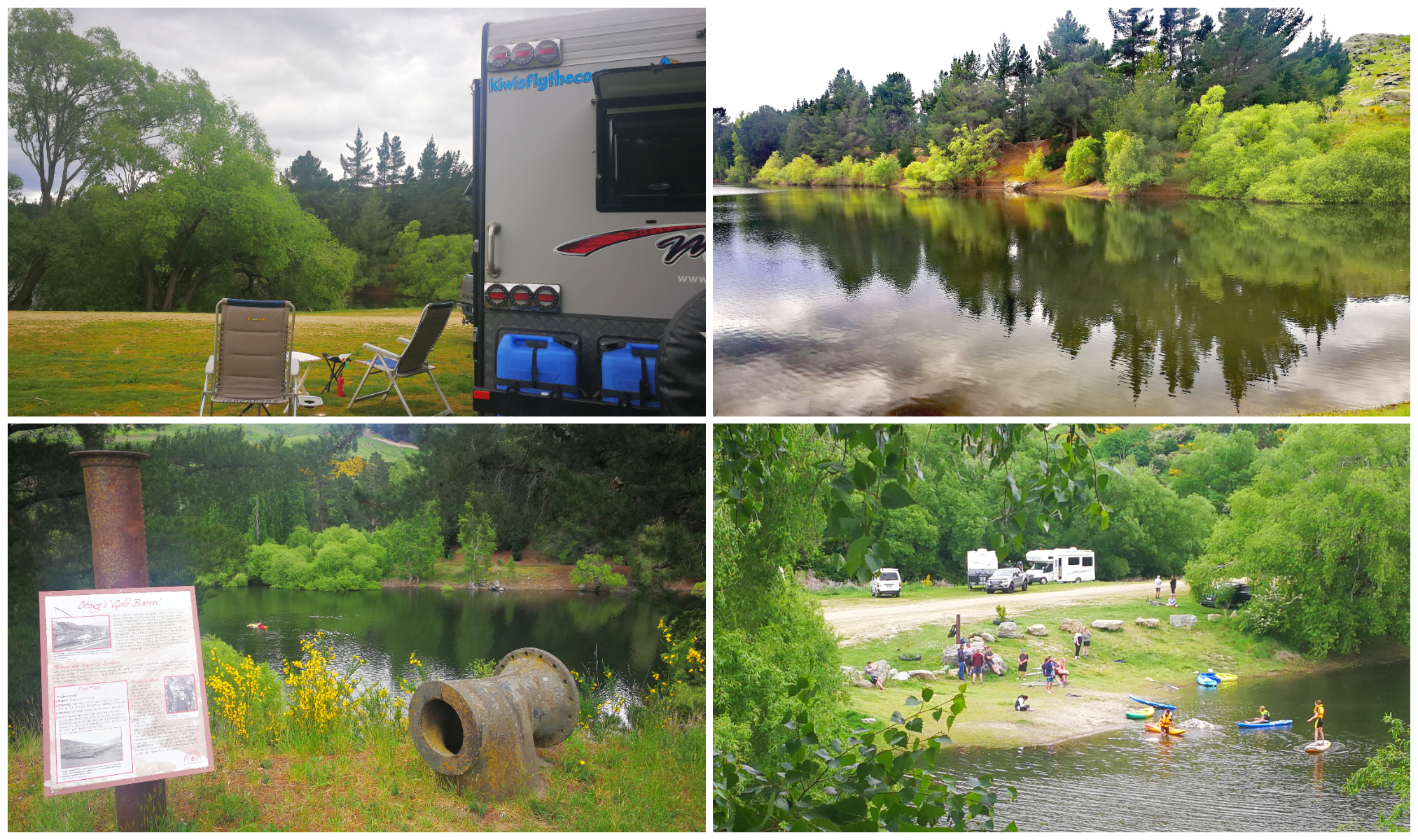
Pinders Pond
Located in the Teviot area (just a few km’s south of Roxburgh), you will find Pinders Pond.
We had cycled passed Pinders Pond while cycling the Clutha Gold Trail. I recalled saying to Scotty that I’d like to come back one day and spend some nights camped beside this beautiful, peaceful pond.
a beautiful, peaceful spot beside the pond
During the height of the summer and holiday time, it is not quite so peaceful. It can get very busy and crowded. It appears to be a popular overnight parking area for the workforce who come to the area to assist with the fruit harvesting.
As we are all aware, the overseas contingent of seasonal workers is missing (sadly). There will still, no doubt, be a number of workers arriving in their vehicles to park up in the late afternoon and depart early morning to start their working day.
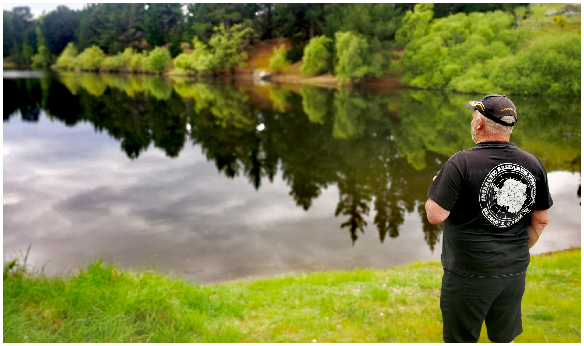
a beautiful, peaceful spot beside the pond
History
Pinders Pond has its own colourful history as it served as an old hydraulic elevation pond (dredge hole) during NZ’s early gold rush days.
Sadly most of the 1890s mining evidence in the Teviot district has now long gone. Gold Dredge numbers peaked at 30 from the present Roxburgh Dam to below Millers Flat. Pinders Pond is about the only major evidence left from the second gold rush period that is open to the public to visit.
A gentleman called John Ewing emigrated from Scotland to join in on the booming gold rush. He soon had large mining interests, which started at Gabriels Gully, here in Teviot and around St Bathans.
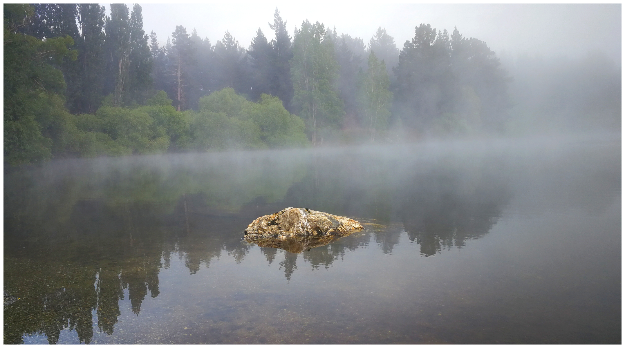
a very moody and misty morning on Pinders Pond
Roxburgh Gorge Cycle Trail
As mentioned earlier, we had returned to the Roxburgh area to complete the Roxburgh Gorge Cycle Trail. We had read and seen pictures of the trail and it was certainly something we wanted to complete.
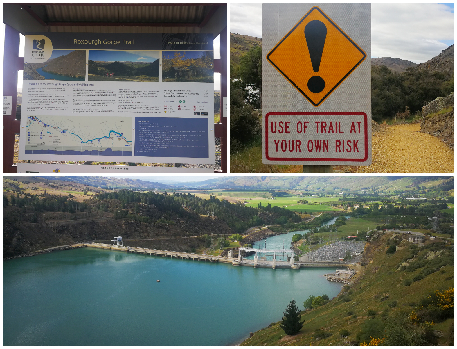
signage at the start of the trail points you in the right direction and the first climb up from the carpark offered spectacular views over the Roxburgh Dam
Two Sections to the Trail
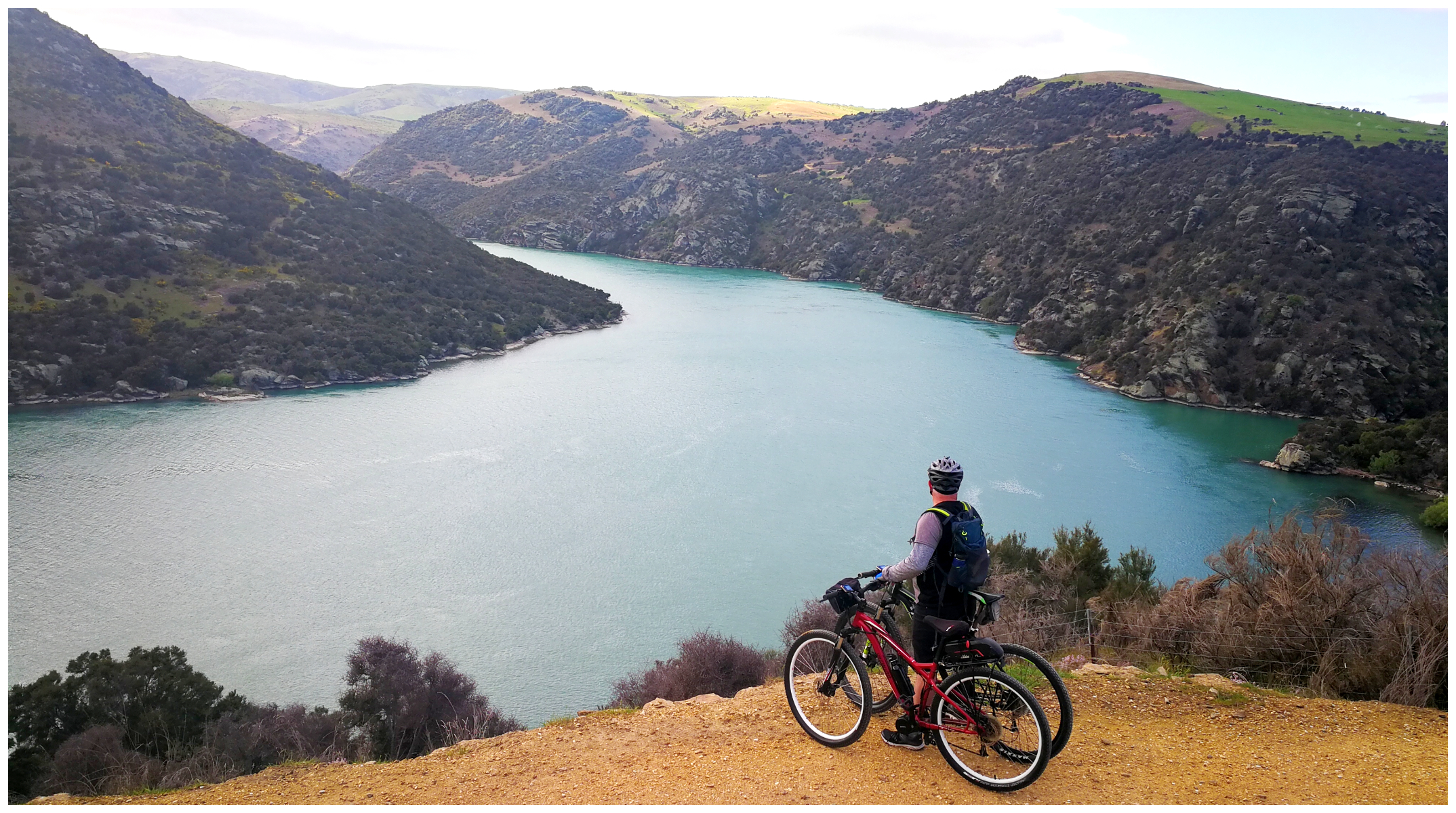
There are actually two parts to the Roxburgh Gorge Cycle Trail, separated by a jet boat ride between the two sections. We decided not to partake in the jetboat ride so we parked the ute at the top of the Roxburgh Dam, unloaded the bikes and set off to ride to Shingle Creek, and return. This section is 22 km return and the vistas are spectacular.
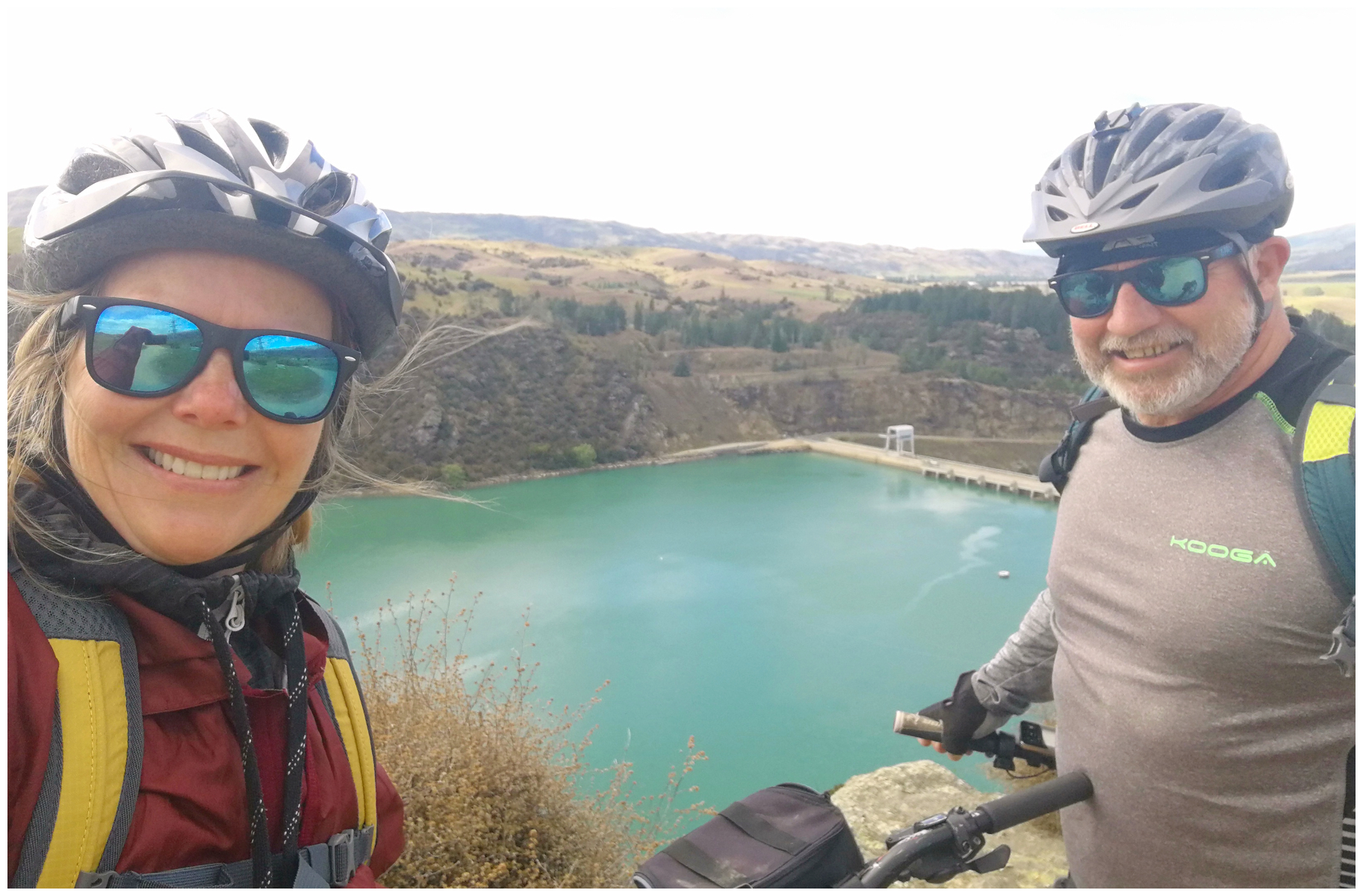
it certainly didn’t take long before our first photo op
The trail follows the Clutha River, past rugged, eroded rocky bluffs. The landscape is barren but beautiful and we were in awe of the effort that must have gone into creating this trail for so many to enjoy.
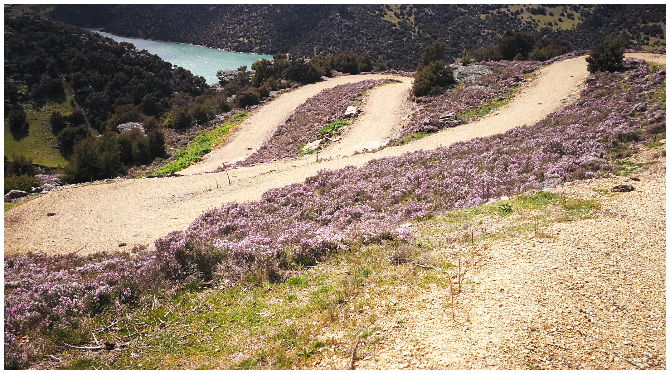
some parts of the trail has sharp switchbacks zigzagging its way down the hill
Yes, it would be fair to say that there is an amount of concentration required to negotiate some tight switchbacks and zigzags. There are some steep dropoffs that are unfenced so some care needs to be taken.
We chose to complete the trail earlier in the morning to avoid too many other cyclists so this makes it a bit easier when approaching some of the blind corners and the narrower parts of the trail. It is also a good idea to escape the hottest part of the day.
allow for plenty of photo stops along the way
Take Time to Smell the Thyme
Wild Thyme grows prolifically around some areas of Central Otago. When it comes into bloom it turns the rugged and rocky terrain into a sea of soft mauve like a thin purple-white haze. It covers the sun-baked earth looking a little like a woolly blanket.
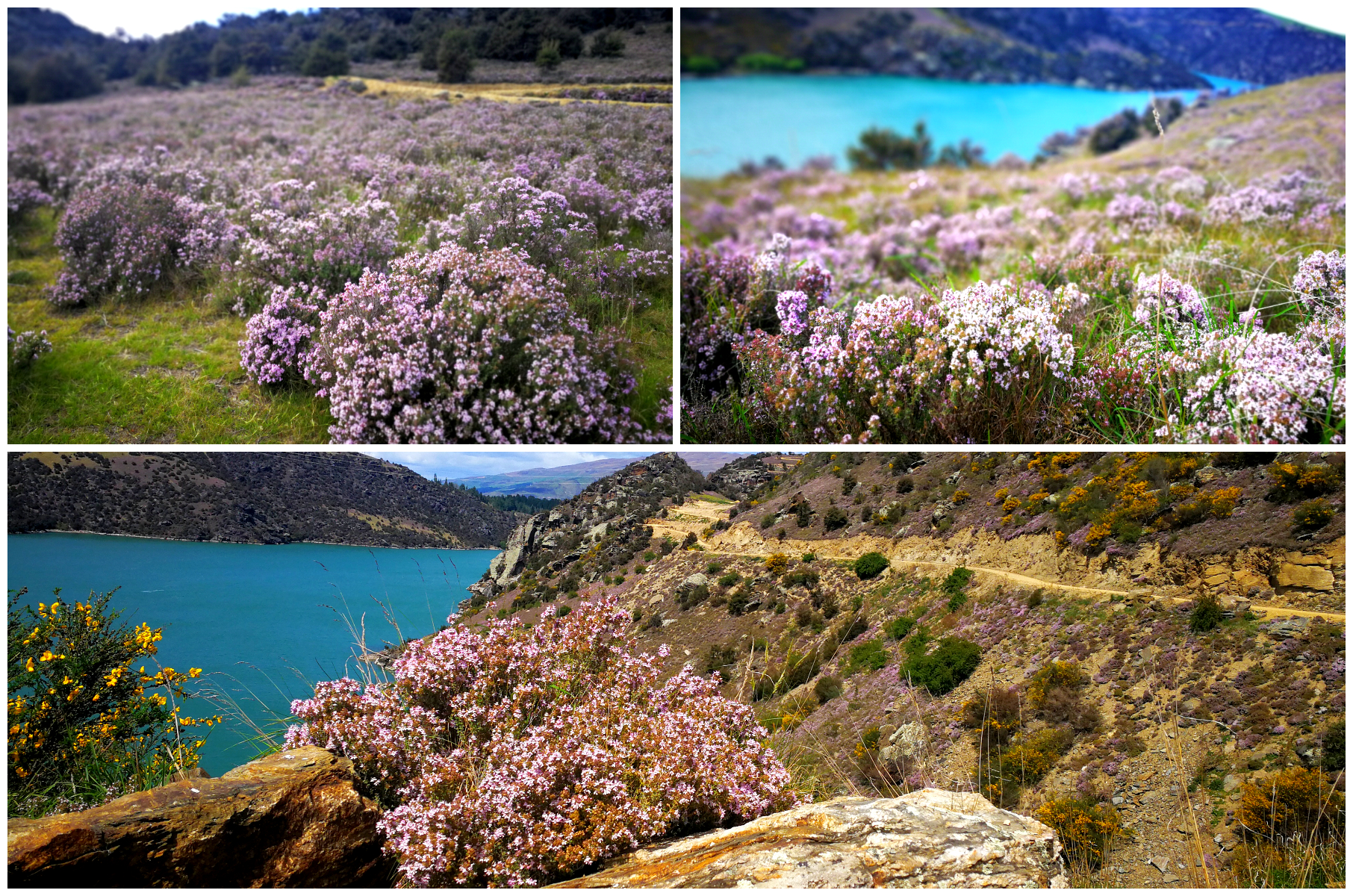
for some reason, I kept thinking of chicken and stuffing as I rode along through the wafts of Thyme
Shingle Creek
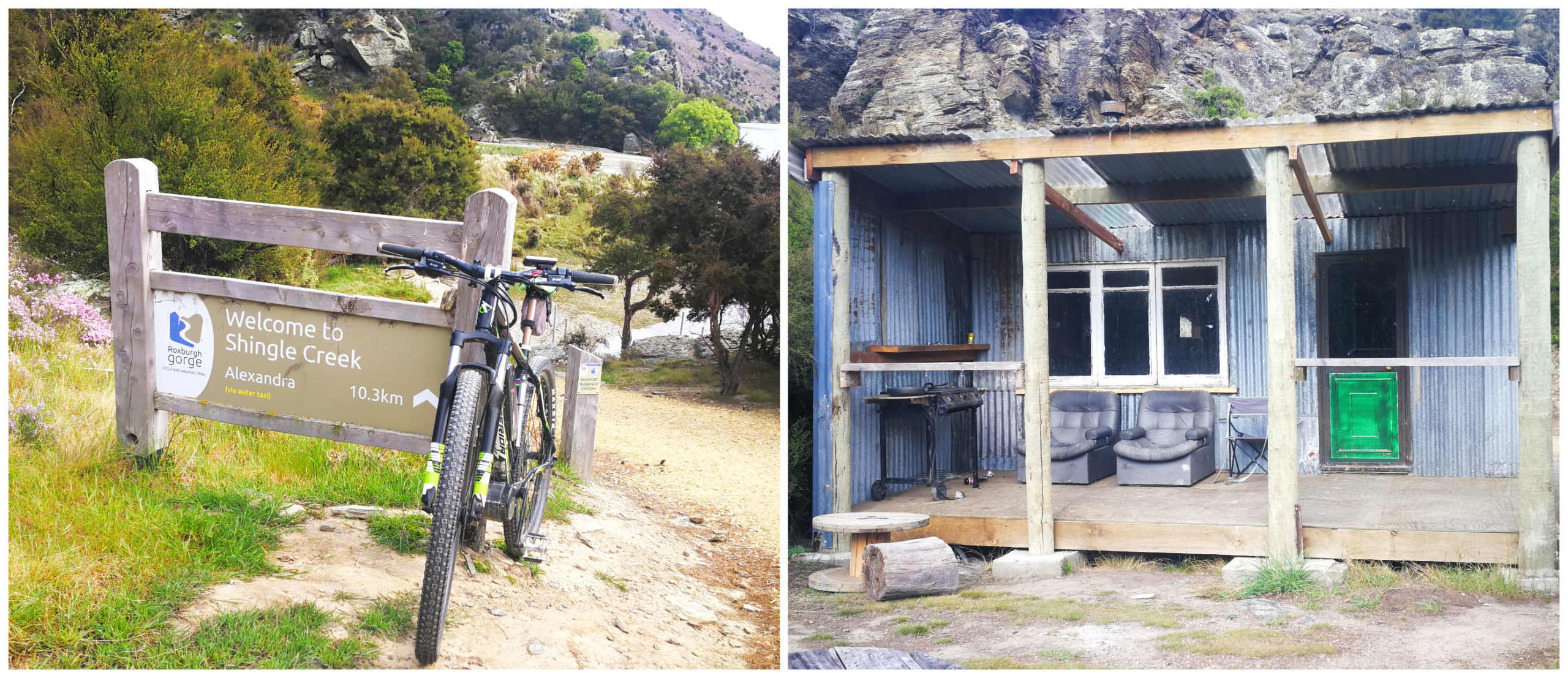
the end of the trail from the Roxburgh at Shingle Creek, and someone’s holiday crib perched on the rocks overlooking the Clutha
If you would like to see more of the Roxburgh Gorge Trail, click on the link below to see a video of our highlights.
Old Man Range and the Obelisk
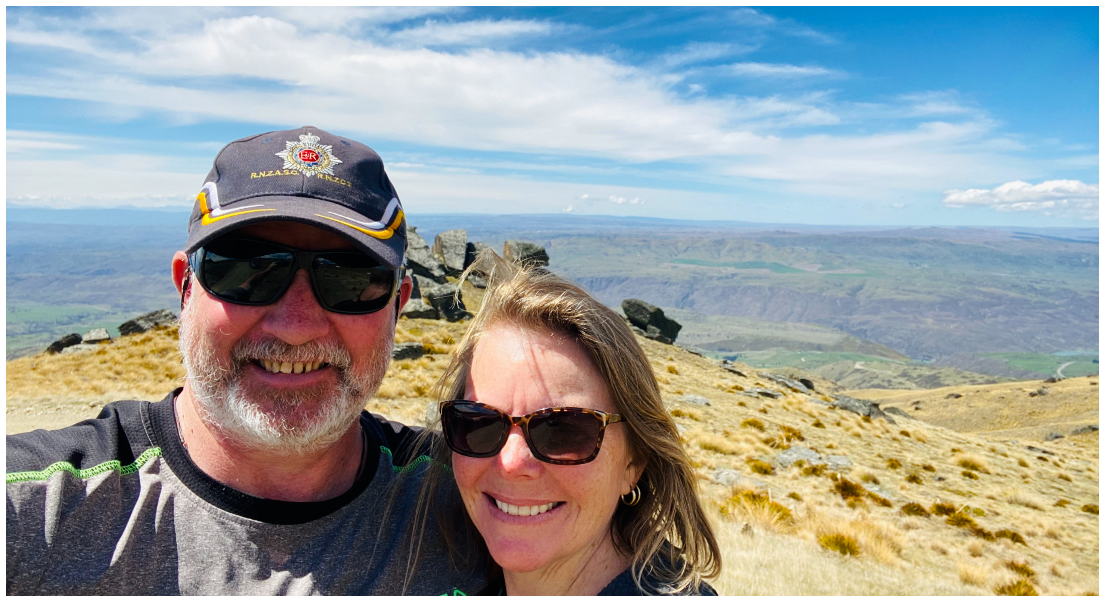
Located between Roxburgh and Alexandra are a couple of access roads which will take you up and along the Old Man Range to the Obelisk, which apparently, has nothing higher between it and the South Pole. At 1,682 m (5,534ft) above sea level, it felt like we on top of the world. Where the views are as big as the sky.
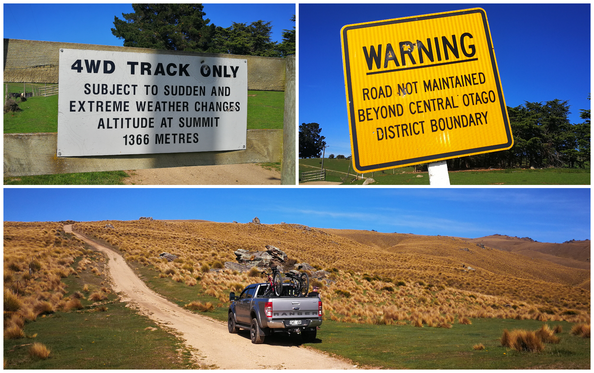
Well, we had plenty of warning at the start of the track
This is certainly a trip that is not to be taken during winter and be careful of the spring thaw as the tracks can become very wet, boggy and slippery.
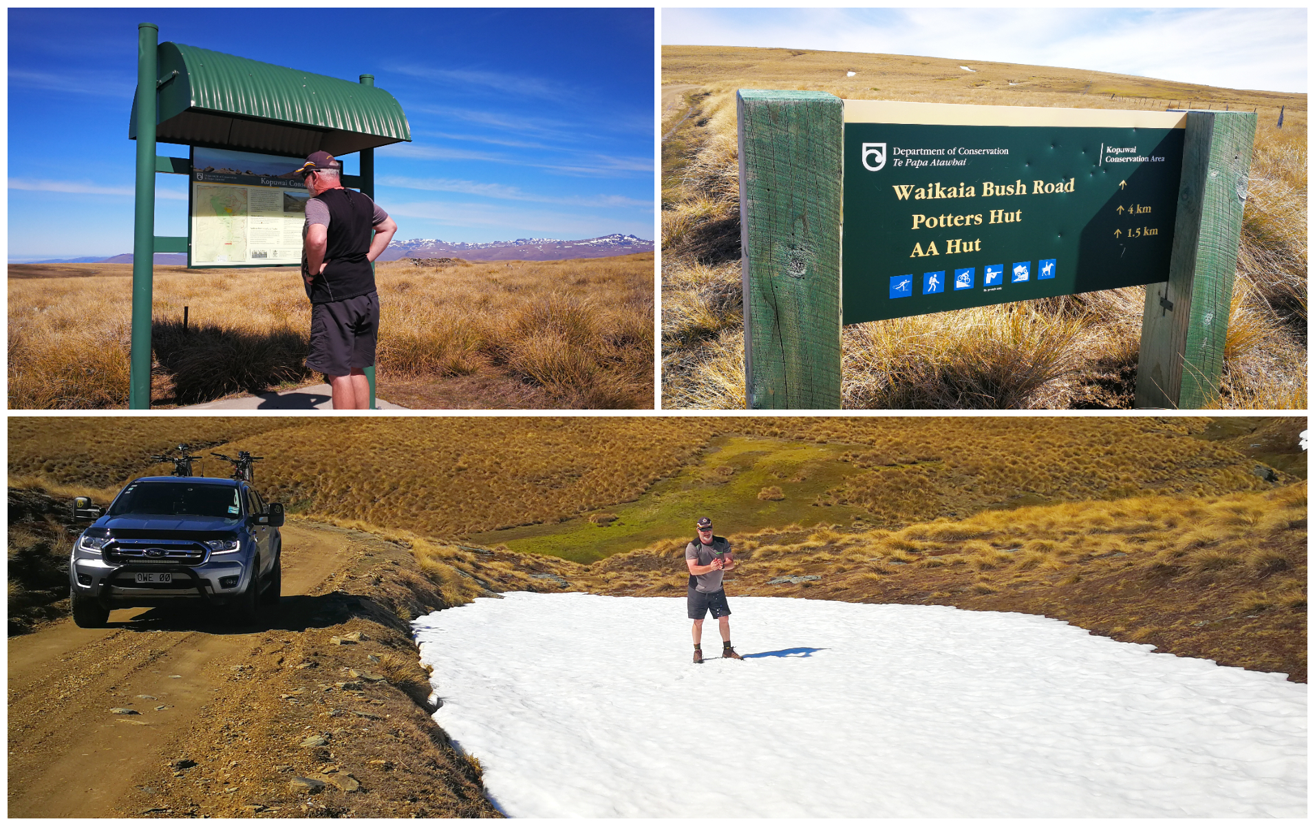
the road up to the start of the conservation area was smooth going, even stopped to play in the melting spring snow!
We decided to tackle it in a loop, turning off the main highway onto Waikaia Bush Road. It is only about 16km but it took us just over an hour to negotiate the track to the top.
we started to negotiate a few more ruts and bogs but the landscape was changing into something quite spectacular!
Do you require a 4WD vehicle? That would be a yes. The first part of the track is relatively easy and you will still get some pretty amazing views. Once you enter the Kopuwai Conservation Area, that is when it starts to get a little more challenging. There are some deep ruts and steep inclines.
The rain hadn’t fallen for a few days and there were still some boggy parts so I can imagine how much worse it could get with even one day of rain.
Landscape
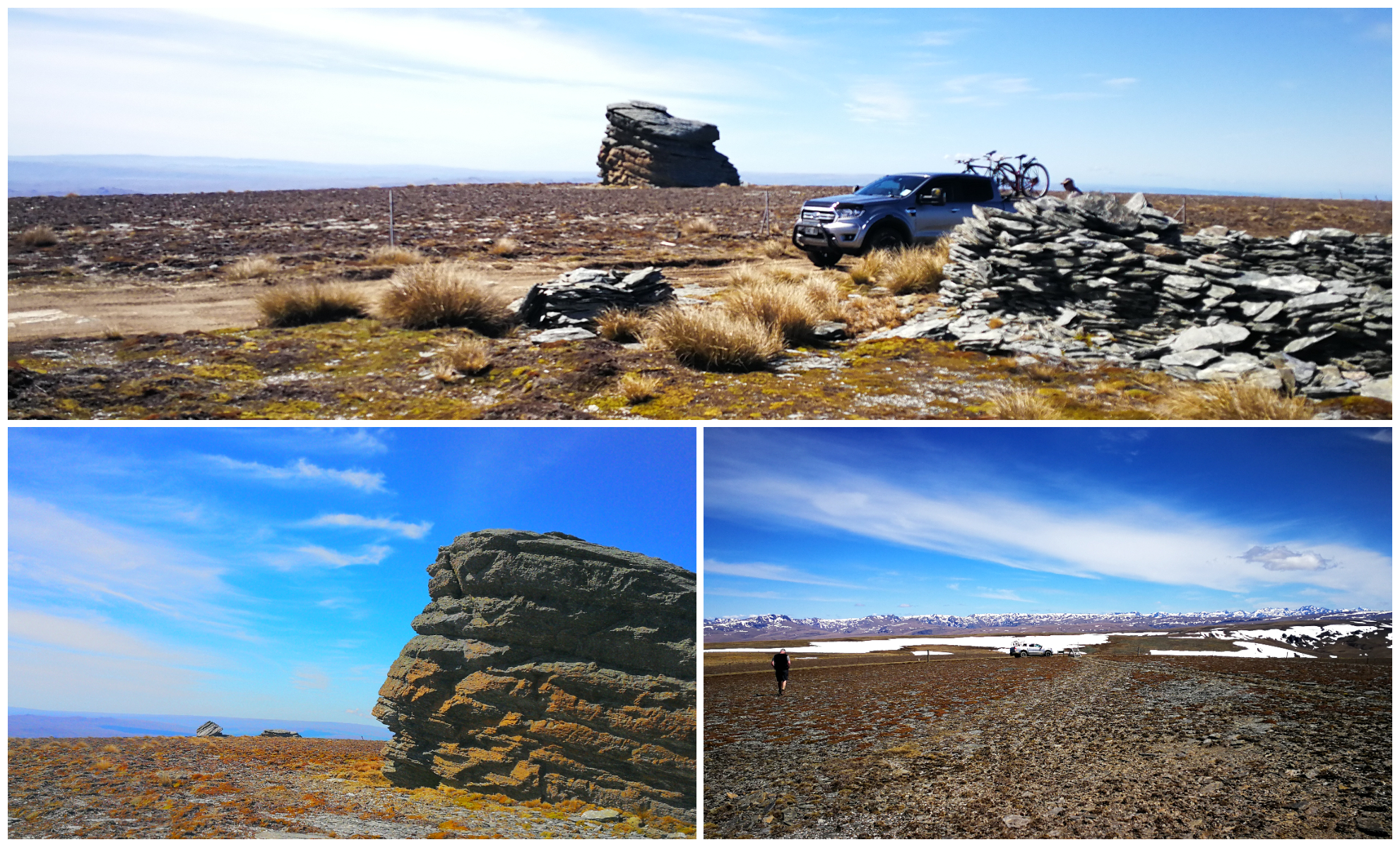
The Old Man Range is dotted with very distinctive and indiscriminately placed schist rock tors that seem to have been put in place and strategically stacked by some sort of superhuman of the past.
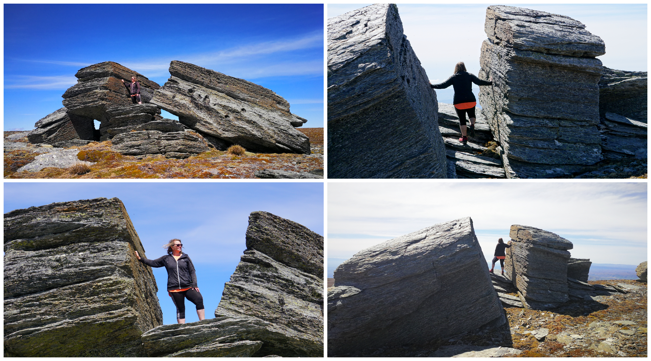
hard to believe mother nature could split this rock like a hot knife through butter
The rolling angles of the slopes and basins create a wave-like effect. The colours of the tussocks and moss created a tapestry of colour in contrast to the melting pockets of snow still clinging on in the deeper ruts and gullies.
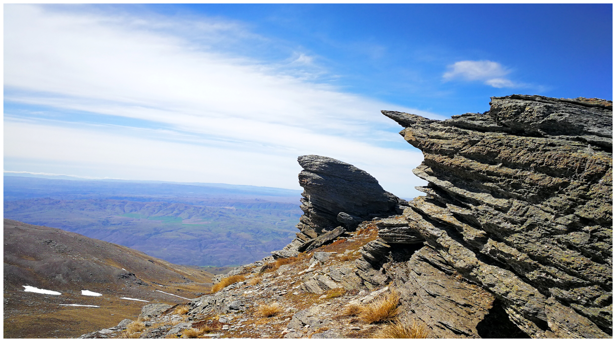
Hyde Rock overhanging a deep gully offers our first glimpse across Central Otago
Hyde Rock is a short walk over a stile offers some spectacular views.
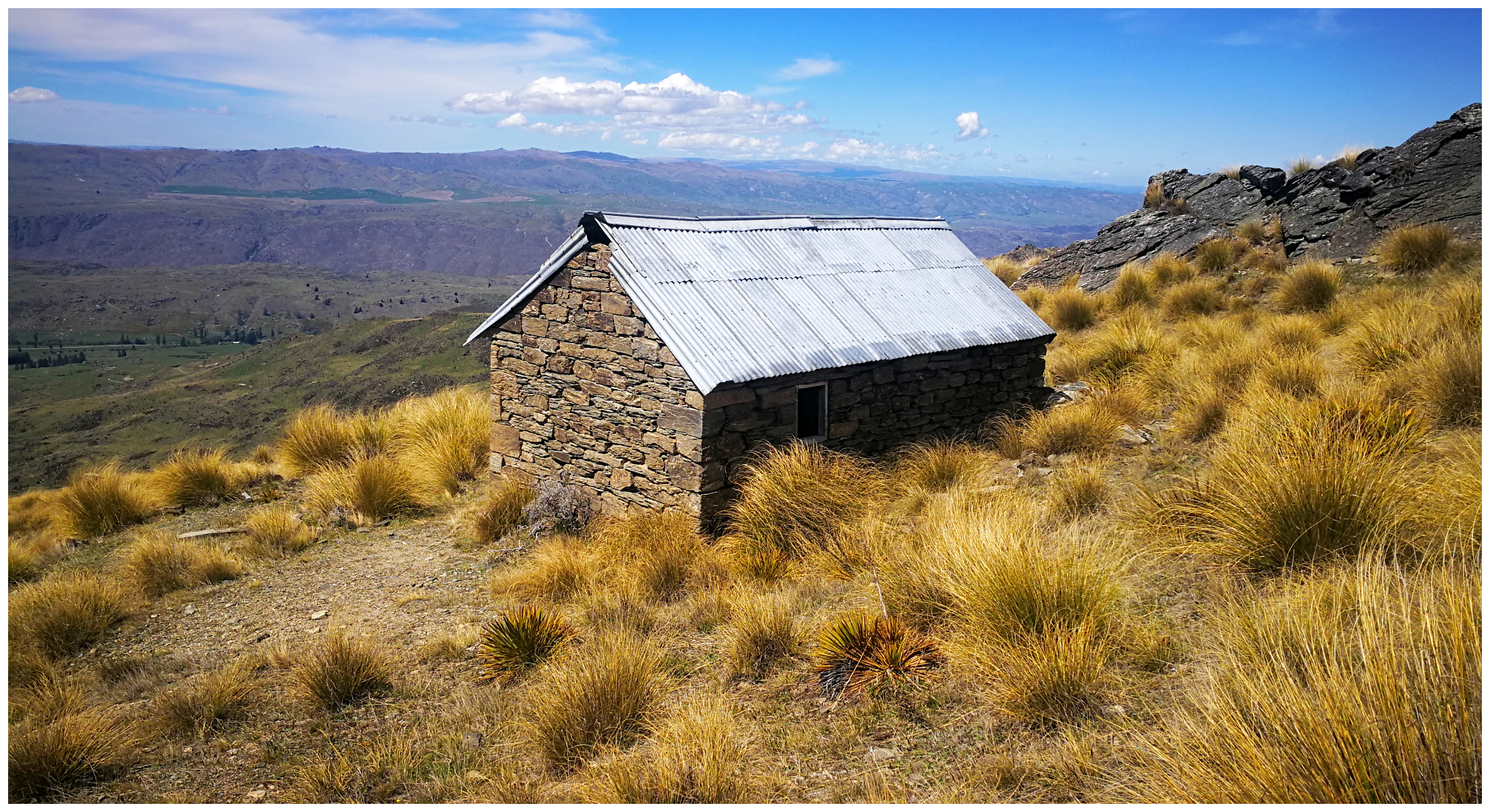
The Kopuwai Conservation Area stretches for some 25,000 hectares and offers a playground for mountain biking, horse riding, 4WD fanatics and cross-country skiing in the winter months. There are also a number of huts dotted around the reserve to offer shelter to those who enjoy the surrounding countryside.
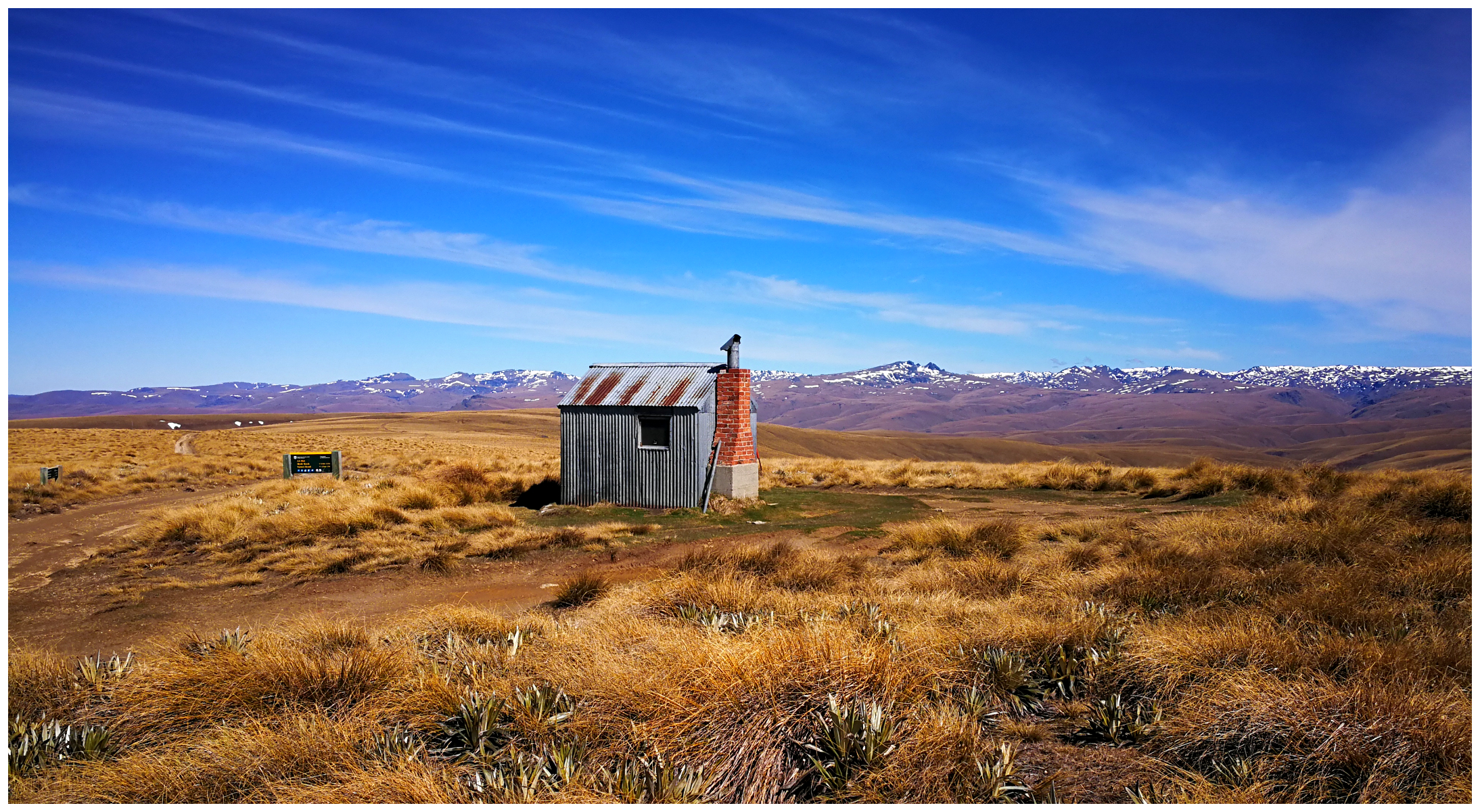
the old high country hut provides shelter for the hiker, biker, hunter or skier
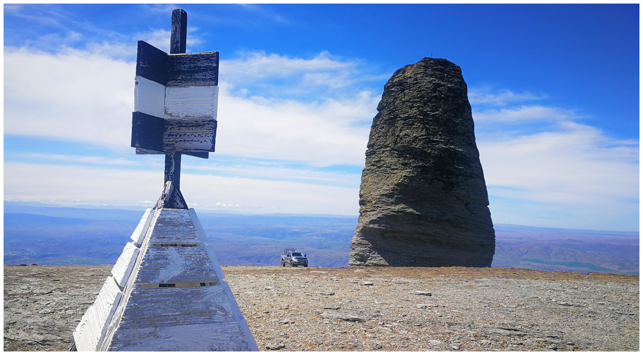
The Obelisk
Sitting right at the top of the range we spotted the 26m tall rock tor known as The Obelisk (or Kopuwai/Old Man Rock). It stands tall, if not on a slight lean, which makes it look like it could topple at any moment.
the impressive 26m tall tor they call The Obelisk dwarfs our ute parked at the base
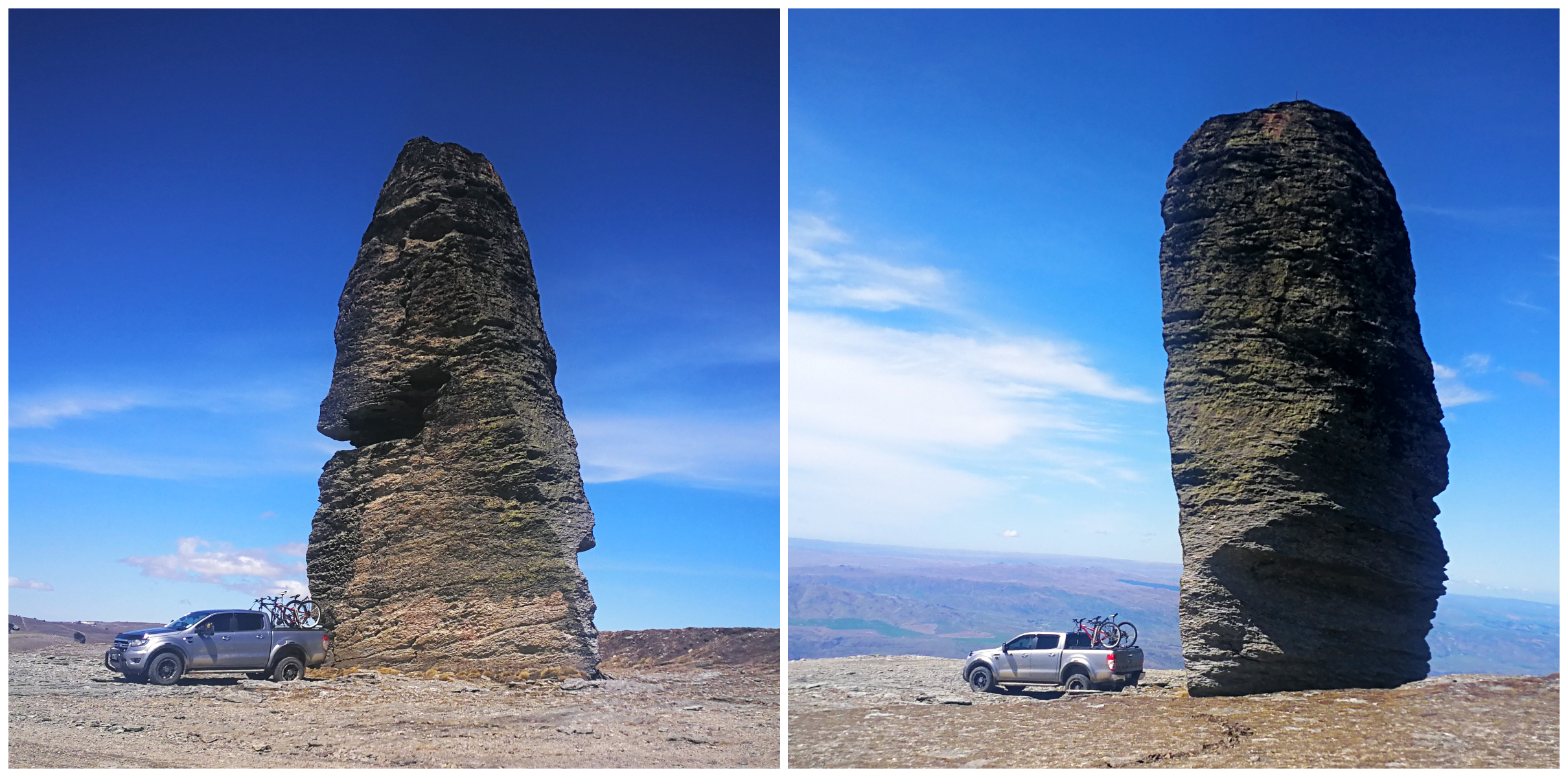
no matter what angle you looked at it, it seems like it was about to topple at any moment!
Standing beside it is a tall TV Tower which was quite the contrast between a natural and a man-made structure. I know which I would prefer to gaze at.
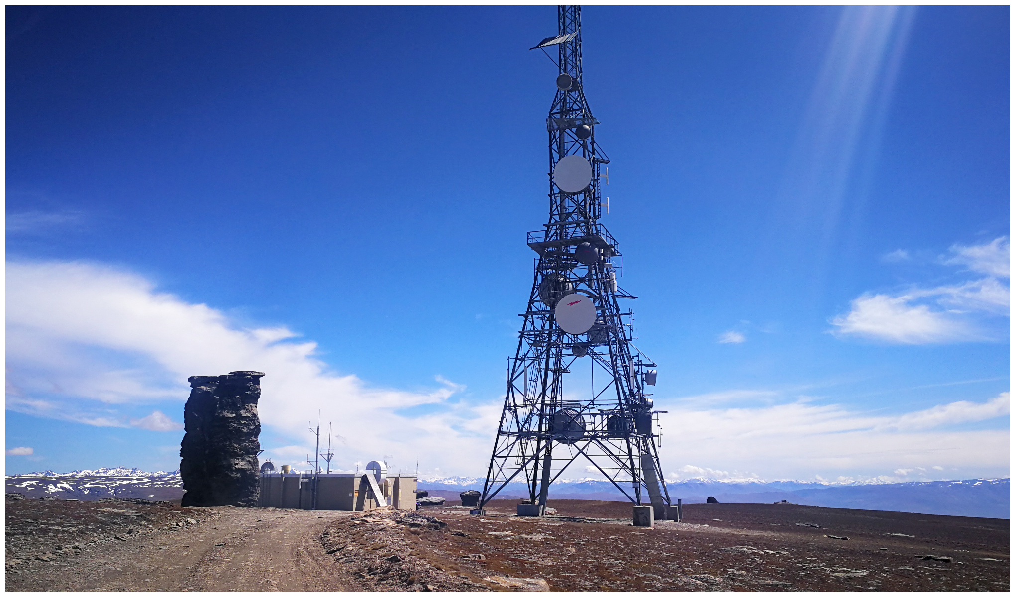
nature vs man-made, I know which I’d prefer
The views could only be described as ‘MASSIVE’. We could clearly make out Alexander and Clyde nestled amongst the lower-lying hills below us. The Roxburgh Gorge cutting its way through the rocky outcrops towards the Roxburgh Township was also clearly defined.
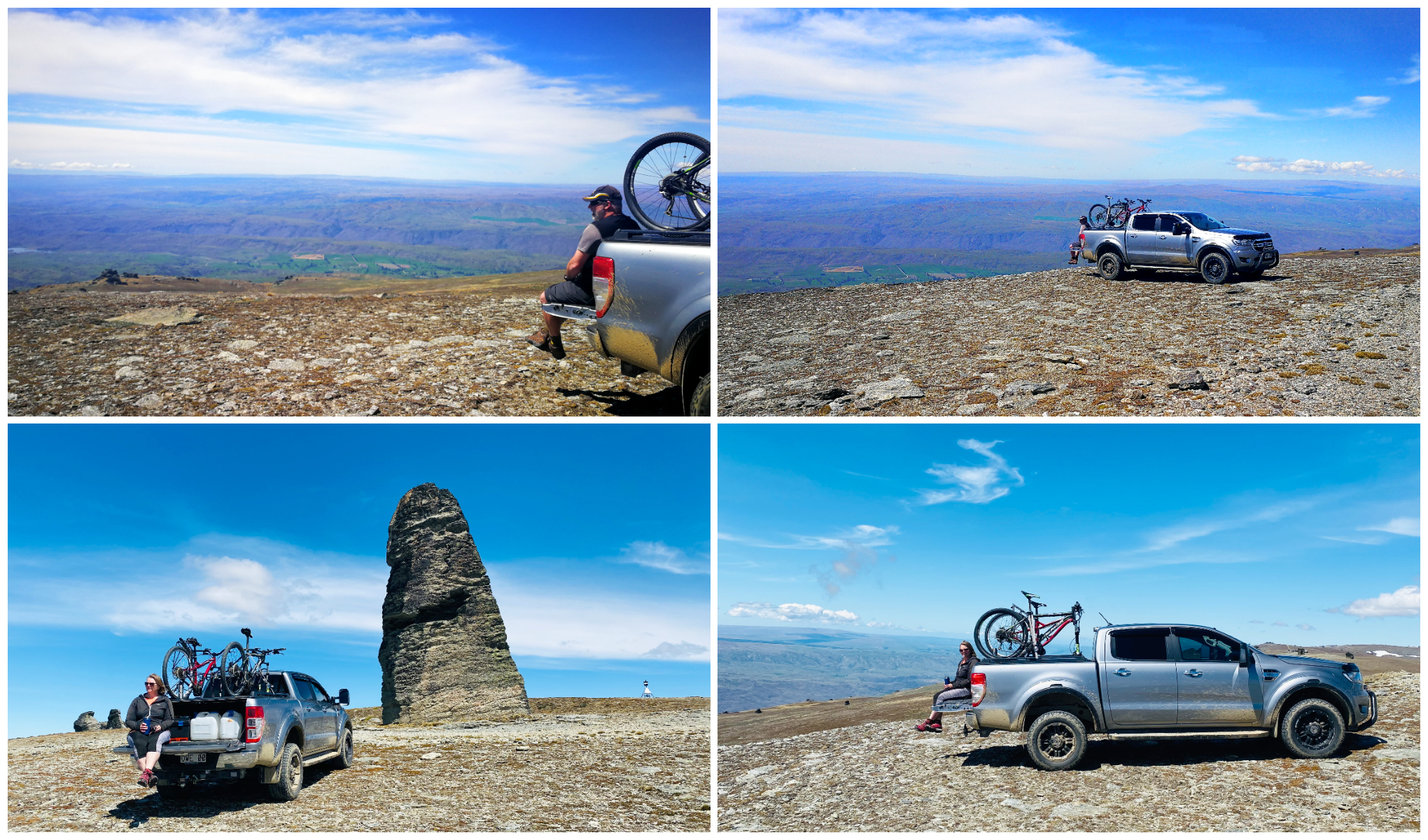
it certainly was an impressive ‘tailgate lunch’ stop!
Those who are followers of our blogs know that we like a good ‘tailgate’ picnic. With the ute backed up to the edge of the ridgeline made it the perfect place to sip some coffee and consume our picnic lunch.

yup, a pretty impressive spot for sure!
The Route Down
As mentioned earlier, we wanted to take a different route down and took the more direct road back to SH8. Symes Road is probably the more popular access to The Obelisk being only 9km in distance. It is undoubtedly the smoother track but it is steeper in places. I’d call it short and sharp. It seemed to have been recently graded which would account for the less bone-shaking trip than the one up.
our trip back down on Symes Rd offered even more spectacular views
Evidence of the old gold mining activities in the area came into sight as we dropped down closer to the main highway.
there is a climb over a ravine to get to White’s Cottage nestled amongst the tussocks
We stopped for a short walk to Whites Hut which sits among tussock and old tailings. Clear evidence of the mining that went on in Whites Reef in the 1880s.
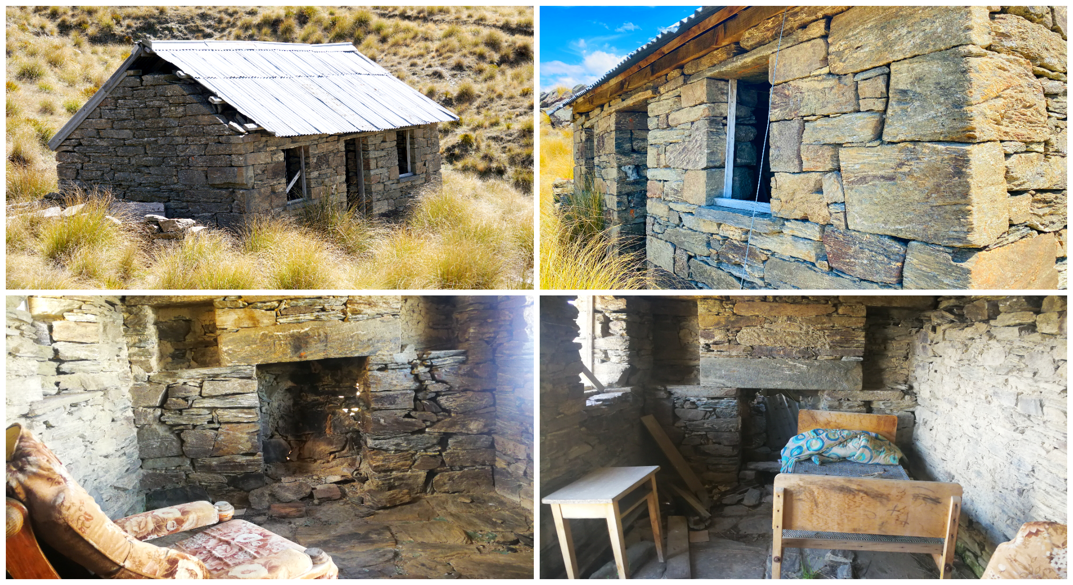
the exterior and interior has undergone some restoration work to ensure its longevity
Mitchell’s Cottage
Only 1km from the end of Symes Road sits Mitchell’s Cottage. It would have to one of the best examples of Central Otago stonework.
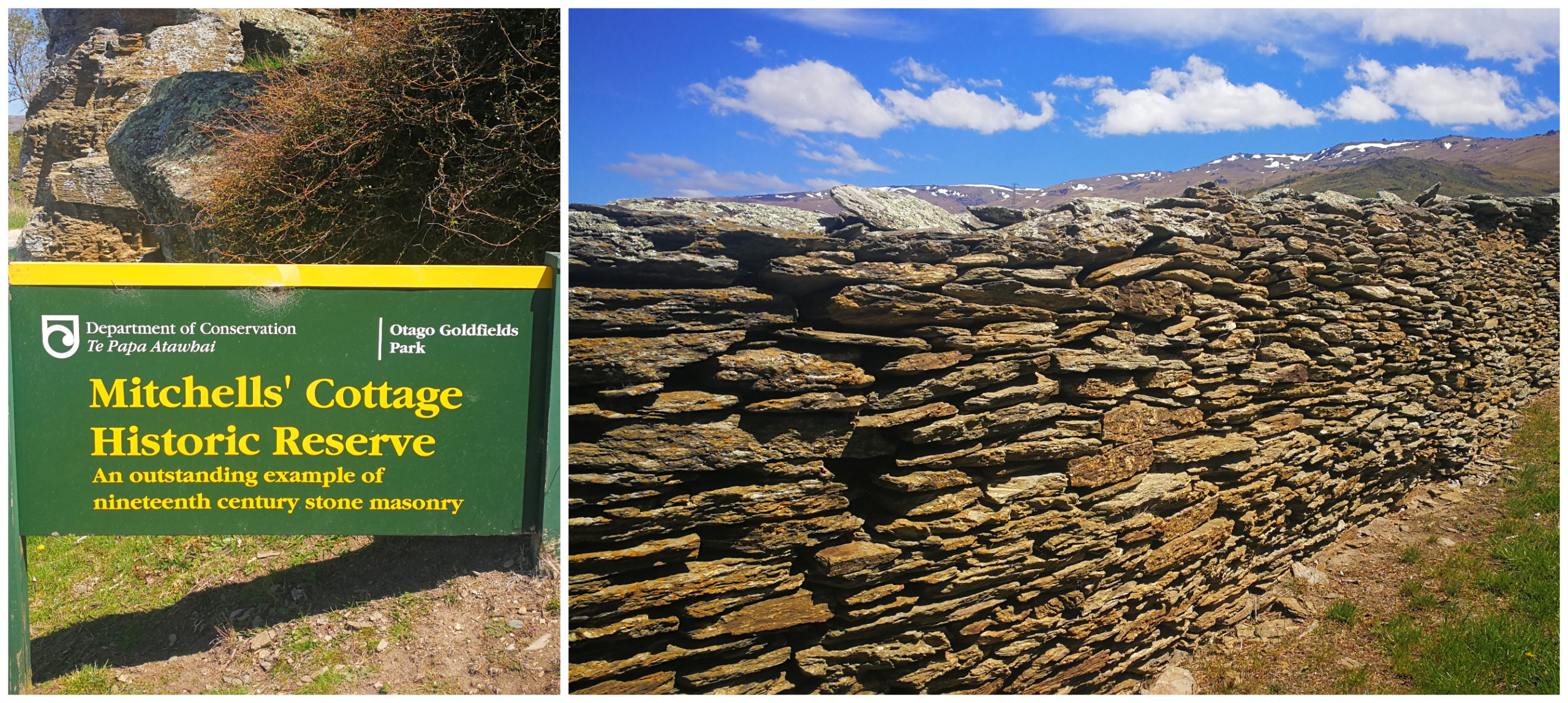
the stone wall is the first indication of how talented the Mitchell brothers were
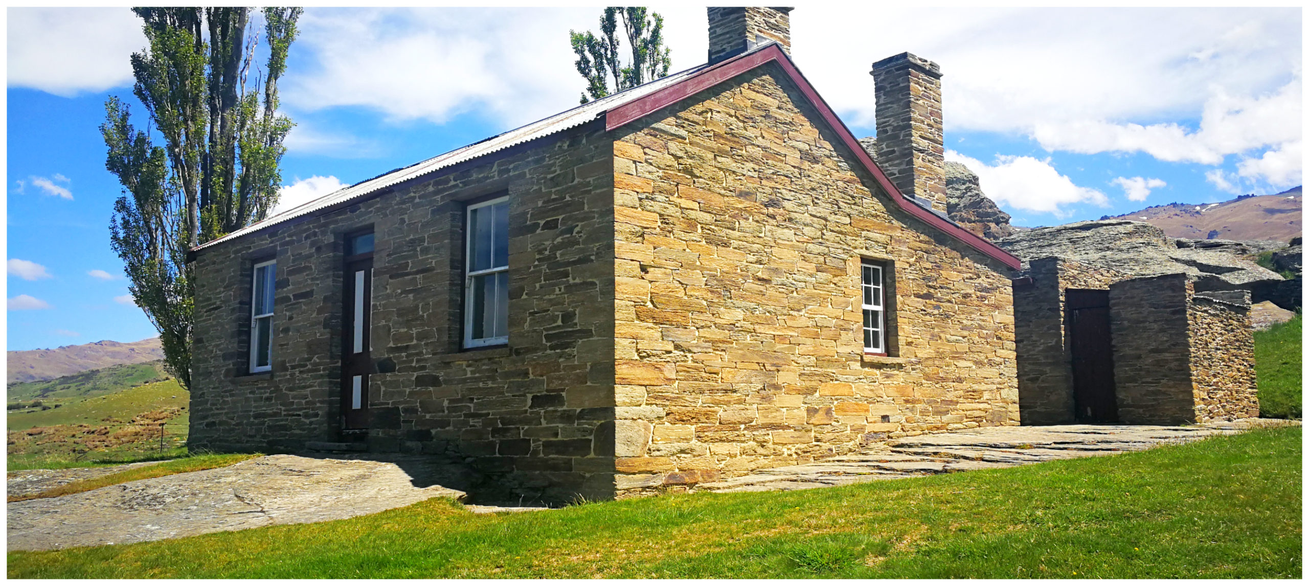
The Mitchell brothers left the Shetland Islands and arrived in NZ in the 1860s. They deciding to settle in the area known as Obelisk Creek in the 1880s. They started the very long project of building the cottage, finally finishing it in 1904. It housed John and his wife Jessie and their 10 children.
hard to imagine 10 kids could fit into this small cottage
The cottage was purchased in 1980 as a reserve and painstakingly restored. It consists of 5 rooms, including a kitchen and scullery. The outbuildings still house the old copper and fireplace. This room must have seen many washing and bath days. Especially with all those children!
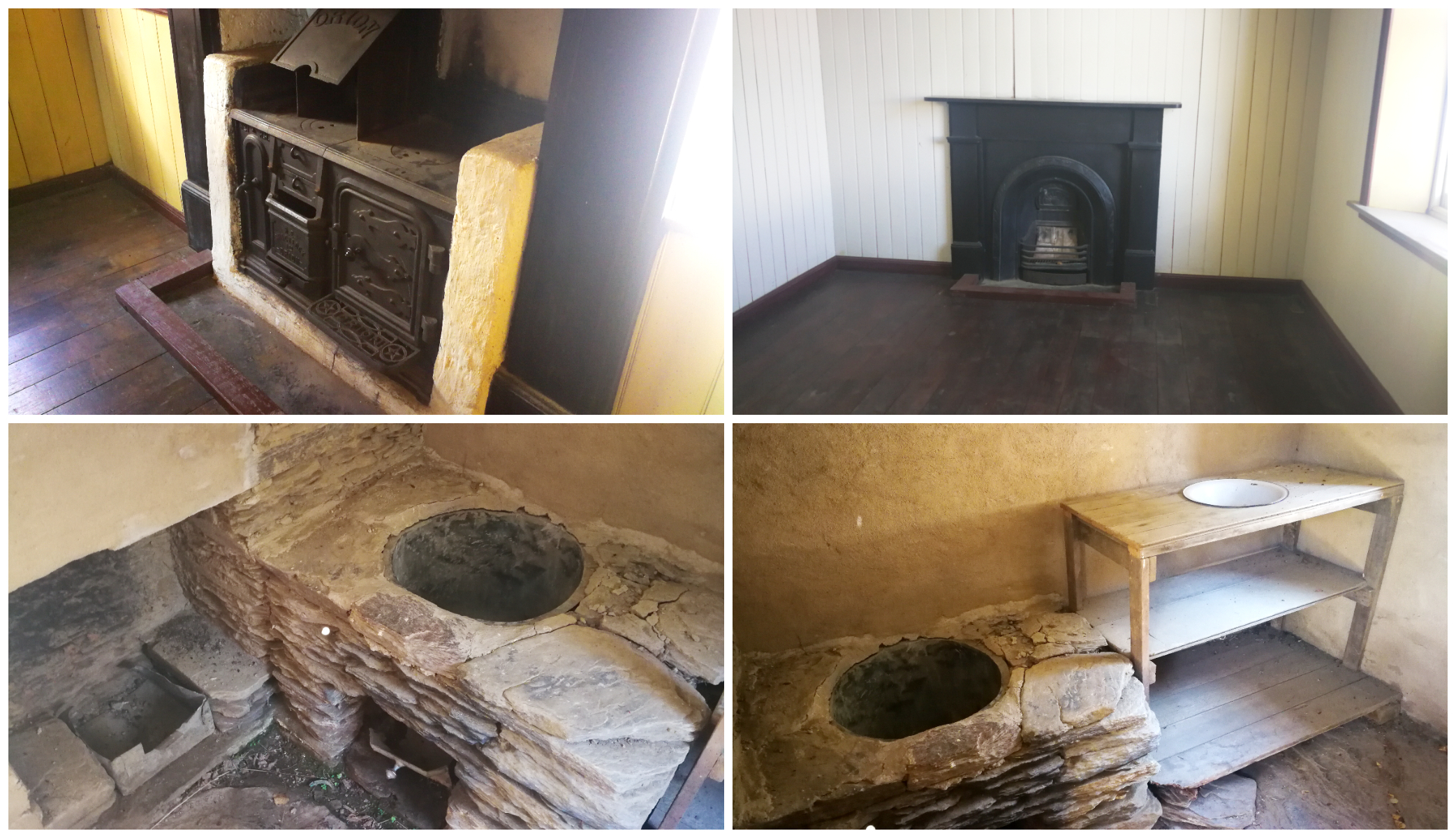
it’s free to wander around the inside of the cottage and the outbuildings – oh and it’s not the toilet, but the old copper used for the washing!
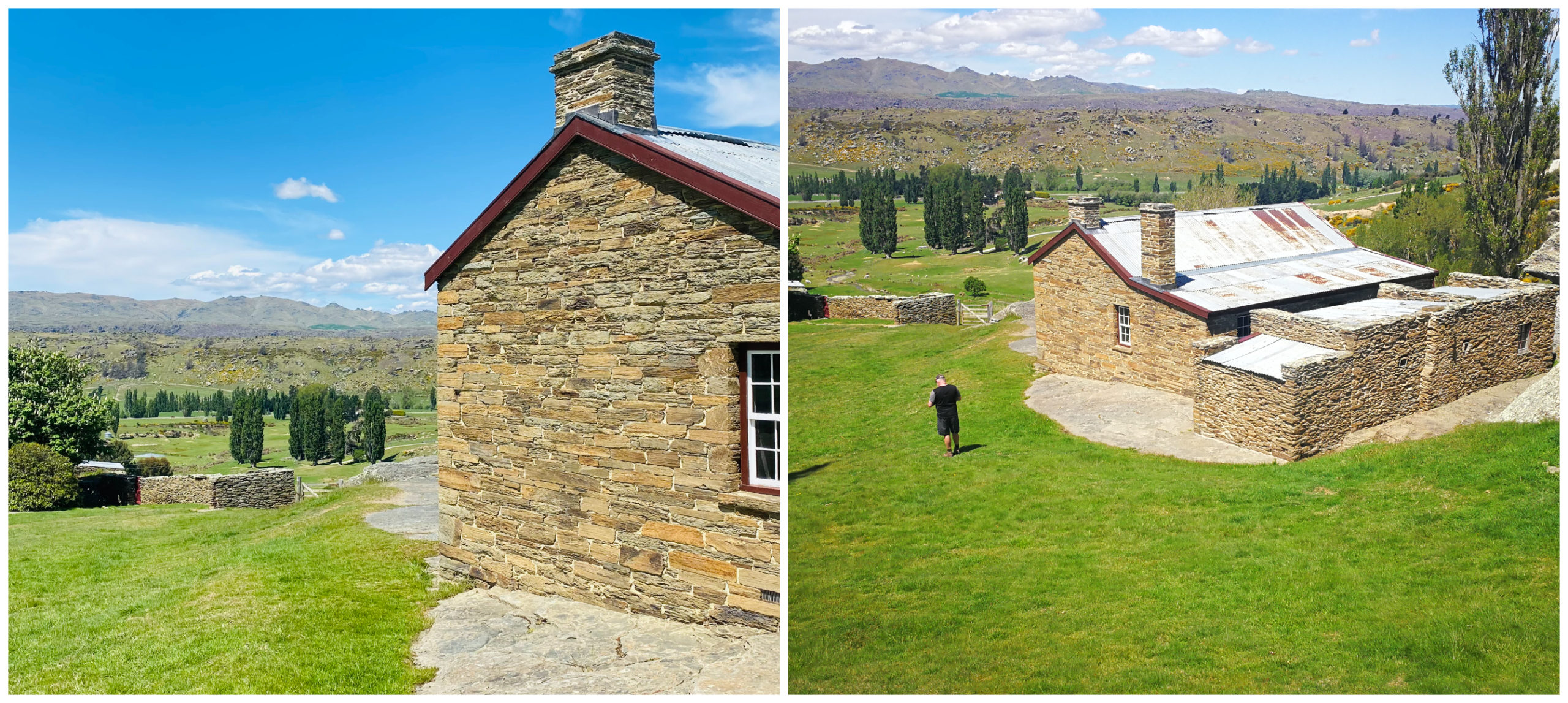
built facing the beautiful view, the cottage has been restored so it can stand the test of time
Click on the link below for a video of our highlights on our trip to the Obelisk.
Roxburgh Summary
It was time to leave Pinders Pond and make our way to Alexandra to set up our next basecamp. More to come in my next blog.
Wow how very cool and thank you I am from Roxburgh-Ettrick and have not made it to the Obelisk yet but I’m gana now
Oh thank you for your feedback. You’ll love exploring the Obelisk! Enjoy.
Wow, amazing, thanks great reading about your adventures. Cycle track with those views stunning, however, would definitely be investing in a e bike before attempting that one. And then the Obelisk! Can you cycle into that though not sure how suitable the road is, you mention sharp drop offs which could be scary if meeting a vehicle.
Thanks Gill. Many do cycle the Obelisk but I don’t think that I would recommend it for the inexperienced. The downhill run would challenge even the most bravest of cyclists!