After spending the Christmas and New Year with family in Invercargill, it was time to hit the road again and Tuapeka Mouth was in our sights.
Click here to read about our stay in Riverton pre-Christmas.
Where is Tuapeka Mouth!
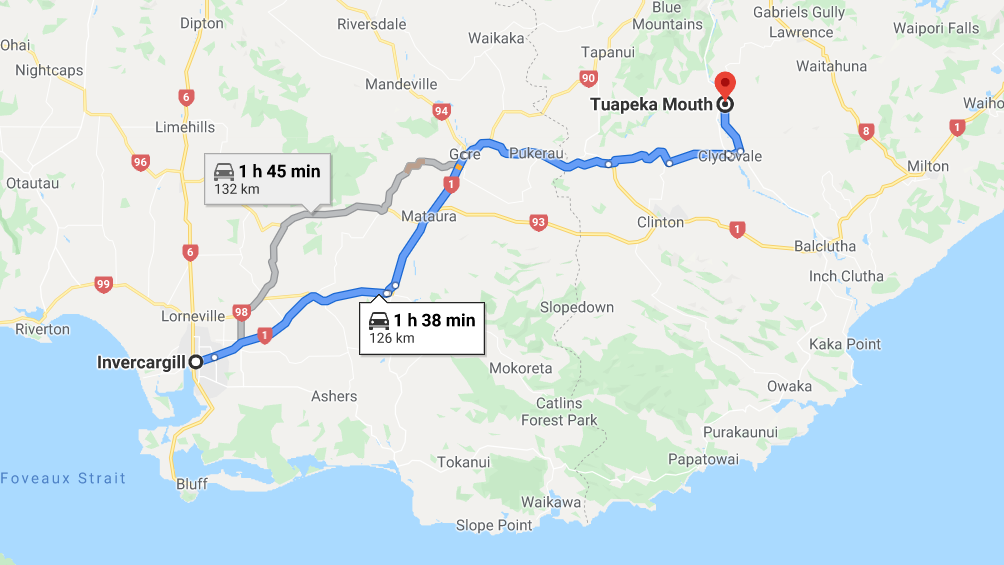
Located about 126km north of Invercargill is the Tuapeka Mouth. It is 33km upriver from Balclutha. This is not to be confused with Tuapeka West. So if you are putting the location into Goggle, make sure you put in “Tuapeka Mouth”.
finding our way to Tuapeka Mouth
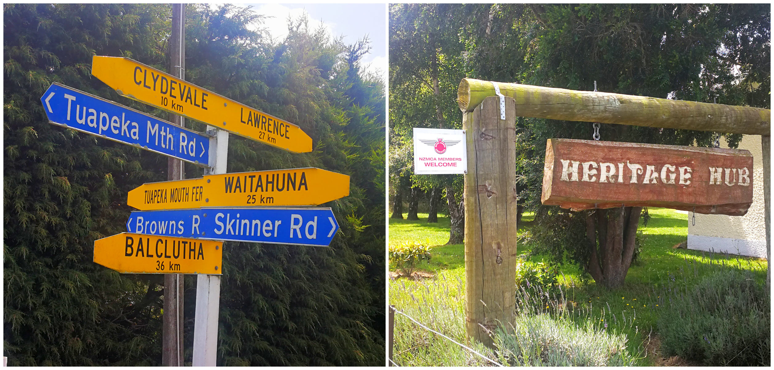
Keep an eye out for signage to find your way
Tuapeka Heritage Hub
The Heritage Hub (NZMCA#8914) was to be our basecamp for the next 3 nights.
In 2013, the Clutha Valley Tuapeka Heritage Trust purchased the former Tuapeka Mouth Presbyterian Church (built 1909) and its grounds and spent 3 months carrying out a massive cleanup. A makeover turned the neglected property into what they can proudly call The Tuapeka Heritage Hub.
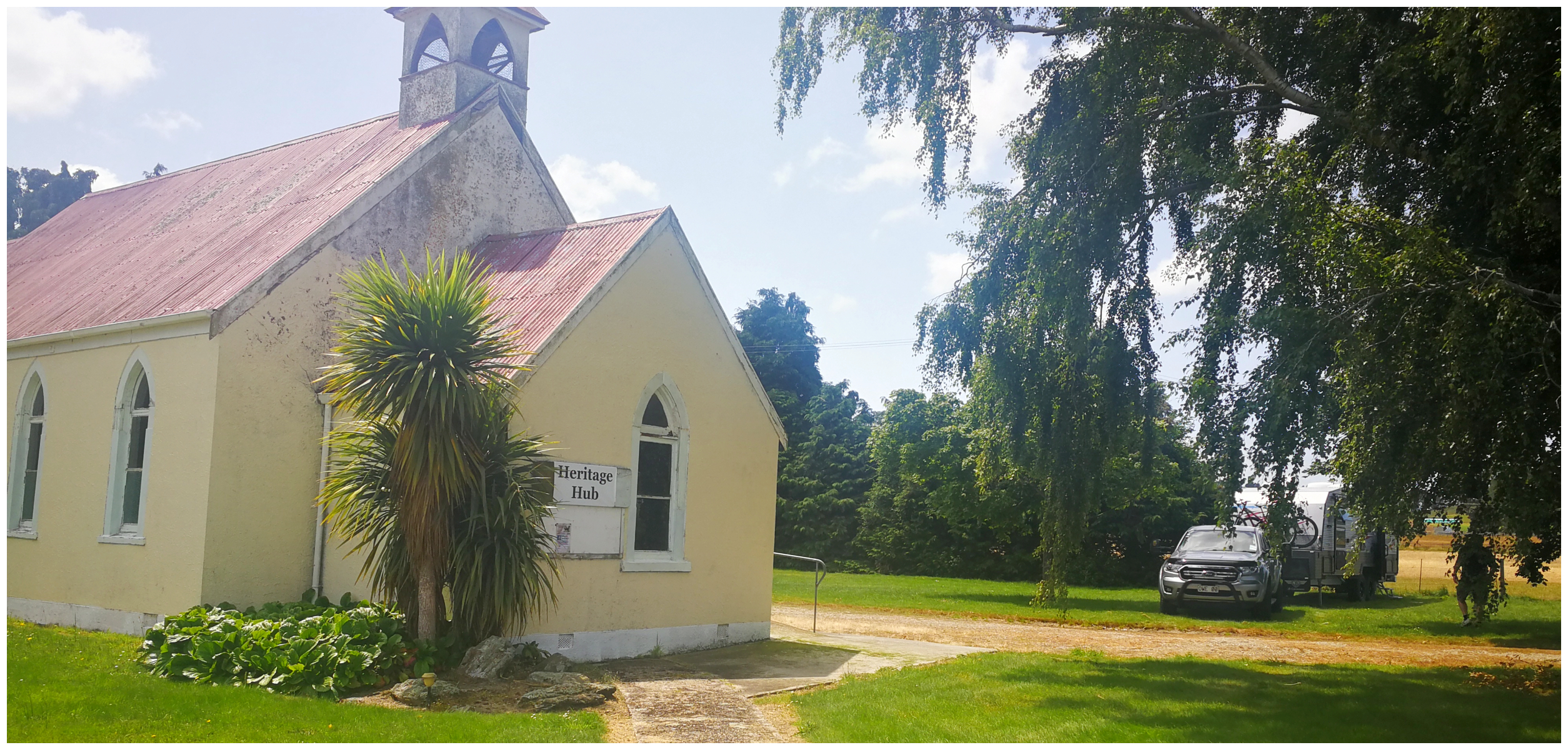
Plenty of flat ground surrounding the 1909 church
There is plenty of flat ground around the buildings and so it was a ‘no-brainer’ to turn it into a camping area and invited NZMCA and members of the public to come to stay and enjoy the local attractions.
At $5 per night per person (max of $10), the old church has an extensive library (for swap/purchase books), table tennis and pool table, darts, toilet and freshwater on offer. There is also a large skip bin for rubbish.
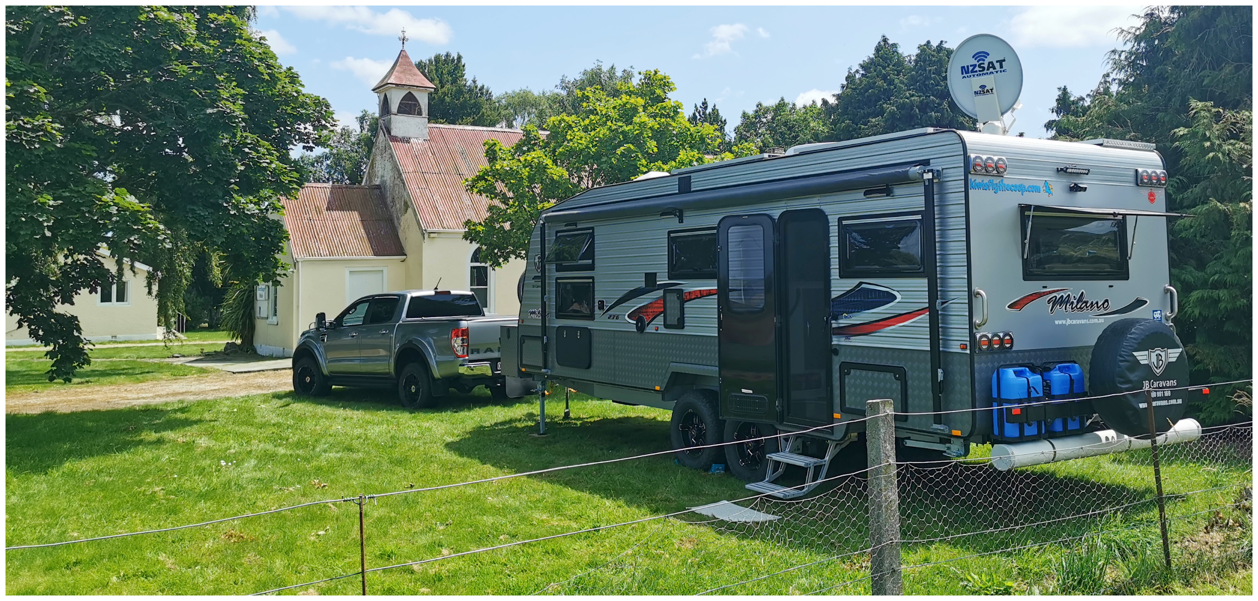
our camping spot next to the church
The church hall has a wealth of information on the history of the area and what walks are available. Campers are also encouraged to use the hall as a meeting place, to gather and socialise. We didn’t need to use the hall as we were the only ones there for our entire stay.
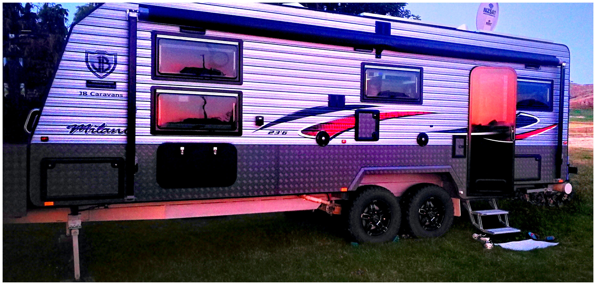
we were treated to a Tuapeka sunset

Mother nature showing off to us
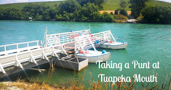
Tuapeka Ferry (The Punt)
To be honest, reading about the Tuapeka Ferry was what attracted us to come and explore Tuapeka.
We thought that it was something a little unusual and we were correct as this is the only punt of its type still operating in New Zealand……. actually, the entire Southern Hemisphere. That was certainly reason enough for us to explore for sure.
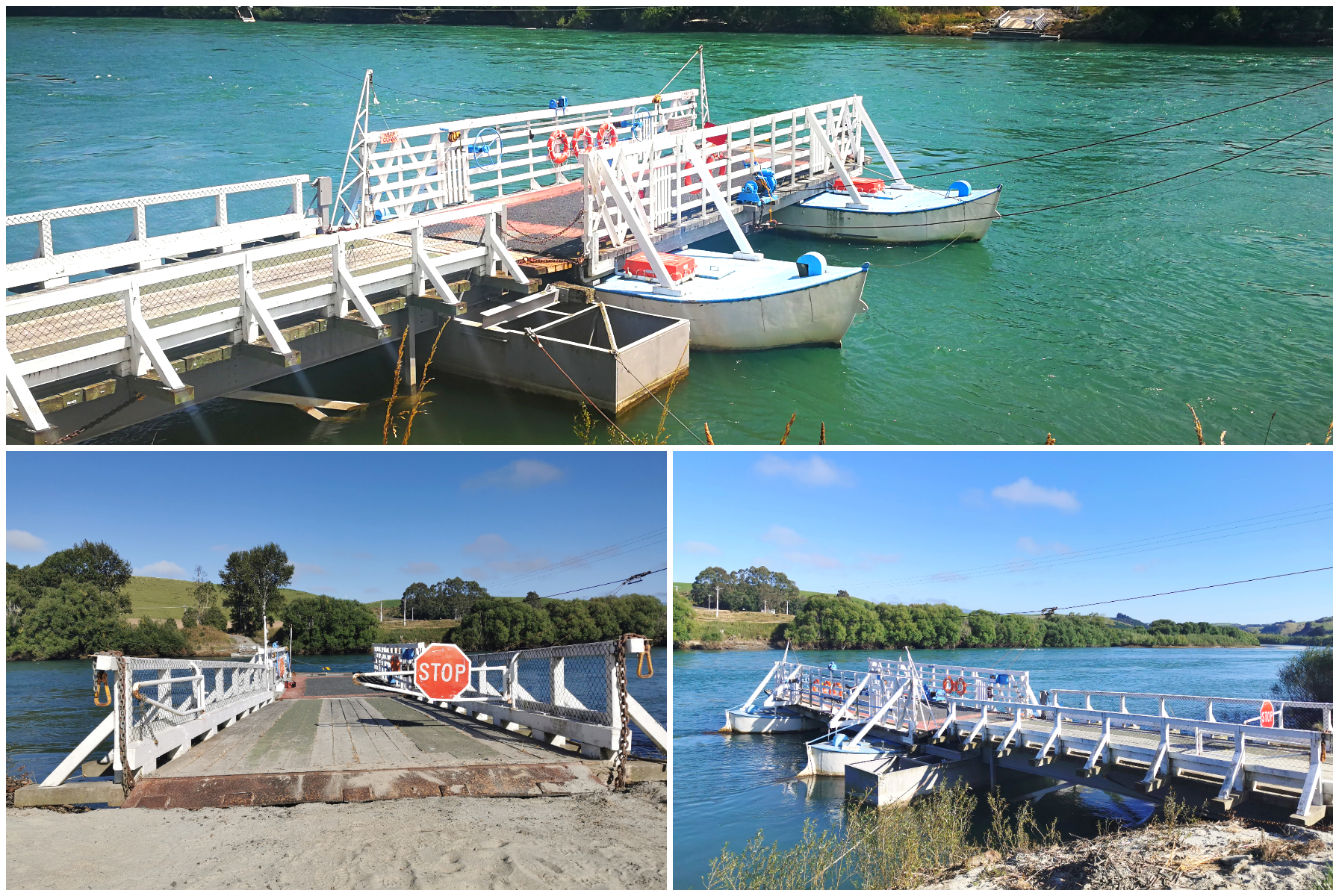
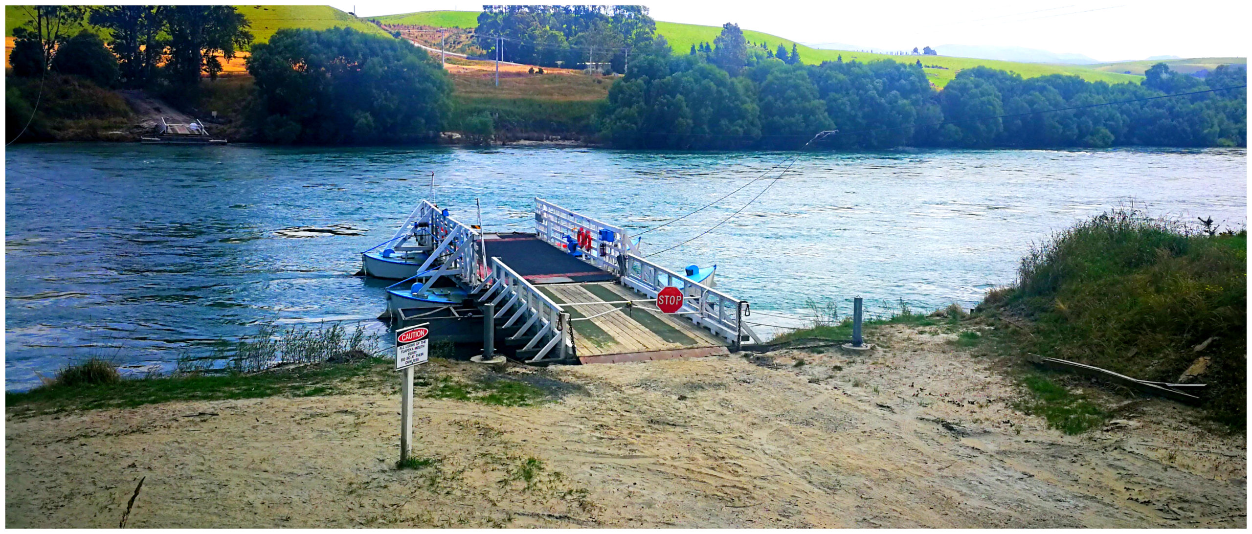
The Tuapeka Mouth Ferry is a local icon and is said to be the last water-driven public punt in the Southern Hemisphere.
It is solely driven by the strong flow of the mighty Clutha River. Best of all, it is classed as part of NZ’s roading system. It is fully funded by the Clutha District Council and NZTA and treated very much like a bridge so it is free! Now that doesn’t happen very often!
The punt consists of a platform attached to two pontoons. There are wire ropes across the river and the force of the river pushes it along, controlled by the punt man/woman. They skillfully work the rudders to maneuver the punt into position on the floating jetties.
A little piece of history in Tuapeka
Just a bit of History
Tuapeka Mouth was an inland port for the old paddle steamer boats up until 1939.
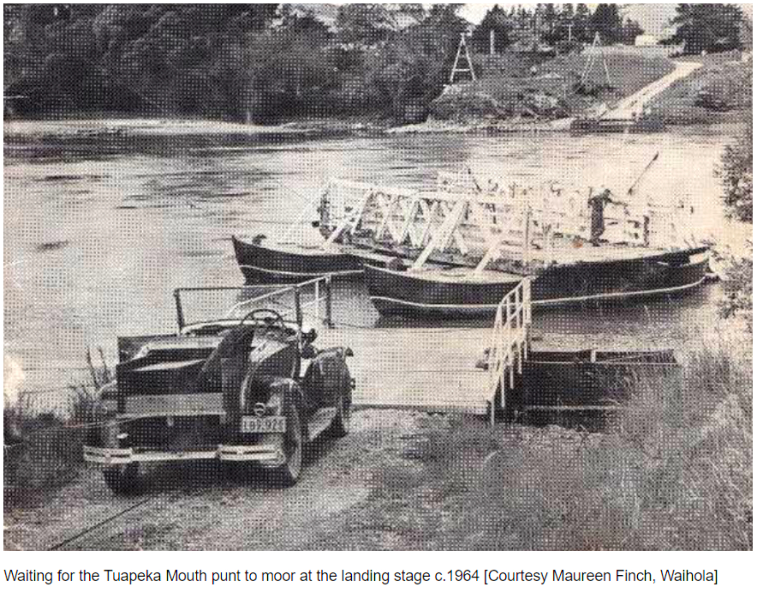
Before the construction of bridges, punts used to be a popular way to cross the Clutha River. There were 25 punts making the journey across the river. The Tuapeka Mouth punt has been in operation since 1896. Following the gold rush at Lawrence in 1861, large numbers of miners worked the Tuapeka River as far as the Tuapeka Mouth. Although the Clutha River was dredged for gold, it was a little ‘hit and miss’. Patronage reduced when the Clydevale bridge 10 kilometres downstream opened up in 1958.
Locals know it as “The Punt”. The original punt had wooden twin hulls. These were replaced in 1915 with steel hulls which were previously used on the Waiau River in Southland.
Operating Hours
Subject to river conditions:
- Summer: 8 am to 10 am AND 4 pm to 6 pm
- Winter: 8 am to 10 am AND 3 pm to 5 pm
The ferry does not operate during the hours of darkness, Good Friday, Christmas Day and the morning of ANZAC Day.
Cars, vans, motorcycles and pedestrians are welcome. You can take your campervan across, however, there are some length and weight restrictions in place. If you would like to know if you can transport your campervan, I’d advise you to contact the Council on 0800 801 350 (during office hours).
The historic punt is mainly used as a tourist attraction, but some locals use it regularly.
Punting on the Clutha River
After doing all this research, I was certainly looking forward to going for a punt. The walk from the Heritage Hub to the ferry is only 1 km. We wandered down and was met by a very smiley punt-woman (I’m not even sure that’s a word!). Fiona was super friendly and quite happy to chat and tell us all about the punt and how it operates.
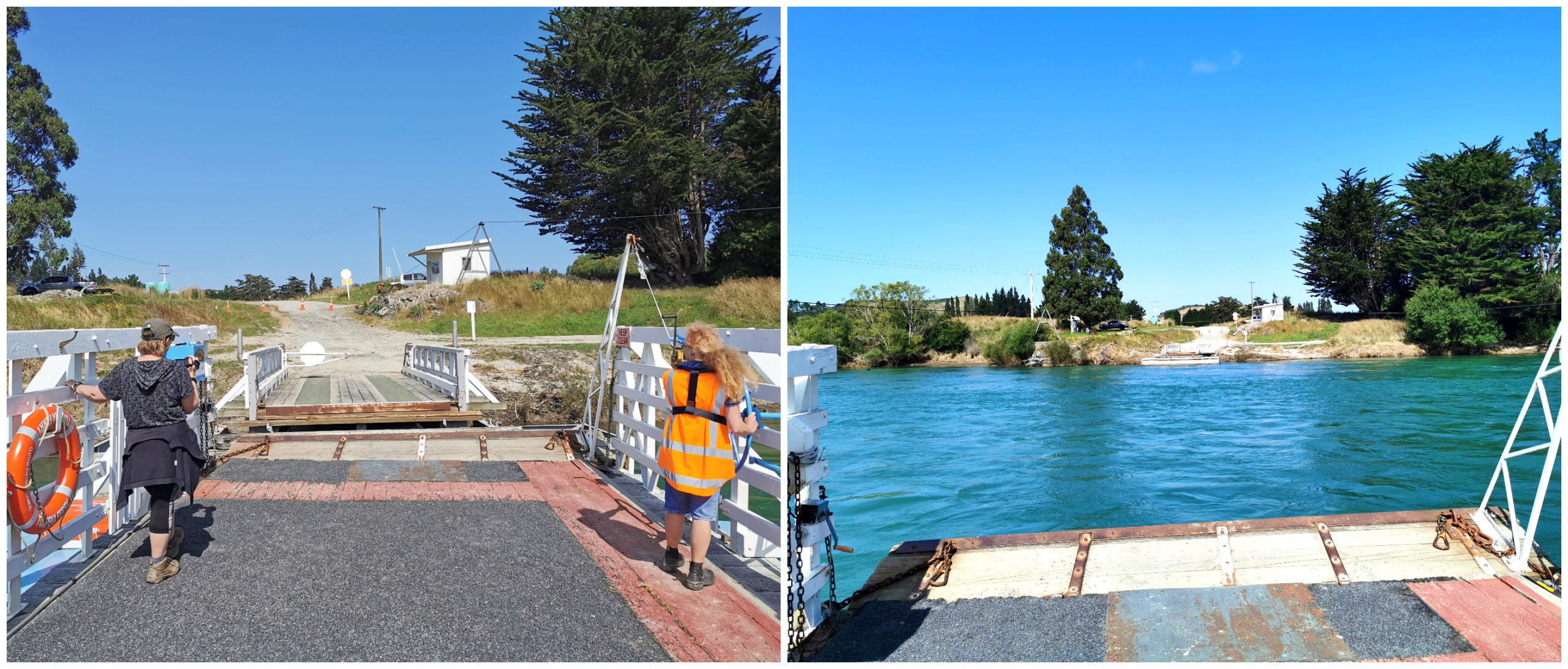
a private ride for two – just us and out punt-woman Fiona
Fiona explained that the punt was currently off-limits for all vehicles but she was happy to take us across and back. The floating pontoons which form the floating jetties on each side of the Clutha had recently been damaged due to a very fast-flowing and flooded river. They were waiting on repairs before once again, being able to take vehicles.
She had us drifting across the swift-flowing Clutha in no time at all. There was certainly a skill to all the maneuvering and steering at the right time to catch the current.
The river was faster flowing as we neared the far side of the riverbank. The punt was travelling along at an angle as the current pushed us closer to the jetty. At a quick flick of a few levers, we had reversed direction and we were making our way back to where we started. The whole return trip took about 10 minutes. I was left in awe of those early engineers and inventors who came up with the design in the first place.
Punt Operators
As mentioned earlier, the Clutha District Council and NZTA fund the operation and maintenance of the punt. This is contracted out to Southroads who employ the Punt operators. Three punt operators are on a 7 day a week roster.
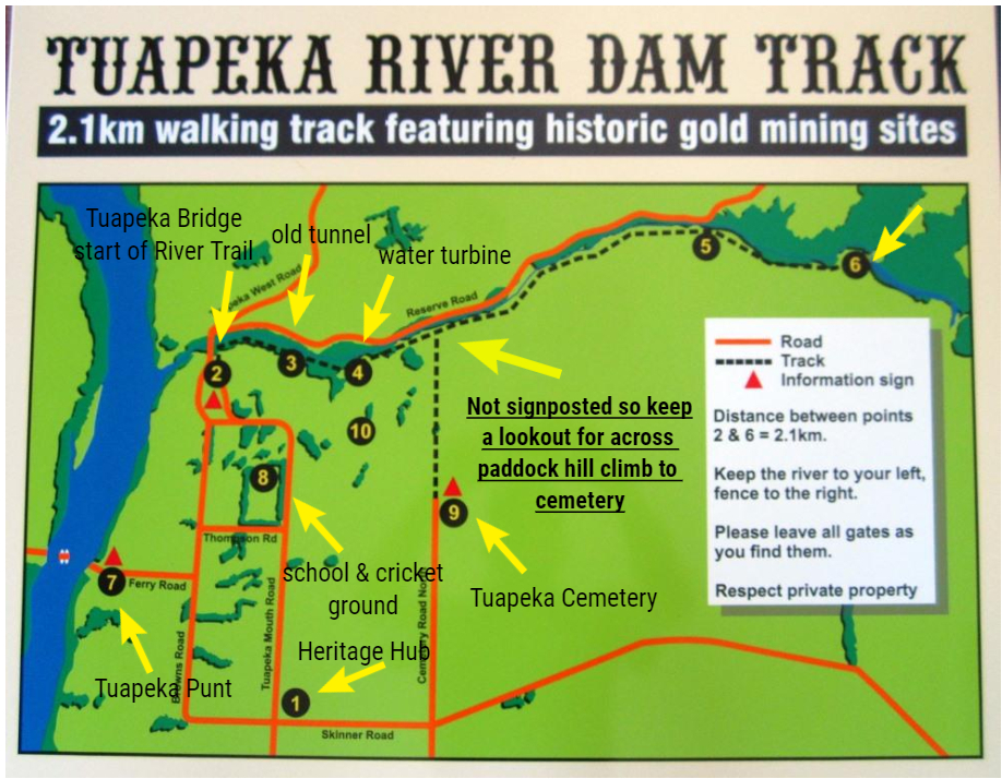
Tuapeka River Dam Walk
We picked up a pamphlet in the old church hall and headed off on foot to walk the Tuapeka River Dam Loop Trail. This is a 2.5hr walk that not only includes the old dam but also encompasses much of the history of Tuapeka Mouth.
Once the inland port opened in 1863, business’ soon followed. There was a total of 3 hotels in the area, of which only one remains (no longer operating). There were also several stores, timber mill, orchards and a garage.
Tuapeka Mouth School
The Tuapeka Mouth School operated from 1870 to 1949. The roll had steadily declined so the decision was made to close the school and the remaining students transferred to Clutha Valley Primary School.
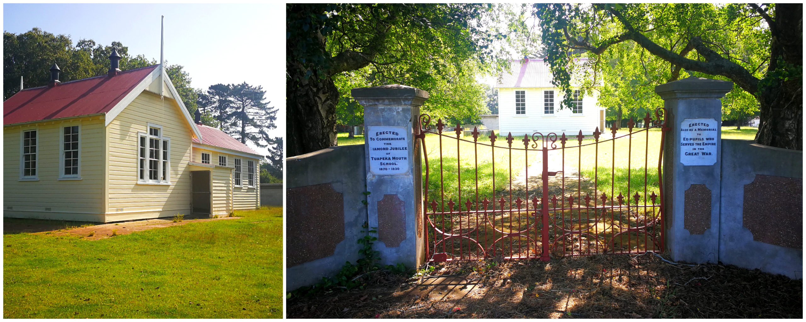
Tuapeka School was built 1870 and Memorial Gates 1930
The school celebrated its Diamond Jubilee in 1930, and war memorial gates were erected to both celebrate the occasion, and pay tribute to those who had lost their lives in the Great War.
Tuapeka River Bridge
If you are wanting to walk this loop track, the Tuapeka River Bridge marks the start of the River Walk. Keep a look-out for the stile as it’s easy to miss from the road.
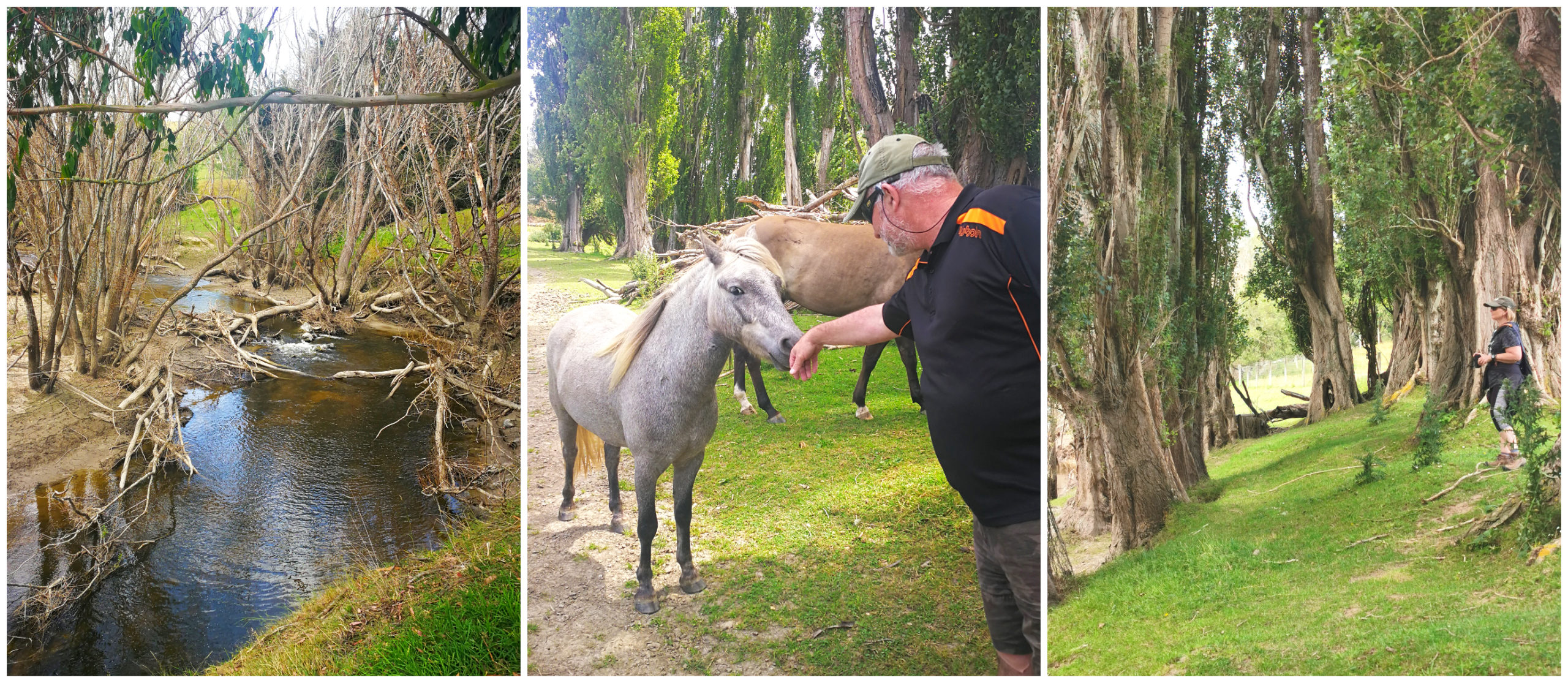
The River Walk starts at the bridge and follows the Tuapeka River which was once a ‘hot spot’ during the gold rush, and Scotty found some new friends
This was a popular spot for the early gold miners. Eighty miners were working the Tuapeka Mouth within a four-mile radius. It wasn’t long before we came across relics of the gold rush era.
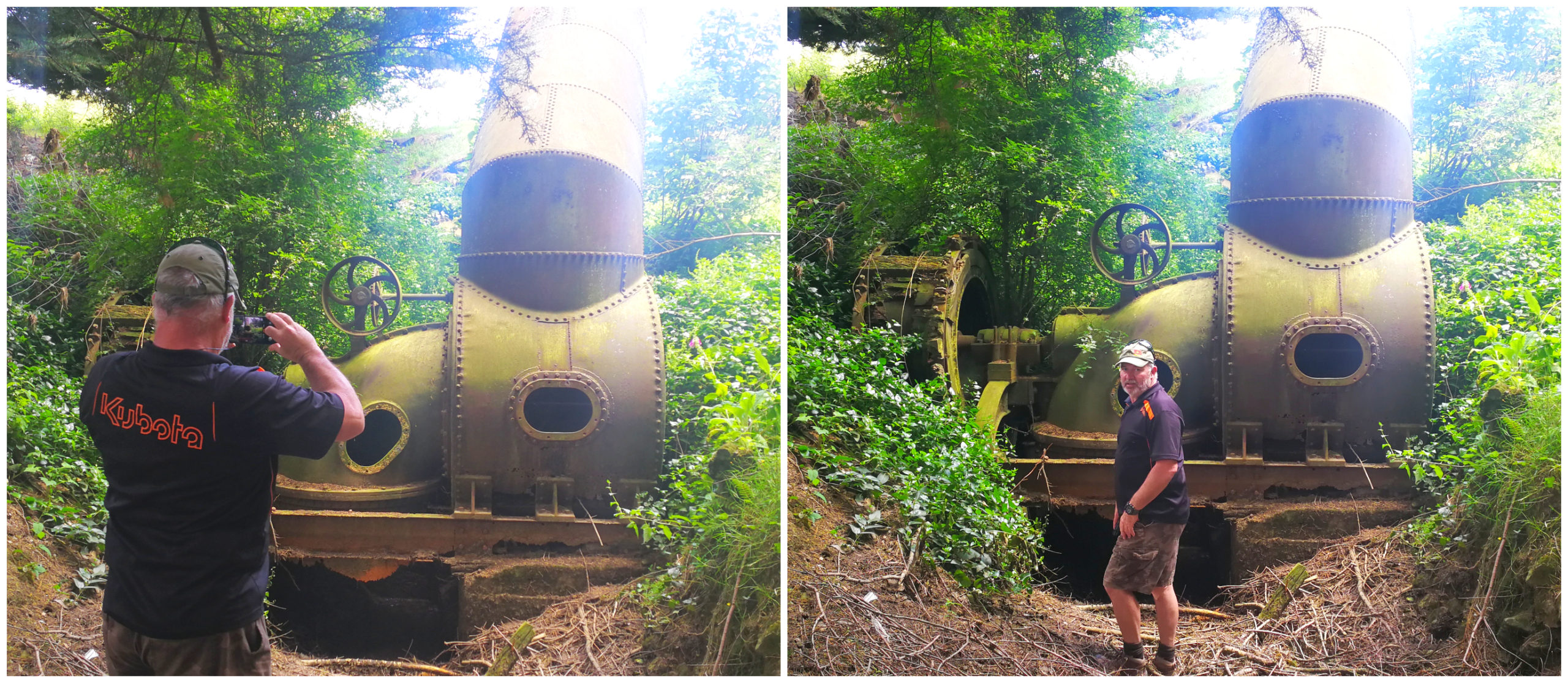
the rusting old turbines
Long before we reached the dam, we discovered the old rusty turbine and tunnel which they built to take the water overflow from the dam, located further up the river.
The Dam
We carried on along the trail, which was quite overgrown, wet and sodden in places. After an hour of walking, we came across the first hint of the large concrete dam. Walls made of rocks and concrete were constructed along the natural flow of the river to harness as much water as possible to drive the turbines.
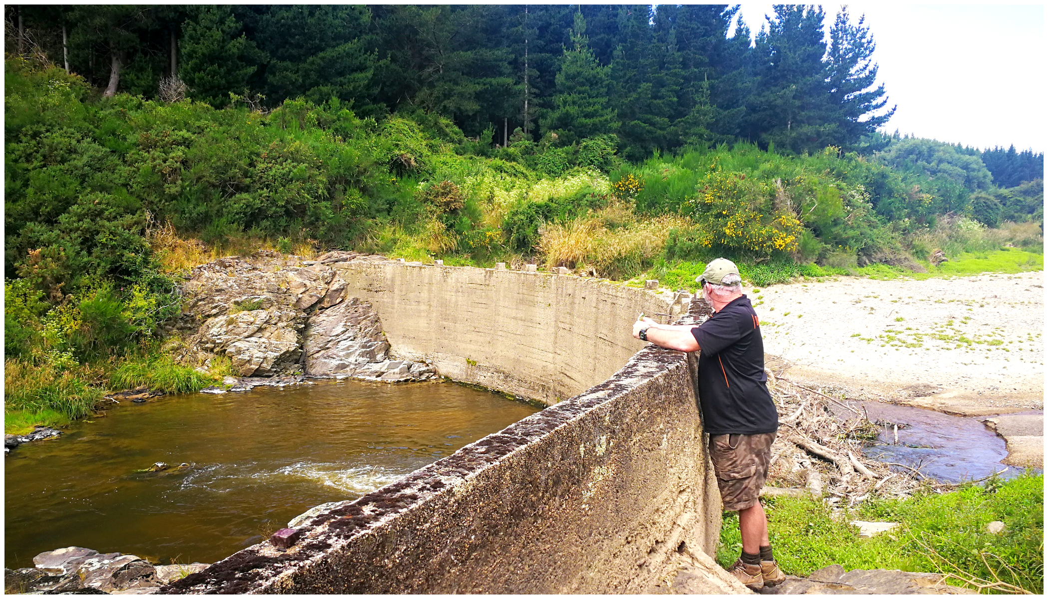
It took just over an hour to reach the dam
The dam was built in the early 1900s and was pivotal in the gold mining projects being undertaken at the time. Old photos show the water spilling over the top of the dam. The water level has receded a lot since then.
We did an ‘about-turn’ and wandered back the way we’d come.
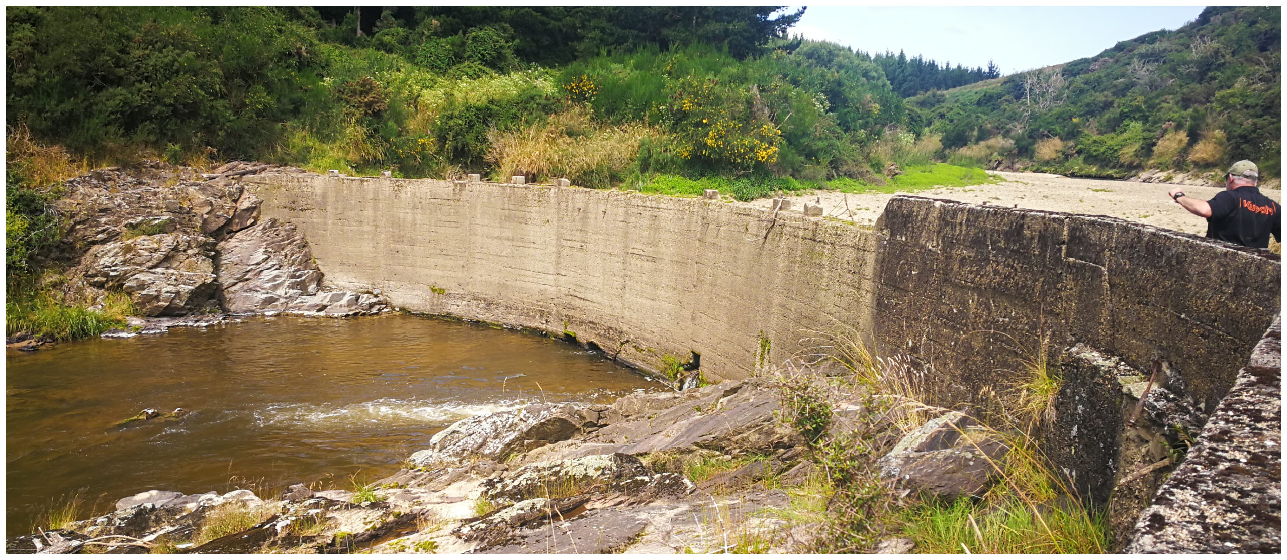
still standing since the 1900s
Tuapeka Cemetery
We didn’t recall seeing any signage telling us where we needed to divert away from the river to get to the old Tuapeka Cemetary, completing a loop back to basecamp.
HINT: when on your return walk back, you need to veer left by the fence line, just before the rusty old turbine (hope that makes sense)! We spent some time consulting with MapsMe and worked out that was the best course to take. We did feel like we were trespassing on someone’s farm as we trudged through paddocks and up a steep hill.
some points of interest along the trail
On speaking with one of the Trustees, they are working on getting some signage up to show walkers where to turn to reach Cemetery North Road.
Wouldn’t you know it, we popped out at the top of Cemetery Road North. Hence, with a road name like that, this is where the cemetery is located.
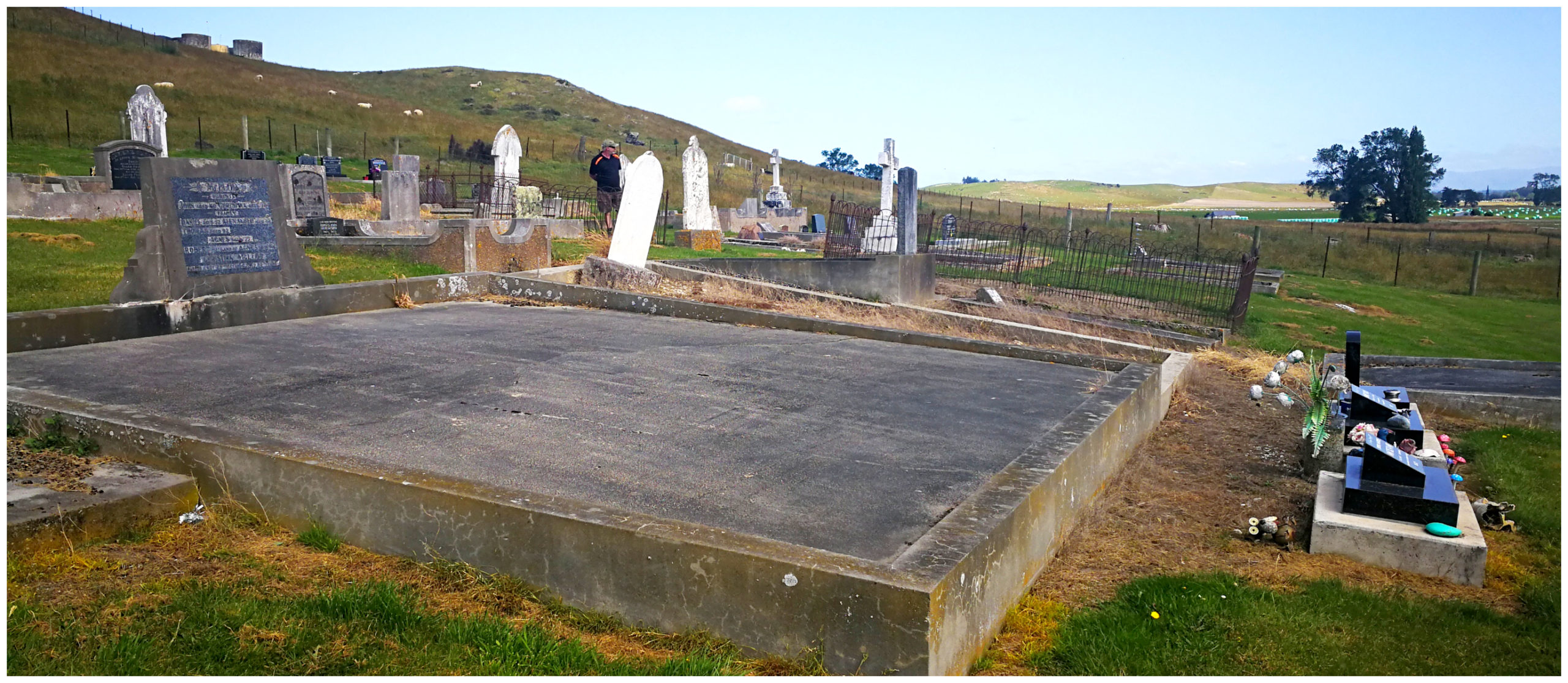
Many stories told on some of these old gravestones
We had a wander around the old gravestones and identified some surnames that were mentioned on quite a few of them. They were some of the early settlers and iconic family names that helped establish Tuapeka Mouth settlement.
It contains the official war grave of 1 man who served in the New Zealand forces during the First World War.
Tuapeka Mouth is certainly worth a stopover while discovering the lower part of the South Island.
Click on the link below for a video of our highlights.
I’d certainly like to park our caravan next to a church with such terrific facilities! And…travelling across the river on a punt would have been an experience. Did that once in South America in the truck we were overloading in, but it was quite a scary experience and I think the punt was made out of cardboard boxes! (LOL). Fabulous post to read and whenever we are next in NZ – probably a couple of years, will be stopping at Tuapeka Mouth for sure. Great read!