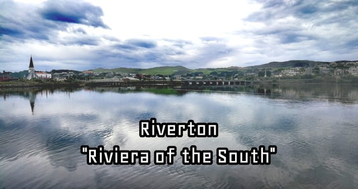
Well, I’m not sure if I’d call it the ‘Riviera of the South’ but Riverton sure does have a certain appeal and charm. You know, the sort of vibe that can easily get under your skin.
Where is Riverton
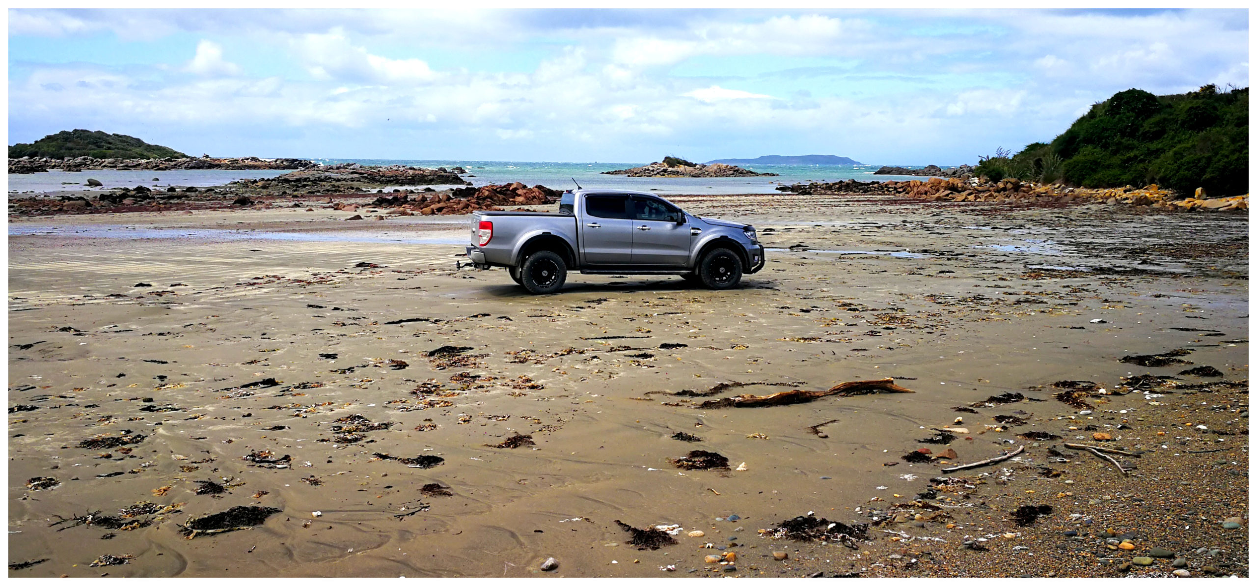
Leaving our base camp in Tuatapere (click here to read our previous blog) it was a mear 50km until we reached Riverton. Situated on SH99 on the Southern Scenic Route, it is only another 30 km until you reach Invercargill.
With Riverton as our base, we were to set off to explore some roads less travelled
Riverton (Aparima) is one of the most popular towns in Western Southland. Because of its picturesque location, it’s a favourite spot for many family holidays in a real NZ “crib” (seaside bach).
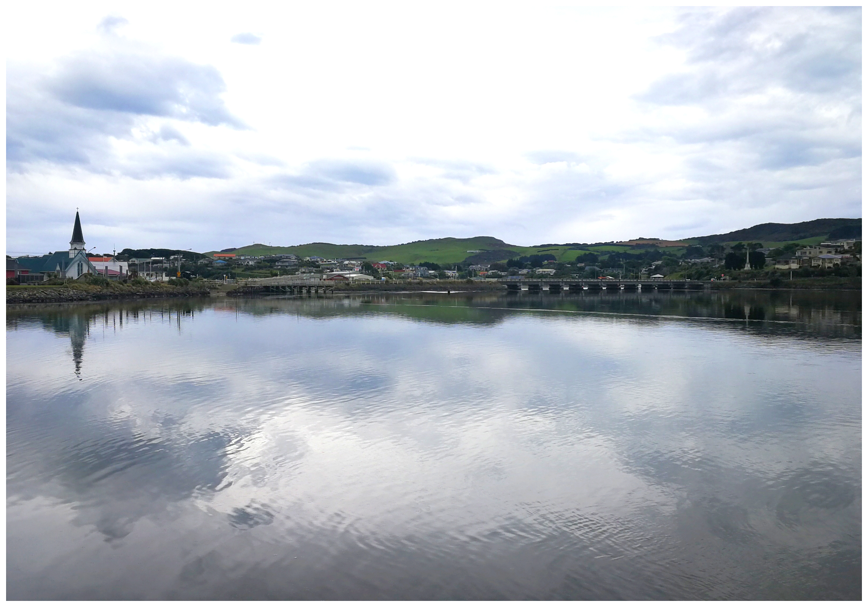
The village itself is sheltered by a scooped out, idyllic inlet
Having being raised in Invercargill, Scotty has loads of fond memories of spending extended family holidays in a few different “cribs” out towards Riverton Rocks. No different to a lot of other local families who still make use of the same “cribs” as he did some 45ish years ago.
The Riviera of the south
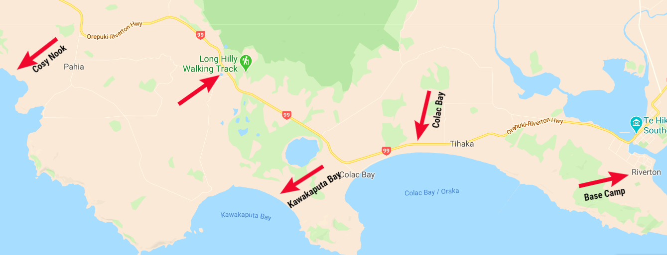
Base Camp
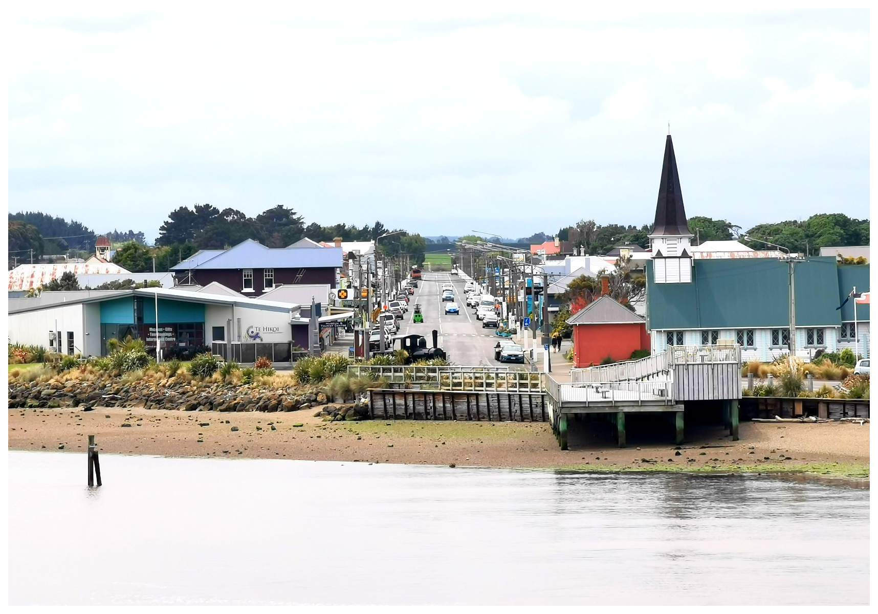
Considering Riverton has become quite a popular seaside destination, our options for places to stay were quite limited. Yes, there is a commercial camping ground and a couple of POP (NZMCA Park over Properties) to choose from, but we decided to park up behind the Carrier Arms Hotel (NZMCA#9232). This is located in the main street of Riverton, close to the small supermarket, cafes and vintage shops and local goods stores.
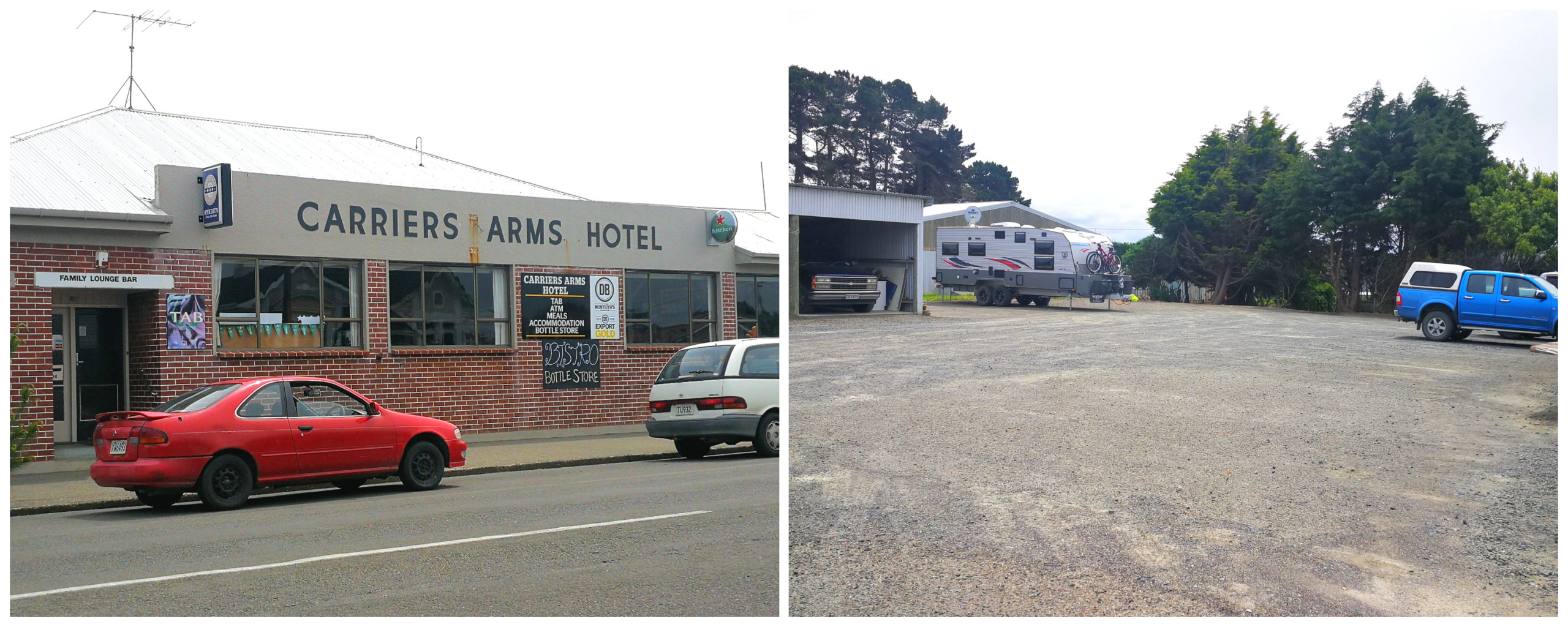
Tucked in behind the Carriers Arms Hotel was our home for the next couple of nights
It is free for members to stay unless you wish to use their facilities (showers and toilets during opening hours). As usual, we always like to repay their hospitality by having a few drinks/meals in their establishment.
We were conveniently located close to shops and attractions
North Beach Track
We headed out on foot to explore the local surrounds. We stumbled across the start of the North Beach Track. The long version is approximately 10 km. Allow 4 hours ( Note – Suitable only low or mid-tide). The short version is approx 2.5 km which takes an hour. This is the option we chose.
The trail follows along Jacobs River Estuary to where it meets the sea. The estuary is formed by the Aparima and Pourakino Rivers. This then leads through a narrow river mouth, flowing out to the Foveaux Strait.
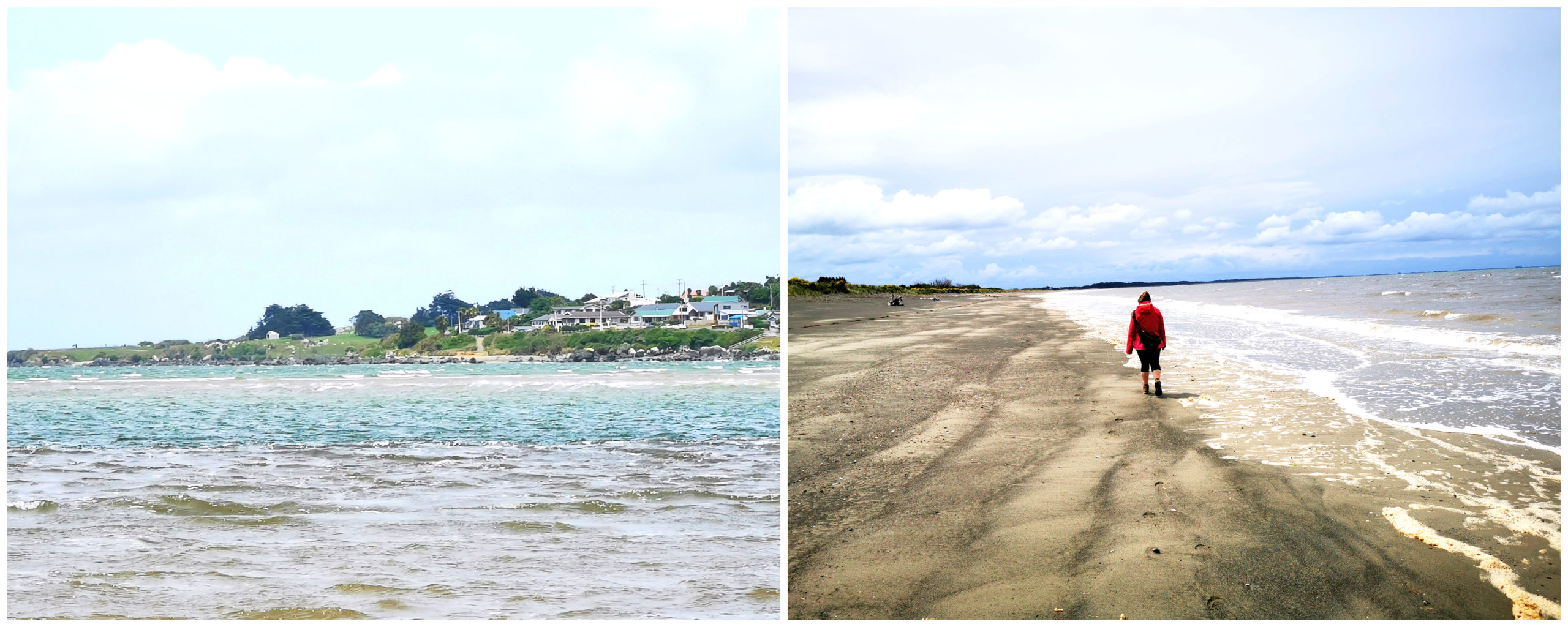
We followed the river to North Beach
We wandered along North Beach as far as the navigation lights. This is where we headed inland and followed the road back to the township.
Fishing and Farming
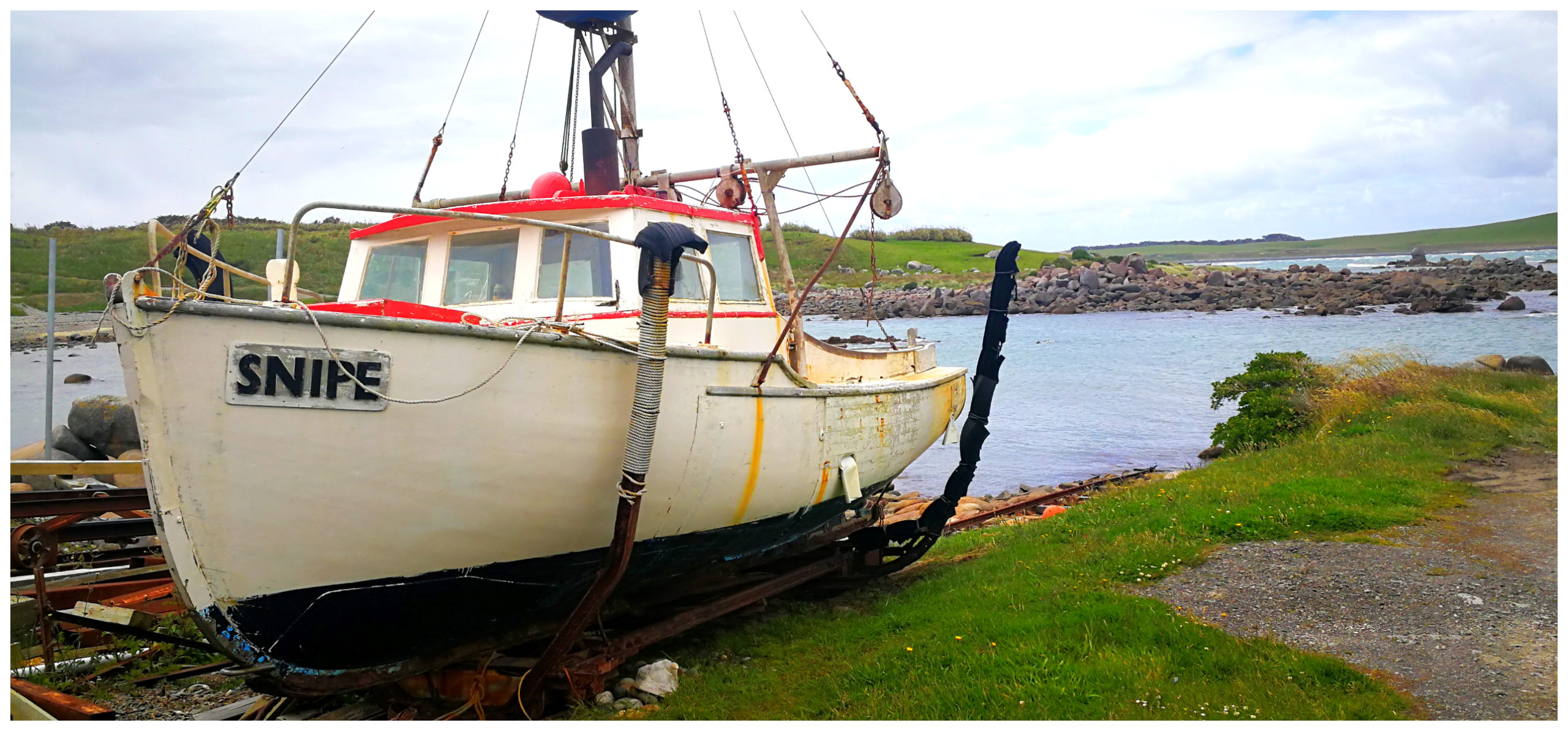
The main industry in Riverton is fishing. As we walked the North Beach Trail, we got a great view of all the fishing boats tied up on the opposite banks of the river.
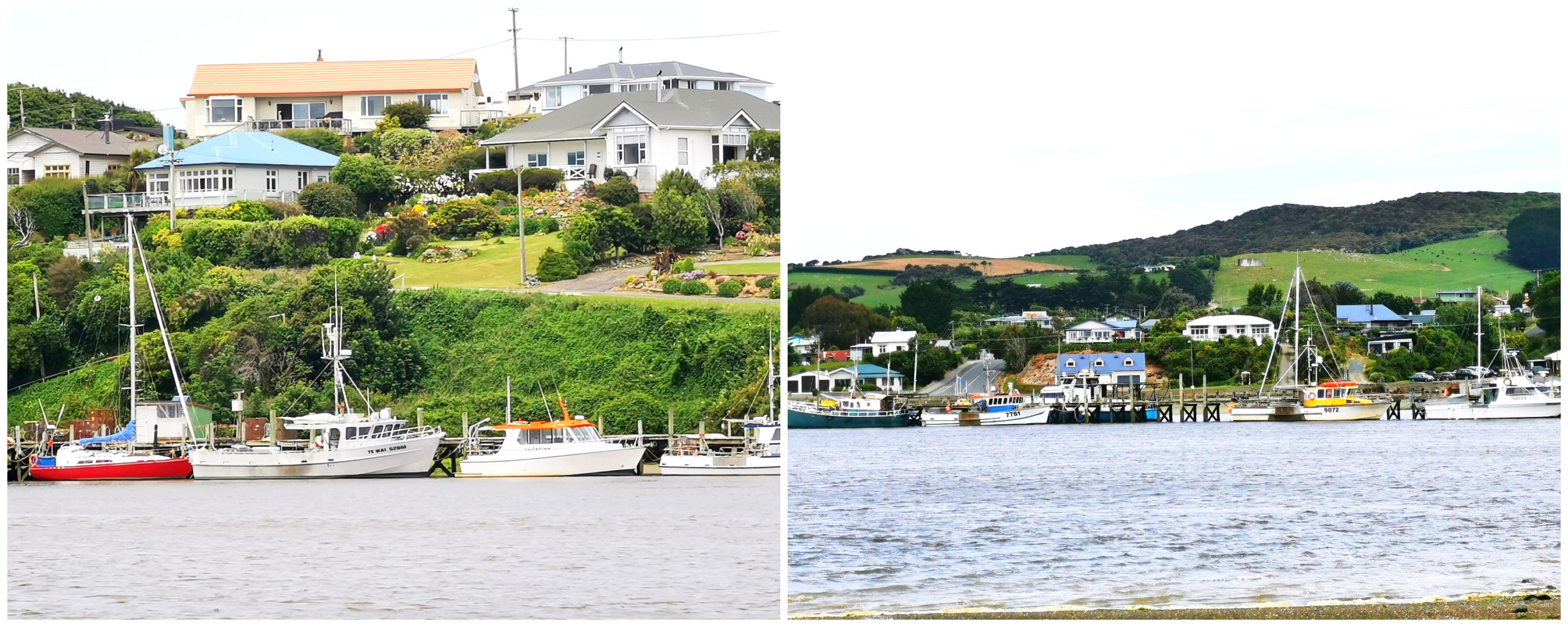
There is still a large fishing fleet based at Riverton
It was obvious that it must be pretty nasty out at sea as the majority of the fishing fleet was tethered to their moorings.
Dairy farming has become more important economically as the fishing industry has been less productive due to competition and climate change. The former fish factory on the main wharf has been converted to a butchery (where we purchased our Christmas Ham and can also recommend their sausages!).
The harbour is still quite busy though as it is a safe harbour for access to NZ’s south/west seas. It is also a favourite destination for water skiing, rowing, fishing and catching the occasional flounder.
Plenty of History
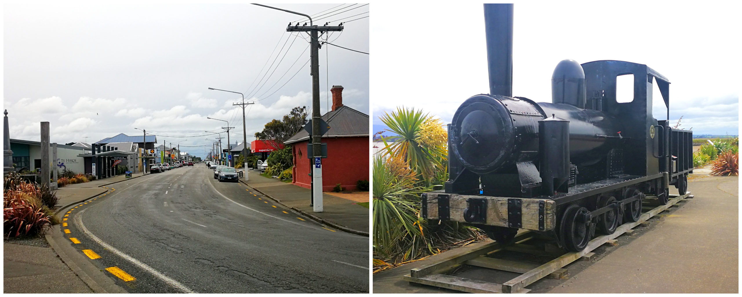
Riverton is the oldest permanent settlement of Southland and one of NZ’s oldest towns.
The Te Hikoi Southern Journey Heritage Museum located in the main street provides an excellent insight into the unique history of the settlement in the area. It is well worth a visit when visiting Riverton.
Although it is the oldest Pakeha settlement in Southland and Otago, before the Europeans, it was home to a substantial Maori Pa. This was known as Aparima. It was a score for the Maori with a safe harbour and ample seafood.
Captain John Howell arrived around 1830 and established a whaling station. He married a Maori woman of high ranking. In doing so, he acquired a lot of land in the area as part of the deal.
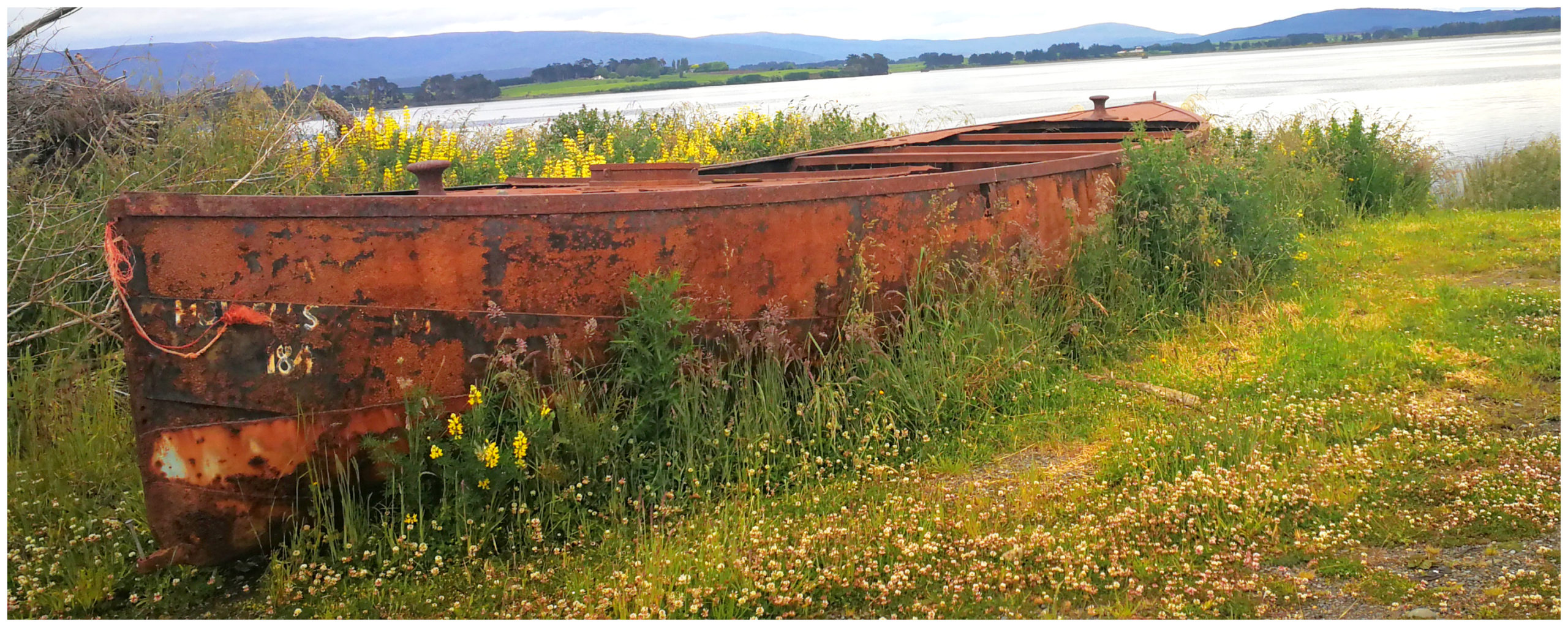
a relic of the past rest on the shores of the inlet
Back then, farming was one of the most important economic activities in the area, but also timber, flax milling, gold mining and of course, fishing was very popular industries.
The harbour had a busy port until the railway opened to Invercargill in 1879.
Riverton Cemetery
On the main Invercargill-Riverton highway (SH 99), from Riverton turn left at the Otautau turnoff into Gummies Bush Road and you will find the Riverton Cemetery. The cemetery is about 2 kilometres along this road, on the left.
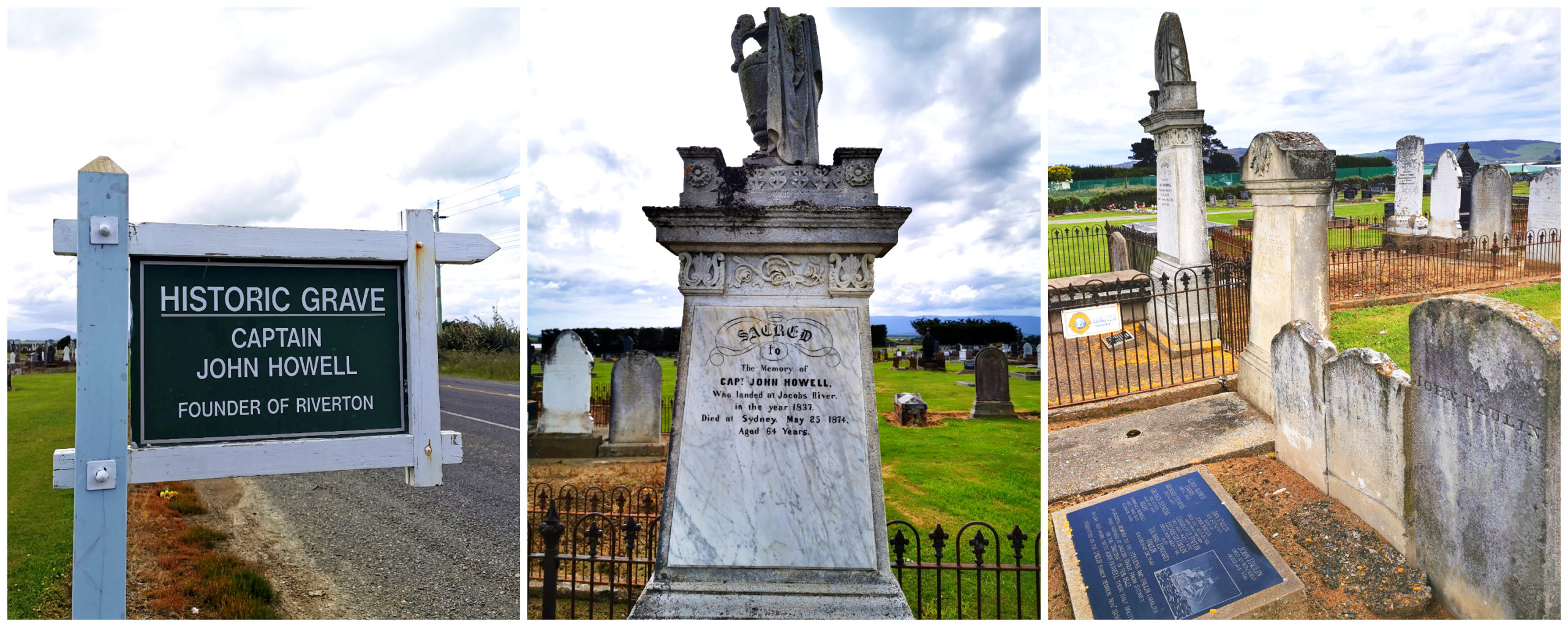
the final resting place for Capt John Howell, his family and descendants
If you love wandering around old cemeteries then the Riverton Cemetary is a ‘must visit’. Many headstones tell a story. Captain John Howell, his wives and descents are easy to find.
We were amazed at the more recent section of the cemetery. It would have to be the most impressive line up of some highly skilled marble carving we’ve seen. Row after row shows some of the most beautiful and creative headstones.
Mores Scenic Reserve
The next day we had a break in the weather so we jumped in the ute and headed to the Mores Scenic Reserve (towards Riverton Rocks).
This is a beautiful reserve located on Howells Hill that offers excellent views over the coast and surrounding area. There are also several great short walks to chose from.
These walks include:
- The Hilltop Lookout Track – a short uphill 20-minute return trail
- Kings Track – an easy 20-minute return trail that follows a bush route which was used by early settlers
- Mores Lookout Track – a 45-minute return trail where you wander through beautiful native forest and winds its way up to a tree-top lookout platform
- Mores Coastal Loop Track – a more difficult 2-hour return trail that follows along beaches and rocky outcrops of the southern coastline
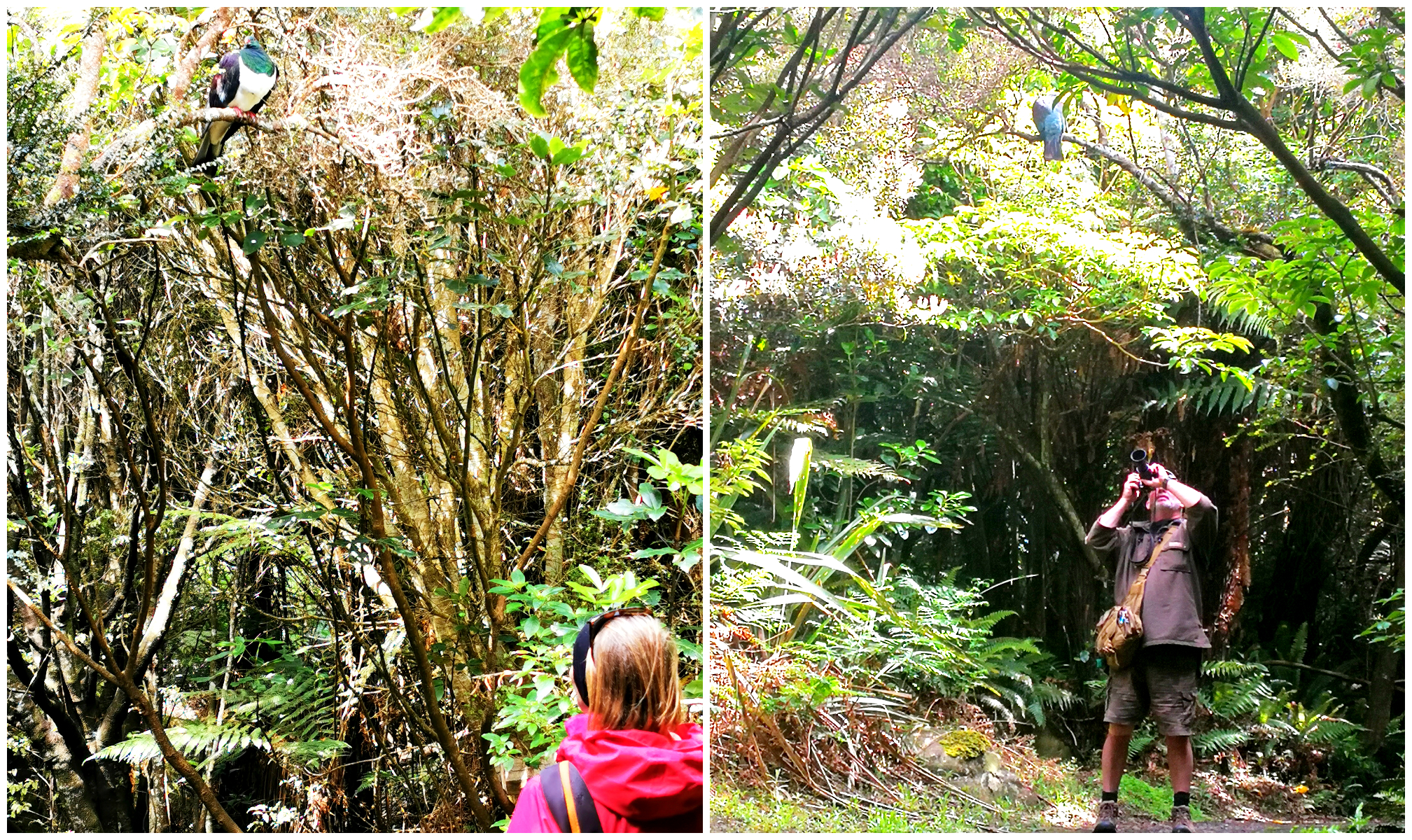
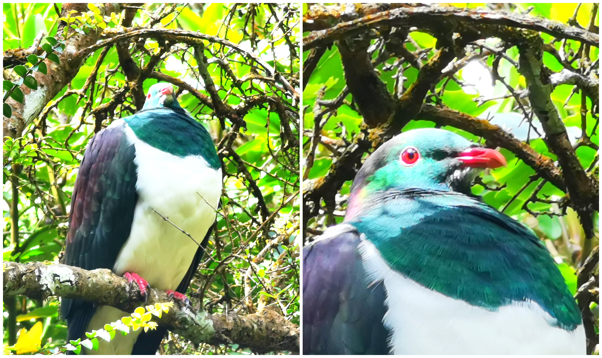
bird spotting on the way to the lookout
the perfect model could have been drunk from all the berries
We’re always attracted to a good lookout so we walked the Mores Lookout Track. The native bush was beautiful and we were enchanted by a rather full (and probably ‘berry drunk’) wood pigeon (kereru). He politely posed for some stunning shots, allowing us to zoom in for some fabulous close-ups.
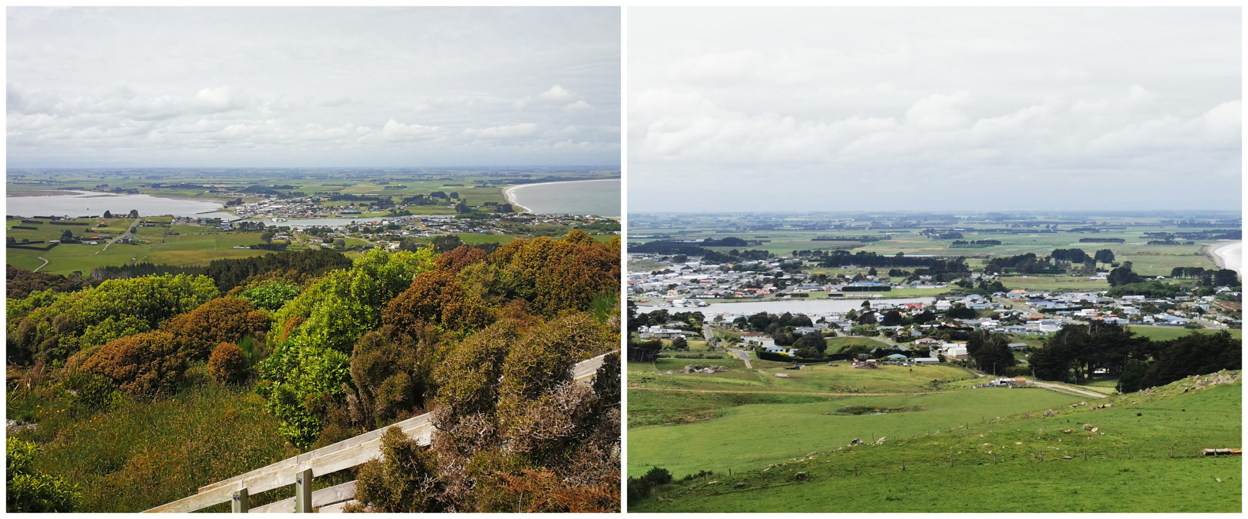
views over Riverton from the lookout
The views at the lookout were spectacular. Panoramic views over Southland and Foveaux Strait towards Stewart Island.
There’s plenty of parking spaces in the carpark and public toilets.
Riverton Rocks
If you carry on driving past the main centre of Riverton, across the bridge and turn left, you will follow the river out towards an area known as Riverton Rocks.
Riverton Rocks includes:
- Mitchell’s Bay – popular for those who like to “ride the waves” (apparently it has a great right-hand break – who knew!!!)
- Taramea Bay and Henderson’s Bay – a very popular location in the summer for Southland residents (provides safe swimming and great for ‘dolphin spotting’ as they travel up the estuary for feeding)
- Howell’s Point (known by the locals as The Point) – a great place for walking, picnicking and bird watching. If you walk up to the trig station at the end, you get a great view of Taramea Bay, Bluff and Stewart Island
the short climb to the Trig Station is worth the views from the top
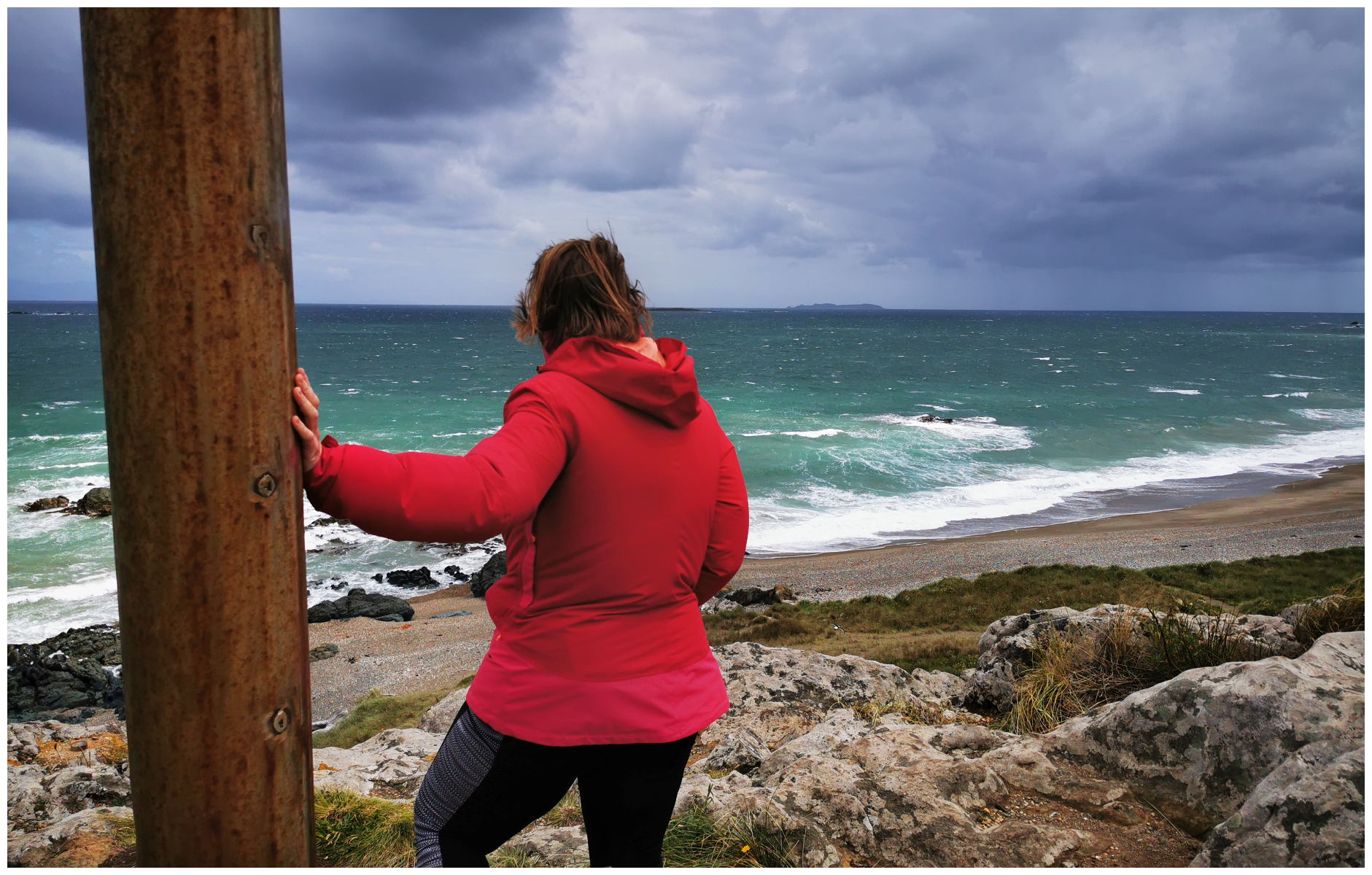
it was a case of having to hold on tight at the top of the Trig Station!!
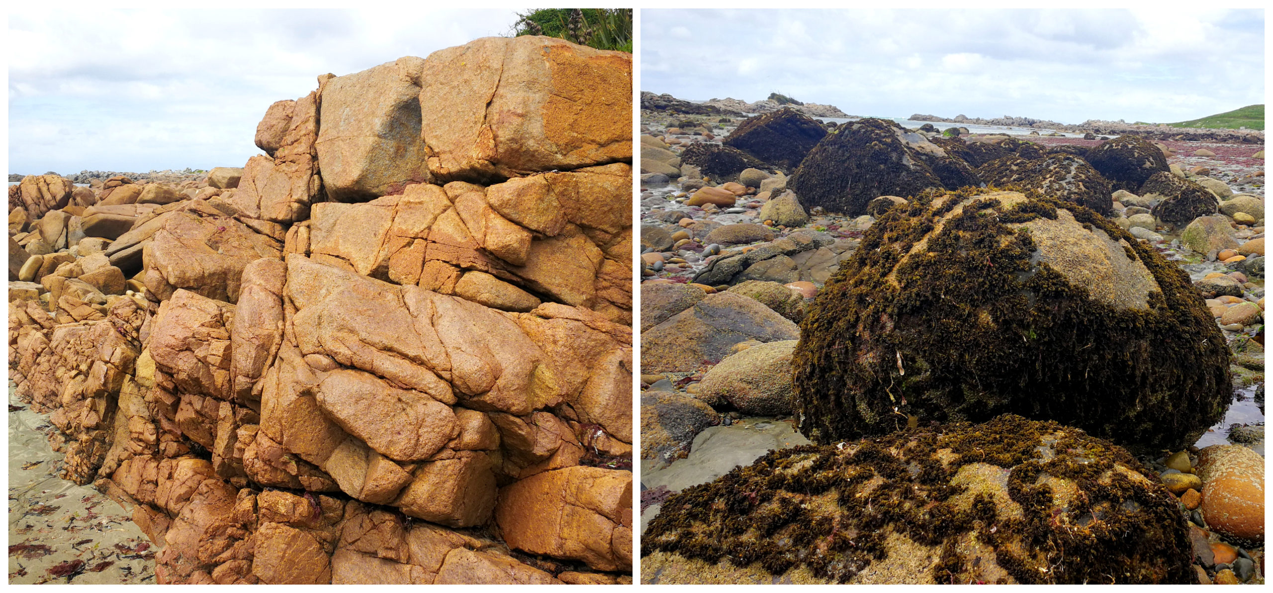
The rocks that are located in this area have scientists excited. The formations reveal rare argillite (rock from the very centre of the Earth).
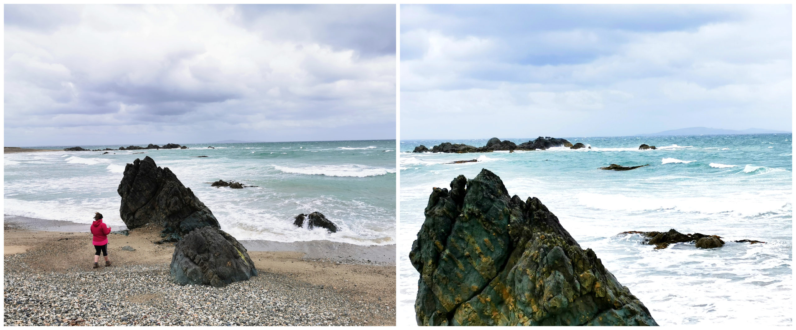
exploring rock formation at Riverton Rocks
More information on this unusual find can be seen at the Te Hikoi Southern Journey Museum.
Long Hilly Track (Round Hill)
With the weather still looking promising, we headed off, destination, Long Hilly Track (Round Hill). This trail is 15km west of Riverton on Round Hill Rd.
The Long Hilly Track takes in several historic mine workings from what was once the largest Chinese mining settlement n NZ. It dates back to 1874.
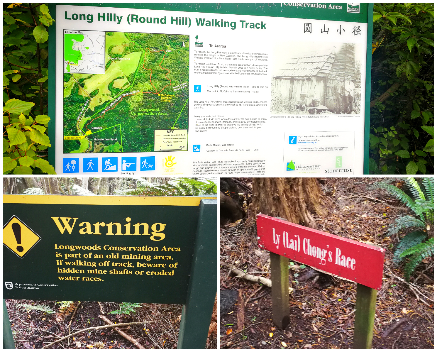
following the signage
There are a few walks that start and end from this point but there is a loop track available which takes 2.15 hrs.
Right from the start of our hike, we were emersed in the quiet native bush while we followed the well-formed gravel track. We were on the lookout for old saw-milling artifacts, past tailings, old sluicing pipes and tramway cuttings. These cuttings would lead to earth dams. The dams which were built high up provided the high-pressure water which was needed for the sluicing nozzles.
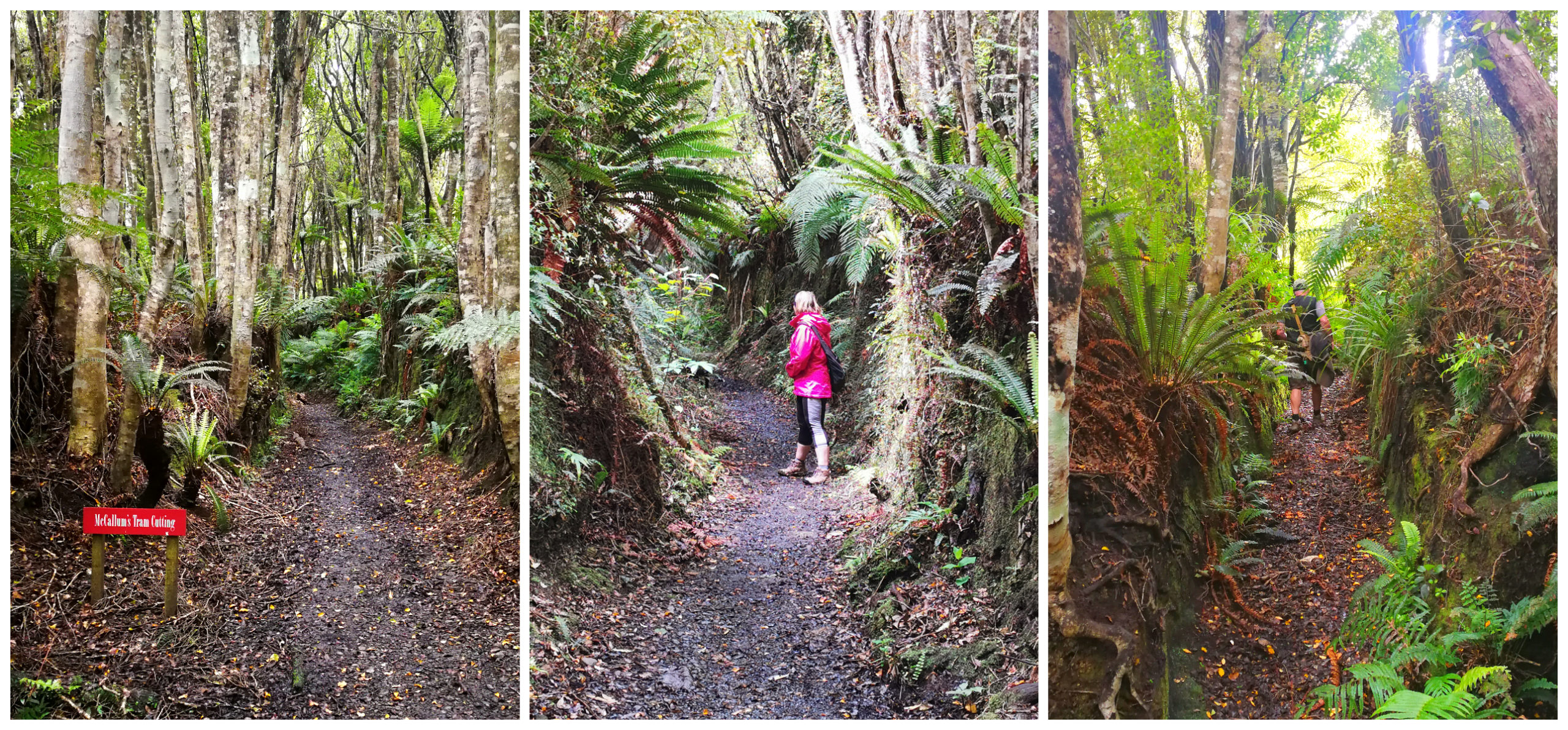
it was fascinating to wander the old tramways which ran to and from old earth dams
Chinese Workforce
Much of that gold-mining history is Chinese as they were employed by a Charles Port to build a 14-kilometre water race. It was hard labour to tunnel through rocky spurs and building trestles across gullies to keep the water flowing at a high rate of speed.
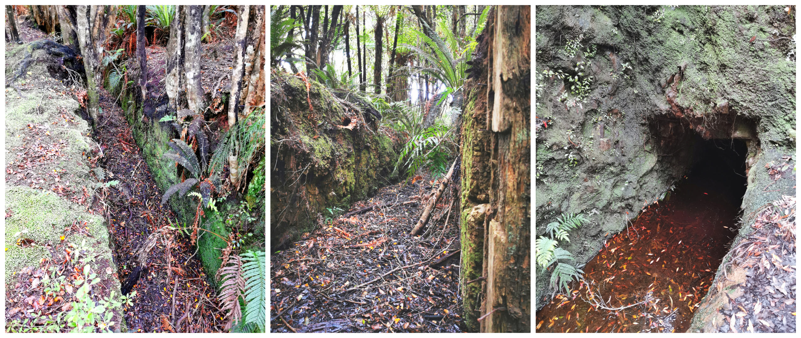
hard labour by some hard-working Chinese miners was still very much evident as we followed the water races
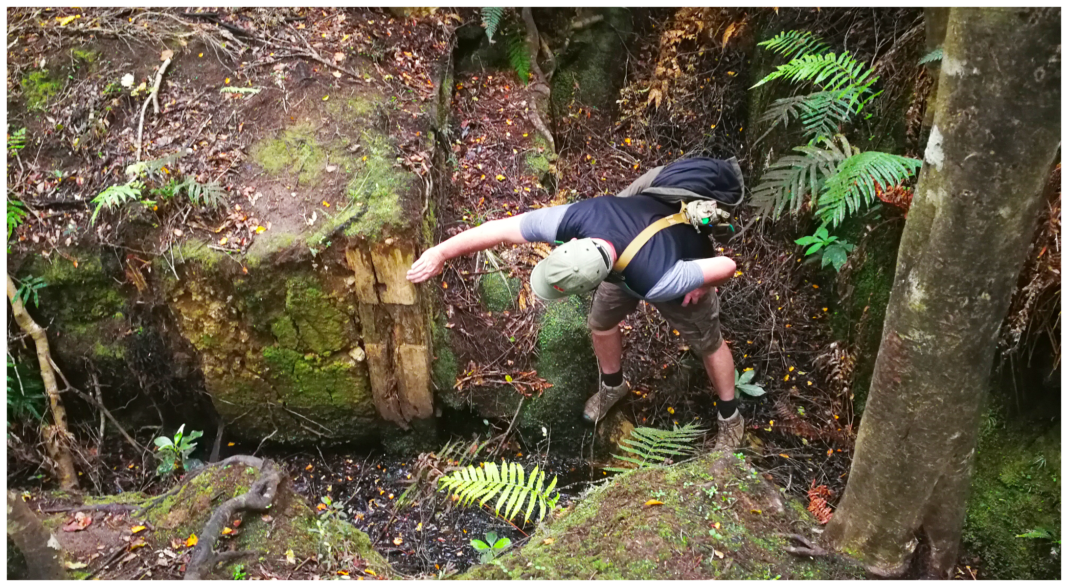
how did they manage to build these structures way back then!
The Chinese settlement at Round Hill was nicknamed Canton. It was a busy small town throughout most of the Round Hill mining operations. It was the most southerly Chinese settlement in the world. At the peak of mining, there were around 300 Chinese miners.
Today, there is little to no evidence that this town even existed. Not a brick, block or trace of any foundations remain.
Although the sign states it is a 2.15hr loop, we were back at the carpark within 1.15hr. That also includes loads of stops for photos.
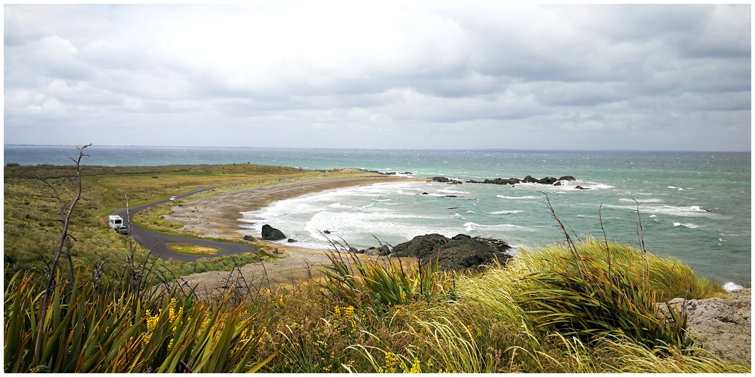
Wakapatu Point/Kawakaputa Bay
Deciding to take the ‘roads less travelled’, we diverted off SH99 and headed for the coast. This was to bring us to Wakaputa Point and onto Kawakaputa Bay. This is the next bay westward from Colac Bay, on the way to Orepuki.
just some of the rock formations that litter the isolated beach
Wakapatu Beach is a beautiful, long sandy/rocky beach with stunning views of Centre Island and Stewart Island.
There is a small rocky island that is accessible at low tide. The weather and tide were against us so we just had to make do with viewing it from the mainland. Many have been caught out by an incoming tide when visiting the island, so much care is needed if deciding to make the walk across. The walk back might not be as much fun!
the tides weren’t quite right for us to explore the small rocky island offshore
Cosy Nook
I’d seen photos and heard about Cosy Nook so I was looking forward to visiting this ‘cosy little nook’.
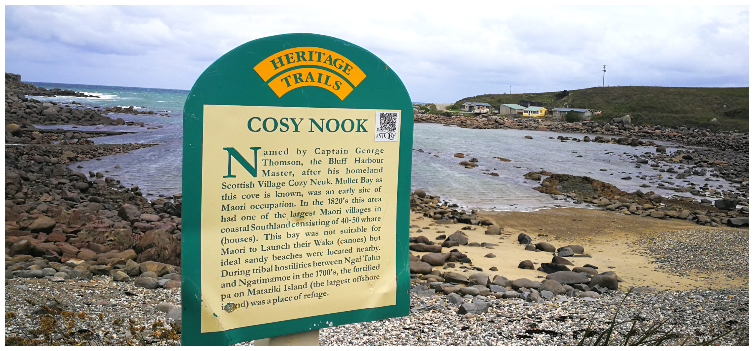
once a busy haven for boats and a populated pa site
As the name suggests, Cosy Nook is a picturesque rocky cove dotted with original and quirky holiday cribs. It is a haven and shelter for fishing boats, ducking out of the sometimes ferocious Foveaux Strait.
such a photogenic cove with quirky little cribs hugging the coastline
A Bustling Maori Village
It was one of the oldest and largest Maori villages back in the 1820s. It is reported to have consisted of 40-50 whare (houses). The small rocky island was once a defended pa site. Sadly 40 members of the tribe drowned when their canoe (waka) sank on the return journey from the Muttonbird Islands in the 1820s.
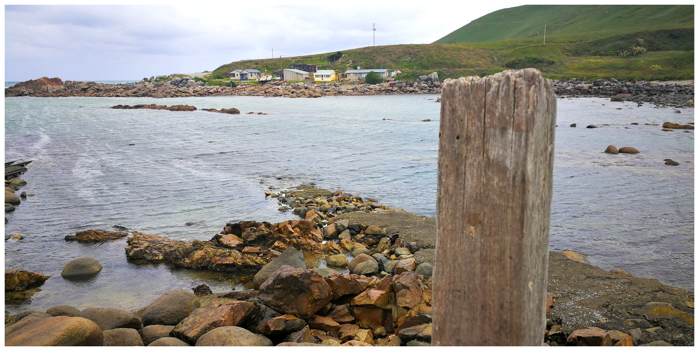
We slowly continued to cruise our way around the small cribs. They are so close to the road that we felt like we were trespassing in the owner’s backyard. We met and saw no one but I’d imagine it would be more populated during the holiday seasons and summer months.
a haven for fishing fleets seeking shelter from the strait
We could see evidence that it must have been a busy place for maintaining fishing vessels. Old railway tracks were still evident where they hauled them out of the water on a cradle.
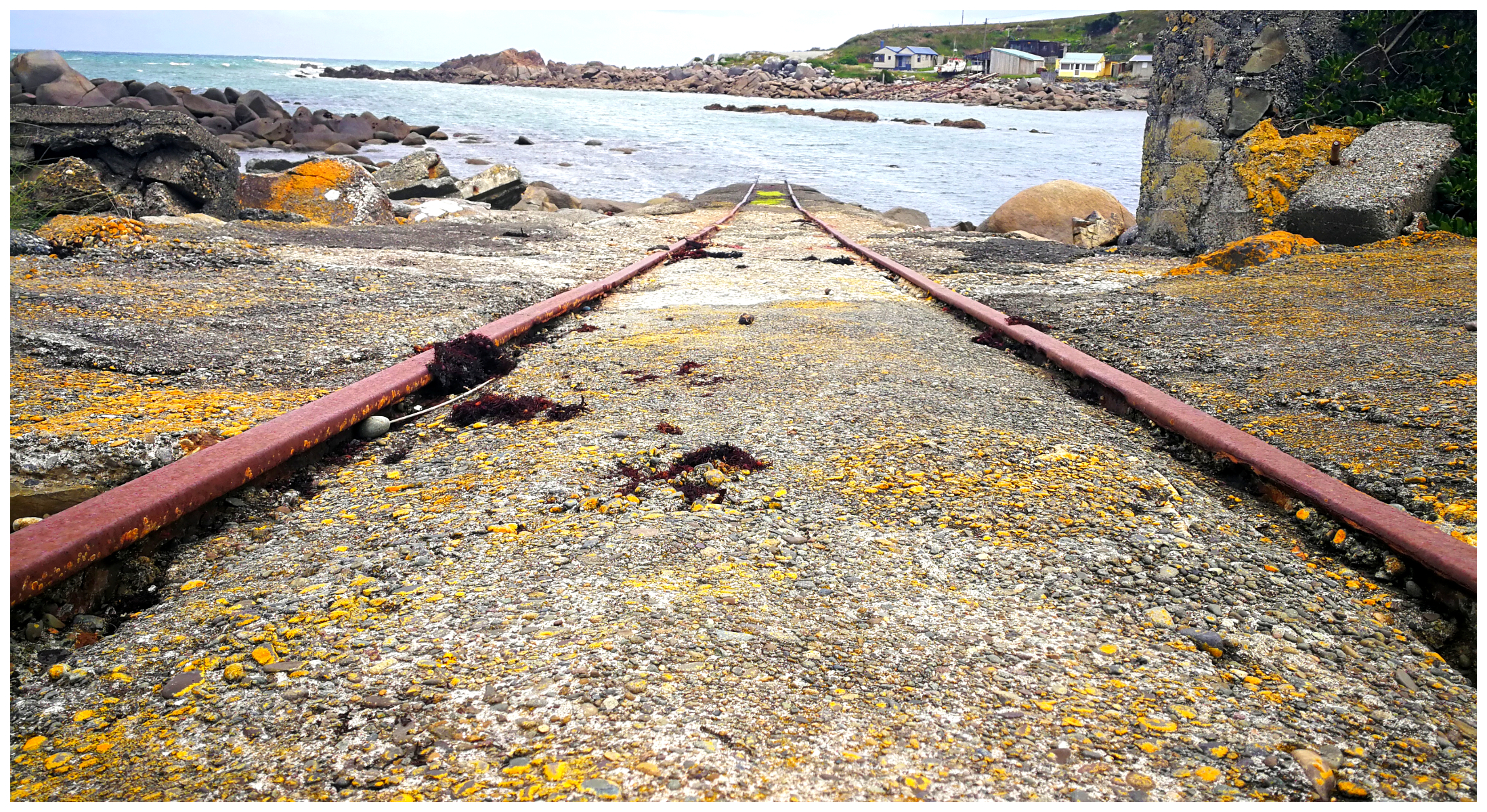
tracks still evident where they would haul up the boats on their cradles
Captain George Thomson can be thanked for giving this little haven such a cute name. Cosy Nook was named after his homeland Scottish village Cozy Neuk.
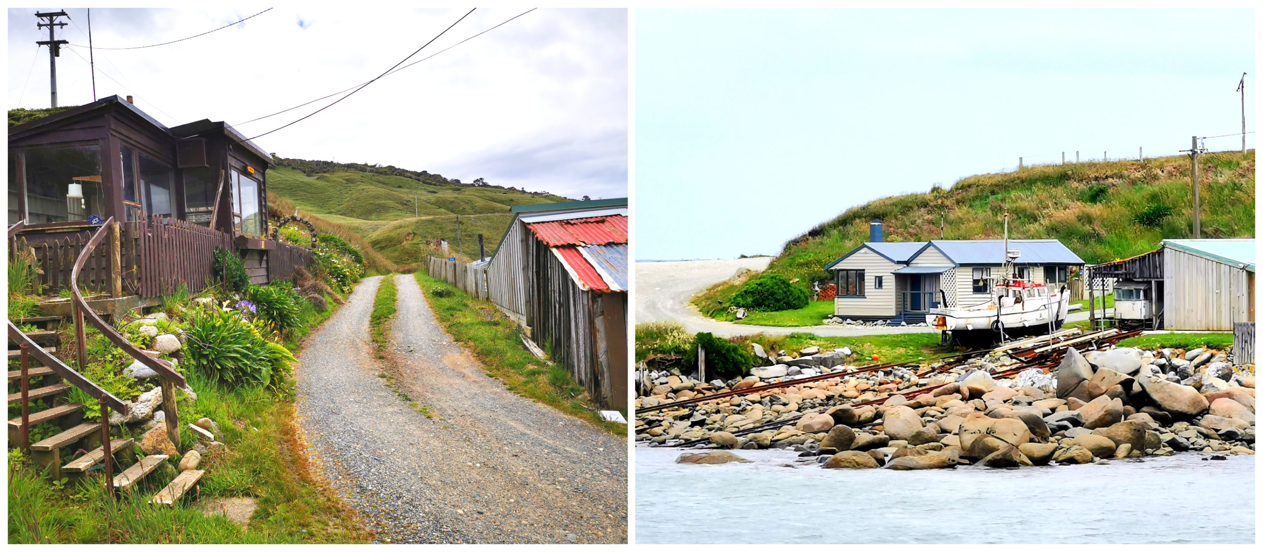
it felt like we were driving through residents front and back yards
Colac Bay
Colac Bay is a popular stopover for travellers and a favourite holiday spot for locals.
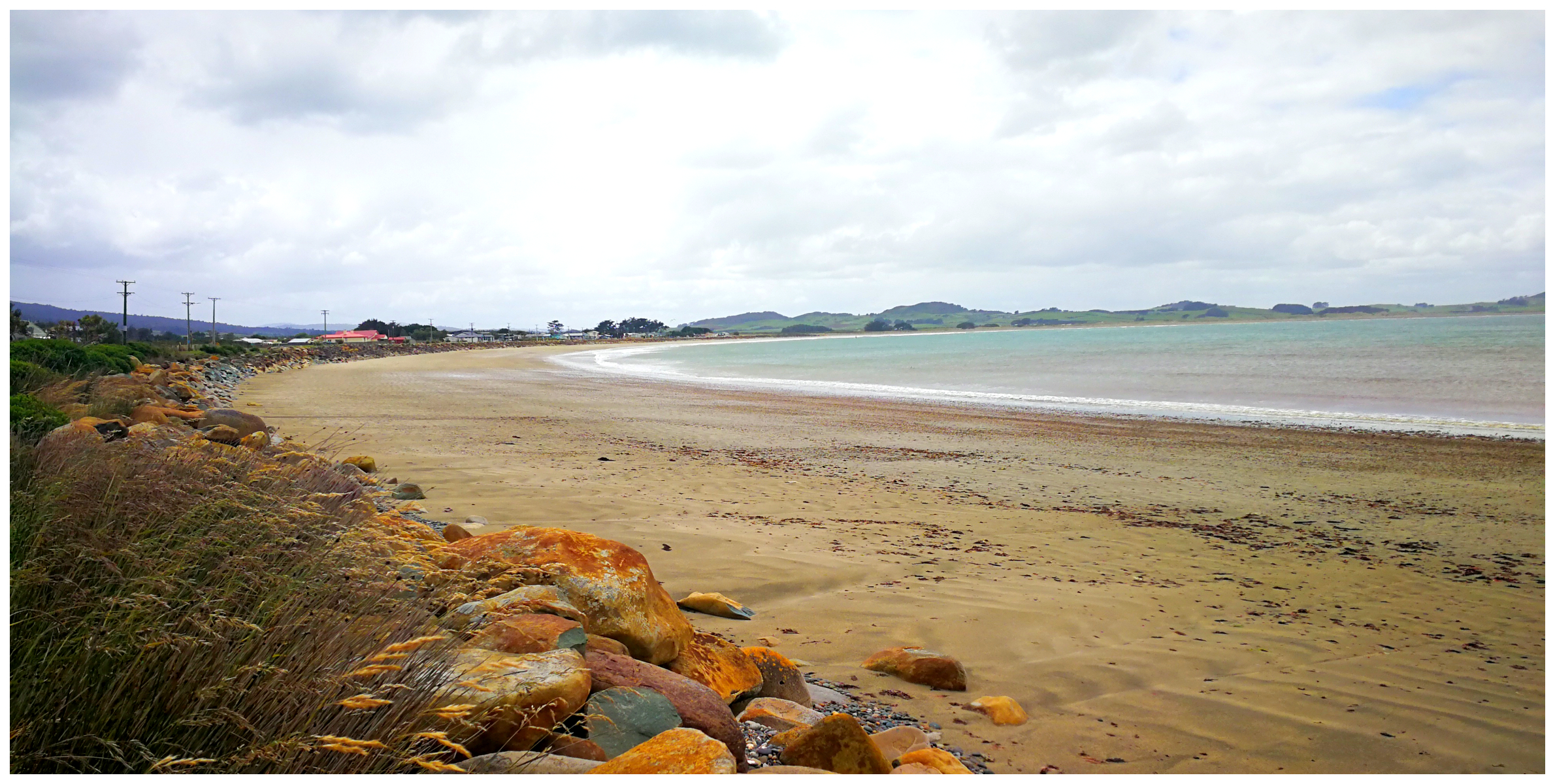
the long sweeping sandy Colac Bay
The beautiful sweeping beach hugs the curving bay and is a popular surf spot. It has an iconic statue of a surfer riding a wave at the entrance to the township. The Colac Bay Classic is an annual surf competition for all ages. It is very popular with the surfing fraternity.
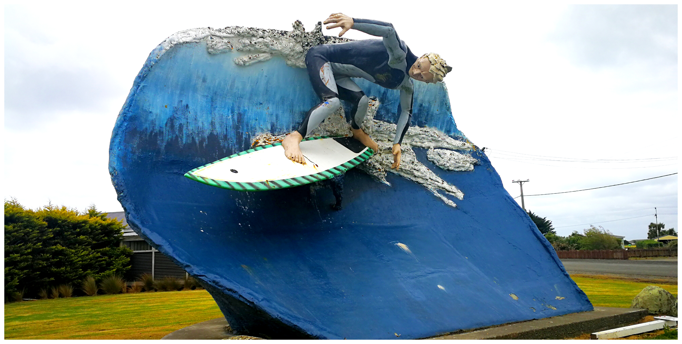
the iconic surfer at the entry to Colac Bay
There is a small freedom camping area along the northern end of the beach (NZMCA #9256). I wouldn’t call it overly roomy so it would be a case of ‘first in first served’.
Colac Bay Tavern
With all this exploring, we had worked up a thirst (and appetite). It would have been rude not to stop off at the Colac Bay Tavern. This is part of the Colac Bay Holiday Park.
They have a reputation for serving the best blue cod meals and burgers. We decided that we’d settle for the cross-cut fries and a couple of cold ones instead.
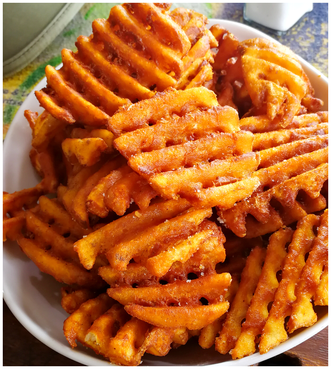
sustenance after a busy day exploring
Summary
Although we were getting close to our Christmas destination of Invercargill, we couldn’t resist stopping off in Riverton. Staying for a couple of nights gave us a chance to explore and experience an area that holds many childhood memories for Scotty.
Here is a link to a video of some of our favourite places we explored:
Invercargill is one place in the South Island we havent’ visited yet but hope to do a tour next year sometime, great photos of the wood pigeon btw
Thanks so much Amy. Hopefully you can add quite a few things to see on your “things to see” list. The pic of the wood pigeon was made much easier seem he was too drunk on berries to move much!!
Interesting and great Information. Thank you
Thanks Gary – appreciate your feedback. L
Great story about our little part of paradise. Thank you
Thanks Alan.
Thank you so much for that wonderful review. I lived in Riverton for 19 years until last year when I sold up and bought a bus and moved up to Taranaki. I will always love riverton; it is a very special place. I so enjoyed the photos that brought back fond memories. Thank you. Happy trails. Cheers Jude Sears
Hi Jude, thanks for your feedback. You spent a long time in Riverton and you must miss it I’m sure. You’re surrounded in another area which has much beauty and is on our list to visit when back up north (whenever that may be). Linda
As kids we grew to love Riverton. We often travelled out to Orepuki and Pahia, the two towns that our parents originated from, often stopping along the way. For much of our childhood the nights between Boxing Day and New Years Eve were spent at the carnival at the Sound Shell, and we always went to Riverton for the annual Regatta. We also many times had picnics at the pavilion, and we also holidayed at the crib of Roly Frost at Riverton Rocks. Many members of the families of both my father and mother were buried at the Riverton Cemetery. I am so thankful for this awesome review you have posted. I was in Invercargill two Christmases ago and made the trip out to Riverton, Colac Bay and Orepuki to reminisce.
Hey Andrew, thanks for your wonderful feedback and sharing your special memories you have and your connection to the Riverton area. Many have contacted me regarding their childhood memories of family holidays spent at Riverton Rocks.