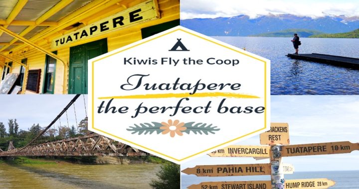
Time to Head to Tuatapere
After extending our stay at Te Anau (see our blog on Out and About in Te Anau and Doubtful Sound), we decided to gap it to the small settlement of Tuatapere.
The next morning, we woke to more torrential rain in Te Anau. We waited it out to see if it was going to ease. At 3 pm, we made the call to hit the road.
Tuatapere was only around 70km away, a nice short trip on rather a dodgy day. In true ‘Kiwis Fly the Coop’ fashion, we love to stay and play in ‘small town NZ’. The people are always friendly and welcoming. Quite often, that is where you find the most interesting history and make some amazing discoveries.
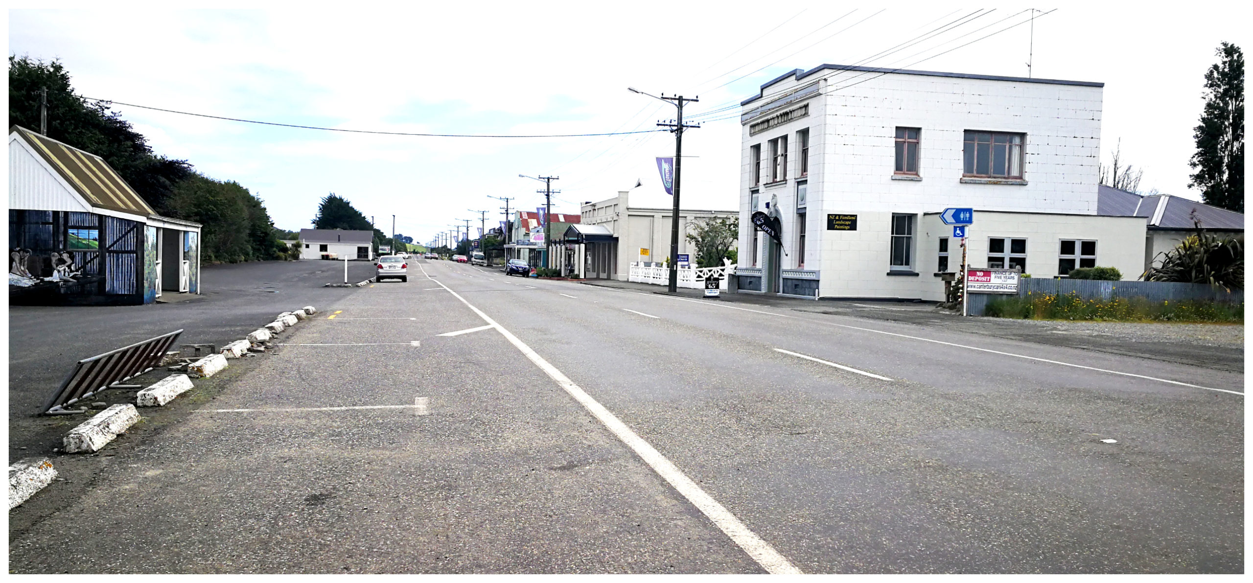
Describing Tuatapere as a ‘sleepy little town’ is not an understatement if the main street is anything to go by
Basecamp
We headed for the Waiau Town and Country Club (#9164) after reading some of the reviews on the NZMCA App. It sounded like a great place to set up basecamp for a few days.
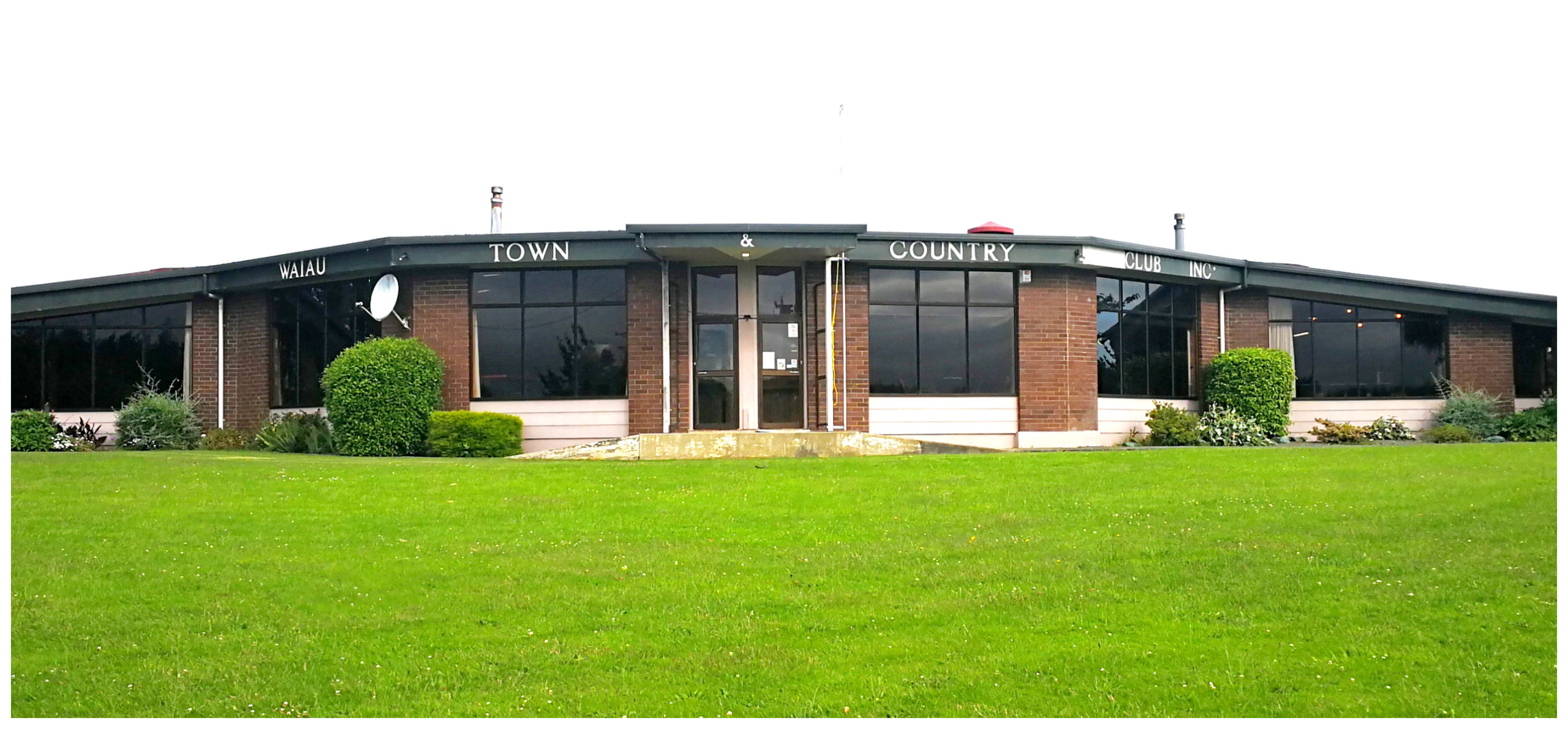
the club is located off the main road so it’s a quiet place to set up basecamp
There is no charge for NZMCA members. The club is open every day for drinks and the restaurant opens Friday, Saturday and Sundays. They allow campers to use their toilets during opening hours and there is water available on site. There is also a dump station only 50m up the road along with large recycling bins.
Although it is located down a side street, it is only a short walk into the small settlement if you need any supplies.
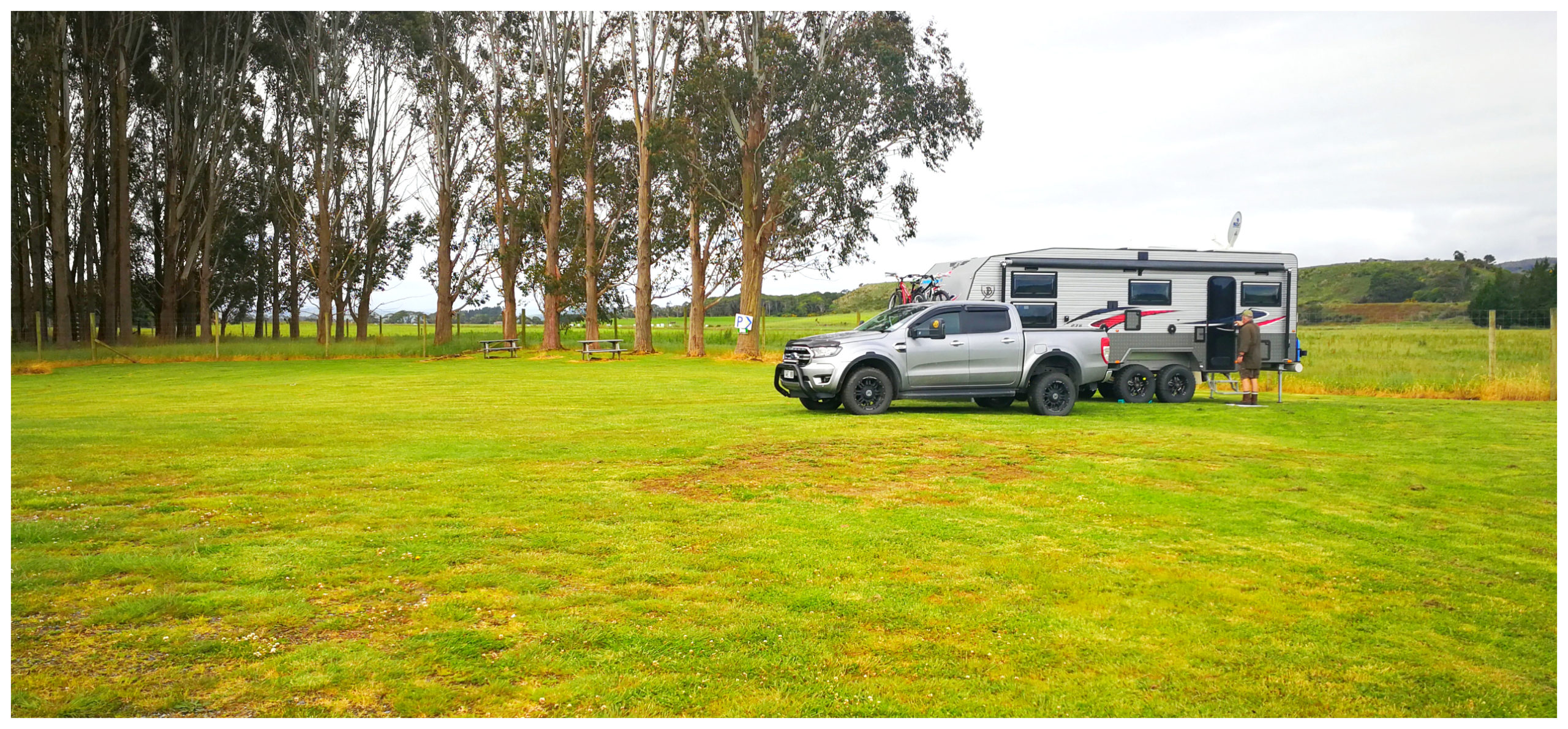
the wide-open grassed area at the rear of the club was our home for the next couple of nights and we made sure to repay their hospitality by having a few drinks at the bar
As NZMCA members, we consider ourselves extremely lucky to have these facilities on offer for us to use. We never take this privilege for granted and always make sure to either purchase drinks and/or a meal as a small token of gratitude.
All About Tuatapere
Tuatapere is a delightful rural town in Southland, just 8 km from the southern coast on the Southern Scenic Route from Invercargill to Te Anau.
It is quite often a town that travellers pass-through for a ‘pee and tea’ stop. We’re are so lucky to be ‘rushing it slowly’ to be able to make extended stopovers at places like this to explore its environs a little more thoroughly.
History
The first European settlers in Tuatapere were Hungarian. I wonder if that is how Tuatapere became known as New Zealand’s Sausage Capital. There is a sign at the town’s entrance which says so.
The famous butchery shop was forced to close quite a few years ago due to illness after pumping out tonnes of sausages, using an original recipe since the 80s. Tuatapere Sausages can still be purchased from a local business – Tui Base Camp, 4 Mcfeely St. They make the famous sausages in their own butchery on their premises.
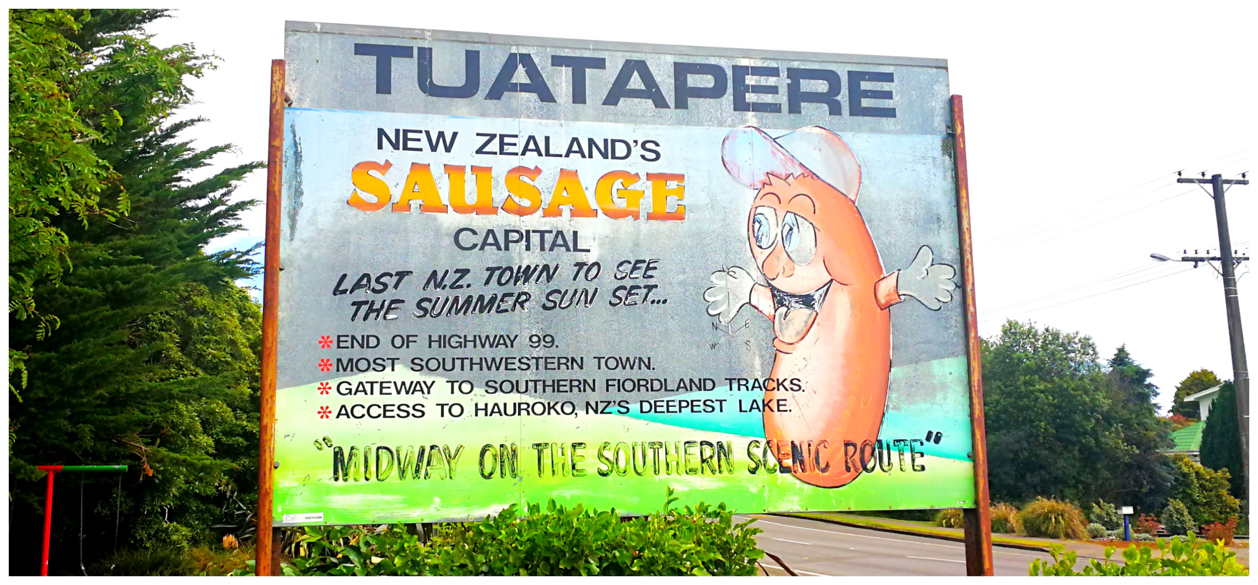
NZ’s Sausage Capital…….because the sign says so!
Railway
In 1909 a branch line was opened up from Invercargill, which was then extended to Orawia (a further 14 km north-east). This opened up some employment opportunities as an engine depot was established in the town. Well, this was until the steam engines were replaced with diesel ones in 1968. This resulted in the closure of the Tuatapere engine depot.
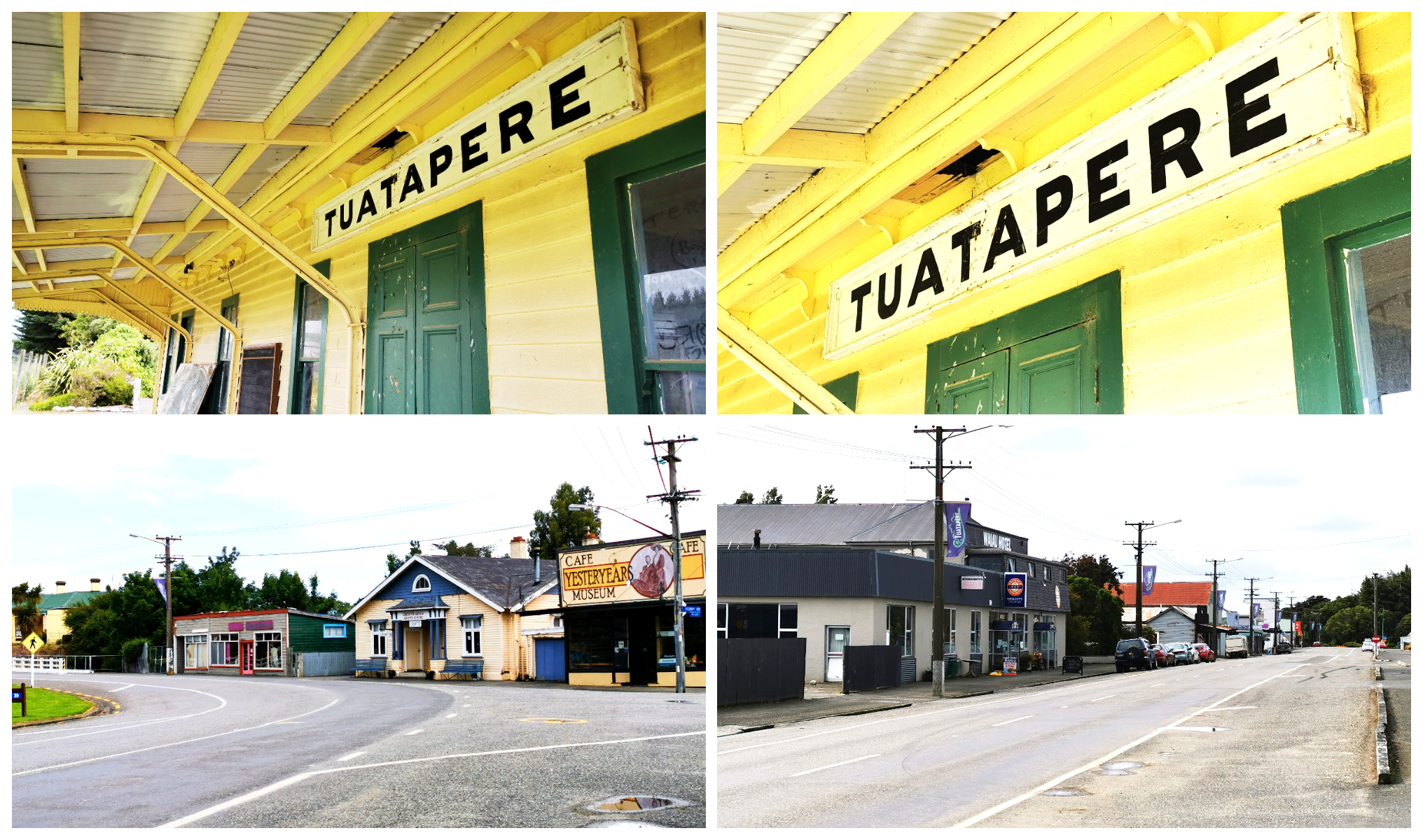
The Railway Station pays tribute to busier days gone by plus more of the old shops that line the main road
Due to a lack of rail traffic, the line was closed in 1976. Some relics of this era has been preserved in Tuatapere, including the old station building and goods shed.
Saw Milling
Tuatapere has a rich sawmilling history and was home to numerous sawmills in the area. It started as a sawmilling centre in the 1880s. Through the 1920s and 1930s, seven mills worked the timber from both the Longwood Range in the east and the Rowallan Forest to the west.
A couple of sawmilling companies are still operating in the local area.
Off to Explore
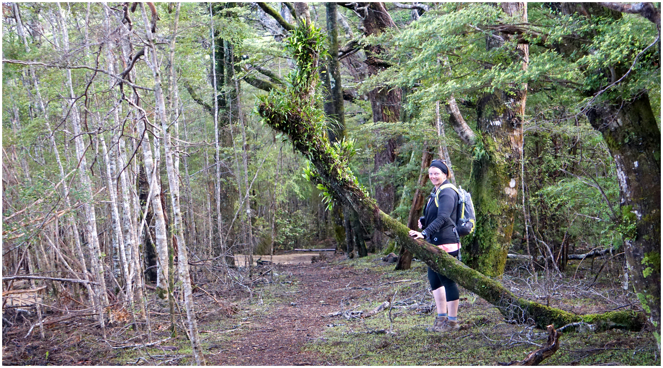
We set off the next morning to explore the areas surrounding Tuatapere.
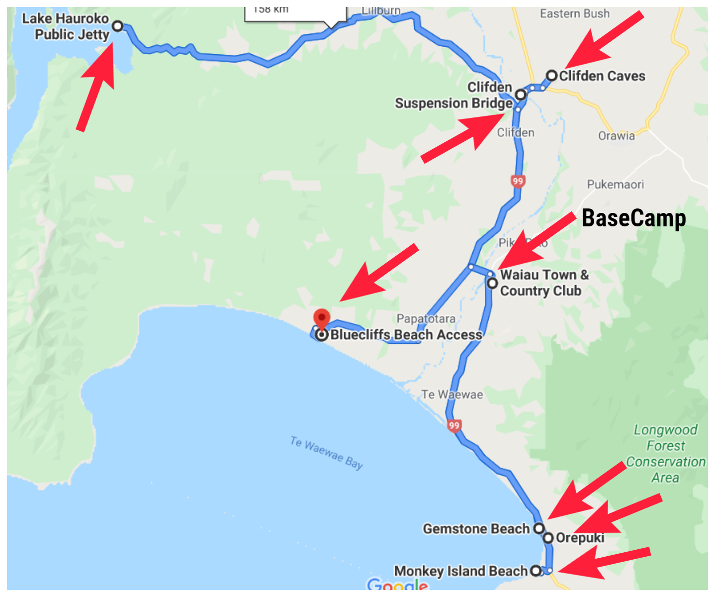
follow the red arrows to see where we went exploring
Lake Hauroko
A 45km drive from Tuatapere, we found Lake Hauroko. This is NZ’s deepest lake at a depth of 462m (that is a massive 1,516 feet). The second deepest in the country is Lake Manapouri at 444m. The long S-shaped lake is 30 km in length and covers 63 square km.
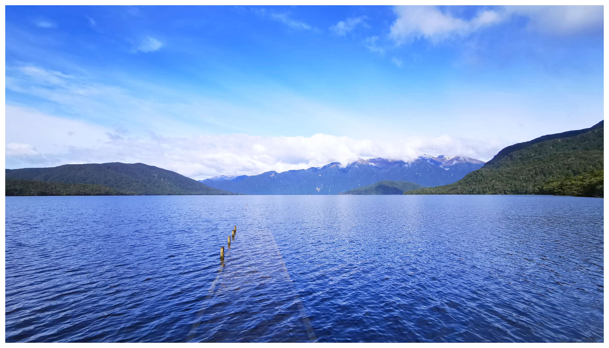
spot the submerged jetty stretching out into the lake
History and Legends
In the middle of this crystal-clear lake, there is a small island called Mary Island. There is a legend linked to a Maori woman buried there, known as ‘the lady of the lake‘. Her burial ground was discovered in one of the island’s caves in 1967, much to the delight of archaeologists and tourists.
Archaeologists believe she was buried in the 16th century and she was laid to rest wearing a flax cloak, seated in an upright position on top of sticks and leaves. They ascertained that she was a Maori female of high-ranking status – in fact, a chieftainess of the Ngati Moi Moi Tribe.
Although the island has open access, her burial site is protected by a grill made of steel and wire mesh.
High Lake Levels
As mentioned in my previous blogs, we had received some horrendous rainfall in the days preceding our arrival. I have no doubt that the lake at this time, far exceeded its official depth of 462m. The shores of the lake were submerged and walking one of the loop bush tracks was quite challenging. We ended up having to admit defeat and we had to turn around and make our way back to the car.
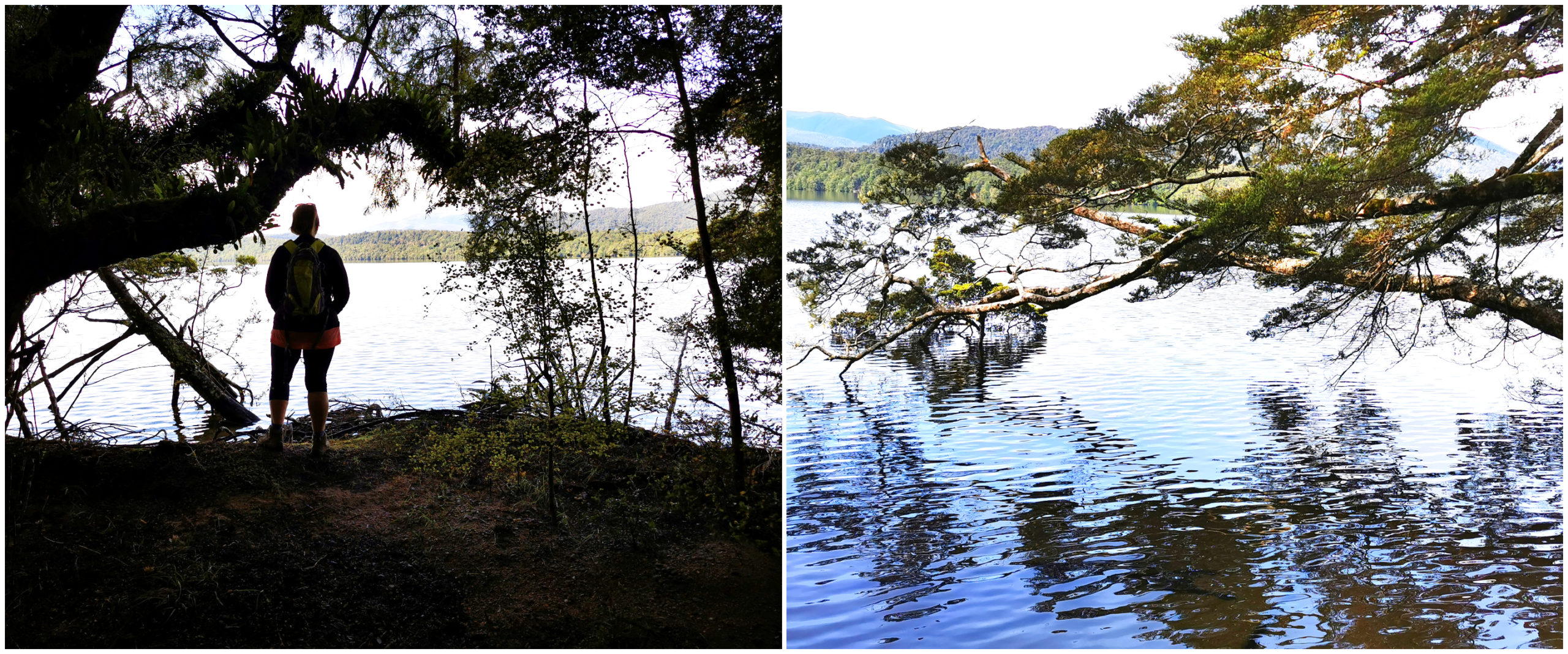
Tackling the challenging lake levels on our walking track
The lake is notorious for its sandflies. They didn’t pose too much of a problem for us whilst walking but we did have quite a few hitchhikers in the cab of the ute for the rest of our driving day.
back onto terra-firma and making our way back to the car park
There is no camping at the shores of the lake, however, there is a free DOC Camp 7 km back towards the main highway.
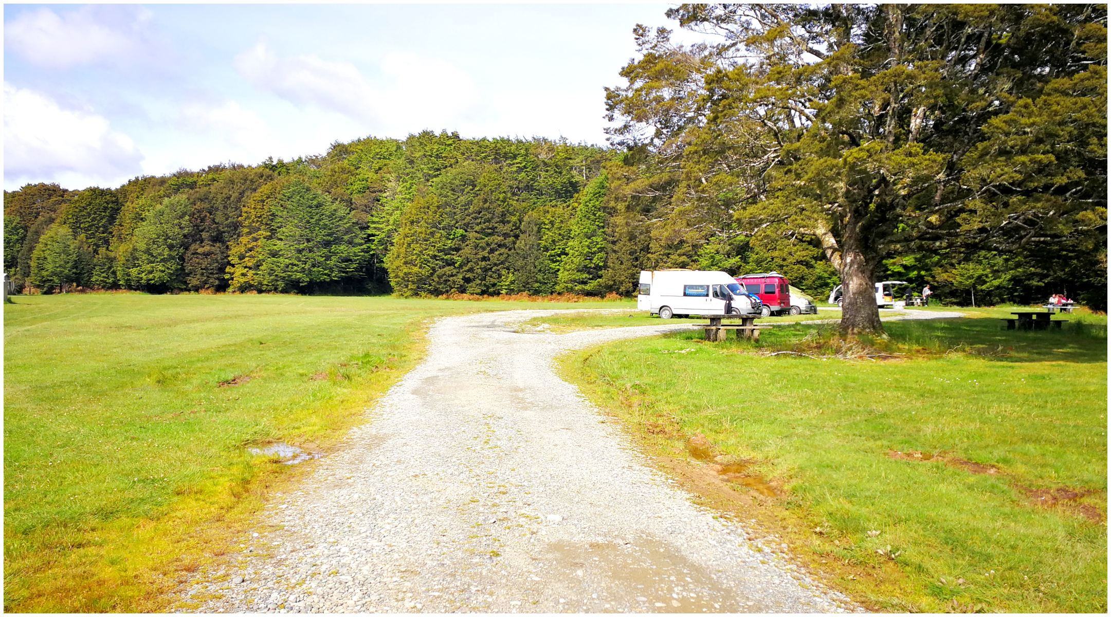
The spacious free DOC Camp
The Clifden Suspension Bridge
Located 15km from Tuatapere, is the single lane Clifden Suspension Bridge, spanning the Waiau River. The bridge was officially opened in 1899, replacing a punt which operated across the swift and dangerous river. This bridge was superseded by a newer version 130m downstream in 1978. This was to cater for an increased volume of traffic from the Manapouri power project.
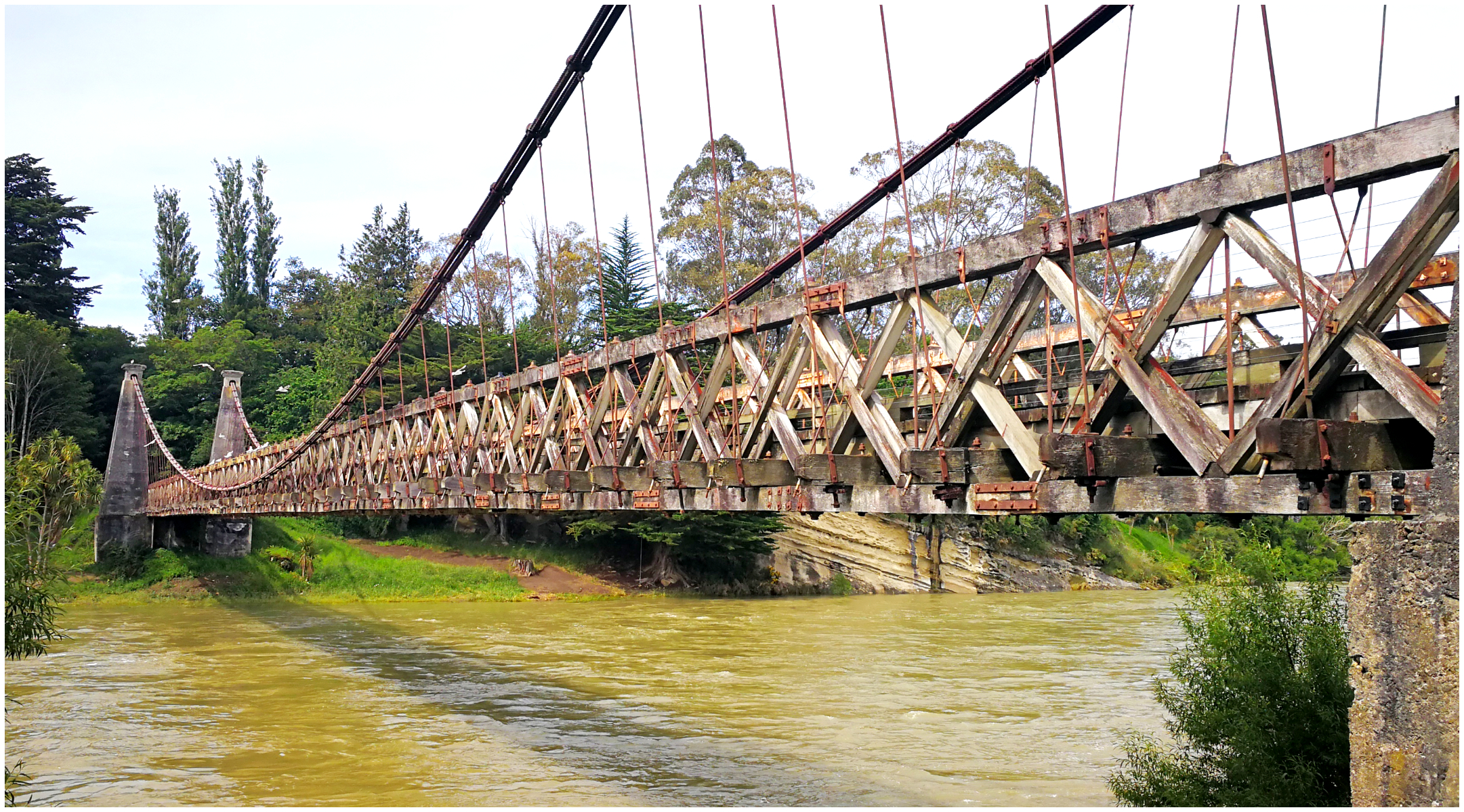
the bridge is constructed of 27 steel cables attached to concrete pillars (clad to resemble stone pillars) and still has its historic wooden decking
It was an important transport link in what was a relatively remote part of Southland.
It never ceases to amaze me how incredibly clever and ingenious those early builders and engineers were. Okay, the bridge has been restored to its former glory, but still, very much stands the test of time.
Since closing in ’78, it has remained a ‘pedestrian-only’ bridge. It did however temporarily close after a large earthquake in 2010. It sustained some serious damage. Thankfully the bridge was repaired and reopened to pedestrians in 2013.
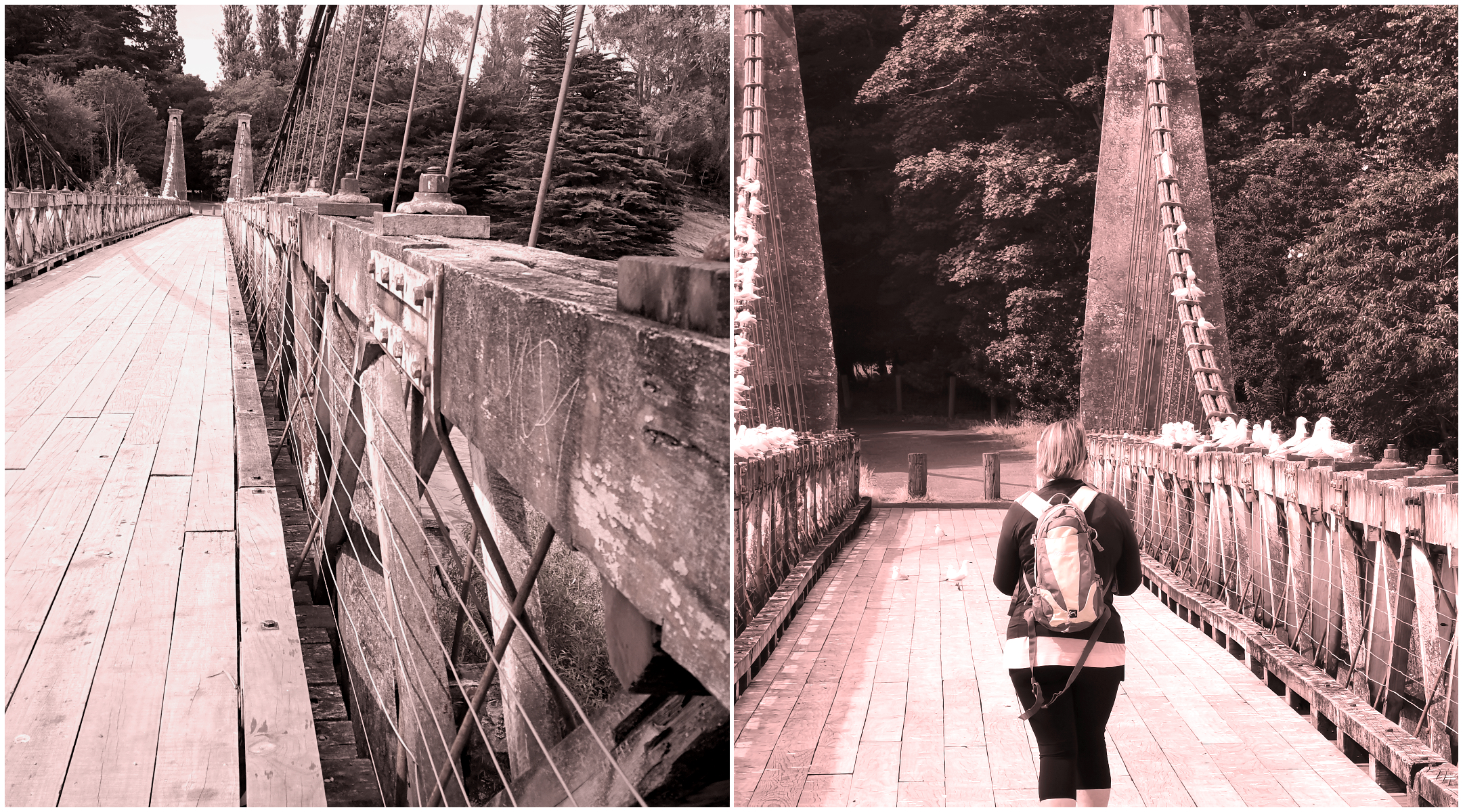
Just me and some of my feathered mates who seem to love this end of the bridge
Clifden Limestone Caves
Limestone caves are actually the most common type of cave in NZ and the world. They likely formed a mere 18 million years ago!
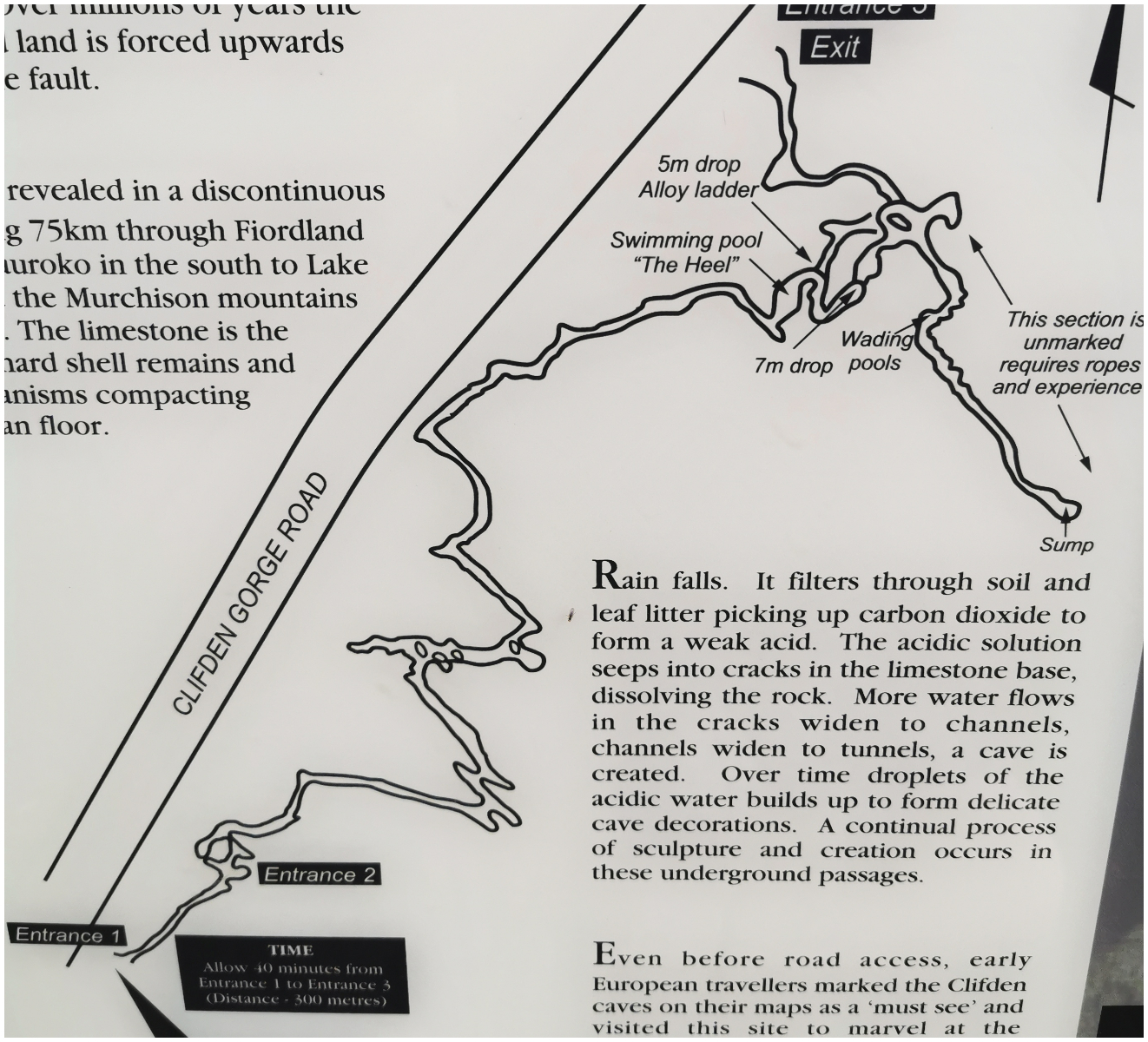
The map showing you the layout of the cave structure
The well-signposted entrance to the caves is fairly easy to find on the Clifden Gorge Road. It’s then quick climb over the stile and that is pretty much where the word ‘easy’ stops.
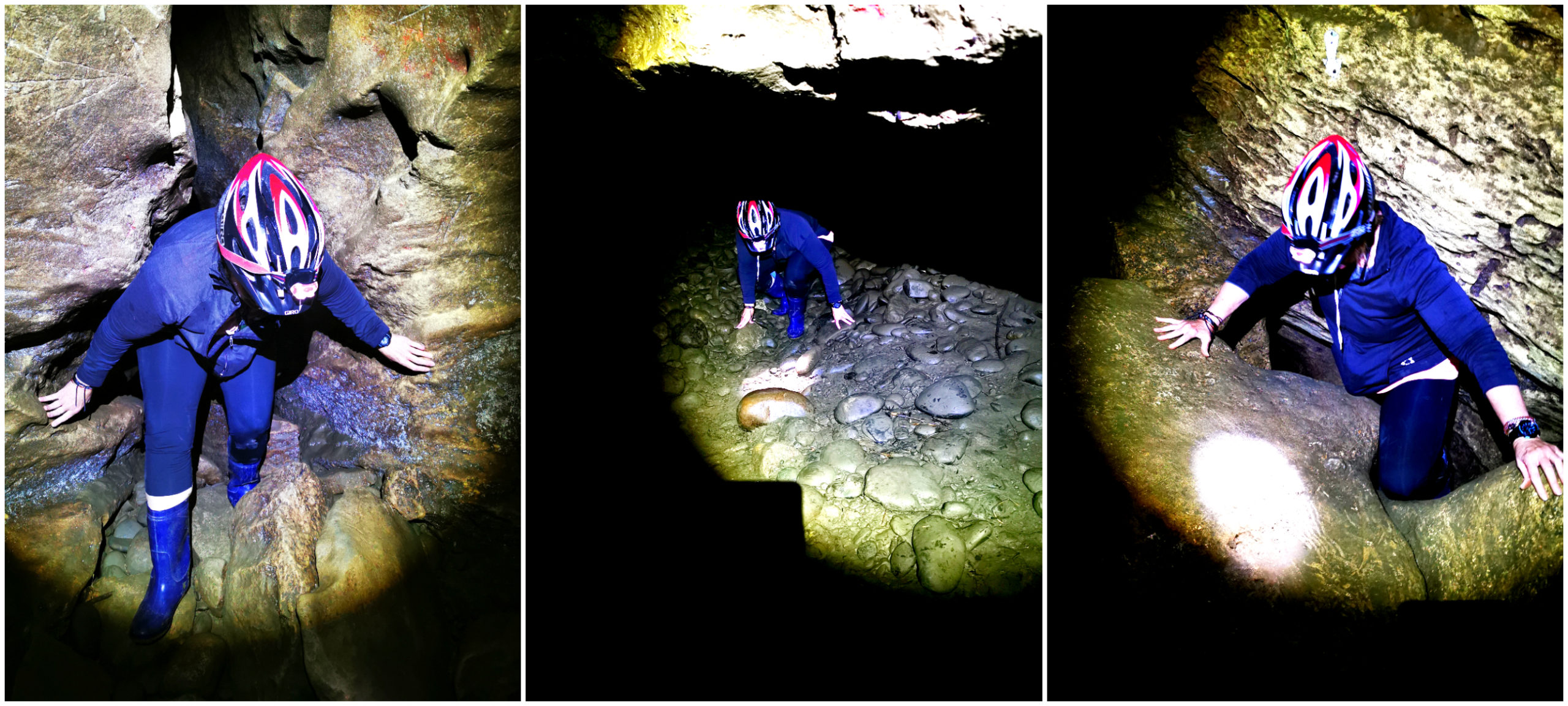
I’m not sure I’m built for caving!!!
It takes approximately 2 hours to traverse through the caving system. A high level of fitness and agility is required. You need to be prepared to get wet and very muddy. You shimmy and squeeze your way through rocks and openings. A helmet is recommended and a torch (or two) is compulsory equipment. You cannot see a hand in front of your face.
Yup, there is a small gap there somewhere to squeeze through!!
A short distance from the start of the cave, I was seriously wondering if it was a good idea to keep going. Scotty (who as usual took the lead) talked me through the extremely confined spaces and when it was safe to put my head up. Scrambling through some small gaps in shear solid rock, I was thinking how fortuitous it was that I wasn’t claustrophobic.
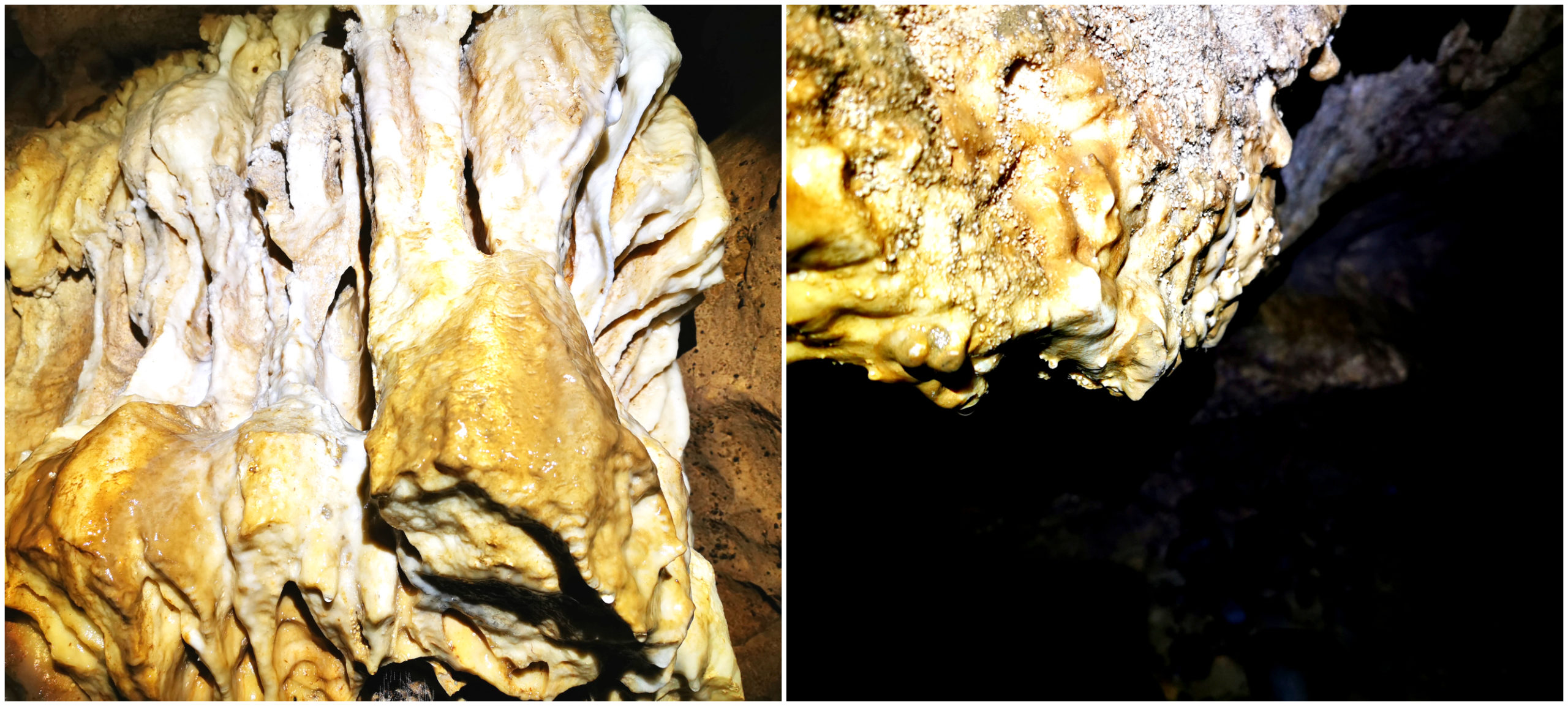
These stalactites are the exact reason why you need to wear a helmet…..so I found out at least 4 times!
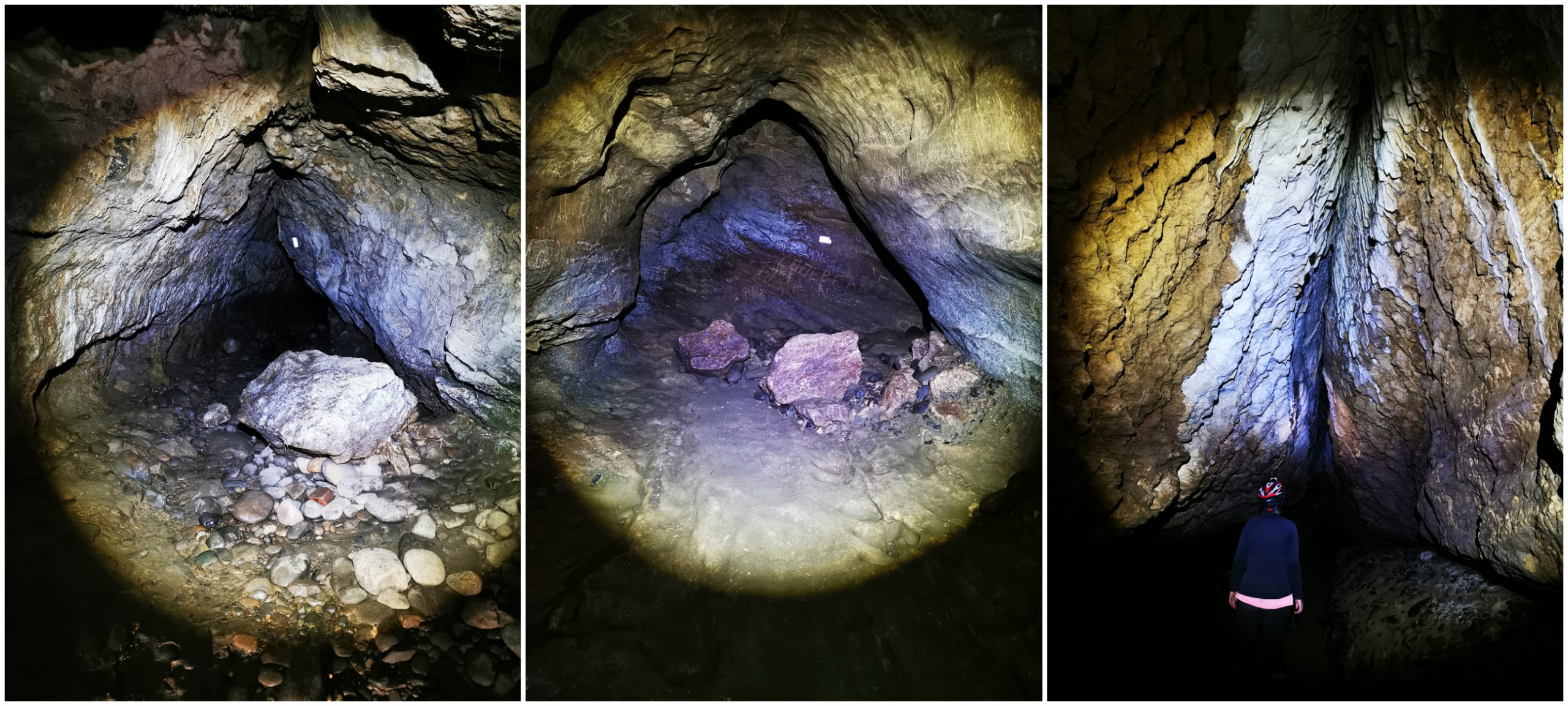
We were thankful for the orange markers, pointing which way to go. There are tunnels that lead off in different directions and it would be extremely easy to become disorientated.
The Swimming Pool
I had read about a point in the cave called the ‘swimming pool’ which was about an hour into the cave. This wasn’t something I was particularly looking forward to. Getting wet was something I was prepared for. I was surprised at how wet we had to get.
There is a very narrow ledge around the pool (which is cold and very deep). Under normal conditions, it would be up to at least your knees but with the heavy rainfall of the past few days, the water level had risen somewhat. It was quite fortuitous that a young German couple arrived at the pool, just as Scotty and I were trying to work out how deep the water was over the ledge as we couldn’t see where it was.
We politely offered for them to go first!! And off they tentatively went. We trained our torches on them and watched them go deeper and deeper. It got to just over their waist before they got to the other side.
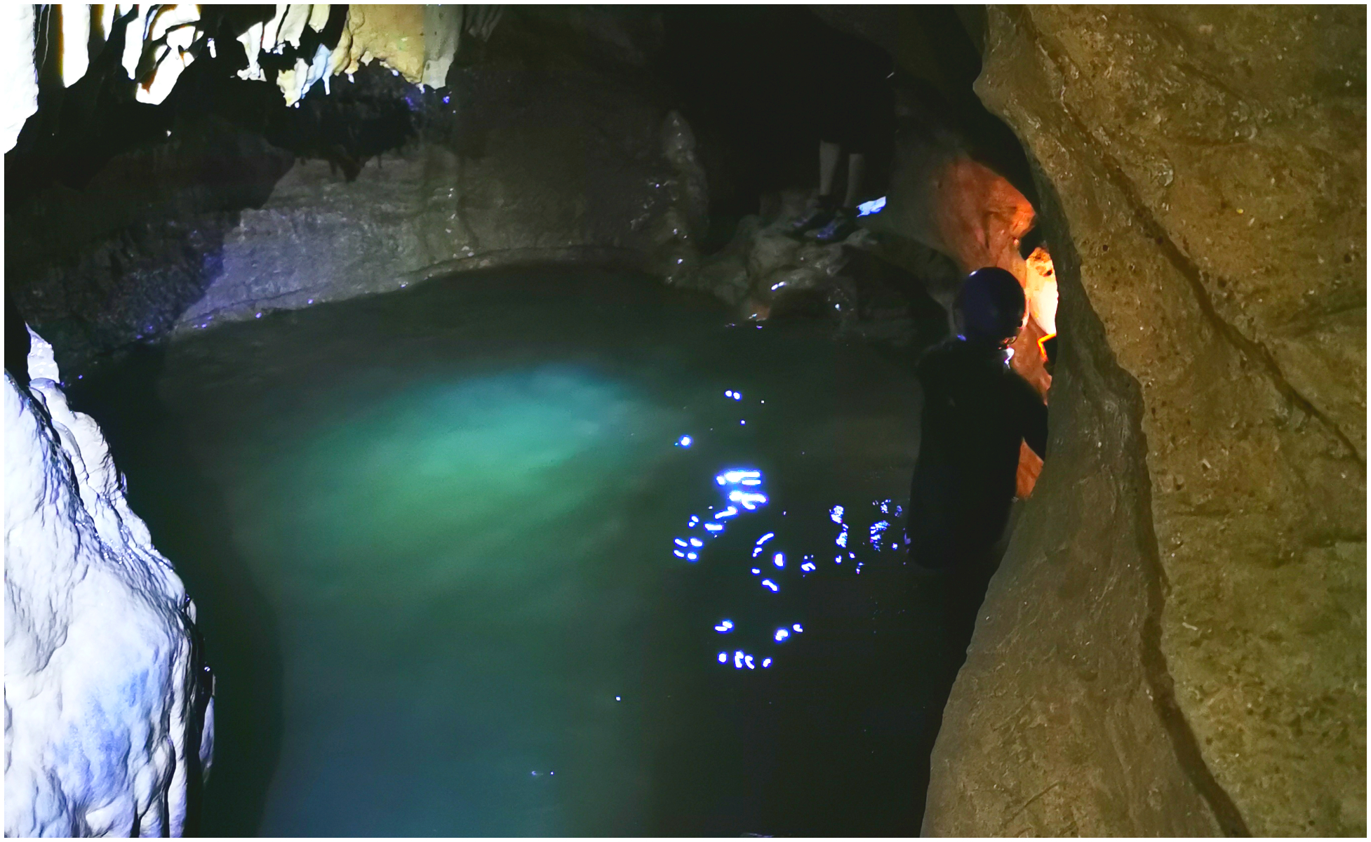
The ‘young’ German tourists negotiating the ledge of the swimming pool
We both agreed that it wasn’t worth the risk to mobile phones and cameras as we didn’t have our waterproof bags with us. We turned around and made our way back out the way we came. Once again crawling and grovelling through gaps, which I’m sure were smaller on our way back!!!
The Tourists Made it
We met back up with our German Guinea Pigs back at the car park. They assured us that we didn’t miss much more of the caves. In fact, things got a bit worse. They had to navigate slippery ladders on some steep rock faces. Yup, I was very glad we didn’t proceed through the swimming pool.
Continuing South
Although we were intending to continue south after leaving our basecamp in Tuatapere, we thought we’d explore some places a little further along the Southern Scenic Route.
Orepuki
We had worked up a bit of an appetite after our caving exploration. We headed to Orepuki Beach Cafe for lunch. It had come very well recommended by some fellow campers.
Oh my…..no words needed
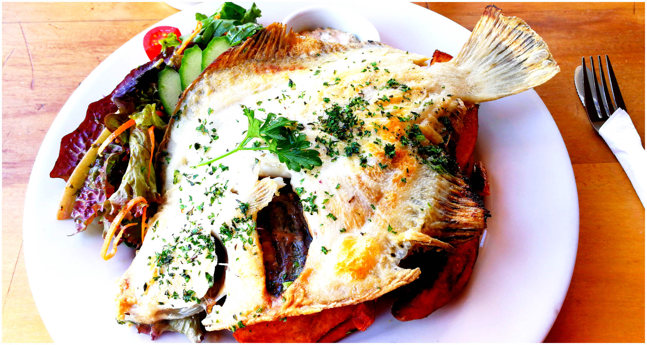
I couldn’t resist a cooked flounder and Scotty enjoyed a lovely flavoursome curry.
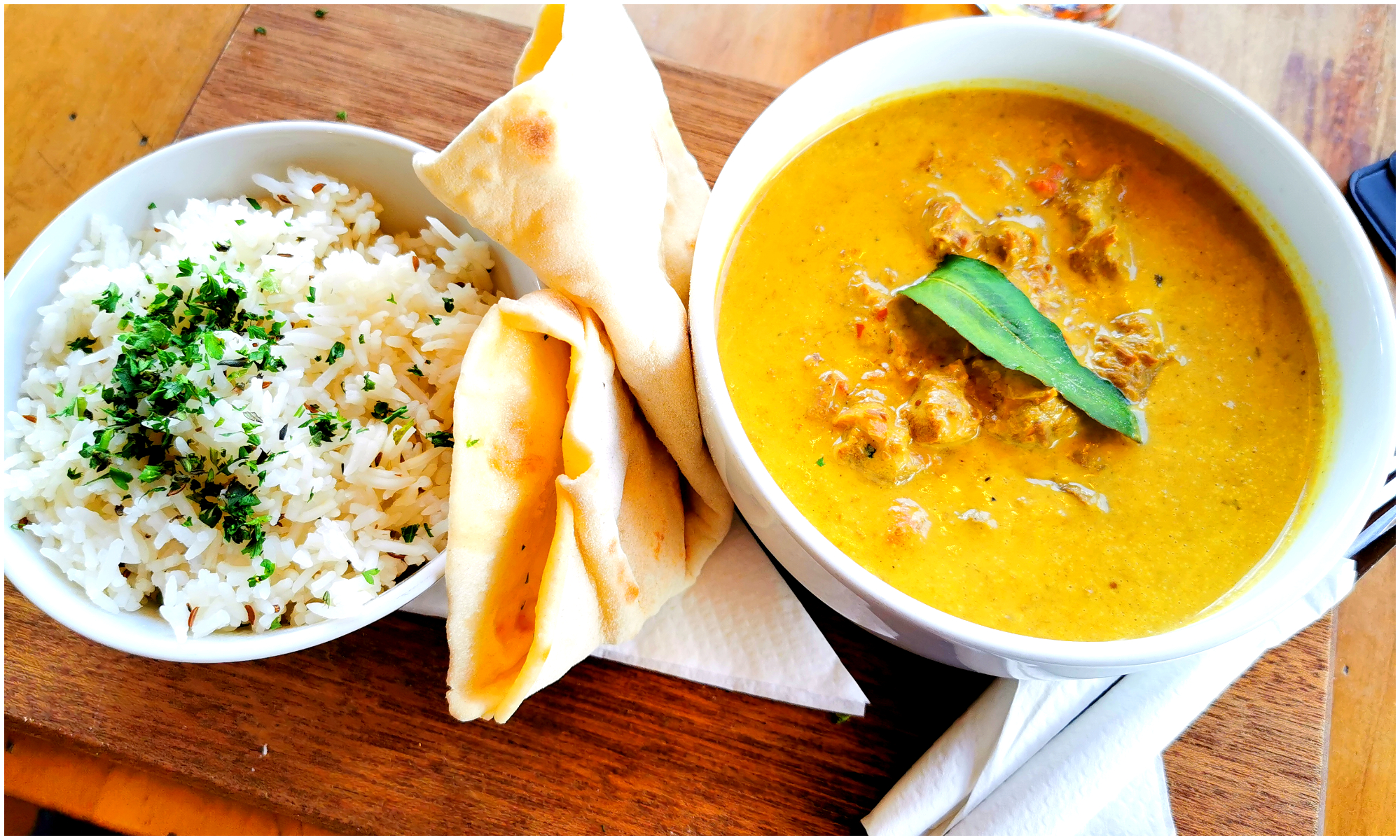
Nothing better than a delicious, flavoursome curry
The surroundings are just beautiful as we took in the character of the grand old house that is the Orepuki Beach Cafe. It was built in 1885 and is located on the main highway overlooking Te Waewae Bay.
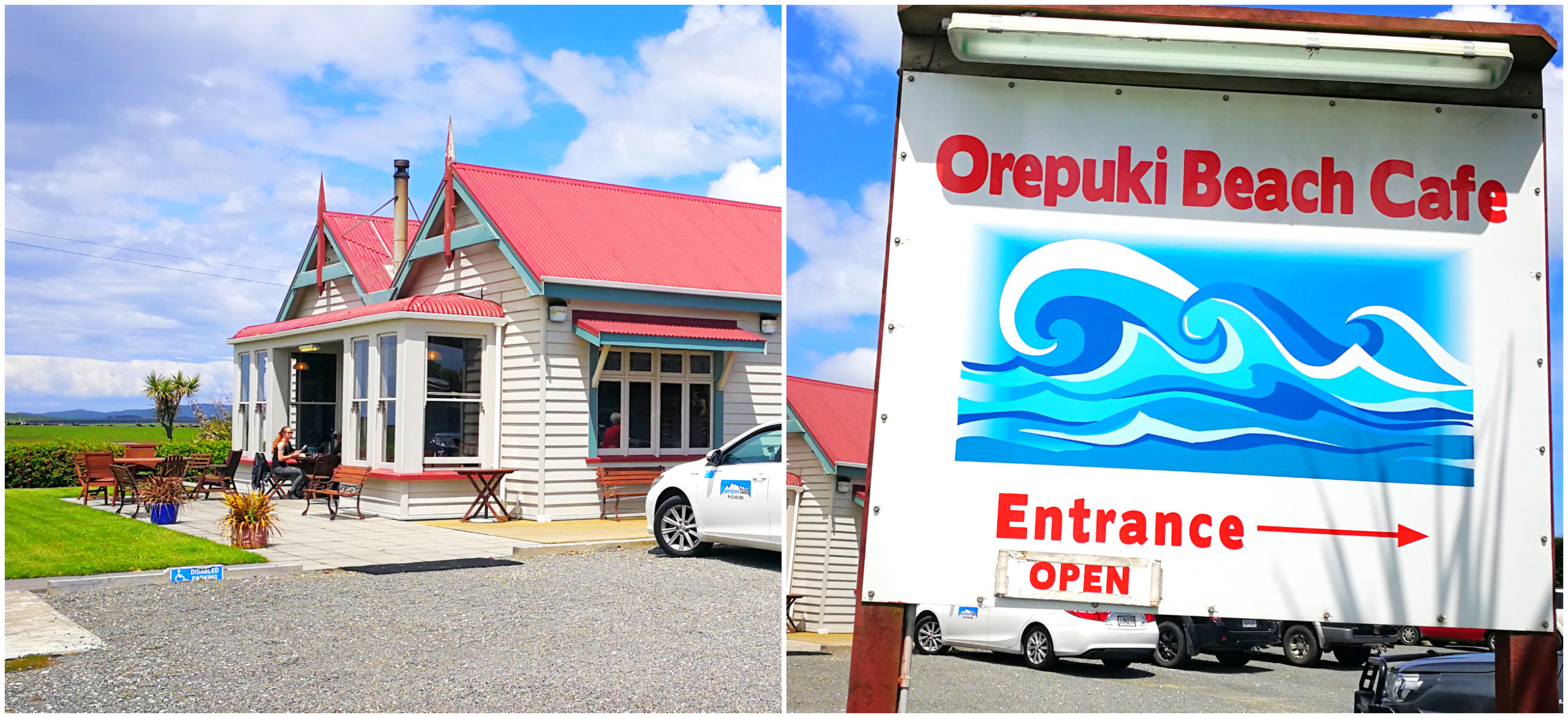
The beautifully restored historic Orepuki Beach Cafe sits in the middle of nowhere
The cafe still sits on 8 hectares of land. It produces its own lamb and beef so very much a paddock to plate menu.
Monkey Island
After we had had our fill at the cafe, we continued along SH99 as far as Monkey Island. This is a popular and well-known stop for many travelling tourist and locals.
They have recently changed the freedom camping area and now there is a large hardstand parking lot for self-contained campers to stay.
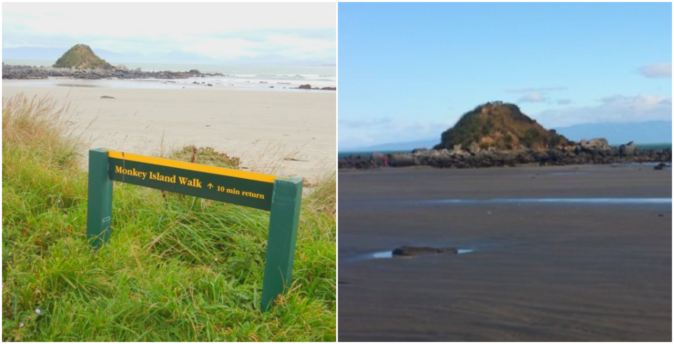
The small and unassuming Monkey Island
At low tide, you can easily walk to the island. There is a stairway that leads to the top of the small island. You can then look along the entire stretch of Te Waewae Bay. This beach is popular for horse riding, surfing and picnics. The large expansive beach always looks deserted as groups spread out along the curved shoreline.
How Did it Get Its Name?
It turns out that the name has nothing to do with actual monkeys! Before the road from Riverton was constructed, a slipway was built for boats on the small island. This was to deliver supplies to the mainland. They used a ‘monkey winch’ to haul these boats onto the slipway – hence the name stuck and became Monkey Island.
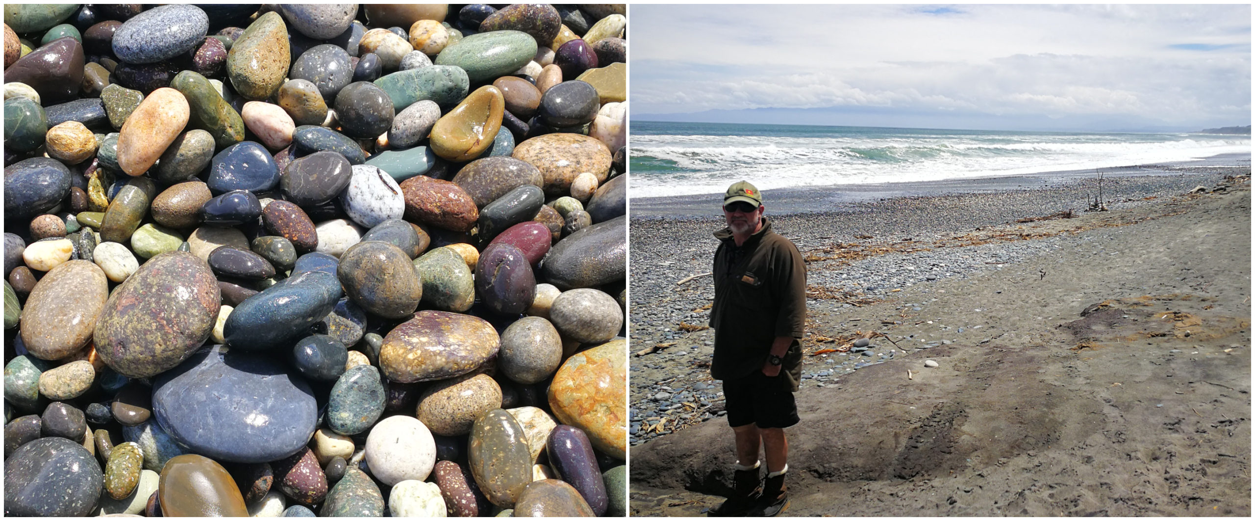
Gemstone Beach
Just a 5-minute drive back long SH99 you’ll find Gemstone Beach. It a beautiful, wild and fascinating beach.
It is in a constant state of change with the surface changing from sandy gravel to stones depending on tides and storms.
Gems such as garnet, jasper, quartz and nephrite can often be found on the beach. Many spend hours beachcombing and fossicking, hoping their efforts yield such gems.
I was on strict orders not to overload the caravan!!!
Our stroll along the beach with our heads down didn’t come up with the goods, but we still found some interesting stones. We didn’t linger too long as it wasn’t very conducive to beachcombing on the day we visited.
The beautiful sheer cliffs that hug the shoreline
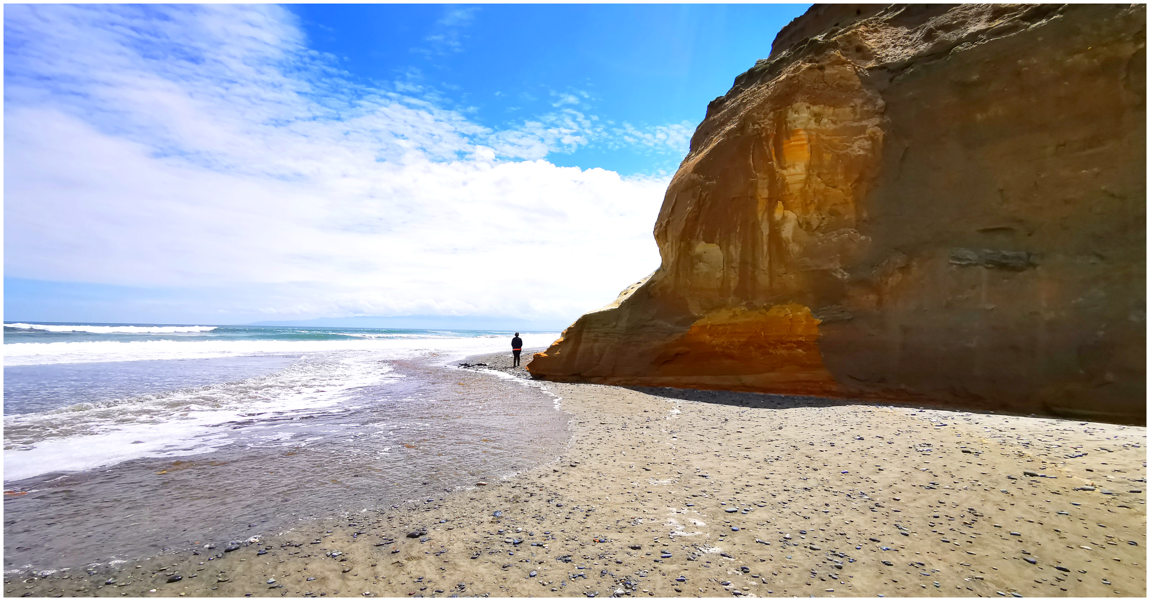
Bluecliffs Beach
A 28 km drive from Tuatapere, towards the coast, we found Bluecliffs Beach. Hikers who are wanting to walk the Hump Track (60km) and the South Coast Track will find themselves starting from the carpark located at Bluecliffs Beach.
It’s a long stretch of undeveloped coastline which is a designated marine mammal sanctuary. Quite often, you can spot Hector’s dolphins and Southern Right Whales.
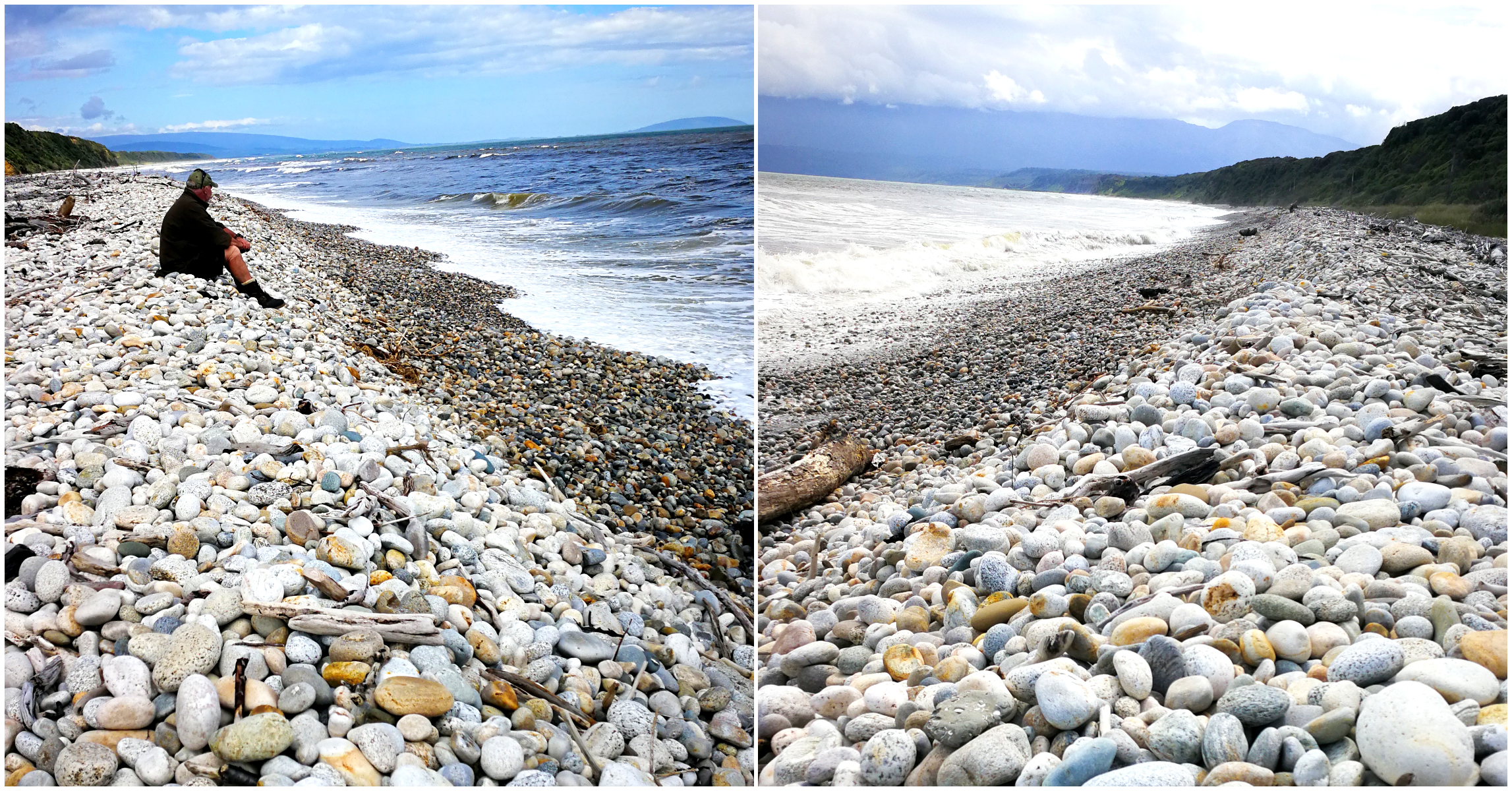
Time for contemplation whilst listening to the crashing waves which constantly polish the white stones of Bluecliffs Beach
Bluecliffs Beach used to be a sandy beach. Nowadays, huge piles of white pebbles are stacked up against the high tide mark. Take care on an incoming tide as the water can come right up to the cliffs. This can easily trap the unaware.
The beauty and solitude of the beach are obvious. The angry waves rolling in constantly tosses and polishes the white stones.
Click on the link below for a video of our highlights while exploring around Tuatapere.
Thanks for the Tuatapere blog and video. Very interesting and appreciated. I was last there about 7 or so years ago and stayed in the local pub there for about 4-5 nights.
Thanks Kevin, hope it brought back some memories for you.
Great blog, very enjoyable reading. Just 1 correction though. The famous Tuatapere sausage is locally made at Tui Basecamp. (formerly Highway 99) Changed hands 2nd September 2019
Oh gosh, thanks for the updated information. I’ll do some research and amend it where appropriate (we missed out buying some while we were there!!)
Great advertising for our progressive little town. I have lived in this village for a year or two born here 1941 have been the local Councillor for some 15 years and this would be one of the better blogs i have witnessed so thank you for your interest and your promotional expertise. Having been to most of the places you have mentioned, i would thank you for your dedication to this fantastic report of our local area.
Oh wow, thank you so much for your feedback. It means a lot. It is always nerve wracking getting feedback from a local, always hoping you’ve been accurate and respectful. I’m so glad you enjoyed reading it and watching our video. I’ve had lots of positive feedback from our followers, many of whom are in the NZMCA and keen travellers. Many of them are hoping to pay a visit and stay in Tuatapere when life returns to normal. We hope to return again some time in the near future – we’d love to do the jet boat trip on the lake. Linda