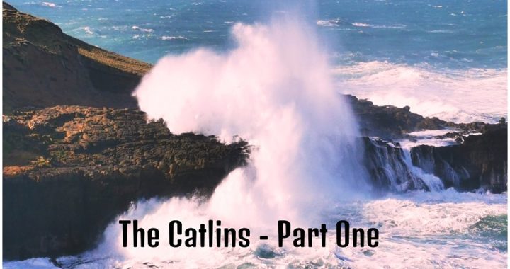
The Catlins was an area we were ‘itching’ to get to explore. Okay, COVID 19 made us delay our trip, but we eventually had a window of opportunity to start our voyage of discovery.
The Catlins is a spectacular coastal stretch between Invercargill and Balclutha. It has a rugged and untouched beauty that is quite unique.
There is so much to see along this Catlins coastline so we decided to tackle it in chunks. So here is Part One, there is more to come so keep your eyes peeled for further blogs.
Scroll in or out on the map above to follow the route we took for the first part of our trip.
Fortrose
Starting out in the far south and working our way northwards, our first stop to explore would be Fortrose.
Invercargill to Fortrose is around a 45km drive and is the gateway to the Catlins.
It’s a small sleepy town that is situated on the shores of Toetoes Estuary and close to the mouth of the mighty Mataura River.
It is a popular spot for water sports and fishing and also boasts the South Islands most southern golf course.
There is a freedom camping spot right beside the estuary but we had our sites on another location further along the route for basecamp.
History
In its heyday in the early 1900s, it was a much livelier centre. First established as a whaling station in 1834. This was only shortlived, being replaced with sawmills, a port, farming, blacksmithing, trading, churches and a school.
The newly built railway (1911) bypassed Fortrose, this coupled with the sea lane becoming impassable due to the sand bar at the Mataura River Mouth, were the contributing factors in the decline of the growth of Fortrose.
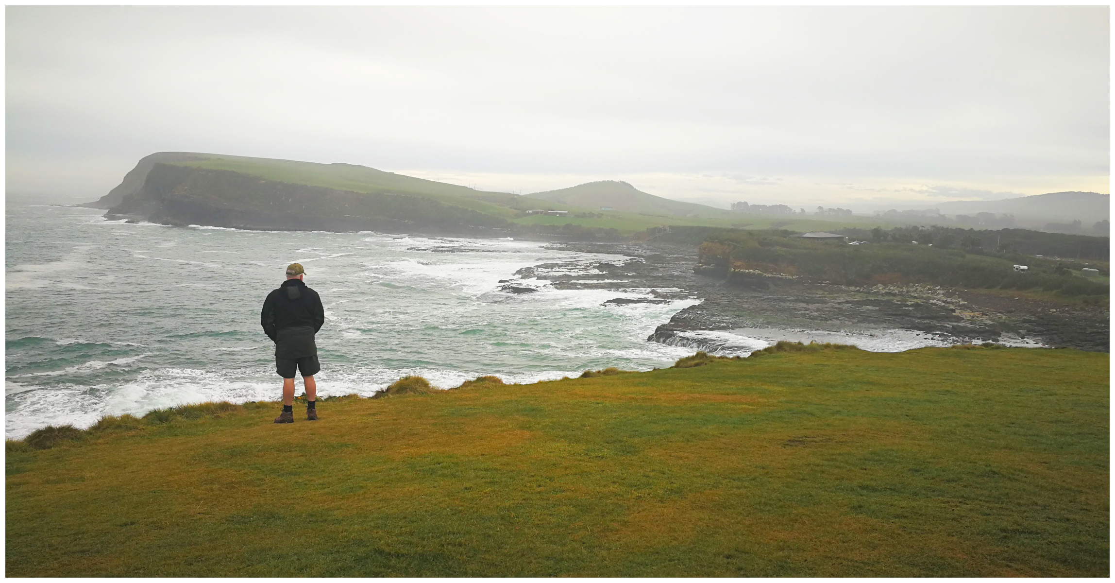
Fortrose Cliffs
Located 2 km from the township you will find a stomach-fluttering steep cliff lookout. It is certainly worthy of a photo-op stop. We managed to drive the ute right to the point to enjoy a 180-degree view back towards the township and out over the rocky outcrops.
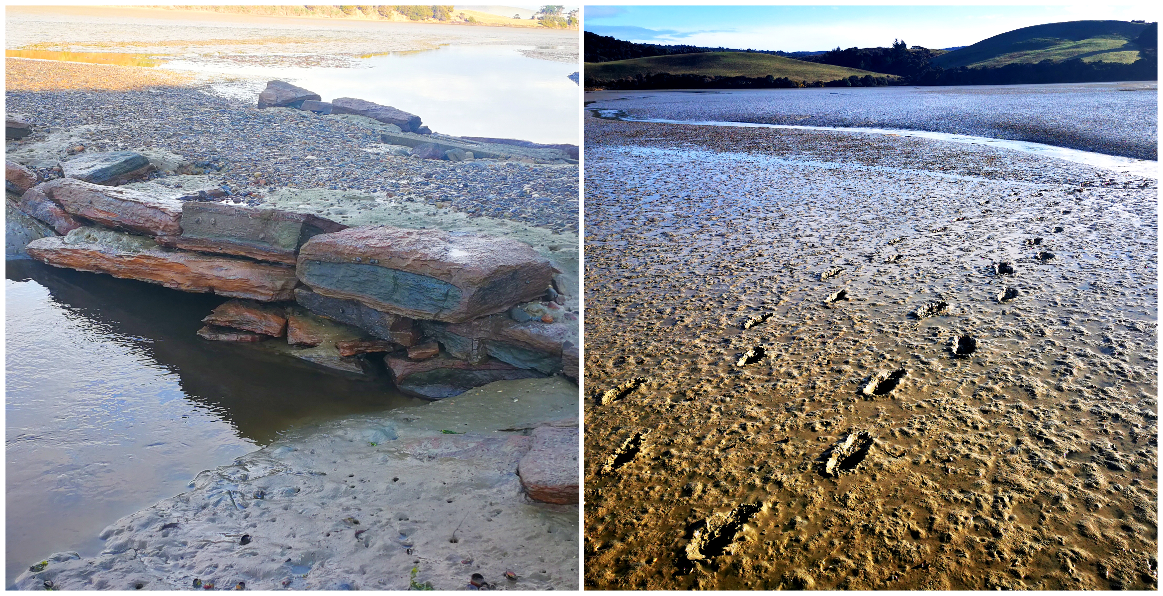
It also offers spectacular views over the mouth of the estuary. On the way to the lookout, there is signage indicating the old shipwreck of the Ino which ran aground in 1886. Not much is left of the wreck and we did struggle to see any sign of her. The tides weren’t in our favour to fossick around to try and find the remaining evidence.
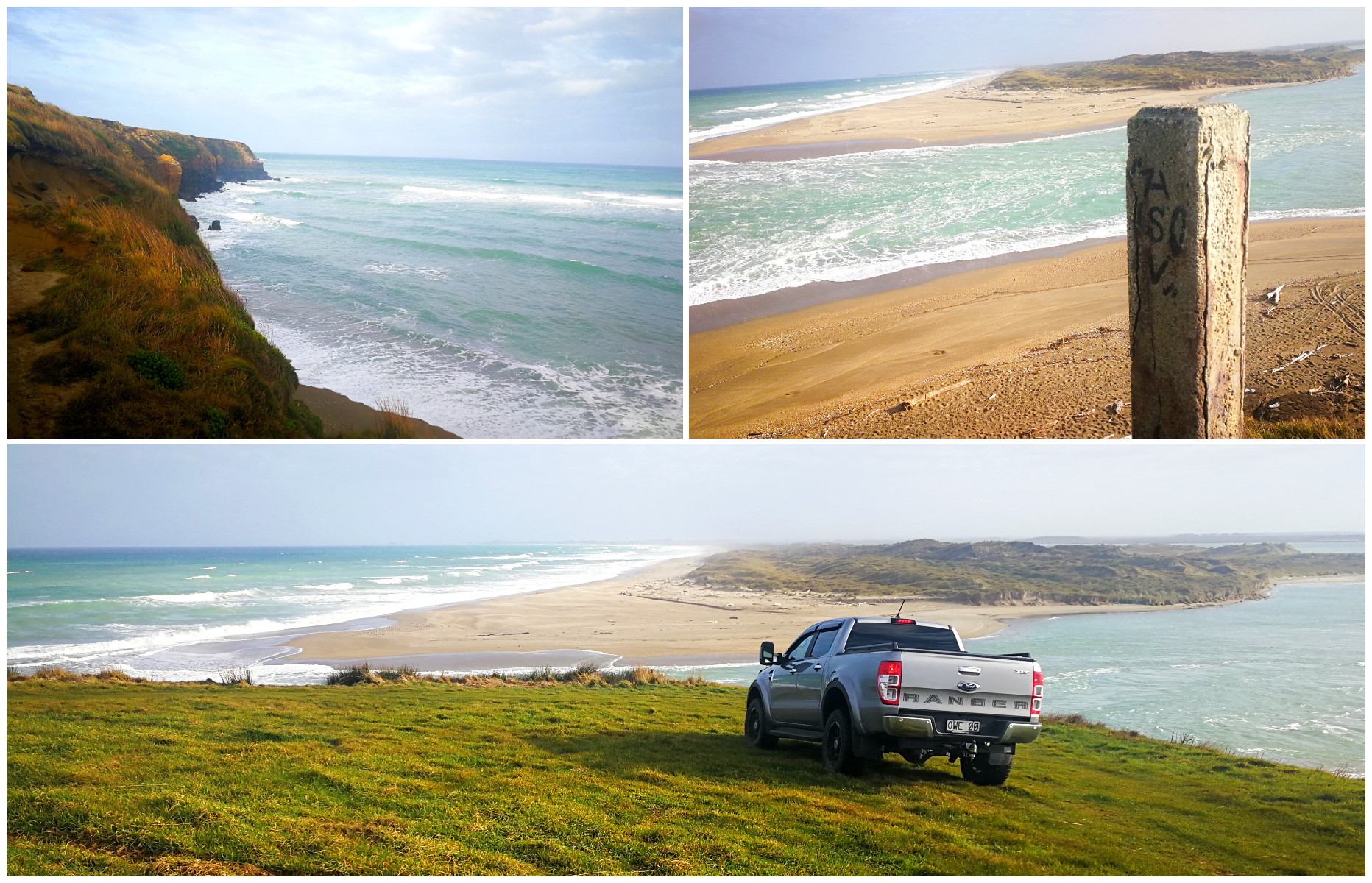
it’s a stunning view over the inlet at Fortrose
Waipapa Point Lighthouse
Just a short 10km drive from Fortrose, you come across the Waipapa Point Lighthouse. From the car park area, it is a quick 10-minute walk past the location of where the old lighthouse keeper’s house stood.
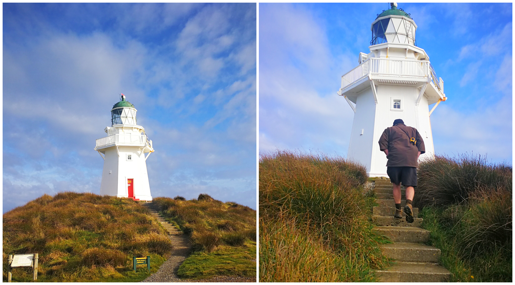
beautifully restored and still standing proud keeping guard over the rocky shores
The lighthouse was built in response to the tragic sinking of the passenger steamer Tararua in 1881. It floundered off the Waipapa Point and all but 20 of the 151 people aboard drowned. The lighthouse was first lit in 1884, became automated in 1974 and still shines its light today.
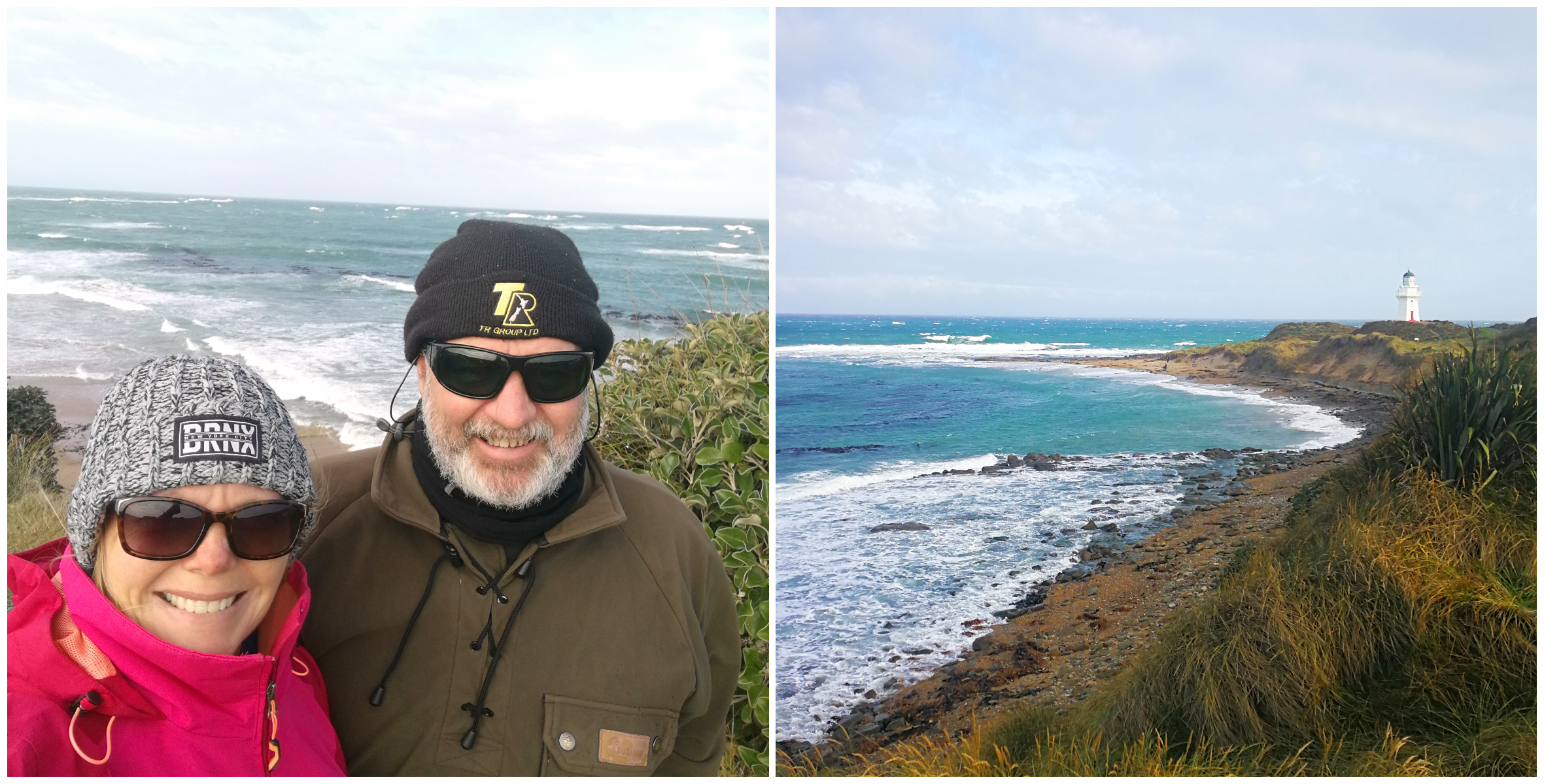
it was a cold and windy spot on the Waipapa Point
At the base of the lighthouse, we found some lazy looking fur seals basking in the sunshine, looking like they didn’t have a care in the world.
Tararua Acre
As mentioned earlier, the SS Tararua struck the reef of Waipapa Point, near to where the lighthouse is situated. It sank the next day and became the worst civilian shipping disaster in NZ’s history.
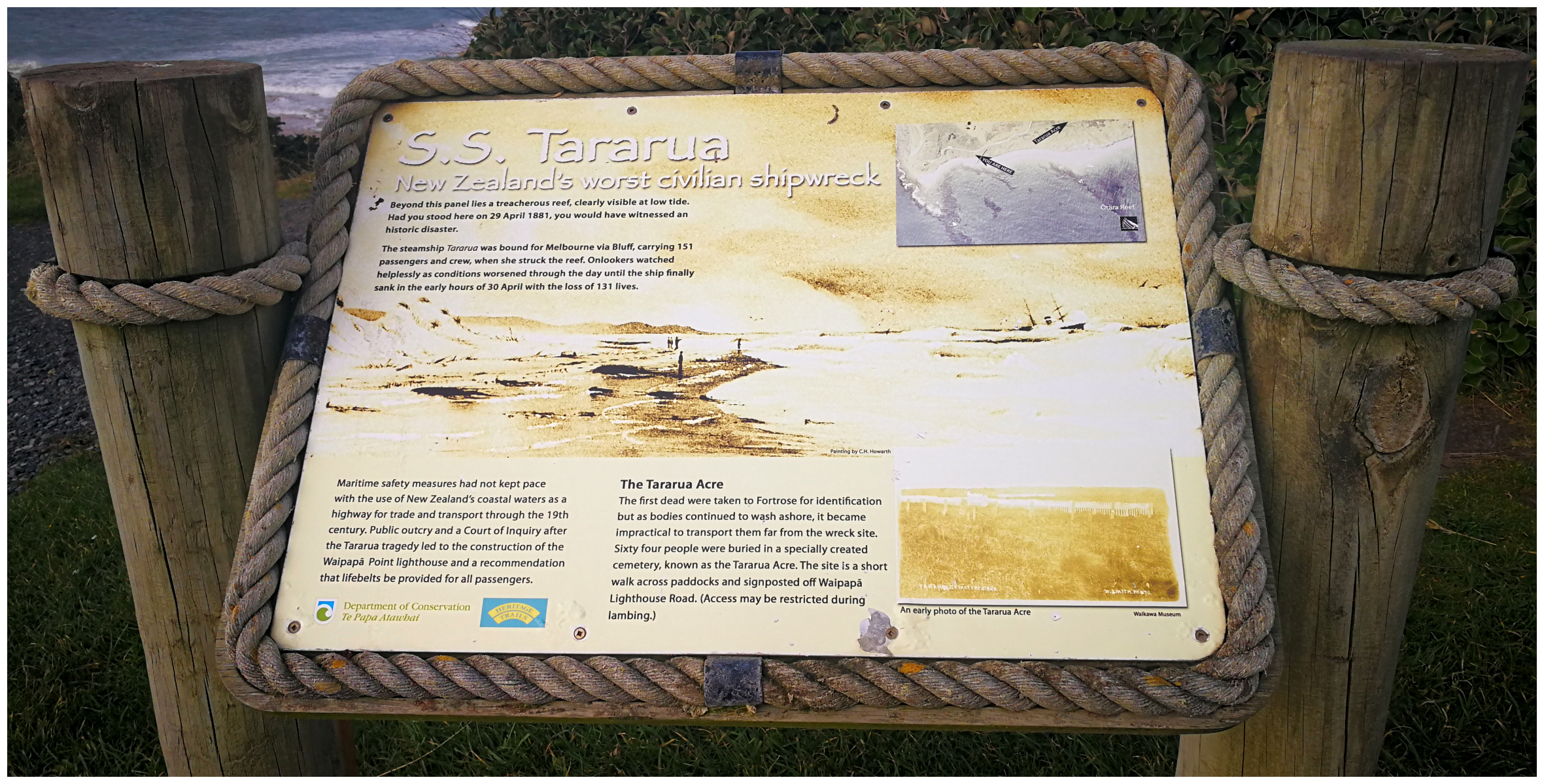
history board telling the woeful tail of the SS Tararua’s demise
When driving to the lighthouse, you will see signage, indicating the gateway where you can walk to the Tararua Acre. It is a wander across some paddocks to get to the graveyard where 55 out of the 74 bodies were laid to rest.
The initial casualties were transported to Fortrose Cemetery for burial, but it soon became apparent that the increasing fatalities made the job too big to continue to bury them all there.
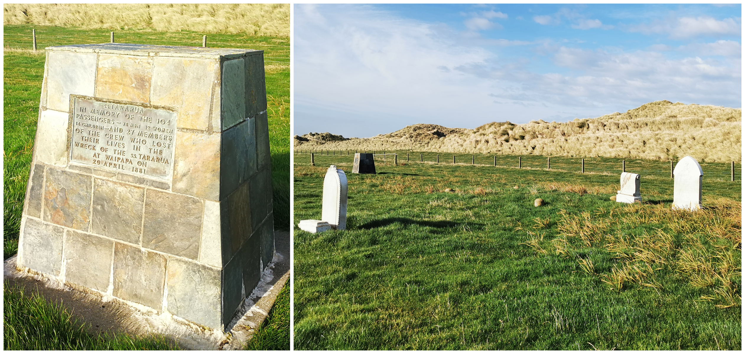
not much remains of the 55 graves
Today, the only evidence of the 55 graves within the fenced-off area are three gravestones and a memorial plinth.
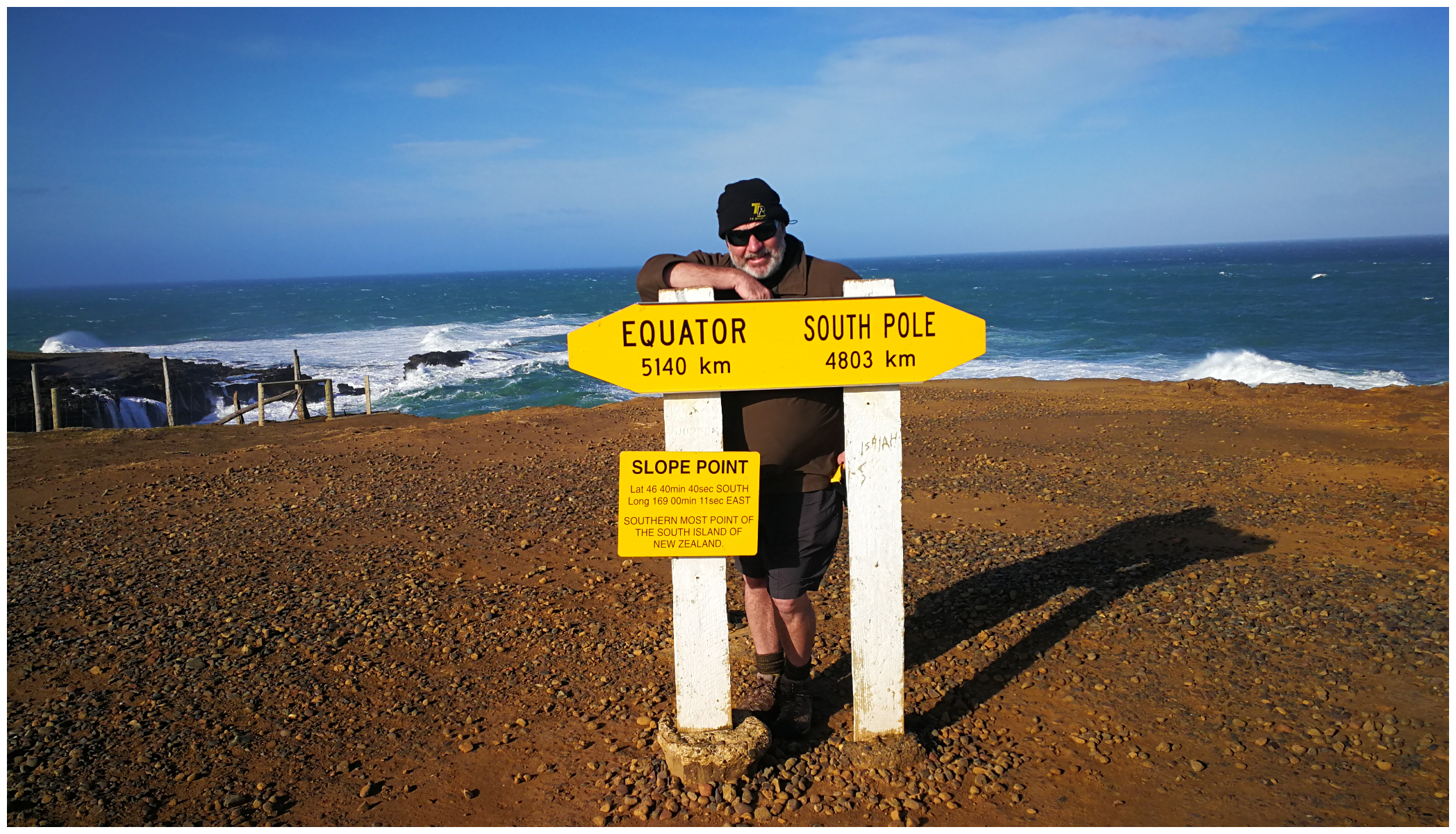
Slope Point
Well, we just had to do it! We’ve travelled to the northernmost point of the South Island, now it was time to stand on the southernmost point, and it just happens to be in the Catlins.
Slope Point lies just south of the small settlements of Waikawa and Haldane and 71km east of Invercargill.
The point is accessible via a 20-minute walk across private farmland. We set off from the carpark and battled a head-on wind. It quickly became apparent as to why it is called ‘Slope Point’. We were certainly trudging along on a slope that’s for sure.
Scotty holding on for dear life!
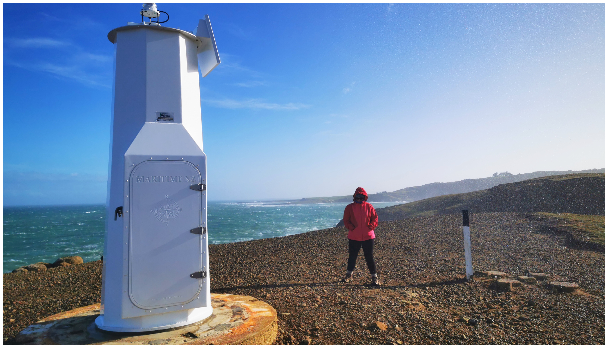
We arrived at the yellow AA signpost indicating the distance to the equator and the south pole. The only other structure at the point is a solar-powered lighthouse. This was bolted down with massive bolts into a very thick slab of concrete. I can’t think why??!!
taking a rather staunch pose against the strong wind
The views of the surrounding ocean and coastline of the point’s steep rugged cliffs are breathtaking. The cold air whipped and whirled around us as we anchored ourselves to the sign or fence line in order to take photos that weren’t going to turn out blurred from the constant movement.
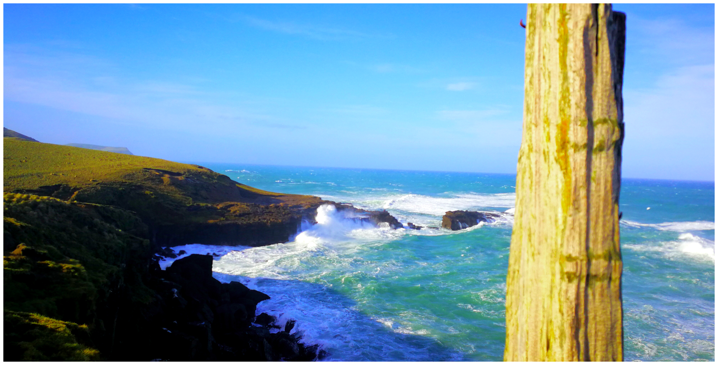
watching the thrashing waves was quite mesmerising
The airflow from the Antarctic Ocean causes the winds to gain immense strength before they smash themselves into this exposed coastal area. The warped sloping trees are a great testament to this for sure.
Note: Dog access is NOT allowed as you’ll be walking through private farmland to get to the point. Access is also limited or prohibited during lambing (Sept-Nov)
Niagara
Our first basecamp on our Catlins Escapade was at the NZMCA Park (#9451) at Niagara. This was to be our base to explore the surrounding area.
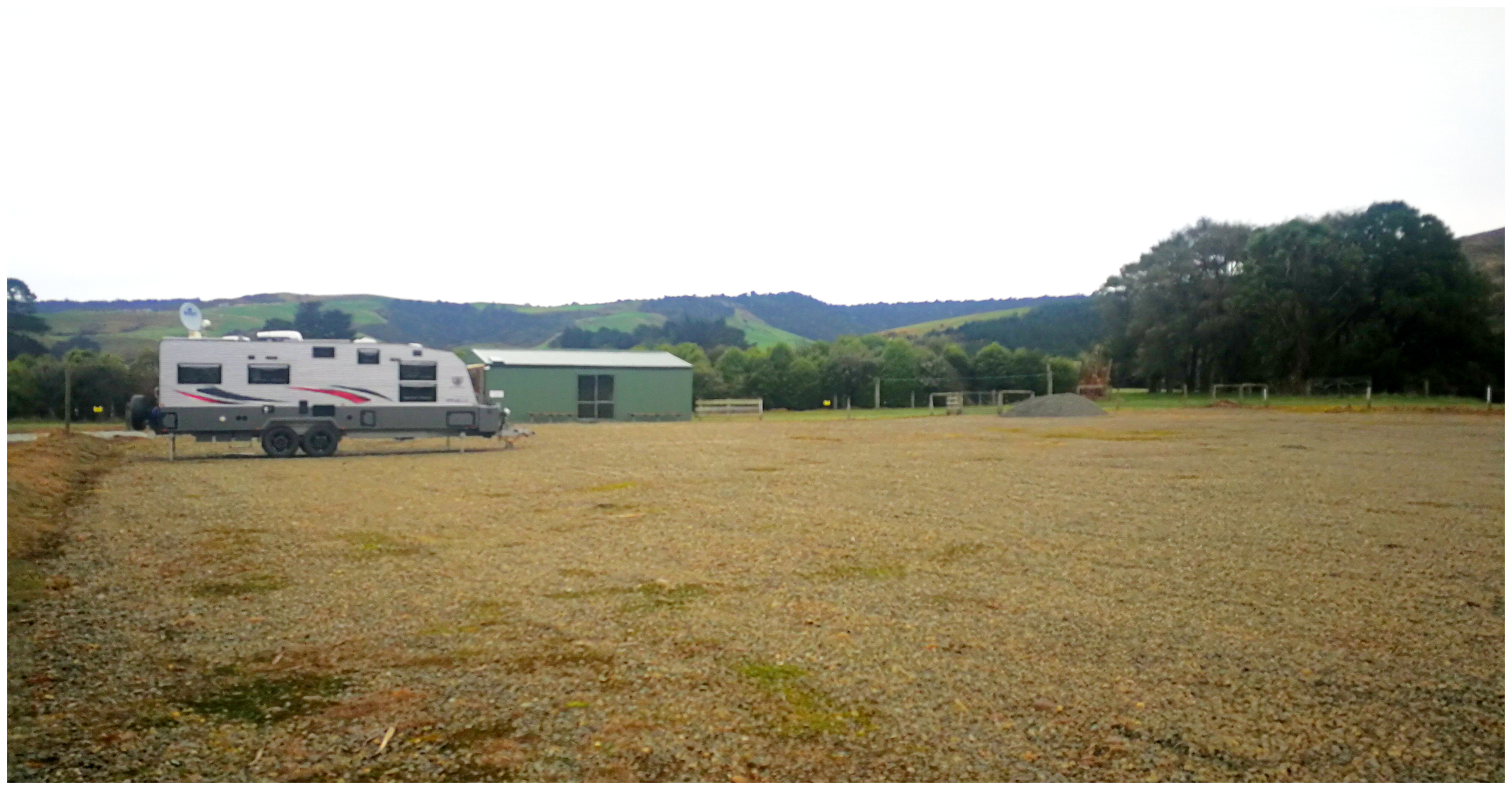
solo campers for our entire stay
It is a spacious flat area which is in the process of being extended. Once finished, there will be plenty of parking for large and small rigs. It is nicely sheltered with a lovely short walk through a man-made shrubbery area. Dogs will love it for their daily walks (on leads of course).
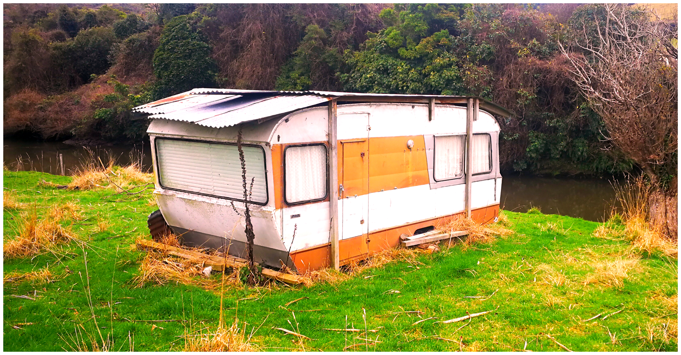
a whitebaiters haven, clearly not self-contained nor mobile!!
It borders the Waikawa River which is popular during the whitebaiting season.
Niagara Falls
It was thanks to a surveyor with a sense of humour who named possibly the smallest falls in NZ after one of the grandest falls in the world. They are so far removed from their namesake that it is quite funny to find them in the Catlins.
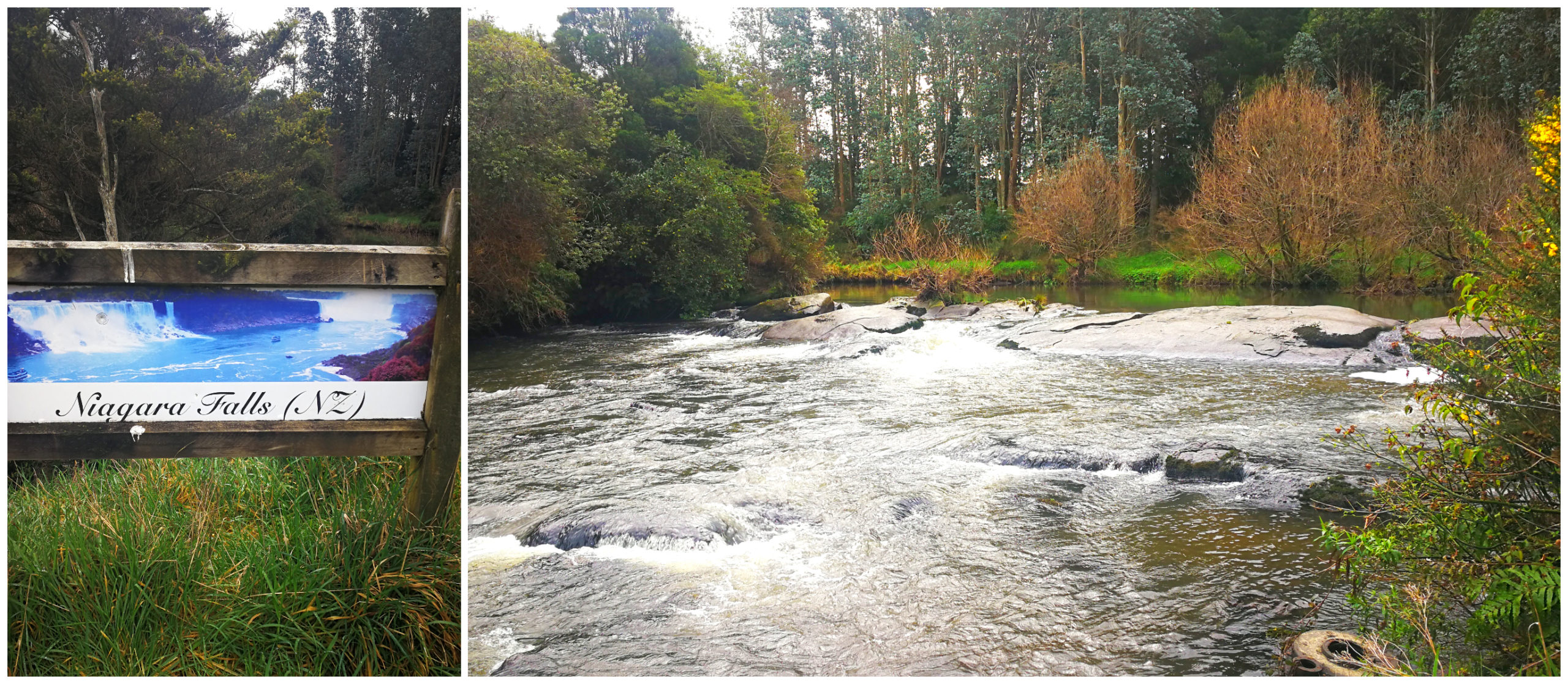
you’ve got to get the obligatory photo op of the Niagara Falls
They are probably the most unremarkable falls I’ve seen. However, they do offer rather a hilarious photo stop for travellers passing through the area. They are located very close to the NZMCA Park and we watched quite a few visitors stopping off for the opportunity to record their visit to Niagara Falls (NZ Style!).
Niagara Falls Cafe
Located just up the main road from the camp, you will find Niagara Falls Cafe. Always keen to support local business, we called in for a coffee and a scone.
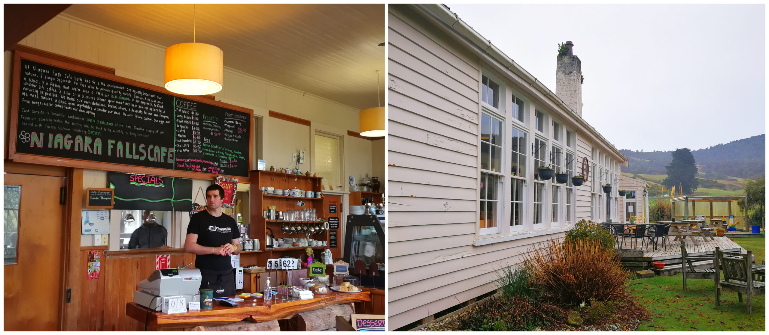
I would recommend a stop at Niagara Falls Cafe
There’s nothing better than sipping on a flat white surrounded in a little bit of local history. The cafe used to be a single classroom which was erected in 1895. The school was in use until its closure in 1972.
Waikawa
Located just down the road (4km) from Niagara, is the small settlement of Waikawa. It sits at the mouth of the Waikawa River. You will find a scattering of houses near the harbour and others nestled on the hillside.
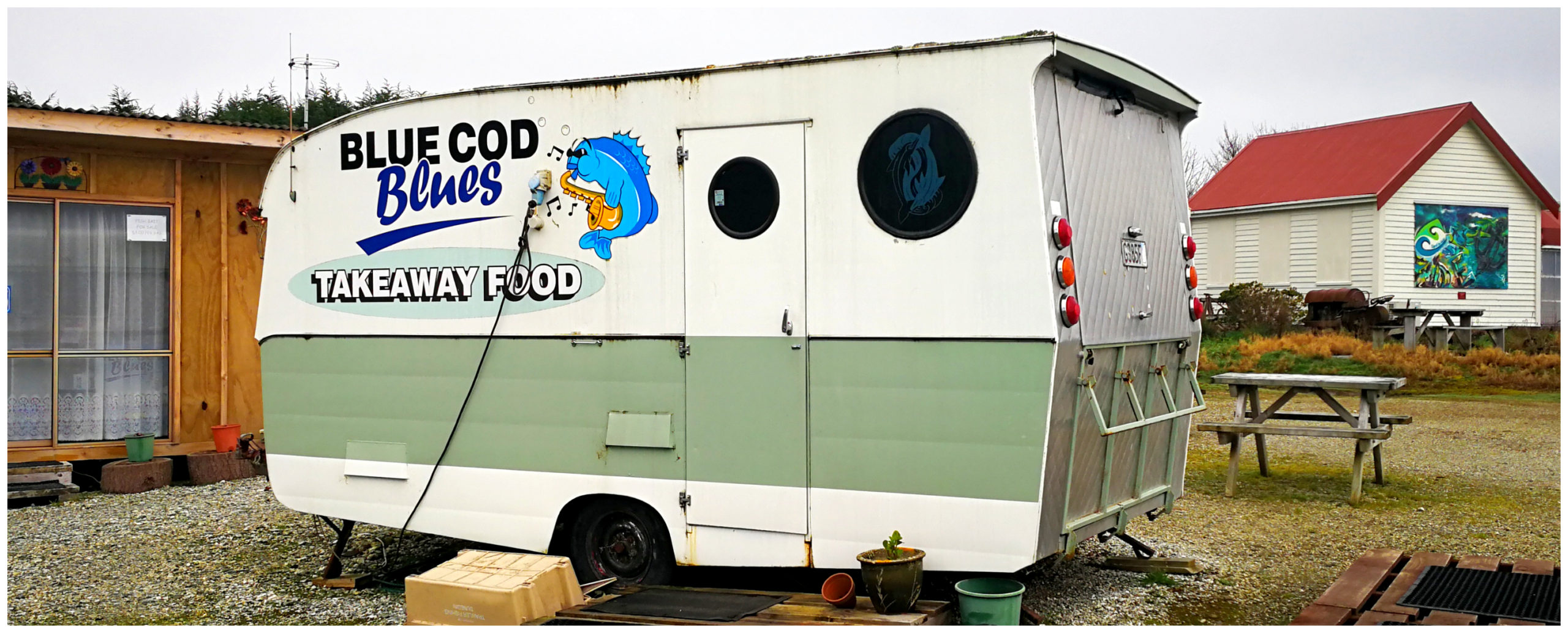
unfortunately, Blue Cod Blues were closed during our visit
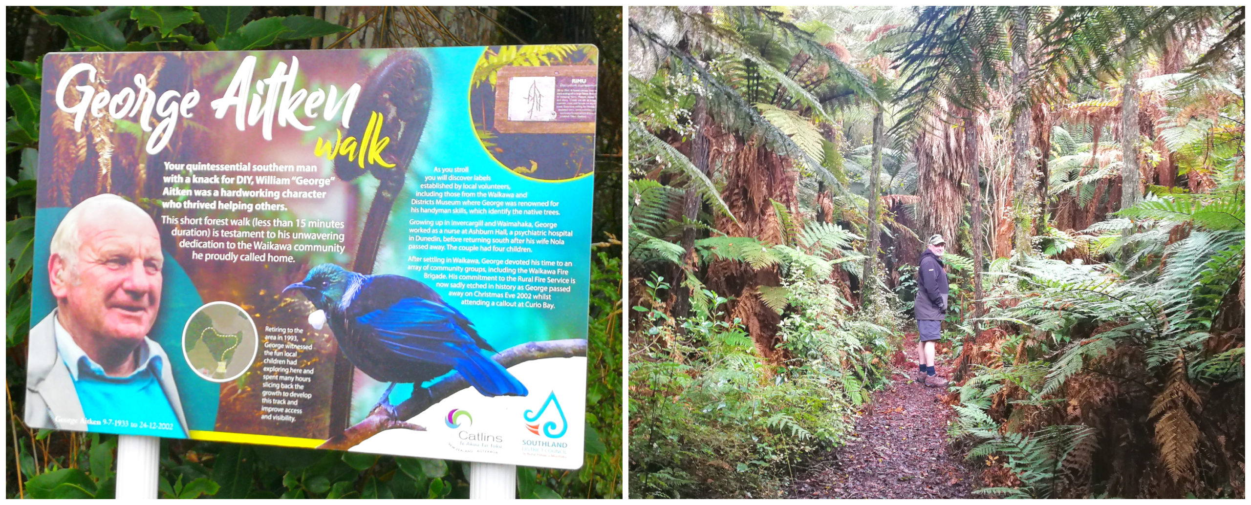
The George Aitken Walk is a short forest walk named in memory of a well-loved local, George Aitken. The walk begins behind the Waikawa Hall. You will find some helpful labels naming the native trees and peaceful views of the estuary.
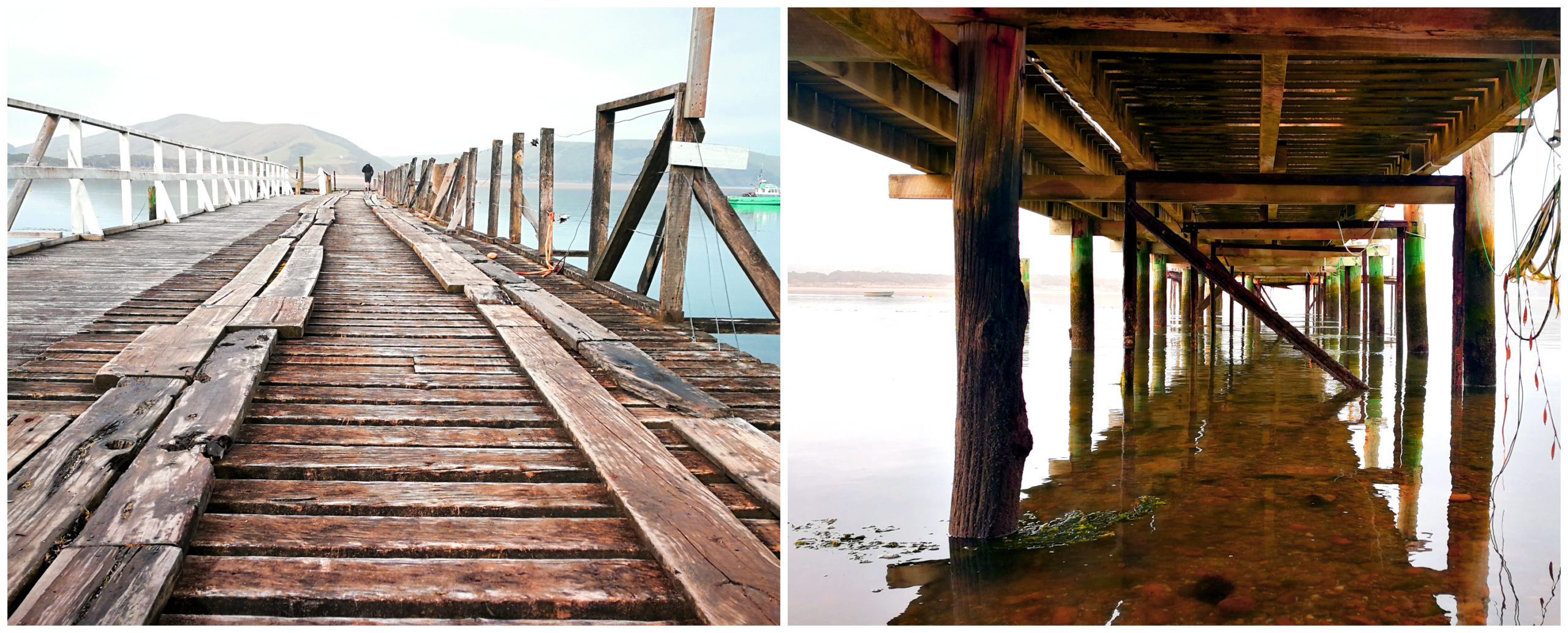
Waikawa was a busy port in the 1880s and early 1900s and the wharf is showing the years of wear and tear
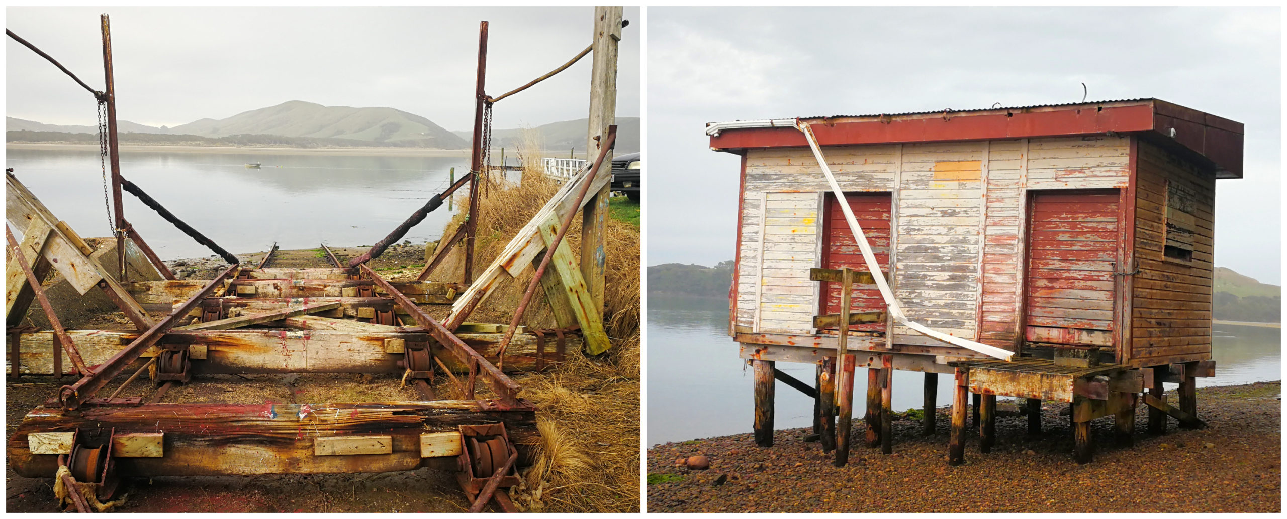
a sheltered haven for the fishing community during the past decades
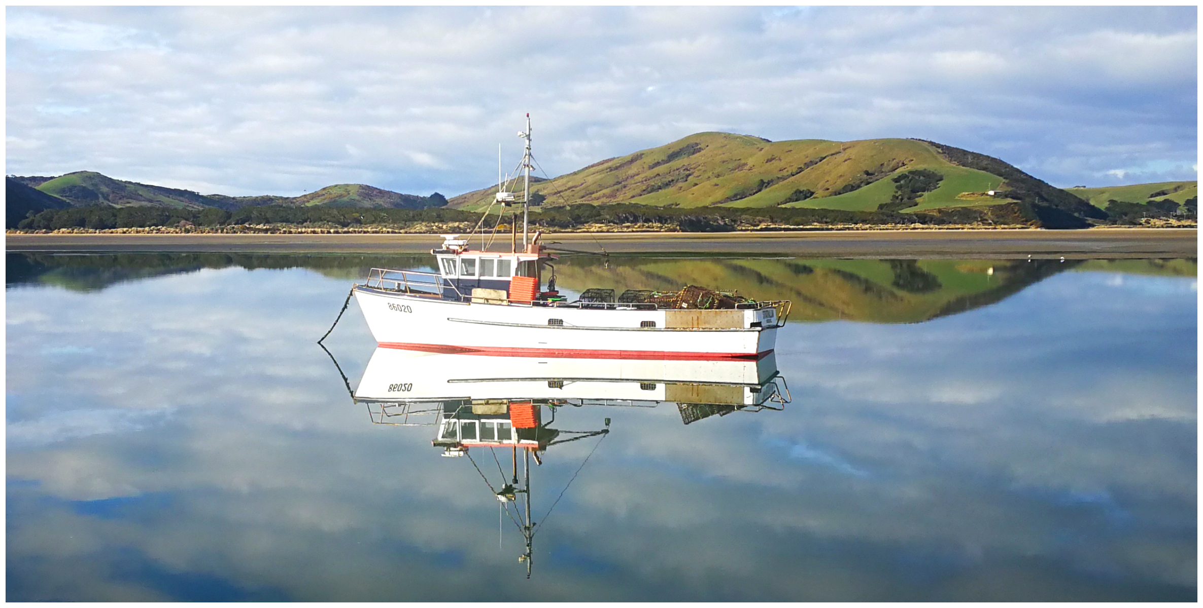
it was certainly a very ‘reflective’ day
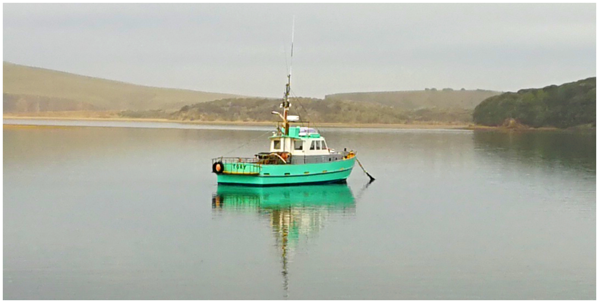
fishing boats still use the sheltered sanctuary of the estuary at Waikawa
Once, a busy port during the 1880s up until the early 1920s when shipping ceased. The town supported whaling, gold mining, stone quarrying, flax milling and farming. With a history like this, it is expected that their little local museum would be jammed packed with memorabilia.
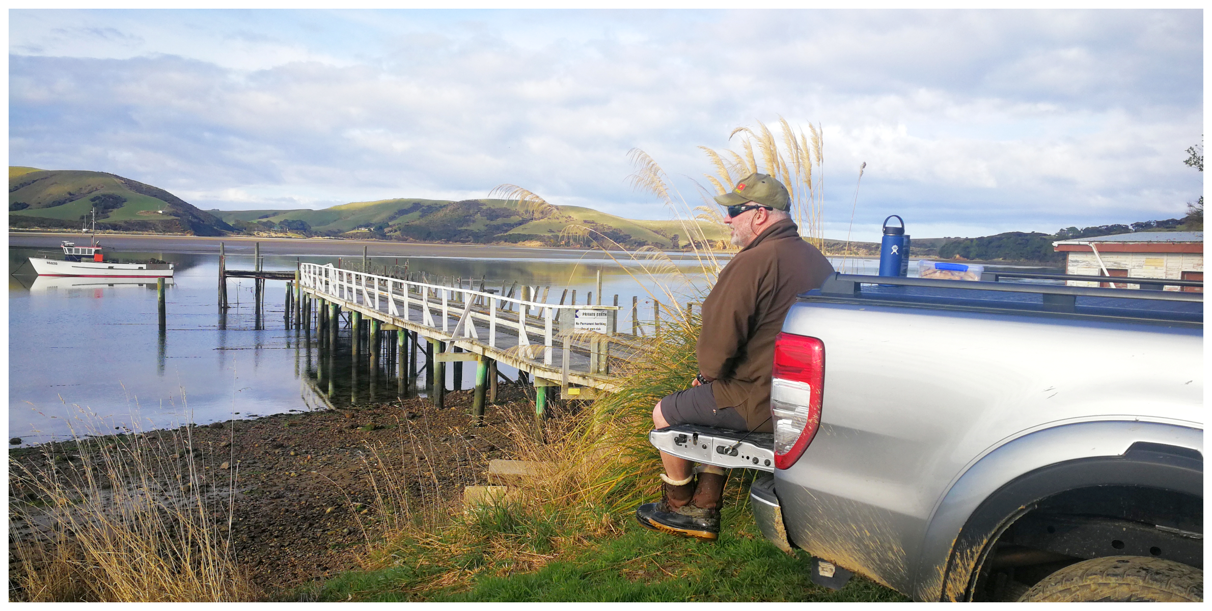
seemed like a good place for a ‘tailgate’ lunch stop
Museum
The Waikawa Museum and Info Centre is formed from two old school buildings. It is run by volunteers and we were lucky enough to happen to be passing whilst two of them had ‘popped’ in to do some vacuuming (or luxing as they seem to say in the south).
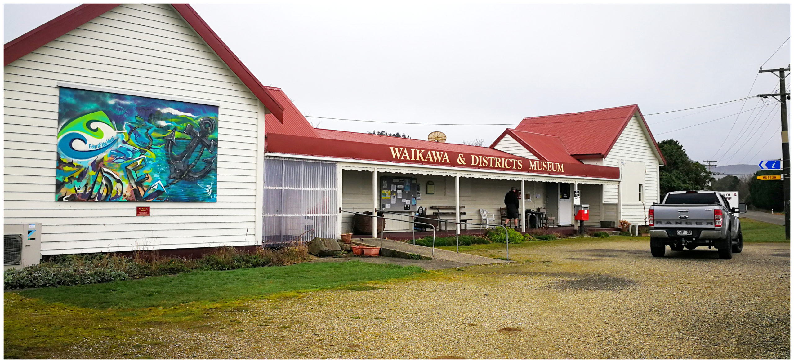
make sure you take time to visit the museum if it is open when you pass through Waikawa
We’re so glad we got the opportunity to wander through as it seems that although the sign says open daily, it doesn’t seem to apply to the winter months so it may be a bit hit and miss if you want to visit during the off-season.
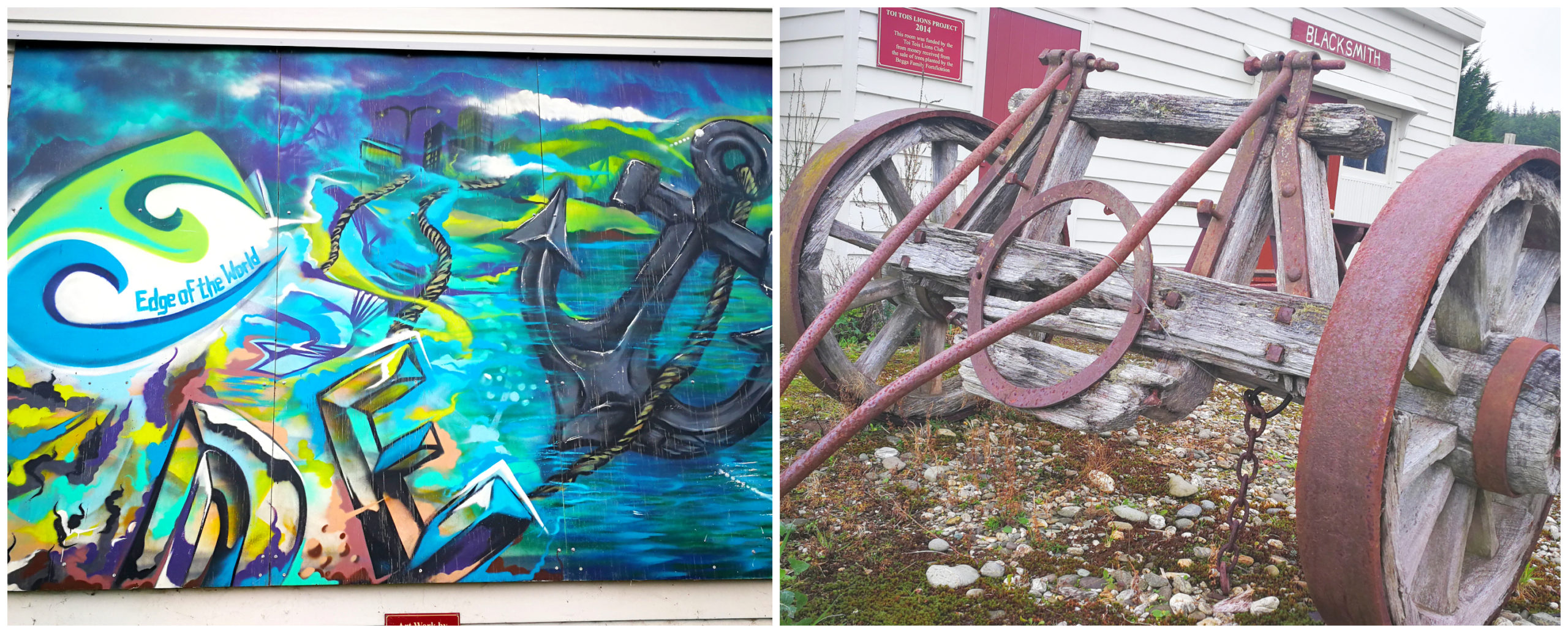
no photos allowed inside but plenty of displays outside
Inside photos are prohibited but you can rest assured that it is a treasure trove of photos, exhibits, memorabilia and all sorts of equipment. A great portrayal of life in Waikawa and surrounding districts from way back in the lives of the earlier settlers and residents.
The Old Coach Road
With a name like that, it was certainly going to get our attention and it was screaming out to be explored.
Luckily, there is actually a walk along the Old Coach Road. The walk across the estuary is only possible at low tide. It starts from the right side of the jetty.
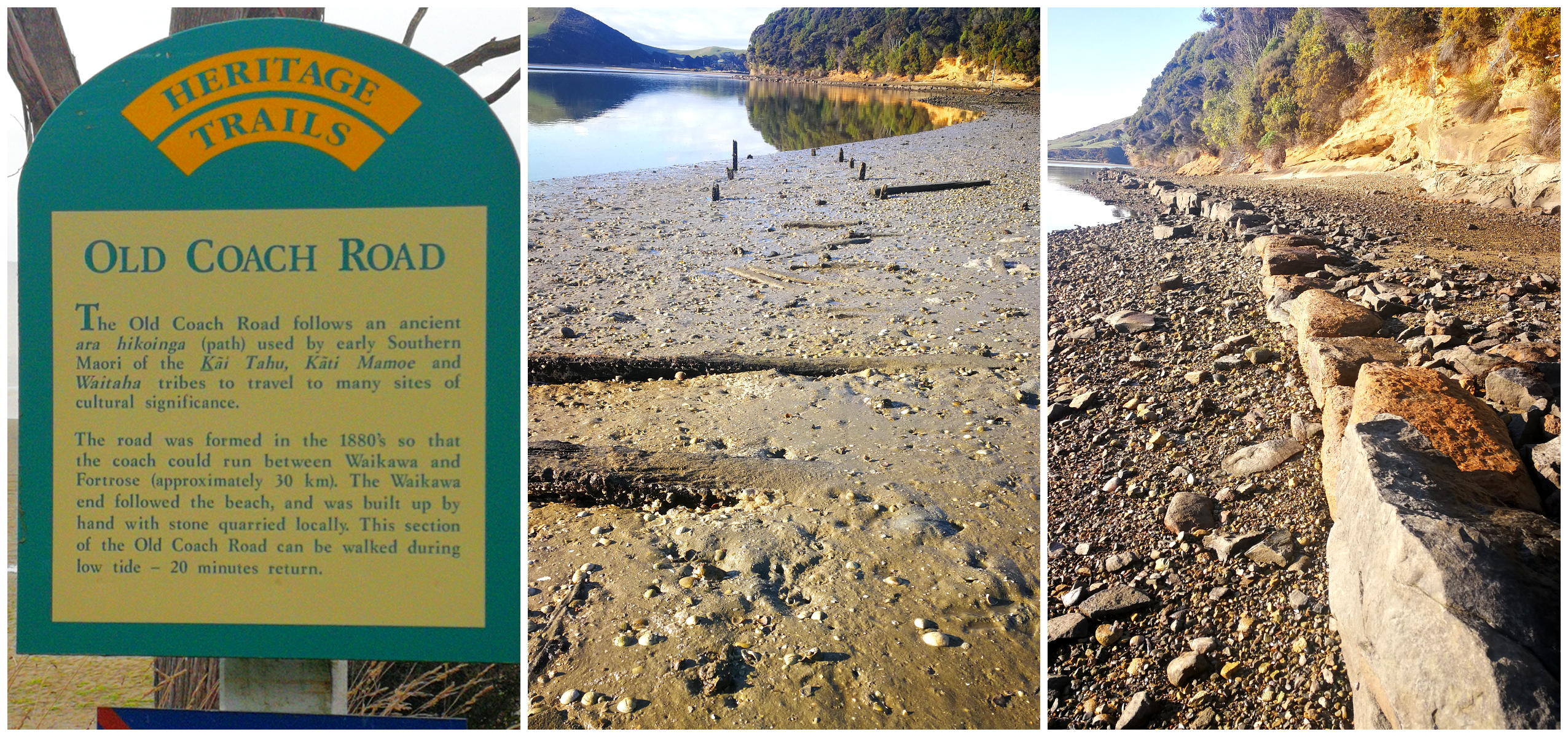
signage indicating the start of the walk, old wharf foundations still visible, as is the outline of the old road
The actual road was formed in the 1880s so that the coach could run between Waikawa and Fortrose. We were excited to see the evidence of stone bridges over the creeks and the road raised above the sand.
ledge showing how they raised the road above the tide
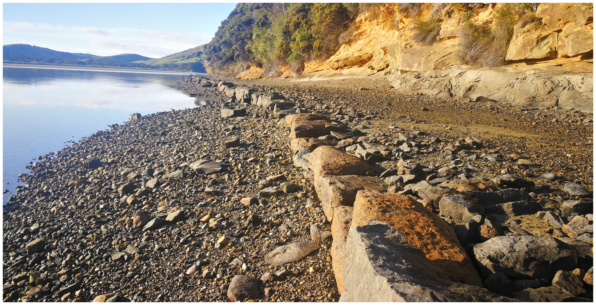
The walk is normally around 20 minutes return. We were so intrigued and fascinated by its history, that we kept walking for some time. That may have been why we had a few ‘sinking moments’ in some rather boggy muddy sections. We spent around 1.5hrs return wandering the Old Coach Road.
more evidence of small bridges over creeks, and getting that sinking feeling, good footwear a must
Curio Bay and Porpoise Bay
Possibly the most well known and popular spot to visit in the Catlins would be Curio and Porpoise Bay. Actually, statistics show that over 100,000 visitors a year make the pilgrimage. At a guess, this would be pre-COVID!
Not only is it a popular spot for humans – it is a favourite spot for some of our most precious and rare inhabitants:
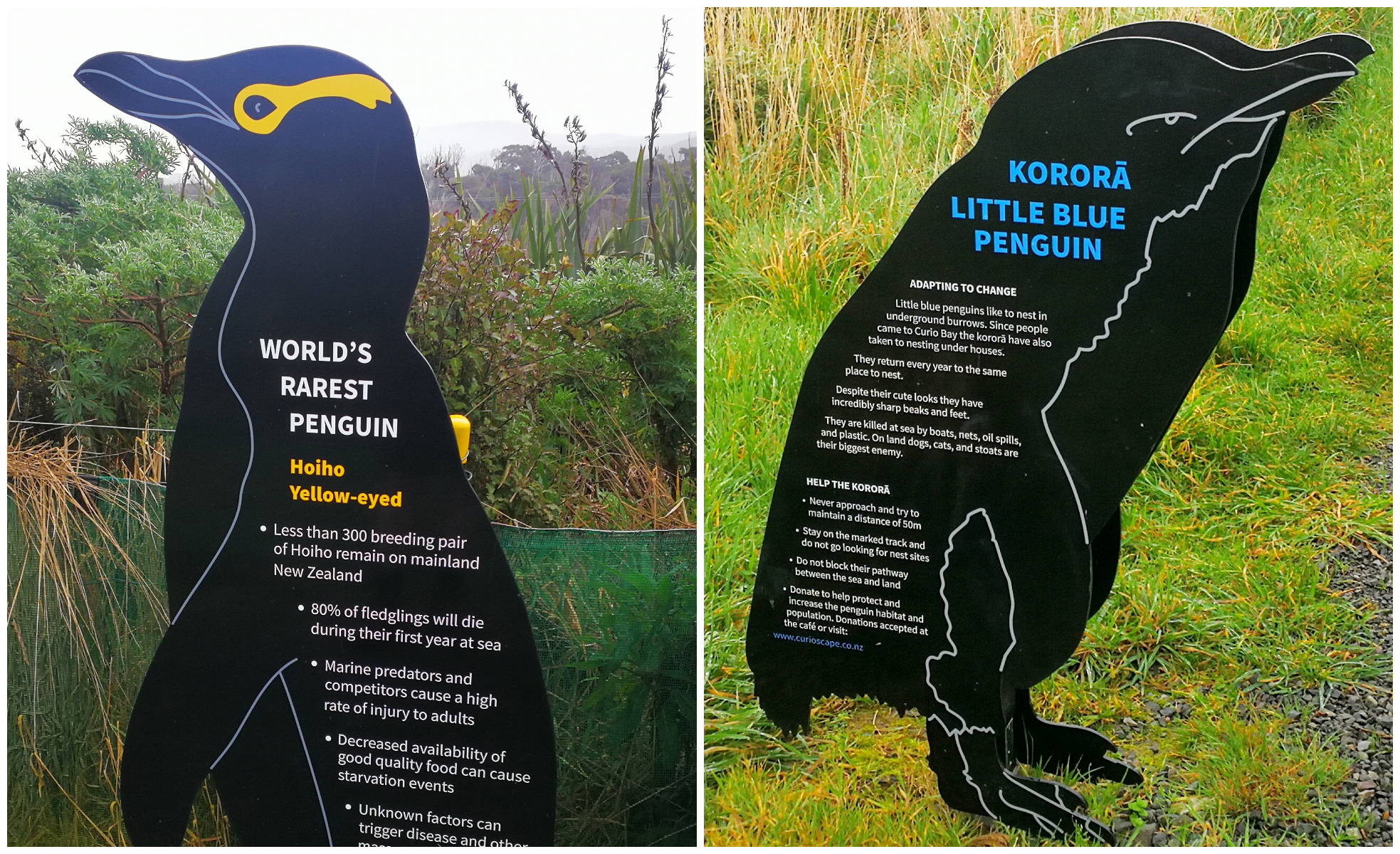
- Yellow-Eyed Penguins (one of the rarest penguins in the world)
- Little Blue Penguins (the smallest species of penguin)
- Hector’s dolphin (one of the smallest and rarest marine dolphins in the world)
- Fur Seals and Sea Lions (their numbers are increasing after nearly hunted to extinction)
You can view the wildlife in the area. Hector’s dolphins play in the surf during the summer months. The Yellow-eyed and Blue penguins nest in the area around Curio Bay. The fur seals and sea lions regularly haul themselves out of the water along the coastline. We were clearly there at the wrong time of the year or time of day as we saw none of the above.
quite a special place for the small penguins
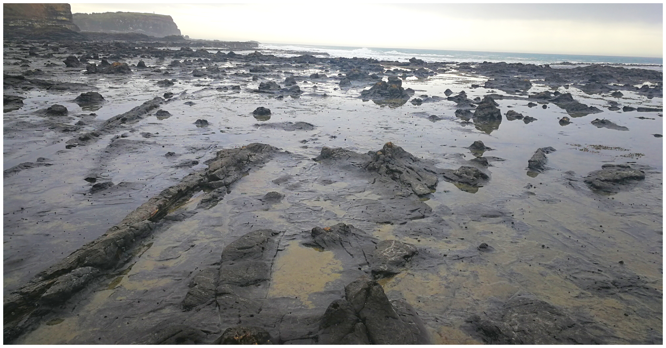
The Fossil Forest
Often referred to as The Petrified Forest, it is one of the most extensive and best-preserved examples of a fossil forest in the world. It actually stretches about 20km and reaches nearly all the way to Slope Point.
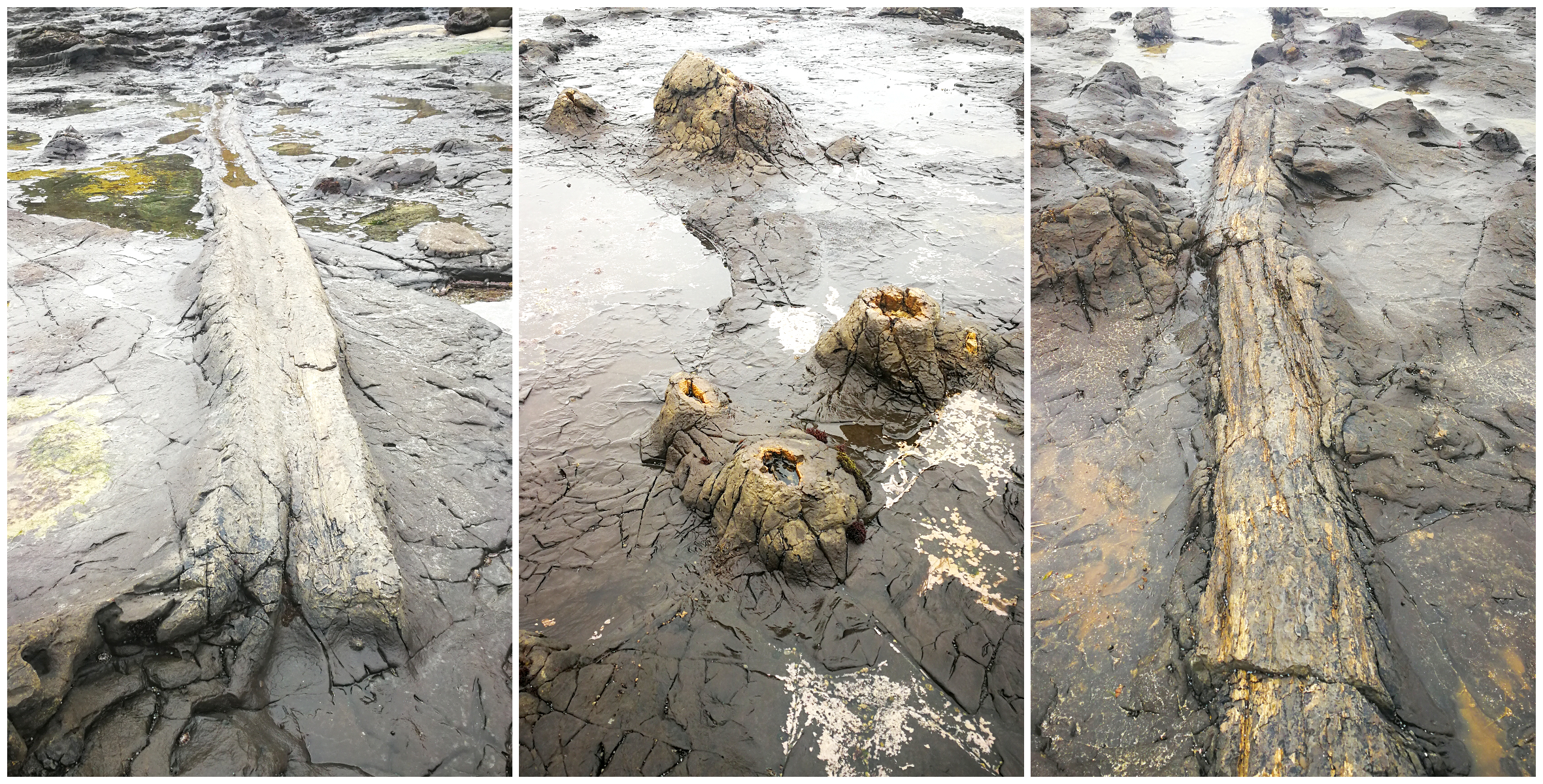
wood looking – well, petrified
Dating back to the Jurassic period, its been laying here for 180 million years.
You can tiptoe your way around the solid rock logs and stumps on low tide. What you think is just another pile of rocks is actually the stump of a once towering tree.
don’t be fooled, these are not a bunch of rocks
There are viewing platforms and information panels which overlook the area. This is especially handy if you can’t do stairs or fancy negotiating the sometimes slippery rocks.
So that I don’t start sounding like a Wikipedia site, here is the link to read more about how the Fossil Forest came about.
don’t forget to take a drive through the camping ground and to the top of the lookout
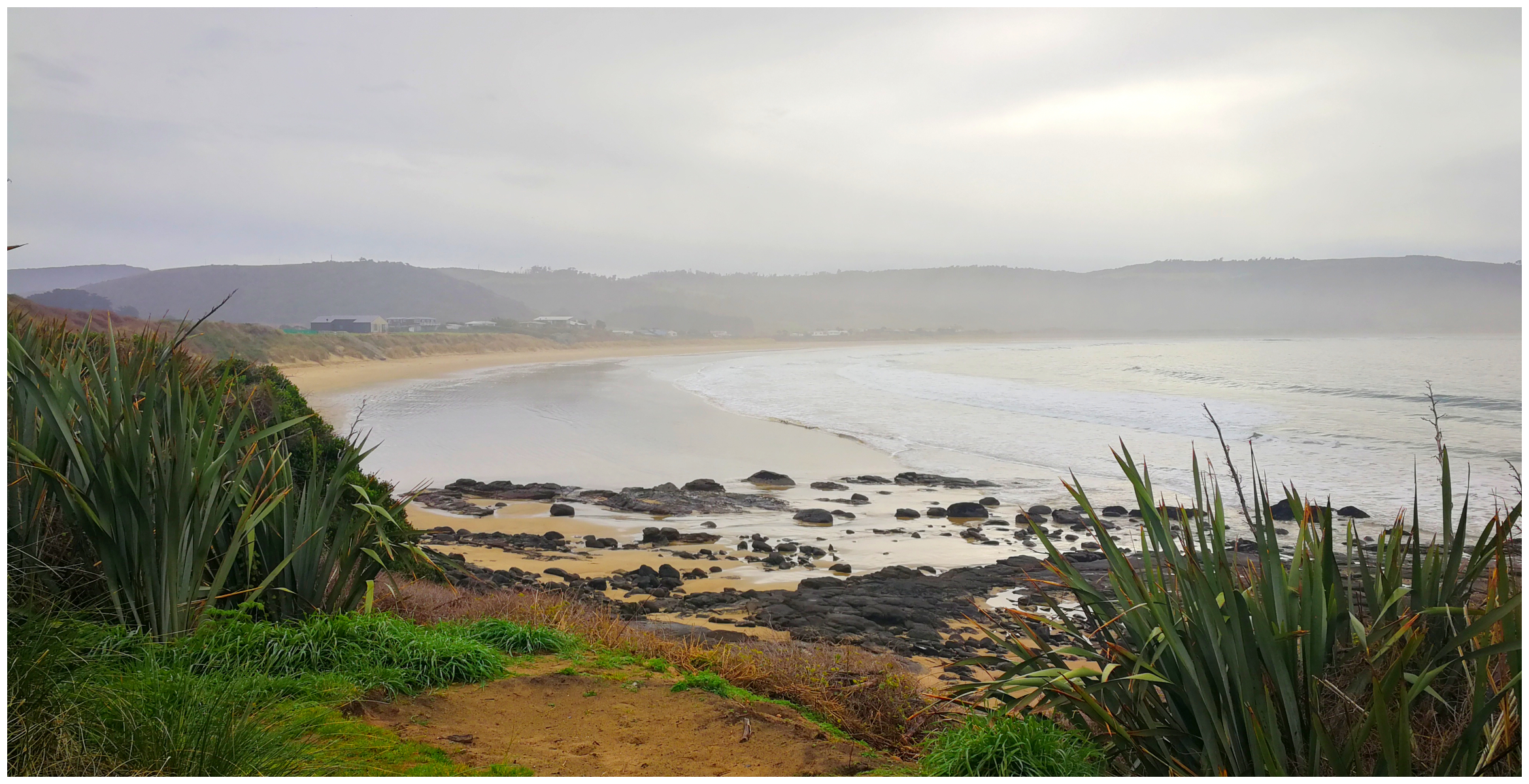
the sweeping Porpoise Bay
Koropuku Falls
It would be fair to say that there are some pretty impressive waterfalls in the Catlins.
Only 10km from Niagara is the Koropuku Falls. Not one of the more well-known falls in the Catlins and slightly more impressive than Niagara Falls!
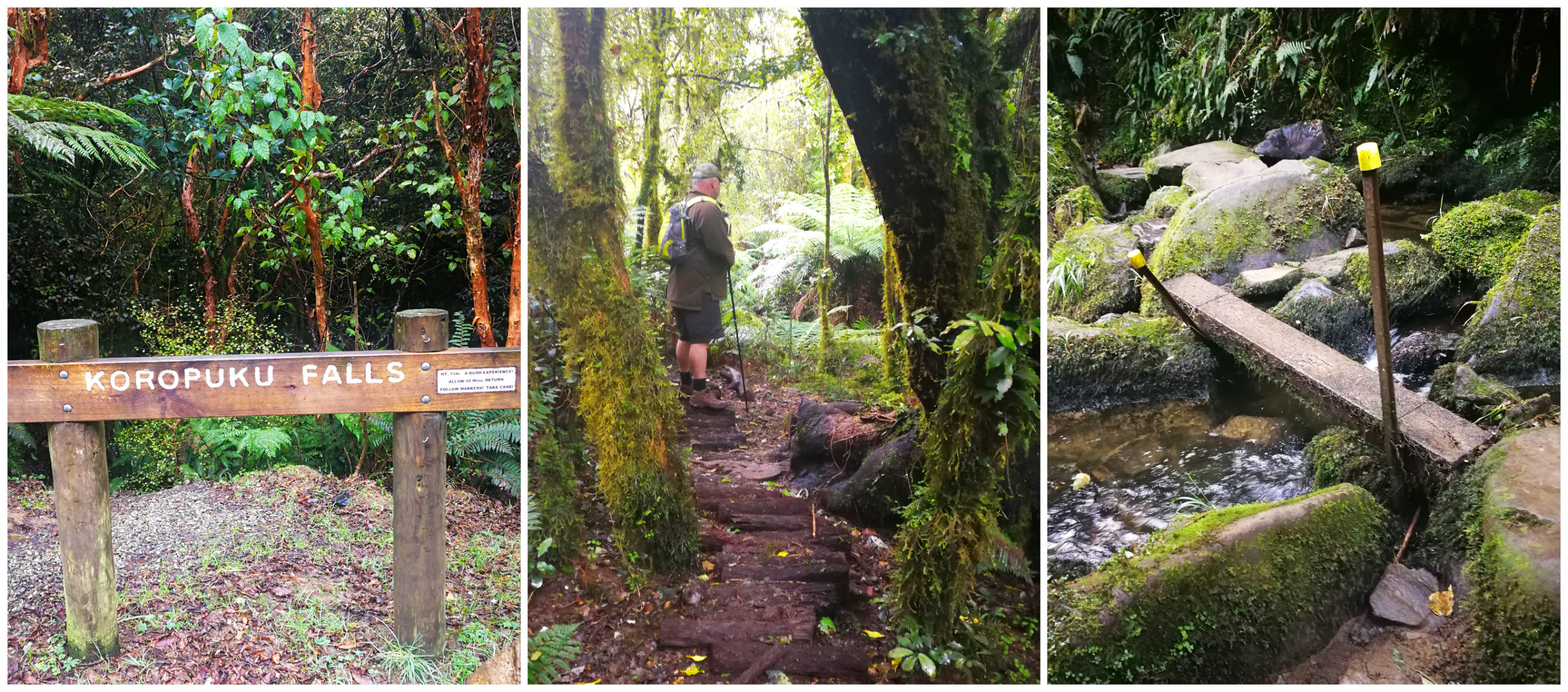
Don’t miss the signage, and the track into the falls is breathtaking
The track was formed through the sheer hard work of a couple of retired guys. They knew of the existence of the falls and decided that they wanted other people to enjoy them too. It took them 15 years to cut a 40-minute return trail. They laid over 2000 punga logs to walk on. I was very grateful for their hard work. It meant that the track was a lot drier than it would have normally been.
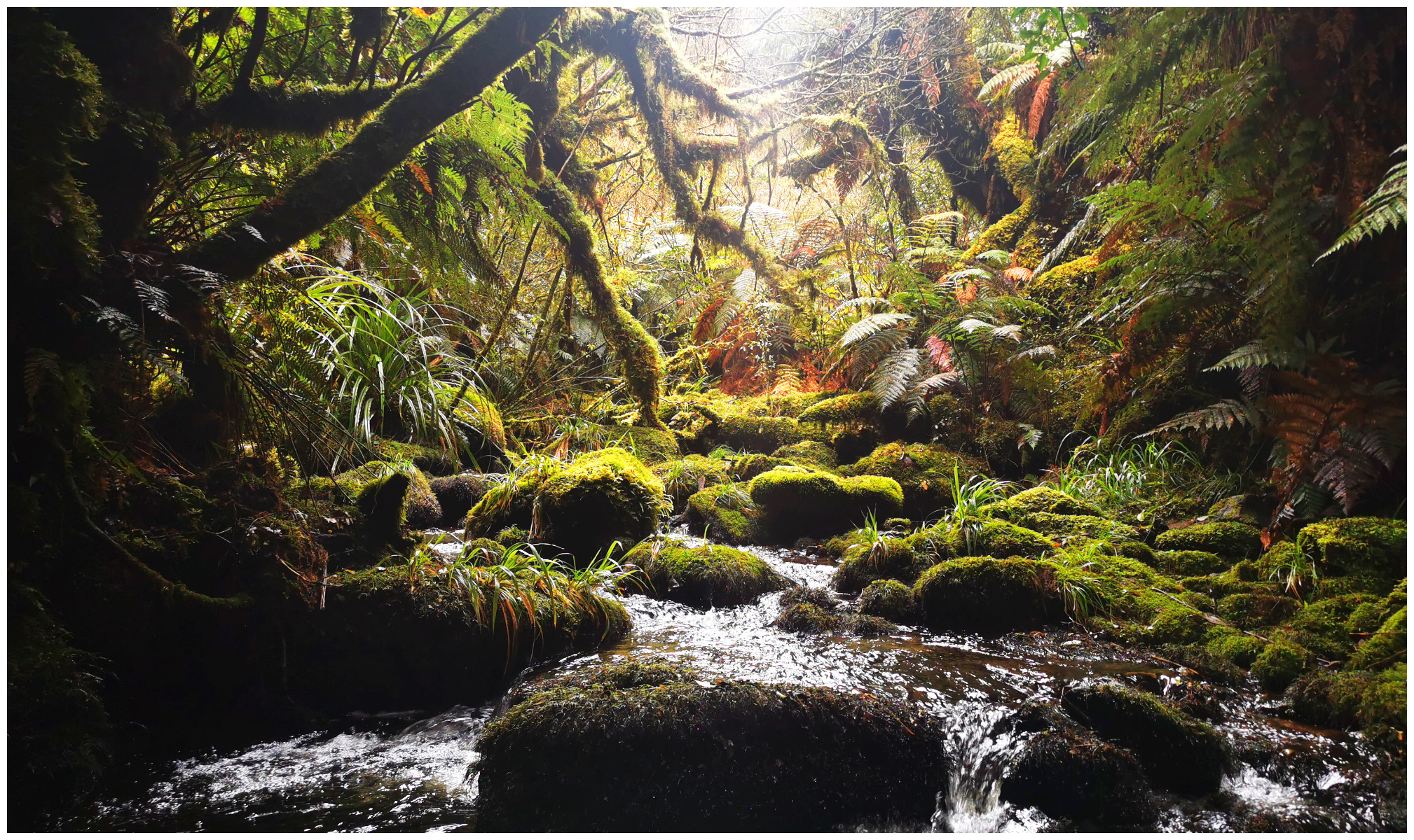
not much more I can say about this view!
There is a little more challenging section just before reaching the falls which involves a little rock climbing which is a tad slippery.
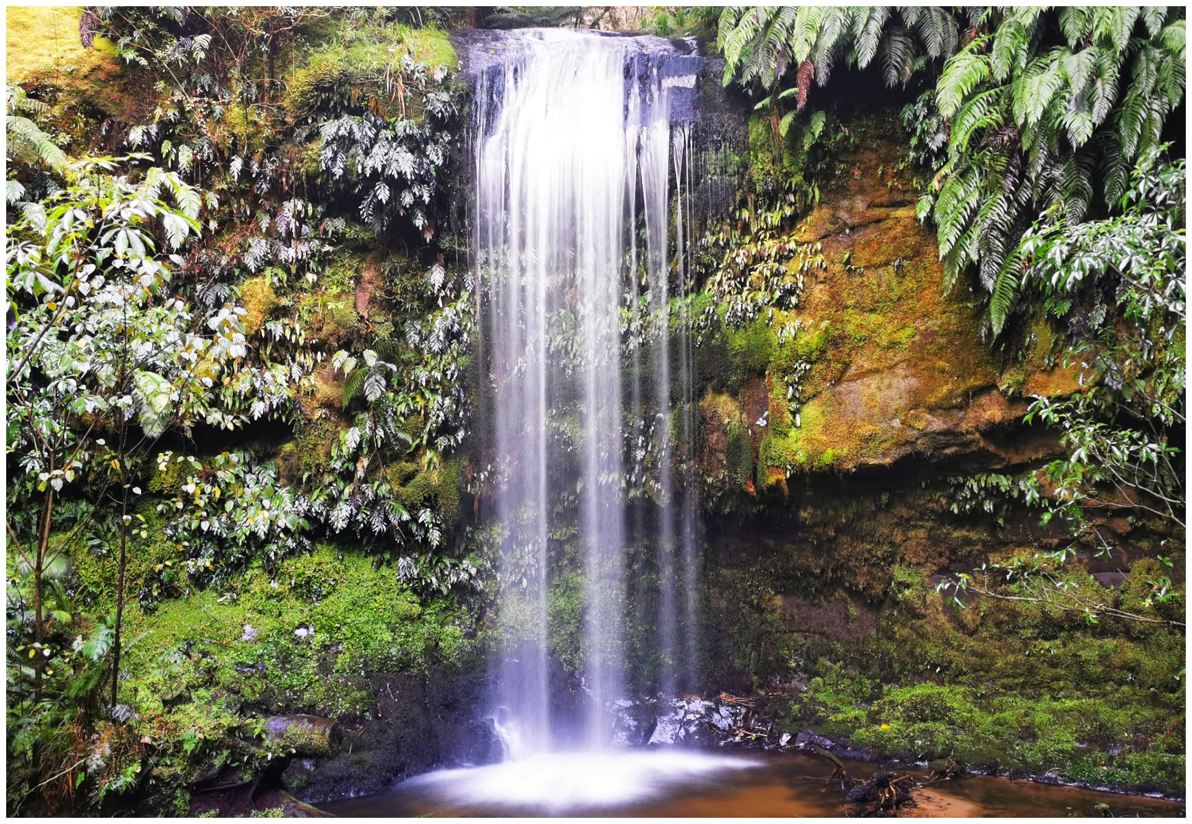
the extra effort at the end was well worth it
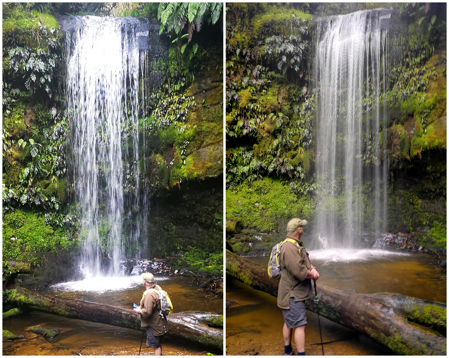
sometimes you just gotta stop and say ‘wow’
Summary
Well, as you have read, this is just Part One of our explorations of the captivating Catlins. It is a shame if you have to rush it. Keep an eye out for Part Two coming soon.
Click on the link to see a video of our highlights of the ‘The Catlins’.
Fantastic record of ur trip. Ur images are great as is ur dialogue. Caitlin’s now on our bucket list!
Glad you enjoyed it, certainly a place for the bucket list! Keep an eye out for Part Two coming up. Thanks for your feedback, Linda
Hiya Linda & Scotty. Thanks for the blog post and video. A great insight into the area. The scones at the Niagara Falls cafe looked like a good size too. Ps. Does Scotty ever get out a long pair of pants to wear?
Hahaha, Scotty is a freak and never wears trousers. It’s shorts all the way!!!
Hi Guys.
I enjoyed your post and photos of the Catlins area which is my ‘back door’. An awesome place to visit for sure.
Just wanted to correct you regarding lambing time as you stated it as September to November when in fact it is from August through to October.
Pleased you enjoyed your time there and hopefully you can visit again in the Summer.
Thanks for the feedback. I researched the information from Wikipedia and The Catlins Offical Website. I try to be as accurate as possible so can only go on the info provided.
Heading into the Catlins tomorrow….. had to look up your blogs, I remembered your visit! Thanks so much, has given me loads of places to visit! Always look forward to your blog!
Thanks Toni, there’s a heap of things to see in the Catlins. Enjoy!
Great write up of our beautiful area next time your passing come stay “18 Carrick “ check out our Facebook page
Keep up the great work!
Thanks Sheryl, we’ll check out ’18 Carrick’ next time in the area. L