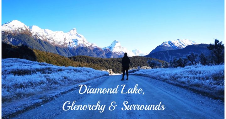
Te Anau to Diamond Lake
To get to Diamond Lake, you need to travel through the metropolis of Queenstown and past Glenorchy. Be aware that on google maps, there is another Diamond Lake near Wanaka.
It was nearing the end of the July School Holidays and we were edging closer to Queenstown. We didn’t particularly want to be anywhere near there during the holiday season. It is still too crowded for us, even with no new ‘incoming’ tourists, it is still heaving, expensive and over-commercialised for our liking.
We drove through the thronging town centre and headed alongside the very picturesque Lake Wakatipu.
We reached the sleepy town of Glenorchy (although not quite as sleepy as it was last time I visited). After a quick stop off at Mrs Whooley’s General Store, we proceeded along the Paradise-Glenorchy Rd. This was new territory for me as I’d never really ventured too much further past Glenorchy. Continuing for another 17km (9km of that is unsealed) we reached Diamond Lake. It was a good road surface and suitable for larger rigs.
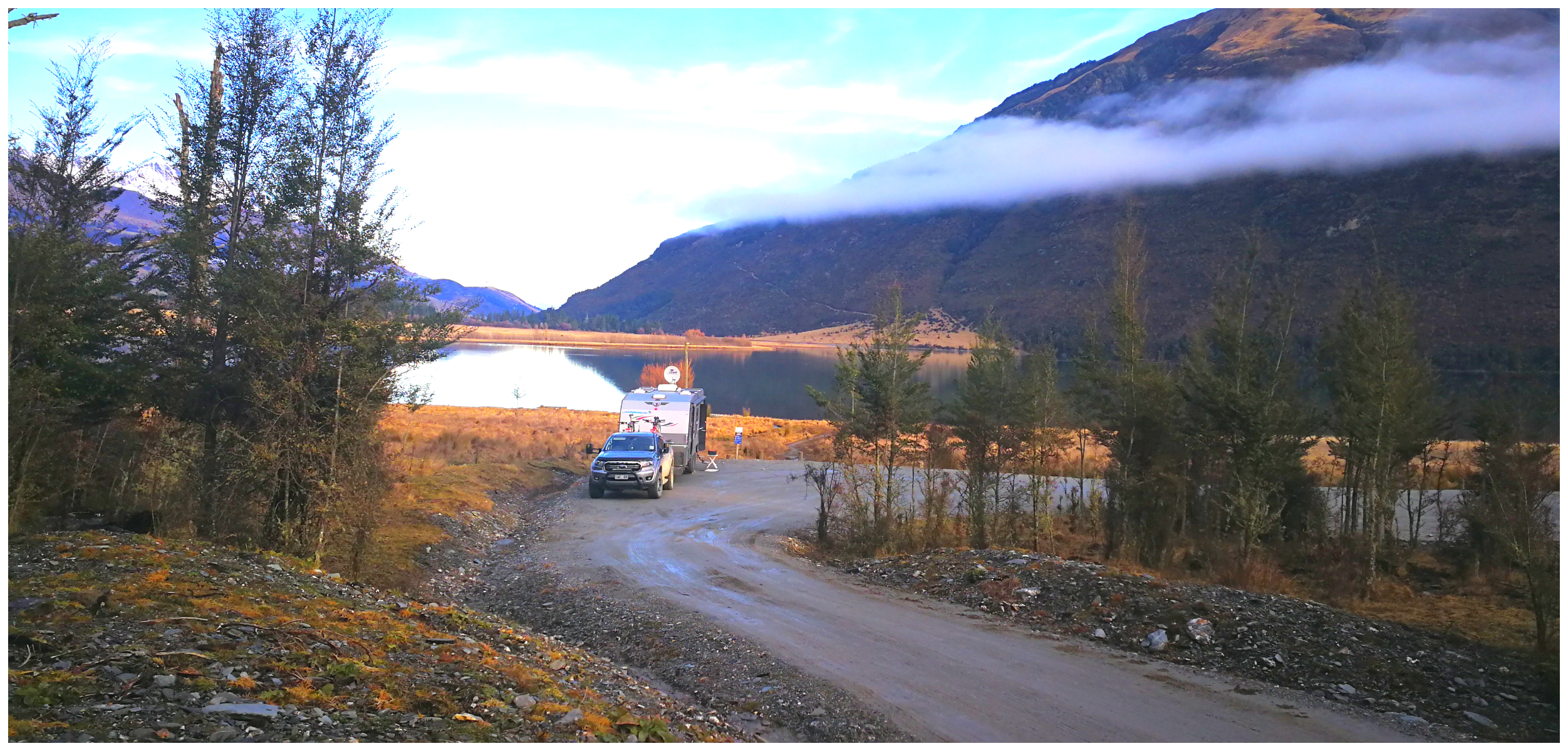
we picked out the cleanest spot to park for the night (thanks to the cows leaving their deposits)
A Diamond Lake in the Mountains
Diamond Lake DoC Camp (#8626) is really just a carpark. It’s good for a one-night stopover to explore the local area. The road in is very picturesque. Unfortunately, there had been cattle that had also thought that it was a good stopover and had left quite a few large calling cards in the parking area.
The DoC camp is $8 per person per night and there are a couple of long drop toilets. Apart from the odd car stopping to use the toilets, we were the only ones there for the night.
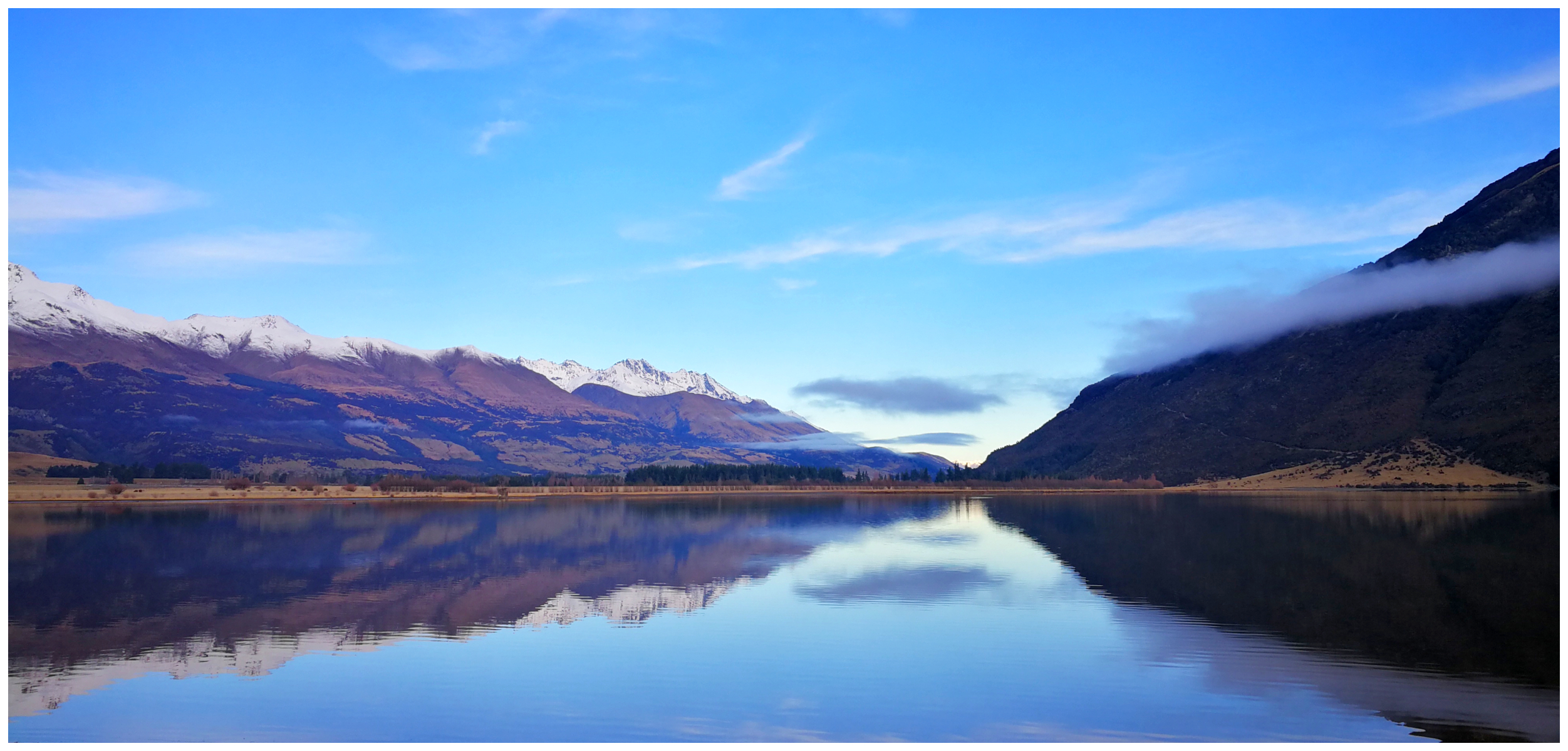
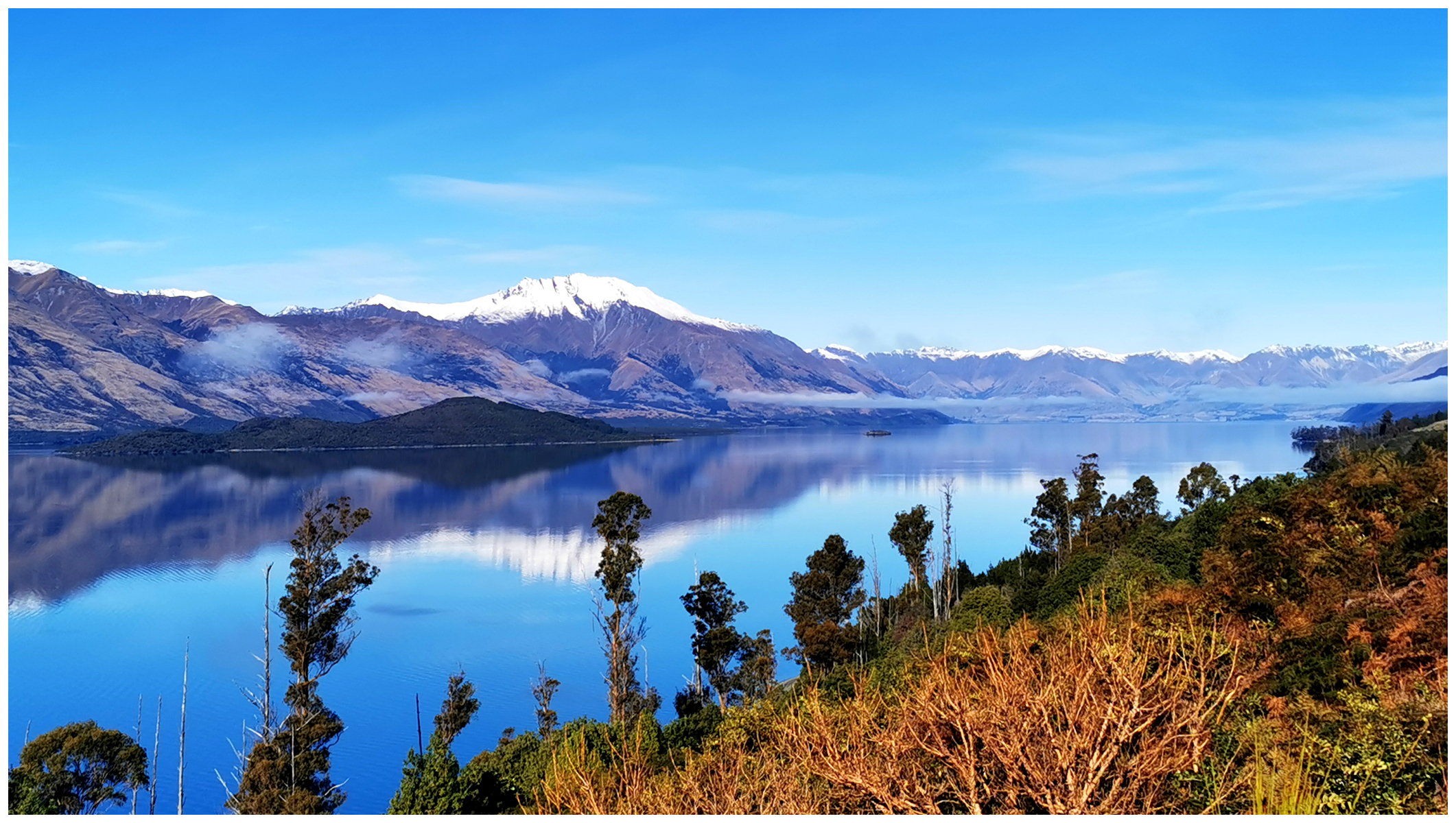
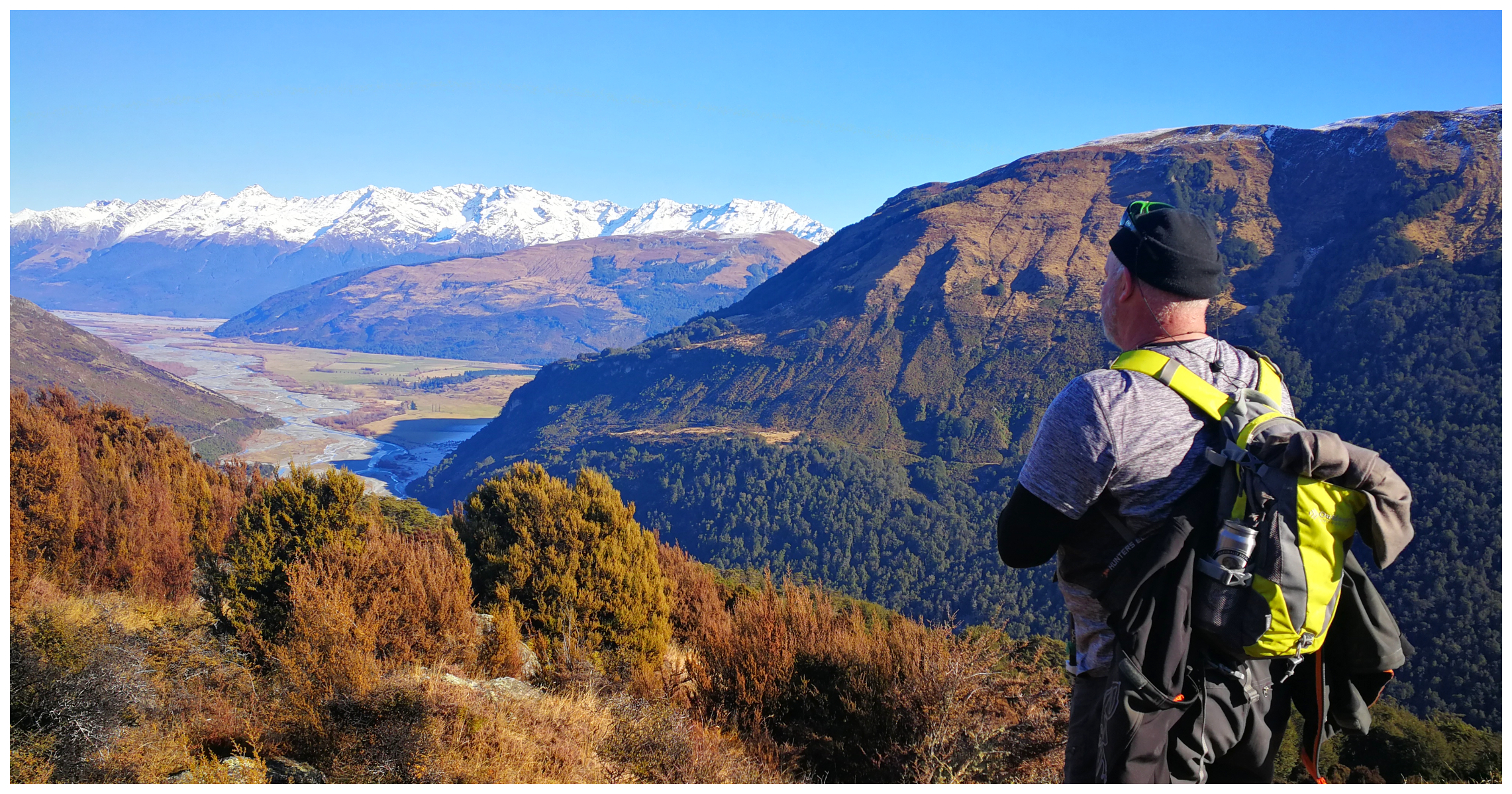
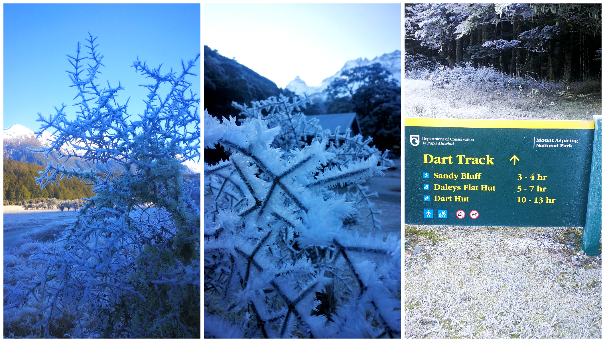
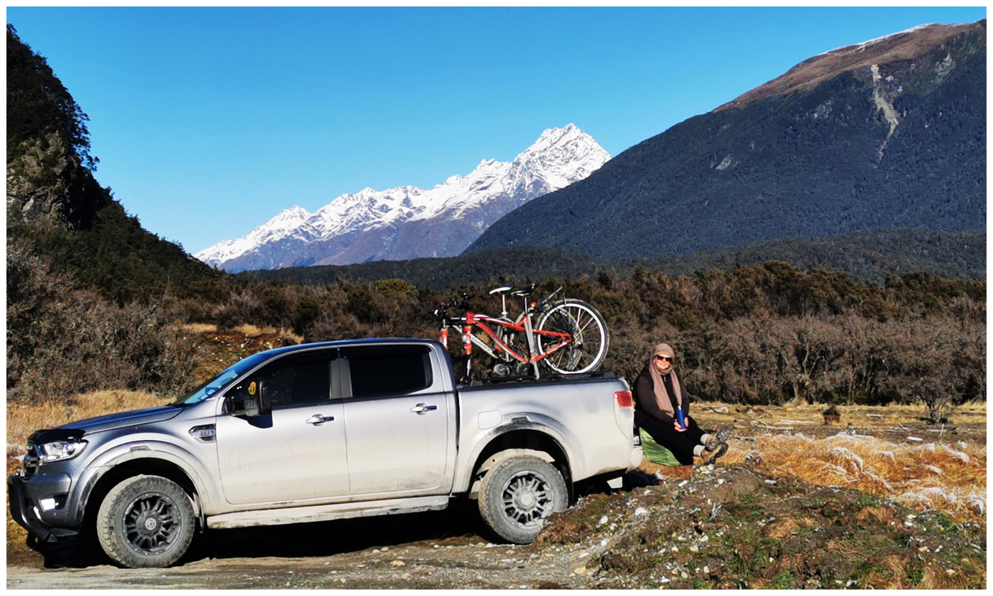
not a bad view for the night
It was getting a bit late in the day to find another camping spot so we positioned ourselves as best we could in what we considered the cleanest part of the car park with the best views.
We did have a clear and panoramic view of the small lake, which reflected beautifully, the snow-capped mountains.
As expected, the temperature started to dip rather dramatically as we lost the sun behind the towering mountains. The heater came on, the charcoal bbq fired up and the skewers for dinner went on.
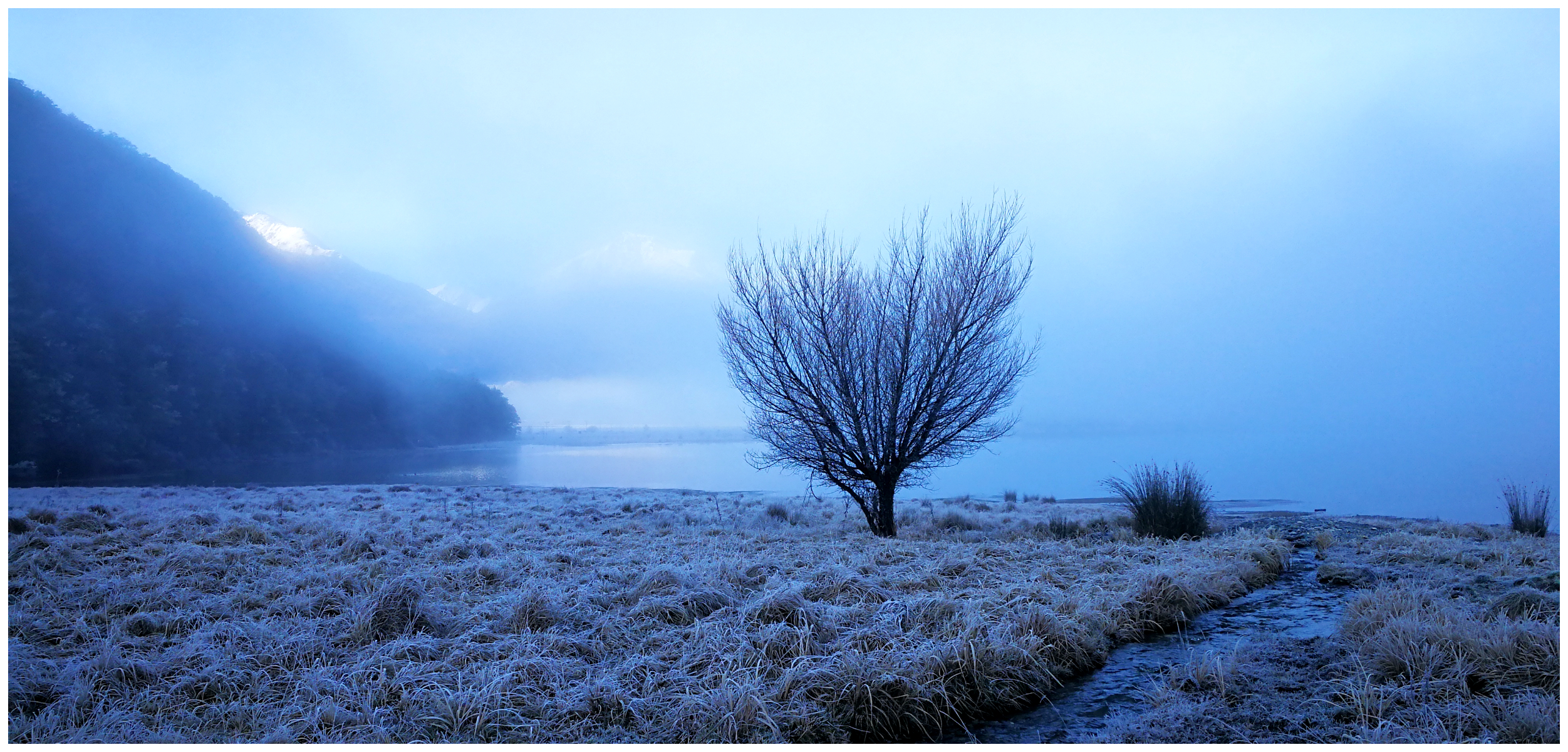
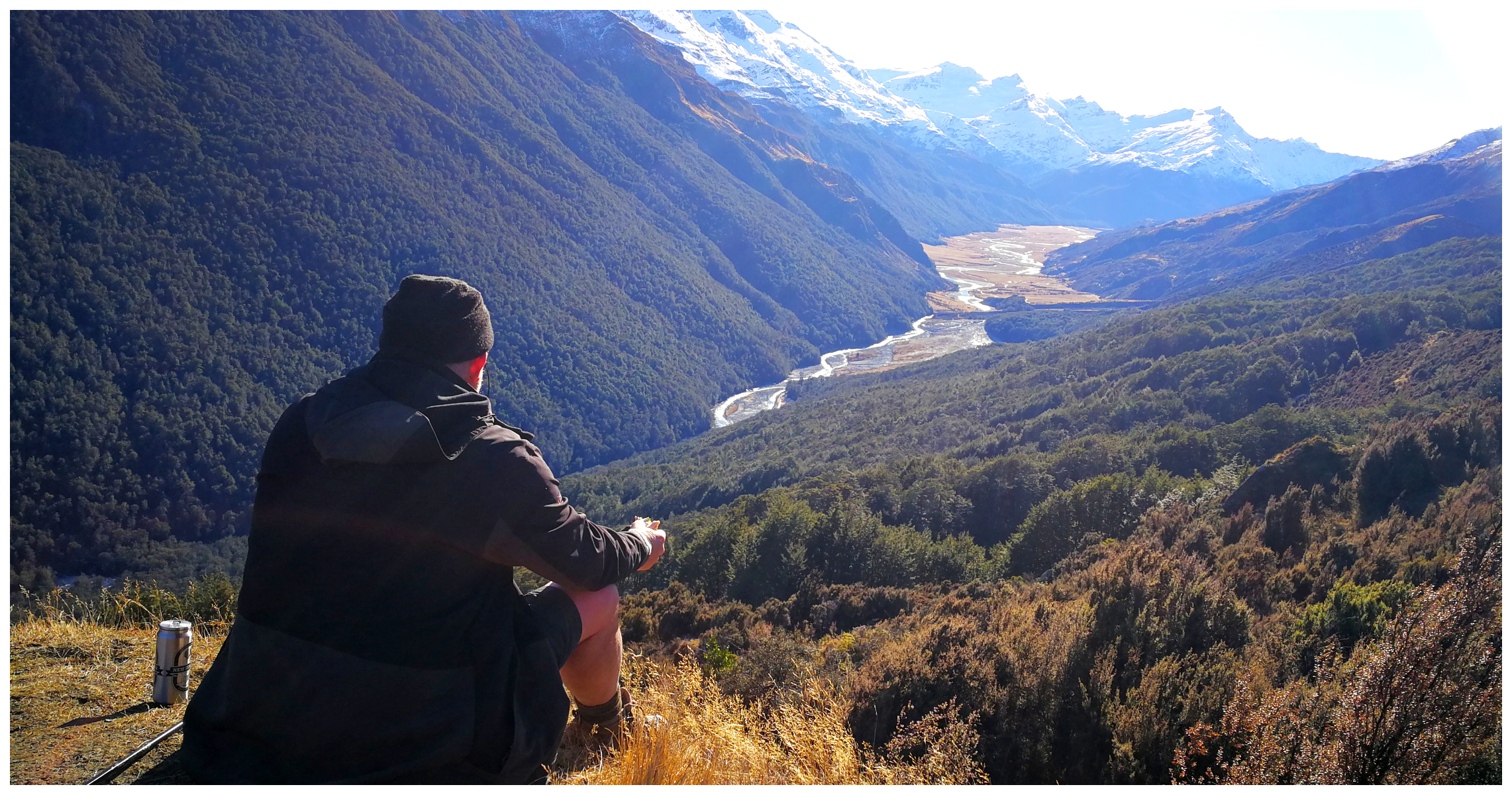
yup, I braved the morning frosts for an early morning pic
There is no internet or phone coverage here and I had thought that there was a Diamond Lake walkway somewhere around here. I was mistaken as it actually starts on the road to Kinloch. We’ll have to save that for another day.
Finding Paradise
We wrapped ourselves up well the following morning (after all it was -6 degrees but Scotty was still in shorts!) and wandered on foot towards Paradise. We walked along the road, uphill for about a kilometre and over a ford before coming to the small settlement of Paradise.
There’s no information on how Paradise actually got its name. There is certainly a biblical theme going on as there is the ‘Rock of Eden’, ‘Heavens Gate’ and you have to cross a ford named the ‘River Jordan’ to get there. Some also say Paradise gets its name from the Paradise duck.
Paradise Trust
Nestled in Paradise is the Paradise Trust. The house was built in 1883 on 128 hectares and was operated as a guest house for over 50 years. Back then, wealthy adventure-seekers made a 2-hour horse and buggy trip from Glenorchy.
The Paradise Trust purchased the property in 1998. The Trust operates on a not-for-profit basis. All funds are invested straight back into maintaining and enhancement of the property.
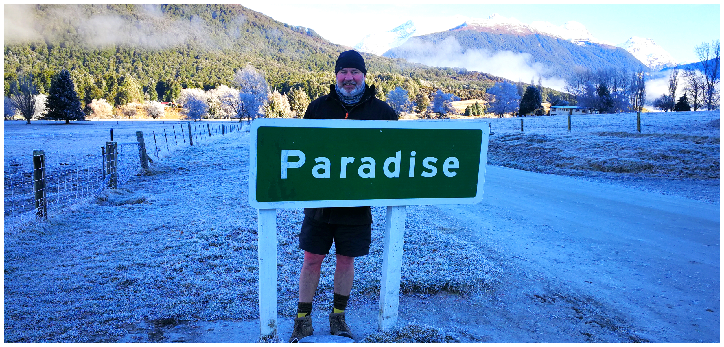
it’s official…..we found Paradise!
There are a variety of accommodation options available for guests to stay (as far as I can work out – not for self-contained campers, unfortunately).
There’s a variety of walks, from short and sweet – to the more strenuous options.
We were hoping to call in and check out some of the tracks but although the website states they are open for visitors all year round, the gate was shut with a sign stating “Closed – guests only”. For more information, click on the link to their website here.
Glenorchy
I’ve always loved visiting this sleepy little town but I’ve never stayed here.
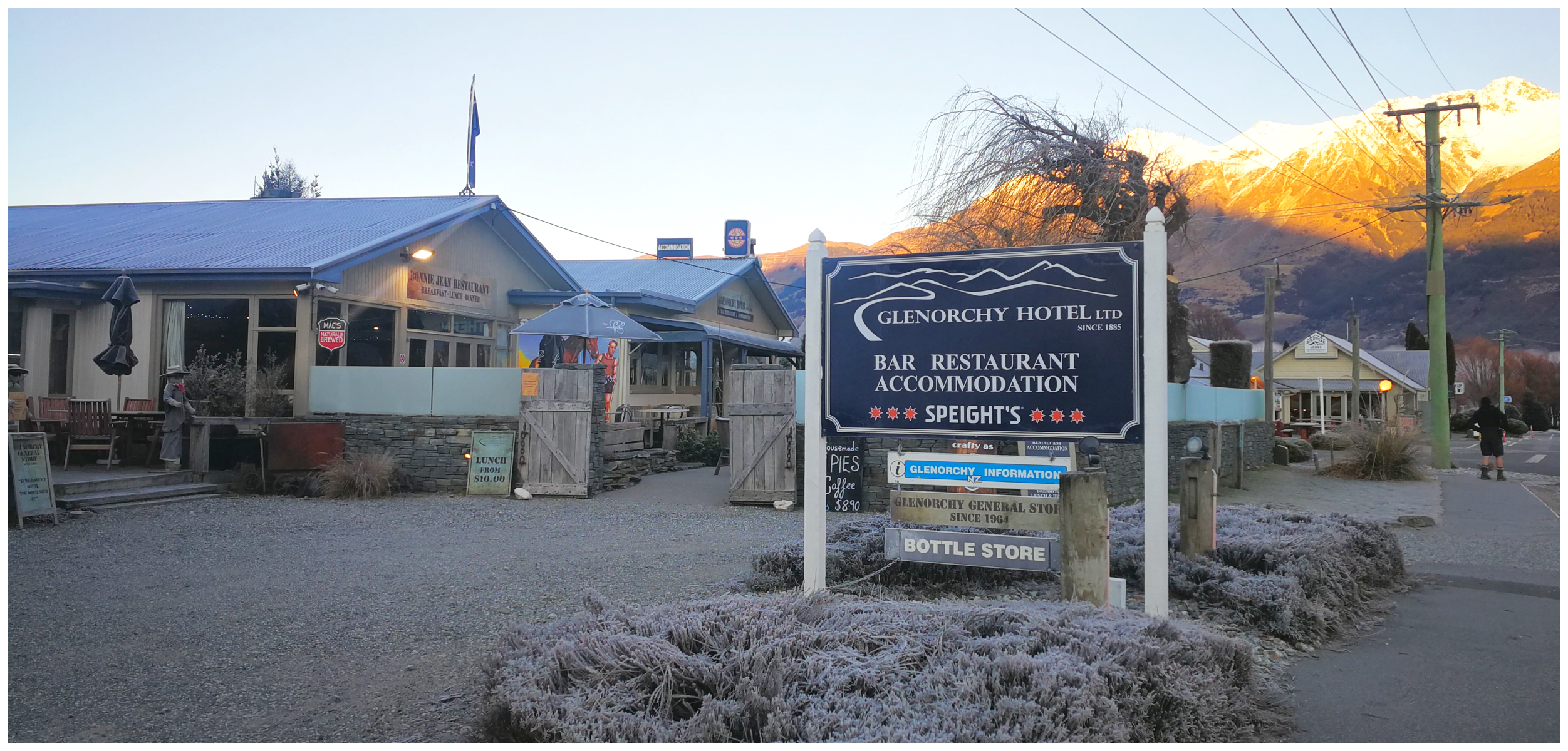
the Glenorchy Hotel and our home for the next 4 nights
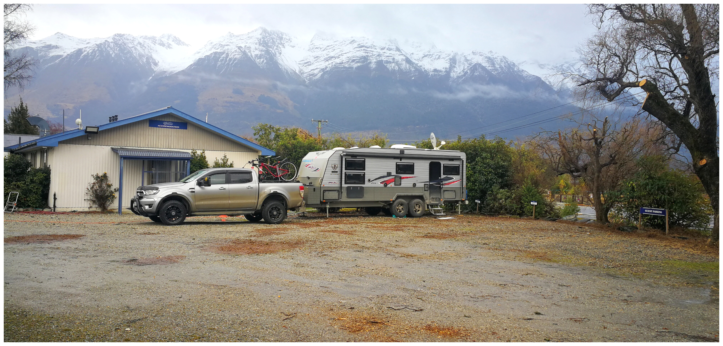
We took up residence at the Glenorchy Hotel carpark (NZMCA#8637). They have some free sites designated for self-contained campers, providing you call in for a drink or meal (or both). You also have the option to plug into power for $12 per night.
yup, it’s just a pub car park but a short walk to the lake and a view of the mountains
We never have a problem in reciprocating the generosity of some of these pubs and we’re always happy to oblige and pay our way in the form of purchasing food and drinks.
Yup, it is a Pub Carpark!
Although it is an ideal location, you do need to be prepared for a little ‘pub noise’ on a Saturday night. They often have live bands performing and it was no different while we were there. We did join the other patrons and listened to a few songs, but decided we’d rather retire back to the caravan. The music could still be heard but it really wasn’t too disruptive. Nothing that some earplugs couldn’t block out.
The girl serving behind the bar said that as soon as the levels of lockdown lowered, they haven’t really noticed much of a decline in patronage and still keeping very busy. Go figure. Maybe the crisis wasn’t quite as bad for some than others in some of these tourists towns.
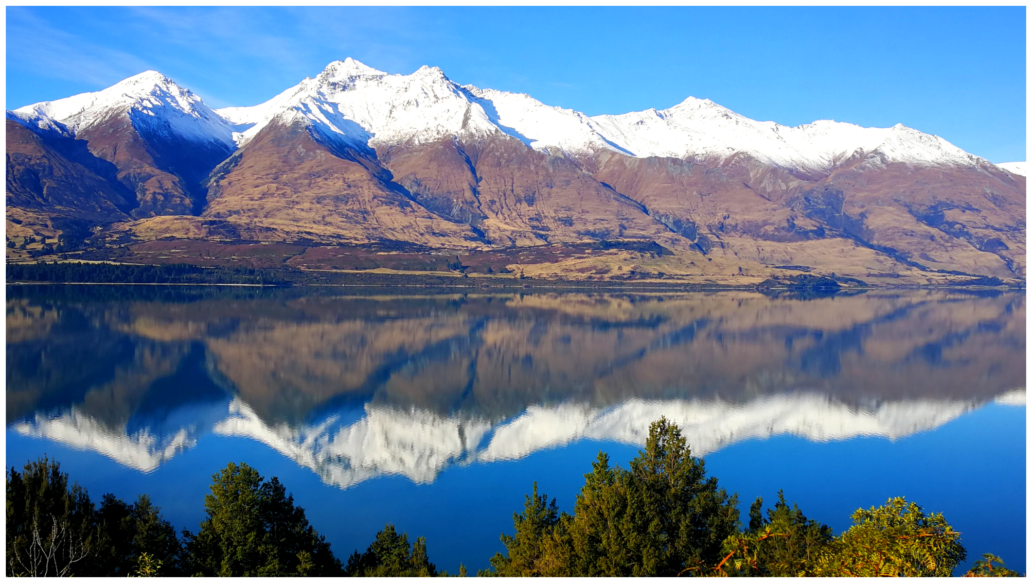
The Very Picturesque Lake Wakatipu
Gazing out over Lake Wakatipu from Glenorchy is quite different to looking at it from the Queenstown end.
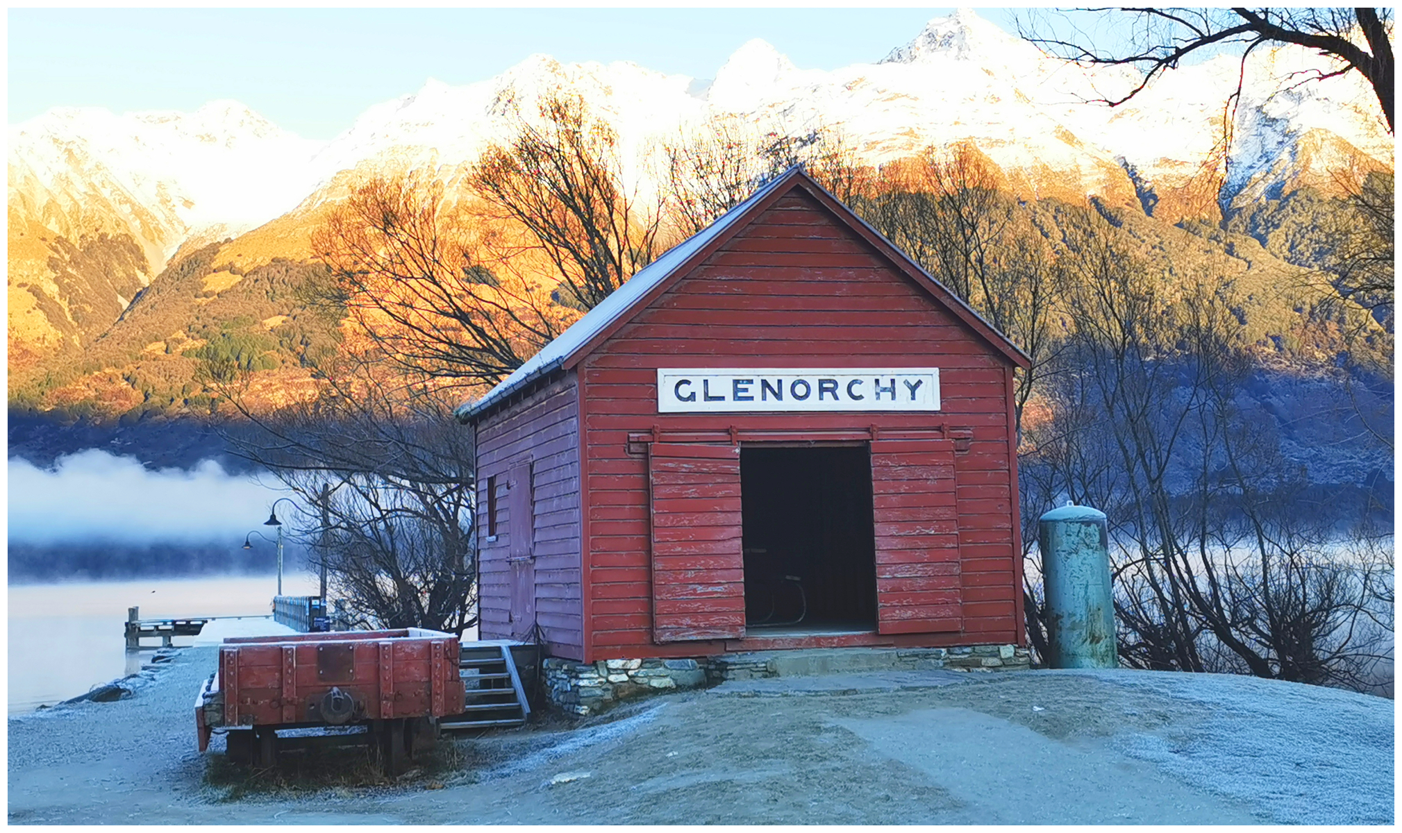
of course, you have to take that iconic Glenorchy shot (without tourists in the way)
It was a bonus to be able to get up, wrap up and wander the short distance to the lake to get some really iconic shots without the throngs of people. Albeit a little less crowded post-COVID but still extremely popular.
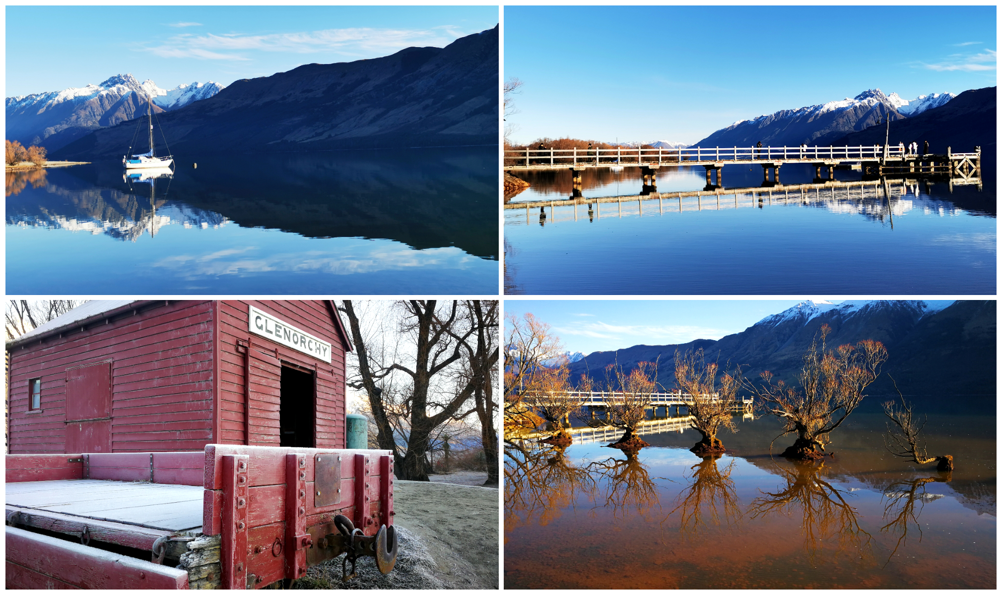
making the most of the sunshine to get some wonderful shots of the lake
It’s very hard to take a ‘bad’ photo of the lake here. The biggest challenge is taking that shot without other visitors trying to do the same thing. You can take different shots at different times of the day as the light and mist can change hourly.
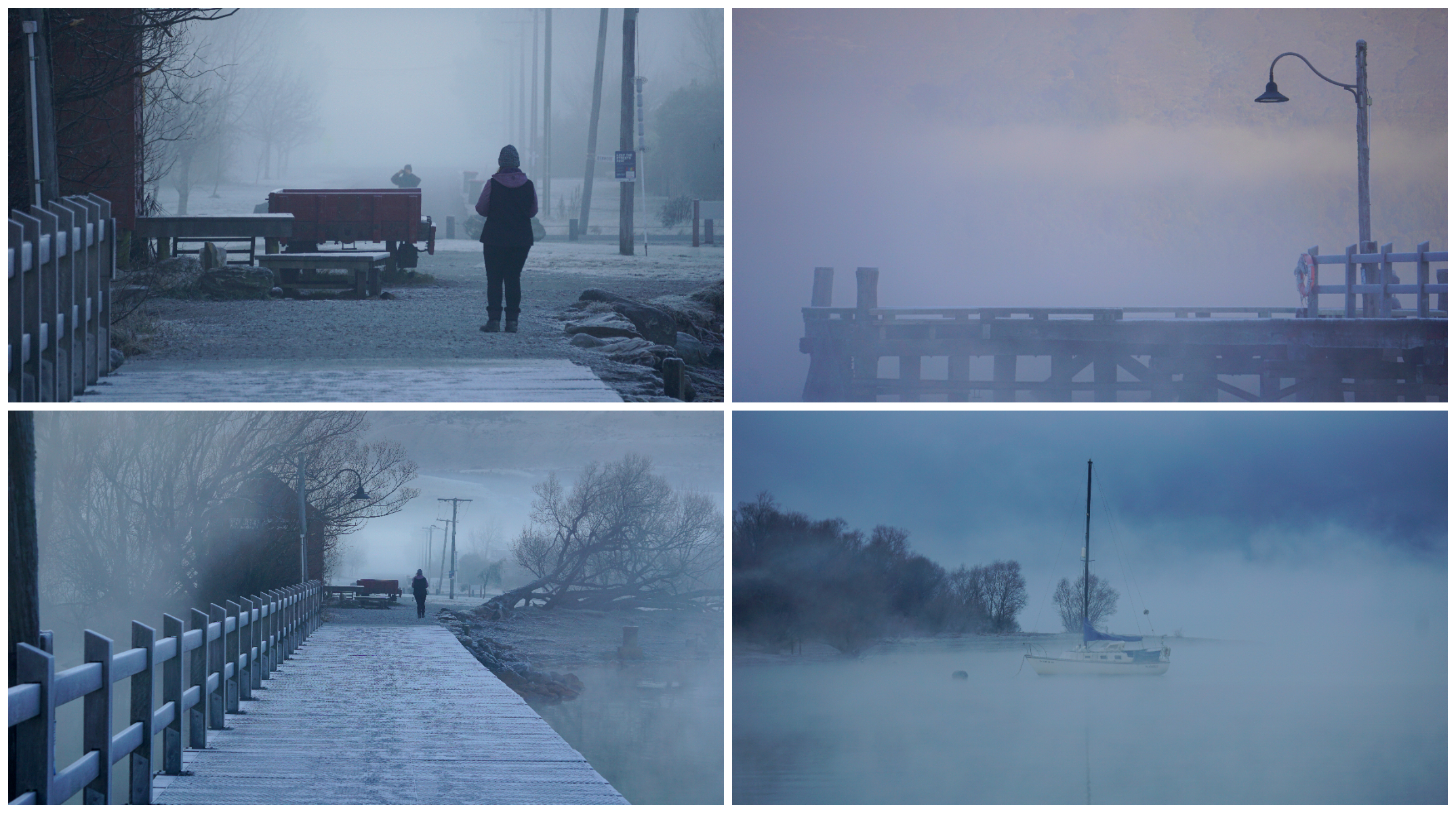
and even on a misty morning, it just added a moody, eerie atmosphere
Scouting the Area
With the caravan unhooked, and the weather looking glorious, we decided to go on a tiki-tour of the local area.
Kinloch
We drove back to the Kinloch area to check out the DoC Camp located there. We thought that it would be worth coming back with the caravan for a couple of nights stay.
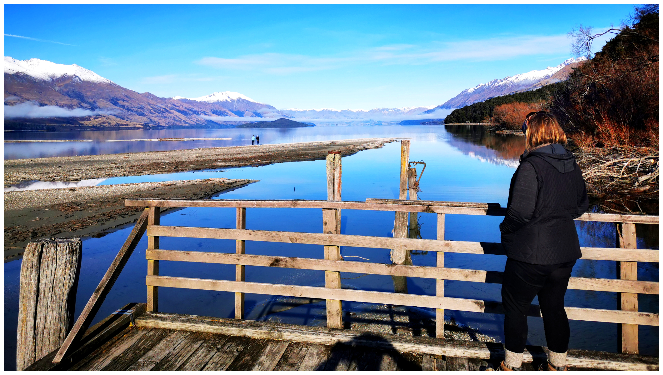
the historic Kinloch wharf on the far side of Lake Wakatipu
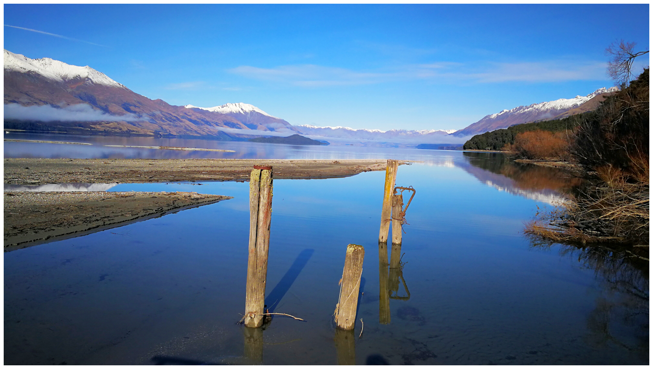
a beautiful peaceful spot, worth a night or two stopover
The road from Kinloch follows the shoreline of Lake Wakatipu all the way through to Greenstone and to Elfin Bay. As with many of the local roads in the area, there are several ford crossings. These are achievable in a 4×2 vehicle but good clearance would be essential. When the weather is not so friendly, it would be more challenging and a 4×4 would be recommended.
a very different view from the other side of Lake Wakatipu looking towards Queenstown
oh my……there was plenty of stops along the way for photos!
There is a DoC Carpark/camping area which services those who set off on a variety of walks/hikes. Lake Rere is a popular loop track which takes around 4-6 hours.
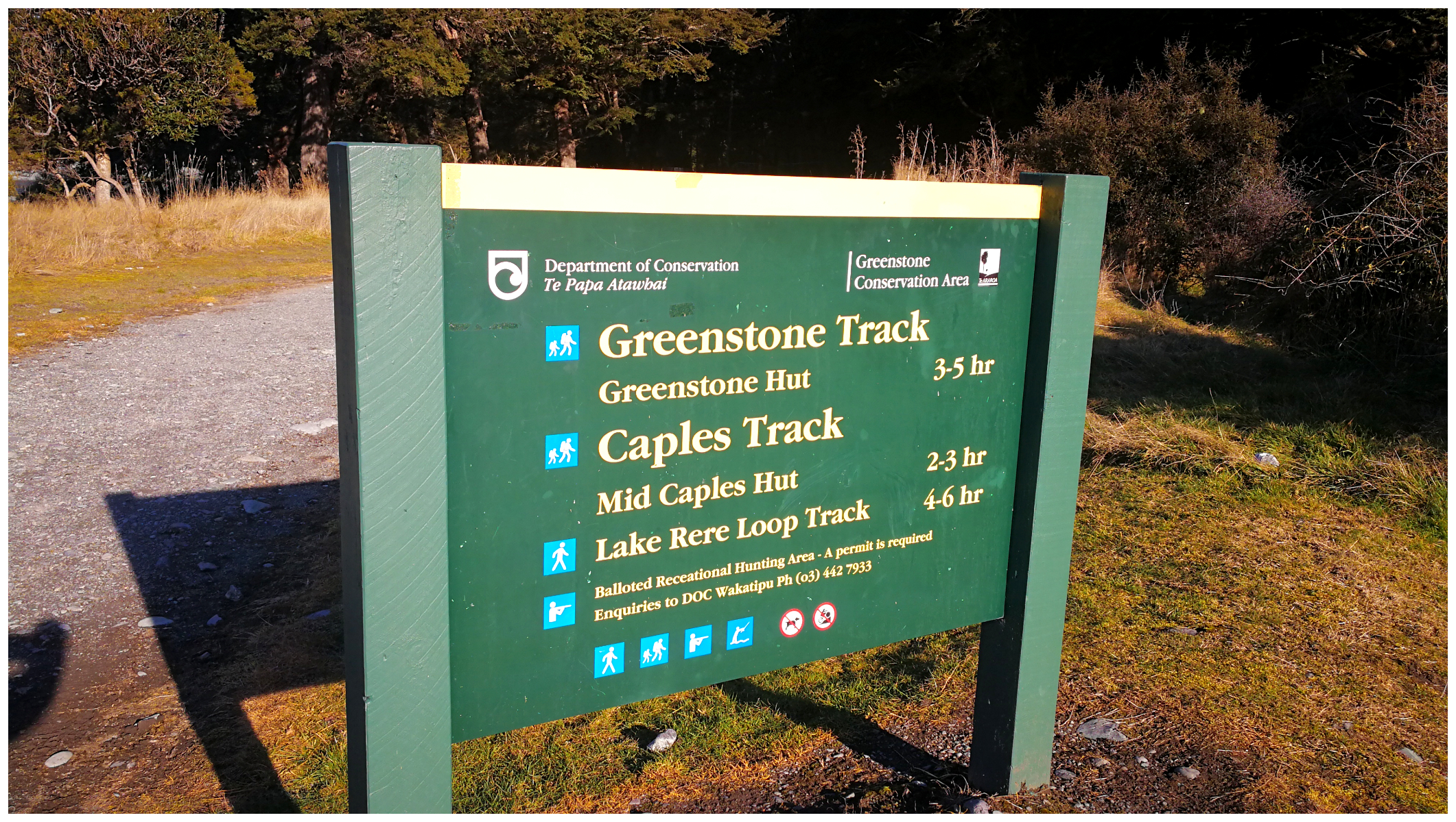
the starting point for a few hikes
We did an about-turn and drove back to Kinloch, but this time heading in the direction of Sylvan Campsite. The Lake Sylvan Walk is currently closed as they are still repairing the swing bridge.
We stopped off at the shelter which is the start of the Routeburn Hiking Track. There were quite a few information and history boards about the Routeburn Track.
Weather permitting, we’d like to return to walk part of the track (the full track is currently closed).
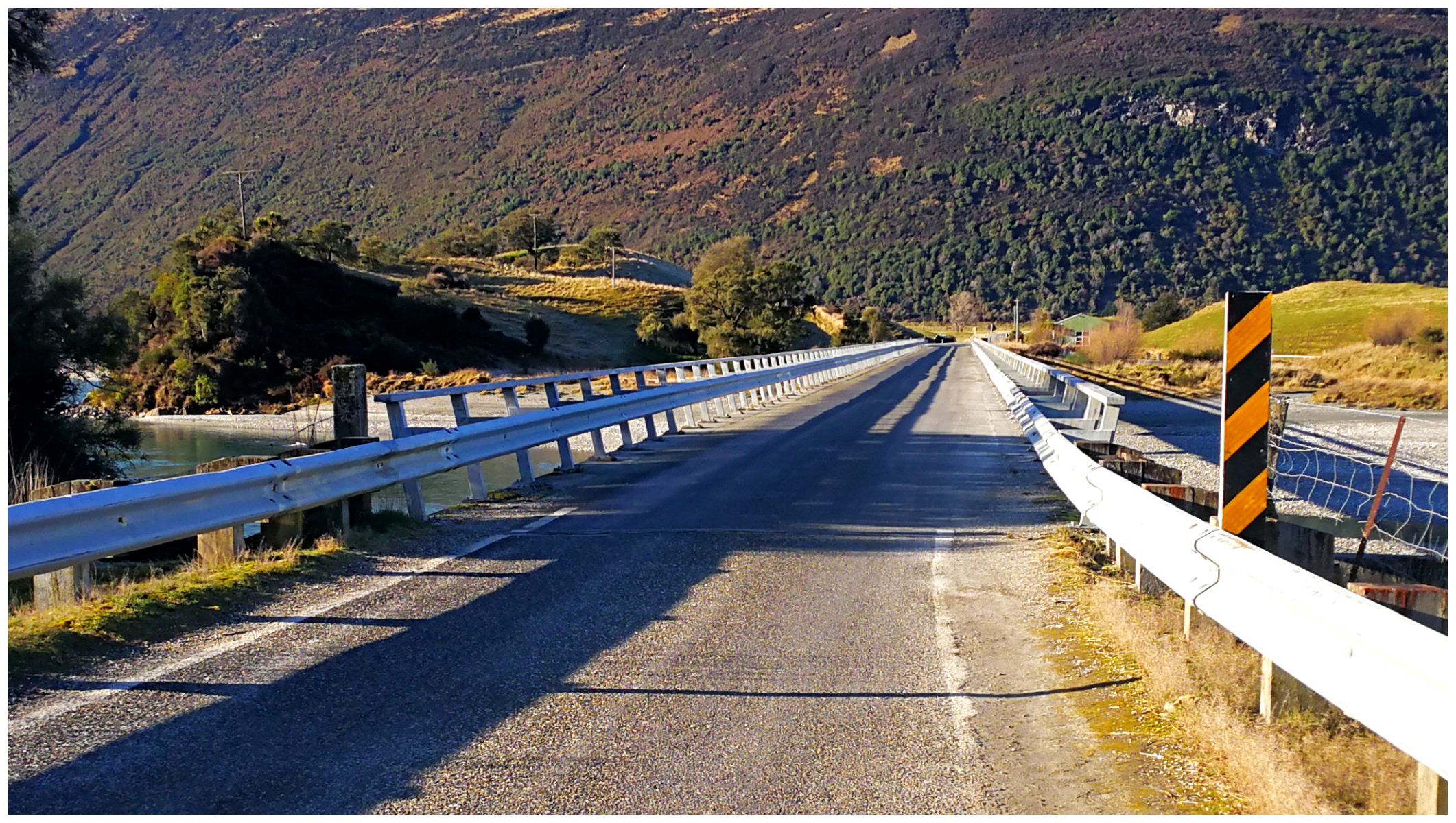
okay, okay, I had to stop and take a photo of ‘One Lane Bridge’ as seen in the TV series of the same name (fairly average when it comes to bridges!)
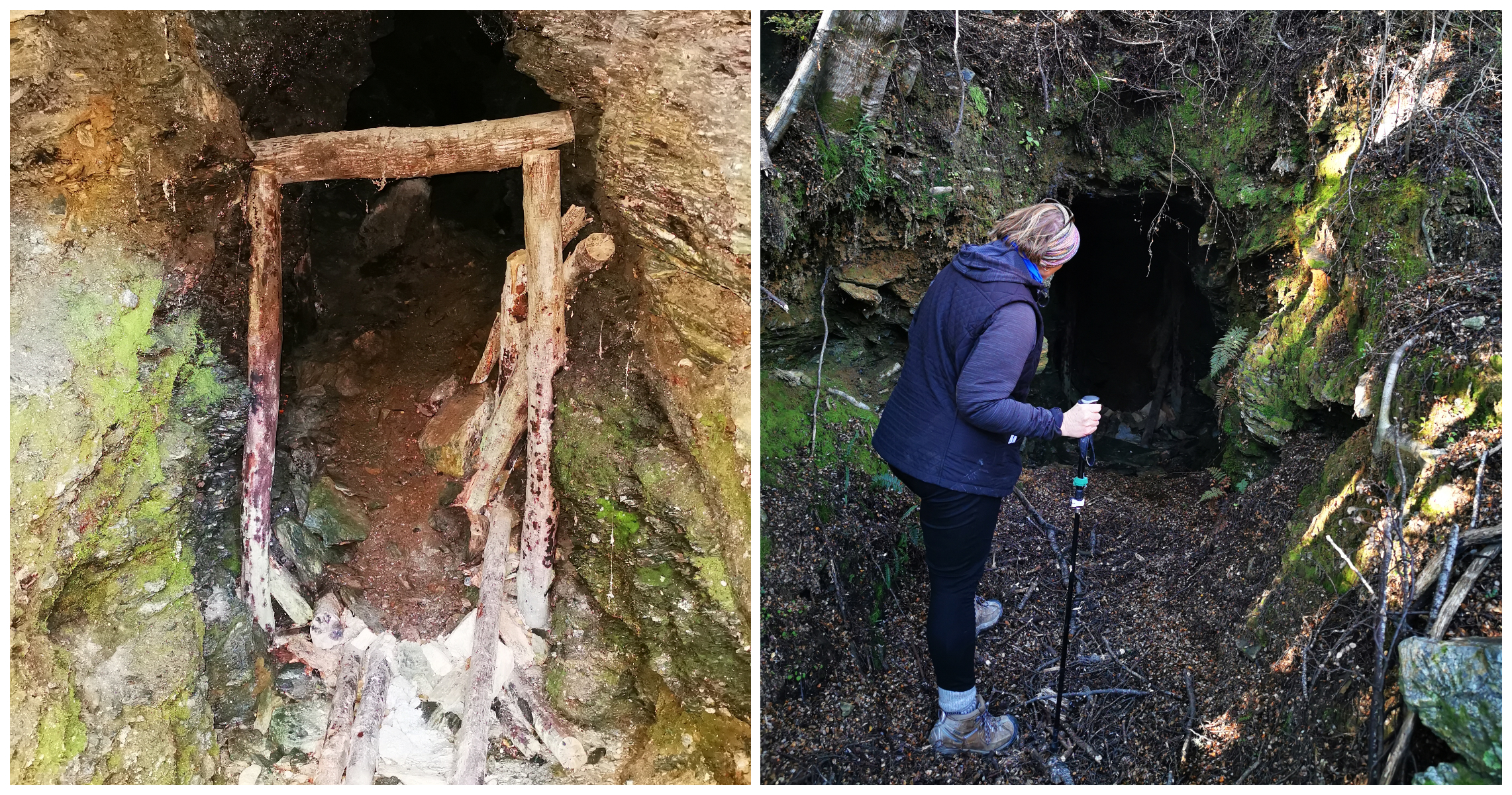
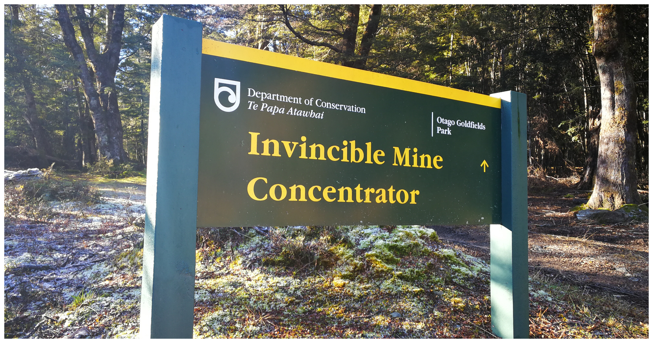
Invincible Mine Track
Heading out along the Paradise-Glenorchy Road, the Rees Valley Road will come up on your right. Travel for approximately 9km down this unsealed road and you will reach the start of the Invincible Mine Track.
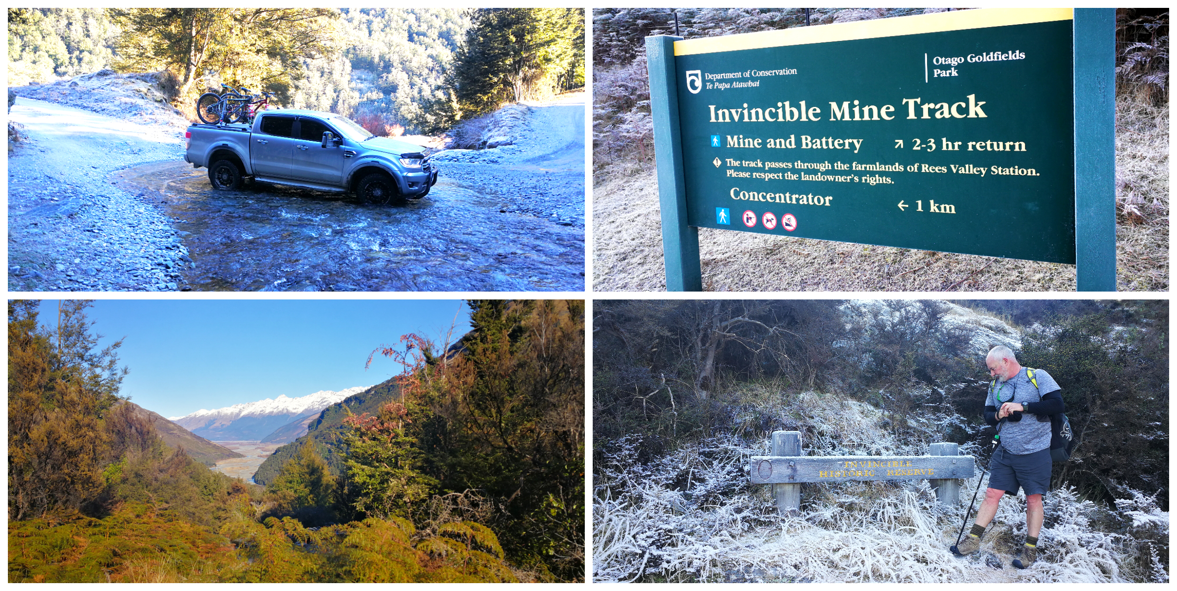
crossing the ford on the route and our uphill hike to the mine
NB: although the road surface is good, there are a couple of stony fords to cross and there is minimal (actually no) parking for motorhomes. We had to squeeze the ute into a small layover as there were already a couple of cars parked there.
One Hour Uphill Slog
The track is a 2-3 hour return hike up a track cut into solid rock by miners back in the 1880s. This was to deliver heavy machinery to the Invincible Mine site way up in the hills.
I really don’t know how they got machinery up there as I struggled just getting myself there! It took an hour of slogging uphill, stopping occasionally to make sure my lungs stayed in my chest! We reached the mine site an hour after setting off.
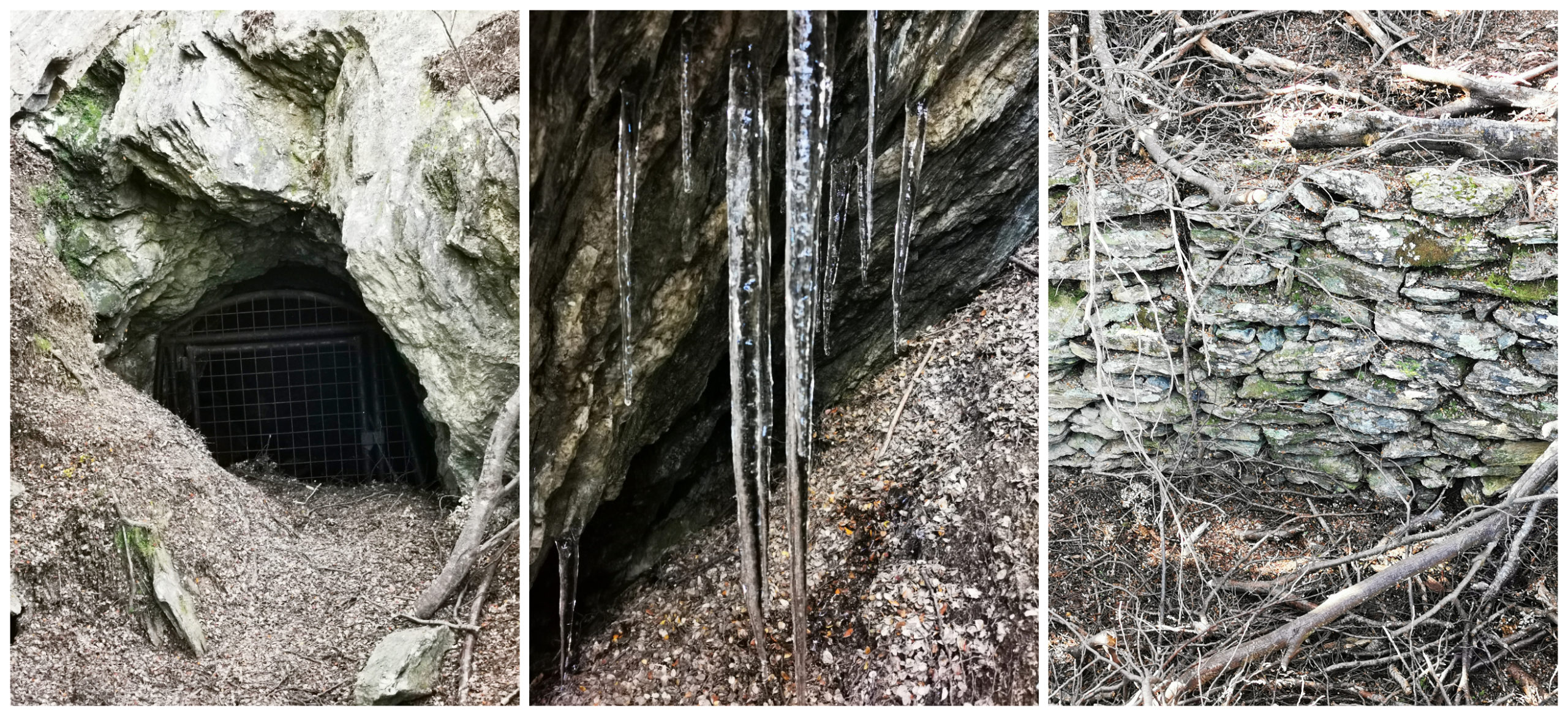
icicles at the head of the mine show just how cold the workers must have been
History Unfolded
The history, as usual, was so interesting. There were some rather faded history/information boards around the site and it was hard to make out where everything was situated. There has been little or no restoration done to the site so many of the workings and equipment has been taken over by nature.
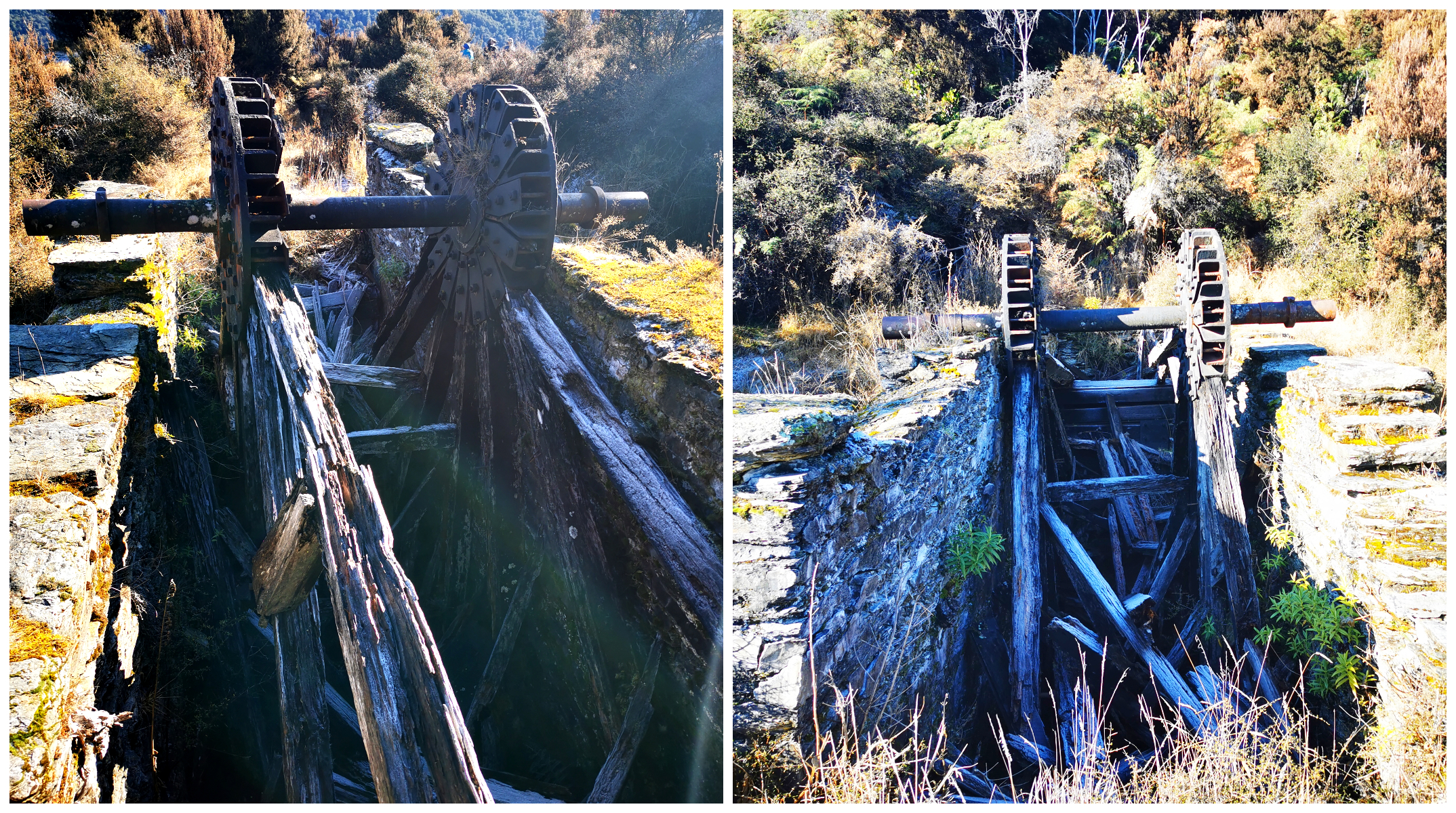
the decaying water wheel
We could clearly still see the remains of the wooden water wheel and a unique set of seven berdans. These were large, slowly revolving cast iron bowls that ground the ore. They can be found dotted around other mine sites in Central Otago, but nowhere are there as many as seven in one place.
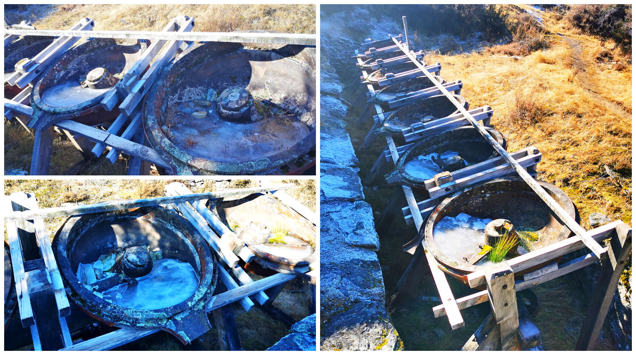
the unique row of seven berdans
This was also the site of a 10-stamper Battery which crushed the quartz before sending it all to the berdans. It was at this stage that we had to spare a thought for the men and horses who transported the equipment up the same track we had just walked up!
Lunch on Top of the World
We shimmied our way up one of the many mounds of tailings that had come out of some of these mines (personally I thought that it was a near-death experience!) but oh my, what a view. It felt like we were standing on top of the world!
oh my……on top of the world
We had a panoramic view of Rees Valley, Rees River and Mt Earnslaw loomed up before us. To cope with the thought of having to negotiate the steep, unstable screed decent, I decided that this was the ideal spot to pop the thermos flasks filled with hot coffee and down our sandwiches.
couldn’t find a better lunchtime view
By the time we made it back to the ute, it was 3.5hrs return. This included considerable time wandering the tracks around the old mine site and a lunch break.
more mines found on our way down
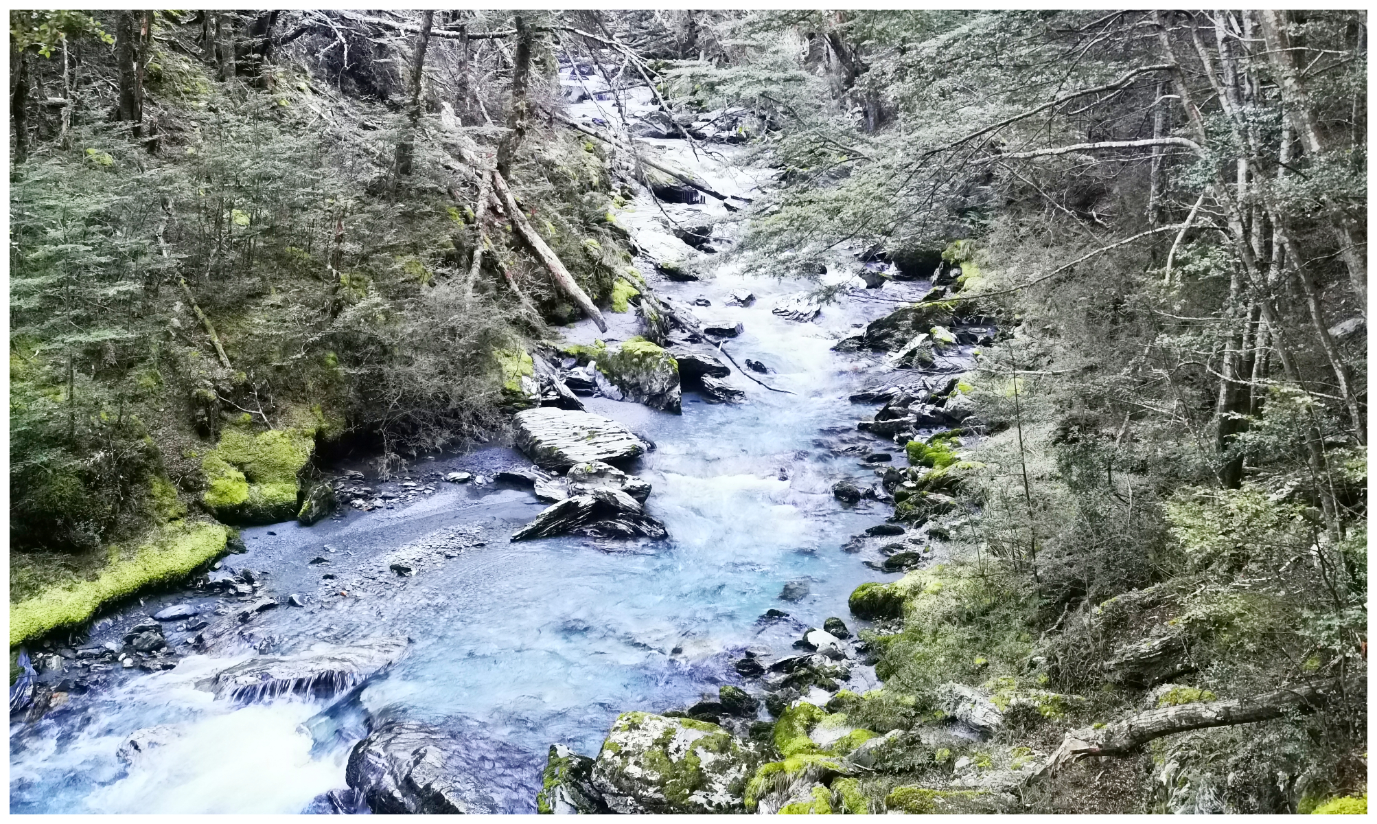
although the water was considered as valuable as gold in the mining industry, it sure makes for a beautiful photo
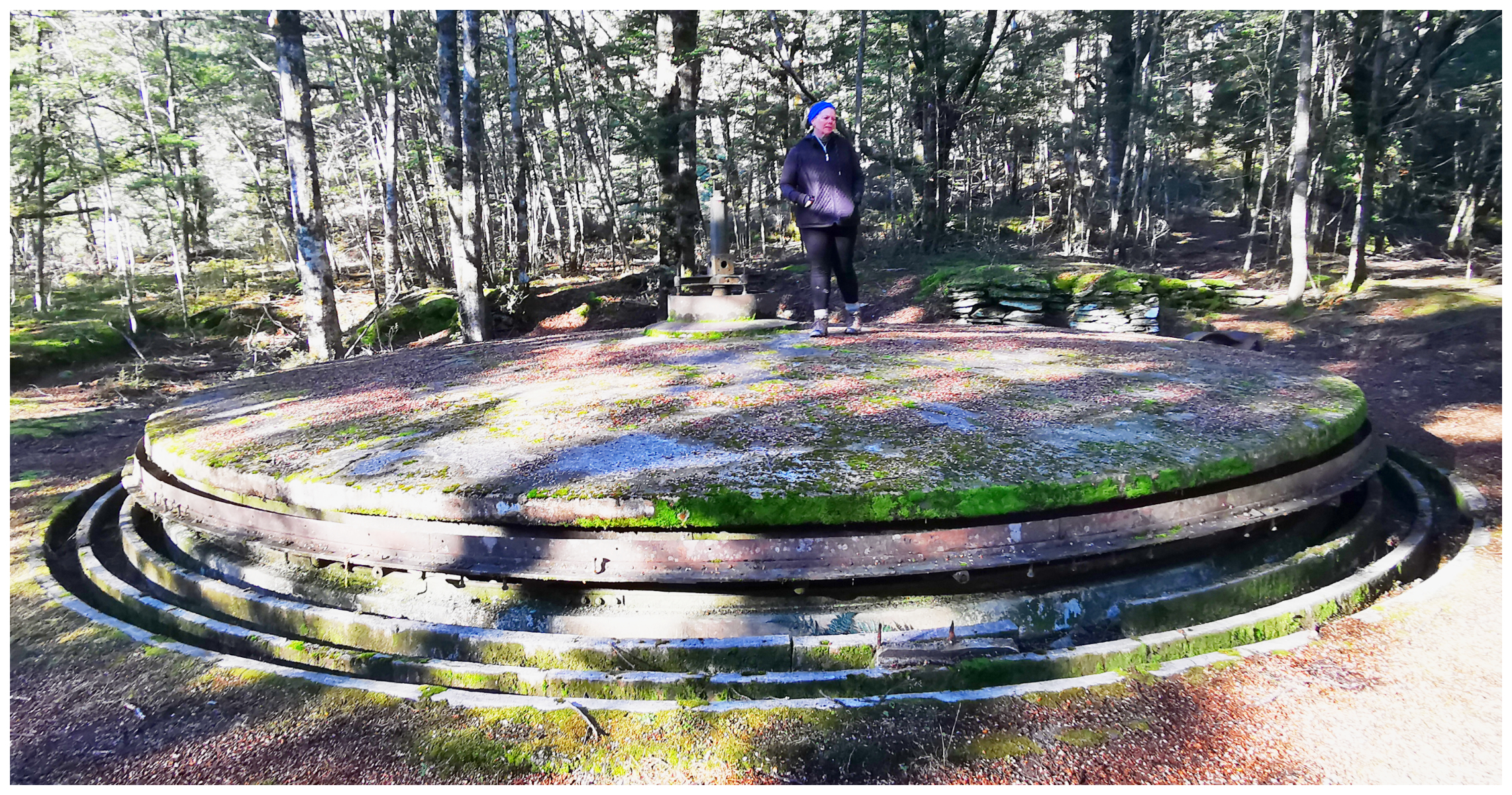
Invincible Concentrator
After fossicking around the old mine site, we made our descent (rather a bit more quickly than we did going up!), jumped in the ute and travelled another kilometre down the road to the Invincible Concentrator.
easy to spot the signage to The Concentrator
We’ve never come across a Concentrator before and we were a bit baffled as to what it actually was.
nope, not heard of a ‘concentrator’ before when it comes to mining
It is a unique buddle (or concentrator) located on the valley floor, far below the Invincible mine. Tailings from the battery were shot down a 680-metre wooden chute to this large circular dome made of solid concrete. The sorted tailings were placed on the stationary surface of the buddle and jets of water turned the dome. This separated out the lighter sand from the heavier gold, which fell into gutters which were located around edges. Go figure – a great example of the ingenuity of those early miners.
we knew it was time to turn around when we were met by this fresh rockfall, with them still rolling down!
Chinaman’s Bluff
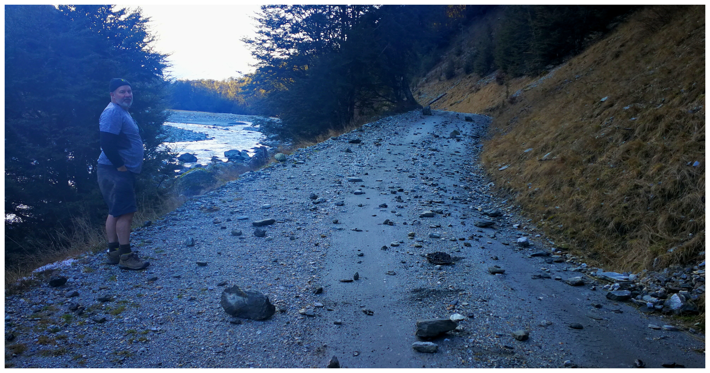
When we were staying at Diamond Lake, we discussed returning to the area to continue to ‘roads end’ to an area called Chinaman’s Bluff. We had read and heard that the road was rather rough in places and certainly not recommended for campervans and caravans.
Well, the recommendations were correct as there are numerous fords to cross, some of them quite deep and rutted. There hadn’t been much rain in the area for a few days so all the crossings were manageable.
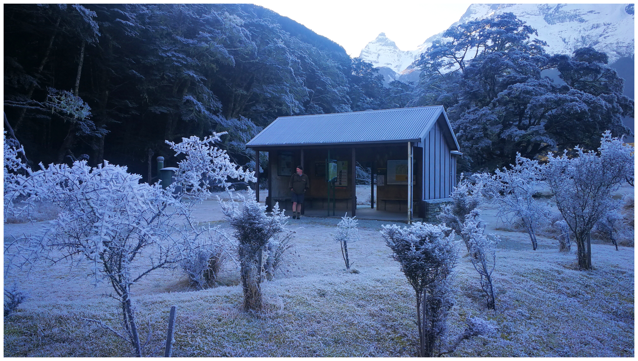
the DoC Hut at Chinamans Bluff
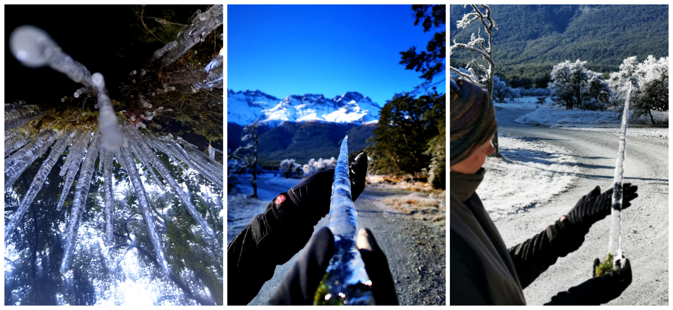
We soon reached places that the sun hadn’t shone and it was quite the winter wonderland. The views of the towering snow-capped mountains were fantastic.
it is an area that doesn’t really see the sun during winter but the hoar frost put on a great show!
We eventually reached the part of the road which had been washed away (we had read about this). It was just prior to arriving at the DoC Camp which is at the start of the Rees-Dart Hiking Track.
We drove up and over a bumpy detour and made it to the small camp/parking area.
History
Europeans arrived in the area in the form of Government surveyors, gold prospectors and run holders in 1863. However, it was the Chinese miners who developed the area. It was them that formed the track which is now the popular Rees-Dart Track (77km).
A party of five miners made the first record of the Dart Glacier.
Rees-Dart Track
This is not a winter track to walk by any means. In times of heavy rain, most of the streams become uncrossable. There is also a significant avalanche danger during the wintery months.
The first section of the Dart Track takes you around the Chinaman’s Bluff section and we envisaged that this would be around a 30-minute ramble as it followed the banks of the Dart River.
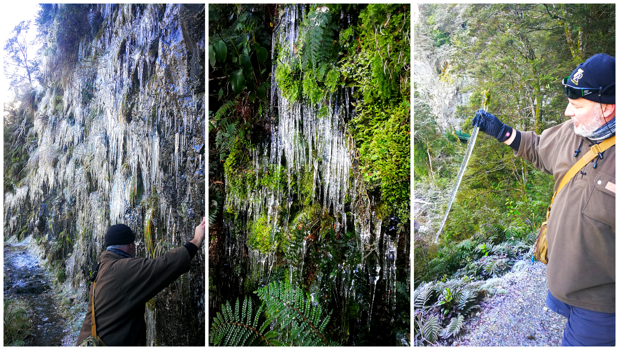
a cascading stationary icicle waterfall
We were so pleased we did as we soon discovered some of the most amazing ‘icicle artistry’ that we had ever seen. Slithers of glistening ice spears clung to the cliff faces beside the trail.
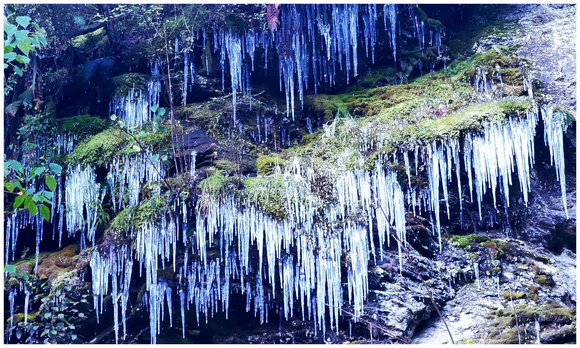
the cliff faces were a visual symphony
The show was something that just could not be replicated by anything manmade. Each corner we turned, provided us with a different show.
yup, those icicles fascinated us
We read the ‘slippery track’ warnings at the start of the trail so we had to keep an eye out for any icy patches. I did find a patch that sent me into some sort of ice skating rendition (but not so gracefully). Thankfully I managed to keep upright but it certainly signified the end of the trail for us. Not before one last standing ovation by mother nature. An entire cliff face full of hanging icy artwork.
it’s fair to say we love our ‘tailgate’ lunches, especially with views like this at the Chinaman’s Bluff DoC Camp
Whakaari Conservation Area
You will find the entry to Whakaari Conservation Area, just 2km from Glenorchy on the Queenstown-Glenorchy Road.
There is a shelter shed in the carpark with history and information boards of what went on in this area. There is also information on the different options you can take when it comes to walking the tracks (NB: this is a shared track so keep an eye out for mountain bikes and horses). Click here if you would like to know more about the tracks in the Whakaari Conservation Area.
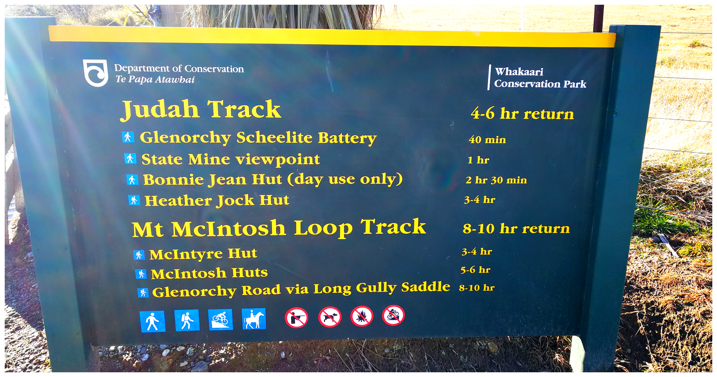
Plenty of options for the avid hiker – as long or as short as you like (no dogs allowed)
Mt Judah
We set out on the old Mt Judah Road, heading for the Glenorchy Scheelite Battery. It is a constant climb as the old road zigzags up the side of the mountain. After approximately half an hour (allowing time to catch our breath and taking in the evolving views) we reached the Battery site. History started unfolding as we wandered the site.
Scheelite Mining
I’m the first to admit that I’d never heard of Scheelite!
I’m no scientist (in fact I failed Science in School Cert) so my eyes glaze over with anything mildly scientific. Saying this, to understand why they mined scheelite I had to get my head around the basics. Scheelite is an important source of tungsten.
When tungsten is refined, it produces a metal which is 1.7 times denser than lead with an extremely high melting point. This is why it was used in the manufacturing of the humble lightbulb (that little wire inside the ‘old school’ bulb). More importantly, it was extremely important in the manufacturing of munitions.
Demand ramped up with the start of WW1 and the need to supply tungsten for the manufacture of ammunition.
This dropped off after the war but with the advent of WW2, the demand for scheelite dramatically increased again. NZ’s two scheelite mines were taken over by the government.
Mining continued on and off until the 3 square kilometre mine site was eventually closed in the 1970s.
Is Scheelite in Use Today?
Well, the answer to this is ‘yes it is’.
- Its hardness means that it is still used in shells and missiles.
- tungsten power is used in some explosives
- it is an electrical conductor so used in electronic circuits
- can be found in welding rods
- because of its high melting point, it is used in the aerospace industry to make rocket engine nozzles
Today, 60% of the world’s tungsten is produced in China with Russia a distant second.
A region near Glenorchy contained the main deposit of scheelite in New Zealand but can be found in at least 19 locations in the South Island and one in the North Island (Coromandel).
The Glenorchy Scheelite Battery
The view from the Battery was outstanding, to say the least. I’m not sure if the miners back in the day had the time to stare in awe of what laid out in front of them. They would have toiled in the process of extracting the minerals out of the scheelite that was brought down from the mines further up the track.
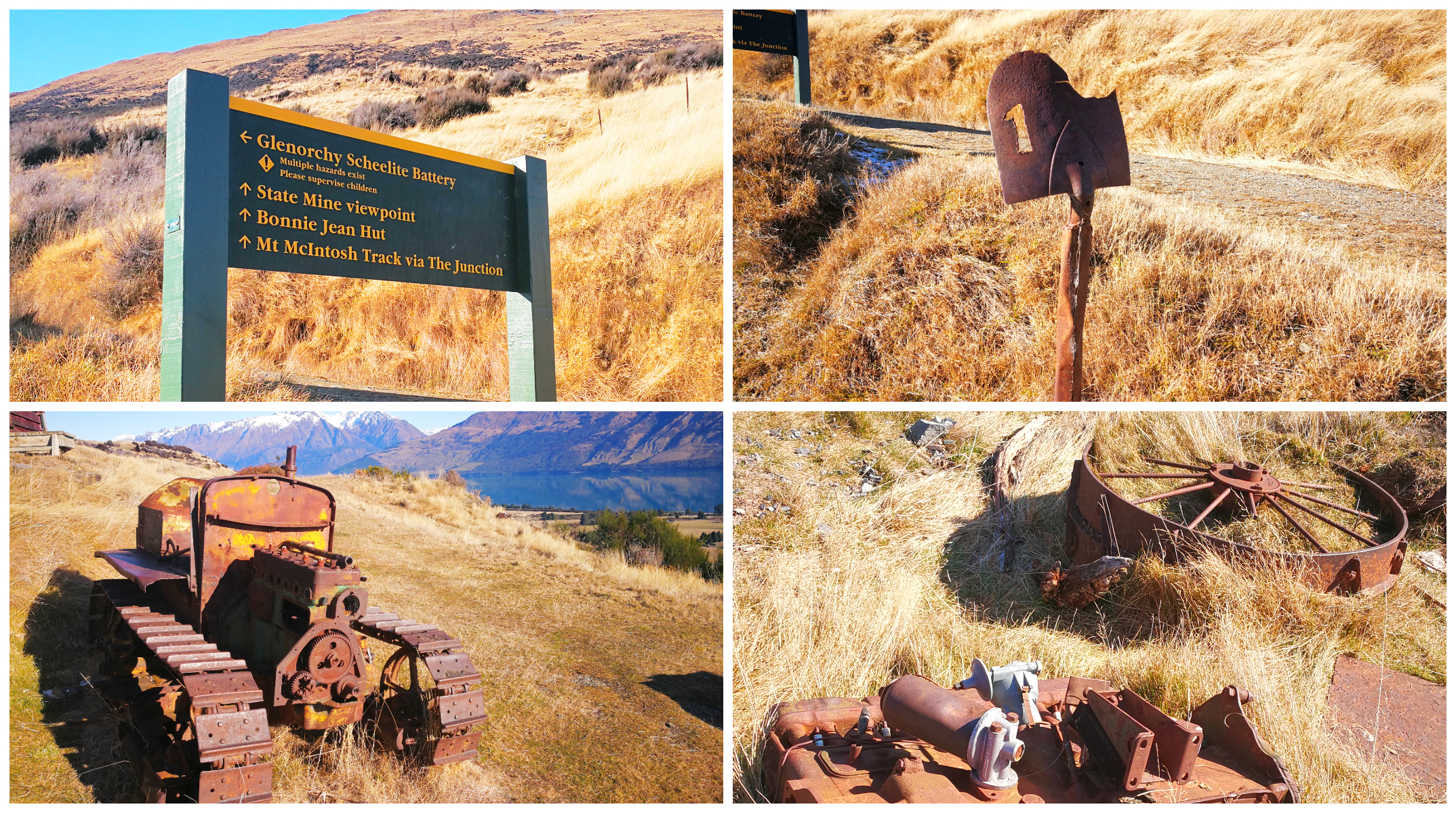
Relics of the Battery site soon came into sight
We wandered in around the Managers Hut which overlooked the battery site.
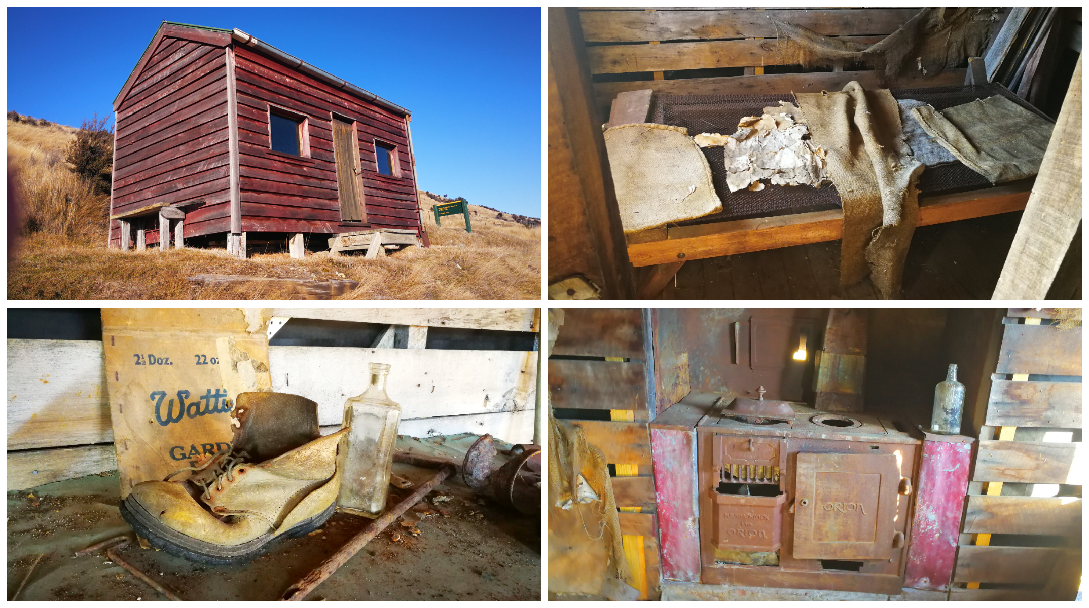
the Managers Hut overlooking the battery operations, the old cooker and bed still intact
There were remanents of some of the equipment used in the process of extraction. This was a similar process used for extracting gold via a stamping battery. Sometimes, it was an added bonus when some of the yellow stuff dropped out.
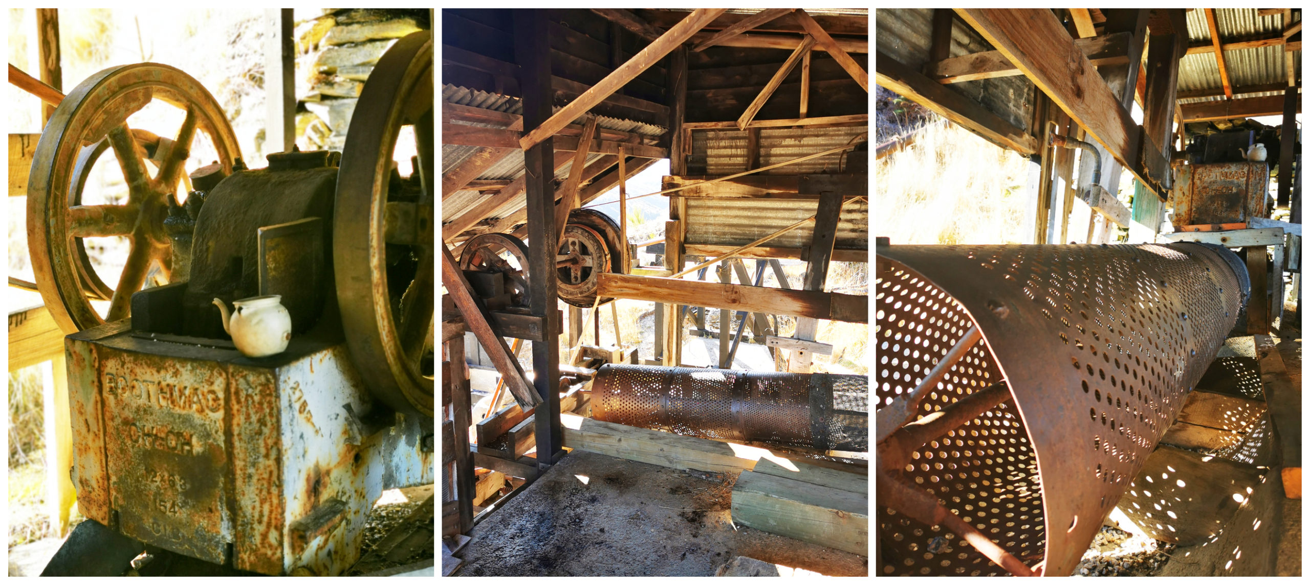
plenty of restored machinery still sitting on the spot where they must have been used 24/7 during peak mining times
State Mine Site
A further trudge uphill for approximately 20 minutes we arrived at the State Mine Site.
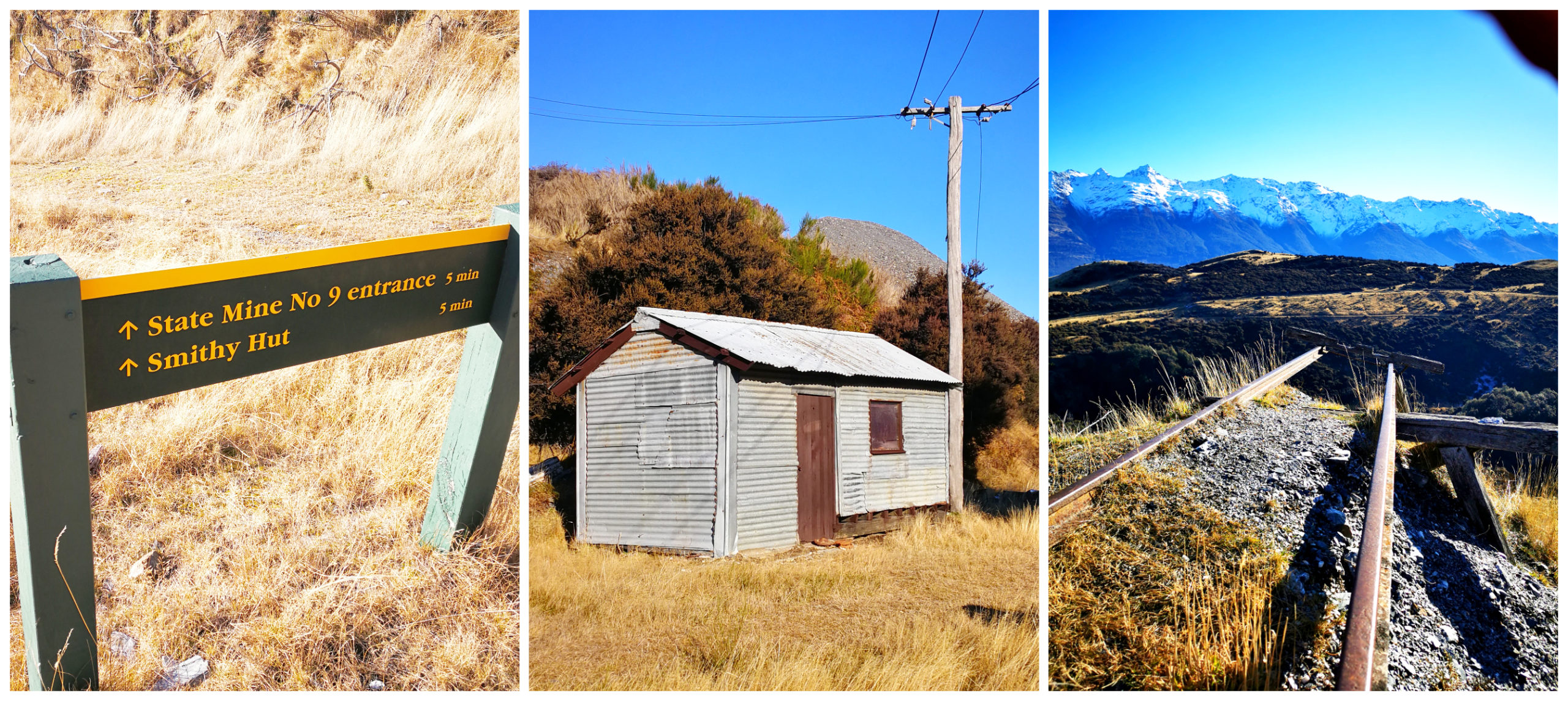
Smithy’s Hut and the railway to nowhere
There are mines dotted all along the massive mountain, some as high as 2000m. We could see the telltale signs of the mines by way of piles of tailings, which pockmarked the hillsides.
Here at the State Mine site, there were really high piles of tailings. We walked down to Smithy’s Hut and Mine Site #9. Long since caved in, some of these mines were about the length of four rugby fields. Burrowing deep into the hillside, they only dug them high enough for a man to walk into so it would have been back-breaking work.
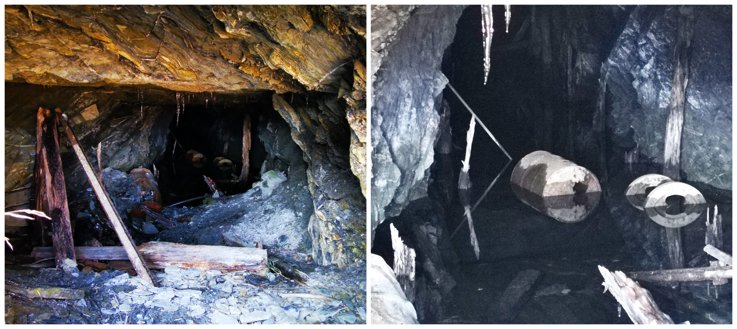
State Mine #9, collapsed and flooded
From here, there is the option to continue walking to a couple of huts which could make for a great mountain bike option.
I had to stop and take in the view from the State Mine #9 site
Glenorchy Estuary Walkway
Located right by the lakefront, you will spot the signage for the Glenorchy Walkway.
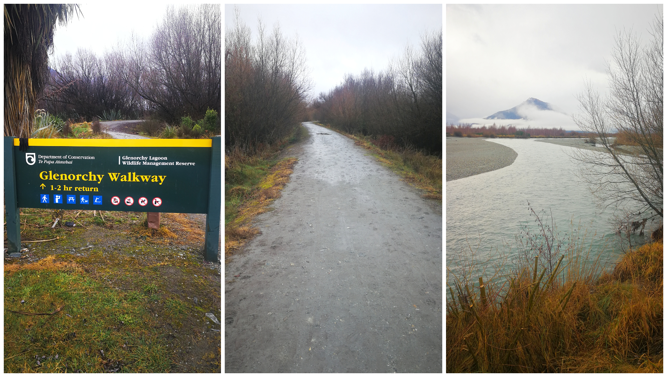
a wet dull day meant there was no one else on the track
There are two parts to this walkway. You can do the long or short version. We opted to go for the whole package and included the boardwalk estuary section which adds another 35-45 minutes.
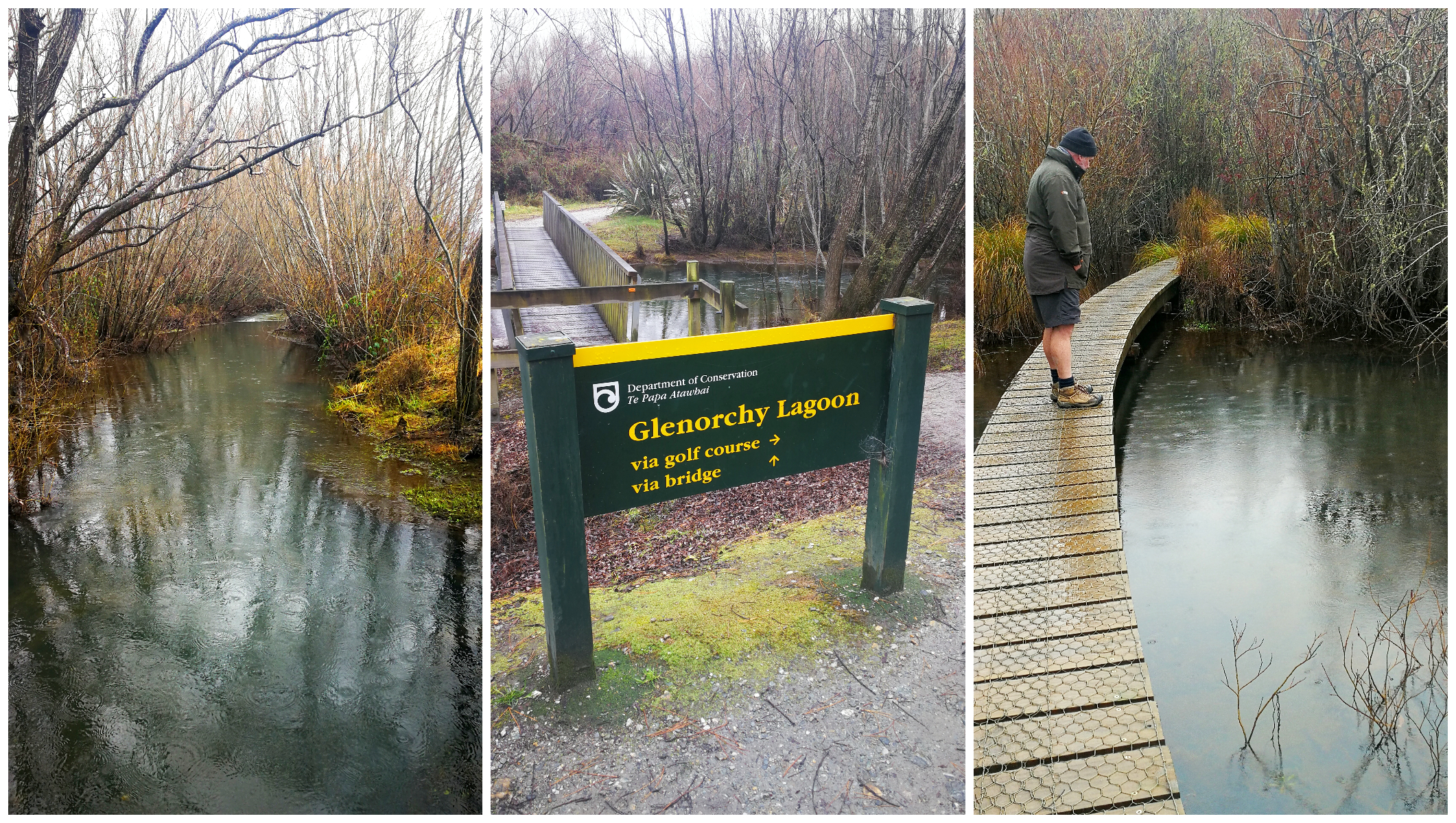
there are some decisions to make along the way, depending on how far you want to walk
Not recommended for cycling as the boardwalk is rather narrow which wouldn’t be too much of a problem unless you got the wobbles on or met someone coming the other way.
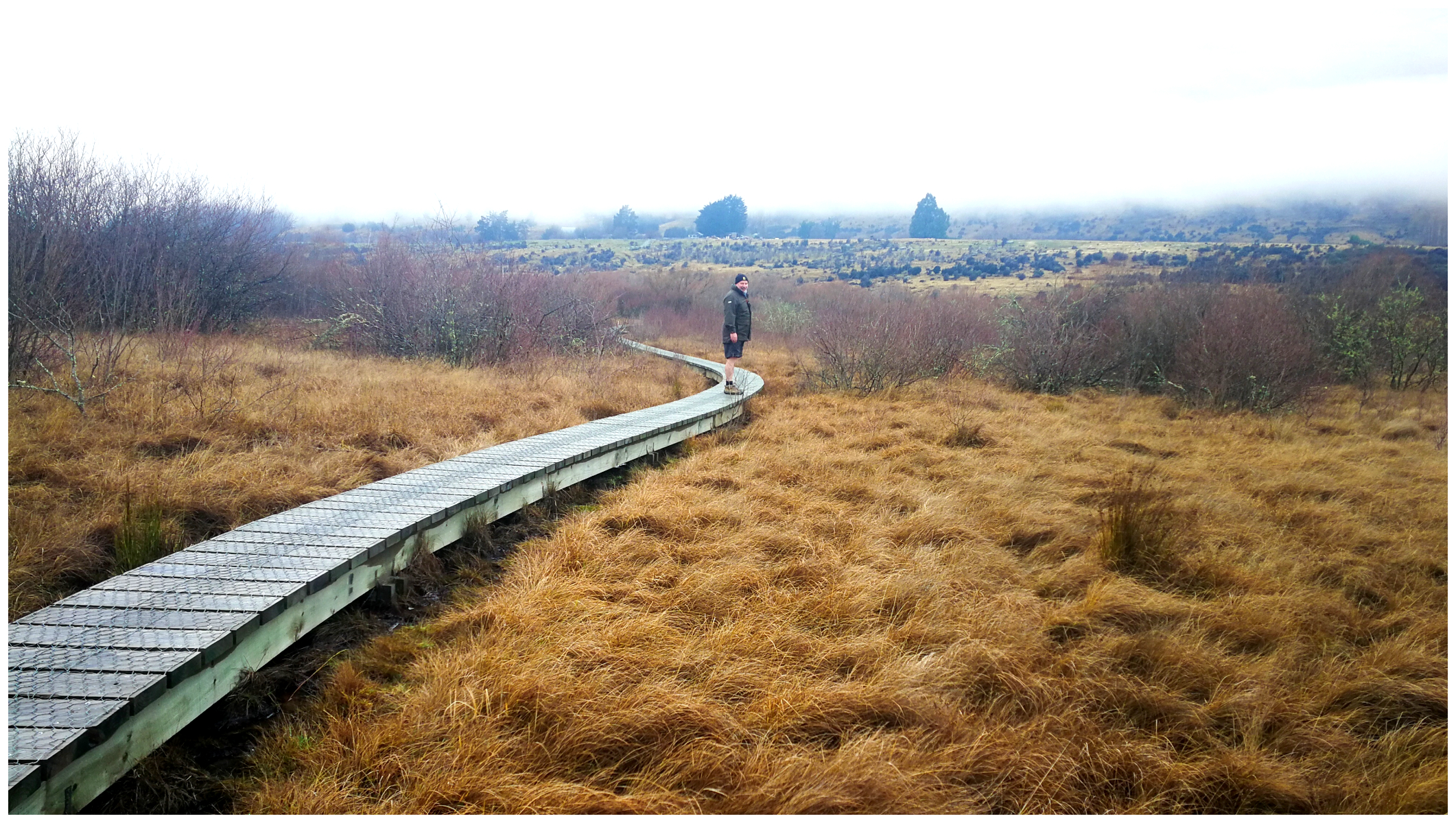
there is a lot of boardwalks which saves you from getting wet feet
The boardwalk is very extensive and well made as it appeared like we were walking on water. There were some attractive laybys to stop at which had park benches and picnic tables. The morning we decided to experience the walkway was not the type of day to sit nor picnic! At least it was deserted and we didn’t meet one person the entire circuit. The track was slippery and muddy in places.
Summary
Well, I think we’ve proved that Glenorchy is certainly more deserving than a day trip or a one-night stopover. Once again, we managed to peel back some layers that we didn’t even know existed. Although we achieved a lot while we were here, we still left some activities we want to come back to do.
Click on the link below for a video of our highlights.