It was farewell to Murchison (see the previous blog) and we were headed to Westport for a quick one-night stopover, before continuing through to Karamea.
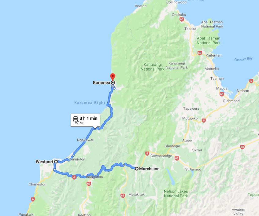
Now Murchison to Karamea is completely doable in one day, we’re ‘rushing it slowly’ so wanted to check out the NZMCA Park (#6479) in Westport, and have a look around the town. More on this in the next blog.
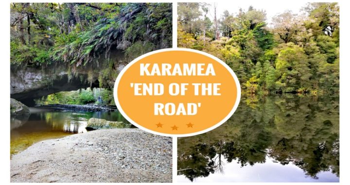
Karamea
Another part of the country that I’ve never visited, it can be considered a little off the beaten track. Once you get to Karamea, you do have to turn around and come back down to continue……well, anywhere really. It’s what you might refer to as ‘the end of the road’.
The small town certainly has a relaxed ‘off the beaten track’ feel, bordered by Kahurangi National Park and the Tasman Sea. There are adequate services including a general store, supermarket (kind of) and a service station.
It caters largely for the trampers coming off or going to the Heaphy Track. It is also considered a haven for cavers, birdwatchers, geologists and mountain bikers.
I’m not feeling that we fit into any of these categories but we were convinced we could sample a little bit of everything that was on offer and keen to seek them all out.
Karamea History
Back in the late 1800s, it boasted a fine harbour and at the time of settlement, it was the only means of contact with the outside world. Most of the immigrants came from England and Scotland. Farming, timber, flax and gold provided a means of living. This all changed with the 1929 Murchison earthquake. The harbour began silting up making it unusable and it also cut the community’s road link off for around 2 years.
Where We Stayed
After travelling the 96km from Westport, we headed to the Karamea Memorial Domain Camping Ground (#6421).
This camping ground has been set up in what was the local rugby grounds. The trust has turned it into a lovely place for campers to stay by utilizing the clubrooms as the ablution block, large homely lounge with a pool table and a fully equipped kitchen. There are also a couple of bunk rooms to cater for those hikers who conquer the Heaphy Track.
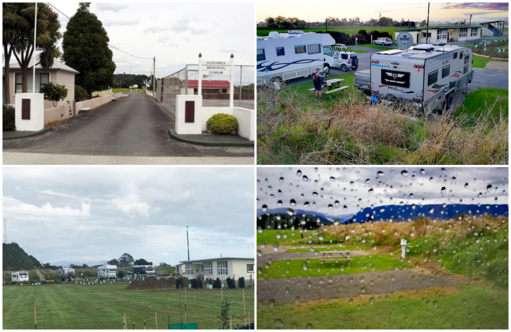
The Karamea Memorial Domain Camping Ground – in the dry AND the wet!
We paid $25 per night for a powered site and quite happily stayed for 3 nights.
Plans are afoot to extend and improve parking as it gets very busy during summer and the whitebait season. Keep this in mind if travelling to this destination during this time.
The new managers had only been there for 2 weeks and are making a great job of looking after the grounds and visitors.
It is located close to the Last Resort where you can grab a bite to eat at their restaurant. Can’t rate or comment as we didn’t take up the opportunity of a meal out. There are some good reviews of the food available.
Things to do in Karamea
Oparara Arches Basin
There was bad weather forecast so as soon as we set up camp and a quick bite to eat, we were on our way to go and visit the Oparara Arches Basin.
Getting There
The basin is about 20km north of Karamea.
It is on an old forestry road and where it branches off the main road, it is 12km to the arches car park, and a further 3km to the caves car park.
This forestry road is gravel, narrow and steep in places. It can become corrugated and extra care is required. It is not recommended for towing or campervans. There is a height restriction bar of 2.8m to restrict larger motorhomes from entering.
There are some shuttle options or car rental available from the Karamea Information Centre.
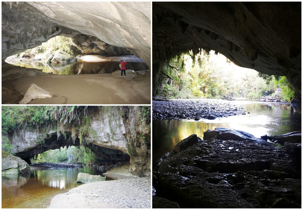
The Arches
The arches are estimated to be 35 million years old and are a complex of limestone caves, arches and channels. They appeared on maps of old Karamea dating back to the 1880s.
As we found out when we arrived, there is more than one option when it comes to viewing these natural phenomenons.
Moria Arch
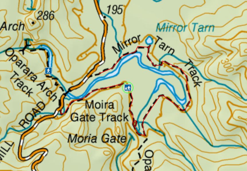
Moria Arch and Mirror Tarn Loop Track
As you can see from the above map, the Moria Gate and Mirror Tarn Loop track is a 1.5hr (4km) loop. As we were pushed for time and wanted to see all the arches and caves, we didn’t do the loop but just walked into the Moria Arch.
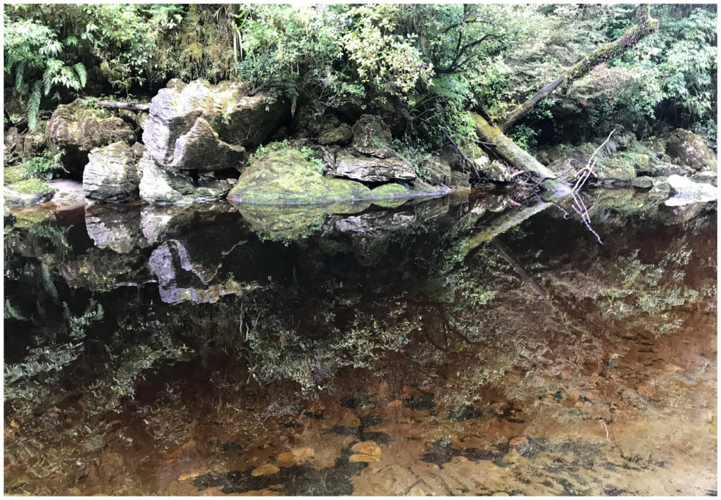
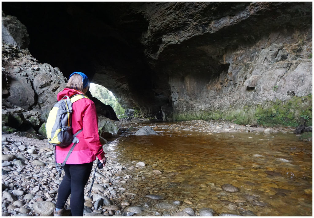
The crystal clear waters of the Oparara River
From the main Oparara car park, we walked through the virgin rain forest which was full of kahikatea, rimu and moss-laden trees.
Although the arches have been in existence for millions of years, this arch only earnt the name of Moria in 1984, after the gate in the Lord of the Rings trilogy.
The graceful and majestic Moria Arch
It was worth our while to take a short side track which took us underneath the arch where we could view the naturally sculptured limestone. The colours were in sharp contrast with the whiskey coloured water of the Oparara River.
Just us and Moria
If you wanted to continue on the loop track, you follow some novel printed paving stones, embossed with the footprint of the mighty extinct Moa.
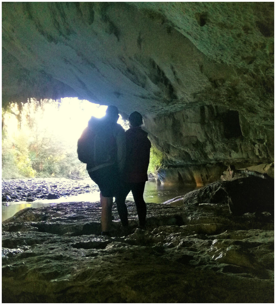
Oparara Arch
We returned back to the car park and headed for the next track which was across the road and a further 100 metres further along.
The sheer size meant it was hard to photograph!
It’s a half-hour (one way) easy walking track to Oparapa Arch, the largest of all the arches, reputed to be the largest one in the Southern Hemisphere. It’s just over 200m long and 40m at its highest point.
The largest limestone arch in the Southern Hemisphere
The track follows the Oparara River and leads about a third of the way into the impressive arch. Ascending up a series of wooden steps, we reached the viewpoint. We seemed somewhat insignificant as we stood in awe, taking in the tall rock arch, stalactites and stalagmites.
Crazy Paving Caves
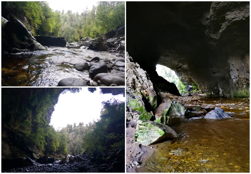
Just a further 3km up the road you will find the track to the Box Canyon and Crazy Paving Caves.
It’s an easy 200m return track where you will come across the craziest paving patterned floor in a cave. This unusual floor pattern was created over a very long period of time from dried out mud. You would pay big money to create a drive or pathway to look like this, and here mother nature took it into her own hands to create what craftsmen would struggle to do.
As we continued deeper into the cave, we could easily make out the individual squares on the floor of the cave, all curling up at the corners. Crouching down towards the end of the cave, we followed the crazy paving lines as far as we could venture.
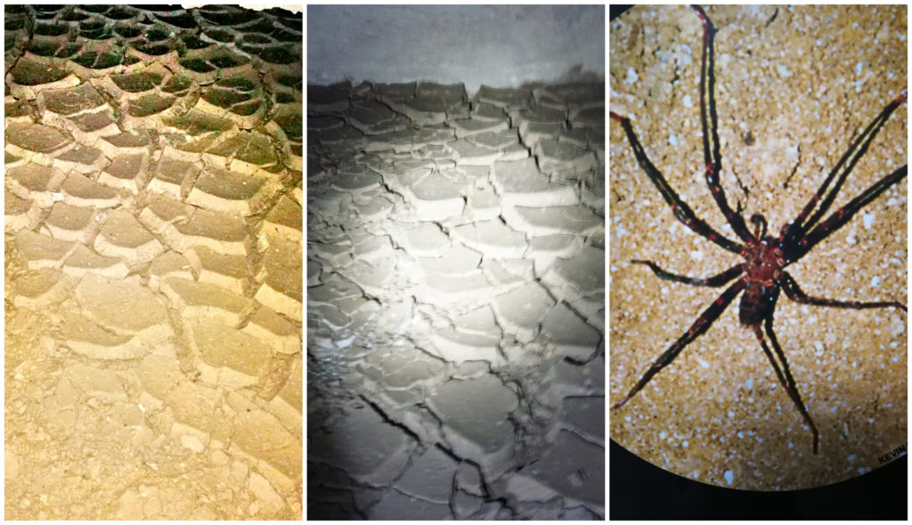
The crazy paving cave floor and a rare spelungulae spider
There are signs to tell me that I could be sharing my caving experience with other cave dwellers such as weta, spiders and beetles. It then proceeded to tell me not to disturb them!! Somehow, I feel that it should be the other way around and they should not be disturbing me!
Box Canyon Cave
Once we found our way back out of the Crazy Paving Cave, we followed the boardwalk up some stairs to the next cave – The Box Canyon Cave. This is as you would expect – a very large cave.
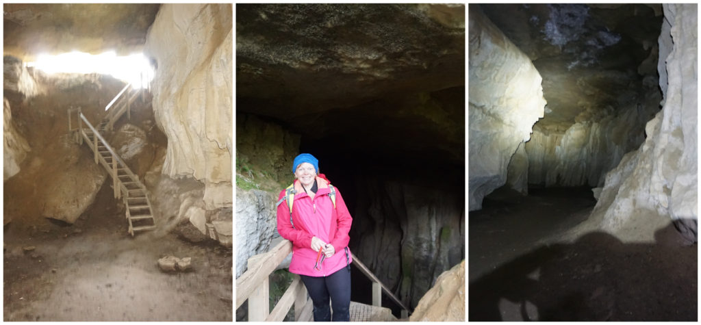
Descending into the Box Canyon
Climbing down some more wooden stairs, switching on our torches, the mystery of the cave revealed itself. We were treated to curved walls in the formation of frozen waves. The cave continues for around another 100 metres with little side rooms jutting off in a few directions.
Mirror Tarn
If you chose not to do the Moira Arch Loop Track, you can still visit the Mirror Tarn by entering the signed track just past the Oparara Bridge. It’s then only a 10-minute walk to the small but picturesque lake tucked away in the bush.
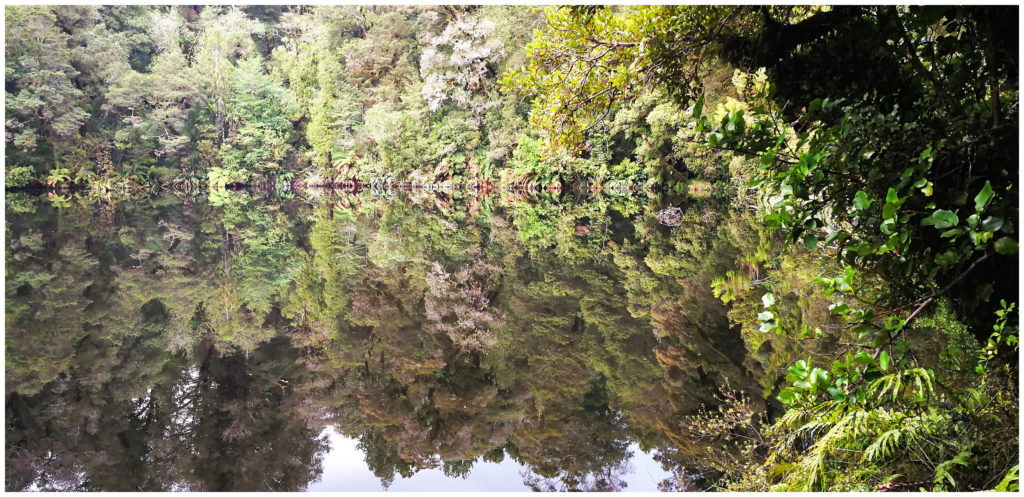
Where reflection meets reality – the Mirror Tarn. Tarn means lake or pond formed by a glacier.
The thick lush green foliage seems to wrap itself around this lake, right up to the edge of the water. This results in the most spectacular reflections on the still, ripple-free water.
We don’t think there has been a day where we’ve needed to hike so little to see so much!
Fenian Cave
We were expecting the weather to pack up on our second day in Karamea, so we were pleasantly surprised that it looked like it might hold off for a bit longer.
We headed out early and made for the Fenian Cave Track which is 10km out of town.
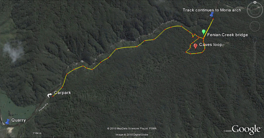
Don’t let the km’s fool you – it’s hard yakka
This is a challenging 5 km track which has suffered a lot of storm damage recently. It is slow going once you are on the loop section of the track so allow a minimum of 3 hours to complete. The expected rain started to fall not long after we set out. Kitted up in our wet weather gear, we continued on the trail.
Some serious bush bashing going on in some sections of the track
In the late 1860s, miners began fossicking for gold in the Fenian and cut a bridle track into the workings. The track starts off from the carpark, following this Bridle Track. It takes us about 40 minutes to walk along this gentle incline until you get to the junction where the Loop Track to the caves begins. This is where it changes from a ‘walking track’ to a ‘tramping track’ and the going gets a lot harder.
The Cave Loop
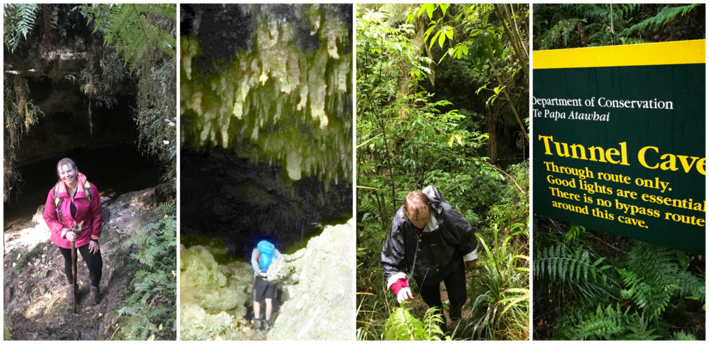
It was muddy, boggy and extremely steep in places. Along this track, there are 3 open access caves. Miners Cave and Cavern Cave are beside the track. The Tunnel Cave is an 80-metre tunnel that the track passes through.
I had read up on the need to traverse this tunnel cave and I had worked myself into a bit of a mental state about it. I was not looking forward to the prospect, especially after reading that some climbing would be required. The cold, dark and wet conditions combined with difficult terrain didn’t conjure up much enthusiasm. I grew quieter as we navigated the difficult track in.
Tunnel Cave
We donned our cycle helmets (turned out to be a good idea), mounted our headlamps (also essential) and proceeded into the darkness.
We played hopscotch with the stream at the base of the cave, not knowing how deep some of those dark pools were. There was enough space to shimmy our way along the sides as the height of the cave started to descend upon us.
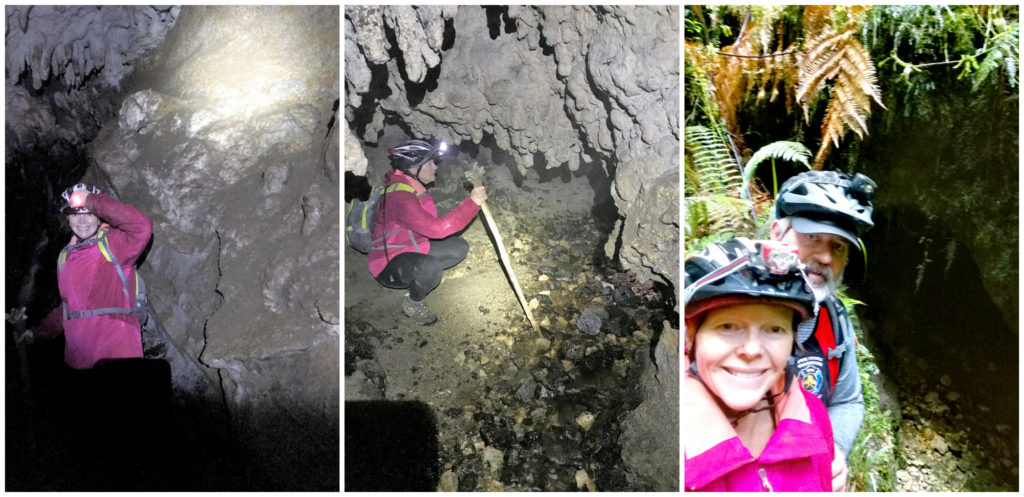
I’m not thinking I’m cut out for caving!!
Walking along, often resembling a duck waddle because of the low ceiling, we came across a steep drop. This must be the point that I read required some climbing ability. Scotty being the leader, navigated the drop first, then encouraged and coached me on where the best footholds were.
Now my descent was far from graceful but successful as my feet touched down at the base of the drop (with a great feeling of relief!). It wasn’t long before I could see the ‘light at the end of the tunnel’. We had successfully made it to the other end in one piece. Quite a feeling of achievement I must say.
If you walk the Fenian Cave track, sturdy footwear, a reasonable level of fitness, torches and preferably helmets are recommended.
The Heaphy Track
The Heaphy Track is one of NZ’s nine great walks. The track finishes (or starts, depending on the which way you’re headed) at Karamea. The 82km, 4-day tramp attracts visitors from all over the world every year.
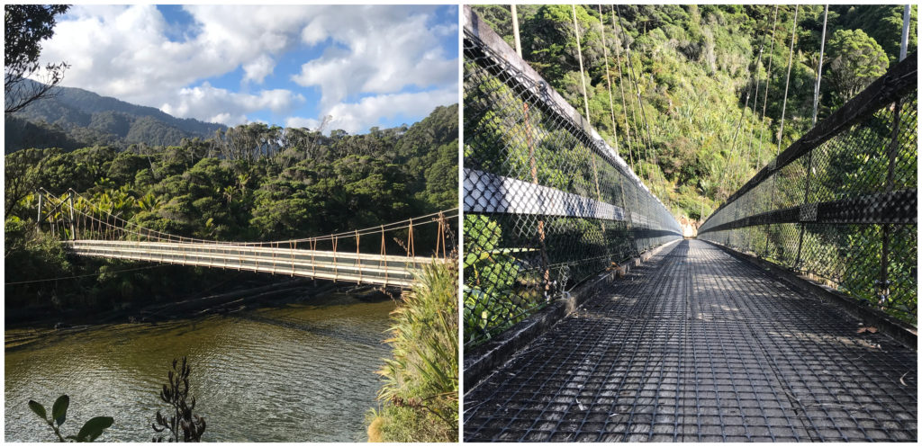
The Kohaihai River suspension bridge is just a short walk from the carpark
Lacking the inclination, preparation and time, we were still keen to do a little ‘taster’ of the track. Not far into the hike, we came across the Kohaihai River suspension bridge.
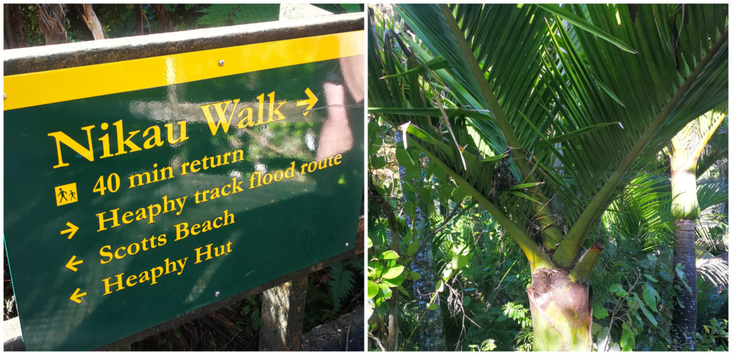
The iconic and native West Coast Nikau palm
This led us into the Nikau Walk which is a side loop track which takes you through a stunning grove of the iconic West Coast nikau palms.
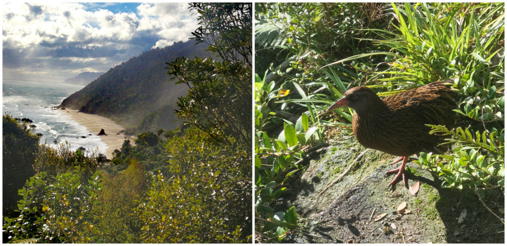
Scott’s Beach as viewed from the lookout, and our little feathered friend, Wally the Weka
From the Nikau Grove, we started the climb up to Scott’s Lookout. A short detour off the Heaphy at the top of the first hill affords a spectacular view north along the West Coast and down to Scott’s Beach. It was a beautiful white sand, blue sea, crashing waves sort of a beach. Looks can be deceiving though. No matter how inviting the waters may look in the heat of a summer’s day, there are strong currents, rips and tides. Swimming is not advisable.
Summary
We enjoyed the relaxed vibe of Karamea and extended our stay for another night. My body was grateful for the reprieve after the treatment of the last couple of days.
The ‘end of the road’ isolation on the ‘no exit’ highway is part of Karamea’s appeal.
Click on the link below to view a video of some of our highlights.
Hi
Thank you for your appreciation and travelog on Karamea. I have lived here for 45 years and having travelled all of NZ in our motorhome, still think it to be the best place to live.
One comment I would make, if you can edit your script, is to correct the spelling of ‘Moira’ Gate to the correct spelling of Moria Gate, correctly named from the Lord of the Rings books. Interestingly I do notice on the map you show, it is spelt Moira in one place and Moria in another just below.
Also a thank you for promoting the Karamea Memorial Domain Camp of which I am the Chairman. We have spent a lot of time, effort and money on bringing up to a more modern camp but still with that old-world charm. In the early nineties, it was described as ‘a port in a storm’ !
Thanks Jonathan for your feedback – I certainly will look at that spelling (I didn’t even notice the different spelling!!!). That camp is a credit to you and the committee and we mentioned to the managers that it is wonderful to see such forward-thinking in a small town to make the most of the assets that are already there and to capture a market that is forever growing. I hope that it proves successful and the changes going forward makes it an even more attractive place to stay. Linda