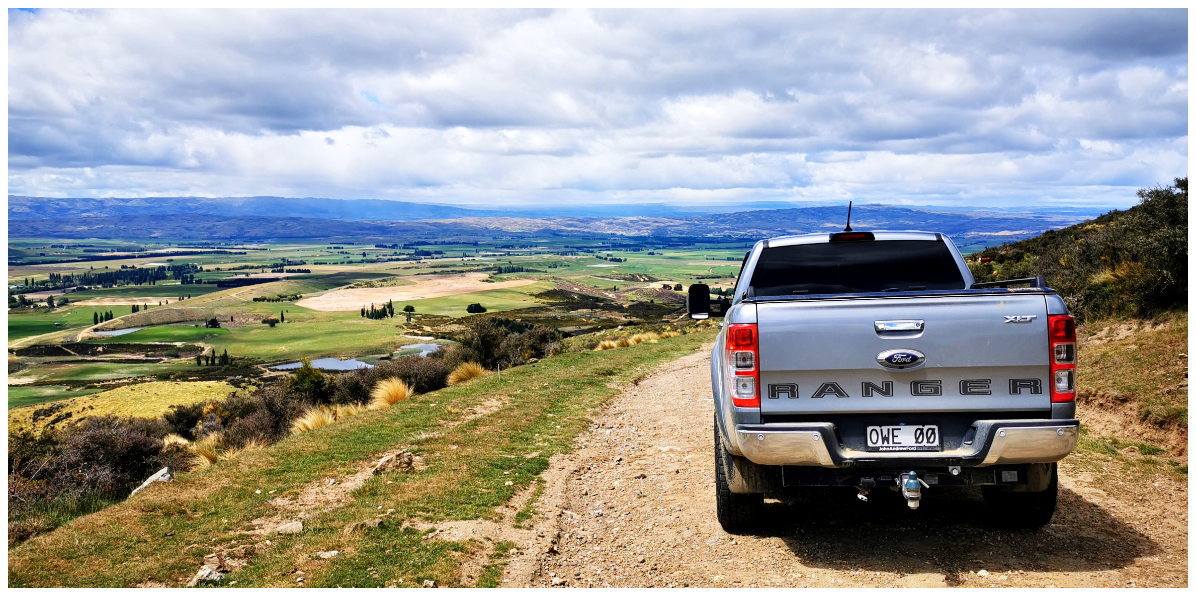
Thomson Gorge Road – Dunstan Mountains
The day after we ‘nailed the Nevis Valley’ (click on the previous blog
here), the sun was still shining so we thought we’d conquer the Thomson Gorge Road.
We decided to travel the road over the Dunstan Mountains from west to east. This meant we joined Thomson Gorge Road near Bendigo and finished up at Matakanui, near Omakau. It is approximately 40km in total, but the Thomson Gorge Road is 28km long.
What to Expect
It is essentially a public road. The surface is firm, albeit some large rocks and metal. There is usually enough room to pass oncoming traffic.
A dry weather road with several ford crossings, it is easy to drive in summer. It is a different story during winter. Heavy rain can cause slips and washouts. Weather conditions can change with frightening speed.
We found the condition of the road good. When we crossed the fords, they weren’t deep, just a bit bumpy so good clearance would be advantageous.
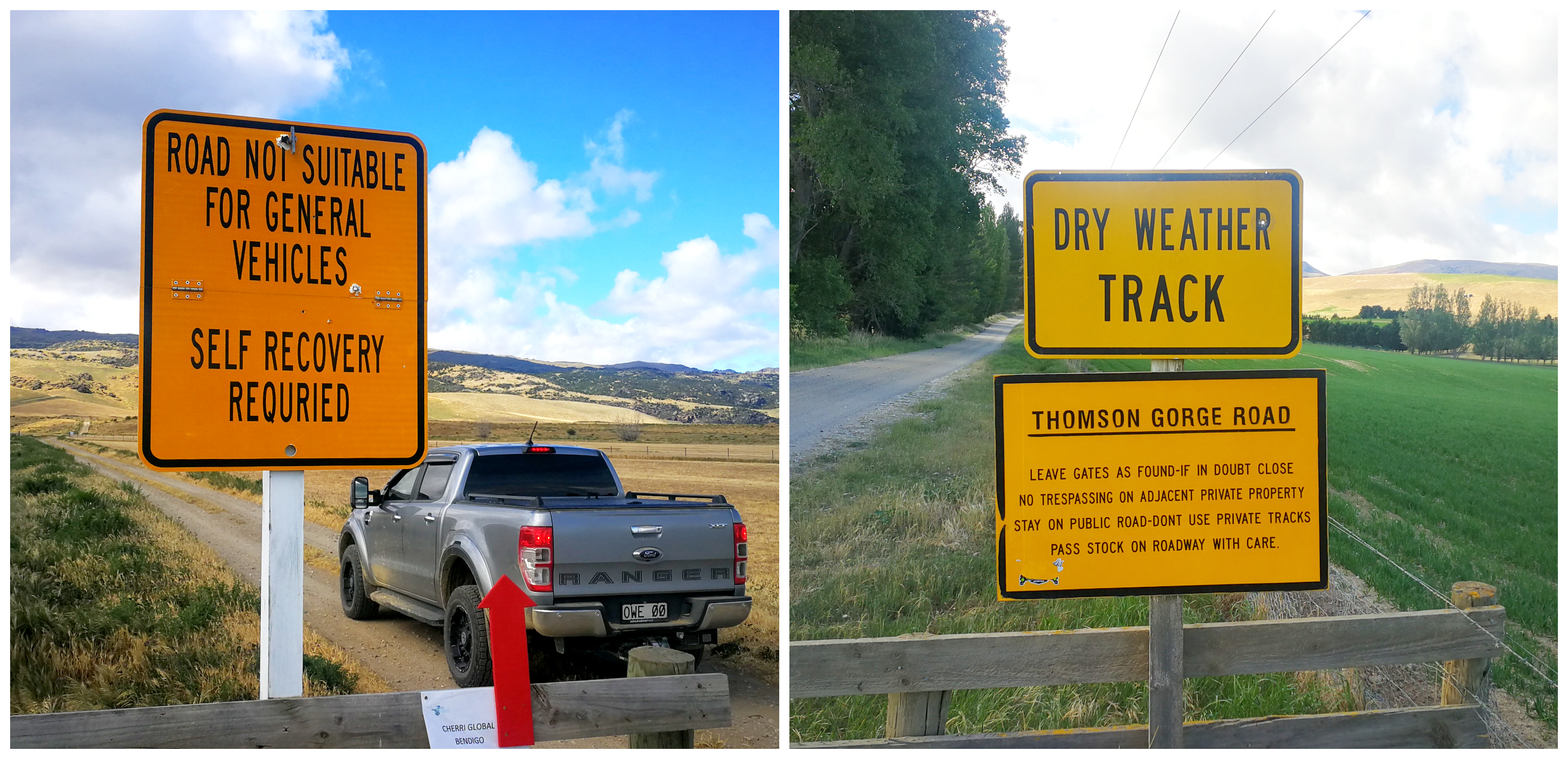
you have plenty of warnings
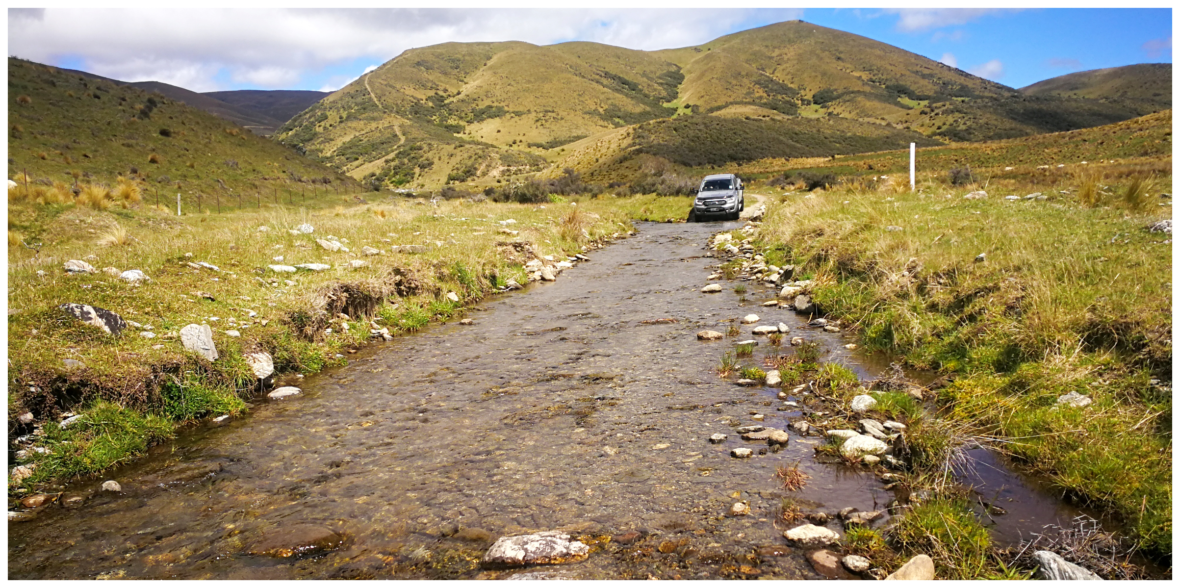
there were a few shallow ford crossings
Gates Galore
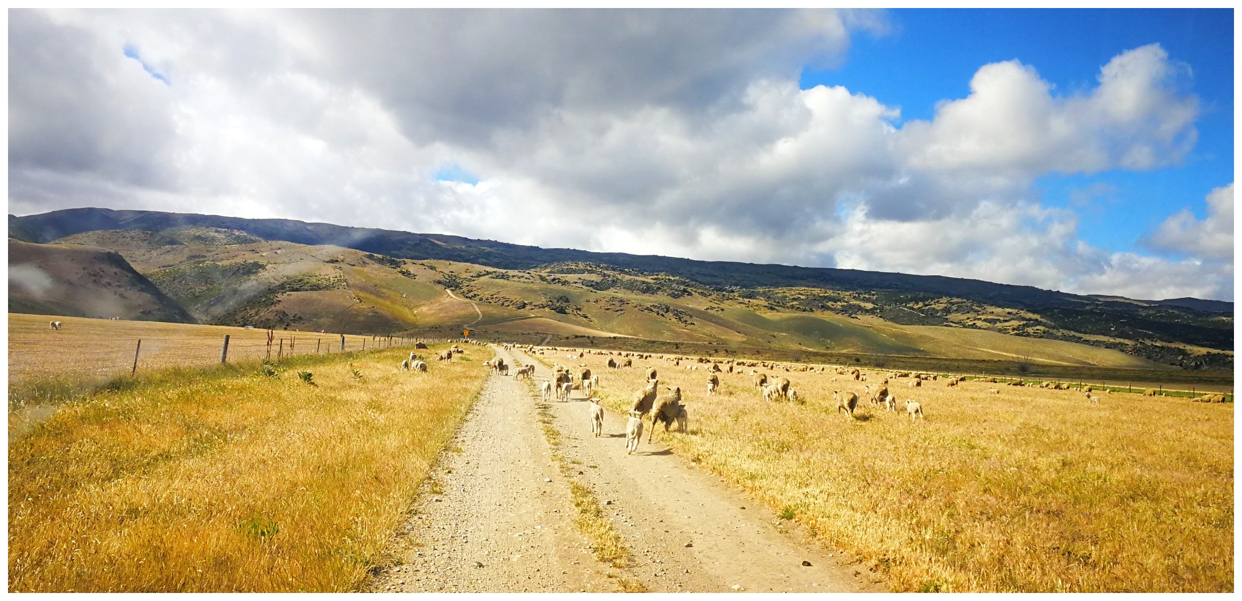
Be aware that someone in the vehicle (usually the passenger if you have one) will have the arduous task of being ‘Chief Gate Opener’. The track passes through six properties so it is imperative that you close all the gates or leave them as you found them (if in doubt, close them).
I counted a grand total of 23 gates which I had to open and close. Kept me busy that’s for sure!
watch out for roadblocks
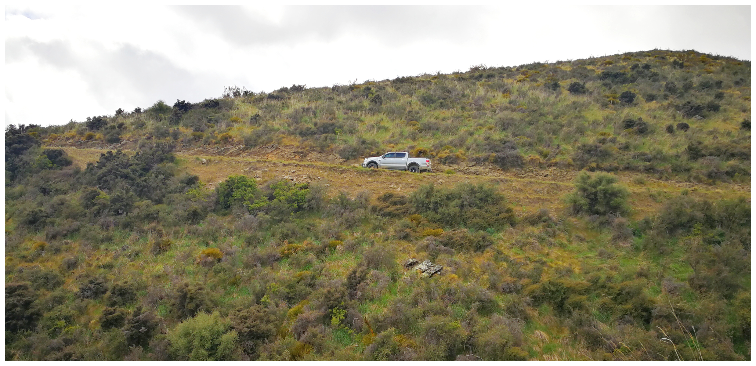
the road is steep and narrow heading up The Saddle
Bendigo
Exploring the history surrounding
Bendigo Historic Reserve is a day trip in itself. We have spent a great deal of time in and around Bendigo, Logantown, Welshtown and walked the many tracks and trails. We have also visited the Come in Time Battery which is located on Thomson Gorge Rd. Check out my blog
here.
History
The first miners used the crossing in late 1862. The gorge track was continuously used by travellers and shepherds.
It was George Thomson, the first long-term run holder of Matakanui Station who named Thomson Creek, Thomson Gorge and Thomson Saddle.
Saddle Crossing
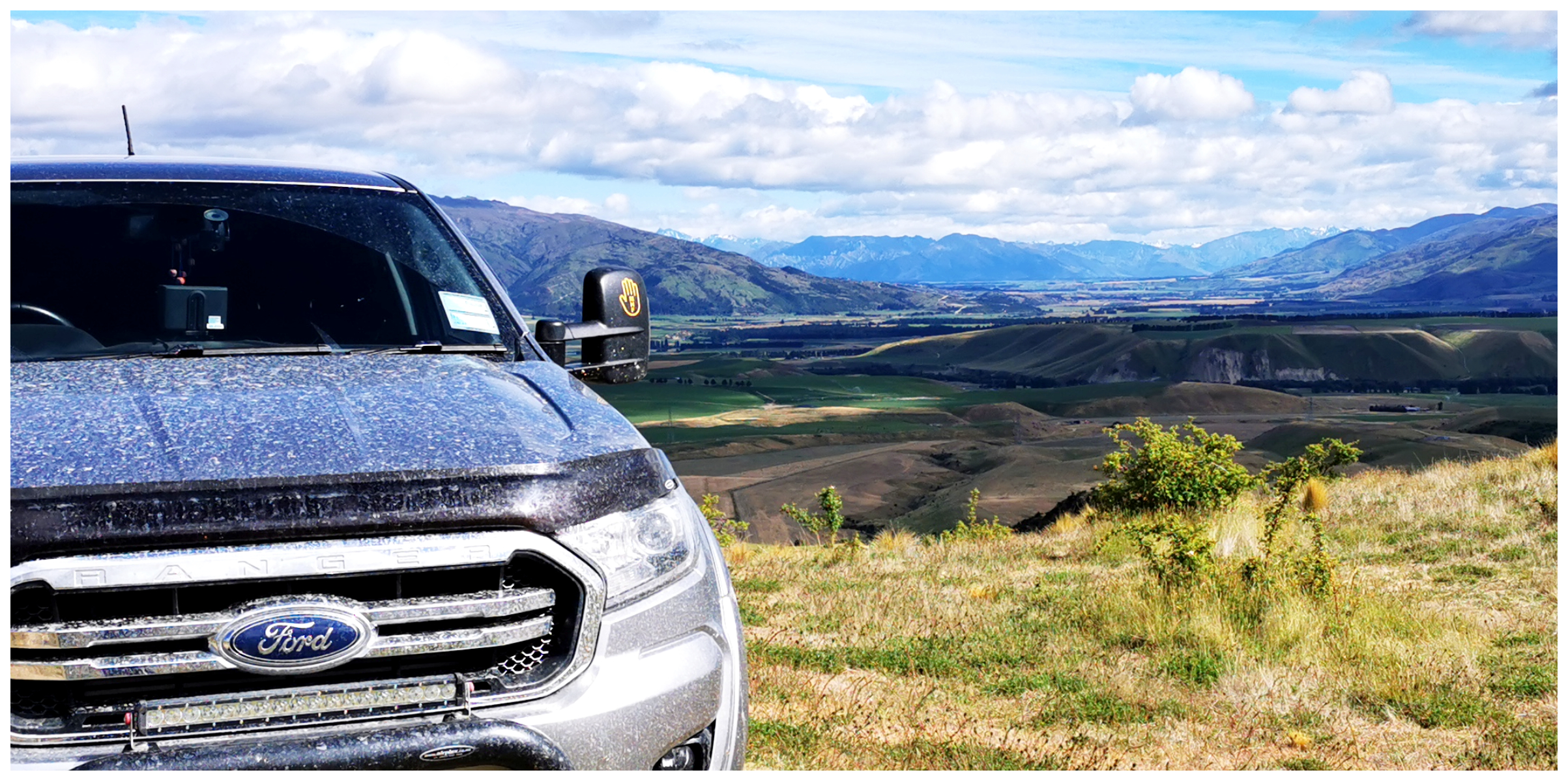
Driving past the Rise and Shine Reef sites, we drove 900m above sea level to the Saddle Crossing. There is a short traverse over the Dunstan Range.
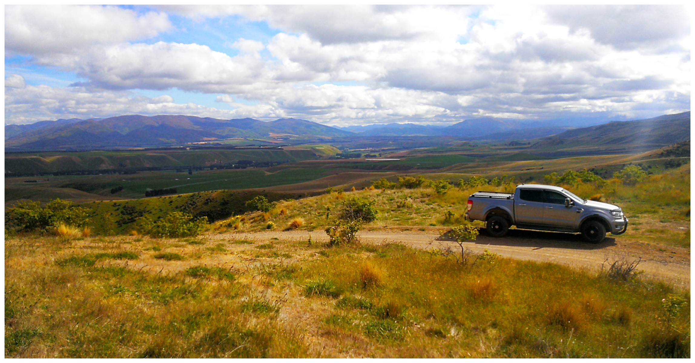
allow plenty of time to stop to admire the views at the top
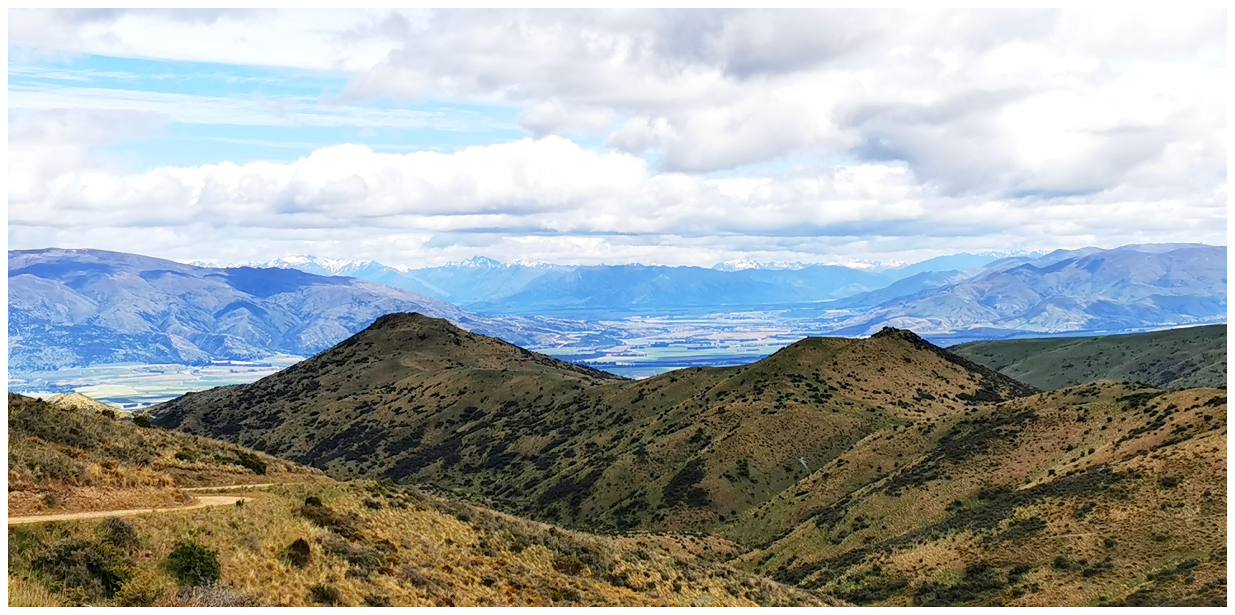
views back towards the Upper Clutha Valley surrounded in mountain ranges
We were rewarded with stunning views over the Upper Clutha Valley towards Lakes Wanaka and Hawea, with the Southern Alps as a backdrop.
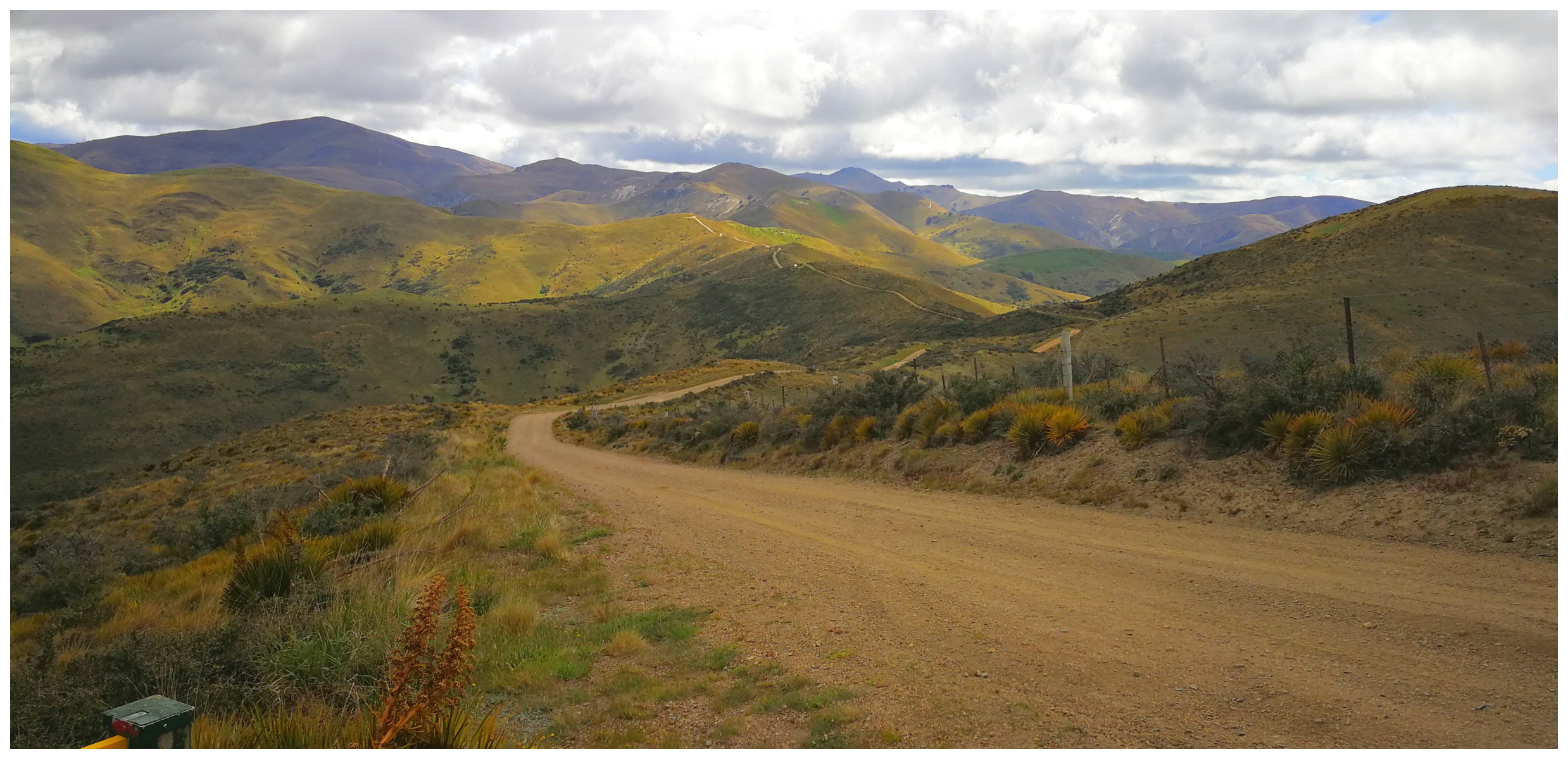
the road ahead disappears off into the distance as we traversed the Dunstan Range
a stunning view on a clear day
Bendigo Station
We crossed through the boundary onto Bendigo Station. This massive high country station consists of some 12,000 hectares with a history which dates back over 150 years. The station was created in the early 1900s.
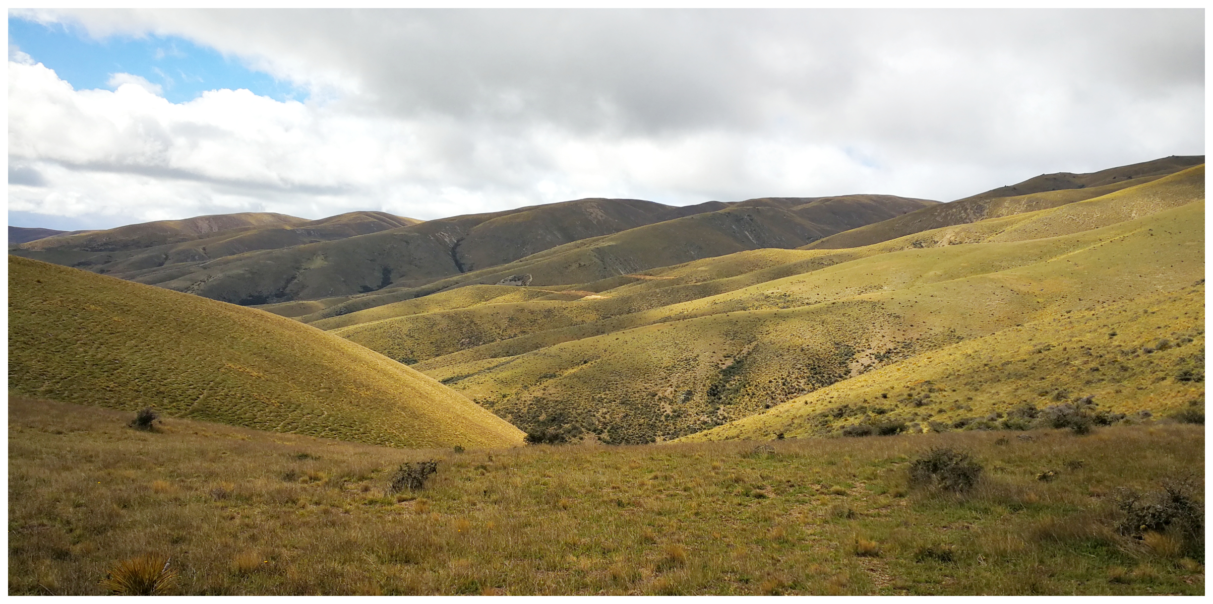
the rolling hills of Bendigo Station looked like a tapestry of colours created by nature
Thomson Creek Diggings
The early travellers passing through the gorge thought they’d try their luck along the way. Apparently, they found traces of gold in the creek. It never turned out to be as prosperous as Bendigo, which offered much better prospects.
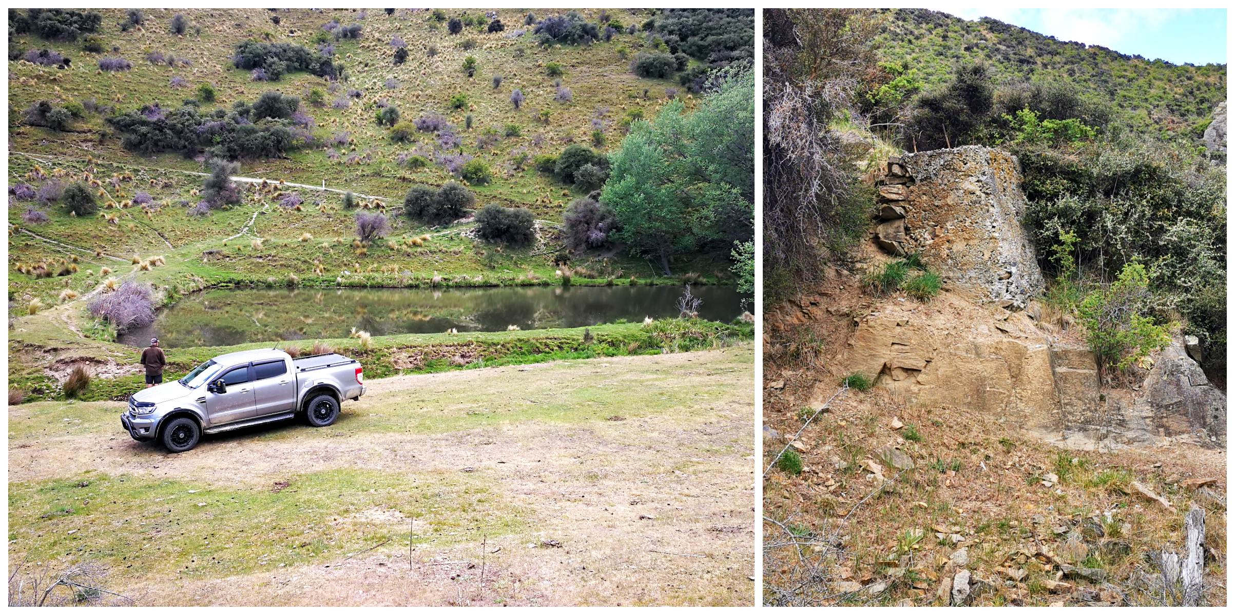
all that remains at the bottom of the valley of the Rise and Shine Reef sites, a holding dam for water supply and concrete foundations of the five-stamper battery
We could certainly spot visible workings from the road. The telltale stacking of stones and diversion channels in the river and creeks. The majority of miners in this area were Chinese.
The hydraulic elevation sluicing left behind the tell-tale ponds which pockmark the landscape.
Thomson Gorge
We started climbing again, this time through the Thomson Gorge with towering rock walls and steep drop-offs (which happened to be on my side of the ute)!! It gave me a similar feeling of driving through the Skippers Canyon!
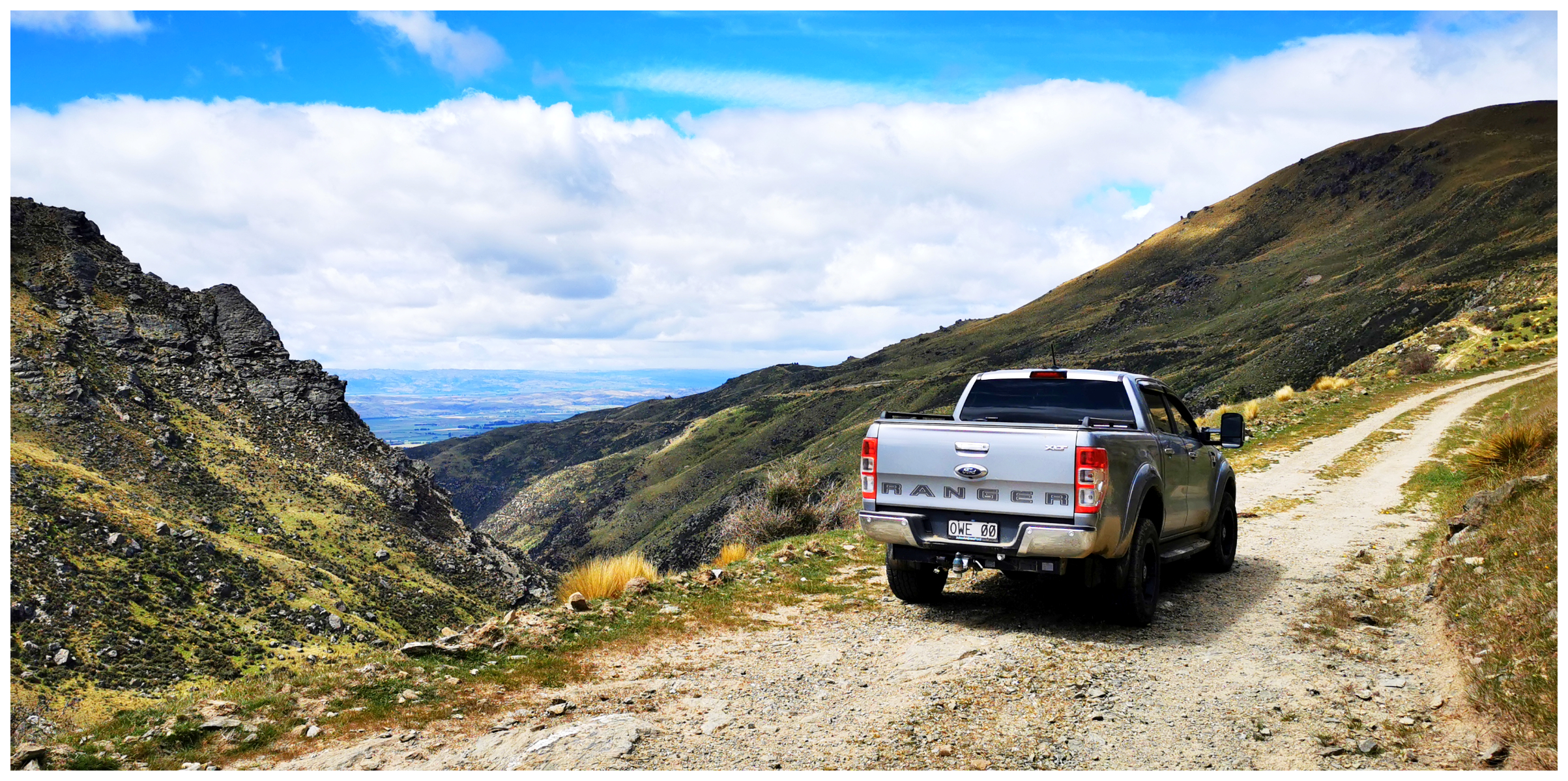
the gorge offers a dramatic vista as the sheer rock faces tower over the river way down below us
When I was brave enough, I glanced way down to the Thomson Creek below. There were the odd stone ruins of homes long abandoned. They must have been hardy souls that lived and worked down at the bottom of the gorge, where the sunshine hours would be limited.
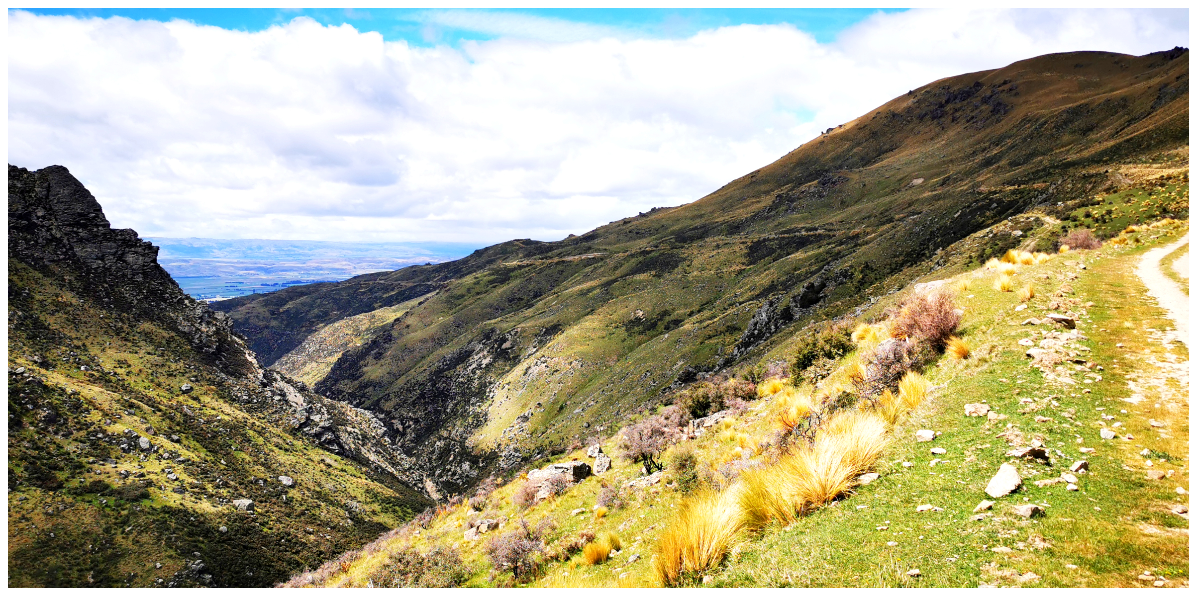
the narrow winding road hugs the side of the mountains as we make our way towards the view across the valley
They certainly built the water races to last, still filled with water but now used for irrigation.
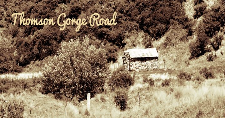
Old Stone Hut
Built beside the headwaters of Thomson Creek is an old stone hut constructed in 1908. This was to provide shelter for the drovers, shepherds and travellers.
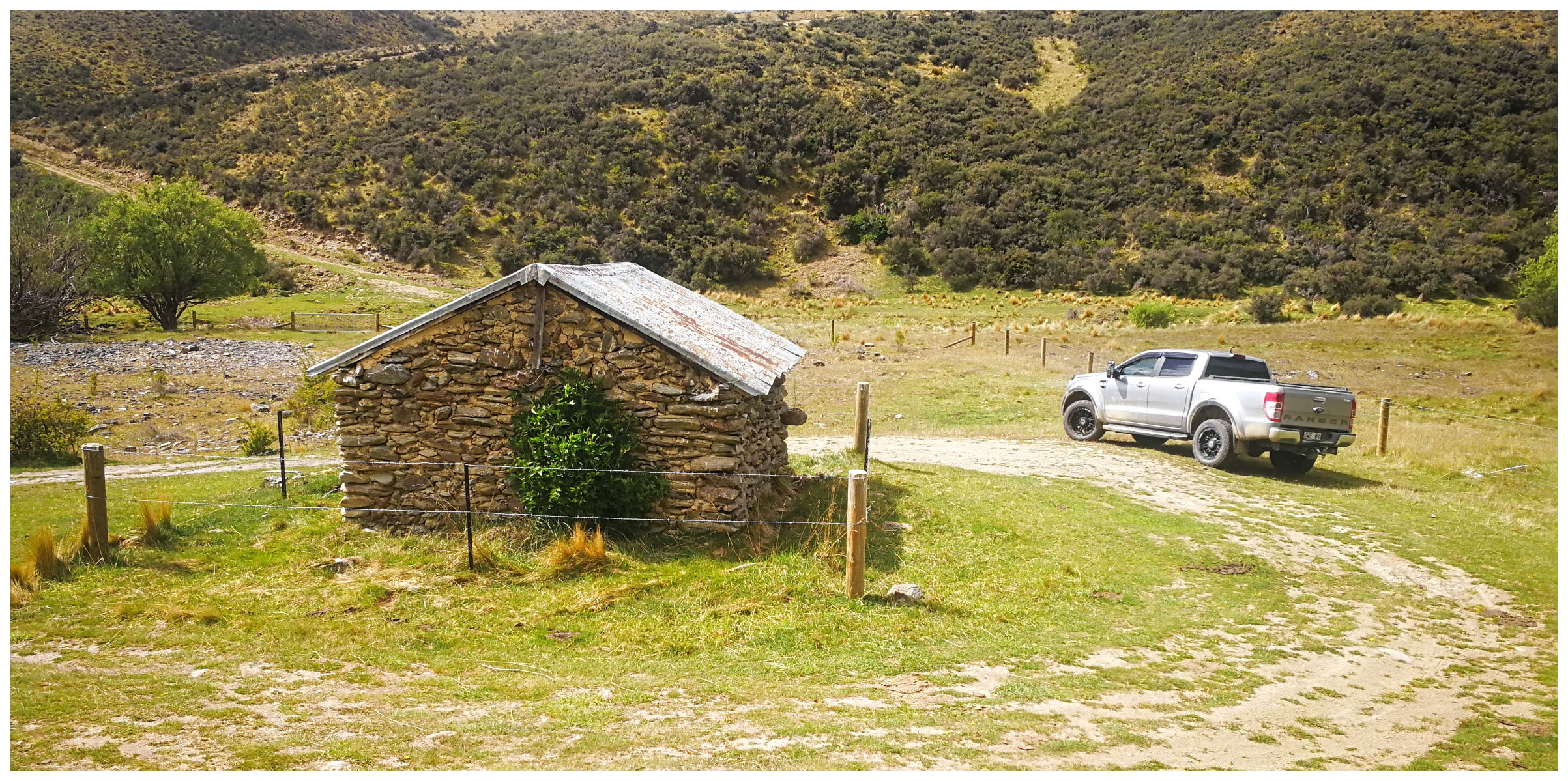
the old musterers hut built close to Thomson Creek
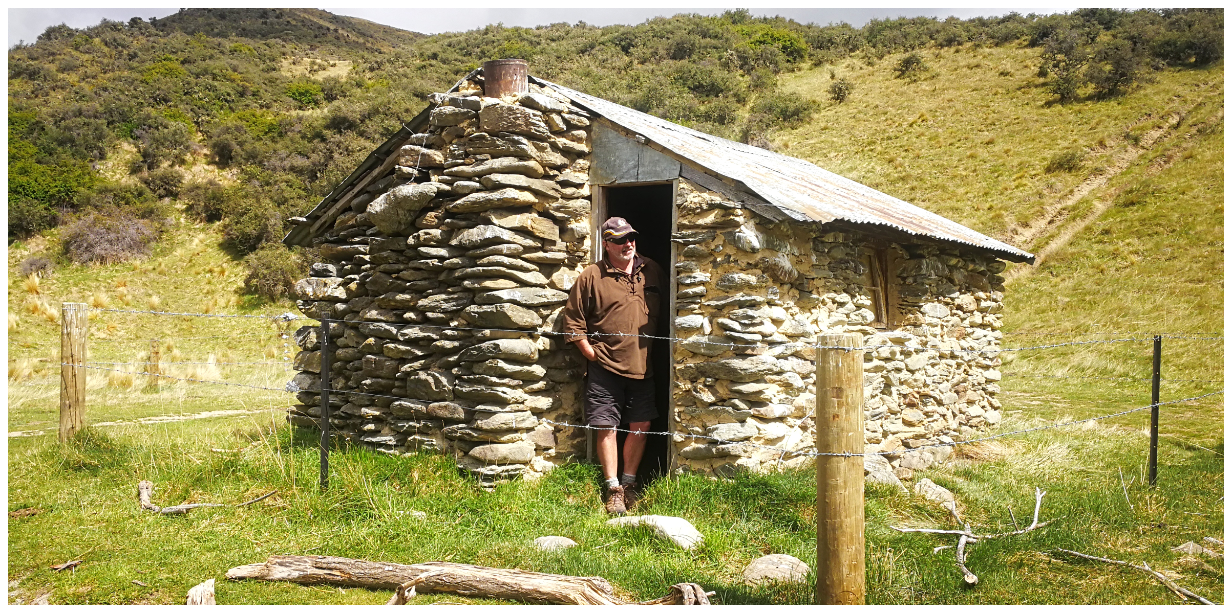
written on the rafters inside are the names of some of the musterers who have sheltered in the hut
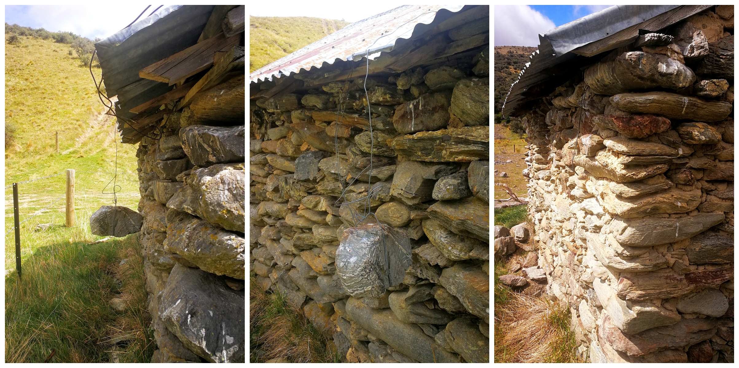
good old Kiwi ingenuity, using large rocks hanging from wire to keep the roof intact – seems to work!
It seemed like it was the perfect lunch stop for us. It provided great shelter for the prevailing wind that was blowing down through the gorge.
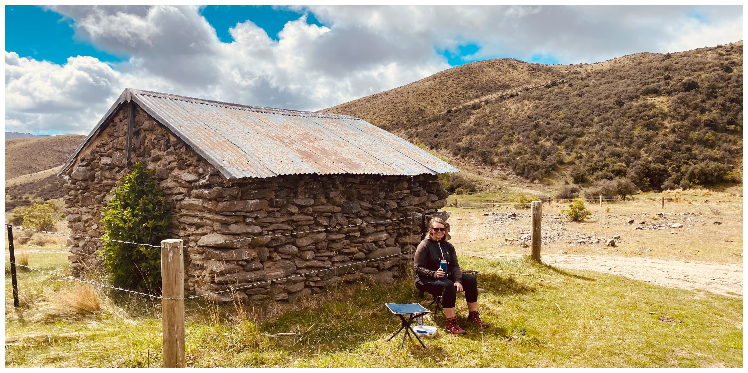
time for lunch!
The eastern side of the Dunstans is more weathered and scarred with rock and shale.
As we descended to the valley below, we could clearly see the evidence of gold workings, water races and hydraulic elevation sluicing ponds. The evidence of old tailings lay in piles, abandoned all those years ago.
the small ponds are an indication of where the miners worked in the pursuit of gold
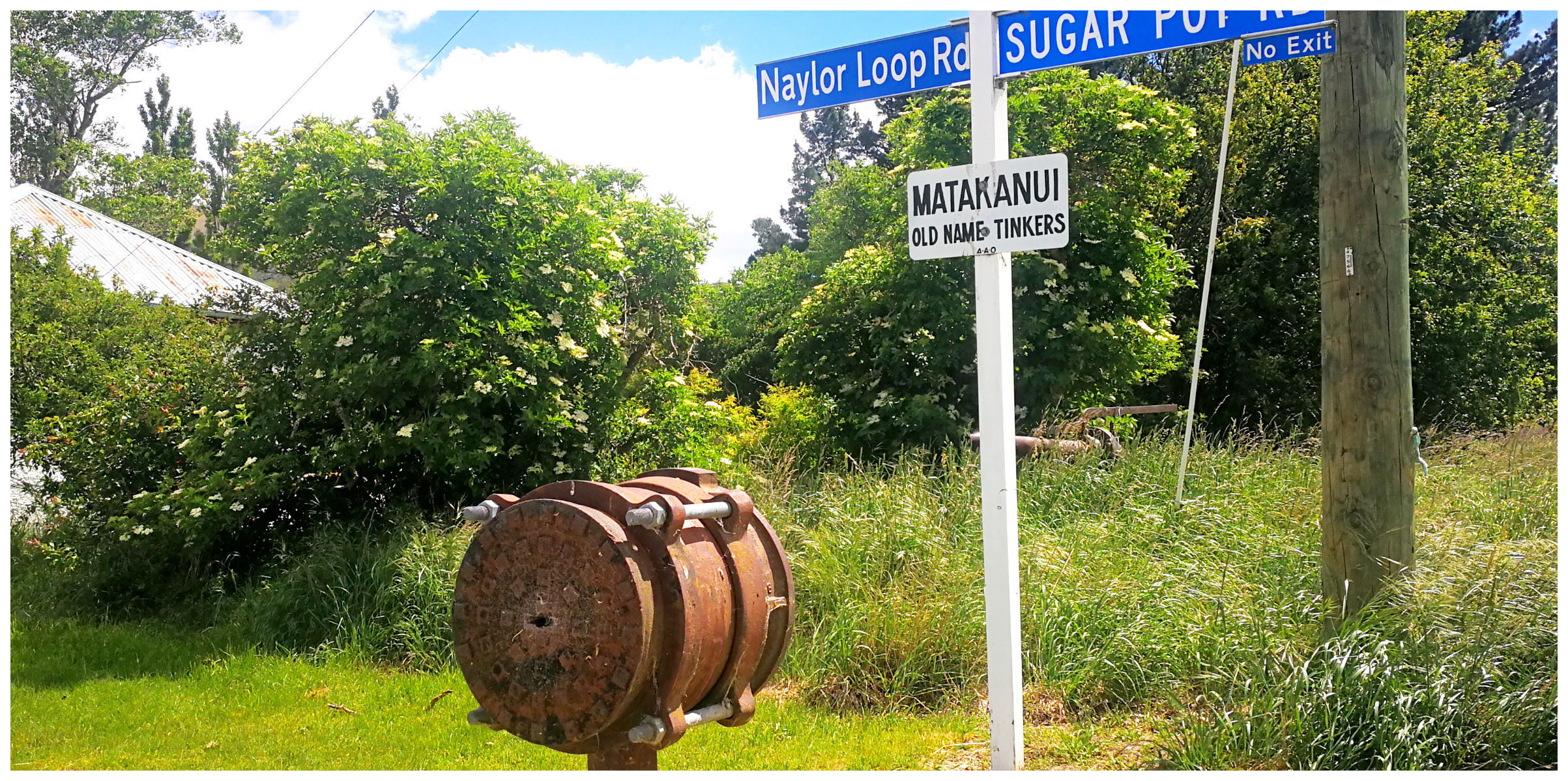
Matakanui
We ended up with a short detour to Matakanui (formerly known as Tinkers), which today resembles a small ‘ghost’ town, with a few buildings still standing, constructed out of sun-dried bricks (hall, Duggan’s store, pub, stable & Bakery).
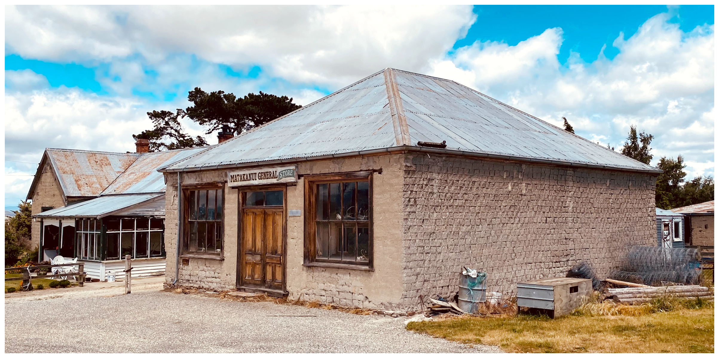
old Duggan’s Store must have been a popular stop for the locals
The Matakanui Hotel (Newton’s Tavern) closed in the late 1960s. The store shut its doors in 1980. The restored bakery is now holiday accommodation.
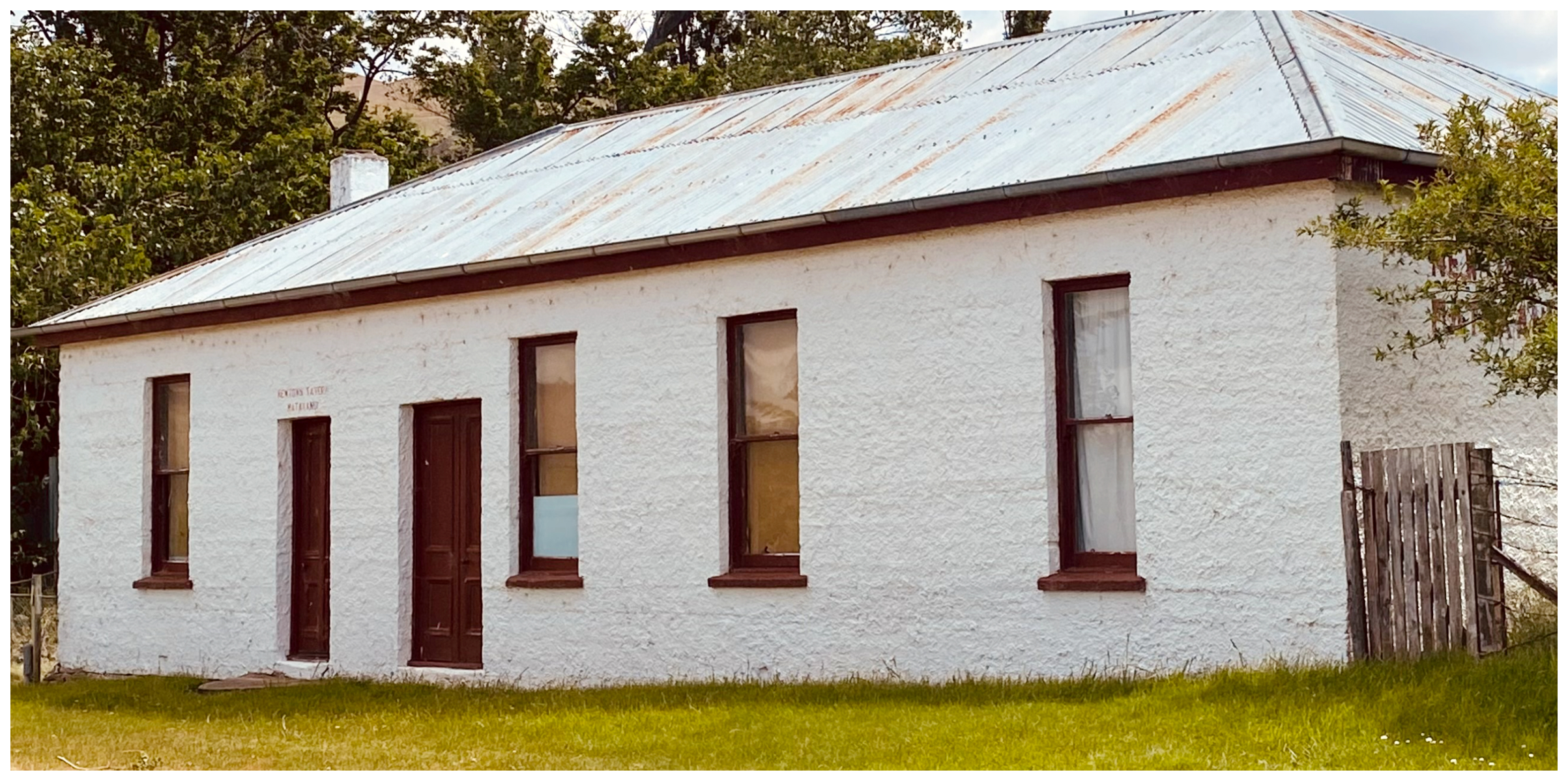
the tavern is now dry, I could have used a stiff drink after all those gates!
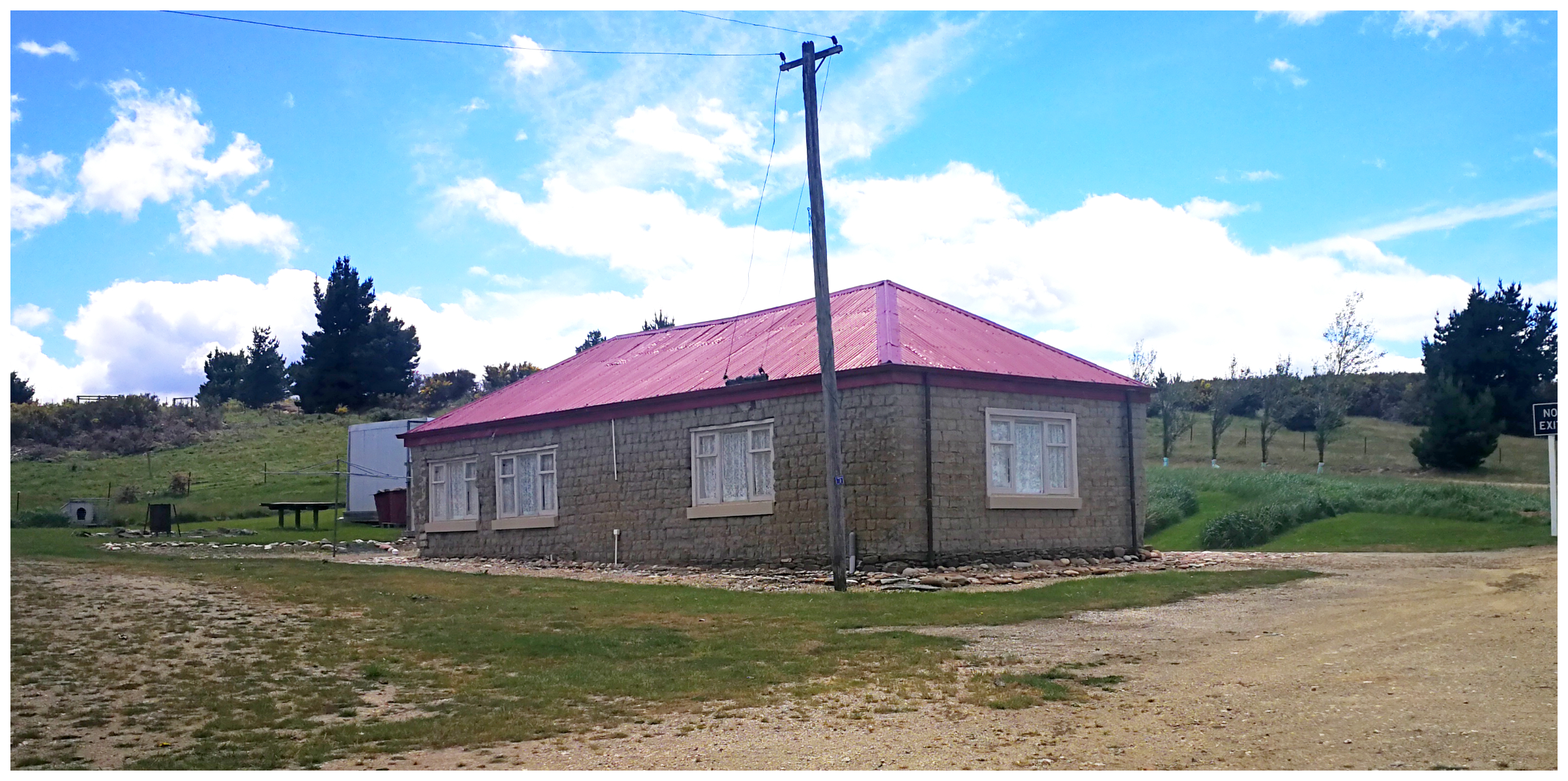
this holiday home was once the bakery
Nearby, surrounded in overgrown scrub, stands an old sluicing monitor gun as a memorial to the old miners who worked here in the late 1800s/early 1900s.
the old monitor gun lies in the overgrown shrubs
Summary
It is a trip back in time as you soak up the history of the old gold mining sites and loads of places of interest along the way.
Often referred to by different names. Morley’s Pass, Thomson Saddle, Thomson Track, Thomson Gorge or The Rise and Shine Road. Each name seems to tell a little more of the history of this important trail.
Make sure to stop often to admire the views and soak up that history.
Thanks Linda and Scotty, another great blog. It is good to get off the main road to explore, there is so much more to see. In a campervan not quite so easy but still plenty to see.
looks awesome, hope to do this on the dirt bikes next month with my mates. Might even camp out the night.
Oh it will be brilliant on dirt bikes and there are some amazing spots to camp out. Enjoy.
looks awesome, hope to do this on the dirt bikes next month with my mates. Might even camp out the night.