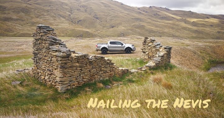
Nevis Valley – A remote backcountry road
We Nailed It
We had been hanging around Central Otago for a few weeks (see the previous blog on Alexandra), but the Nevis Valley Road was still sitting on our ‘Things to Do” list. An entire day is required for the full loop from Cromwell, through the Nevis to Garston and back to Cromwell via Kingston and Frankton.
The round trip is approximately 210km so firstly putting a whole day aside, plus waiting for the perfect weather conditions during the lead up was imperative. There are a lot of fords and creeks to negotiate. We wanted to make sure that the water level was down before attempting the full day trip.
The Nevis Valley is effectively three very different environments – the Upper Nevis, the Nevis Gorge and the Lower Nevis.
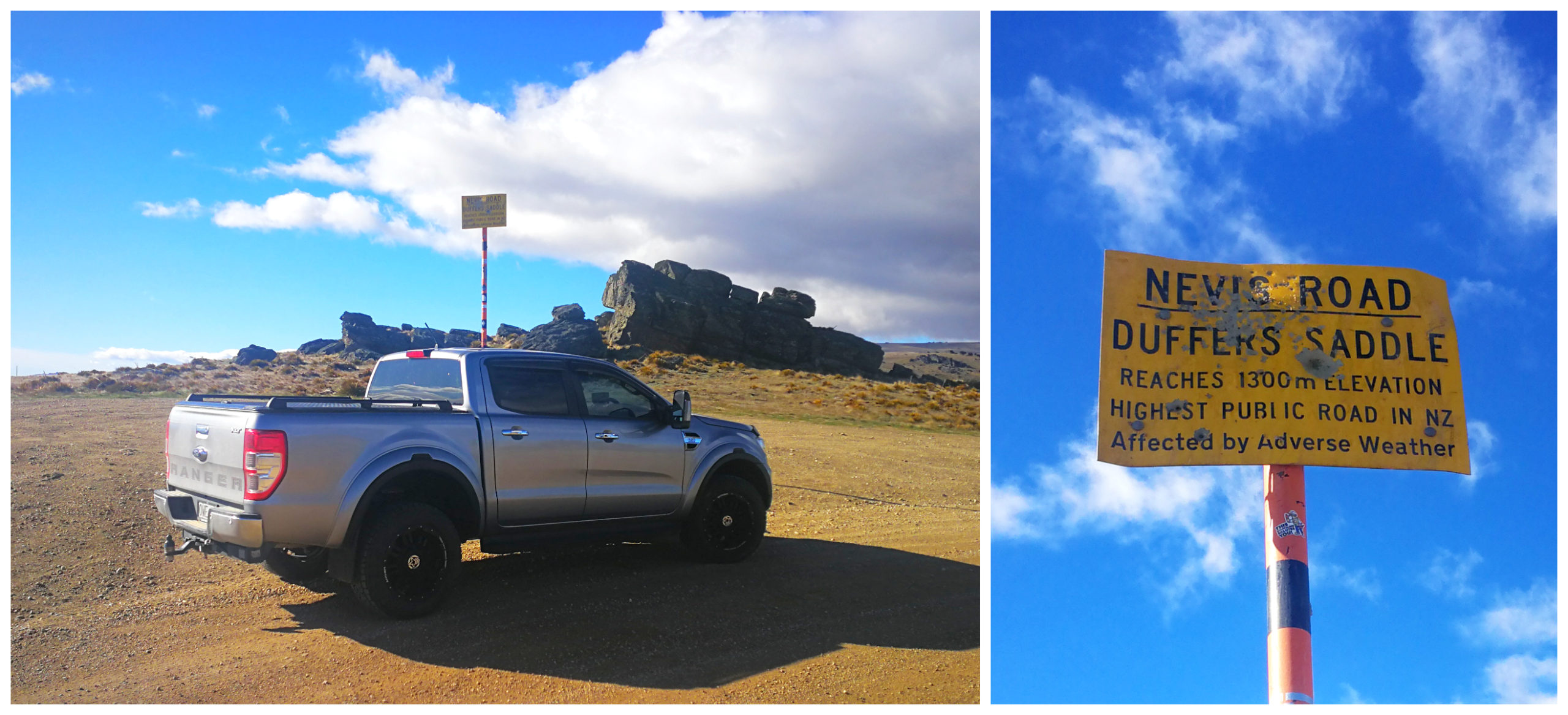
Current Road Conditions
The warning signs clearly state that this is a dry weather road only, and may require 4×4. There is also another sign which states that there are 25 fords to cross. This number mustn’t have included the streams to negotiate as I diligently counted each water crossing and they totalled 31!
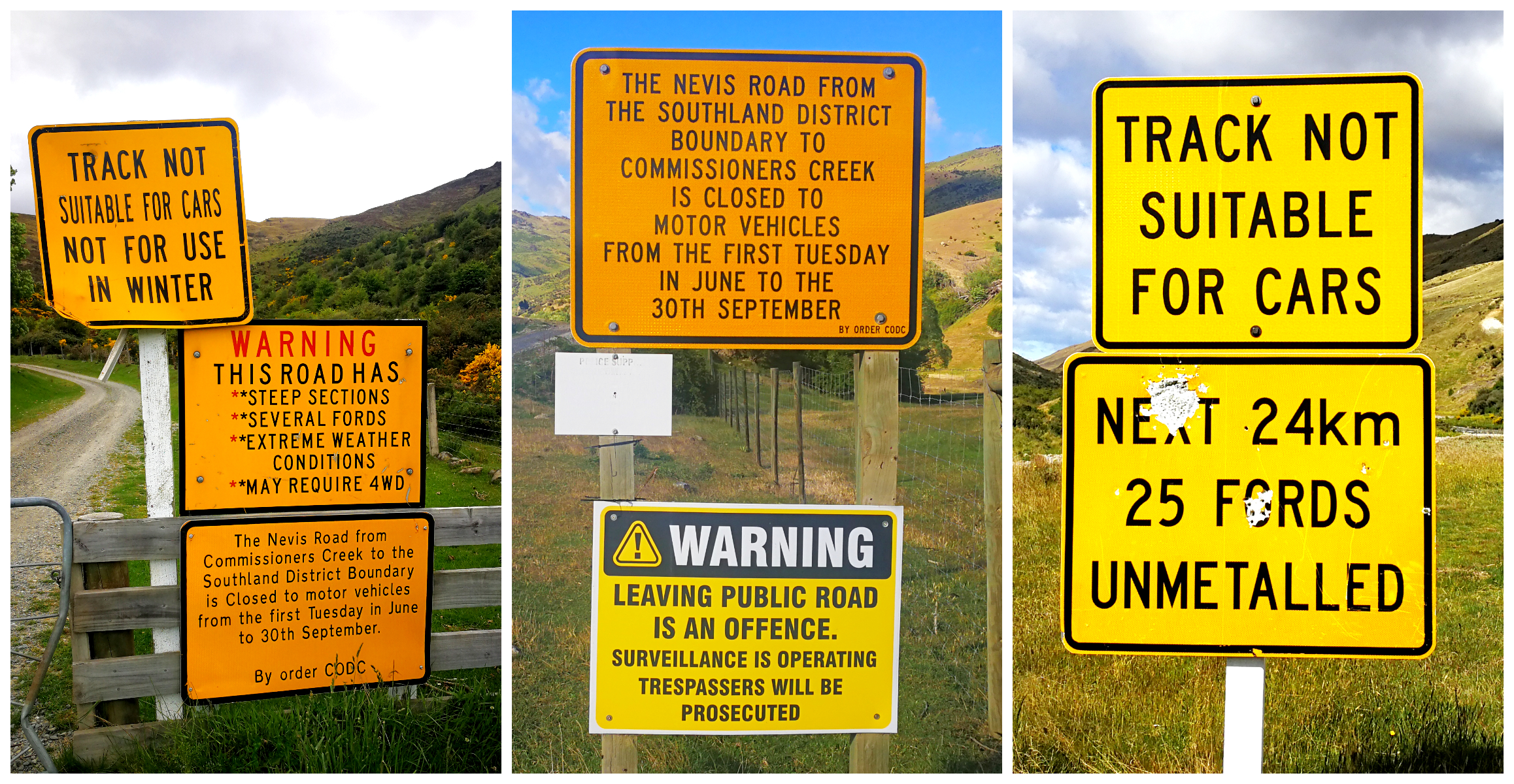
many signs to warn you of what’s coming up and the underestimated number of fords!!
In saying that, the first part of the track from Bannockburn into the Lower Nevis, up over the Duffers Saddle, can be accessed by an ordinary car during the dry summer months. The condition of the track can lull you into a false sense of security as from this point, through to the other end is where the more challenging part of the track starts.
Good Clearance & possibly 4×4
I’ve heard stories and comments that some have completed the entire crossing in either bus, motorhome or a normal car. I can only comment on the road and crossings as we experienced them and there was no way that any of these modes of transport would have been able to get across some of the fords and streams. The last part of the track (Garston end) in particular was the most gnarley.
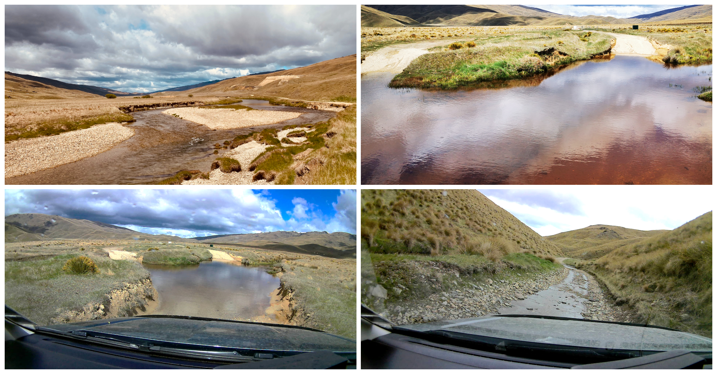
some crossings were deeper than others
It is a popular route for 4×4 enthusiasts and they have carved up some deep entry and exits so there were a few occasions when we had to pause and survey which was the best path to follow and how best to tackle them.
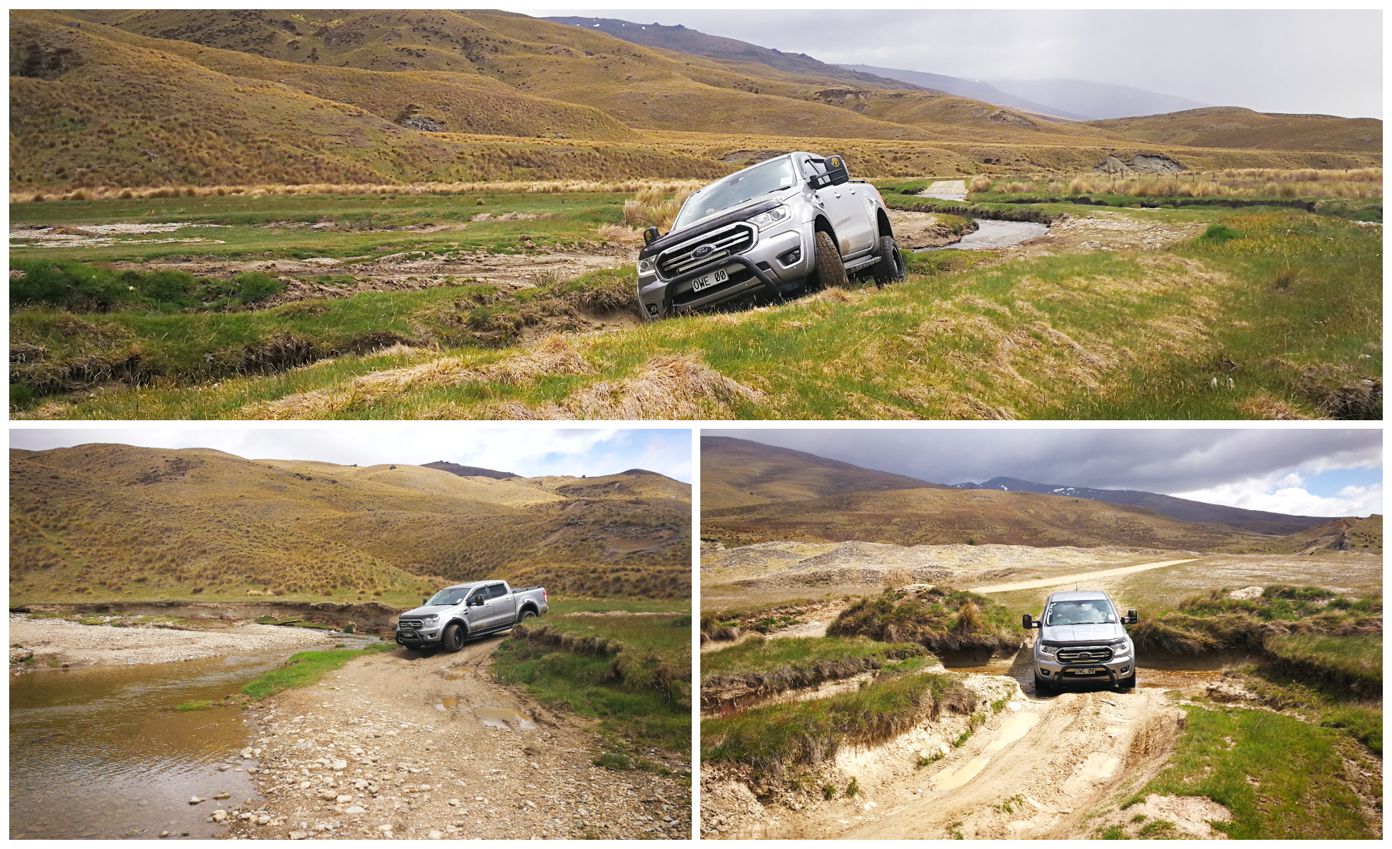
sometimes we ended up in some precarious angles!
The Ranger (and Scotty) handled the track very well and the deepest water crossing reached no higher than the wheel hubs. There were a few times when Scotty needed to engage 4 wheel drive. There was very little mobile phone coverage so we had our Emergency Locator Beacon on board with us in case of emergencies.
Highlights of the Nevis Valley
Carrick Range
The first section of the road over the Carrick Range is a climb to 1,300m. This road follows the miner’s route to the Nevis diggings and settlements.
Just as we turned off Bannockburn Road we spotted the Carrick Station Woolshed. The road descending down from the Carrick Range meant that the wagons and early motor vehicles would have to attach a large flat schist rock to the end of a steel chain. This was to act as a brake on the steep descent.
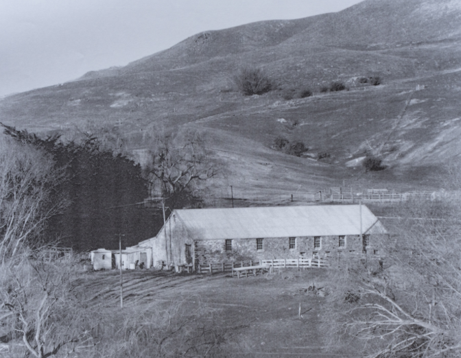
photo courtesy of oldbannockburn.nz
When they reached the bottom, the rock was discarded at the woolshed. Some of these rocks were used in the building of this shed.
We Start the Climb
We could understand the need for an extra braking system for those early wagons and motor vehicles. There is apparently a spot on the road called Dead Horse Pinch. This is where many of the poor horses pulling wagonloads of dredge pieces up this very steep section of the road, just couldn’t make it any further! I’ll say no more!
this could have well been Dead Horse Pinch!
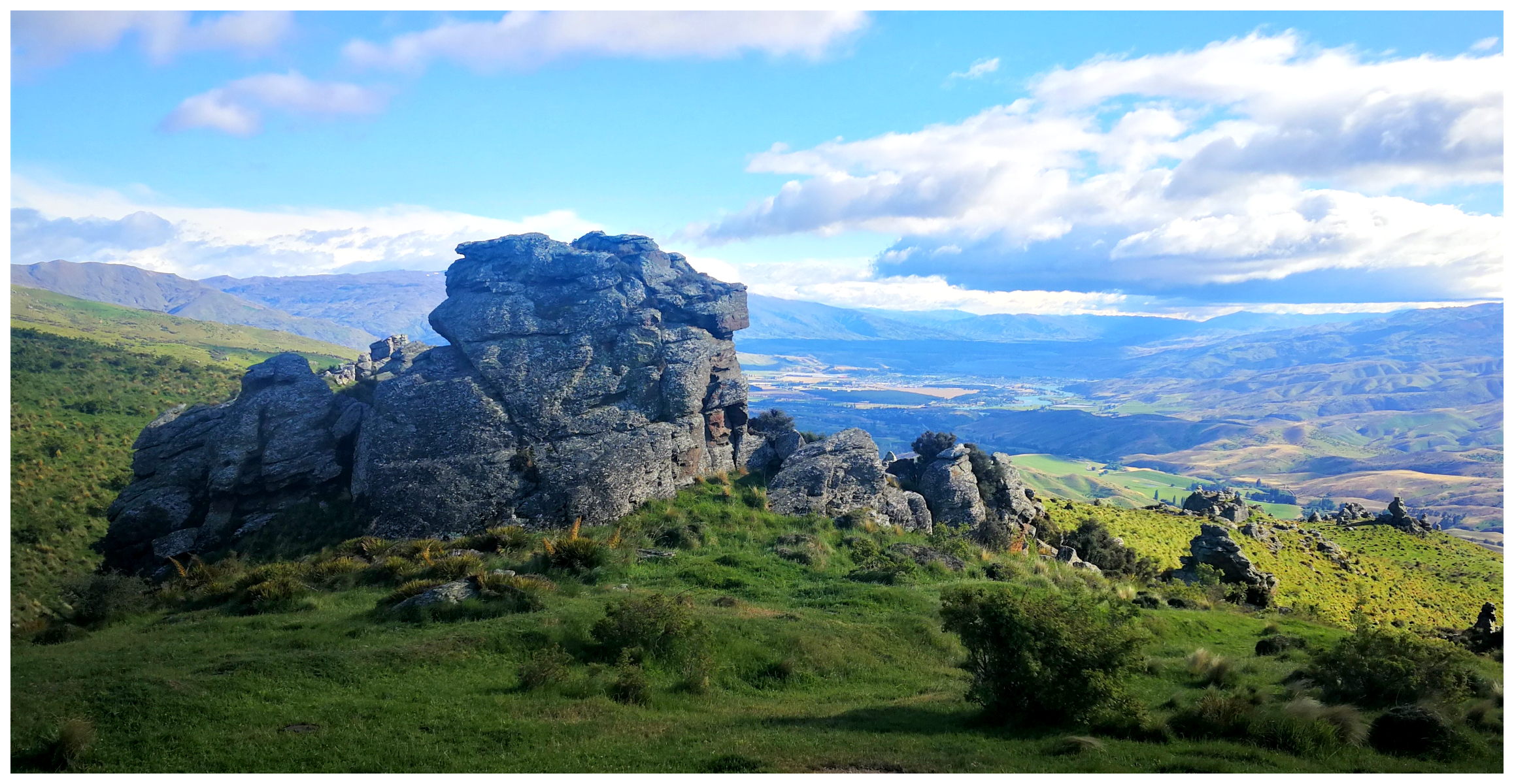
the schist tors dominated the landscape
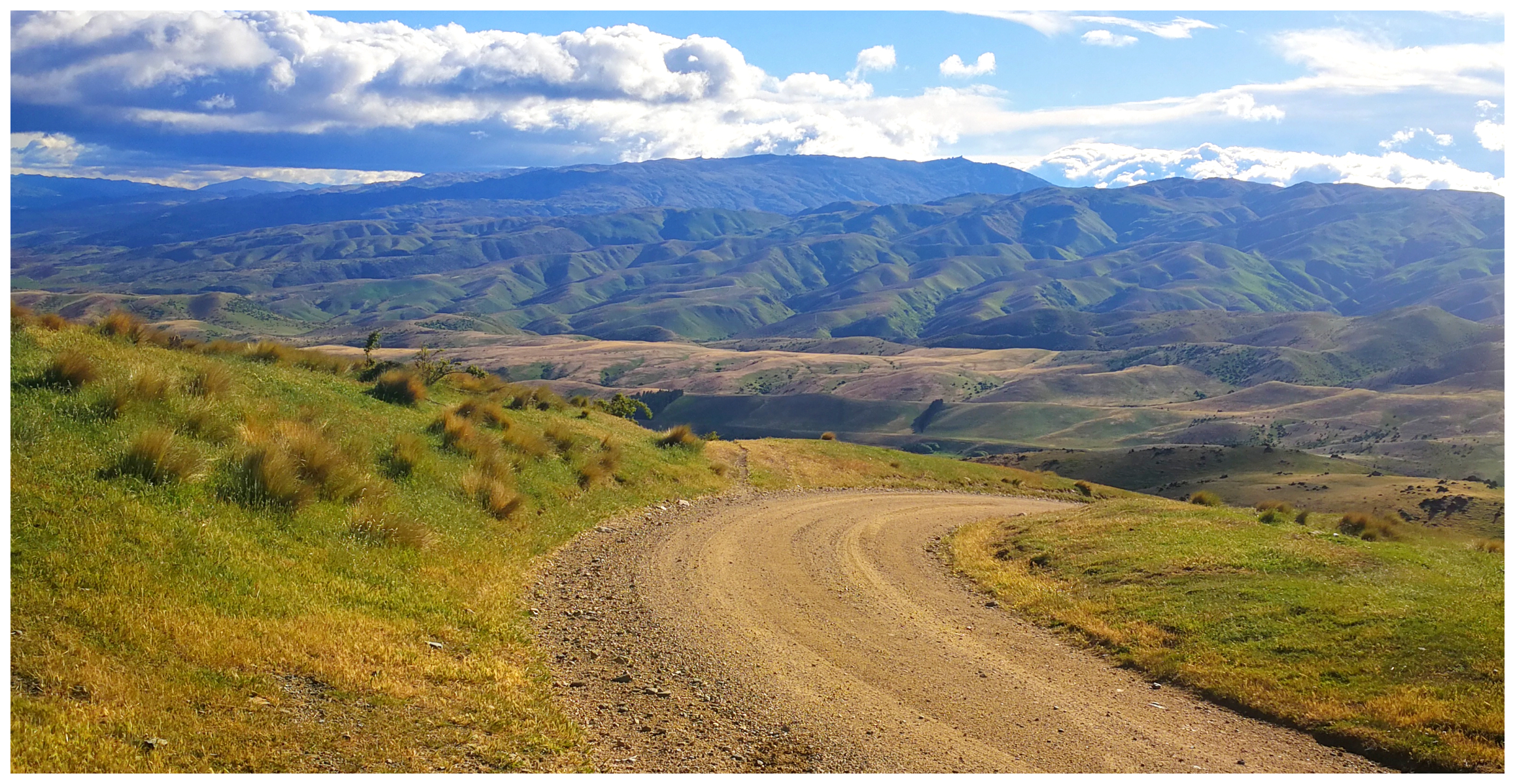
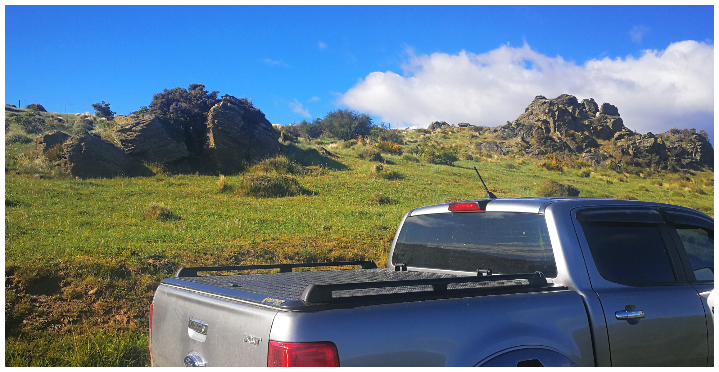
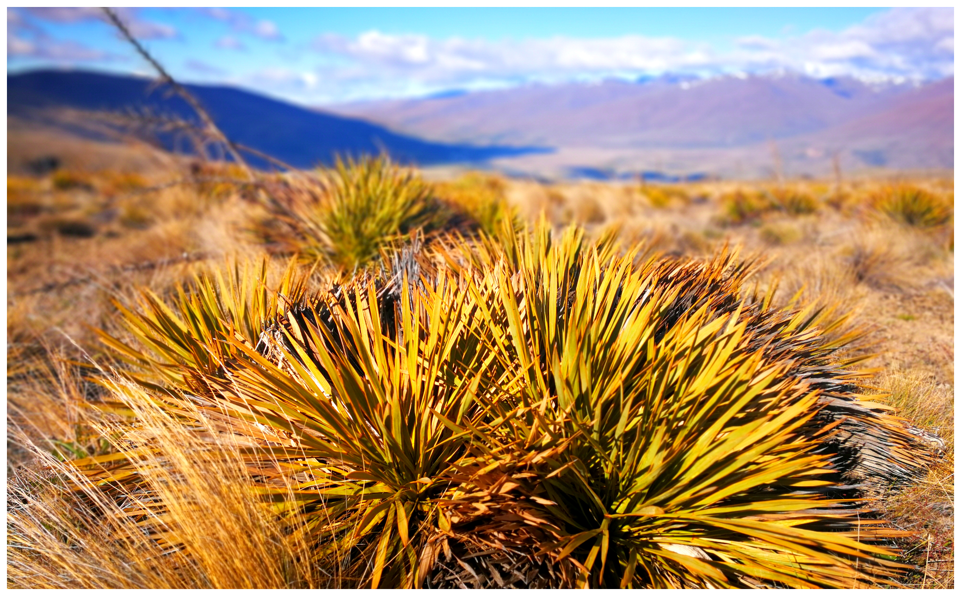
The landscape started to change dramatically. The track weaved its way uphill through tussock grasslands, pockmarked with gnarly schist rock tors.
the views as we reached the summit were truly jaw-dropping
Looking back, we could see the Upper Clutha Valley, with Lake Dunstan, flanked by the Pisa Range to the west (with the Southern Alps in the background) and the beautiful Dunstan Mountains to the east. As we came over the summit, we had panoramic views of the St Bathans Range.
“The Cutting”
Our journey took us through The Cutting which regularly closes in the winter. This section is the highest maintained mountain pass road in NZ. We seemed to be surrounded by mountain ranges. These included Old Woman Range, Garvie Mountains and the Carrick Range.
We reached the highest point of the Saddle
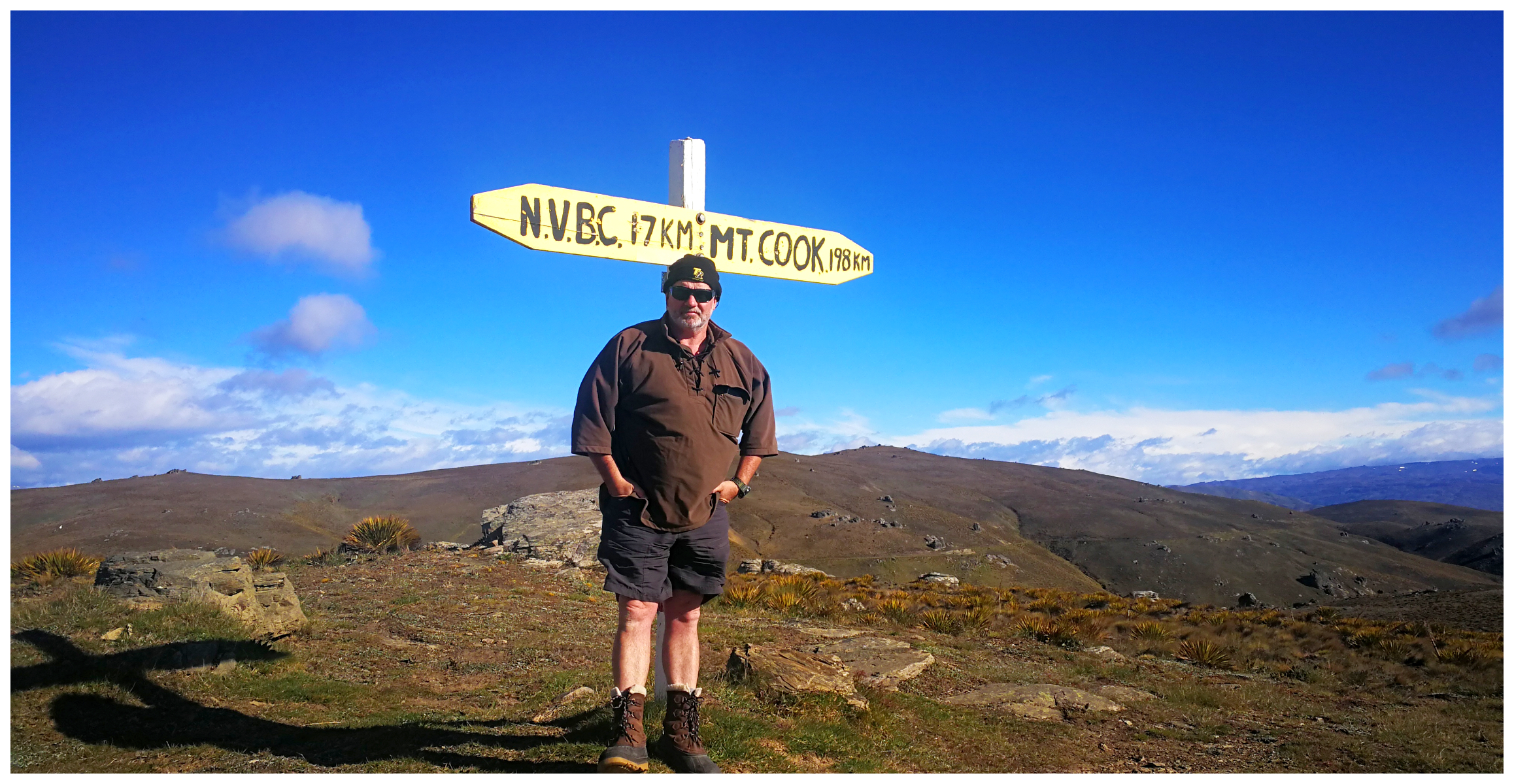
on a clear day, one can see Mt Cook
We also spotted The Remarkables with Double Cone dominating the skyline.
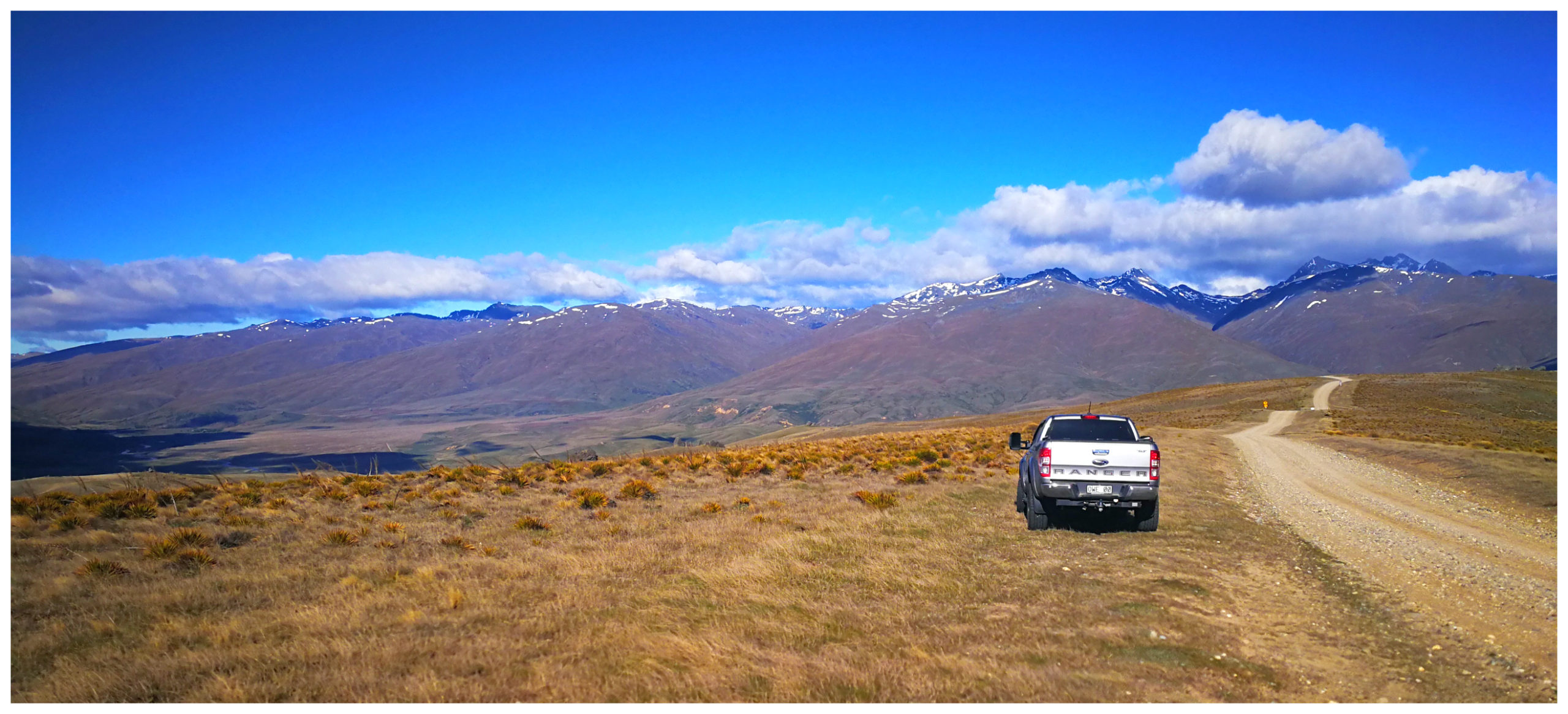
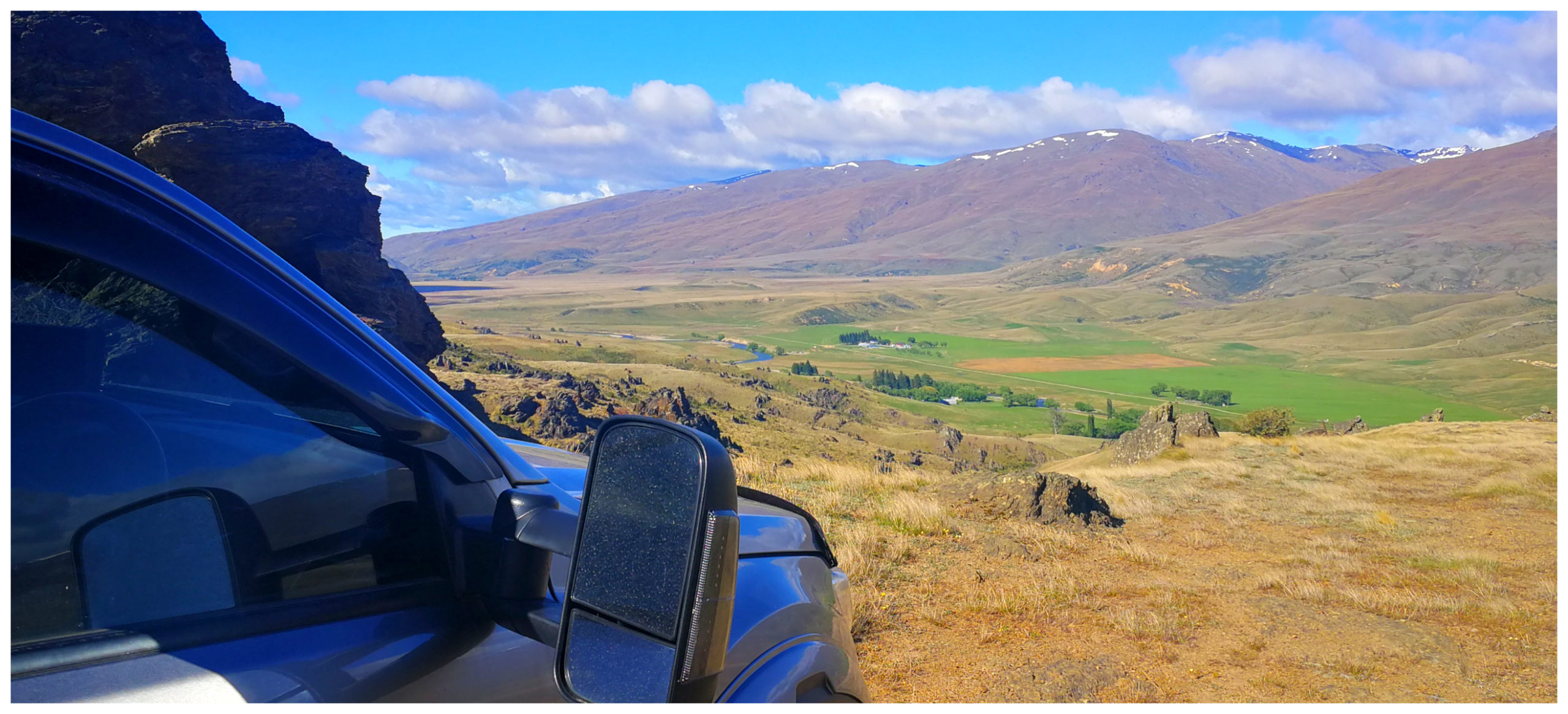
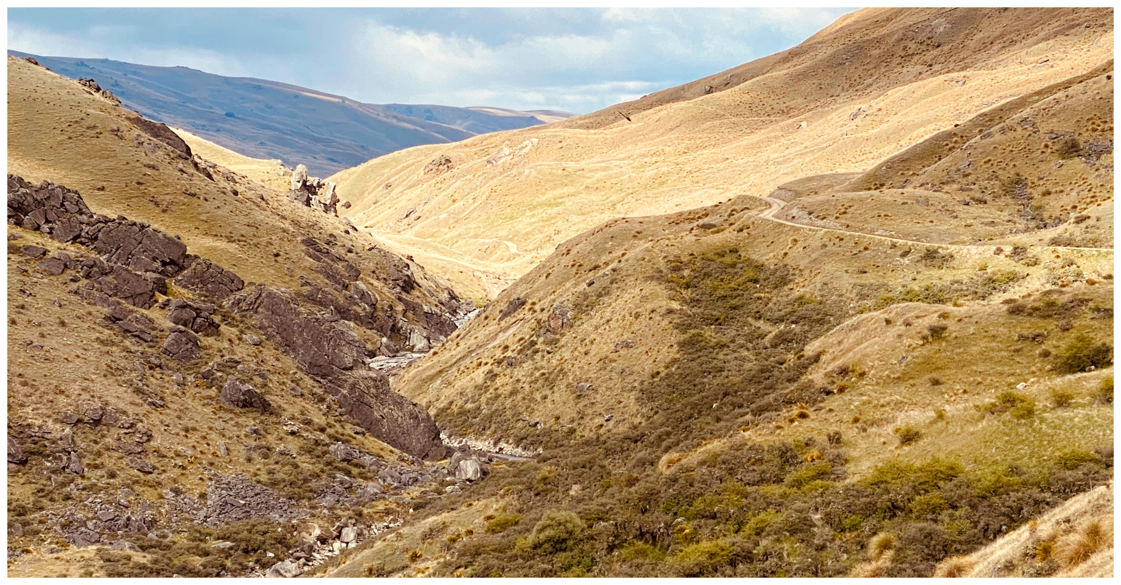
Lower Nevis Valley
On our descent, we got our first views of the Lower Nevis Valley and the Nevis River nestling within a spectacular tor-dotted tussock landscape.
it was all downhill to the valley below
The valley consists of two sections – each about 6km long, separated by a 4km long gorge (more on this later in the blog).
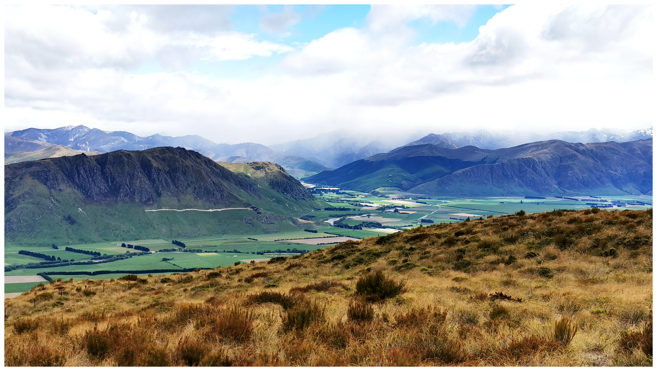
more panoramic views overlooking Ben Nevis Station below
We spotted the small cluster of buildings close to the Nevis River which is the Ben Nevis Station. Small clusters of trees throughout the Lower Nevis Valley mark signs of small settlements that used to dot the landscape.
the cluster of trees along the valley are a giveaway to where the settlements used to be located
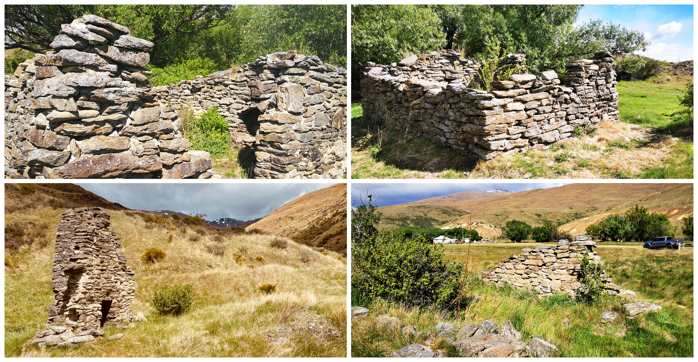
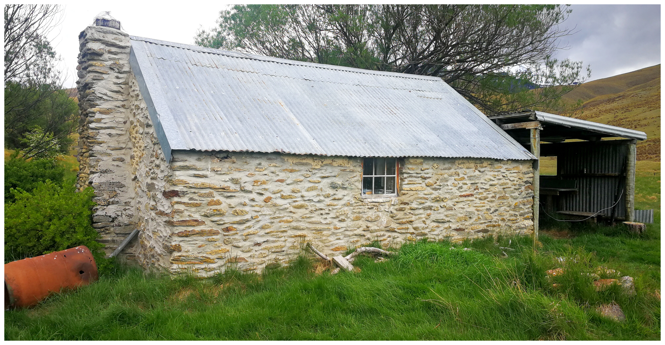
The Crossing Settlement
One of these more substantial settlements was the Crossing Settlement. This is at the point where the road crosses the Nevis River.
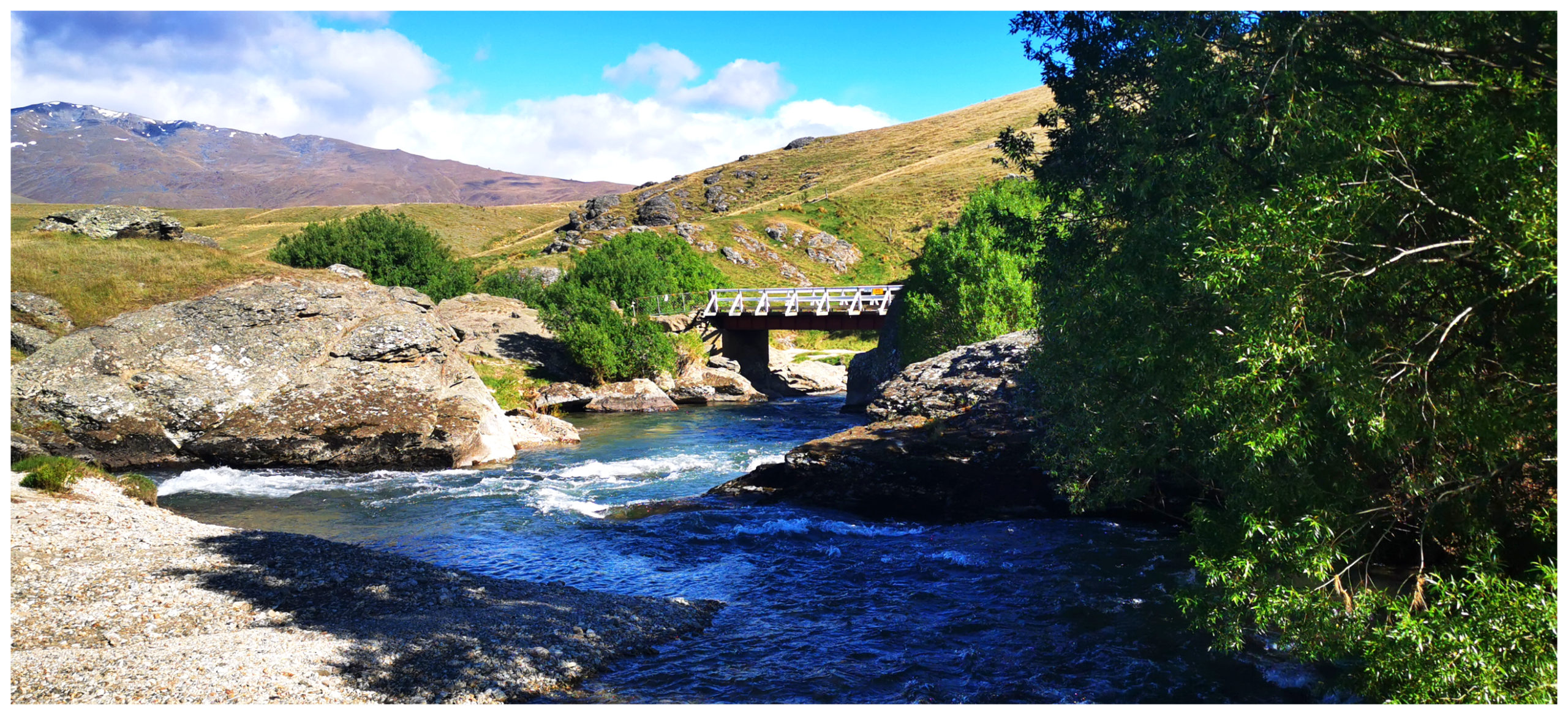
the original bridge was taken out by huge slabs of ice washing down from the mountains
A small settlement sprung up after gold was discovered in the river and its creeks. There was a small cluster of buildings including three hotels.
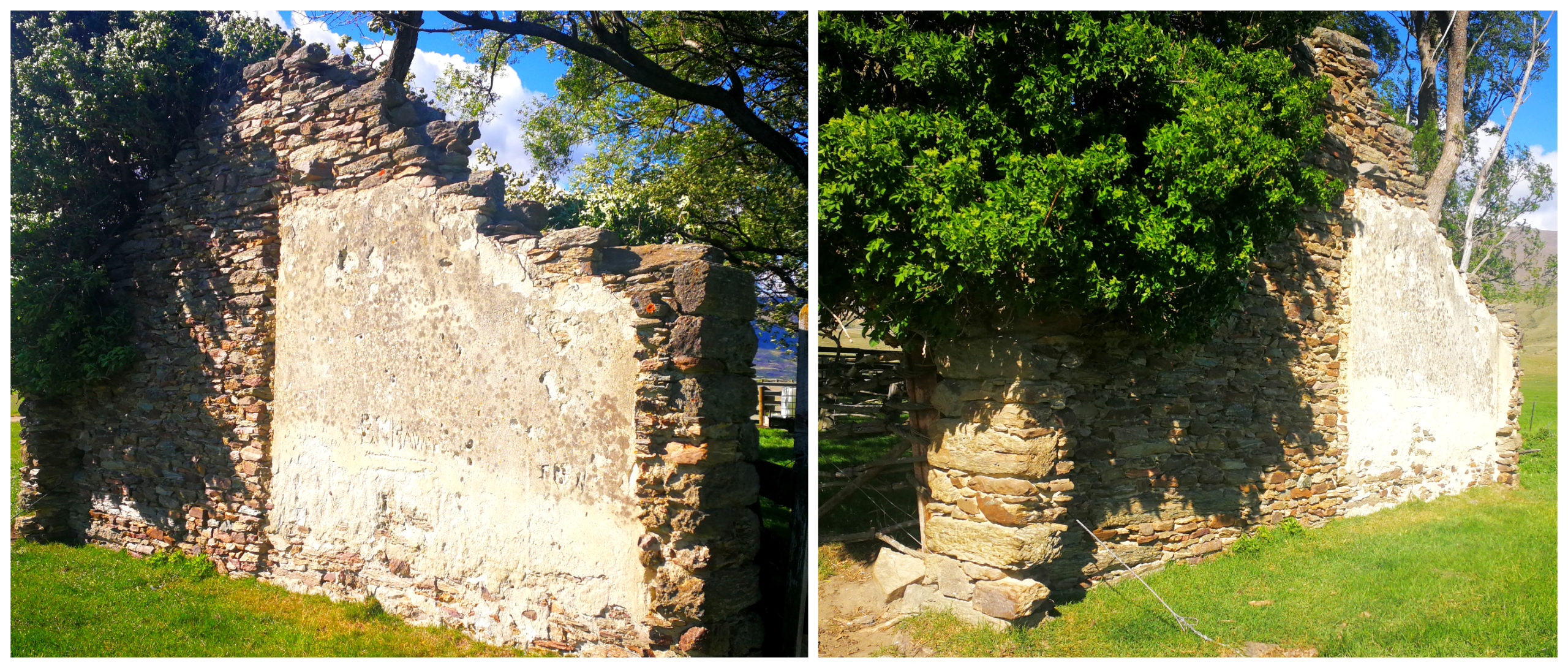
the last standing wall of the Nevis Crossing Hotel
All that is left of the old commercial buildings is one wall of the Nevis Crossing Hotel. Evidence of the horse yards can also be seen.
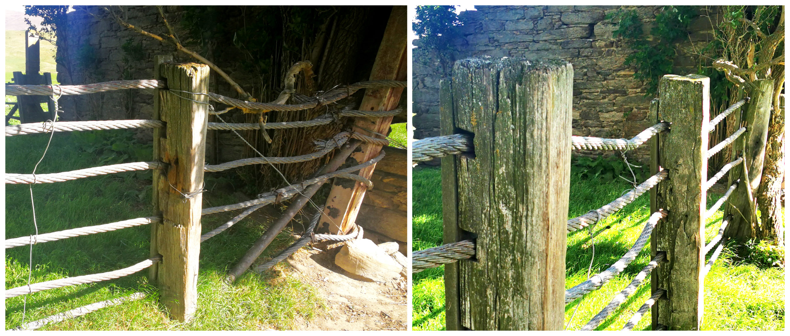
the original posts and cables behind the hotel to hold the horses while the thirsty travellers rehydrated
Flooding back in the 1860s destroyed all evidence from the first round of mining. Post flooding, new methods of mining were adopted with various sluicing methods and dredging. These were carried out as late as 1939.
Clear evidence of their workings could be seen along the valley. At times there were 6 dredges working in the river.
In the 1870s there were an estimated 300 Chinese working the Nevis area with their own shop set up somewhere south of the Nevis settlement.
Nevis Cemetery
It is thought that there were two cemetery sites in the Lower Nevis. We spotted the fenced-off area on our right-hand side, on a raised section which had the most amazing views over the valley floor. The souls that rest here certainly have a peaceful and serene resting place.
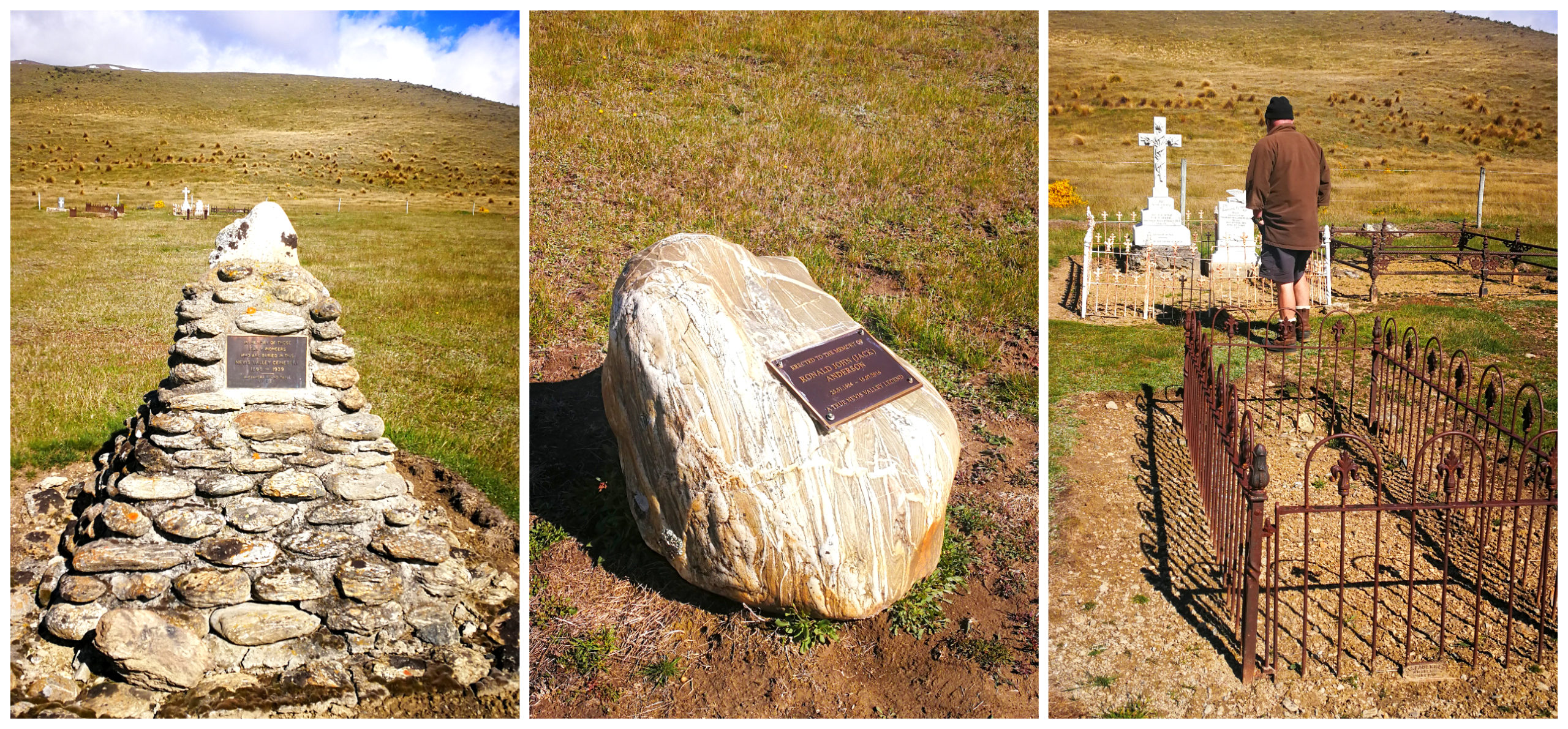
so many graves, so few headstones
It is believed to have up to 40 gravesites. This includes some Chinese miners.
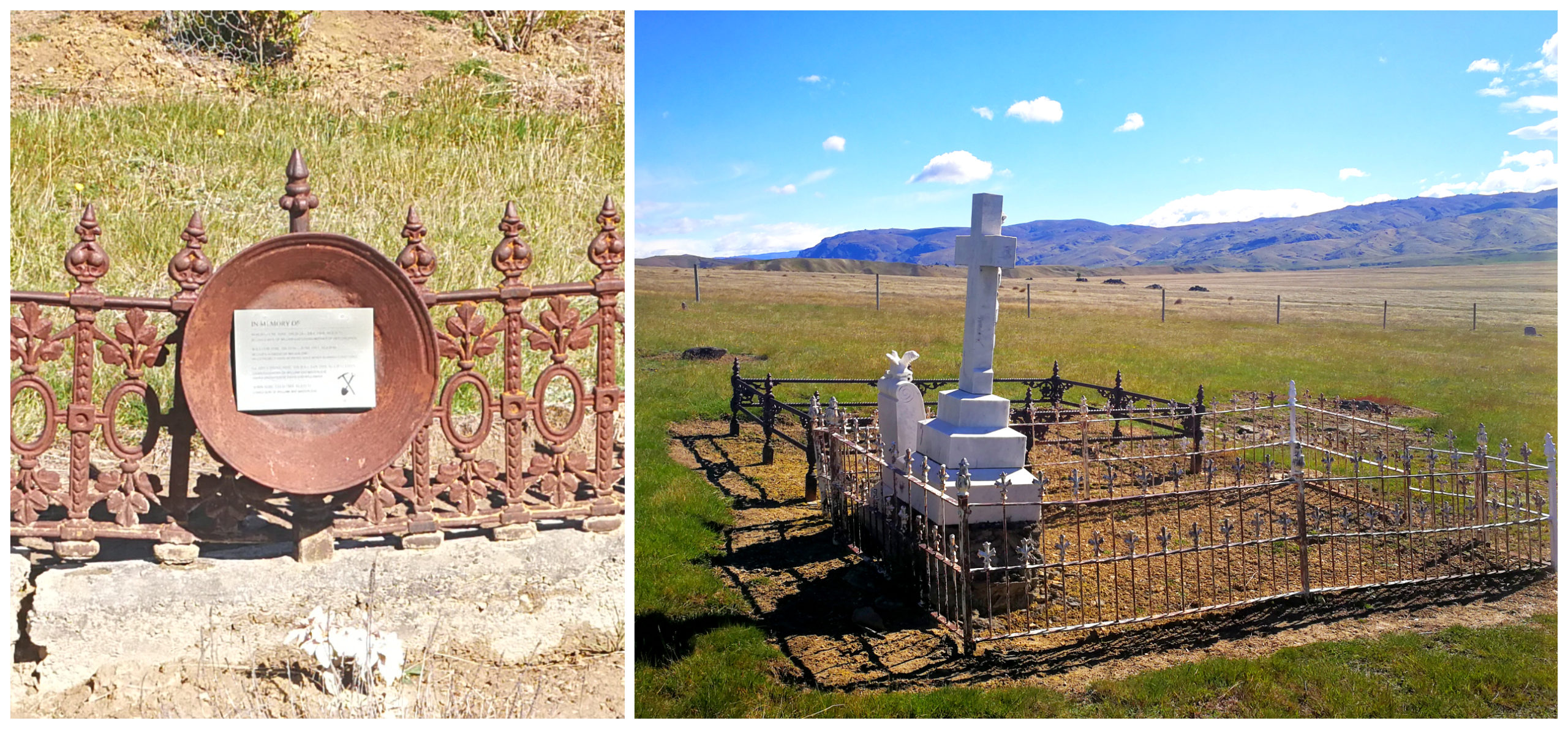
a beautiful, peaceful spot for a cemetery
Today, there are only a few marked graves, including some very renown names such as Stewart, Graham and McLean.
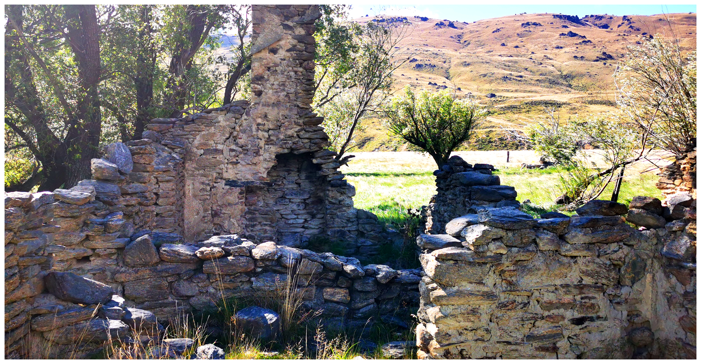
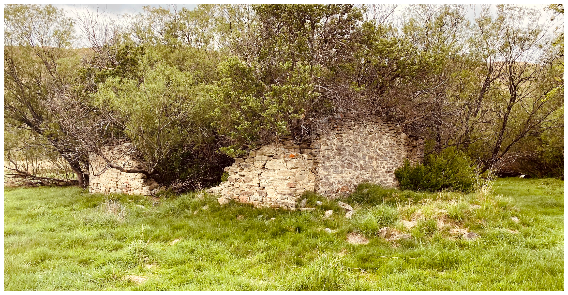
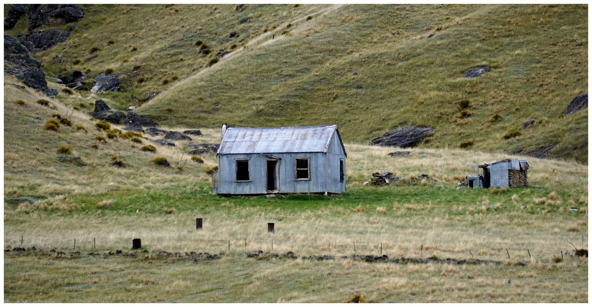
Lower Nevis Settlement
The Lower Nevis settlement was the main town in the valley. Less than half the town area remains today thanks to intense dredging operations.
just a few buildings remain, great they can point us in the direction of the nearest pub!
There are a couple of the original structures remaining and are still occupied.
no chance of a drink here
There is also the ruins of the hotel and store, earth and corrugated iron homestead and a 1903 wooden and corrugated iron homestead. It is still owned by the Adie family. Their claim lies on the slopes behind the homestead.
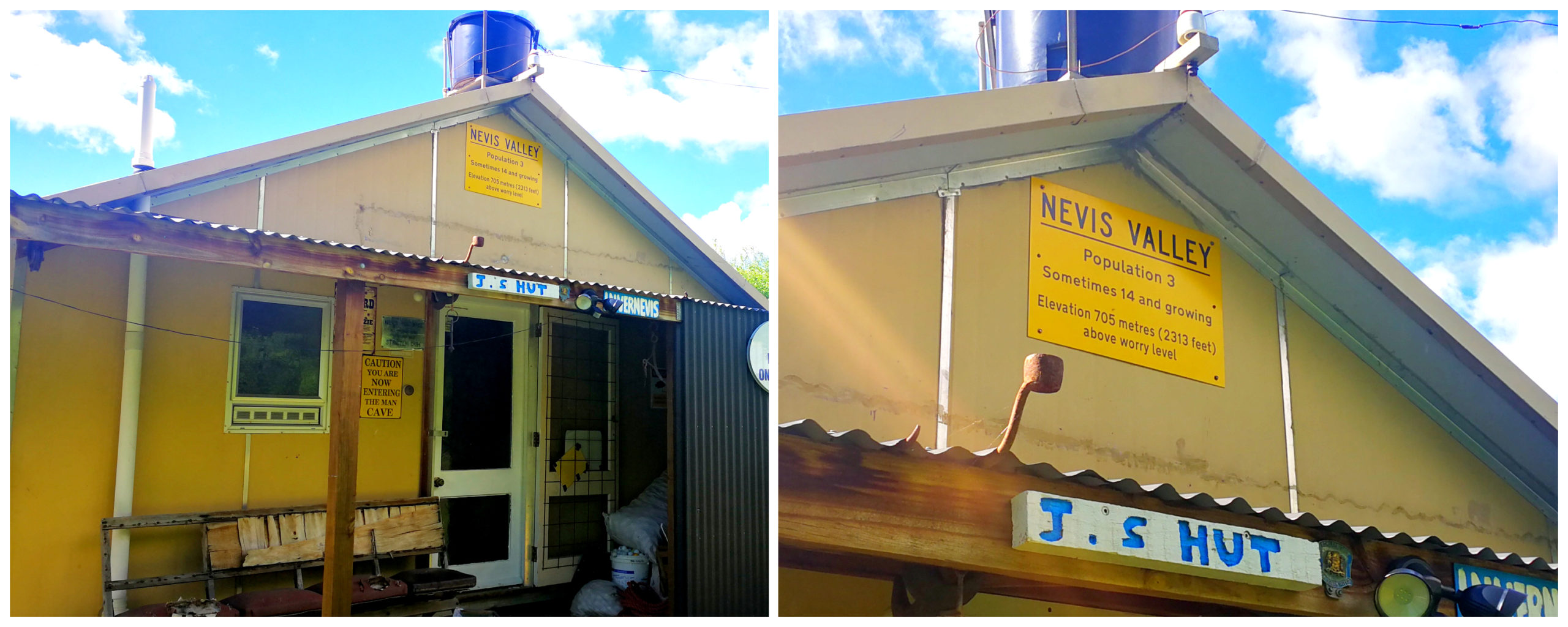
quite an eccentric house and collections
We stopped off at a rather eccentric looking hut, surrounded by mining memorabilia and outbuildings. There were many memories and treasures of a by-gone era.
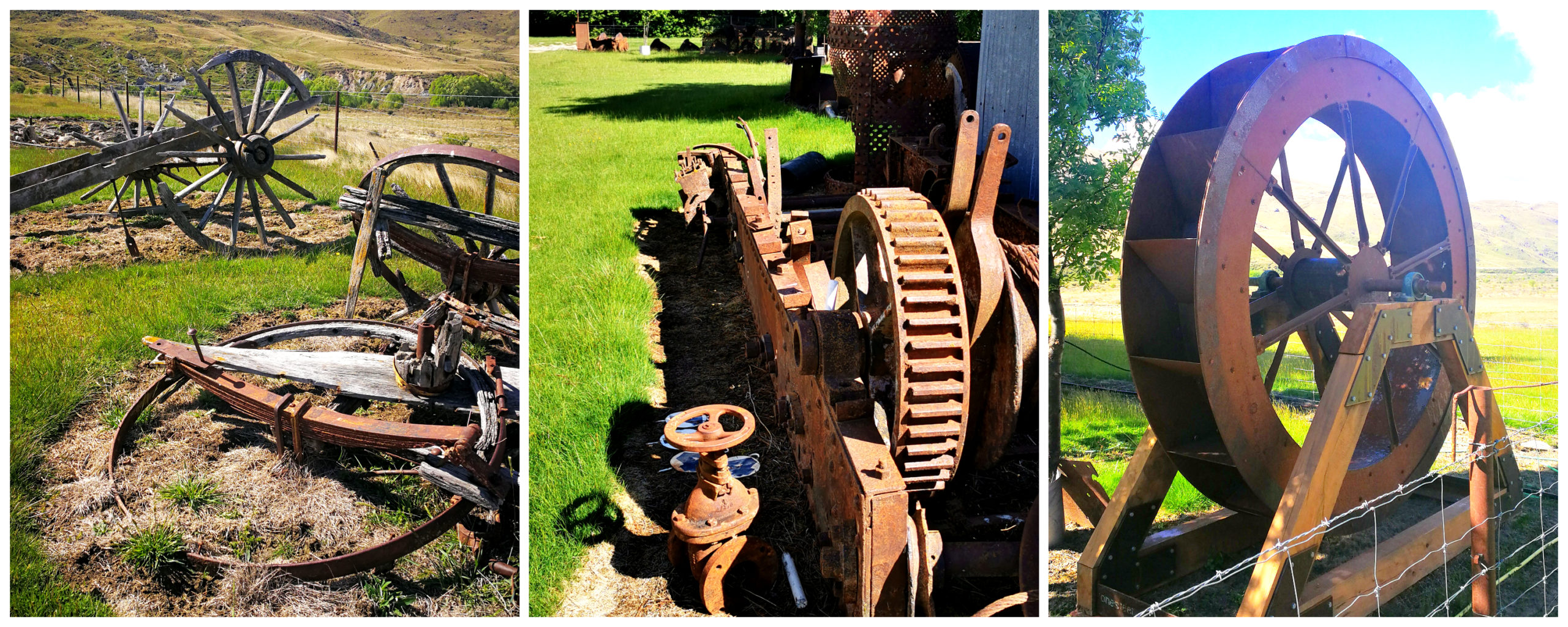
relics left behind post-mining days
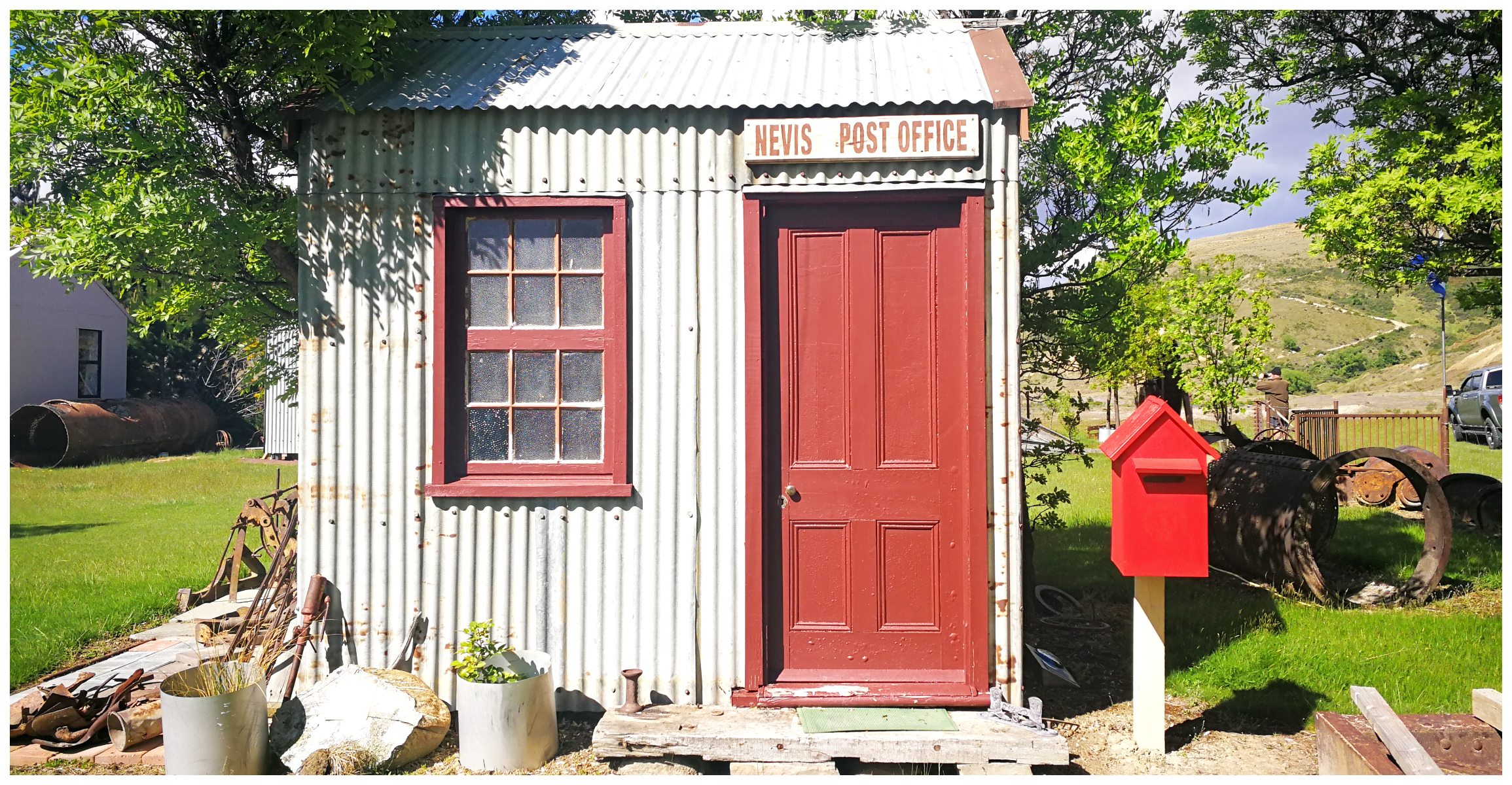
this would have to be the cutest Post Office I’ve ever seen
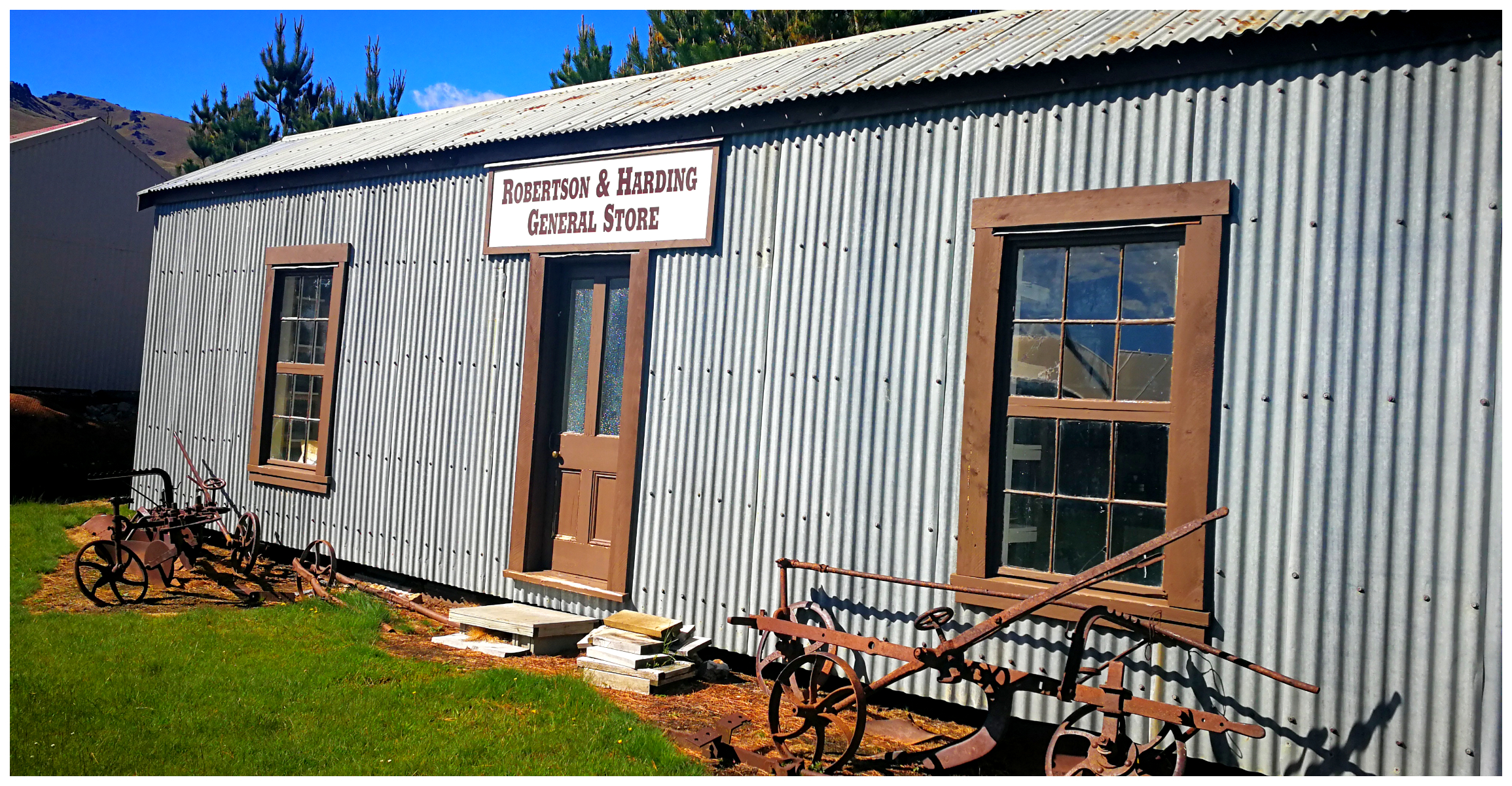
this must have been a bustling General Store in its day
The Gorge
As mentioned earlier, the valley is in two parts, separated by a 4km gorge. We spotted the stacked stone mounds at the entrance to the gorge which was a major Chinese working claim. The rest of the tailing evidence was from both Chinese and European workings.
plenty of evidence of residents long since departed
We also spotted the occasional stone remains of some of the miner’s huts.
Again, similar to the Lower Nevis Valley, the miners used various mining techniques – sluicing, dredging and hydraulic elevation which has left behind their telltale ponds dotted through the gorge and valleys.
Baillie’s or Bailey’s Hill
We nearly missed the abandoned homestead of John Bailey, named “Loch Linnhe”. He was one of the first miners in the area.
the ruins of the abandoned homestead
Nestled between trees and off the main track lay the ruins of the abandoned homestead. There was a new homestead built near Kingston. However, for many years it provided shelter for miners and dredge workers when toiling away in this area.
in contrast to the homestead, the musterers hut is in much better condition
Set behind the homestead is an excellent example of an old stone hut. This was formerly the old O’Connell home, then a mustering hut. We could see the names of the yearly mustering gangs inscribed on the ceiling rafters.
Camerons Gully
Before starting our ascent over the Hector Mountains, we stopped off at Camerons Gully. There is a large Hydraulic Elevating Hole which today, is a very pretty pond which appears like an oasis in the tussock laden land.
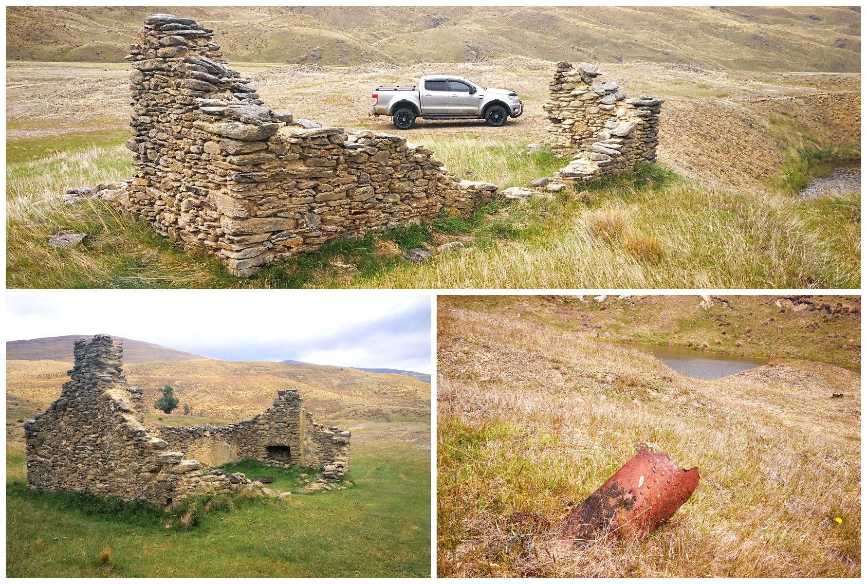
relics left behind at the hydraulic elevation sluicing site
The remains of the old stone huts would indicate that the operation was carried out in the late 1800s. The hydraulic elevation workings were actually between 1930 and 1948. Certainly, a more recent activity compared to other mining operations throughout the area.
Hector Mountains
This is the next big climb on the Nevis Valley Road. The climb up the Hector Mountains is not as high as the Carrick Range. We ascended the 1,100m above sea level and it was quite stunning. Nokomai valley came into view with the Roaring Lion Creek joining up to the Nevis River.
the river squeezes between the towering mountains carving a path through the gorge
Chinese miners built and maintained The Roaring Lion Creek water race. We caught glimpses of it twisting and turning down towards where the Nokomai workings took place. This was the main water supply for the Nokomai mining operations from 1900 through to the 1940s.
our views as we descended down towards Garston
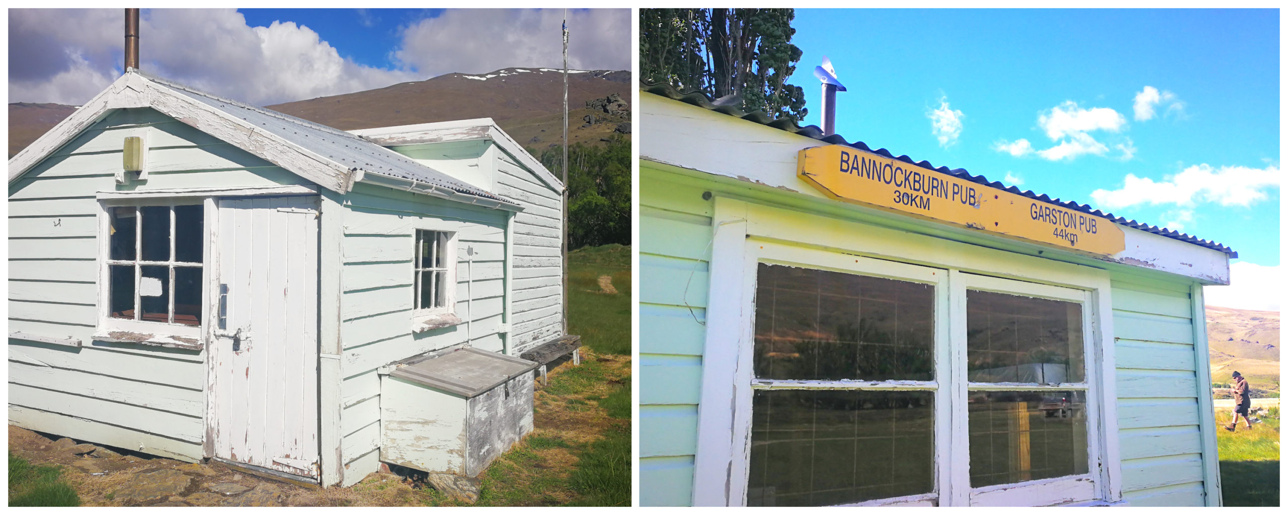
Historic Ski Hut
On the downhill slopes of the Hector Mountains lies the old historic ski hut. The building of the hut started in 1934. Constructed in three stages, by 1946 it could accommodate 45 skiers. A new ski hut on Coronet Peak was built in 1950. This became more popular with skiers. They considered Coronet Peak had better ski conditions and equipment.
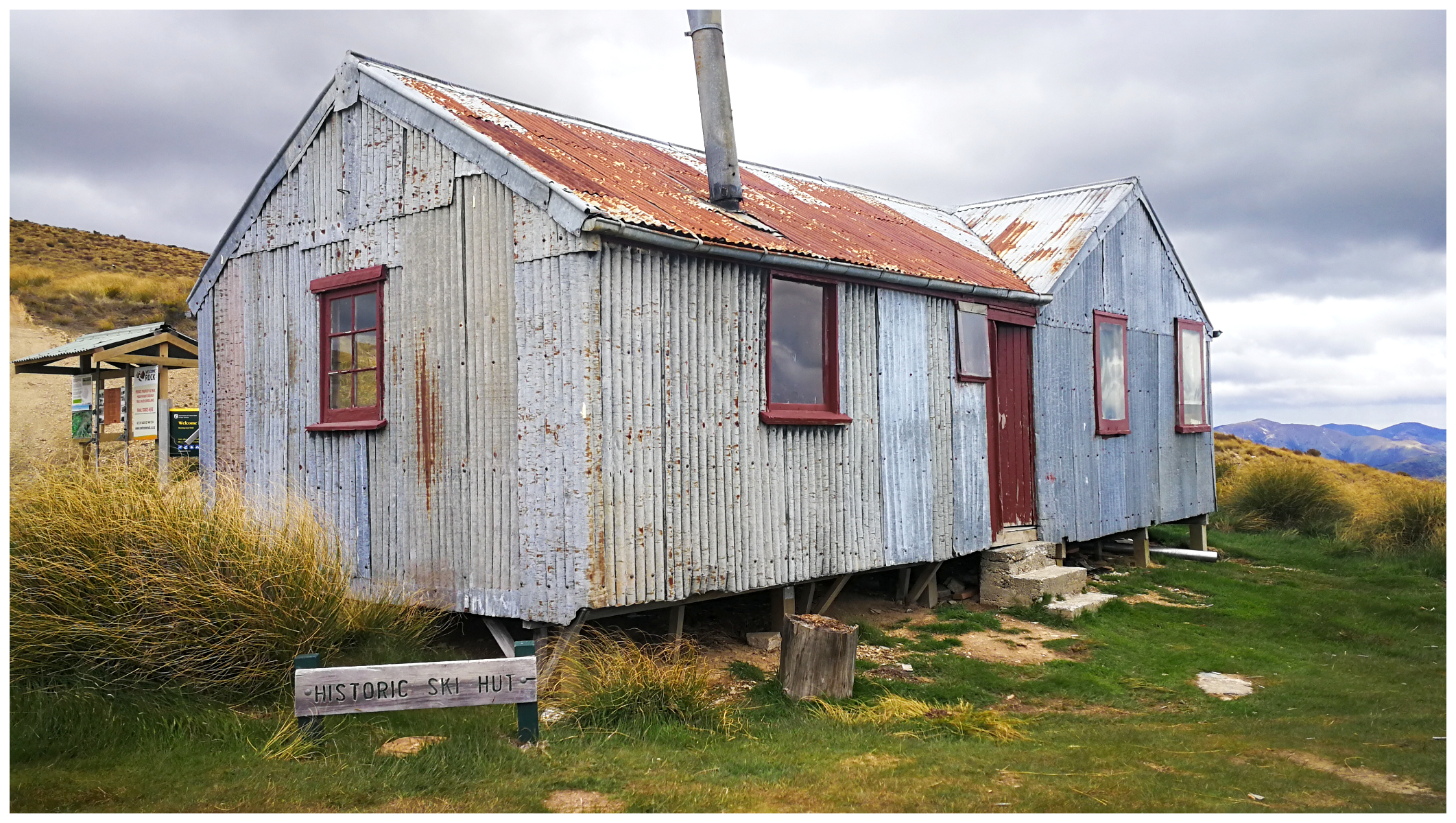
the well-used skier’s come trampers hut has had its day
DoC now looks after the maintenance and repairs. The hut could do with a bit of TLC. I’m not sure too many people take advantage of the overnight digs. There was a lot of daylight filtering through the walls and window flashings.
our trip through and over the Nevis Valley is one of our most memorable roadies. The scenery and history combine to make it a fantastic day out
It’s a beautiful drive. We did some of it in September but a week of rain prior and rivers and streams were too high to cross and gate was closed. Still a fabulous day. We went back down via Carricktown – not for the faint hearted particularly after rain. You are living our dream lol. One day…
It’s great that you got to drive even a small section of the road. It is certainly a ‘dry weather’ road! Carricktownn is pretty amazing too. Love soaking up the history of Central Otago.
This sounds like one of the most interesting explorations you’ve done and the photos are fabulous.
Thanks Robin, we had a wonderful time exploring the Nevis.
Great photos and coverage of your Nevis trip. Have driven, motorcycled and mountain biked this this back country road a number of times and agree that it is a spectacular trip. We certainly have some wonderful country to explore around Otago.
Regard
John and Anne Sparrow.
Wow, you have certainly covered all modes of transport! Would be great on a motorbike but not so sure on a mountain bike!! Well done.
Hi Linda. You shifted Dead Horse Pinch!!! It is actually on the Pigroot (SH85) just east of Ranfurly. Check out the Topo maps @ .
There is a lookout there with some signage that explains how it got the name. Actually quite an interesting place to stop as the photos give a pretty good idea of the conditions the old Teamsters had to face at times.
Oh my goodness, there must be a lot of dead horses around! There is also 2 Dead Horse Pinches on the Nevis, one going up the Carrick Range, and another on the other side. Must have been a common occurrence! Those poor horses!! We’re looking forward to exploring more of the Pigroot. It’s loaded with history too.
I loved reading about your adventure on the Nevis and look forward to further trips. and hope to venture to the Nevis but probably not all the way!
Thank you! Bannockburn to Ben Nevis and return is a great day trip out and the more manageable part of the track.
Great photos of the beloved Nevis. Let me assure you that the owner of the eccentric huts at the Lower Nevis Township (the third site) is not eccentric.!!! It is only a recreation of our past on a private section. Gods acre. The people are Scot and stopped there on their way home to heaven and realized that they had made it. Anyway well done.
Thanks for your feedback, always appreciated. I use the term ‘eccentric’ as a term of endearment. I loved how they had diligently collected relics of the history of the area, otherwise lost forever. Thank goodness they did.